|
|

|
|
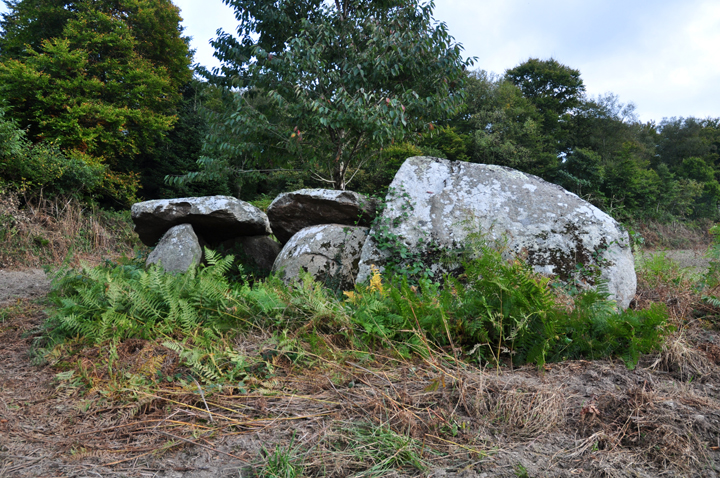
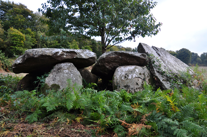
Toul an UrzAllee-Couverte
|
||||||||||||||||||
|
|
|
Images (click to view fullsize) |
|
|
Fieldnotes |
|
|
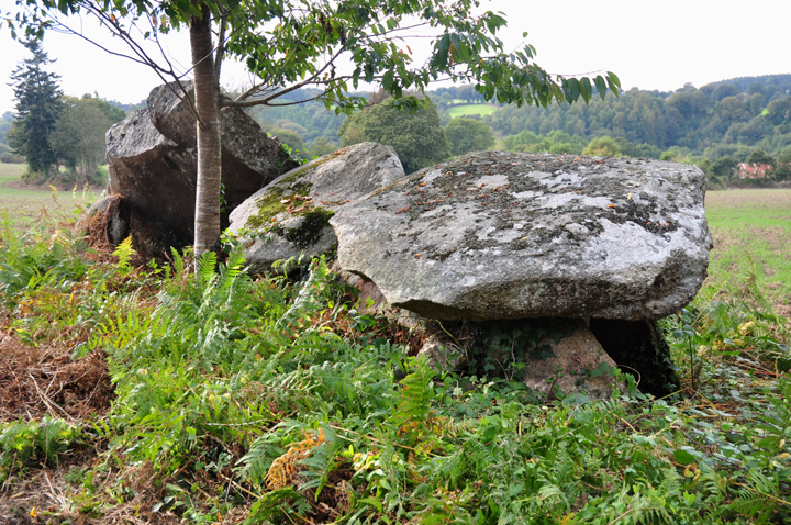
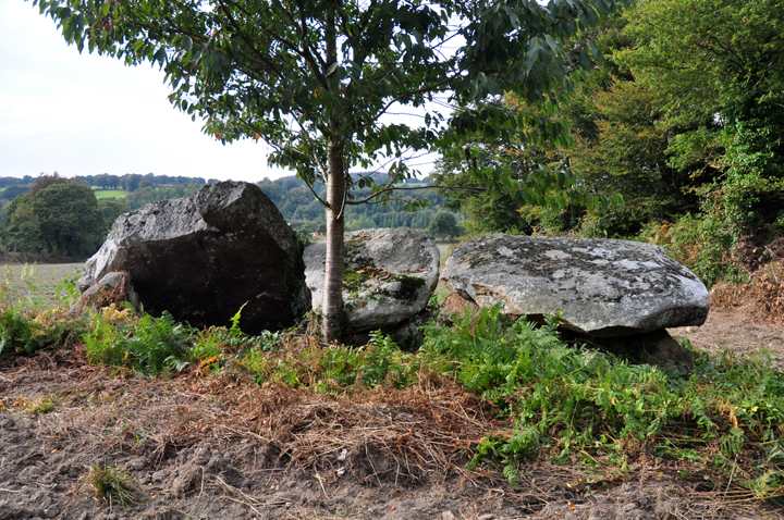
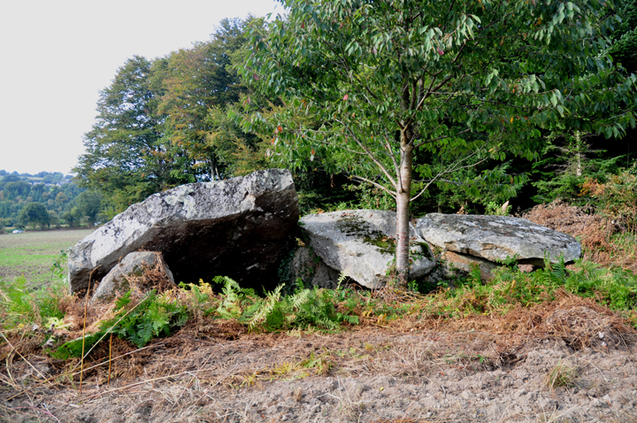
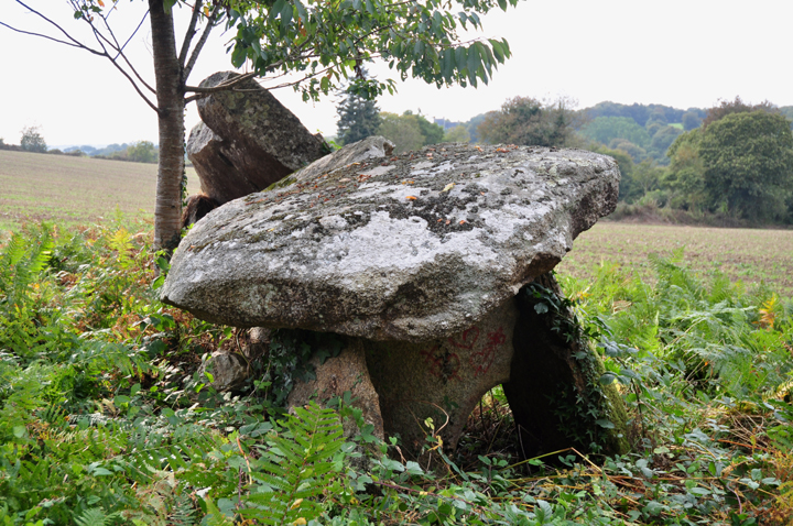
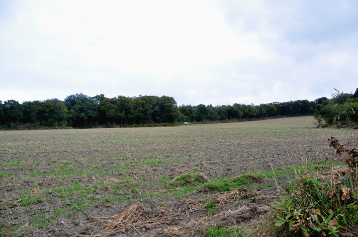
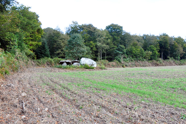
Access: Samuel Lewis in 'Guide to the Menhirs and other Megaliths of Central Brittany' says this is on the right (west) of the dead-end road to Kerangle farm. It's not, it's on the left (east). He's placed it correctly on the map, but unfortunately in this case the map is on a different page. Sod's law meant that we followed his instructions instead of his map! So, as you clear a line of trees to the east of the road approaching the farm at the end of the road, keep your eyes peeled to the left (east). At the far side of a large field with woods beyond, you should be able to spot the monument if it's not in crop (though it was quite overgrown when we first saw it). It was a bit of a slog around the edge of the ploughed field, but if it had been in crop, we would never have spotted it! Visited Wednesday 30 September 2009 Thought we'd missed this one as the field on the right (west) was in crop & we thought that's where it was (see above). Tried to ask at the farm. but there was no answer Luckily, as we gave up & drove back down the road, Jane spotted something on the far side of a field to the east. It was a fair way off & we couldn't be sure, but especially as this was our last site of the day & we wouldn't be back, I decided to trog around the field edge. For much of the walk, my view was blocked by trees, but as I cleared them it looked like this was probably it, but it looked overgrown & trashed. How wrong I was! Once I'd tramped down a lot of fern, bracken & bramble (less hard work than I expected) I could see quite a cool little allee couverte. (All my photos are post-'gardening'!) It's not in great condition, but I still found it very pleasing. Lewis speculates that it may have been built with one of the capstones only supported on one side, but I thought this unlikely. I may be wrong of course! |
9th November 2009ce Edited 9th November 2009ce |
|
Toul an Urz means the 'bear hole', surely a reference to when our ursine friends still roamed the nearby forest. One of the three remain capstones, the thinnest and largest, slopes right down to the ground. Whether it originally did so is hard to say – unlikely I'd have thought. Traditionally, girls wanting a husband would slide down the stone. Surely they'd have been better off speed-dating?! |
 Posted by Jane
12th October 2009ce |