|
|

|
|
Y DasRound Barrow(s)
|
||||||||||||||||||||||||
|
|
|
Images (click to view fullsize) |
|
|
Fieldnotes |
|
|
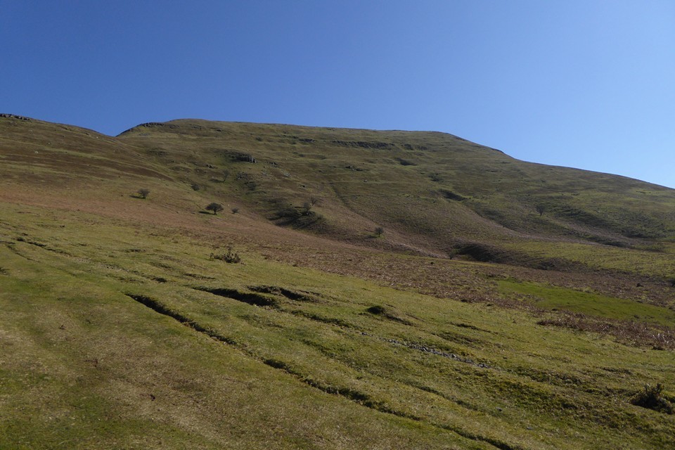
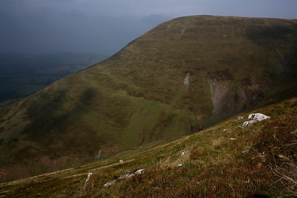
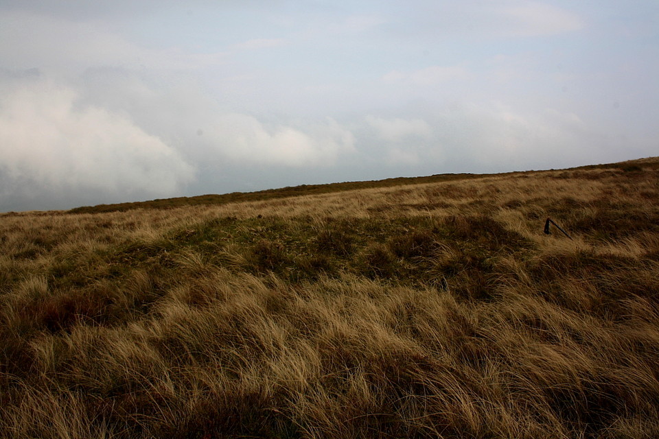
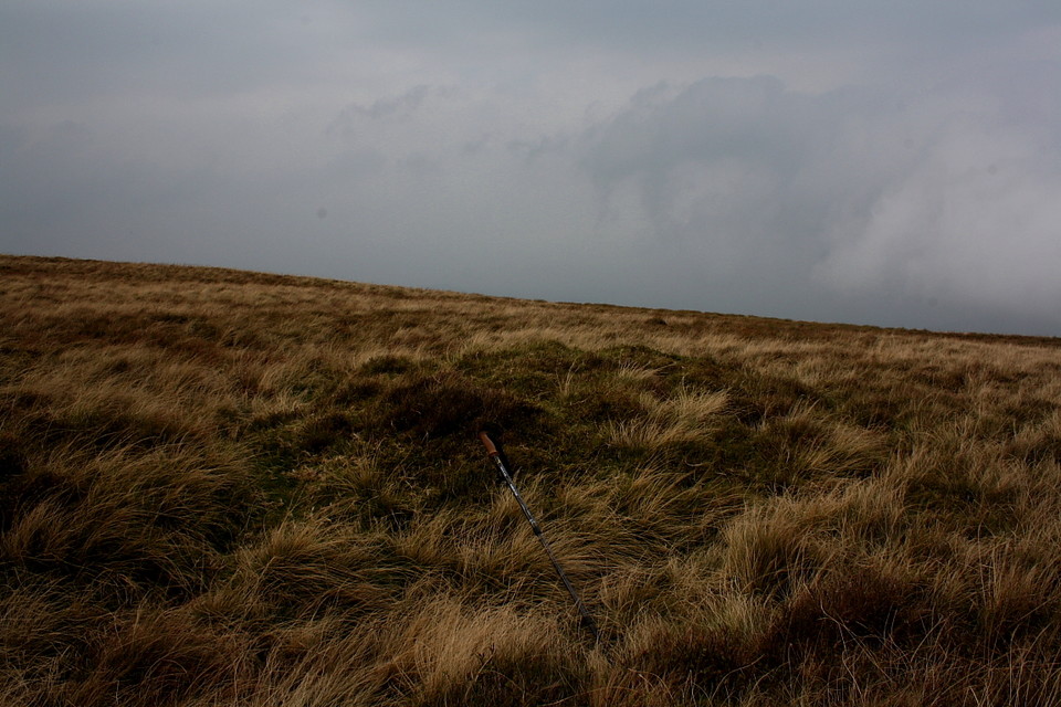
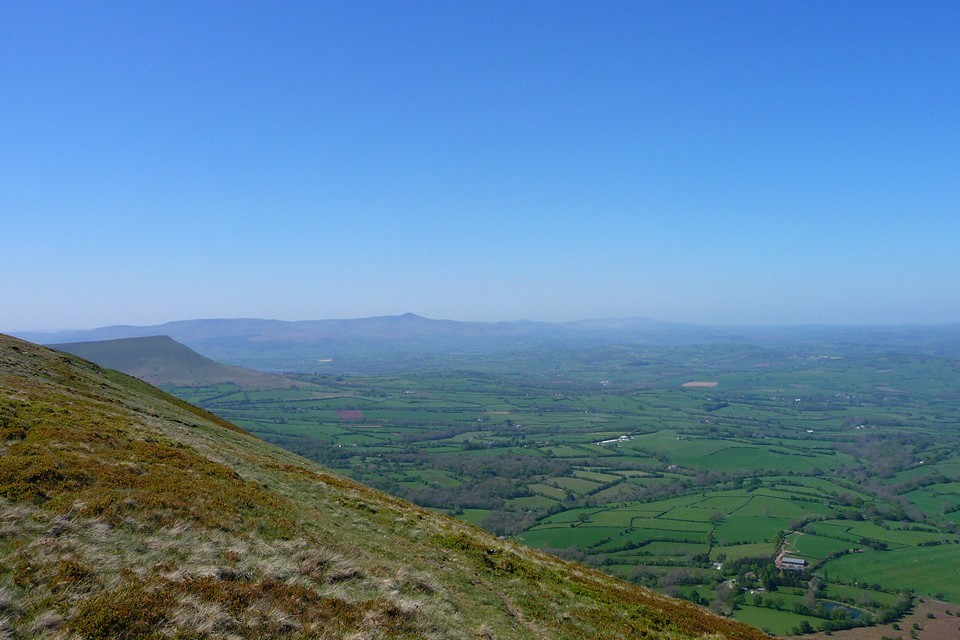
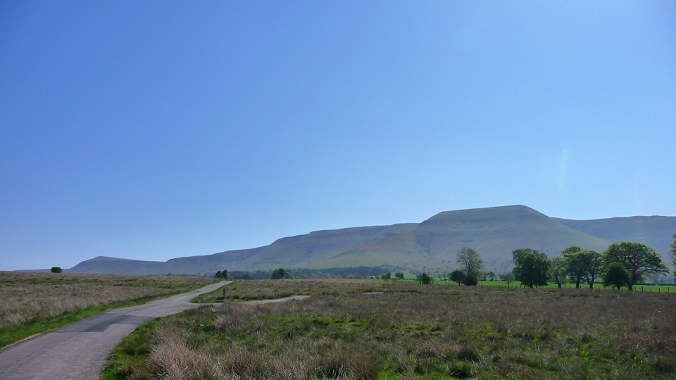
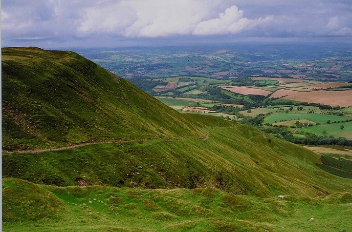
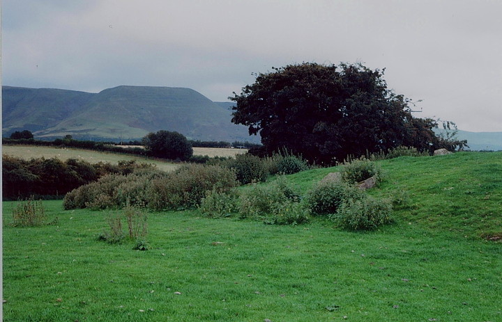
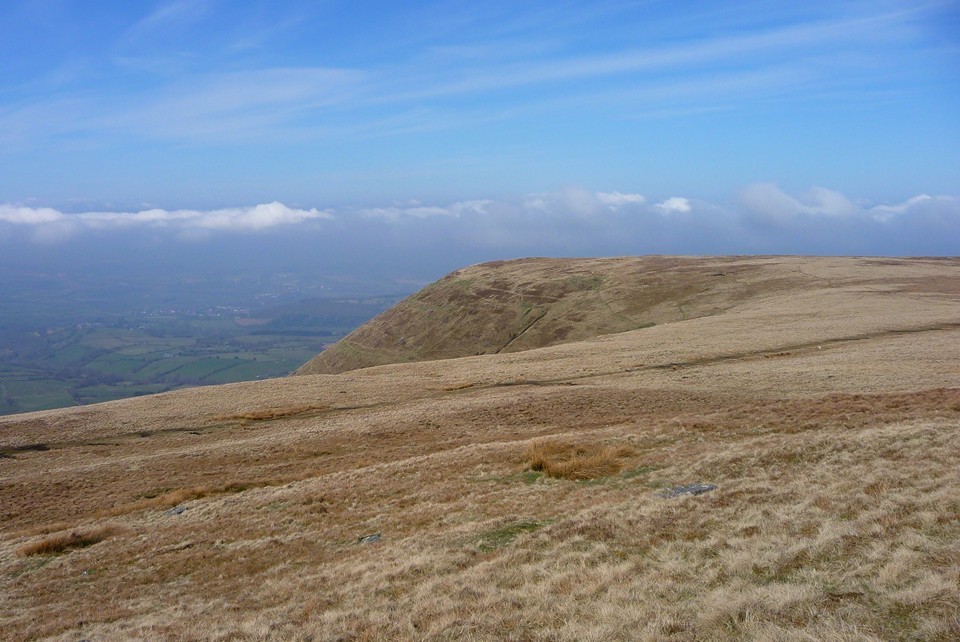
To be honest.... inquisitive travellers such as The Mam C and I don't require any excuses to revisit Y Das, north-western bastion of The Black Mountains. Yeah, the sublime views, particularly when perched upon the western escarpment edge looking across Mynydd Bychan and Cwm y Nant to Y Grib - that wondrous, narrow ridge breaching these uplands with all the certainty of a Masadian siege ramp - are surely sufficient reward to satiate even the most stilted heart? Nevertheless we have one. An excuse, that is, since previous visits here were manifestly unable to determine the location of a small Bronze Age round barrow said to reside upon the summit plateau. It really shouldn't be that difficult.... Oh, and we also want to carry on to conclude some, er, unfinished business upon nearby Mynydd Bychan to the south. The attractive village of Talgarth - still shadowed by the somewhat sinister Norman round keep of Bronllys, rising to the approx north-west - is the gateway to the hills around these parts. Incidentally possessing a good local bakery, too. Anyway, head east past the (main) church and, noting 'The Lodge' upon your left, pass through the farmyard at Ffostyll to arrive at a sharp right turn a little further on. Follow this, ignoring the right turn at Llanelieu Court, to park upon the copious grassy verge a little beyond the next right. Here, assuming the cloud base is clear of the summits, Y Das will be visible as the flat-topped, wedge-shaped height rising to the approx south-east, Mynydd Bychan and Y Grib the supporting cast right skyline (if this is not the case... I would seriously consider a postponement since the Black Mountains demand exemplary compass work in mist). We follow the signed, fenced bridleway heading for Rhiw Cwnstab, the landscape rising to pass the Wern Frank round barrow, this so overcome with the ubiquitous gorse as to defy all attempts at positive identification. The path eventually accesses a well graded track overlooking Cwm Cwnstab ascending to the bwlch between Y Das and Pen Rhos-Dirion, the bedrock old red sandstone adding a somewhat surreal twist to the colour palette utilised by Nature.... however we decide to venture off-piste and make our way up the grassy ridge itself straight to the summit. Just for the hell of it. The sheer contrast between the lush pastoral patchwork of fields lying far below and the brutal upland grass is perhaps as extreme here, upon the summit plateau of Y Das, as in any location in Wales. We go walkabout along the northern flank and it's the Mam C who makes the discovery first. A small mound set some considerable distance back from the escarpment edge so as to deny the visitor those exceptional downward vistas. It's by no means a substantial monument - Coflein's dimensions of '5.0m by 4.0m and 0.50m high' appearing realistic enough - but nevertheless relatively well defined, having apparently survived the ravages of several millennia up here pretty well, all things considered. We settle down for coffee - and chocolate for the Mam C - duly noting how the topography at this point limits views to the horizons, specifically excluding the immediate locale below. Clearly this needn't have been the case and hence would appear intentional. It also creates a fundamental disaccord between wishing to remain at the site and the urge to enjoy all this mountain top has to offer, aesthetically speaking. Eventually the latter can no longer be denied and we continue to the western escarpment edge. As mentioned at the beginning this is, in our opinion, a truly sublime viewpoint, the rollercoaster profile of Y Grib leading the eye toward Bwlch Bach a'r Grib, Castell Dinas and the soaring bulk of Mynydd Troed appearing far in excess of its relatively limited elevation. Across the cwm to the approx south rises Mynydd Bychan, the flank of Y Das falling precipitously to Cwm Dwr-y-Coed below. From here I reckon I can appreciate the position of the 'platform cairn' a little to the left of the modern cairn surmounting Mynydd Bychan's pronounced prow. Yeah, guess this should be our next port of call traversing this upland desert wilderness. |
 Posted by GLADMAN
7th December 2014ce Edited 11th December 2014ce |
|
Attempted to visit 28.4.2011. I walked up from Talgarth, following my route of last year. I didn't re-visit Wern Frank round barrow, but decided to crack on with the day's main uphill before it got too hot. It's a stiff climb, but more than worth the effort. But not for the barrow. Reading Mr G's notes, I feel better, as I couldn't find anything up here that looked comfortably like a round barrow. Plenty of heathery, peat-y lumps and bumps, but none that I would say hand on heart is "it". Prehistory radar on the blink then. But who cares? The views, once you've staggered up the northern face of the Black Mountains escarpment, are absolutely terrific. You get the whole spread of the Brecon Beacons to the west, from Allt Lwyd and Carn Pica, the central peaks of Cribyn, Pen y Fan and Corn Du, through the mountains of Fforest Fawr and all the way across to Fan Hir and Fan Brycheiniog in Y Mynydd Du. At least you do on a mist-free day (last time I was here the visibility was rather less impressive). After wandering around for a fruitless while, I headed northeast towards Rhos Dirion, the day's highest point. |
 Posted by thesweetcheat
6th May 2011ce |
|
An unobtrusive round barrow - presumably Bronze Age - set high upon Y Das, western promontory of Pen Rhos Dirion, itself rising to 2, 338ft and part of the great northern escarpment of the Black Mountains. Only formally 'recorded' in 2007, due, no doubt, to the undulating terrain and uncompromising nature of the summit plateau, the monument is easily overlooked if you don't know what you're looking at - as I can well attest, much to my subsequent shame. Nevertheless what a site to have as your final resting place, with mesmeric views of the Wye valley etc! The glider pilots, who use the thermals generated by the escarpment edge to great effect, probably possess the best view of all, but for the rest of us a reasonably straightforward path/track up Cwm Cwnstab, beginning at 188333, is the most direct route. Coflein: - 'An earth mound, 5.0m by 4.0m and 0.50m high. The mound was covered by grass and moss when recorded in September 2007'. In other words it looks just like a bump on the mountain top. Doh! Well, that's my excuse, m'lud. |
Posted by GLADMAN 26th September 2009ce Edited 26th September 2009ce |