The Modern Antiquarian. Stone Circles, Ancient Sites, Neolithic Monuments, Ancient Monuments, Prehistoric Sites, Megalithic MysteriesThe Modern Antiquarian


Smålands stenar

Stone Circle

<b>Smålands stenar</b>Posted by L-M KImage © L-M K
Latitude:57° 10' 18.76" N
Longitude:   13° 25' 41.33" E

Added by L-M K


Discussion Topics0 discussions
Start a topic


Show  |  Hide
Web searches for Smålands stenar
Show map   (inline Google Map)

Images (click to view fullsize)

Add an image Add an image
Photographs:<b>Smålands stenar</b>Posted by L-M K <b>Smålands stenar</b>Posted by L-M K <b>Smålands stenar</b>Posted by L-M K Maps / Plans / Diagrams:<b>Smålands stenar</b>Posted by L-M K

Fieldnotes

Add fieldnotes Add fieldnotes
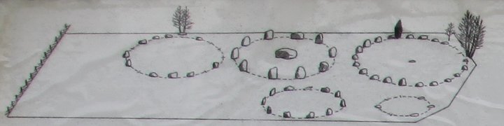
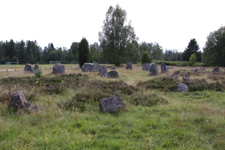
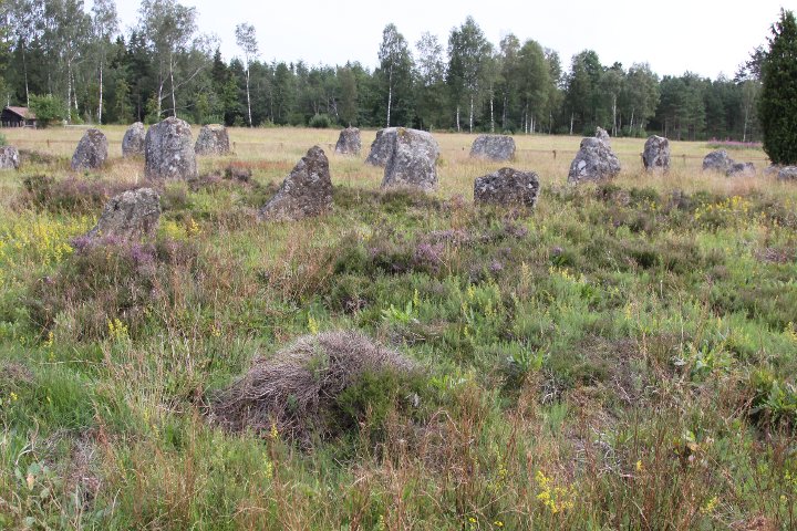
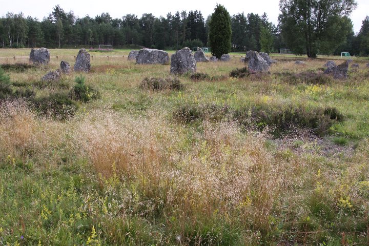
According to an info sign at the place, the five stone circles were built in the later iron age (0-500CE).

The name of the site, 'Smålands stenar' (the stones of Småland) which by the way has given the nearby town it's name (Smålandsstenar), was invented by the megalith-interested priest Daniel Nordin in the early 19th century. Before that, the name of the site was 'Skäppekullen'

How to get there
The town Smålandsstenar is about 72 kms along road 26 from Halmstad.

Driving northwards, almost when you have exited the town, there is a white sign with black letters 'Gravfält' pointing to the right. Turn right and drive about 500 metres, then turn right and drive 250 metres.

The circles can be seen in GE (or google maps).
Posted by L-M K
9th August 2009ce
Edited 12th August 2009ce