|
|

|
|
Vauxhall CrossAncient Trackway
|
|
|
|
Images (click to view fullsize) |
|
Photographs: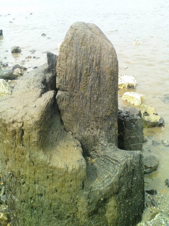
 Artistic / Interpretive:

|
Fieldnotes |
|
|
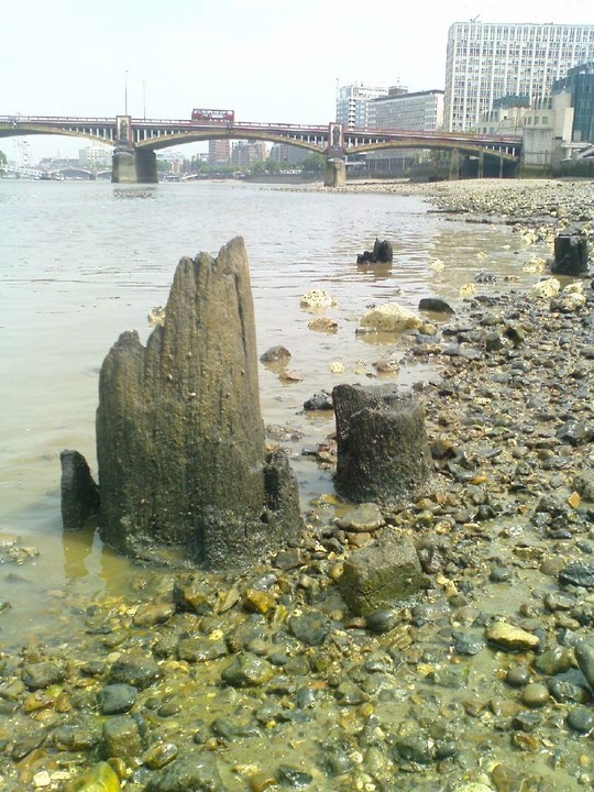
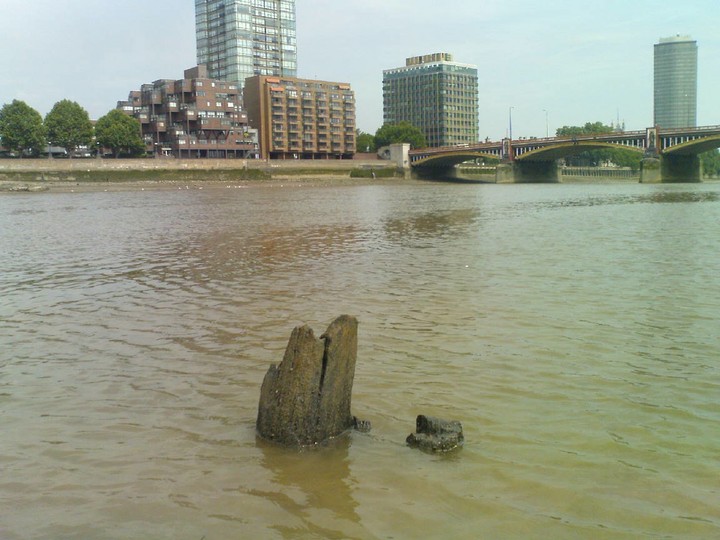
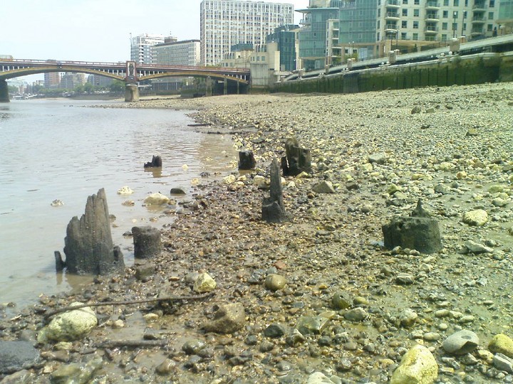
To view the site of the timber structure, walk north east along the embankment road from the southern end of Vauxhall bridge past the MI5 building. This is easy to spot as it looks exactly like a secret services building. Between Mi5 and the adjacent office building is a short road which leads to a ramp down into the river. This is the route used by the amphibious London 'Duck' tours. You will need to go at very low tide. Tide times can be found here: http://www.pla.co.uk/display_fixedpage.cfm/id/11/ (Add an hour or so onto the Tower Pier times). Turn left at the bottom and walk under the bridge. On either side of the bridge in the embankment wall you will pass the outfalls of the river Effra. (Opposite further upstream on the north bank you will see an arched opening which is one of the outfalls of the river Tyburn). The structure is visible as a collection of timber stumps in the river just beyond the huge green glass St George's apartment development which is above you on your left. The timbers can also be seen from above - again only at very low tide - from the raised embankment path to the south west of the bridge at the end of the St George's development - not where the information board claims. |
 Posted by nix
16th June 2009ce Edited 26th June 2009ce |
Miscellaneous |
|
|
The dig is here in their Bronze Age Compilation: http://www.channel4.com/programmes/time-team-digs/4od#2927032 |
Posted by nix 8th March 2011ce Edited 10th March 2011ce |
|
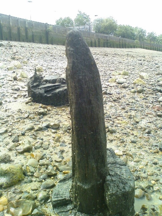
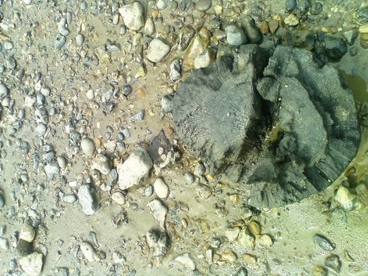
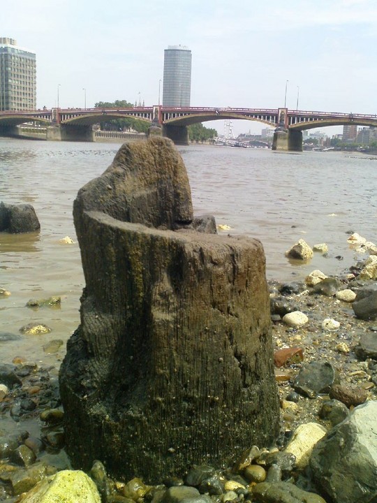
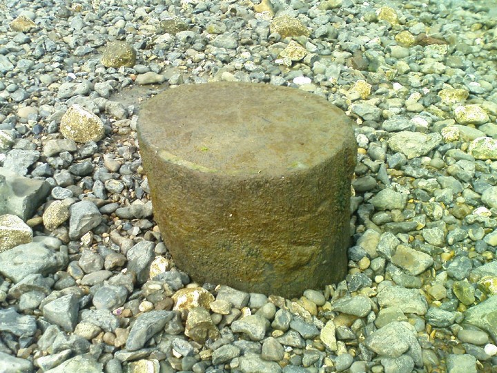
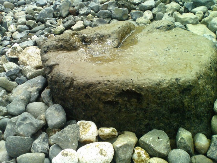
Standing at Vauxhall cross - a large busy intersection of railway lines, an underground station, bus station a traffic roundabout and the home of MI5 - it is difficult to imagine that this is a site of some prehistoric significance. But take the ramp down to the relative peace of the Thames foreshore at low tide and things become clearer. In 1999, following the discovery of neolithic axe heads by a member of the public, the remains of a bronze age timber structure were found - revealed by the eroding river bank. The site was partially explored further by Time Team in 2002 (Series Nine Episode 1) who found further axe heads and investigated one of the posts. The structure is considered to either be an early bridge across the river or possibly a jetty intended to connect the shore with an island which is now lost. The Thames at the period in question would have been much shallower and many such Eyots - raised gravel mounds - exist under the water. Bronze spears were also discovered - apparently intentionally placed into the river bed. This location is topographically significant - it is the point where the tidal Thames turns - where salt water meets fresh and the place where the rivers Effra, on the south bank and Tyburn, on the north, (both now subterranean) empty into the greater river. These outfalls can also be seen at low tide. As these rivers were once navigable, it is likely that the area was a focus of some activity and it appears that several ancient routes converged upon it - as their contemporary equivalents still do. A southern projection of the Roman Watling street reaches the river on the bank north of Vauxhall. In this analysis: http://www.johnchaple.co.uk/medieval.html the author attributes Kennington lane as being on the route of a raised pre-roman trackway between the site of the original Kennington settlement (on a gravel hill above the Thames flood plain) and Vauxhall. The timber bridge / jetty would then be a continuation of this route - linking the Kennington settlement either with the 'holy' island or the north bank of the Thames. There are two rows of about twenty stumps - leaning inwards and giving an estimated jetty width of about four meters. Each is approximately 400mm in diameter. The structure may be soon gone because now exposed, it is subject to erosion - although Time team established that the posts are deeply grounded. The mystery is at least as much as how timber can survive for thousands of years - particularly in a situation like this. For further info, refer to: http://www.britarch.ac.uk/ba/ba46/ba46news.html |
Posted by nix 16th June 2009ce Edited 26th June 2009ce |