|
|

|
|
Tow BarrowLong Barrow
|
||||||||||||||||||||||||
|
|
|
Images (click to view fullsize) |
|

|
Fieldnotes |
|
|
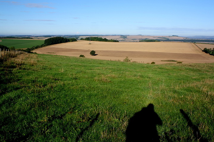
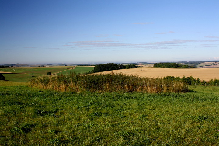
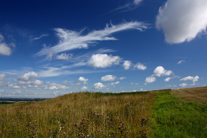
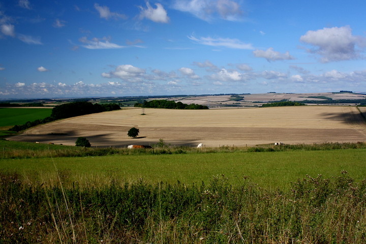
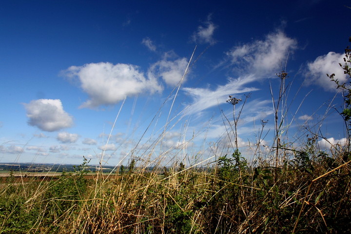
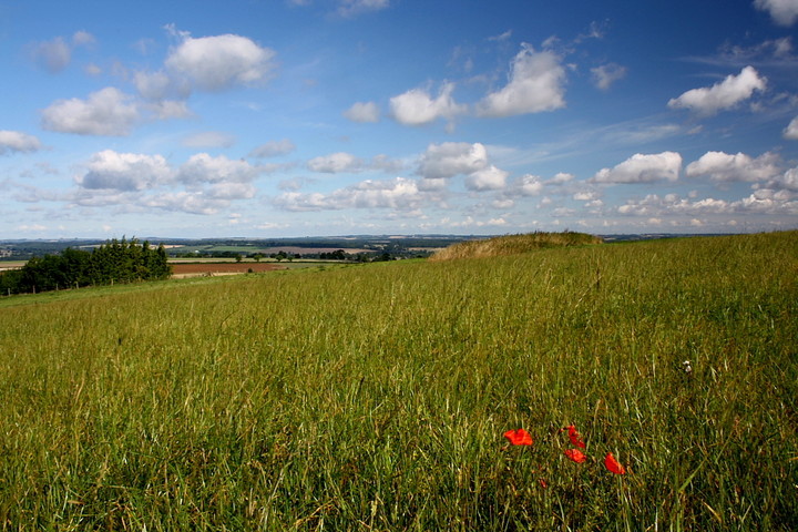
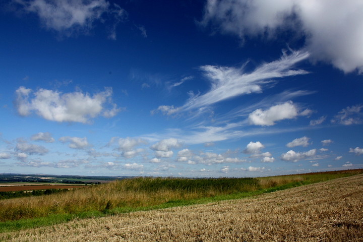
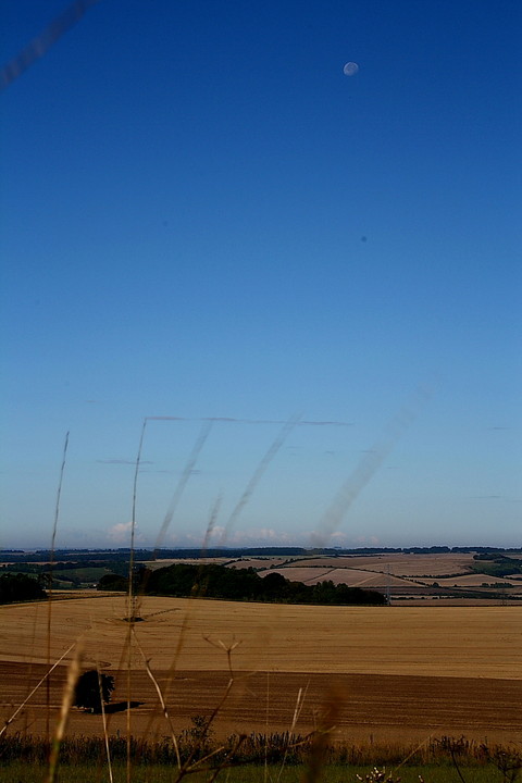
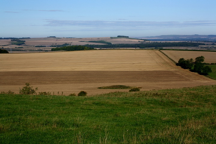
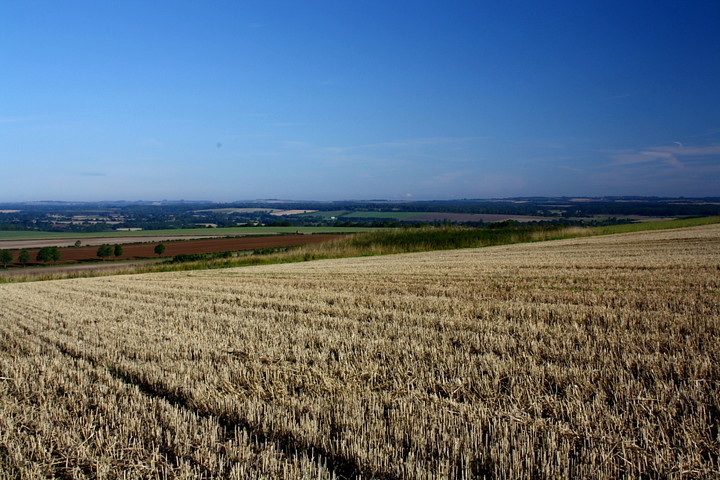
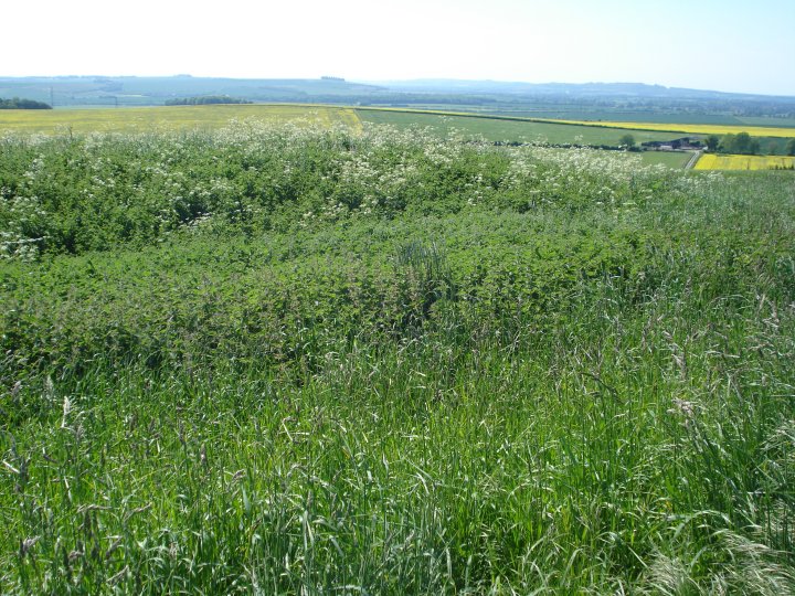
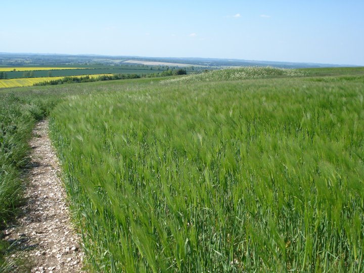
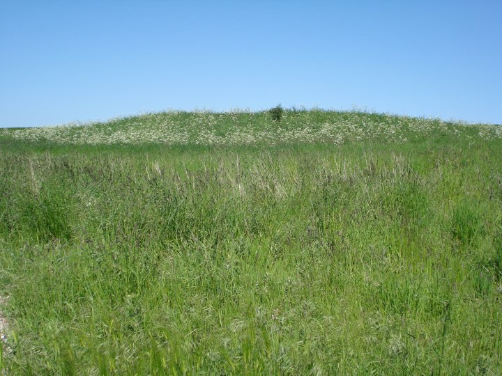
August Bank Holiday weekend isn't usually noted for providing much opportunity to exercise the old grey matter... not that there's anything wrong with the usual cliches, you understand, but I can do without garden centres and barbecues if the opportunity to do something different arises, thanks very much. So a trip to see The Mam C in South Wales is a welcome prospect this morning. Once the customary extreme reluctance to drag myself out of bed is overcome, that is. Today, I decide upon a diversion in Wiltshire en route. As you do. As Chance notes, the area south of Hungerford could well lay a claim to be 'long barrow central', such is the volume of sites to be seen. Arriving early morning at the tiny hamlet of Tidcombe, the deep blue sky promises a beautiful day. A bridleway - initially of tarmacadam - ascends Tidcombe Down (ha! how our language must confuse the Germans!) to the approx SW, the mutilated, yet nevertheless substantial Tidcombe long barrow itself visible to south-east. The track continues, the surface grass now and sodden with heavy dew which plays havoc with my light boots, crossing a field of golden crop . What looks mightily like the long barrow rises beyond... yet it is in the wrong place according to the map. Hmmm. The route bisects another path and here, to the right, a concrete water tower leads the visitor to an OS trig point near the rogue 'long barrow'. Aye, 'tis a reservoir after all. I follow the path downhill towards a copse of trees and a wondrous view, veering across grass to the left. Sure enough a large round barrow is soon visible, an even larger example apparently standing up hill to the south. But no, even in its seriously overgrown state, side ditches proclaim this to be the long barrow, if a somewhat short, long barrow. Right on! A further large round barrow sits in the field below to the west, beyond a herd of somewhat perplexed cows. The beauty of this landscape is spellbinding in this light, not spectacularly so as that of a mountainous region, perhaps, but captivating nonetheless with The Vale of The White Horse on the northern skyline, that of Pewsey the western. It's difficult to find somewhere to sit - OK sprawl - amongst the nettles, but, that feat accomplished, what a morning to contemplate 'stuff' - human stuff such as relationships and what not - with the moon hanging suspended in an impossibly blue sky. Hey, I swear the insurmountable suddenly seems feasible up here. And why not? For me this is one of the key reasons to visit these wonderful places... clarity of thought. That's not to say it's absolutely quiet at Tow Barrow today.. but farmers have gotta do what farmers have gotta do. I'm glad I came. |
 Posted by GLADMAN
4th September 2010ce Edited 4th September 2010ce |
|
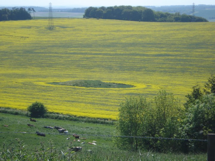
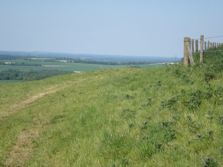
This late Neolithic long barrow is short at 30m long and only stands 1.5m high by 22m wide, but has only been partially excavated, just before the outbreak of world war one in 1914. Few notes survive of the findings made by O.G. Crawford and Hooton, with some of the Neolithic pottery now housed at Harvard University in America. The long barrow survives well as an earthwork, orientated SSW-NNE on the crest of a west facing slope, surrounded by several later Bronze Age round barrows, most examined at the same time in 1914. Like most of the long barrows, the flanking ditches, from which material used to construct the mound was quarried, run parallel to the north and south sides of the mound. These have been partly infilled during the years but survive as earthworks 5m wide and 1m deep on the south side and 6m wide and 1.5m deep to the north. The barrow is easy to reach from the fair mile and a farm track runs up to the top of the hill with a water tower. I travelled up by cycle but you should have no trouble if you want to try driving up to it. If not, park up by the Fair mile and walk up the track, past Ash Tree Dryer and walk into the field along the fence line. I visited at the end of May and the surrounding field was sown with barley. Cross into the pasture and follow the fence to view the later round barrows. This site should be viewed in conjunction with the other long barrows, disc barrows and bell barrows within the 3 mile radius. Use the Magic site or Google earth to get the bigger picture. Here's a link to try http://www.magic.gov.uk/website/magic/opener.htm?startTopic=magicall&chosenLayers=moncIndex&xygridref=426987,157257&startScale=20000 |
 Posted by Chance
24th September 2009ce |