|
|

|
|
Goddards Barn BarrowRound Barrow(s)
|
||||||||||||||||||||||||
|
|
|
Images (click to view fullsize) |
|
|
Fieldnotes |
|
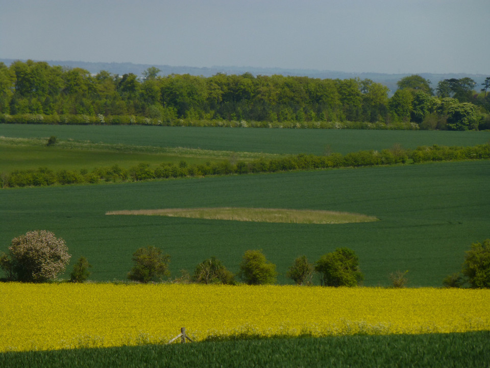
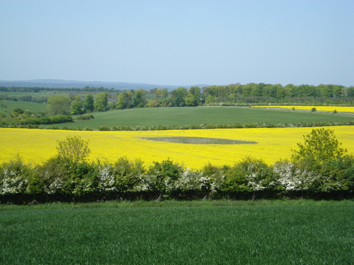
| A bronze age bowl barrow. I would say it is just over a meter high as you can see it above the oil seed rape wich surrounds it. it is situated 300 yds south of Goddards Barn below the ridgeway, thus the name. |
12th May 2009ce |
Miscellaneous |
|
|
Details of Barrow on Pastscape Monument No. 233715 A Bronze Age round barrow is situated on a north west facing slope overlooking a dry valley. The barrow is recorded, in varying states of preservation, on aerial photographs. It is visible as an earthwork mound, with a diameter of 30m, on early photographs. The outer ditch of the barrow, which has a diameter of 60m, is visible as a cropmark on more recent photographs. [SU 41818612] Very large mound, about 50 paces in diameter and about 8 ft. high under cultivation, apparently a barrow, noted by O.G.S. Crawford. It lies 300 yards south of Garddard's Barn, West Lockinge, at Lat. 51 34' 19" and Long. 1 23' 48". (1) SU 41748619 Large Bowl barrow [There is a large mound on the 6" (SU 48 NW) a short distance S.E. of Grinsell's siting and it is possible that this is the barrow referred to by authorities 1 and 2]. (2) This ditchless mound is at SU 4185 8612. (Published on O.S. 6" 1960 at SU 4187 8610). Cultivation has caused a degree of spreading and the height is now 1.7 metres. It is almost certainly artificial and is probably a bowl barrow. Surveyed at 1/2500. (3) The Bronze Age round barrow referred to by the previous authorities is situated on a north west facing slope overlooking a dry valley and Goddard's Barn. The barrow is recorded, in varying states of preservation, and has been mapped from aerial photographs. It is visible as an earthwork mound, with a diameter of 30m, on early photographs. The outer ditch of the barrow, which has a diameter of 60m, is visible as a cropmark on more recent photographs. (4) -------------------------------------------------------------------------------- SOURCE TEXT -------------------------------------------------------------------------------- ( 1) General reference Berks. A.J., 43, 1939, 13. (L.V. Grinsell) ( 2) General reference Reading Mus. 6" 13.9.62 ( 3) Field Investigators Comments F1 JP 17-MAR-64 ( 4) Oblique aerial photograph reference number NMR SU4186/4-9 (2169/1049-54) 20-JUL-1984 |
 Posted by Chance
16th September 2012ce |