|
|

|
|
Carreg Maen TaroStanding Stone / Menhir
|
||||||||||||||||||||||||
|
|
|
Images (click to view fullsize) |
|


|
Fieldnotes |
|
|
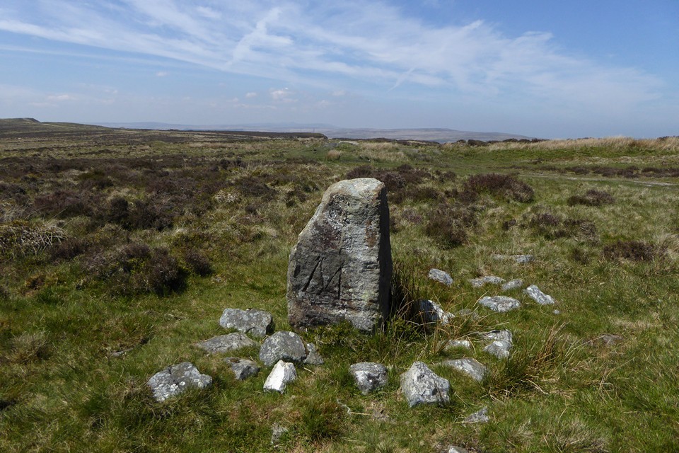
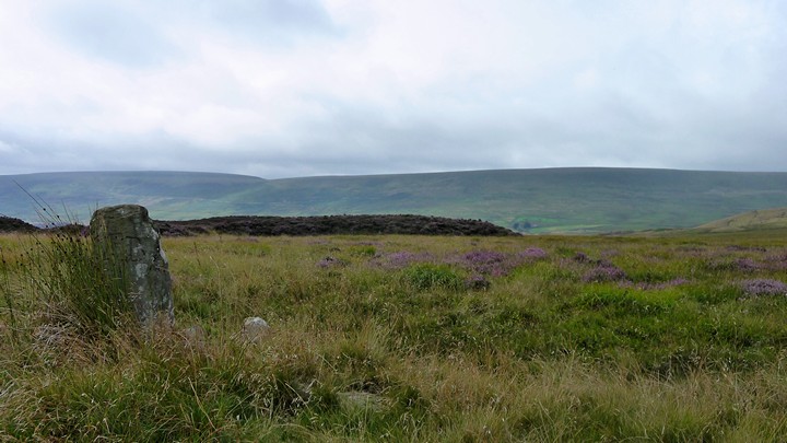
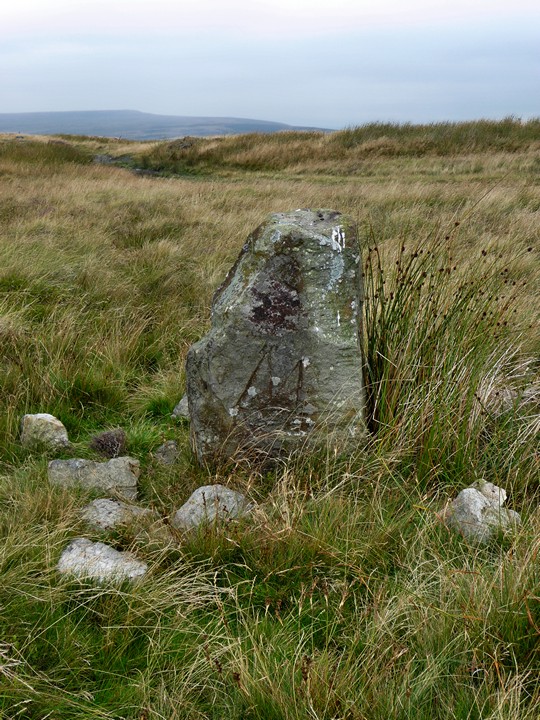
A long overdue revisit on a hot and sunny bank holiday Monday (31 May 2021). I arrive here the long way round this time, after a lengthy walk from Blaenavon over the moorland tops of Mynydd Coety and Cefn Coch. Descending to Waun Afon, I'm glad of the dry weather as the causeway across the moor (complete with mostly-stripped, overturned car) is partially under water. Once I reach the road, the landscape turns rather grimly industrial, gravelly tracks winding up the humps of disused mining and quarry tips. The scars on the immediate foreground are greatly compensated for by the terrific panoramic views along the northern skyline though, from Pen y Fan to the northwest, Mynydd Llangatwg and the Black Mountains north, and the Sugarloaf/Mynydd Pen y Fal and Blorenge northeast. The stone is as small as I remember, although at least it hasn't got any smaller. The last time I came, I came straight up from Blaenavon and I barely knew any of the skyline hills by name, let alone by personal experience. Now I return to a landscape where I recognise all the distant hills and have climbed most of them, so the landscape context is greatly enriched on this second visit. I still have doubts about the age of the stone, but there's no doubt at all about the pedigree of its placement. I'm glad to be back here, and it's especially good to return to South Wales after what seems like a very long time. After a nice rest and some food, I head up over the tall spoil heaps to the east before heading to the heaving bank holiday carpark by Pen-ffordd-goch pond, then on to the gentle (and thankfully final) climb to the masts on Cefn y Galchen and an equally overdue revisit to Carn y Defaid. |
 Posted by thesweetcheat
12th February 2022ce Edited 12th February 2022ce |
|
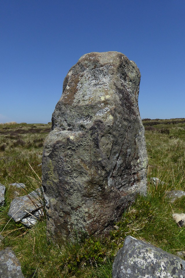
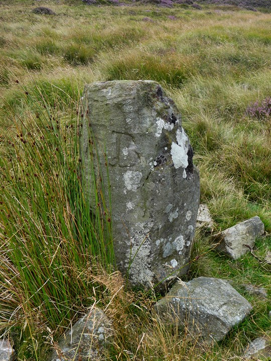
Visited 1.4.14 Directions: From Blaenavon take the B4246 north towards Abergavenny. When you reach the top of the mountain you will see a lake and car park on your right. Directly opposite there is a road to the left – turn here. Drive down the road and after about 1 mile you will see a pub on your right (Lamb and Fox) and a rough car park opposite – park here. From the car park walk up the track until it splits into several ‘tracks’. The track leading to the highest ground (above the workings) and the stone can be seen in the distance to your right. The walk only takes about 15 minutes. It was a quiet day in work and the chance was to be had for an early finish. I would have been a ‘fool’ not to take advantage of the opportunity! It was a warm, sunny day as I drove up through the World Heritage Site of Blaenavon and out onto the open mountainside. There were a couple of ‘likely lads’ hanging around the car park so I made sure the car was locked as I headed out onto the hillside. Judging by the amount of fresh lorry tyre tracks I saw this area is still being used for some reason or other? Now, I often refer to these moorland sites as bleak. But there are two types of bleak; bleak in a nice way i.e. the Brecon Beacons or bleak in a horrible way i.e. old industrial area (South Wales Valleys). Unfortunately this site falls into the latter category – unless industrial history happens to be your thing of course. Carreg Maen Taro is about 1 metre tall and the ‘M’ + ‘B’ markings are obvious. The stone is covered in lichen of various shades of green. There are many large stones scattered around the base of the stone. I then walked over to the nearby fallen stone which made a handy place to sit and write these notes. Oddly enough this stone was covered in white lichen. All was quiet here except for birdsong – which is always nice. The only company I had were a few scraggy sheep and a lone horse in the distance. The sun was warm with only a slight breeze. The views would have been very good had it not been for the haze, although the Sugar Loaf and the Blorenge were easy to make out. I sat a while and was well with the world. It was certainly better than being in work! On the way back to the car I managed to collect a bag of horse manure for the vegetable patch – always a bonus! This is an easy site to visit and worth the effort if you happen to be in Blaenavon visiting the famous iron works. |
Posted by CARL 2nd April 2014ce |
|
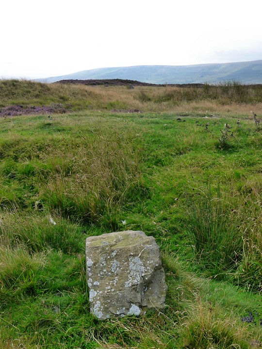
Visited 14.8.2009 on a cloudy walk up from Blaenavon. The site is both better than expected and a bit of a disappointment - better than expected as the position is superb, with excellent views north over the Black Mountains, to nearby Blorenge and the Sugar Loaf; a bit of a disappointment as the 1.7m stone in Coflein turns out to be rather smaller - less than a metre in height. It has the inscribed M and B, and there is another smaller, fallen stone a little distance to the north, nearer to the edge of Blaen Pig. Definitely worth a visit, despite the shrinking size of the stone. |
Posted by thesweetcheat 30th August 2009ce Edited 30th May 2021ce |
Folklore |
|
|
From Coflein: "This is an ancient standing stone erected (according to tradition) in early British times to commemorate a battle which was fought here between two kings or chiefs, one of whom was named Ifor. ..... About 1km to the south east of Carreg Maen Taro is the site of two burial cairns called Careg-Croes-Ifor (nprn 405021), presumably the same Ifor mentioned above, and Pen-ffordd-goch (the head of the red road) (nprn 404999), 1.5km to the south east, is said to take its name from a battle waged there; there thus seems to be a vague tradition of a battle fought somewhere in the area. B.A.Malaws, RCAHMW, 13 October 2006." |
Posted by thesweetcheat 28th March 2009ce |
Miscellaneous |
|
| Chunky standing stone 1.7m high on the boundary of Breconshire and Monmouthshire. It has the letters "B" and "M" inscribed, reflecting the two counties. |
Posted by thesweetcheat 28th March 2009ce |