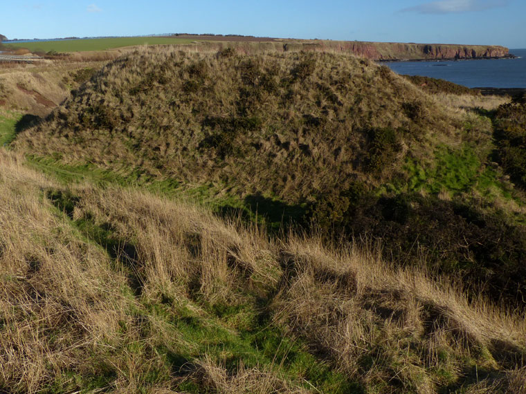
Of the Iron Age promontory fort of Maiden Castle nothing tangible remains except what appears to be a prominent grassy mound some ten or so metres high. But once you climb this it is clear that it is a rampart: a gently curving ridge, just two metres wide along its crest, protecting the narrow grass and gorse covered headland beyond.
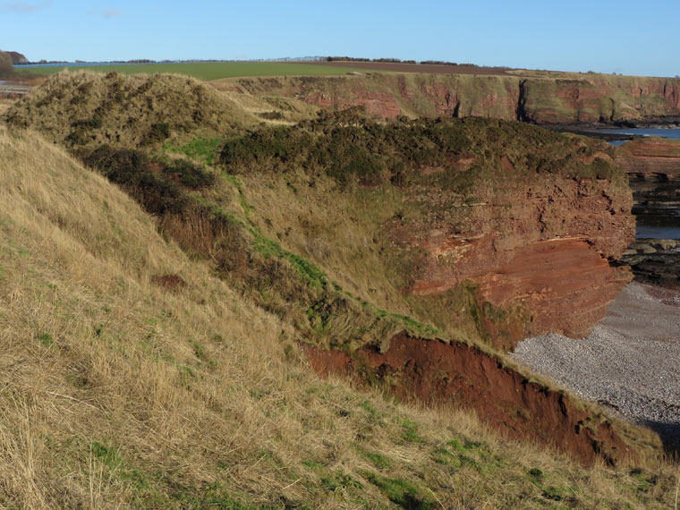
From the shingle beach below it is clear why a fort was built here: rugged 30 metre cliffs provided no means of access.
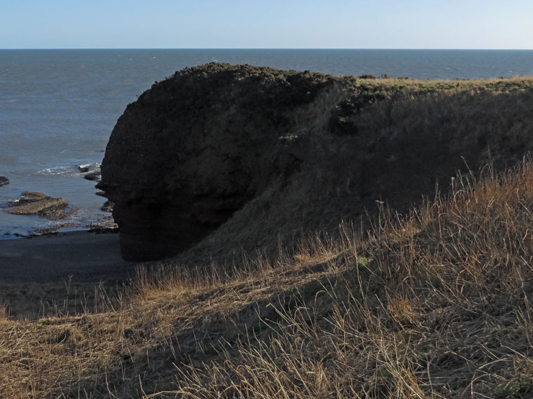
Maiden Castle lies beside the coastal path heading north from Arbroath, about 1½ kilometres walk from the sea-front car-park. The mound comes prominently into view shortly after turning the corner above the sea stack known as the Deil's Heid.
Maiden Castle is a fantastic vantage point providing breath-taking views over Carlingheugh Bay. Just north of the Castle, easy grassy slopes lead down to the shingle beach from where you can admire the amazing sandstone architecture all around you.
This promontory fort had little worry of attack on its seaward side, as it's protected by 80 foot cliffs. And on the other side, it's defended by an impressive 11m high rampart. There are several caves beneath it:
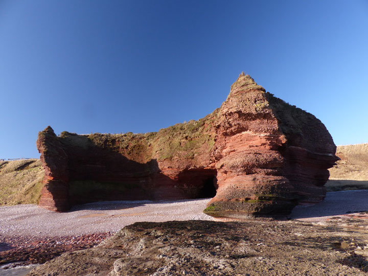
There are several caves in the rocks, along the W. between Arbroath and Auchmithy, one of which can be entered only at low water. When seals abounded on this coast, it was customary to let people down to this cave with a rope round their body, to the depth of 40 feet, with ropes of straw rolled round their legs, and bludgeons in their hands, in order to kill seals.
There is another, called the Maiden Castle cave, the entry to which is about 10 feet above high water-mark. The mason-lodge of Arbroath built a gate to it, and gave it a door many years ago. They walked in procession every year on St. John's day* from Arbroath to this cave, where they admitted new members. It is about 231 feet long, and from 10 to 24 feet broad. At the farther end there is a spring of fine water, but exceedingly cold.
Above the cave are the vestiges of a fort, about 100 feet above the level of the sea, and on the land side the remains of the fosse and rampart are still visible.
There is another cave, which appears as if it had been cut out of the face of the rock, the entry to which is about 40 feet above the sea. It is about 12 feet long, 10 broad, and 8 high. The access to it is difficult and dangerous.
This is from v12 of the Statistical Account of Scotland of the 1790s.
*This has got a curious tale as well. Because the Masons (still?) celebrate John the Evangelist's day, which is the 27th of December, and (more recently?) John the Baptist's day, which is the 24th June - that is, basically the winter and summer solstices. This page has more details.

 Posted by LesHamilton
 Posted by Rhiannon