|
|

|
|
WelshburyHillfort
|
||||||||||||||||||||||||
|
|
|
Images (click to view fullsize) |
|
Photographs: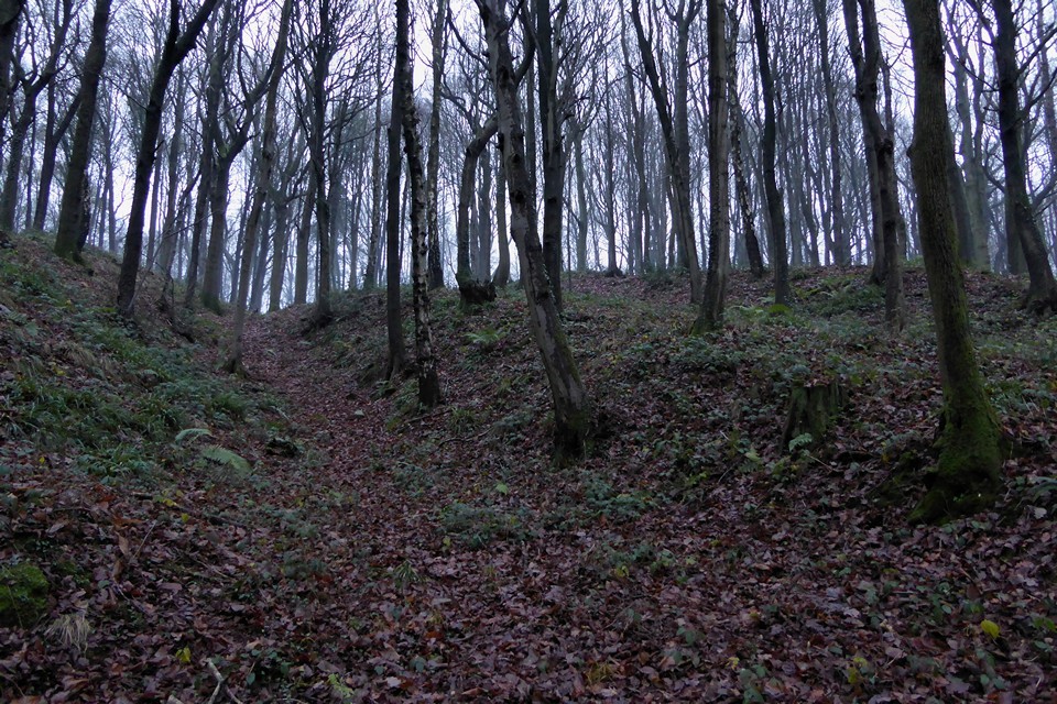
 Artistic / Interpretive:
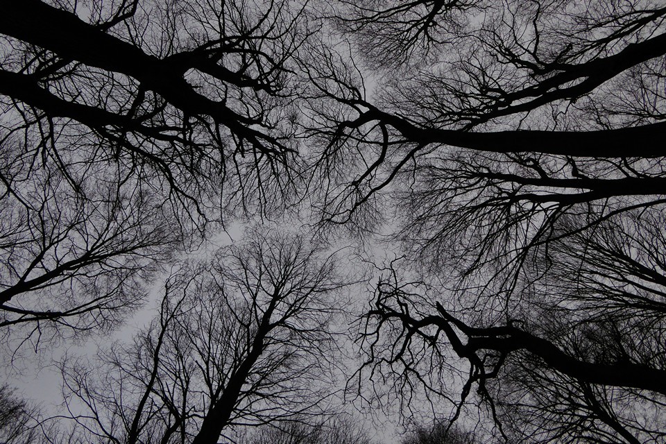
|
Fieldnotes |
|
|
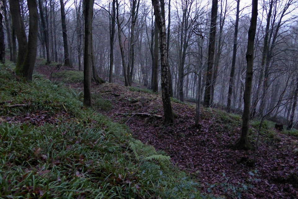
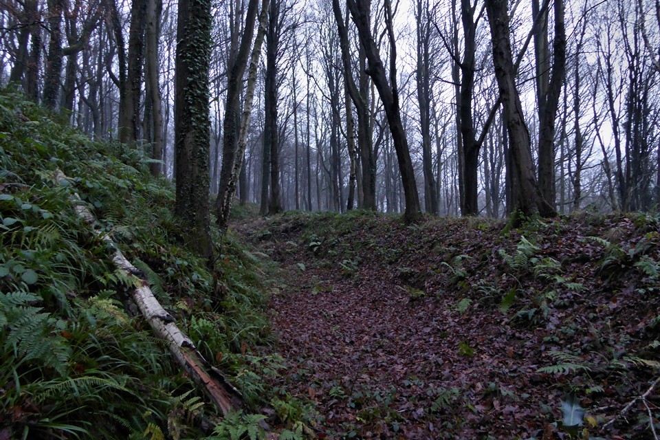
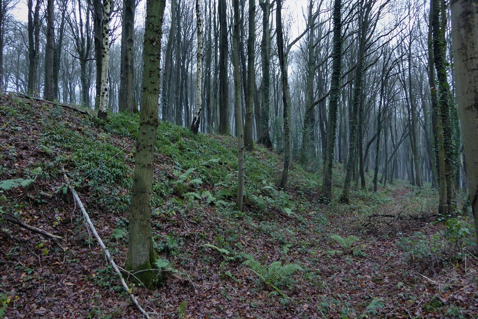
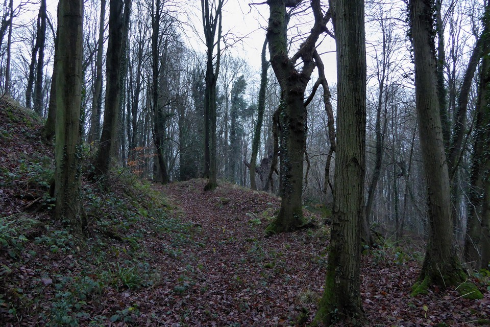
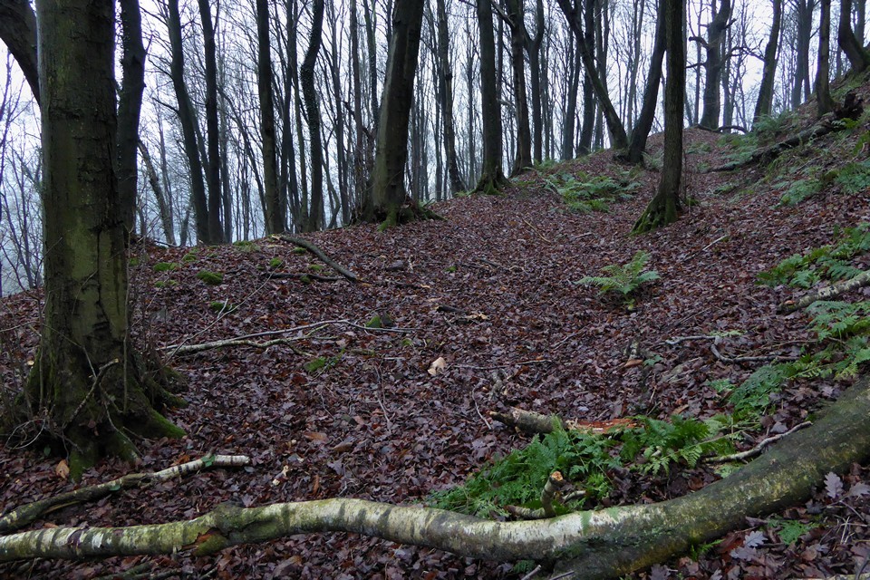
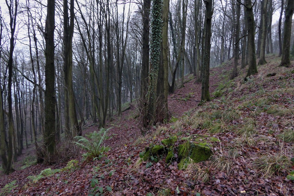
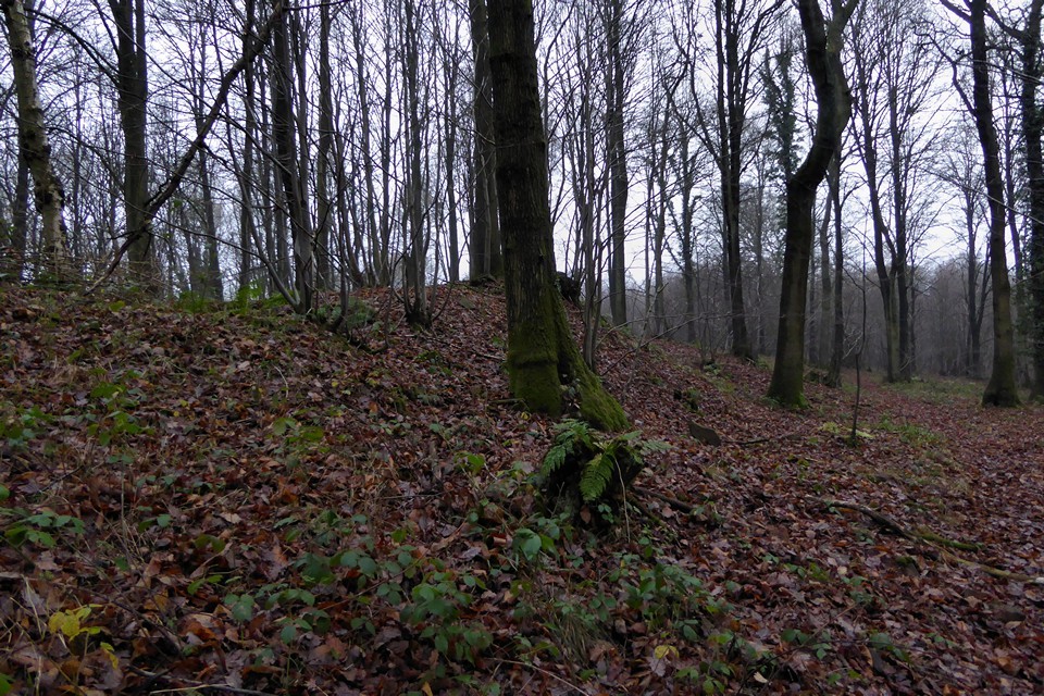
A very overdue visit on 17.12.2016. It's the best part of 7 years since I added this site to TMA, so really about time I made the effort to come here. Heeding the warnings of Carl's approach, I come at the site from Little Dean to the south, via the edge of the woods below Chestnut Inclosures. It's been a claggy, misty December day and the light is dull, tendrils of mist rising from the Severn a couple of miles or so to the east. Where the path Carl was on gets to the southern edge of the hill, a narrower footpath heads north up the hill - it might be easy to miss this in summer as the vegetation seeks to strangle it, so look out for a stile into a field on the south, which is opposite the entrance to the footpath. Coming from this direction the ascent is at its most gentle, the steeper slopes of the hill are on the north and east sides. Before reaching the fort, there is a meeting with a remarkable tree, a massive beech of huge height and girth, and great age for the species. The woods here are a lovely mix of deciduous trees, birch and beech, oak and chestnut. The footpath arrives at the southern tip of the fort, where a bank rises on the right but nothing on the left, making it a little difficult to gain bearings of the layout at first. In fact the fort is an irregular shape, like a "q" with this bank being the western side of the short tail (in fact it's very similar in layout to Midsummer Camp on the Malverns). It's immediately apparent that the banks here are stone-built, plentiful mossy stones protruding through the winter cover of dying vegetation. Because of this disorientation I initially keep heading north rather than following the bank around. The ground is still rising slightly, with a big drop now becoming apparent on the right (east). Soon I reach a confused junction of banks and ditches, which resolve themselves into the point where the tail of the "q" meets the body. The drop the east is now quite severe, with any view curtailed by the heavy tree cover and mist rising from the river valley beyond. Without the trees I imagine I might be standing in the thin upper reach of a temperature inversion. Deep leaf litter muffles my footfalls. Towards the north I come to a clearer circle, a fairy ring among the trees. This is the only clear and relatively flat spot within the fort interior, and makes a good place to stop and take in the quiet of the woods on this somewhat eerie day. At the northern end the ground drops very abruptly, a 5 metre drop from the top of the rampart to the next level down. It seems that this has been created by terracing the naturally steep slope rather than needing to create a wholly artificial defence, but it would certainly be a formidable obstacle and provides an excellent vantage over the valley below. The killer construction though is on the west. Here a massive inner bank towers above two further lines of bank and ditch. There is a wide space between inner and middle defences, which gives the impression that the outer ditches are slight and shallow in comparison. This impression is quickly dispelled by dropping down the slippery slope for a closer look, which reveals the middle ditch to be a good 6 feet deep. Near the southwestern corner, the lines of ramparts are crossed by a slightly raised causeway, but it's not clear whether this represents an original feature or a later intrusion. Either way it's a pretty steep climb back up to the inner rampart. Disembodied voices and the bark of a dog rising from the valley settlement below to the west, the screech of an irate squirrel somewhere in the trees above me and seagull cries from the Severn are the only noises to interrupt the quiet. No boars today, although grubbings and scrapings in the soft earth at the top of the hill appear to indicate their occasional presence. The day has been grey throughout, and this close to Midwinter the light fails early. By the time I've walked around the site and its defences, it's getting towards 4 o'clock and already darkening. Although it's a fairly compact fort, the multiple lines to explore make it feel bigger and it's taken me a good hour to get round it. It's an atmospheric place, and one that would repay a visit on a sunny spring day before the canopy refills and the brambles entwine the accesses. |
 Posted by thesweetcheat
18th December 2016ce Edited 18th December 2016ce |
|
Visited 10.3.12 Directions: Take the A4151 west from Elton towards Cinderford. Then take the minor road north signposted Pope’s Hill. When you arrive at Pope’s Hill go west past the impressive Flaxley Abbey (why is there an Abbey stuck out here on its own?) and keep an eye out for the public footpath sign on your left. This is opposite a small farm outbuilding and has a convenient parking space for one car next to it. Karen, Sophie, Dafydd and little Ella-May (granddaughter) stayed in the car whilst I trudged up the path towards the Hillfort. The ‘path’ is popular with horse riders judging by the amount of muck and mud and it was with some difficulty I skirted around the worse of it. However, the higher up the path I got the less mud/muck I encountered. The ‘path’ skirts around the north / west of the Hillfort I was looking for a way to come off the path and strike out for the summit. This was proving to be very difficult due to the dense undergrowth. Luckily enough I found an area of brown, collapsed ferns which looked like my best bet (this would also have been difficult to access if I had come in the middle of summer). I made my way up the steep sided hill with the warm spring sunshine on my back. Now, either I am getting older or these hills are getting steeper? Either way the sweat was soon dripping off my forehead and it was time to take the top off – steady girls! As I said it was a steep old climb but when I got to the top it was worth the effort. I only had time to explore the northern defences which consisted of a single ditch / rampart still a stunning 5 metres high in places! Had it not been for the trees it would be a tremendous view from this commanding of positions. On the way back down to the car I noticed a slow worm sunning itself on the dry bracken. I had a quick look but didn’t want to disturb it. All in all worth the effort although this site would only be accessible to those who are mobile and fairly fit. |
Posted by CARL 13th March 2012ce |
Miscellaneous |
|
| Although only covering an area of 1.7ha, this small hillfort has an impressive three lines of ramparts on the south and west sides. |
Posted by thesweetcheat 23rd February 2009ce |