|
|

|
|
Cleeve CloudHillfort
|
||||||||||||||||||||||||
|
|
|
Images (click to view fullsize) |
|
Photographs:


 Maps / Plans / Diagrams:
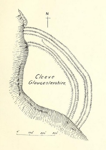 Artistic / Interpretive:
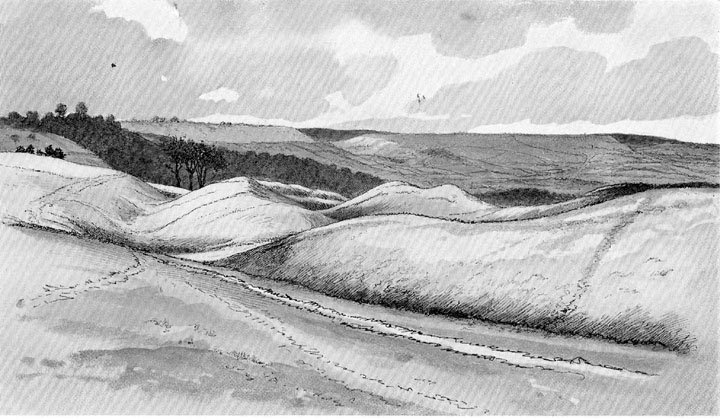
|
Fieldnotes |
|
|
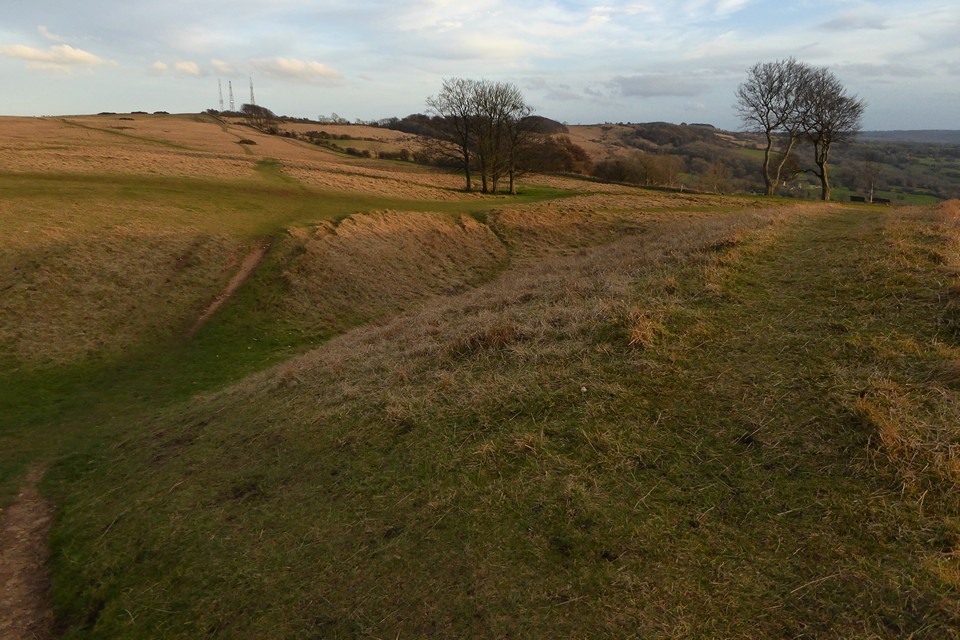
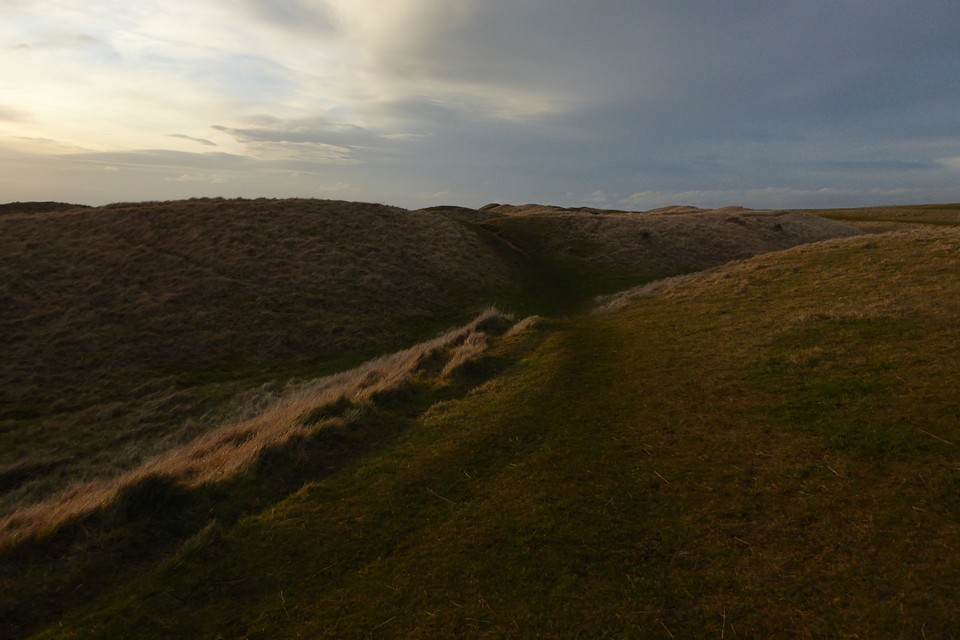
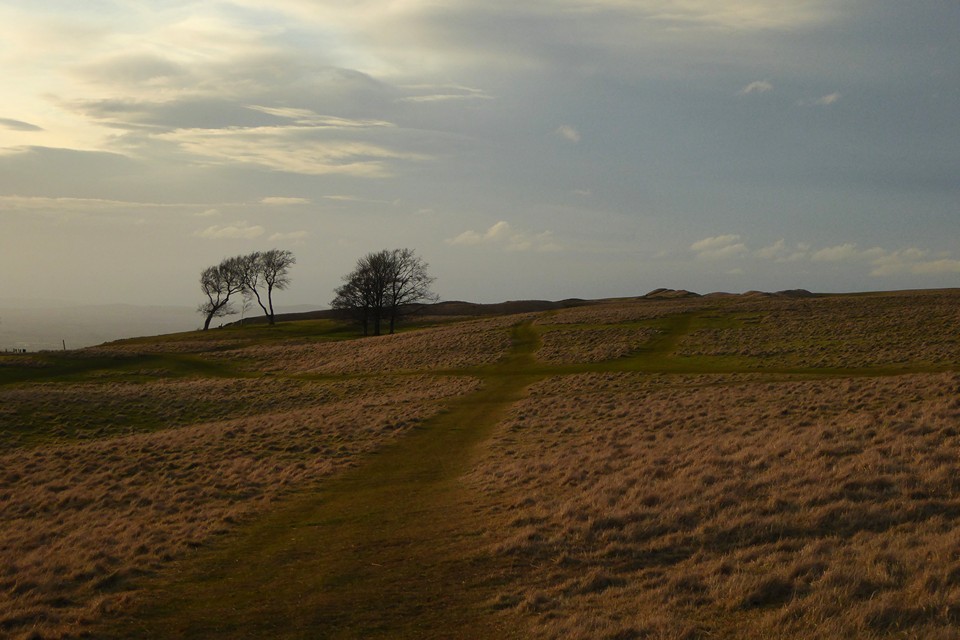
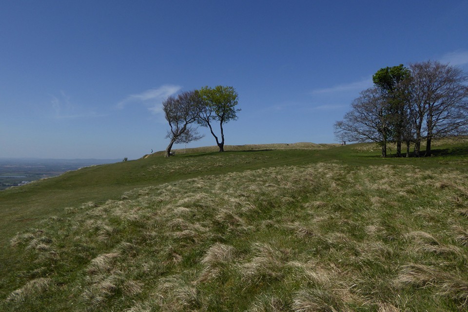
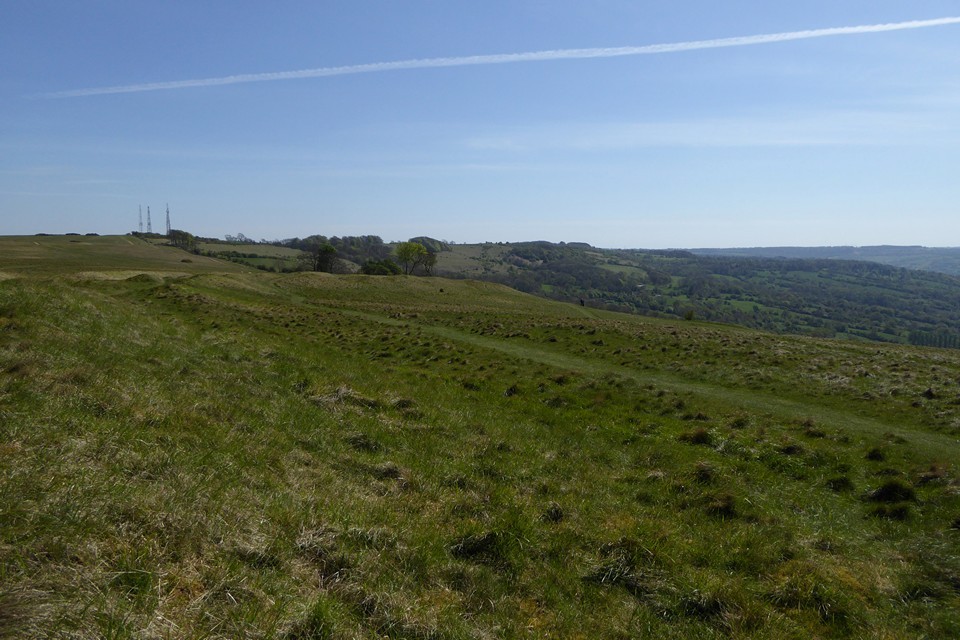
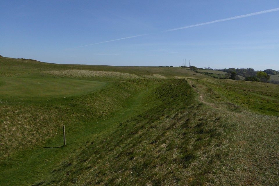
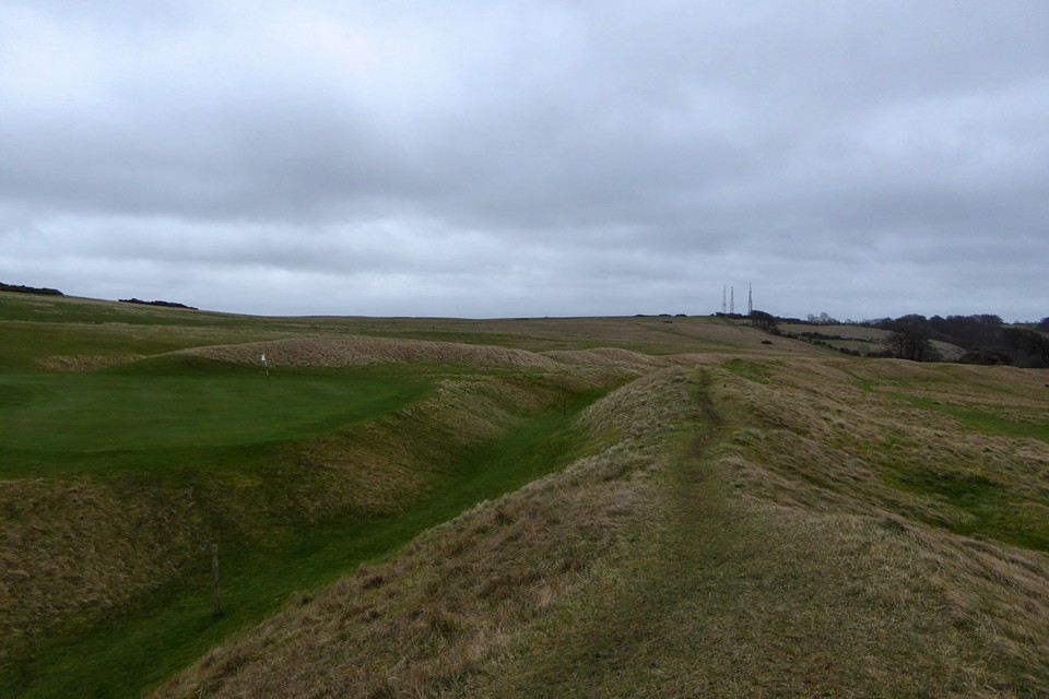
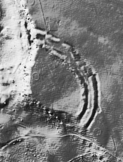
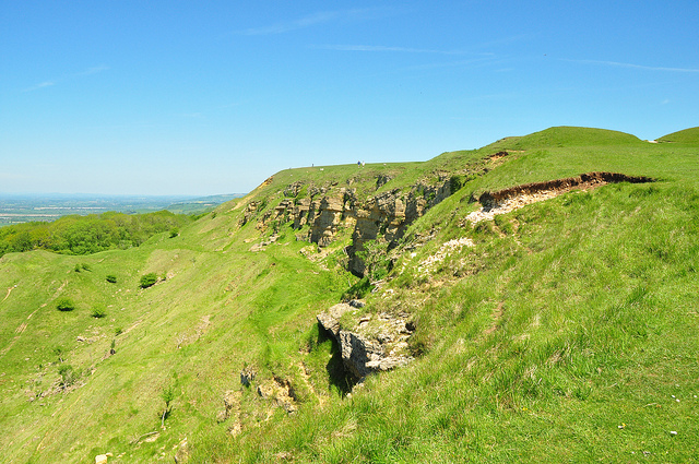
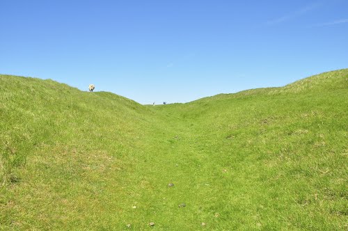
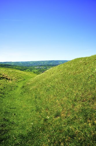
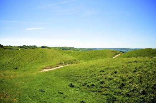
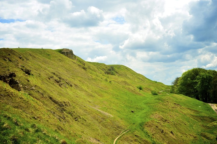
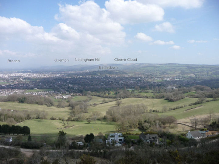
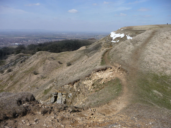
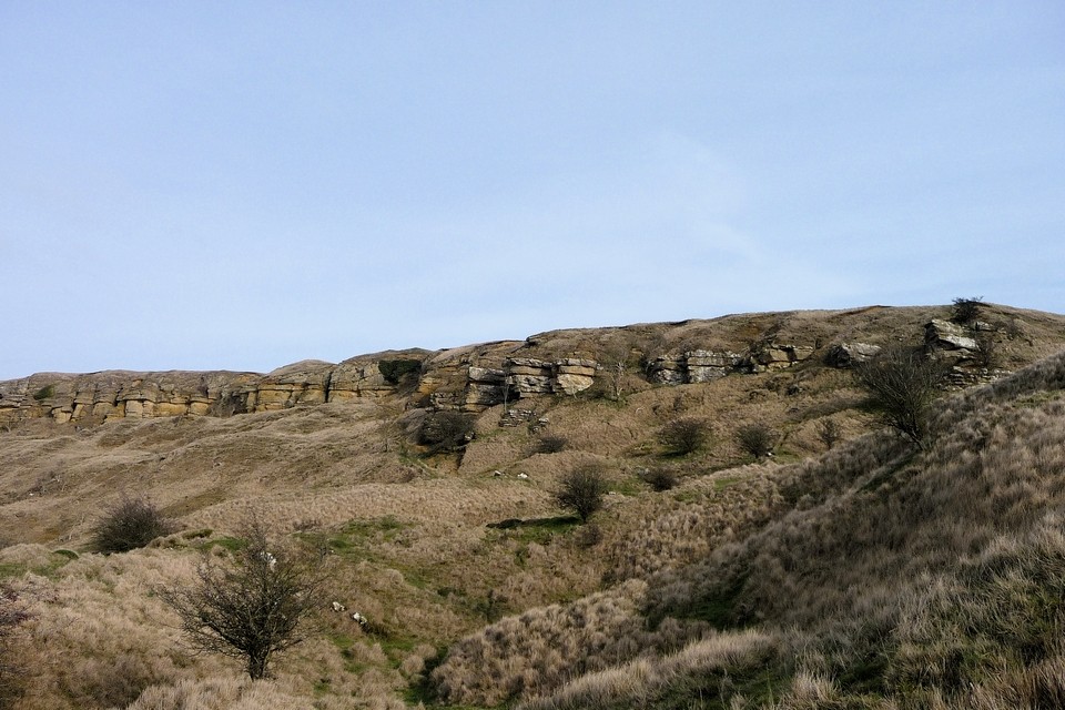
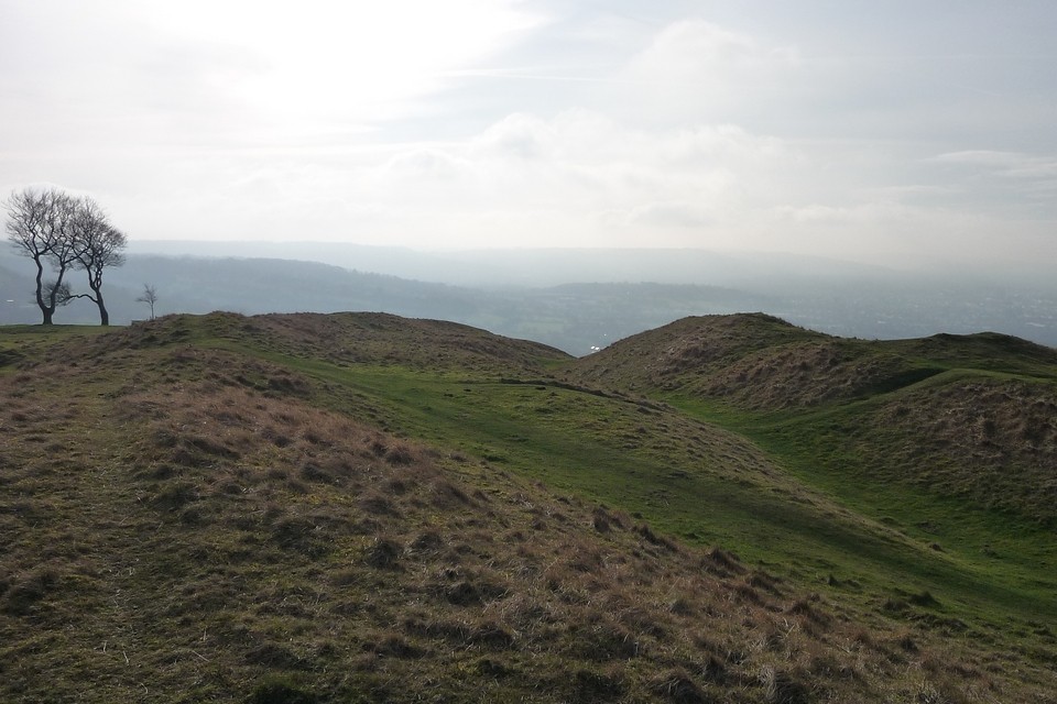
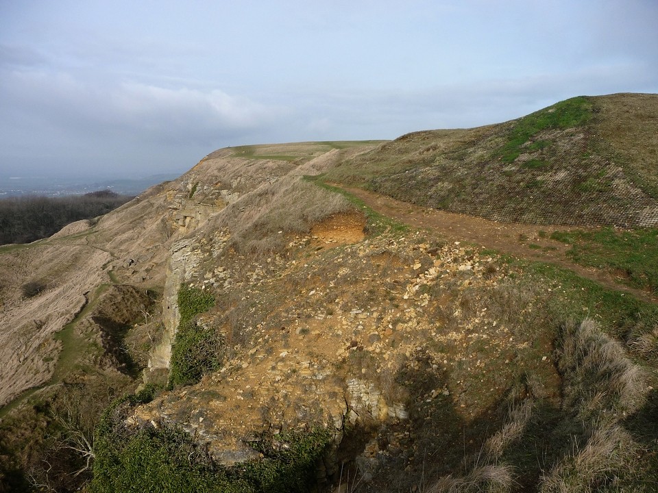
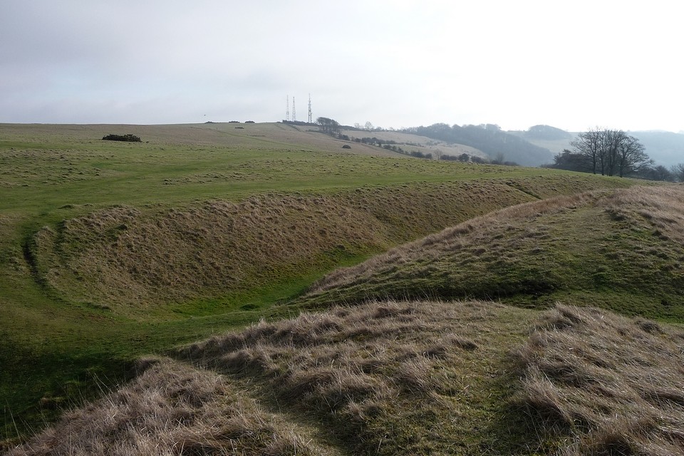
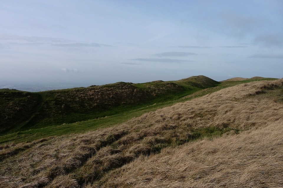
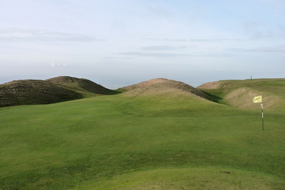
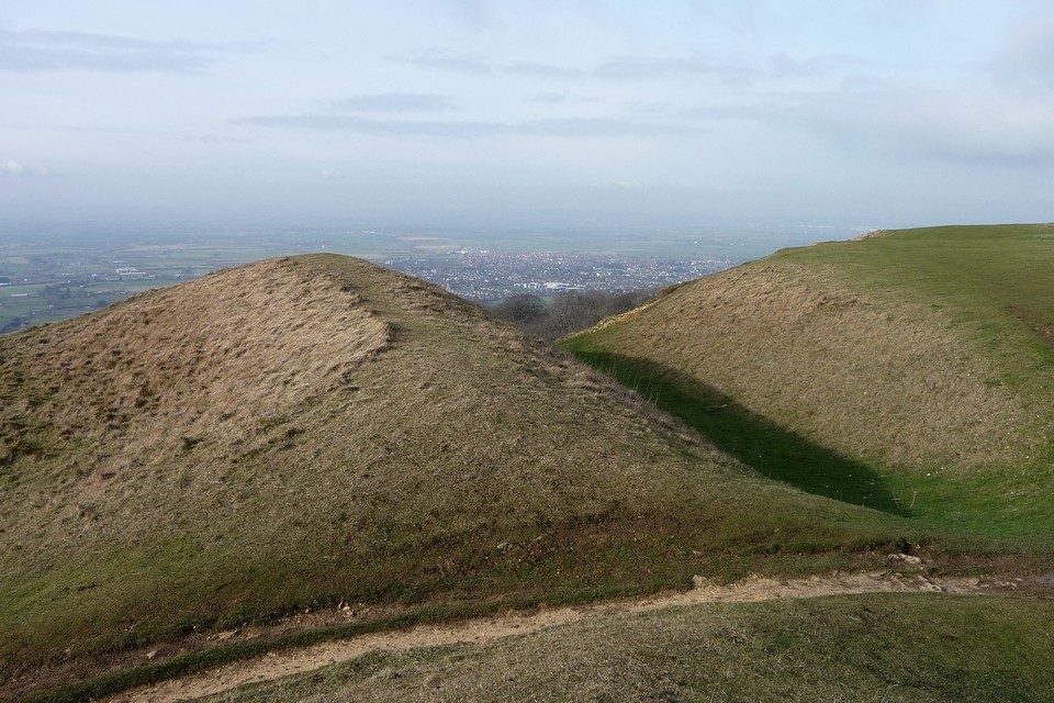
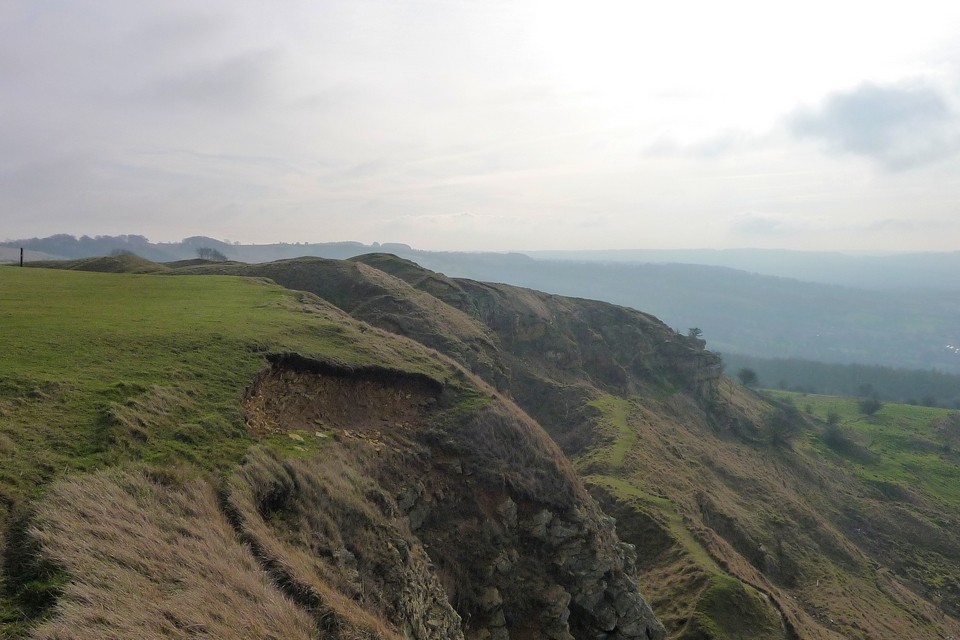
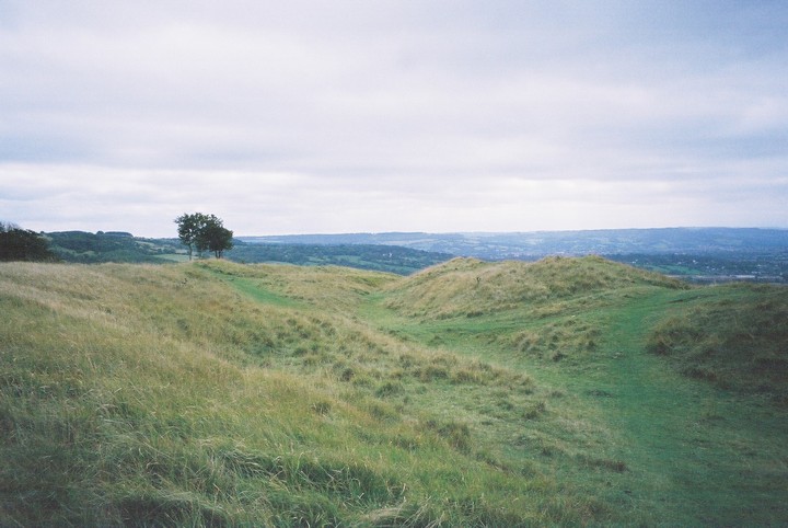
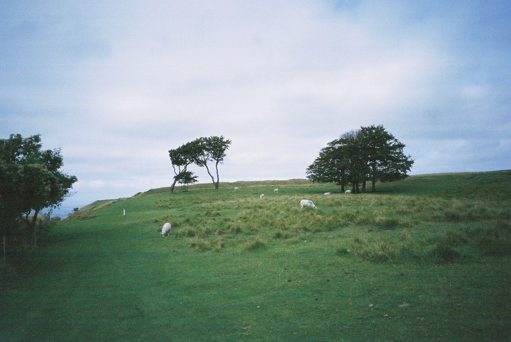
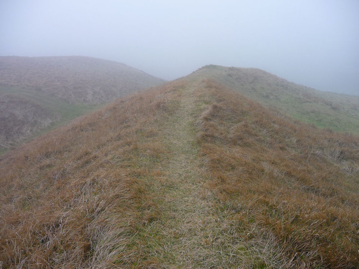
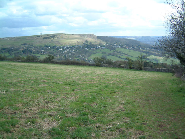
Cleeve Hill has a wealth of Iron Age remains, as well as some possibly earlier monuments. Unfortunately, much of the hill has been badly damaged by limestone quarrying, to build the pretty Cotswolds villages and towns that so attract the tourists. The northwestern part is particularly badly affected, where the quarries have dug straight into the scarp face of the hill. But there is still enough to see, including a rectilinear enclosure that shows up particularly well in today’s light. The Ring is a small oval enclosure, set on steeply sloping ground. What function it served is unclear, maybe a stock pen or homestead site. The interior has been flattened into a platform for a now-vanished golf tee, but the surrounding bank and ditch are pretty well preserved and clear. An adjacent mound to the east has been tentatively identified as a hut circle, although there is also a possibility that it was a round barrow. The Cotswold Way passes right next to these two sites, so no excuse for not indulging in a brief re-visit. There is a very fine view of Nottingham Hill fort from here as well. The path then steepens to approach the northern summit of the hill, which has several separate summits, strung across its mile or so of top. Although not the highest, this one provides the best views, as reflected in a topograph. The Malverns and May Hill are clear today, but the Forest of Dean and Wales beyond are reduced to hazy smudges on the horizon. It’s busy here on such a lovely day, golfers, strollers and runners vying for position. I head south, crossing the remains of the Iron Age cross dyke that encircles this part of the hill, following the contour and largely unaffected by the quarries. The path now hugs the top of the escarpment, with artificially created cliffs dropping away vertiginously to my right. It’s quite cold up here on the edge, snow still clings to the scarps below me and the wind serves up a reminder that the late winter is only just receding. A number of the benches up here are festooned with brightly coloured ribbons, very similar to what you find at sacred wells across the country. Clearly this hilltop still represents a sacred place for locals. With the views stretching away across the vale below, to the mini-mountain range of the Malverns, it’s not difficult to understand why. The final prehistoric stop-off of the day is the once-impressive Cleeve Cloud fort. Three lines of defensive banks and ditches cut the interior off from the rest of the hill, but sadly the western half of the fort is gone, another victim of the inexorable need for building stone. To add insult to grievous injury, a golf green has been inserted into the northern ramparts of the fort. Bah. Despite all of this, it is a fine site still, the defences that remain are substantial and the views are immense. A good spot to stop off for a while and contemplate the route ahead, aided by what’s left of my lunch. This post appears as part of the weblog entry The Cotswold Way III – Winchcombe – Dowdeswell 6 April 2013
|
 Posted by thesweetcheat
14th April 2013ce Edited 18th September 2016ce |
|
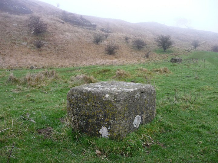
Visited 22.12.2008, walking from Winchcombe via Belas Knap longbarrow and then along the Cotswold Way. This is the second time I have visited Cleeve Hill using this route, but since the last time the Cotswold Way appears to have been re-routed, so from Belas Knap the route now plunges down a steep wooded valley and then back up the other side onto the hill. By the time I reached the hill it was covered in thick fog and rather lacking in recognisable landmarks! Eventually I found the 13th hole of the golf course which rather spoils visits to this site. The golf course covers much of the top of the hill, around the summits - on a summer's day visitors are advised to watch out for golf balls! Even in thick "pea-soup" fog on a Monday morning after the midwinter solstice, there were golfers (mainly heard rather than seen through the fog). Having said all of that, there is much to appreciate on the hill. At 330m it is the highest point in the Cotswolds. There is a hillfort, an impressive linear bank/ditch dyke, and an earthwork known as The Ring. There are remains of various barrows, but these are very difficult to see (even without the fog). Cleeve Hill can be visited by car if you have one and is also served by a good bus service from Cheltenham or Winchcombe. The hillfort ramparts (double bank and ditch) are fairly well preserved and now enclose c. 3 acres along the edge of the escarpment. Quarrying has destroyed much of the western/south-western side of the fort (although it has emphasised the sheer drop away from the fort on that side). There are spectactular views towards the Malverns on a non-foggy day. Taking a path over the edge and down the west, you come across the enigmatic stone block known as "Huddlestone's Table" (see Folklore for more on this). |
Posted by thesweetcheat 29th December 2008ce Edited 18th September 2016ce |
| Visited August 2002. As you approach Cleeve Cloud from Cheltenham the sheer size of the escarpment is amazing. The ridge rises sheer from the Severn Valley floor up to over 300 metres (the highest part of the Cotswold Hills). This is why I have defined it as a sacred hill, there seems to be real reverence for it in the landscape. The sense of peace you have whilst walking round and taking in the view and the landscape is almost to see the world as the ancients saw it. The modern world can try to interfere, note the numbly positioned golf club nearby, but on Cleeve Cloud I felt the atmosphere of a different time. |
Posted by Damonm 14th January 2003ce Edited 18th September 2016ce |
Folklore |
|
|
Generally the fort is thought to originally date from the early Iron Age, with the single bank and ditch being doubled in the last couple of centuries BCE. Huddlestone's Table (information from "Cleeve Hill: The History of the Common and its People" - David H. Aldred 1990 [Alan Sutton Publishing Limited]): Traditionally the stone is said to mark the spot where King Kenulf of Mercia took leave of various important guests after the 811 dedication of Winchcombe Abbey. In 1779 an article about the stone appeared in "Gentlemen's Magazine" linking it in true antiquarian style with Druids and so on. |
Posted by thesweetcheat 29th December 2008ce |