The Modern Antiquarian
Log in
|
Register
Home
Latest Posts
Forums
Maps
Help
Browse Sites
News
Blog
Contributors
The Books
Select
-
Belgium
Denmark
Eire
France
Germany
Greece
Italy
The Netherlands
Norway
Portugal
Republic of Malta
Spain
Sweden
Switzerland
United Kingdom
England
Southern England
Wiltshire
Boar's Bottom
Round Barrow(s)
Boar's Bottom (Round Barrow(s)) on The Modern Antiquarian, the UK & Ireland's most popular megalithic community website. 1 image, 1 fieldnote, plus information on many more ancient sites nearby and across the UK & Ireland.
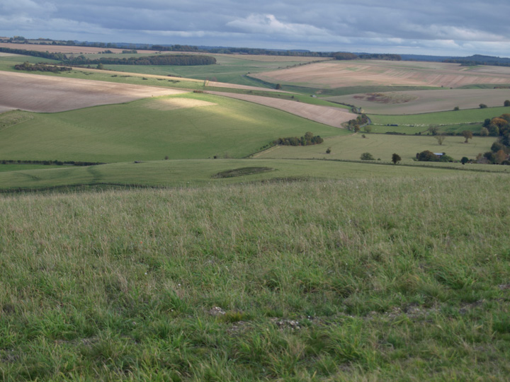
Image © Mike Rowland 13/10/2008
Nearest Town:
Warminster (7km N)
OS Ref (GB):
ST852379 /
Sheet: 183
Latitude:
51° 8' 22.59" N
Longitude:
2° 12' 41.66" W
Added by
formicaant
Images (1)
Fieldnotes (1)
0 discussions
Start a topic
Show |
Hide
Web searches for Boar's Bottom
Flickr
Google
Google Images
MAGIC
The Megalithic Portal
Bing
Stone Pages
Streetmap.co.uk
Wikipedia
Show map
(inline Google Map)
- Sites within 20 km -
-
Cold Kitchen Hill (0.72km WNW) (16 posts)
Biddcombe and Whitepits Down Cross Dykes (0.82km WSW) (5 posts)
Egbert's Stones (0.94km SSW) (4 posts)
Cold Kitchen Hill (Western) (1.23km W) (6 posts)
East of Court Hill Plantation, Kingston Deverill (1.87km WSW) (1 post)
Pertwood Down Long Barrow (2.06km E) (10 posts)
Dairy Farm barrow (2.21km WSW) (11 posts)
Gunschurch (3.76km NE) (2 posts)
Cow Down (4.32km NE) (3 posts)
Robin Hood's Bower (5.01km NNE) (2 posts)
Hangman's Copse (5.11km N) (4 posts)
Long Ivor Farm (5.18km NE) (6 posts)
White Sheet Hill (5.75km WSW) (28 posts)
Long Knoll Barrow (6.56km WSW) (1 post)
Sutton Veny Barrows (6.89km ENE) (6 posts)
Cley Hill (7km NNW) (34 posts)
East Knoyle (7.33km SE) (1 post)
King Barrow (7.89km NE) (2 posts)
Cop Heap (8.09km NNE) (2 posts)
Roddenbury Hill (8.12km WNW) (4 posts)
Corton Long Barrow (8.26km ENE) (6 posts)
Scratchbury (8.68km NE) (15 posts)
Arn Hill Down (8.82km NNE) (2 posts)
Battlesbury Camp (8.87km NNE) (14 posts)
Middle Hill (8.95km NE) (2 posts)
Golden Barrow (destroyed) (9.43km ENE) (8 posts)
Park Hill Camp (9.46km WSW) (2 posts)
Heytesbury Long Barrow (9.59km NE) (1 post)
River Frome Barrow (9.89km WNW) (3 posts)
Boyton Down Long Barrow (9.98km ENE) (3 posts)
Boyton Down Round Barrow (9.99km ENE) (3 posts)
Oxendean Down (10.58km NNE) (4 posts)
Sherrington Motte (10.84km ENE) (3 posts)
Jack's Castle (10.86km WSW) (4 posts)
Norton Bavant Long Barrow (10.91km NE) (3 posts)
Upton Great Barrow (11.17km ENE) (4 posts)
Dirtley Wood Bowl Barrow (11.29km NNE) (2 posts)
Kenwalch's Castle (11.3km WSW) (2 posts)
Sherrington Long Barrow (11.62km ENE) (2 posts)
Knook Barrows (12.36km ENE) (2 posts)
Knook Castle (12.37km ENE) (1 post)
Boles Barrow (12.49km NE) (4 posts)
Longbury (12.5km SSW) (7 posts)
Castle Barrow (12.87km ENE) (1 post)
Shave Farm (12.9km WSW) (1 post)
South Down Sleight (13.04km NE) (3 posts)
Fromefield (13.13km WNW) (14 posts)
Codford Circle (13.21km ENE) (2 posts)
Castle Rings (13.28km SE) (7 posts)
Imber (14.41km NE) (4 posts)
Old Wardour Castle Grotto (14.42km ESE) (9 posts)
Bratton Castle & Westbury White Horse (14.44km NNE) (33 posts)
Castle Ditches (Tisbury) (14.78km ESE) (7 posts)
Tedbury Camp (15.31km WNW) (1 post)
Murtry Hill (15.57km WNW) (22 posts)
The Bloodstone (15.73km NNE) (3 posts)
The Devil's Bed and Bolster (15.82km NNW) (16 posts)
Bilbury Rings (15.84km E) (1 post)
Wick Ball Camp (15.93km E) (1 post)
Barrow Hill (Buckland Dinham) (16.01km WNW) (11 posts)
Wadbury Camp (16.02km WNW) (2 posts)
Church End Ring (16.03km E) (1 post)
Tom Tivey's Hole (16.05km W) (1 post)
Hanging Langford Camp (16.08km E) (2 posts)
White Sheet Hill (16.37km ESE) (8 posts)
Tinhead Hill (16.75km NNE) (8 posts)
Buxbury Hill Long Barrow (17.34km ESE) (4 posts)
Woodlands Earthwork (17.61km ESE) (3 posts)
Kill Barrow (17.83km NE) (1 post)
East Castle (17.87km E) (4 posts)
Charlton Down (18.09km SE) (3 posts)
Yarnbury Castle (18.41km ENE) (29 posts)
Creech Hill (18.42km WSW) (3 posts)
Big Tree Long Barrow (18.58km WNW) (4 posts)
Win Green (18.68km SE) (1 post)
Small Down (18.73km W) (6 posts)
Charlton Down Ditch (18.87km SE) (4 posts)
Winkelbury (18.87km SE) (20 posts)
Kingsdown Camp (19.13km WNW) (3 posts)
Old Ditch Longbarrow (19.22km ENE) (22 posts)
Chiselbury (19.23km E) (15 posts)
Ferne Hollow (19.36km SE) (3 posts)
Ashmore Down (19.37km SE) (12 posts)
Tilshead Lodge Longbarrow (19.38km ENE) (13 posts)
Grovely Castle (19.68km E) (4 posts)
Fontmell Down (19.84km SSE) (6 posts)
- Facilities within 20 km -
-
Jen's Cafe (Cafe: 12.5 km WNW)
Cafe in a bus (Cafe: 19.9 km E)
- Add -
-
Add news
Add an image
Add fieldnotes
Add folklore
Add miscellaneous
Add a link
-
Add a site
Add a nearby facility
Add an alternative name/spelling
Images
(click to view fullsize)
Add an image
Fieldnotes
Add fieldnotes
A rare saucer type round barrow to the east of the long barrow. These low barrows are very susceptible to any kind of agricultural activities especially ploughing and they don't survive well.
Comments (0)
|
Add a comment
|
Permalink
Posted by
formicaant
15th October 2008ce

 Posted by formicaant