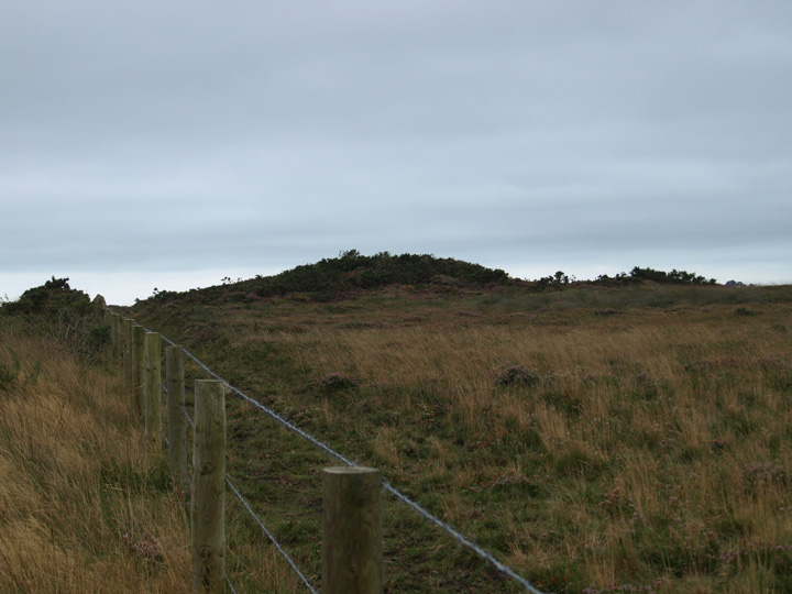
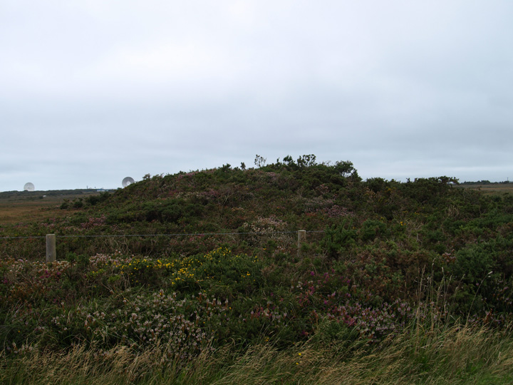
The Modern Antiquarian
Log in
|
Register
Home
Latest Posts
Forums
Maps
Help
Browse Sites
News
Blog
Contributors
The Books
Select
-
Belgium
Denmark
Eire
France
Germany
Greece
Italy
The Netherlands
Norway
Portugal
Republic of Malta
Spain
Sweden
Switzerland
United Kingdom
England
Southern England
Cornwall
Traboe
Round Barrow(s)
Traboe (Round Barrow(s)) on The Modern Antiquarian, the UK & Ireland's most popular megalithic community website. 2 images, 1 fieldnote, plus information on many more ancient sites nearby and across the UK & Ireland.
Image © Mike Rowland 07/09/2008.
Nearest Town:
Mullion (5km SW)
OS Ref (GB):
SW737210 /
Sheet: 204
Latitude:
50° 2' 43.34" N
Longitude:
5° 9' 40.39" W
Added by
formicaant
Images (2)
Fieldnotes (1)
0 discussions
Start a topic
Show |
Hide
Web searches for Traboe
Flickr
Google
Google Images
MAGIC
The Megalithic Portal
Bing
Stone Pages
Streetmap.co.uk
Wikipedia
Show map
(inline Google Map)
- Sites within 20 km -
-
Dry Tree Menhir (1.2km W) (29 posts)
Goonhilly Down (1.2km W) (16 posts)
Three Brothers of Grugith (2.67km E) (24 posts)
Halliggye Fogou (3.69km WNW) (53 posts)
Caer Vallack (3.69km NW) (1 post)
St Keverne Beacon (3.82km E) (0 posts)
Little Kistles (3.96km E) (0 posts)
Crousa Common Menhirs (4.01km E) (11 posts)
Tremenhere Menhir (4.08km ENE) (13 posts)
Higher Boden Roundhouse (4.09km NE) (1 post)
Higher Boden Fogou (4.09km NE) (8 posts)
Gear (4.12km NW) (1 post)
Poldowrian (4.24km SE) (3 posts)
Roskruge Beacon (4.74km ENE) (0 posts)
Lankidden (4.75km SE) (12 posts)
Mawgan Cross (4.88km WNW) (4 posts)
Chynhalls Point (5.98km ESE) (11 posts)
Hervan Menhir (6.07km SW) (3 posts)
Lowland Point (6.55km E) (7 posts)
Giants Quoits (6.79km ENE) (7 posts)
Little Dennis (6.83km NE) (9 posts)
Tolvan Holed Stone (7.37km NW) (27 posts)
Mullion Towans (7.43km WSW) (6 posts)
Boskenwyn Down (7.51km WNW) (1 post)
Halzephron Cliff (8.32km WSW) (5 posts)
Kynance Gate Settlement (8.61km SSW) (10 posts)
Trewardreva Fogou (9.03km NNW) (26 posts)
Crasken Round (9.39km WNW) (0 posts)
The Rill (9.77km SW) (7 posts)
Eathorne Menhir (10.33km N) (7 posts)
Tolmen Stone (Constantine) (10.59km NNW) (9 posts)
Higher Spargo (11.2km N) (2 posts)
Mabe Church (11.56km N) (13 posts)
Garland Round (11.69km W) (0 posts)
Wendron Mortar Outcrop (11.87km NW) (5 posts)
Prospidnick Longstone (13.05km WNW) (8 posts)
Men Amber (14.15km WNW) (11 posts)
Stithians Cupmarked Stones (14.48km NNW) (5 posts)
Burras Menhir (14.58km NW) (13 posts)
Camel Rock (14.91km W) (6 posts)
Trewavas Cliff (15.04km W) (17 posts)
Calvadnack Settlement (15.22km NW) (1 post)
Crowan Beacon (15.76km NW) (1 post)
Tregonning Hill (15.81km W) (11 posts)
Stithians Menhir (15.83km N) (5 posts)
Carnmenellis (15.94km NW) (7 posts)
Drym Round (16.34km WNW) (0 posts)
Nine Maidens (Troon) (16.39km NW) (36 posts)
Castle Pencaire (16.42km W) (28 posts)
Tregear Round (16.42km WNW) (0 posts)
Hangman's Barrow (16.93km NW) (12 posts)
Godolphin Hill (17.67km W) (8 posts)
Trebowland Round (17.7km NNW) (2 posts)
Carvannel Menhir (17.85km NNW) (6 posts)
Four Lanes barrows (18km NW) (4 posts)
Carwynnen Quoit (18.35km NW) (60 posts)
Gear Round (19.53km WNW) (0 posts)
Cudden Point (19.91km W) (2 posts)
- Facilities within 20 km -
-
Coverack (Youth Hostel: 5.4 km ESE)
- Add -
-
Add news
Add an image
Add fieldnotes
Add folklore
Add miscellaneous
Add a link
Add a nearby facility
Add an alternative name/spelling
Images
(click to view fullsize)
Add an image
Fieldnotes
Add fieldnotes
These two barrows are north of the Goonhilly down and Dry tree sites. There are three here but I could only see two of them. Both were visible from the road past them and appear to be in pretty good condition.
Comments (0)
|
Add a comment
|
Permalink
Posted by
formicaant
8th September 2008ce