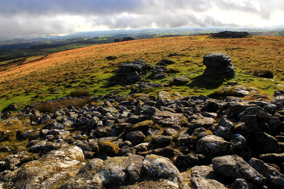
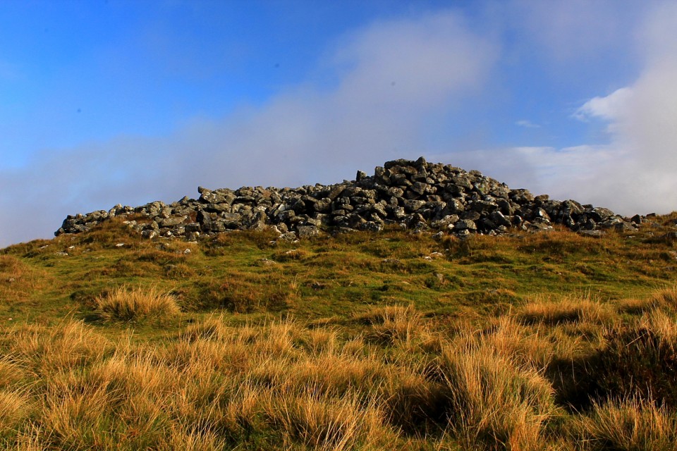
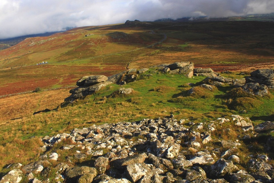
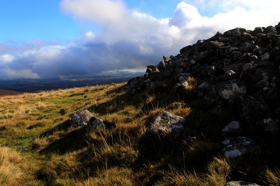
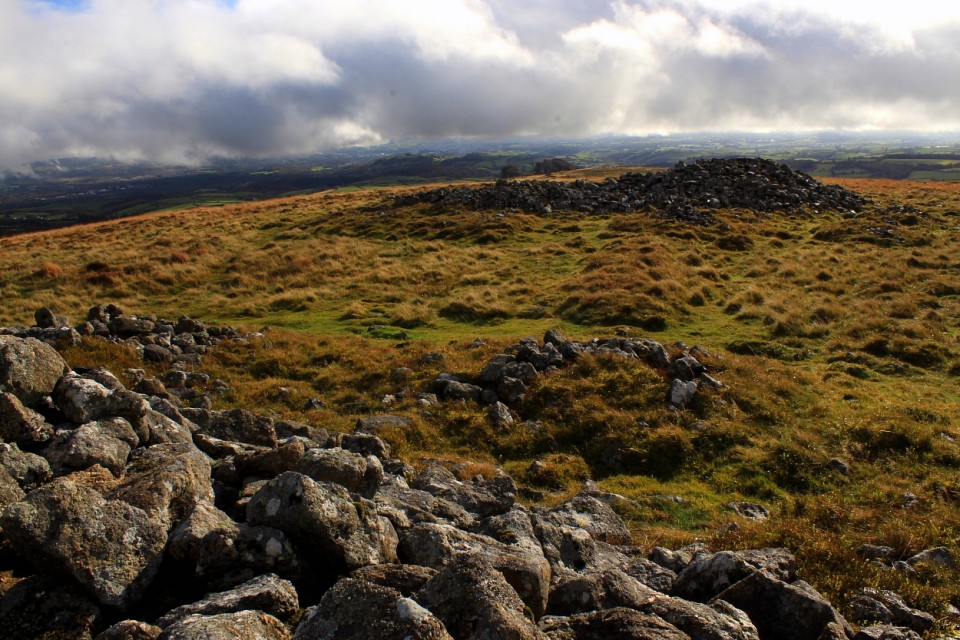
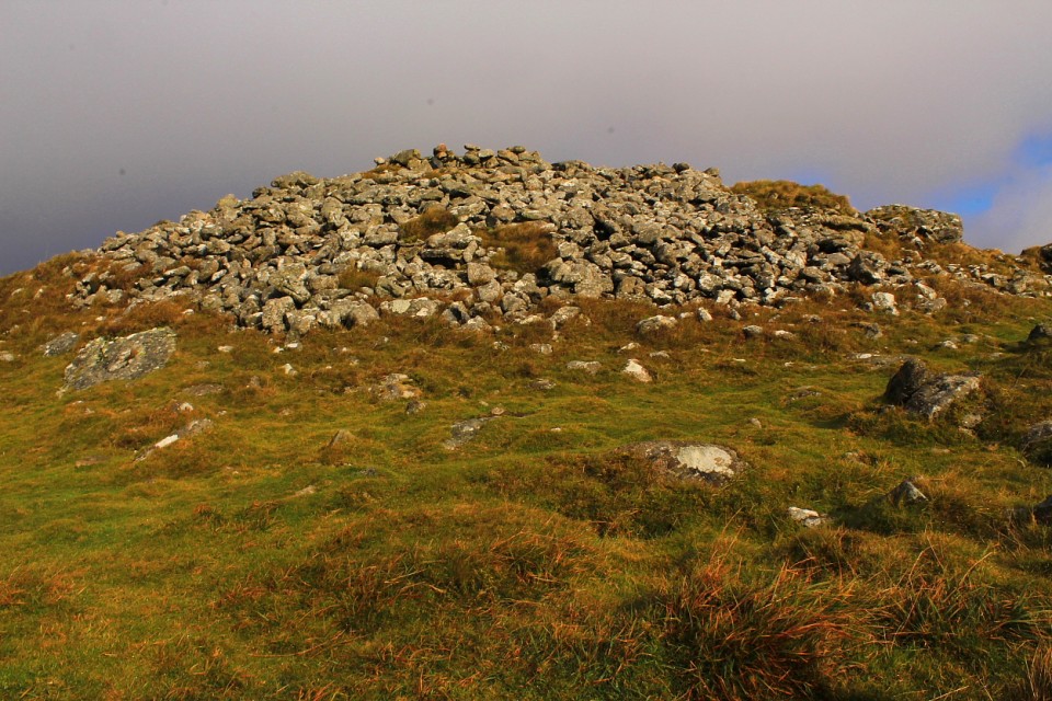
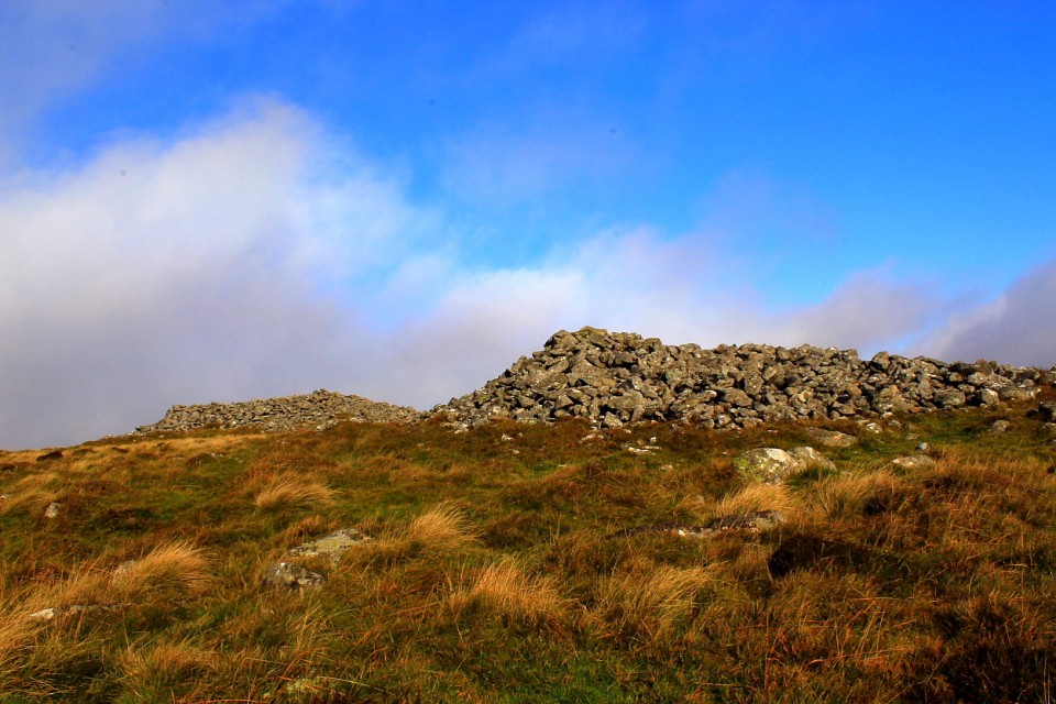
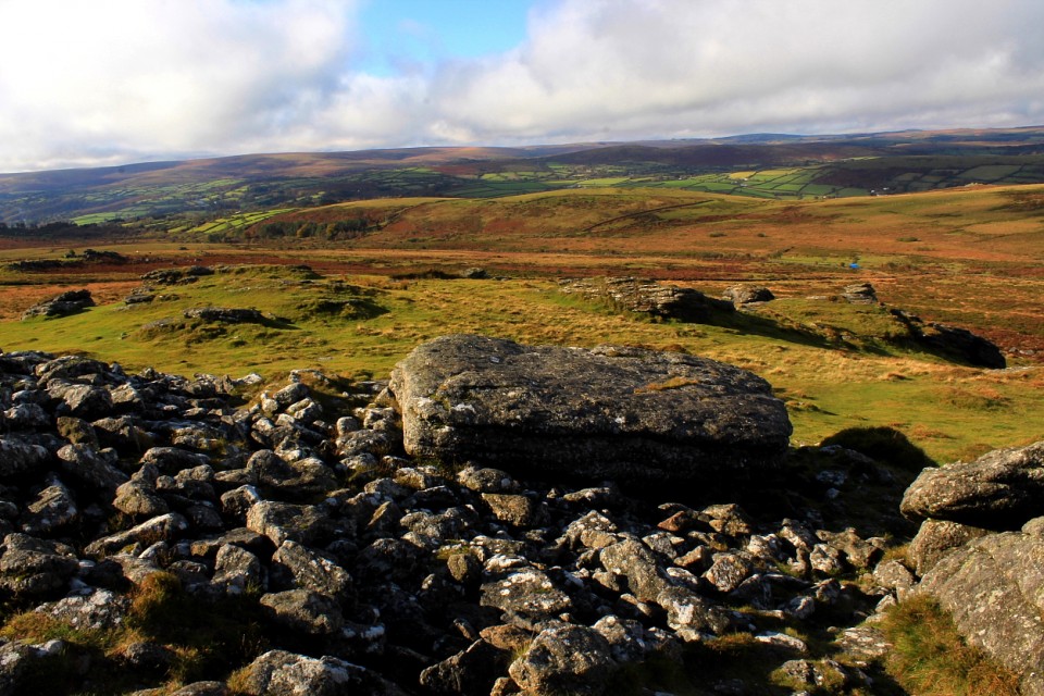
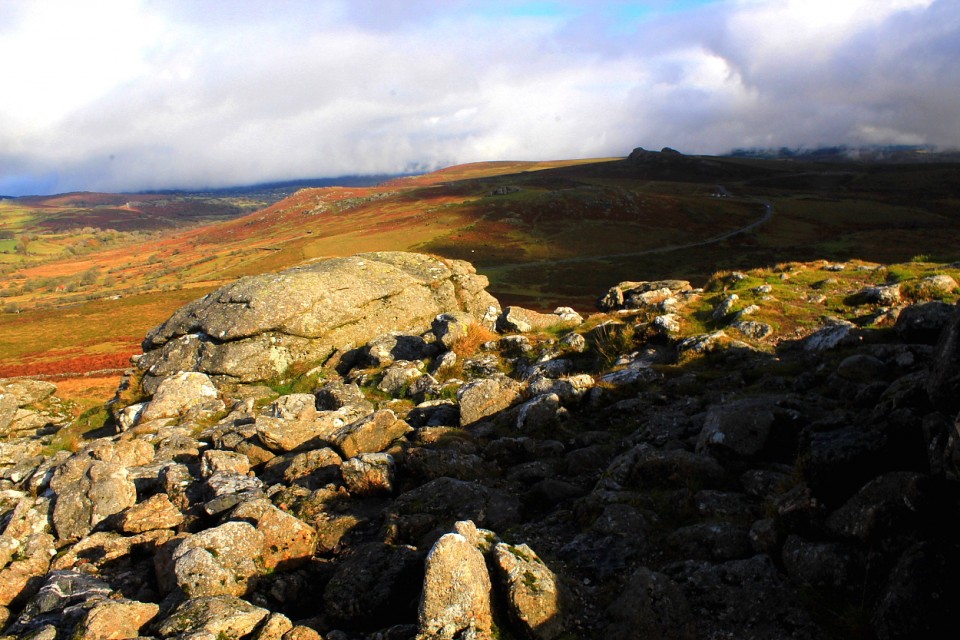
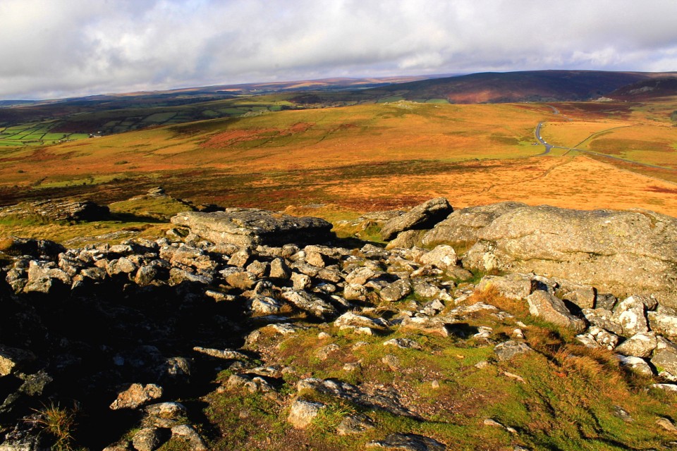
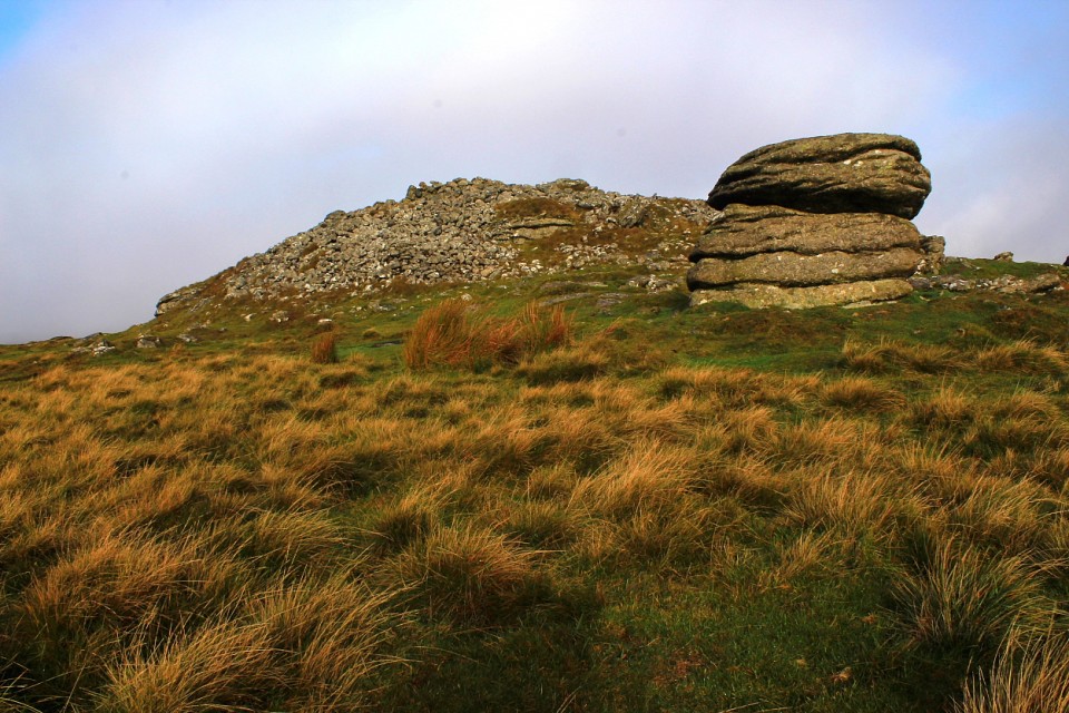
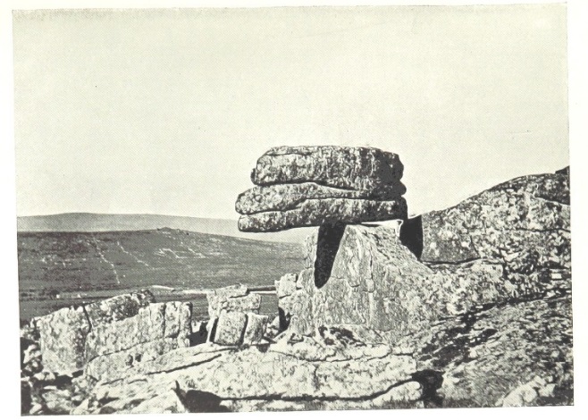
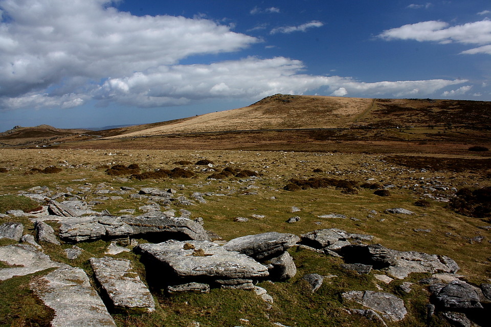
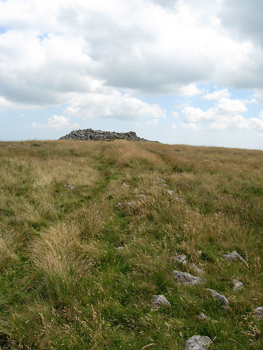
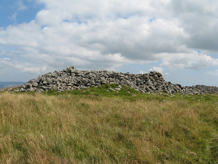
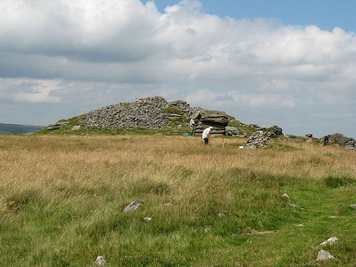
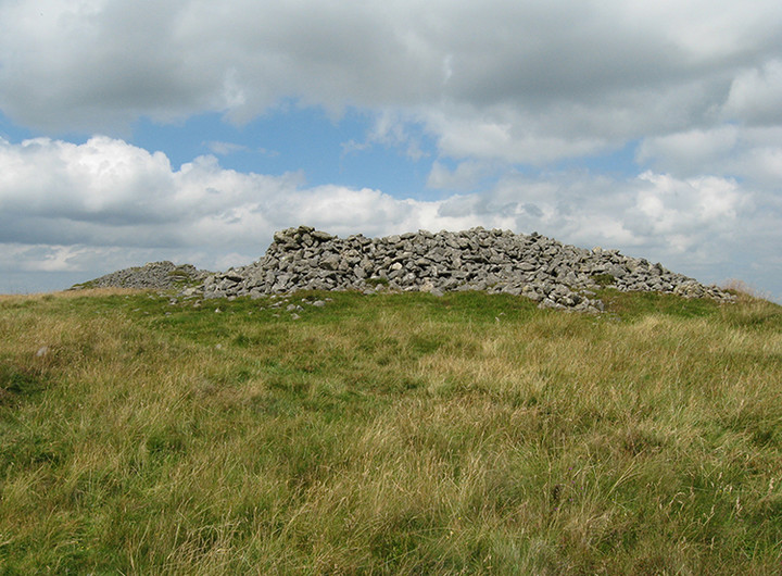
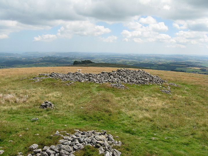
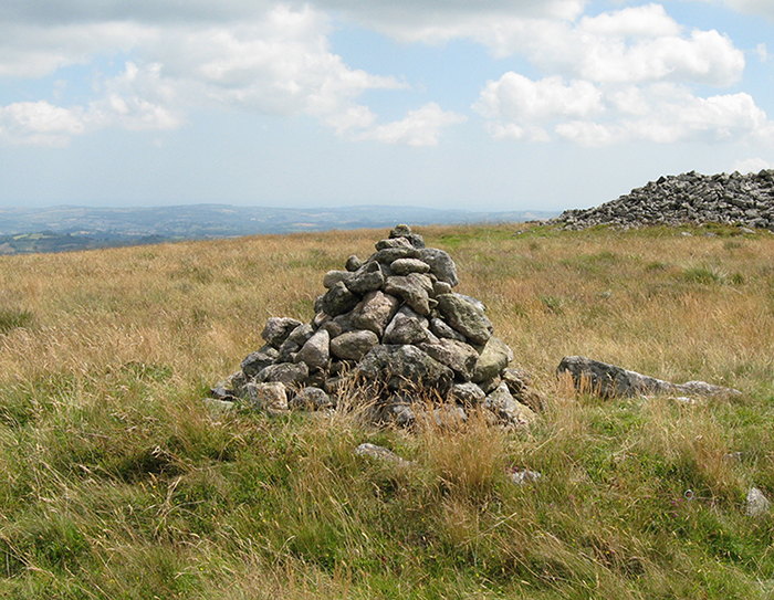
Log in
|
Register
Home
Latest Posts
Forums
Maps
Help
Browse Sites
News
Blog
Contributors
The Books
Select
-
Belgium
Denmark
Eire
France
Greece
Italy
The Netherlands
Norway
Portugal
Republic of Malta
Spain
Sweden
Switzerland
United Kingdom
England
Southern England
Devon
Dartmoor
Rippon Tor
Cairn(s)
Rippon Tor (Cairn(s)) on The Modern Antiquarian, the UK & Ireland's most popular megalithic community website. 8 images, plus information on many more ancient sites nearby and across the UK & Ireland.
Image © Peter Castle ©
Nearest Town:
Ashburton (5km SSE)
OS Ref (GB):
SX746756 /
Sheet: 191
Latitude:
50° 33' 57.79" N
Longitude:
3° 46' 15.09" W
Added by
Lubin
Images (8)
0 discussions
Start a topic
Show |
Hide
Web searches for Rippon Tor
Flash Earth
Flickr
Google
Google Images
MAGIC
The Megalithic Portal
Bing
Stone Pages
Streetmap.co.uk
Wikipedia
Show map
(inline Google Map)
- Sites within 20 km -
-
Blackslade Down (1.2km WSW) (1 post)
Hound Tor (3.2km NNW) (5 posts)
Black Hill (4.11km NNE) (1 post)
Bowerman's Nose (4.81km NNW) (8 posts)
Corndon Tor (6.05km WSW) (1 post)
Hamel Down (6.51km WNW) (6 posts)
Yar Tor (6.52km WSW) (4 posts)
King's Barrow (6.87km WNW) (2 posts)
Grims Lake Mire (6.91km WNW) (5 posts)
Grimspound & Hookney Tor (6.94km WNW) (43 posts)
Coffin Stone (7.25km WSW) (1 post)
Hembury Castle (7.37km S) (5 posts)
Yar Tor Hut Circle (7.5km WSW) (6 posts)
Cator Common North Cairn (7.56km W) (4 posts)
Soussons Common Cairn Circle (7.68km W) (27 posts)
Challacombe (7.77km WNW) (20 posts)
Aller Brook (7.87km WSW) (2 posts)
Soussons Down (7.95km W) (2 posts)
Holne Moor Triple Row (8.38km SW) (2 posts)
East Bovey Head (8.47km WNW) (4 posts)
Birch Tor (8.47km WNW) (6 posts)
Holne Moor (9.15km WSW) (3 posts)
Water Hill (9.32km WNW) (1 post)
Water Hill (9.34km WNW) (1 post)
Laughter Tor (9.37km WSW) (11 posts)
Mardle Valley (9.67km SW) (2 posts)
Down Ridge (9.7km WSW) (6 posts)
Denbury (9.95km ESE) (8 posts)
Denbury Hillfort round barrows (9.95km ESE) (6 posts)
Hurston Ridge (9.95km WNW) (20 posts)
Dunnabridge Pound (10.02km WSW) (6 posts)
West Vitifer (10.02km WNW) (2 posts)
Hurston Ridge (10.02km WNW) (3 posts)
Bellever (10.1km W) (32 posts)
Ryder's Hill (10.37km SW) (3 posts)
Lakehead Hill (10.38km W) (43 posts)
Kraps Ring (10.47km W) (5 posts)
Stannon Newtake (10.64km W) (2 posts)
Skir Hill (10.66km WSW) (1 post)
Chagford Common (10.85km WNW) (3 posts)
Sherberton Stone Circle (10.93km WSW) (12 posts)
Berry's Wood (10.97km E) (1 post)
Assycombe Hill (10.98km WNW) (17 posts)
Heath Stone (11.02km WNW) (2 posts)
Pupers Hill (11.1km SW) (4 posts)
Archerton, Newtake (11.23km W) (3 posts)
Hut Circles 2 (11.29km WNW) (3 posts)
Fernworthy Hut Circle (11.38km WNW) (2 posts)
Roundy Park (11.42km W) (18 posts)
Roundy Park (11.42km W) (3 posts)
Fernworthy Round House (11.43km WNW) (1 post)
West Lowton (11.44km WNW) (1 post)
Meacombe Burial Chamber (11.48km NNW) (11 posts)
Chittaford Cairn and Cist (11.56km W) (10 posts)
Swincombe Ford Newtake (11.58km WSW) (2 posts)
Chittaford Down (11.6km W) (11 posts)
Harbourne Head (11.71km SSW) (6 posts)
Thornworthy Down (11.73km WNW) (5 posts)
Gripper's Hill (11.73km SSW) (3 posts)
Mardon Down Stone Circle (11.78km N) (19 posts)
Harbourne Head (11.79km SSW) (3 posts)
Mardon Down Cairns (11.97km N) (1 post)
Joan Ford's Newtake (11.98km WSW) (4 posts)
Giant's Grave (Dartmoor) (12.04km N) (13 posts)
Heap of Sinners (12.07km SW) (4 posts)
Brockhill Ford West (12.07km SW) (2 posts)
Snowdon (12.12km SW) (7 posts)
Rowtor Bog Cairns (12.23km W) (4 posts)
Chudleigh Rocks (12.23km ENE) (6 posts)
Stennen Hill (12.26km W) (3 posts)
Mardon Down Cairn Circle (12.27km N) (9 posts)
Brockhill Foot West (12.3km SW) (4 posts)
Fernworthy Cairn and Cairn Circle (Eastern) (12.35km WNW) (4 posts)
Biller's Pound (12.4km SW) (3 posts)
Mardon Down (12.42km N) (1 post)
Fernworthy (12.42km WNW) (36 posts)
Fernworthy Stone Row (South) (12.42km WNW) (7 posts)
Huntingdon Warren Settlement (12.44km SW) (2 posts)
Fernworthy Stone Row (North) (12.56km WNW) (13 posts)
Ter Hill (12.59km WSW) (3 posts)
White Tor Stone Row (12.94km W) (2 posts)
The Greywethers (13.03km WNW) (50 posts)
Royal Hill Cist (13.03km WSW) (4 posts)
Castle Dyke (Chudleigh) (13.1km ENE) (1 post)
Rider's Rings (13.17km SSW) (0 posts)
Eastern White Barrow. (13.24km SW) (1 post)
Childe's Tomb (13.26km WSW) (7 posts)
The Crock of Gold Cist (13.29km WSW) (7 posts)
Royal Hill (13.32km WSW) (0 posts)
Cranbrook Castle (13.41km NNW) (11 posts)
Stall Moor Stone Row (13.45km SW) (15 posts)
Shovel Down (13.47km WNW) (2 posts)
Shovel Down & The Long Stone (13.47km WNW) (54 posts)
Blakey Tor (13.47km WSW) (3 posts)
Round Hill (13.51km WSW) (8 posts)
Wistman's Wood (13.54km W) (3 posts)
Littaford Tor (13.62km W) (1 post)
Broad Down Cairn (13.77km W) (3 posts)
Western White Barrow (13.78km SW) (4 posts)
Kes Tor (13.8km WNW) (6 posts)
Goldsmith's Cross/Fox Tor Mire (13.94km WSW) (5 posts)
Brown Heath (14.36km SW) (0 posts)
Crow Tor (14.37km W) (3 posts)
Prestonbury Castle (14.49km NNW) (16 posts)
Erme Pound (14.69km SW) (5 posts)
Fox Tor Mire (14.79km WSW) (2 posts)
Hook Lake (14.81km SW) (5 posts)
Hook Lake (14.89km SW) (4 posts)
Scorhill (14.93km WNW) (68 posts)
Milber Down Camp (14.98km E) (2 posts)
Great Gnat's Head (15.07km WSW) (4 posts)
Stall Moor Cairn (15.38km SW) (7 posts)
Long Plantation (15.47km W) (3 posts)
Beardown Man (15.47km W) (13 posts)
Buttern Hill Chambered Cairn. (15.7km WNW) (3 posts)
Stall Moor Stone Circle (15.74km SW) (20 posts)
Blatchford Bottom 2 (15.74km SW) (2 posts)
Buttern Hill (15.85km WNW) (0 posts)
The Spinsters' Rock (15.86km NW) (41 posts)
Blatchford Bottom settlements (15.89km SW) (3 posts)
Calveslake Tor (15.96km WSW) (3 posts)
Aish Ridge (16.01km SSW) (4 posts)
Three Barrows (16.04km SW) (10 posts)
Buttern Hill Stone Circle (16.11km WNW) (12 posts)
Corringdon Ball Long Barrow (16.13km SSW) (12 posts)
Whitehorse Hill (16.18km WNW) (2 posts)
Grim's Grave (16.21km SW) (5 posts)
Eylesbarrow (16.23km WSW) (8 posts)
Cut Hill (16.27km W) (15 posts)
Conies Down (16.32km W) (1 post)
Langstone Moor (16.38km W) (1 post)
Langcombe Brook / Deadman's Bottom (16.41km SW) (13 posts)
Corringdon Ball Stone Row (16.41km SSW) (16 posts)
Corringdon Ball (16.45km SSW) (1 post)
Round cairn east of Down Tor (16.54km WSW) (4 posts)
Enclosure east of Down Tor (16.61km WSW) (4 posts)
Stall Moor (16.66km SW) (1 post)
Sharp Tor (16.78km SW) (7 posts)
Down Tor (17.01km WSW) (39 posts)
Glasscombe Corner (17.04km SSW) (13 posts)
Hillson's House (17.1km SW) (8 posts)
Glaze Meet (17.16km SSW) (4 posts)
Hart Tor (17.29km WSW) (3 posts)
Hart Tor North Stone Circle & Rows (17.29km WSW) (3 posts)
Hingston Hill North (17.35km WSW) (3 posts)
Ranny Brook (17.36km SW) (4 posts)
Piles Hill (17.37km SSW) (9 posts)
Raddick Hill (17.39km WSW) (3 posts)
Stalldown cairn circle (17.41km SW) (3 posts)
Cuckoo Rock (17.46km WSW) (3 posts)
Glasscombe Ball North (17.47km SSW) (1 post)
Stalldown Stone Row (17.48km SW) (47 posts)
Piles Hill (17.49km SSW) (10 posts)
Castle Dyke (Little Haldon) (17.5km ENE) (1 post)
Beacon Hill (17.52km ESE) (1 post)
Drizzlecombe Megalithic Complex (17.54km WSW) (94 posts)
Black Tor (17.56km WSW) (2 posts)
Glasscombe Ball (17.59km SSW) (5 posts)
Down Tor South (17.74km WSW) (3 posts)
Stalldown Cairns (17.75km SW) (7 posts)
Eylesbarrow South West (17.75km WSW) (2 posts)
Coombebrook North East (17.79km SW) (2 posts)
Hart Tor (17.84km WSW) (7 posts)
White Moor Stone Circle (17.89km WNW) (30 posts)
Stalldown South-East (18.03km SW) (10 posts)
Black Tor (18.03km WSW) (2 posts)
Butterdon (18.03km SSW) (25 posts)
Yes Tor Bottom (18.06km WSW) (2 posts)
Spurrell's Cross Stone Row (18.06km SSW) (8 posts)
Harrowthorn Plantation North (18.09km SW) (2 posts)
Whittenknowles Rocks Settlement (18.15km WSW) (5 posts)
Outcombe (18.21km WSW) (2 posts)
Hen Tor North / Shavercombe Brook (18.26km SW) (8 posts)
Yellowmeade (18.28km WSW) (3 posts)
Dendles Waste (18.35km SW) (2 posts)
Harford Moor (18.39km SSW) (10 posts)
Butterdon Hill (north) cairn (18.48km SSW) (4 posts)
Yellowmead SE cairn (18.51km WSW) (5 posts)
Yellowmead Multiple Stone Circle (18.74km WSW) (49 posts)
Leeden Tor South (18.76km WSW) (2 posts)
Burford Down cairn and cist (18.84km SW) (4 posts)
Gutter Tor (18.86km WSW) (2 posts)
Burford Down (18.92km SW) (14 posts)
Shell Top (18.96km SW) (3 posts)
Butterdon Hill cairn circle (19.01km SSW) (6 posts)
Langstone Moor Stone Circle (19.01km W) (9 posts)
Ditsworthy Cairn Circle (19.02km WSW) (2 posts)
Gutter Tor (19.05km WSW) (3 posts)
White Hill (19.05km WNW) (13 posts)
Ingra Tor (19.08km WSW) (2 posts)
Cosdon Hill (19.08km WNW) (22 posts)
Gutter Tor Cist (19.09km WSW) (4 posts)
Weatherdon Hill (19.1km SSW) (3 posts)
Butterdon Hill Chambered Tomb (19.12km SSW) (7 posts)
Butterdon Hill (19.12km SSW) (0 posts)
Butterdon Hill (19.17km SSW) (20 posts)
Langstone Moor (19.18km W) (2 posts)
Gutter Tor (19.22km WSW) (1 post)
Leather Tor South (19.23km WSW) (2 posts)
Merrivale Stone Circle (19.26km WSW) (24 posts)
Cosdon Beacon (19.3km WNW) (1 post)
Willings Wall Warren (19.31km WSW) (3 posts)
Merrivale Bridge Settlement (19.34km WSW) (7 posts)
Sharpitor (19.36km WSW) (8 posts)
Willings Walls Warren (19.37km SW) (2 posts)
Butter Brook Ford (19.37km SSW) (6 posts)
Penn Beacon (19.38km SW) (2 posts)
Sharpitor (19.49km WSW) (12 posts)
Cuckoo Ball (19.52km SSW) (12 posts)
Spanish Lake (19.56km SW) (1 post)
The Plague Market At Merrivale (19.6km WSW) (96 posts)
Penn Beacon South (19.65km SW) (3 posts)
Willings Walls Reave (19.73km SW) (2 posts)
Langstone Moor Stone Row (19.79km W) (6 posts)
Addicombe (19.81km SSW) (0 posts)
Shell Top South West (19.82km SW) (0 posts)
Legis Tor Cist (19.89km WSW) (6 posts)
- Facilities within 20 km -
-
The Ring of Bells Inn (Bed & Breakfast: 8.2 km NNW)
Warren House Inn (Pub: 8.9 km WNW)
The Plume of Feathers Inn (Pub: 15.8 km WSW)
Manor Farm Camping and... (Camping Site: 17.3 km ESE)
- Add -
-
Add news
Add an image
Add fieldnotes
Add folklore
Add miscellaneous
Add a link
-
Add a site
Add a nearby facility
Add an alternative name/spelling
Images
(click to view fullsize)
Add an image