The Modern Antiquarian
Log in
|
Register
Home
Latest Posts
Forums
Maps
Help
Browse Sites
News
Blog
Contributors
The Books
Select
-
Belgium
Denmark
Eire
France
Germany
Greece
Italy
The Netherlands
Norway
Portugal
Republic of Malta
Spain
Sweden
Switzerland
United Kingdom
County Cavan
Banagher/Slieve Glah
Banagher (Henge)
Henge
Banagher (Henge) (Henge) on The Modern Antiquarian, the UK & Ireland's most popular megalithic community website. 2 images, plus information on many more ancient sites nearby and across the UK & Ireland.
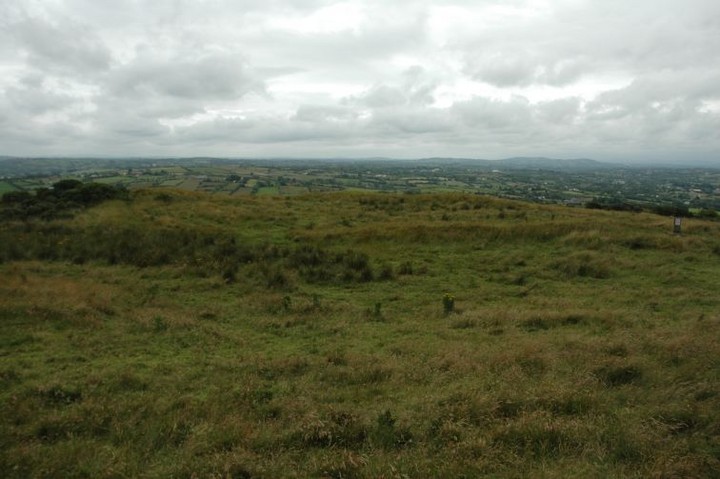
Image © ryaner
Nearest Town:
Cavan (7km NW)
OS Ref (IE):
N468996 /
Sheet: 34
Latitude:
53° 56' 36.82" N
Longitude:
7° 17' 13.96" W
Added by
ryaner
Images (2)
0 discussions
Start a topic
Show |
Hide
Web searches for Banagher (Henge)
Flickr
Google
Google Images
The Megalithic Portal
Bing
Stone Pages
Wikipedia
Show map
(inline Google Map)
- Sites within 20 km -
-
Banagher (0km N) (0 posts)
Banagher (SE Circle) (0.14km WNW) (7 posts)
Banagher (NW Circle) (0.28km WNW) (2 posts)
Banagher (0.32km ENE) (4 posts)
Banagher (0.32km ENE) (0 posts)
Moher (0.61km WSW) (1 post)
Slieve Glah (1.34km NW) (5 posts)
Cargagh (2.15km E) (0 posts)
Black Pig Dyke (4.17km SW) (0 posts)
Pollamore Near (4.89km WNW) (0 posts)
Polleragh (5.19km SW) (0 posts)
Duffcastle (7.52km SSE) (8 posts)
Aghawee (7.55km SSW) (6 posts)
Mullacastle (7.56km S) (0 posts)
Drumbee (7.56km S) (0 posts)
Shantemon Hilltop Enclosure (7.9km NNW) (0 posts)
Carrickacroy (8.14km S) (0 posts)
Shantemon (8.19km NNW) (11 posts)
Knockatudor (9.13km NE) (7 posts)
Aghadrumgowna or Calf Field (9.59km NE) (9 posts)
Carrickclevan (12.4km WSW) (8 posts)
Drumroosk (12.43km WSW) (0 posts)
Drumanny (12.6km NW) (3 posts)
Drumhawnagh (13.73km WSW) (7 posts)
Mullaghboy (14.15km WSW) (0 posts)
Killycatron (14.24km WSW) (0 posts)
Middletown (14.33km WSW) (8 posts)
Gartnanoul (15.3km W) (7 posts)
Moydristan (15.4km SSW) (0 posts)
Clonbockoge (16.37km SE) (0 posts)
Barconny (16.56km SE) (2 posts)
Drumavrack (16.8km N) (3 posts)
Virginia Park Estate (17.36km ESE) (3 posts)
Brackloney (17.98km SE) (0 posts)
Farranagloch (18.11km SE) (2 posts)
Corraneary Lough (18.94km ENE) (0 posts)
Tullystown (19.11km S) (0 posts)
Raffony (19.14km E) (0 posts)
Drumhart (19.28km W) (0 posts)
Cloghchurnel (19.97km SW) (1 post)
- Add -
-
Add news
Add an image
Add fieldnotes
Add folklore
Add miscellaneous
Add a link
-
Add a site
Add a nearby facility
Add an alternative name/spelling
Images
(click to view fullsize)
Add an image
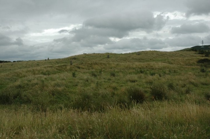
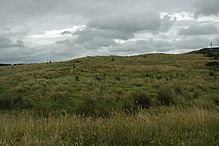 Image © ryaner