The Modern Antiquarian
Log in
|
Register
Home
Latest Posts
Forums
Maps
Help
Browse Sites
News
Blog
Contributors
The Books
Select
-
Belgium
Denmark
Eire
France
Germany
Greece
Italy
The Netherlands
Norway
Portugal
Republic of Malta
Spain
Sweden
Switzerland
United Kingdom
County Kerry
City of Shrone
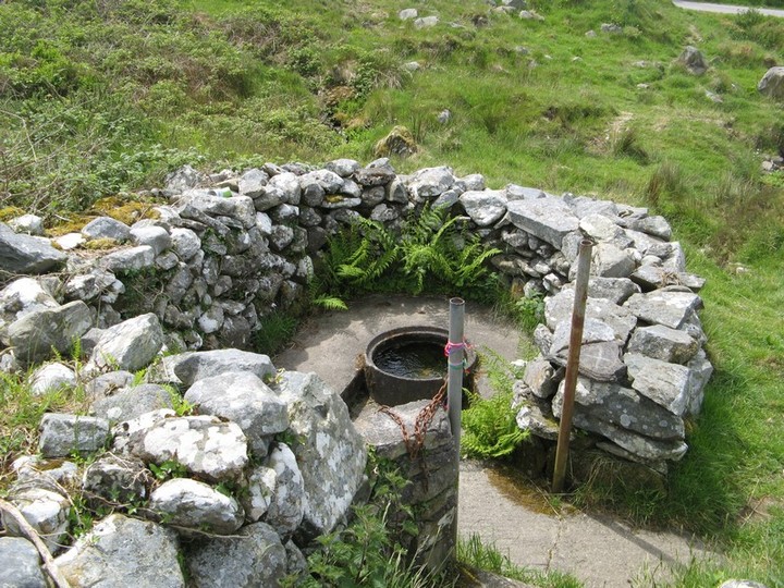
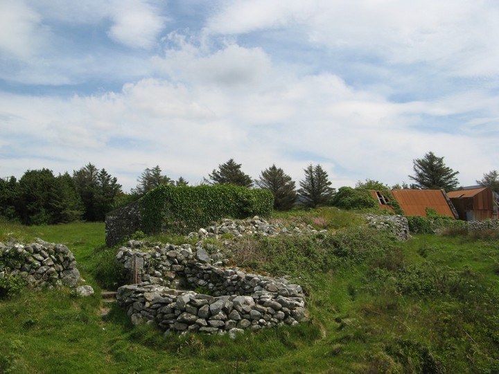
City of Shrone
Sacred Well
City of Shrone (Sacred Well) on The Modern Antiquarian, the UK & Ireland's most popular megalithic community website. 2 images, plus information on many more ancient sites nearby and across the UK & Ireland.
Image © Bawn79 © 2008
Nearest Town:
Ballydesmond (16km N)
OS Ref (IE):
W138883 /
Sheet: 79
Latitude:
52° 2' 24.49" N
Longitude:
9° 15' 23.05" W
Added by
bawn79
Images (2)
0 discussions
Start a topic
Show |
Hide
Web searches for City of Shrone
Flickr
Google
Google Images
The Megalithic Portal
Bing
Stone Pages
Wikipedia
Show map
(inline Google Map)
- Sites within 20 km -
-
City of Shrone (0km N) (15 posts)
Eastern Pap (2.73km S) (6 posts)
The Paps of Anu (2.97km SSW) (7 posts)
Claragh W (9.46km ENE) (2 posts)
Farrankeal (9.57km NNE) (1 post)
Farrankeal (9.57km NNE) (2 posts)
Kilmeedy W (9.96km ENE) (0 posts)
Claragh E (10.46km ENE) (2 posts)
Kilmeedy E (10.46km ENE) (0 posts)
Knocknashannagh (11.08km NE) (1 post)
Lumnagh More (12.92km SSE) (0 posts)
Gortnatubbrid (13.54km SE) (4 posts)
Gortnatubbrid (13.54km SE) (13 posts)
St Abban's Grave (13.73km SE) (1 post)
Shanacloon (13.73km SE) (5 posts)
St Abban's Grave (13.73km SE) (4 posts)
Shanralagh (13.76km ENE) (3 posts)
Cloghboola Beg (13.82km E) (0 posts)
Cloghboola More (13.82km E) (0 posts)
Ballymakeery (14.04km ESE) (5 posts)
Lissyvigeen (14.23km W) (40 posts)
Glantane South (14.92km E) (8 posts)
Glantane East S (15.06km E) (16 posts)
Glantane East N (15.07km E) (14 posts)
Glantane East N (15.07km E) (5 posts)
Glantane East (15.12km E) (7 posts)
Gortanimill (15.8km SE) (16 posts)
Glenreagh (16.01km NNE) (1 post)
Carrigonirtane (16.12km E) (4 posts)
Cabragh N (16.33km E) (6 posts)
Cabragh (16.33km E) (4 posts)
Knocknakilla (16.33km E) (24 posts)
Carriganimmy (16.42km E) (15 posts)
Carrigonirtane (16.54km E) (6 posts)
Cabragh (16.67km E) (4 posts)
Reananerree (16.69km SE) (11 posts)
Reananarree (16.82km SE) (3 posts)
Cloghboola Beg (16.92km E) (12 posts)
Derryfineen (16.92km SE) (6 posts)
Derryfineen (17.02km SE) (5 posts)
Clashmaguire (17.2km E) (2 posts)
Knocknakilla (17.43km E) (0 posts)
Lack More (17.68km SE) (9 posts)
Clashmaguire (17.95km ESE) (1 post)
Glenleigh (18.05km ENE) (3 posts)
Knockraheen (18.32km E) (19 posts)
Lissacresig (18.41km ESE) (3 posts)
Gortnalicky (18.41km ESE) (1 post)
Grousemount (18.47km S) (3 posts)
Cools (18.66km ESE) (3 posts)
Gorteennakilla (18.98km SSE) (6 posts)
Lissacresig 2 (19.11km ESE) (5 posts)
Lissacresig 3 (19.11km ESE) (4 posts)
Lissacresig 1 (19.19km ESE) (4 posts)
Knocknagappul (19.31km E) (2 posts)
Lackaduv (19.94km E) (5 posts)
Scrahanard (19.97km E) (15 posts)
- Add -
-
Add news
Add an image
Add fieldnotes
Add folklore
Add miscellaneous
Add a link
-
Add a site
Add a nearby facility
Add an alternative name/spelling
Images
(click to view fullsize)
Add an image
 Image © Bawn79 © 2008