The Modern Antiquarian
Log in
|
Register
Home
Latest Posts
Forums
Maps
Help
Browse Sites
News
Blog
Contributors
The Books
Select
-
Belgium
Denmark
Eire
France
Germany
Greece
Italy
The Netherlands
Norway
Portugal
Republic of Malta
Spain
Sweden
Switzerland
United Kingdom
The Channel Islands
Jersey
Le Pinacle
Natural Rock Feature
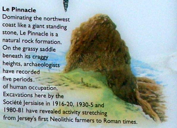
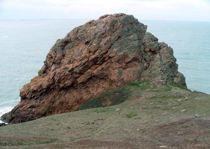
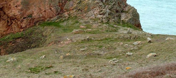
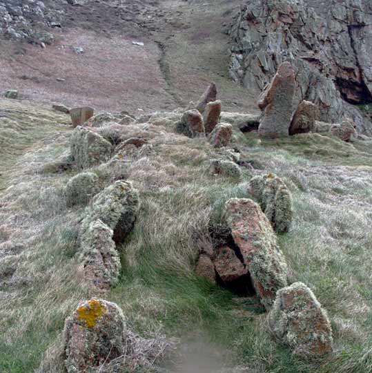
Le Pinacle (Le Pinnacle) (Natural Rock Feature) on The Modern Antiquarian, the UK & Ireland's most popular megalithic community website. 4 images, plus information on many more ancient sites nearby and across the UK & Ireland.
Image © baza
Also known as:
Le Pinnacle
OS Ref (GB):
Latitude:
49° 15' 10.86" N
Longitude:
2° 15' 0.49" W
Added by
fitzcoraldo
Images (4)
0 discussions
Start a topic
Show |
Hide
Web searches for Le Pinacle
Flickr
Google
Google Images
Bing
Stone Pages
Wikipedia
Show map
(inline Google Map)
- Sites within 20 km -
-
La Hougue des Geonnais (2.61km E) (4 posts)
Les Monts Grantez (3.12km ESE) (5 posts)
Les Blanches Banques (6.34km SE) (2 posts)
The Broken Menhir (6.53km SE) (3 posts)
The Ossuary (6.57km SE) (5 posts)
The Little Menhir (6.61km SE) (4 posts)
La Tête des Quennevais (6.72km SE) (0 posts)
The Great Menhir (6.94km SE) (2 posts)
Cherry Farm (7.03km ESE) (3 posts)
La Sergente (7.55km SSE) (7 posts)
La Hougue Boëte (7.83km E) (3 posts)
La Table des Marthes (7.98km SSE) (4 posts)
La Hougue de Vinde (10.69km ESE) (6 posts)
Ville es Nouaux (10.72km ESE) (13 posts)
La Hougue des Platons (10.9km E) (7 posts)
La Hougue Bie (14.73km E) (18 posts)
Le Dolmen de Mont Ube (15.59km ESE) (6 posts)
Le Dolmen du Couperon (15.72km E) (10 posts)
La Blanche Pierre (15.91km ESE) (4 posts)
La Pouquelaye de Faldouet (17.12km E) (10 posts)
- Add -
-
Add news
Add an image
Add fieldnotes
Add folklore
Add miscellaneous
Add a link
-
Add a site
Add a nearby facility
Add an alternative name/spelling
Images
(click to view fullsize)
Add an image
Photographs:
Maps / Plans / Diagrams:
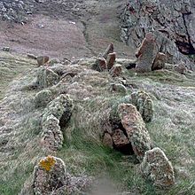 Image © baza

 Maps / Plans / Diagrams: