The Modern Antiquarian
Log in
|
Register
Home
Latest Posts
Forums
Maps
Help
Browse Sites
News
Blog
Contributors
The Books
Select
-
Belgium
Denmark
Eire
France
Germany
Greece
Italy
The Netherlands
Norway
Portugal
Republic of Malta
Spain
Sweden
Switzerland
United Kingdom
County Kerry
Darrynane More
Standing Stone / Menhir
Darrynane More (Standing Stone / Menhir) on The Modern Antiquarian, the UK & Ireland's most popular megalithic community website. 7 images, 1 fieldnote, plus information on many more ancient sites nearby and across the UK & Ireland.
Image © Michael Mitchell
Nearest Town:
Waterville (8km NW)
OS Ref (IE):
V535589 /
Sheets: 83, 84
Latitude:
51° 45' 48.33" N
Longitude:
10° 7' 20.26" W
Added by
bawn79
Images (7)
Fieldnotes (1)
0 discussions
Start a topic
Show |
Hide
Web searches for Darrynane More
Flickr
Google
Google Images
The Megalithic Portal
Bing
Stone Pages
Wikipedia
Show map
(inline Google Map)
- Sites within 20 km -
-
Caherdaniel (0.95km ENE) (4 posts)
Cahernageeha (1.49km WNW) (5 posts)
Coomnahorna East (2.82km NE) (0 posts)
Coomatloukane North (2.95km W) (11 posts)
Coomatloukane (3.07km W) (16 posts)
Loher (3.88km WNW) (15 posts)
Eightercua (6.23km NW) (22 posts)
Waterville (7.43km NW) (3 posts)
Staigue Bridge (7.9km ENE) (13 posts)
Staigue (7.94km ENE) (0 posts)
Staigue Cashel (8.75km ENE) (21 posts)
Dromod (10.32km N) (3 posts)
Hag of Beara (11.64km E) (9 posts)
Kealoge (12.54km SE) (6 posts)
Urhin (12.62km ESE) (5 posts)
Ardacluggin (12.8km ESE) (4 posts)
Ardacluggin (13.4km ESE) (1 post)
Ballycrovane (13.55km E) (18 posts)
Coulagh (13.61km ESE) (5 posts)
Coulagh (13.76km ESE) (1 post)
Leabaleaha (14.71km W) (11 posts)
Teernahillane (16.08km ESE) (4 posts)
Teernahillane (16.15km ESE) (9 posts)
Kealoge (16.2km SE) (3 posts)
Teernahillane (16.75km ESE) (1 post)
Teernahillane (16.75km ESE) (3 posts)
Knockoura (17.1km ESE) (2 posts)
Killough West (17.21km SSE) (9 posts)
Kilmackowen (17.22km E) (9 posts)
Kilmackowen (17.36km E) (17 posts)
Gour (17.44km ESE) (10 posts)
Dromtine (17.45km NE) (4 posts)
Gort na Gainimhe (17.48km S) (6 posts)
Ardgroom Outward (17.5km E) (34 posts)
Derreenataggart West (17.91km ESE) (31 posts)
Fanahy (18.12km ESE) (4 posts)
Loughane More (18.31km SSE) (6 posts)
Glashananinnaun (18.48km E) (5 posts)
Cahermore (18.64km SE) (5 posts)
Cloontreem (18.72km E) (15 posts)
Oghermong (18.85km NW) (1 post)
Rodeen 1 (18.86km E) (3 posts)
Derreenataggart Middle (18.92km ESE) (2 posts)
Rodeen 3 (18.99km E) (4 posts)
The Waters (19.11km SSW) (3 posts)
Rodeen 2 (19.35km E) (5 posts)
Derrymihin West (19.8km ESE) (3 posts)
- Add -
-
Add news
Add an image
Add fieldnotes
Add folklore
Add miscellaneous
Add a link
-
Add a site
Add a nearby facility
Add an alternative name/spelling
Images
(click to view fullsize)
Add an image
Fieldnotes
Add fieldnotes
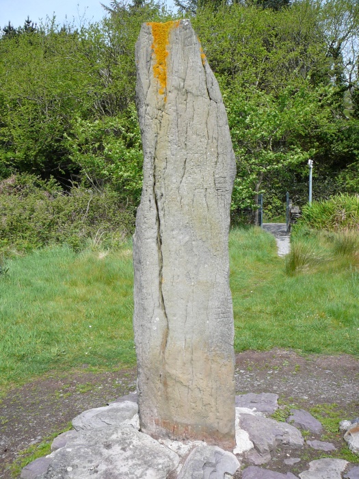
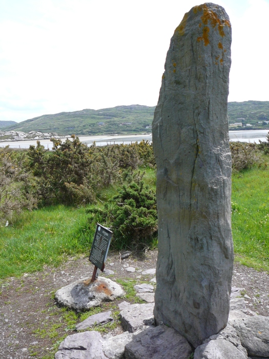
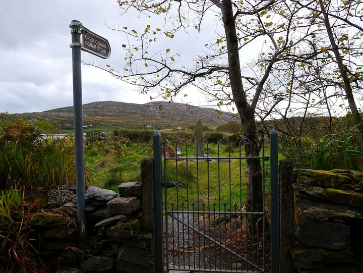
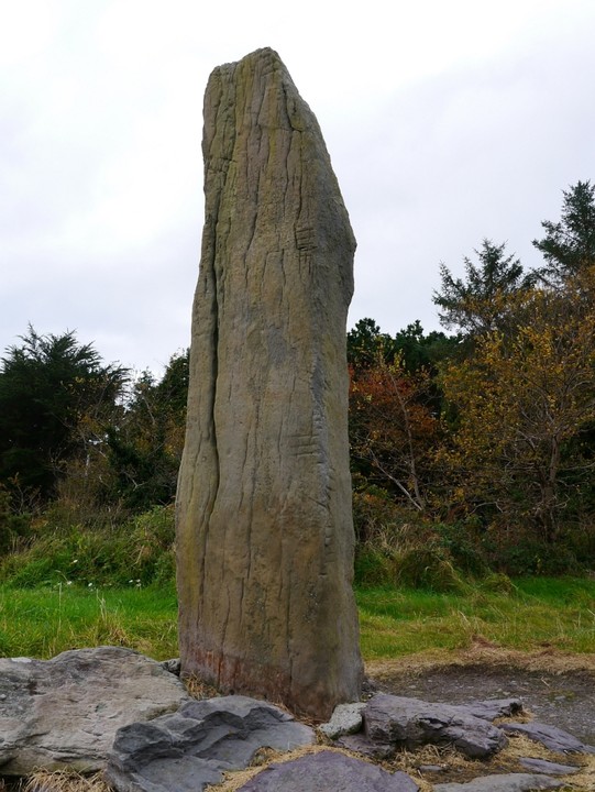
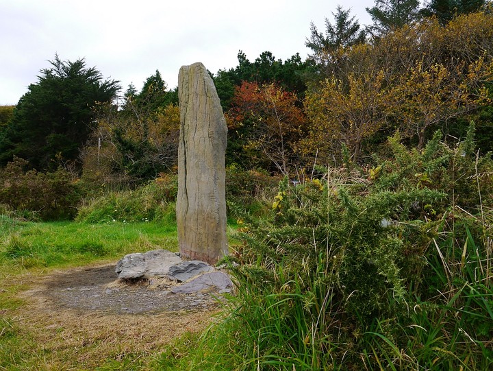
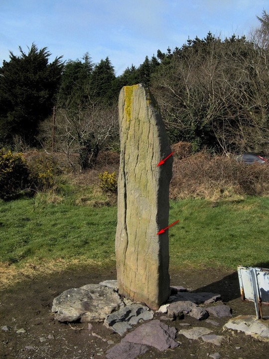
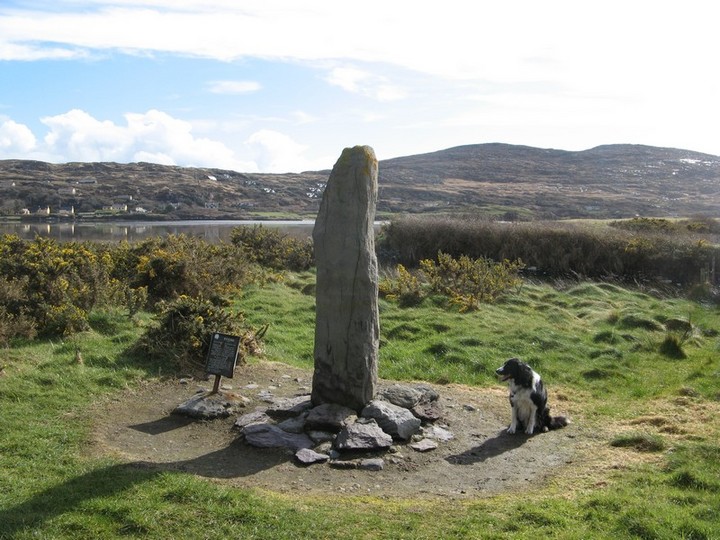
This standing stone is near the village of Caherdaniel, follow the signs for Derrynane House (Home of Daniel O'Connel). The standing stone itself must 2.2m high and there are two pieces of Ogham on it.
Comments (0)
|
Add a comment
|
Permalink
Posted by
bawn79
26th March 2008ce