|
|

|
|
Kempstone HillStanding Stones
|
||||||||||||||||||||||||
|
|
|
Images (click to view fullsize) |
|


|
Fieldnotes |
|
|
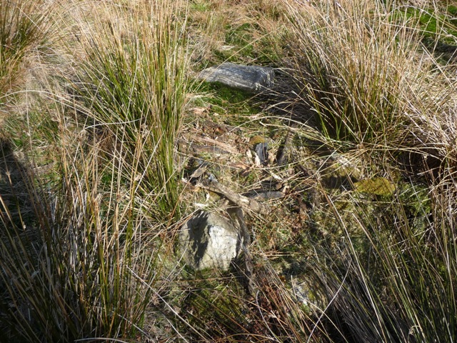
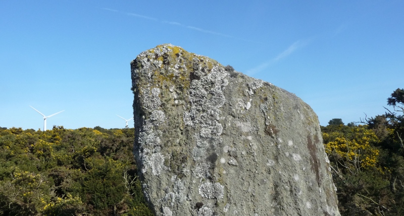
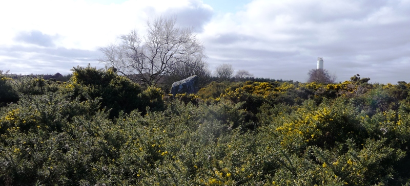
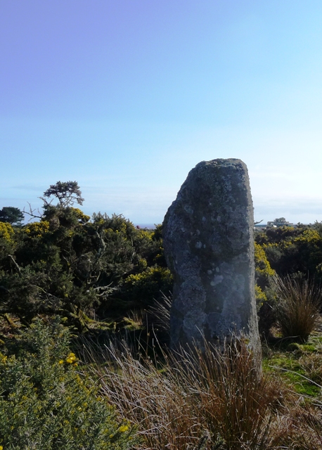
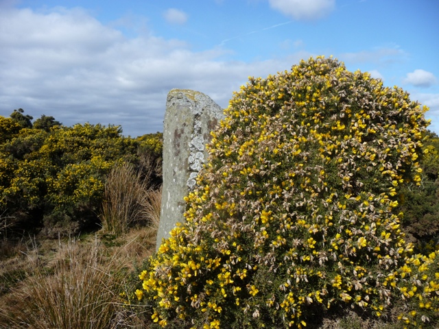
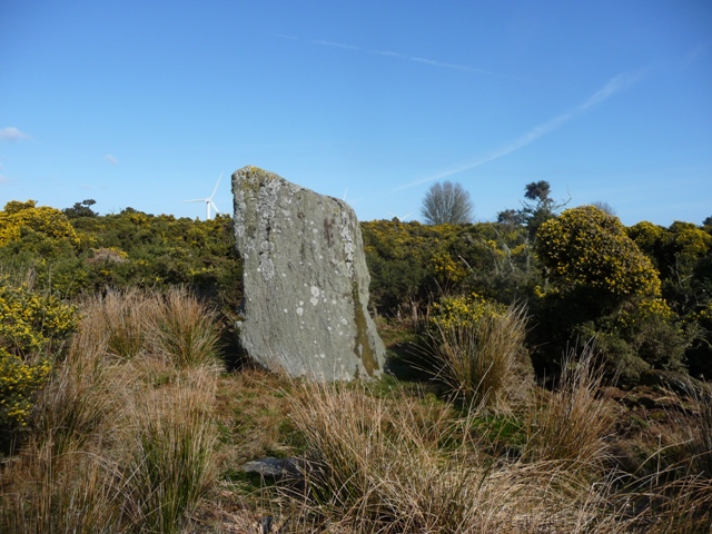
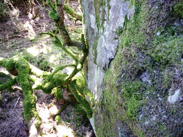
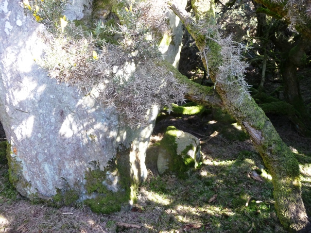
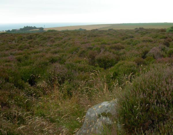
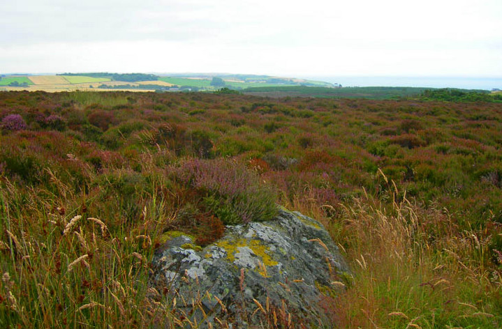
If getting to the cairn involved some crawling then it was good practise for a lot more crawling to the nearest standing stone. NO87678947 From the cairn I re-crawled to the clearing and looked west. No standing stone could seen thanks to over head high gorse so I headed northish beyond the vegetation, west then south eastish into the next clearing. Going by the Canmore map the stone stood half way down this gap and in amongst the gorse. With no sight of the stone it was on all fours and I crawled beneath the branches. About 30 meters (I floundered for more than that thanks to trunks of the vegetation) in I spotted the base of the stone. It is a magnificently shaped stone with no visible markings standing at 1.8m high, at its base it is almost 1m wide. After taking what photos I could I crawled back out. NO87608942 Once out of the undergrowth and a check of the damage, your legs will take a battering here, I hobbled slightly further west where fortunately the standing stone can be seen. Bizarrely and thankfully a small path to the north leads to the stone. Set in the midst of a probable cairn this is a lovely and beautifully shaped stone. It stands at almost 3m in height being over 1m at its base. Also near is the remnants of a cist still clearly visible. Wonderful sites, a magical place. Final score Gorse 2 Drew 3 Visited 23/3/2017. |
9th May 2017ce |
|
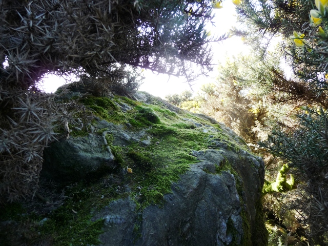
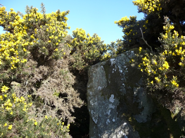
Kempstone Hill is an ancient site overlooking the North Sea which includes standing stones, tumuli and other megalithic elements. This relatively unexplored location is considered by many scholars as the likely spot of the first recorded battle in Scottish history, Mons Graupius. The expansive moorland ridge provides a commanding vantage point in all directions and an aesthetic setting for this prehistoric puzzle. The herein fieldnotes are based upon my site visits to Kempstone Hill in August, 2007 combined with literature analysis as annotated. PREHISTORY. The glacial advance from the last ice age ice reached the 300 foot mark on the west slope of neighbouring Megray Hill, with the ice sheet likely overtopping Kempstone Hill, but probably not extending very far on the seaward slope. (Edinburgh, 1963) When the glacier retreated, this locus may have been an attractive zone for prehistoric men with a penchant for megalithic construction, since it is the southernmost coastal position where gneiss and other Scottish Highland boulder types are found immediately north of the Highland Boundary Fault. Speaking of the pre-Roman era, Groome notes that Kempstone Hill holds numerous tumuli, some of them large, as well as the standing stones; he further asserts that these megaliths are: "supposed to be sepulchral monuments raised on a battlefield".(Groome, 1885) This is a remarkable observation, since he published prior to the confluence of numerous modern scholars endorsing Kempstone Hill as the site of the Battle of Mons Graupius. Thus he is clearly speaking of the site's use as a truly prehistoric tribal battlefield. It is not without coincidence that the very name "Kemp" is the Celtic word for battle, as first noted in the context of Kempstone Hill by an early endorser of this site as the locus of Mons Graupius.(Society, 1845) Regarding the two large standing stones at Kempstone, RCAHMS records note that one measures 1.8m in height and thickens from 0.6m by 0.7m at the base to 1.3m by 0.9m near the top; it appears to stand in the centre of a cairn 4.5m in diameter. The other, situated 85m to the Southwest measures up to 1.3m by 0.9m and 2.4m in height. Human skeletal remains were found at the spot of each major stone. (RCAHMS, 1984) By the base of the east side of the smaller of these two stones, a small pit covered by a slab 0.3m square.. Stuart describes Kempstone Hill as containing five or six Druidical circles, one of which contained three very large concentric. All around, especially towards the north , are scattered a vast number of cairns and tumuli of different shapes and dimensions, some of them being of great height and circumference. (Stuart, 1841} MONS GRAUPIUS. The local vicinity, including Kempstone and Megray Hills and Raedykes, has been suggested as the most likely site of the Battle of Mons Graupius, (Hogan, 2007) the first recorded battle in Scottish history. The topography of Kempstone is remarkably consistent with Tacitus' account of the conflict of the Romans and Caledonians, especially the ability of Roman soldiers to signal to ships in the North Sea. There is no similar location along the Roman marching line that offers this capability. In addition to sources already noted, Roy, Surenne and Watt have each advanced the tenet that the locus of Kempstone Hill was the site of this epic battle. Finds of chariot wheels, chariot axle rings and roman weaponry have been recovered in the vicinity and at Cantlayhills immediately at the north of Kempstone. (Marren, 1990) ENVIRONMENT. The entire top of the rounded Kempstone Hill is covered in heather moorland with copses of gorse interspersed. The gorse patches are strangely distributed, as though they are formed from soil conditions that may have been modified in earlier times. For example, the areas that appear to be tumuli are typically overgrown with the higher gorse plants. I encountered a particularly mysterious tumulus/gorse patch toward the eastern end of the hill, which had a highly unusual patch within it containing a low grass, totally untypical of the entire hill; furthermore there was a very flat gneiss slab approximately 1.7 meters long lying prone within the thicket.. Below the moor level on the hill are fertile grain fields, and in the valley below flows Limpet Burn, with considerable wildlife habitat. Kempstone and Megray Hills are the southernmost coastal elements of the Mounth, which are rich in gneiss and granitic rock, suitable for use in the noble megaliths of Kempstone Hill. REFERENCES. * Edinburgh Geological Society (1963) "Transactions of the Edinburgh Geological Society", Neill and Co. * Francis Hindes Groome (1885) "Ordnance Gazetteer of Scotland: A Survey of Scottish Topography", T.C. Jack publisher, Scotland * Society for the Benefit of the Sons and Daughters of the Clergy (1845) "The New Statistical Account of Scotland", W. Blackwood and Sons. Scotland * The Royal Commission on the Ancient and Historical Monuments of Scotland (RCAHMS) (1984)." The archaeological sites and monuments of North Kincardine, Kincardine and Deeside District, Grampian Region", The archaeological sites and monuments of Scotland series no 21, Edinburgh, 18, No. 91 * John Stuart of Inchbreck, Lit. Gr. P. Aberdeen (c. 1841) "Various accounts of the progress of Roman arms in Scotland and of the scene of the great battle between Agricola and Galgacus" * C. Michael Hogan (2007) "Elsick Mounth", The Megalithic Portal, ed. Andy Burnham * William Roy (1793) ''The military antiquities of the Romans in Britain'' * Gabriel Jacques Surenne (1827) ''Letter to Sir Walter Scott'' * Archibald Watt (1985) ''Highways and Byways around Kincardineshire'', Stonehaven Heritage Society * Peter Marren (1990) "Grampian Battlefields: The Historic Battles of North East Scotland from AD84", Aberdeen University Press, 224 pages ISBN 0080365981 |
 Posted by C Michael Hogan
26th December 2007ce |
Folklore |
|
The Kempstonehill, the scene of this grim legend, is a moor several hundred acres in extent, about 432 feet above sea level. It is on the Cowie estate, and lies about two miles south of Stonehaven. On the summit of the ridge two unchiselled stones have stood up for untold centuries, and it is from these that the hill derives its name.Aberdeen Press and Journal, 16th March, 1928. |
 Posted by Rhiannon
27th December 2019ce |