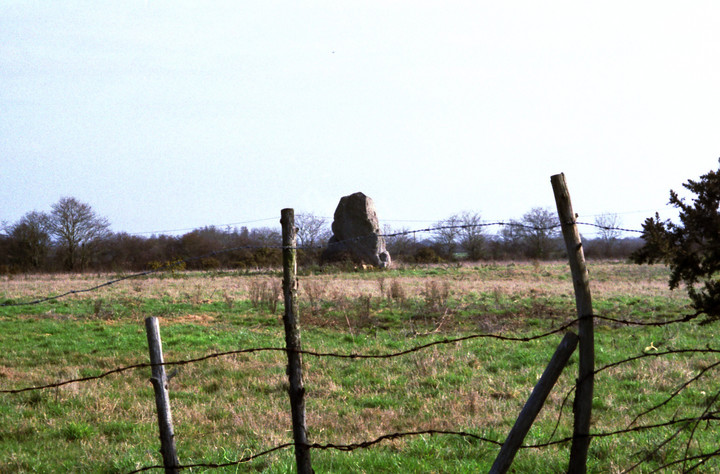
The Modern Antiquarian
Log in
|
Register
Home
Latest Posts
Forums
Maps
Help
Browse Sites
News
Blog
Contributors
The Books
Select
-
Belgium
Denmark
Eire
France
Germany
Greece
Italy
The Netherlands
Norway
Portugal
Republic of Malta
Spain
Sweden
Switzerland
United Kingdom
Loire-Atlantique (44)
Menhir des Cassis
Standing Stone / Menhir
Menhir des Cassis (Standing Stone / Menhir) on The Modern Antiquarian, the UK & Ireland's most popular megalithic community website. 1 image, 1 fieldnote, plus information on many more ancient sites nearby and across the UK & Ireland.
Image © Mark Williamson
Latitude:
47° 14' 55.56" N
Longitude:
2° 5' 13.41" W
Added by
Spaceship mark
Images (1)
Fieldnotes (1)
0 discussions
Start a topic
Show |
Hide
Web searches for Menhir des Cassis
Flickr
Google
Google Images
Bing
Stone Pages
Wikipedia
Show map
(inline Google Map)
- Sites within 20 km -
-
Menhir de Mégerie (0.48km ENE) (2 posts)
Menhir de Pierre Bonde (2km NE) (2 posts)
Menhirs des Pierres Blanches (2.46km NNE) (3 posts)
Dolmen de la Briordais (4.17km WSW) (2 posts)
Menhir de Plessis-Gamat (5.09km W) (2 posts)
Dolmen des Rossignols (6.31km WSW) (4 posts)
Menhir du Menhir (6.84km SW) (2 posts)
Menhir du Boivre (7.23km SW) (3 posts)
Tumulus de Dissignac (14.73km W) (5 posts)
Tumulus Des Mousseaux (14.95km S) (5 posts)
Joselière Dolmen (16.28km SSE) (2 posts)
- Add -
-
Add news
Add an image
Add fieldnotes
Add folklore
Add miscellaneous
Add a link
-
Add a site
Add an alternative name/spelling
Images
(click to view fullsize)
Add an image
Fieldnotes
Add fieldnotes
AAAGGHH! More private property! And a lovely tapering lozenge menhir this is too. Maybe 3m+ but I can't get to it at all. How frustrating this is becoming.
Comments (0)
|
Add a comment
|
Permalink
Posted by
Spaceship mark
6th November 2007ce