The Modern Antiquarian
Log in
|
Register
Home
Latest Posts
Forums
Maps
Help
Browse Sites
News
Blog
Contributors
The Books
Select
-
Belgium
Denmark
Eire
France
Germany
Greece
Italy
The Netherlands
Norway
Portugal
Republic of Malta
Spain
Sweden
Switzerland
United Kingdom
County Dublin
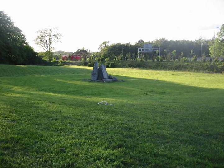
Taylorsgrange
Portal Tomb
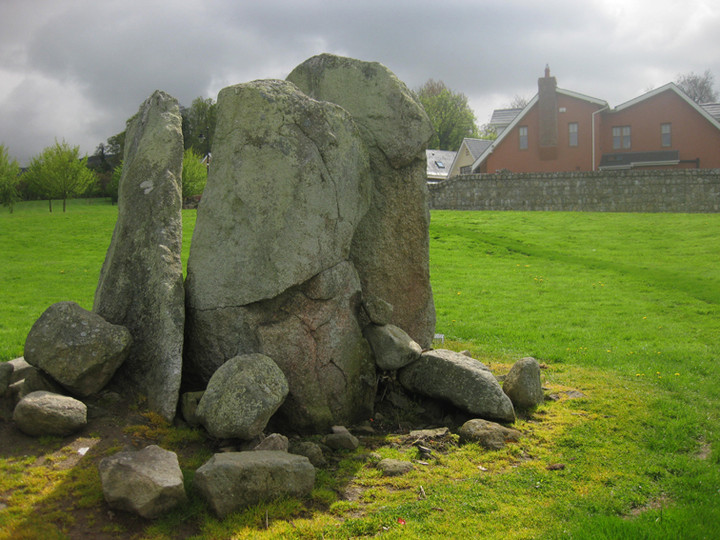
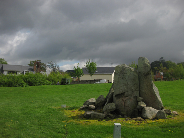
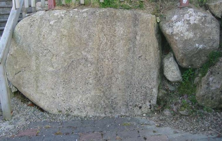
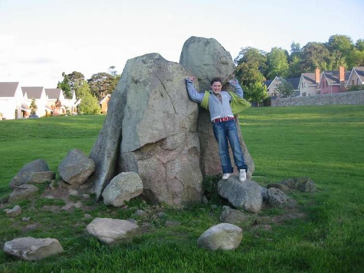
Taylorsgrange (The Brehon's Chair/Glensouthwell) (Portal Tomb) on The Modern Antiquarian, the UK & Ireland's most popular megalithic community website. 11 images, plus information on many more ancient sites nearby and across the UK & Ireland.
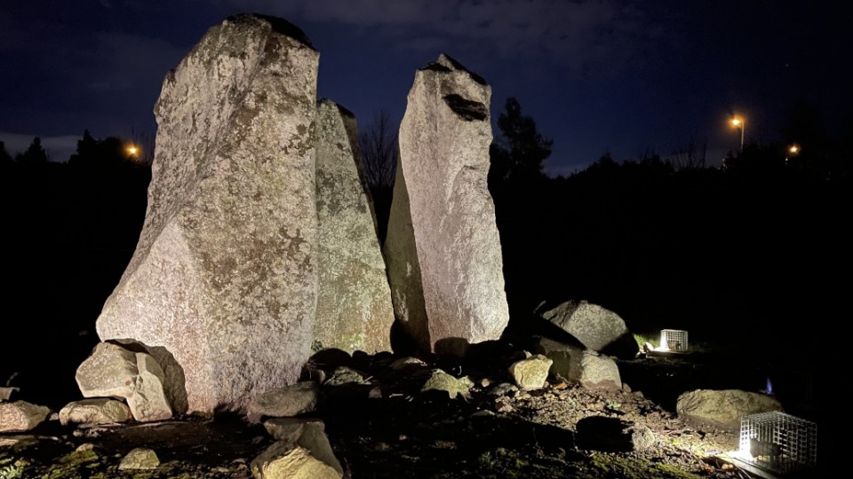
Image © ryaner
Also known as:
The Brehon's Chair
Glensouthwell
Nearest Town:
Tallaght (7km W)
OS Ref (IE):
O158255 /
Sheet: 50
Latitude:
53° 16' 1.96" N
Longitude:
6° 15' 51.1" W
Added by
FourWinds
Images (11)
0 discussions
Start a topic
Show |
Hide
Web searches for Taylorsgrange
Flickr
Google
Google Images
The Megalithic Portal
Bing
Stone Pages
Wikipedia
Show map
(inline Google Map)
- Sites within 20 km -
-
Kilmashogue Standing Stone (1.07km SSW) (0 posts)
Kilmashogue Wedge Tomb (1.16km SW) (19 posts)
Rockbrook II (1.87km WSW) (1 post)
Kilmashogue (2.02km SW) (12 posts)
Rockbrook I (2.08km WSW) (6 posts)
Three Rocks Mountain (3.02km ESE) (0 posts)
Tibradden (3.03km SW) (6 posts)
Mount Venus (3.19km WSW) (36 posts)
Tibradden (3.35km SSW) (3 posts)
Fairy Castle (3.39km SE) (5 posts)
Two Rocks Mountain (3.39km SE) (0 posts)
Kilgobbin (3.79km E) (0 posts)
Woodtown (4.04km WSW) (1 post)
Killakee (4.09km WSW) (13 posts)
Monpelier (4.59km WSW) (0 posts)
Monpelier (Hell Fire Club) (4.64km WSW) (20 posts)
Leopardstown (4.82km ENE) (8 posts)
Ballyedmonduff (4.9km ESE) (29 posts)
Kiltiernan (4.91km ESE) (13 posts)
Newtown Hill Standing Stone (5.53km ESE) (1 post)
Newtown Hill Fulacht Fai (5.53km ESE) (0 posts)
Newtown Hill Barrow (5.53km ESE) (4 posts)
Newtown Hill Cairn (5.57km ESE) (2 posts)
Settlement (5.61km ESE) (2 posts)
Piperstown (5.72km SW) (0 posts)
Glassamucky Mountain (5.85km SW) (19 posts)
Bohernabreena (5.92km WSW) (8 posts)
Stillorgan Park (5.96km ENE) (3 posts)
Piperstown (5.99km SW) (0 posts)
Piperstown Standing Stone (6.08km WSW) (1 post)
Piperstown (6.08km WSW) (23 posts)
Glencullen (6.2km ESE) (12 posts)
Glassamucky Brakes (6.28km SW) (11 posts)
Foxrock (6.41km ENE) (7 posts)
Glassamucky Brakes (6.51km SW) (3 posts)
Tallaght (6.74km W) (5 posts)
Ballybetagh (6.86km ESE) (6 posts)
Cunard (6.92km SW) (15 posts)
Knocknagun (6.92km SSE) (6 posts)
Kill of the Grange (6.98km ENE) (5 posts)
Glassamucky (7.09km WSW) (4 posts)
Glendruid (7.17km E) (26 posts)
Prince William's Seat (7.34km SSE) (4 posts)
Brenanstown (7.52km E) (5 posts)
Barnaslingan (7.92km ESE) (0 posts)
Laughanstown (8km E) (12 posts)
Annacrivey (8.12km SE) (8 posts)
Raven's Rock (8.21km SE) (3 posts)
Carrigeenoura (8.35km WSW) (0 posts)
Ballinascorney Upper (8.39km WSW) (9 posts)
Ballymorefinn Cist (8.43km WSW) (6 posts)
Kingswood (8.49km WNW) (6 posts)
Belgard Deer Park (8.53km WSW) (3 posts)
Ballymorefinn Hill Outcrop (8.65km WSW) (6 posts)
Raheendhu/Ballinascorney (8.7km WSW) (4 posts)
Belgard Deer Park (8.82km WSW) (6 posts)
Ballymaice (8.89km WSW) (12 posts)
Shankhill (9.01km E) (0 posts)
Kiltalawn (9.28km W) (4 posts)
Crookan Cairn (9.4km WSW) (11 posts)
Knockanvinidee (9.44km WSW) (2 posts)
Seahan II (9.45km SW) (4 posts)
Seahan I (9.45km SW) (6 posts)
Seahan III (9.45km SW) (11 posts)
Carrickgollogan (9.55km ESE) (7 posts)
Parknasilogue (9.66km ESE) (7 posts)
The Druids' Judgement Seat (9.69km E) (4 posts)
Lugmore Cist (9.89km WSW) (7 posts)
Lugmore (9.89km WSW) (0 posts)
Ballybrack (9.91km E) (25 posts)
Dublin Zoological Gardens (10.11km NW) (5 posts)
Knockannavea (10.16km WSW) (3 posts)
Killiney Hill/Dalkey Commons (10.16km E) (2 posts)
Knockmaroon (10.55km NW) (11 posts)
Enniskerry (10.59km ESE) (0 posts)
Onagh (10.99km SE) (8 posts)
Seefingan (11.17km SW) (11 posts)
Crooksling (11.19km WSW) (9 posts)
Mountseskin (11.28km WSW) (1 post)
Boherboy (11.46km W) (19 posts)
Butter Mountain (11.59km WSW) (3 posts)
Ashtown Demesne (11.64km NW) (10 posts)
Dalkey Island (11.89km ENE) (1 post)
Kilcroney (11.92km ESE) (1 post)
Palmerstown Lower (11.96km WNW) (5 posts)
Crooksling (11.98km WSW) (0 posts)
Raheen (12.13km WSW) (5 posts)
Ballyfolan (12.35km WSW) (4 posts)
Seefin Hill (12.42km SW) (56 posts)
Ballyfolan (12.44km WSW) (10 posts)
Seefin 2 (12.48km SW) (7 posts)
Lugg (12.58km WSW) (13 posts)
Lugg (12.65km WSW) (1 post)
Claremont (12.79km NNW) (5 posts)
Glenaraneen (12.93km WSW) (7 posts)
Cloghleagh (13.05km SW) (3 posts)
Rathcoole (13.11km W) (6 posts)
Giltspur (13.33km ESE) (7 posts)
Rocky Valley (13.42km ESE) (0 posts)
Knockandinny (13.9km WSW) (0 posts)
Kilbride (Talbotstown Lower By.) (13.93km WSW) (2 posts)
Kilbride (Talbotstown Lower By.) (13.93km WSW) (4 posts)
Crockaunadreenagh (13.96km WSW) (7 posts)
Slievethoul II and III (13.96km WSW) (4 posts)
Kilbride (Talbotstown Lower By.) (13.97km WSW) (2 posts)
Dowery (13.97km WSW) (0 posts)
Slievethoul II (14.1km WSW) (0 posts)
Knockatillane (14.16km WSW) (2 posts)
Carignagower (14.17km WSW) (0 posts)
Glencap Commons Upper (14.23km ESE) (8 posts)
Slievethoul I (14.3km WSW) (9 posts)
Ballynabrocky (14.39km SW) (0 posts)
Ballyremon Commons (14.42km SE) (4 posts)
Long Hill (14.42km SE) (0 posts)
Kilmacanoge South (14.45km ESE) (3 posts)
Coolock (14.46km NNE) (8 posts)
The Coffin Stone (Djouce) (15.21km SSE) (0 posts)
Lucan and Pettycannon (15.53km WNW) (3 posts)
Tinode (15.56km WSW) (3 posts)
Daw (15.72km SSW) (0 posts)
Tinode II (15.84km WSW) (2 posts)
Newtown lower (16.04km WSW) (7 posts)
Goldenhill mound (16.24km WSW) (2 posts)
Goldenhill (16.24km WSW) (13 posts)
Kilmurry South (16.41km ESE) (2 posts)
Corduff II (16.43km NW) (3 posts)
Grange (Newcastle By.) (16.47km W) (3 posts)
Athgoe Hill (16.53km W) (6 posts)
Cromwellstown (16.72km WSW) (2 posts)
Howth Cairns (16.78km NE) (0 posts)
Glasnamullen Holy Well (16.84km SE) (1 post)
Ben Of Howth (17.07km NE) (0 posts)
Muck Rock (17.27km NE) (4 posts)
Howth Demesne (17.36km NE) (25 posts)
Corduff (17.59km NW) (3 posts)
The Great Bailey (17.64km NE) (4 posts)
Woodend Hill (17.64km SW) (0 posts)
Kilteel (17.66km WSW) (2 posts)
Sorrel Hill (17.83km SW) (7 posts)
Downshill (17.85km SE) (3 posts)
Sutton South (17.85km NE) (6 posts)
Ringwood (18km W) (4 posts)
Downs Hill (18km SE) (0 posts)
Oldcourt (18.13km SW) (4 posts)
Portmarnock (18.36km NNE) (0 posts)
Drumnigh (18.39km NNE) (8 posts)
Kilbeg Cairn (18.5km SW) (4 posts)
Butterhill (18.73km WSW) (0 posts)
Caureen (18.93km WSW) (7 posts)
Blackrock (19.01km SW) (4 posts)
Lugnagun (19.18km SW) (14 posts)
Howth (19.32km NE) (7 posts)
Lugnagun Cairn (19.44km SW) (4 posts)
Butterhill (19.46km SW) (0 posts)
Cloghoge (19.47km S) (4 posts)
- Add -
-
Add news
Add an image
Add fieldnotes
Add folklore
Add miscellaneous
Add a link
-
Add a site
Add a nearby facility
Add an alternative name/spelling
Images
(click to view fullsize)
Add an image
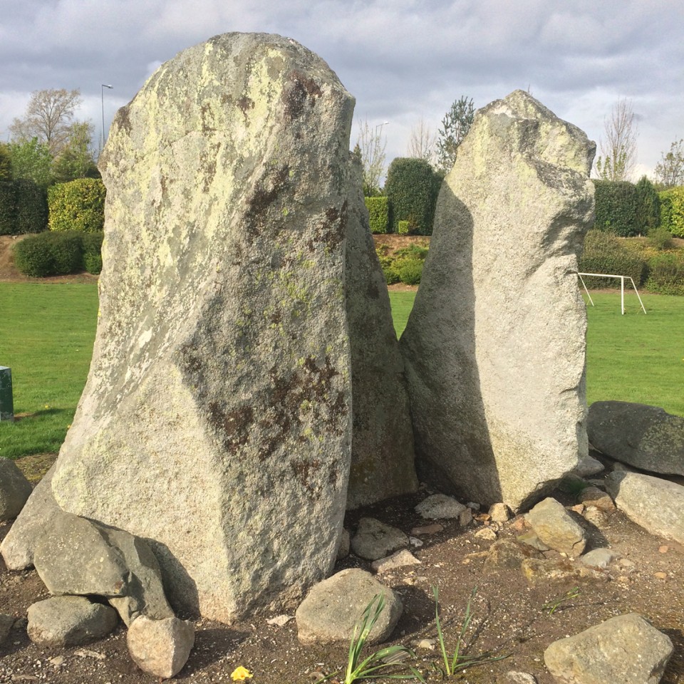
 Image © ryaner
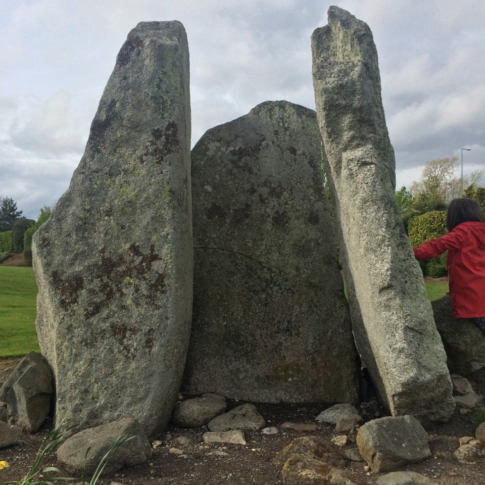