On a fourth visit to north-east Antrim this summer, we set our sights firmly on the cairn on Knocklayd and here, the passage tomb of Carnanmore on East Torr. Three times we had scouted the approach, once even contemplating a shot at it from the west at Ballyvennaght, the saturated, boggy terrain and the low, misty, drizzly cloud dissuading us from our madness. Tom Fourwinds, in Monu-Mental about Prehistoric Antrim, suggests parking at the road junction a kilometre-and-a-half north of the tomb and just below the passage tomb on West Torr and to approach Carnanmore from there. Sage advice, but we’d decided to stick to tombs relatively close to the road on our first trip (excepting Ballygilbert), not being very familiar with the locale, and then, on the following two trips, low cloud and sea mist acted like the curtains of a stage, teasing us but never opening.
Not today. Having earlier summited Knocklayd we decided to follow our plan and make for East Torr, this after watching the low cloud doing a dance around its cairn before finally evaporating in the midday sun. It was a different day to that on our first trip when there was not a cloud in sight nor any haze to obscure the thrilling views. This time Kintyre, Islay and Jura were hidden and Rathlin, scarcely 10 kms to the north, only partially visible.
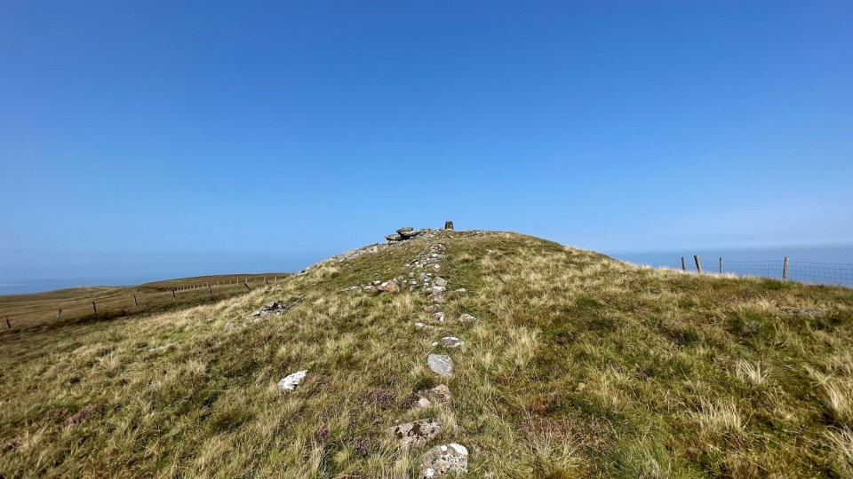
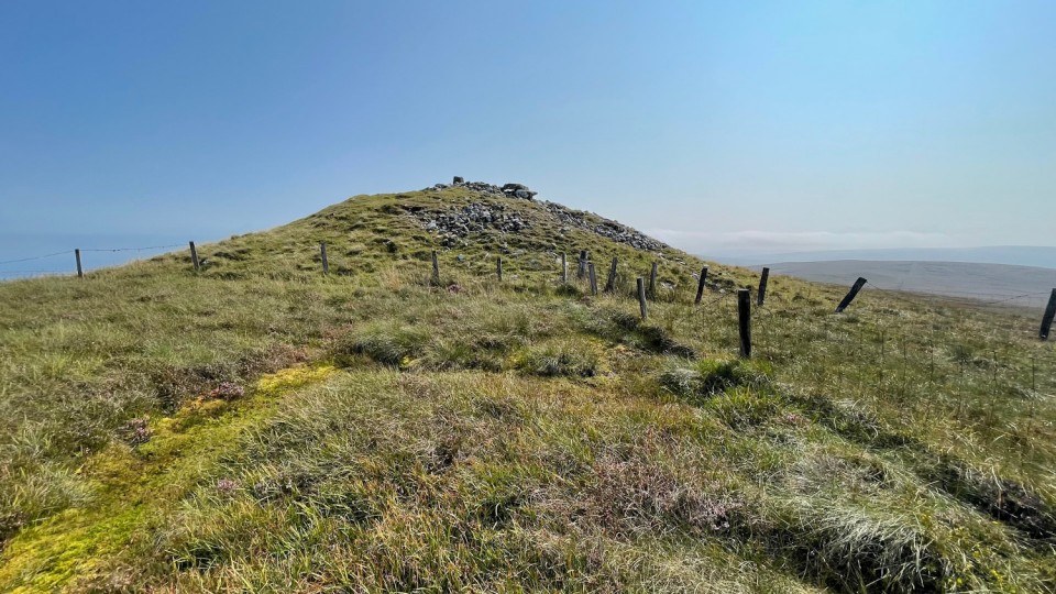
Leaving the car at the aforementioned junction, we vaulted the gate and set off. It’s at or around the 255 metre contour with the summit at 379 metres, so a gentle 134 metres gain over a kilometre and a half, directly south. The first half a kilometre is relatively easy, grass-covered and firm. There are two fences to surmount, but both have stiles, the first signalling a change in terrain to boggier, heavier ground. After a while a north/south fence appears on your right – it was too tempting not to stick with this and, as it turns out, it points directly at the tomb.
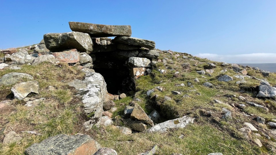
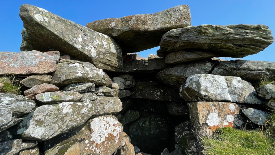
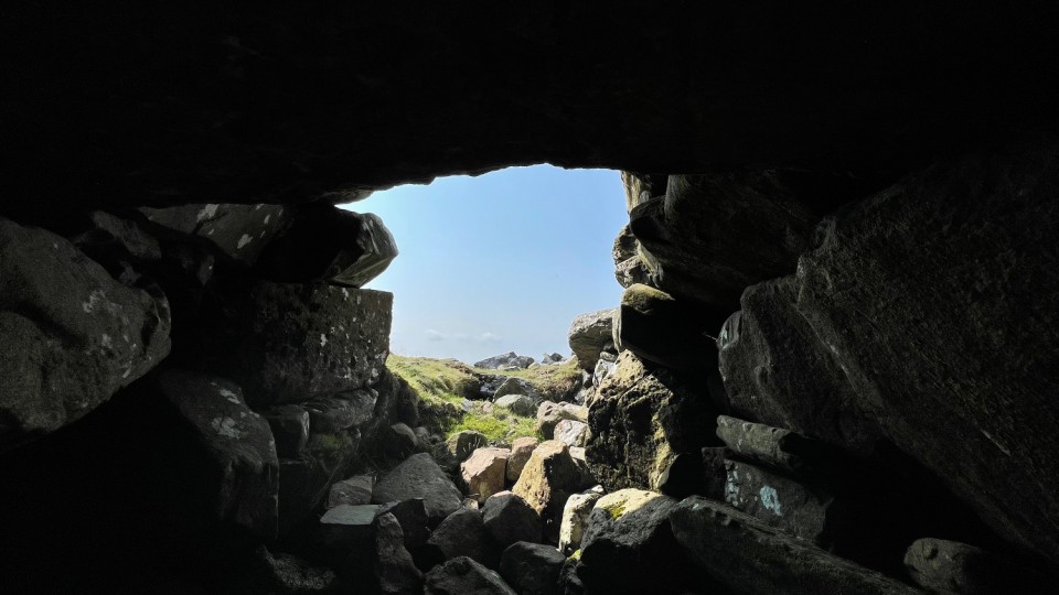
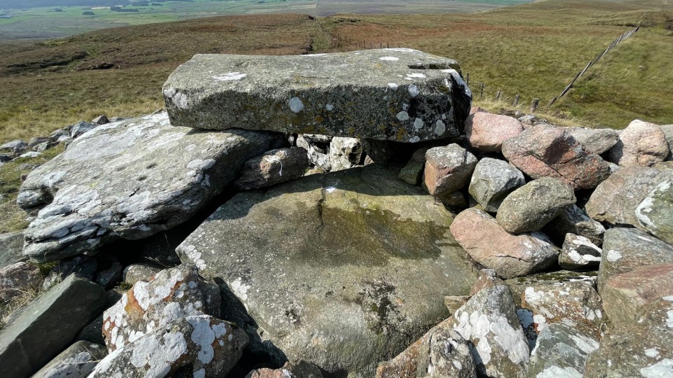
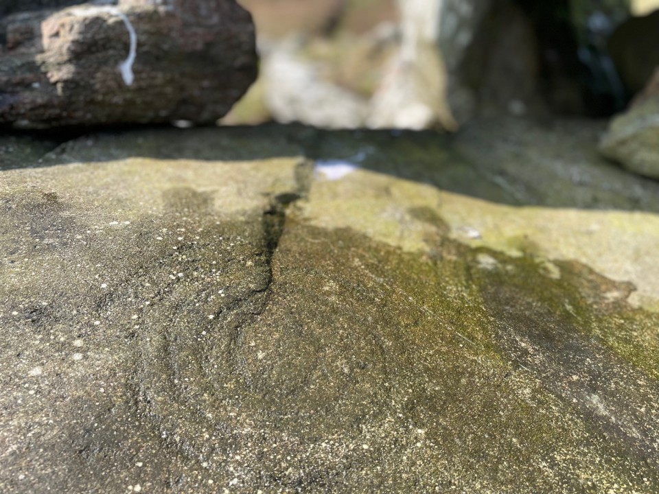
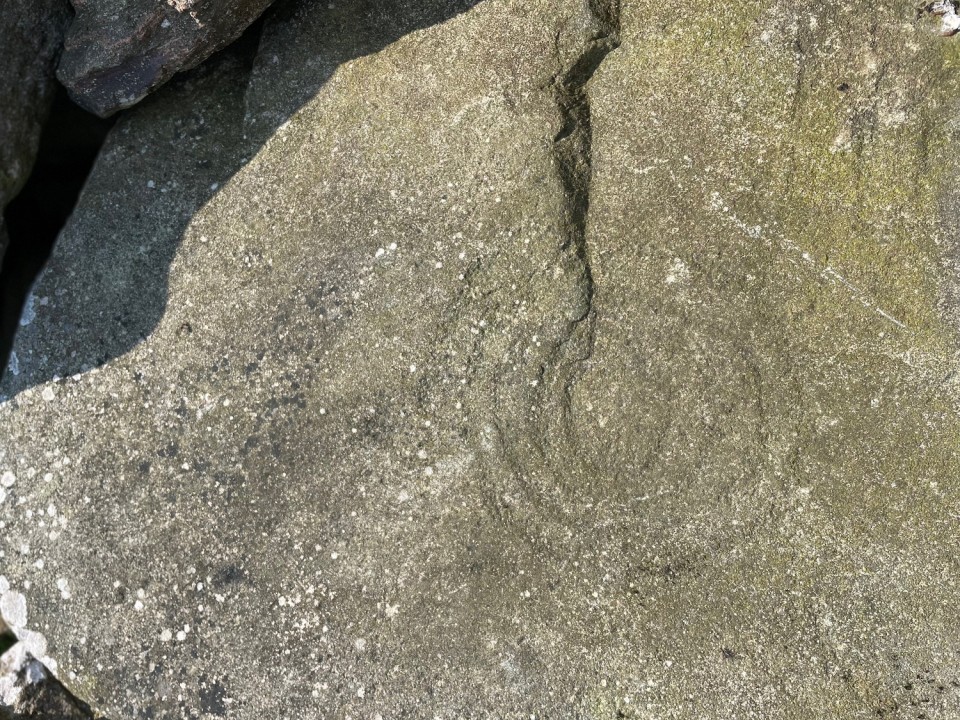
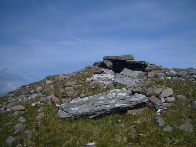
The cairn emerges on the sightline about 300 metres away as you approach from the north. Excitement and anticipation start to really kick in here. I knew from Fourwind’s book and other writings that Carnanmore is special but nothing really prepared me for just how magnificent it actually is. The last fence hurdled as if it wasn’t there, the top of the tomb is hard to resist. I deliberately took my time, trying to slow the experience, but the first surprise of the site is immediate, the spirals on the stone behind the capstone readily apparent in the sunshine. A judicious splash of water revealed the delicate and very worn designs even further. The cupmarks on the next stone to the south are also readily visible.
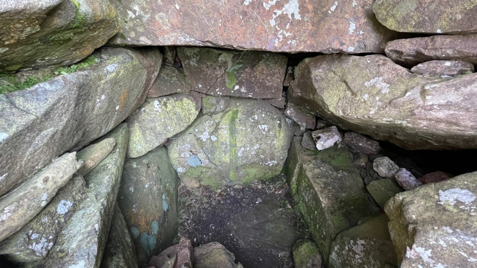
The cairn is actually quite steep-sided. There are no traces of a kerb that I could see, but surely the combination of slippage and deliberate robbing has led to the top of the chamber being exposed. Entrance into the tomb was gained by removing the eastern, front portion of the chamber as it met the passage, the passage now filled with cairn rubble, its roofstones having been removed and thrown about the place. The chamber floor is accessed by clambering down the rubble in the passage. The removal of the front part of the chamber has exposed the magnificent corbelling in cross-section, the delicate nature of which seems to continue to exist due to the relative isolation of the location. Looking front-on at this and below, on the passage rubble, the two stones that support the capstone look like a winged spectre, guardian of the monument perhaps, demanding continued respect. The southern wall of the chamber looks to be deteriorating, with a void appearing behind the bottom orthostat and the corbelling it supports. It brought to mind the precarious state of the walls around the neck of the passage in Seefin in Wicklow.
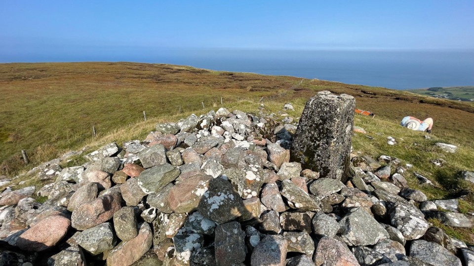
Standing in the chamber looking out I wanted the passage to align directly onto the cairn on Knocklayd. It doesn’t. It’s possible Carnanmore has a summer solstice sunset alignment and it’s also possible that its construction predates Knocklayd, neither of which matters to us today. In the late summer sunshine my companion took a nap at the back of the mound. From there the terrain falls precipitously away towards the sea down at Torr Head. Try as we might we couldn’t make out Kintyre, the mass of which seemed like just a stones throw away from West Torr back in early July on our first visit. Sitting here writing this now, on reflection, a visit here was a good, if unplanned, way to bookend our Antrim adventures. And once again, a shout-out to Tom Fourwinds (Ian Thompson) for leading the way.
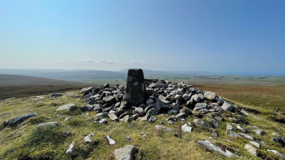
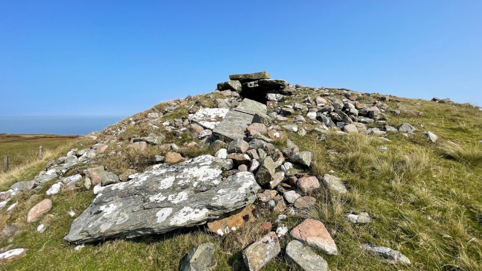
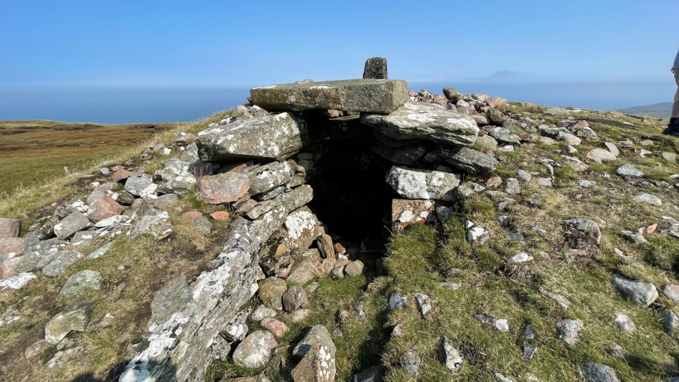
A fatiguing scramble, and the top of Carnanmore - 1,254 feet - is reached. As indicated by the name, this mountain has on its summit a "great carn," considerable remains of which are still to be seen. It is to be feared, however, that much of it has been erected into very matter-of-fact stone ditches, to mark the boundaries of "my Lord's" estate. The remaining portions are well worthy of examination.
The northern side seems to have been partially removed, thus exposing a large chamber of unhewn stones; part of a covering of larger slabs still remains in position, while others lie scattered about. It is probable the carn was erected to commemorate some great victory, or mark the burial place of some powerful chief, whose name and deeds are alike long forgotten.
Though the carn is itself a monument of antiquity, one at least of the stones used in its construction belongs to a more distant period still. On its upper surface, but almost defaced by long exposure, are several cuplike depression, evidently of human workmanship. Were these the only marks upon the stone they might easily have been overlooked; but, on the under side of the slab, which can fortunately be seen by a person entering the chamber above referred to, many more perfect hollows, arranged in something like order, are quite perceptible. The present position of the stone is certainly not that which it occupied when the depressions were cut, as many of those on the under side are now entirely out of reach.


 Posted by ryaner
 Posted by Rhiannon