Taking the main road, SS125, north out of Dorgali, you come to a left turn (SP38) signposted to Serra Orrios but keep going on. You need to go another 750 metres along the road - the first bend is sharp, and it's most of the way round the second bend when there's a track to the right to the dolmen, with a farm track almost directly opposite it. There's room to park a couple of cars under a tree opposite the track to the dolmen.
There is a signpost, but it had been knocked or pulled over and was just inside the field - I pulled it over the wire fence and propped it up against the wall, so those travelling south at least would be able to see it.
The track continues for 140 metres, then there's a fork and a sign directs you to keep left, up a much narrower and quite overgrown path, for another 120 or so metres until the way ahead becomes almost impassable and instead you go through a gate to the left. A series of arrows painted on rocks guide you the last 140 metres to the dolmen itself.
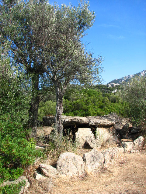
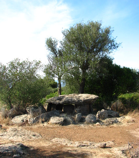
What a stunning spot! A young German-speaking couple were picnicking there, but kindly moved for our cameras.
The dolmen, dated to c 3000BCE, has an almost circular capstone, resting on 7 slabs, and a kerb of stones around it.