|
|

|
|
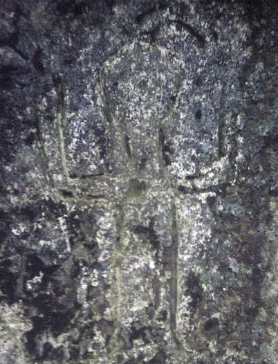
King's CaveCarving
|
||||||||||||||||||||||||
|
|
|
Images (click to view fullsize) |
|

|
Fieldnotes |
|
|
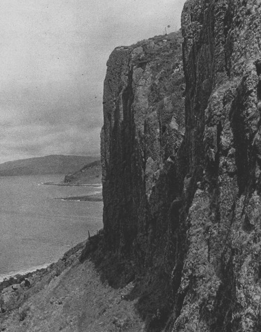
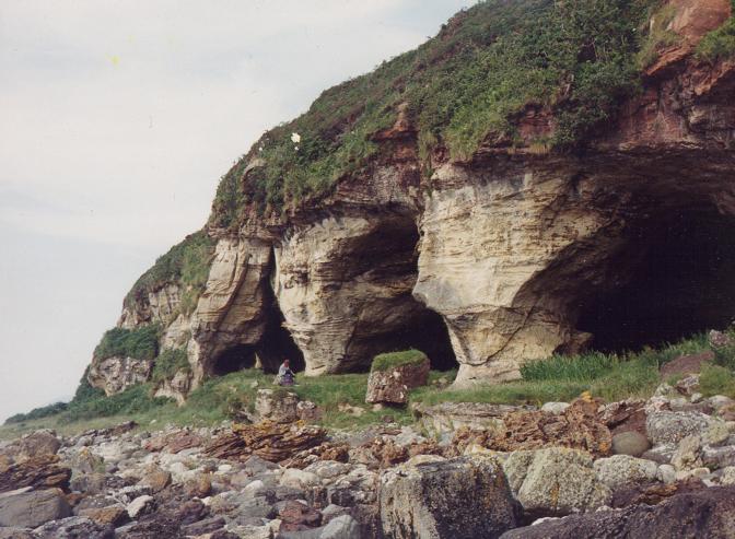
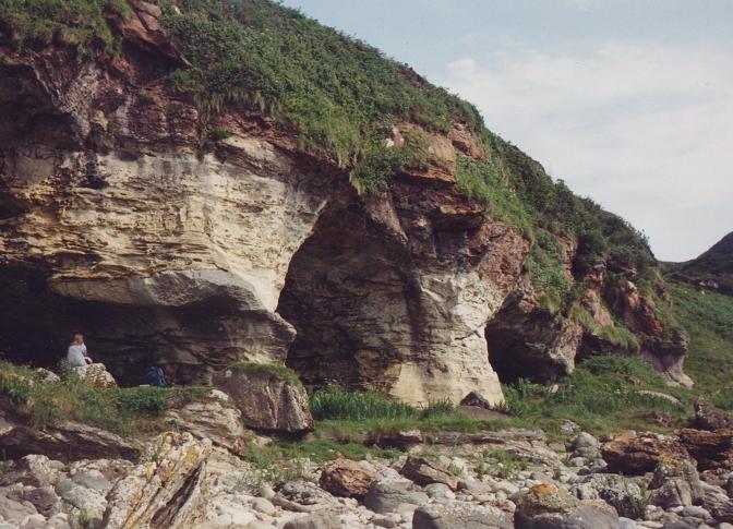
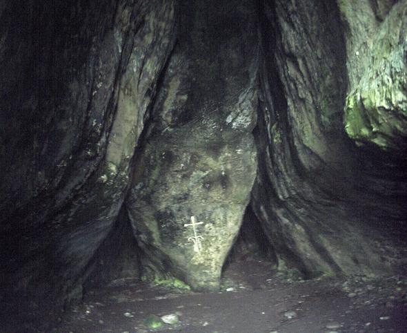
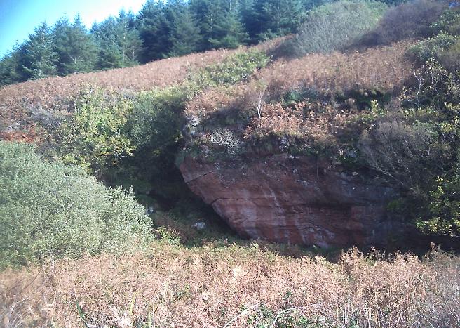
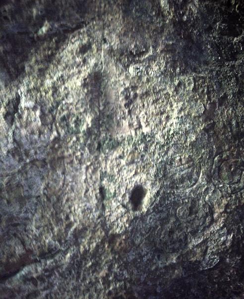
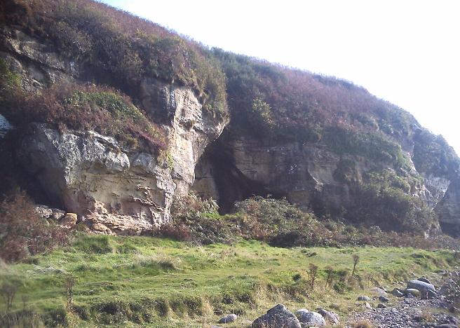
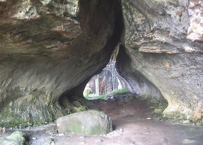
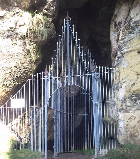
11 October 2010. We headed South through the forestry from the car park a mile or two south of Machrie. The car park is well signposted and a visit to the caves is best done as a circular walk. Over the years we have built a preference for walking in heading South and returning to the car park along the cliff walk to the North of the caves. It just seems easier, and this walk does involve walking over a few hills (The Big Hill of the King - Torr Righ Mor) on the way in and (The Little Hill of the King - Tor Righ Beag) on the way back. The shortened name Tormore is given to an area of farms a mile to the North. Just three short months ago we were here in baking summer sunshine. Now today the wind is driving into us with an arctic blast although the sun is shining brightly. My other and better half thoughtfully carried my fleece and waterproof out of the car boot leaving it usefully hanging in a wardrobe in our cottage at King's Cross Point on the other side of the island. I pulled on my hat with earflaps and gritted my teeth as we marched into the wind. Junior ran ahead doing aeroplane impressions along the path. It takes about twenty five minutes of stiff walking to get to the cliffs above the caves and begin the descent. (Anyone with kids who visits this site might want to detour up the first burn along the shore to see the dinosaur footprints on a sandstone slab. There are also more dino-footprint trails on the Cleats Shore below Bennecarrigan between Torrylinn and Sliddery on the South end of the island) There were plenty of visitors on the Sunday lunchtime when we visited. They all really focussed in on the main King's Cave. Some christian person had thoughtfully painted yellow emulsion over an ancient incised cross. Although I dont do chalking of cups, rings, carvings etc I can understand why people used to do that kind of thing. But this emulsion is new since July, so what gives? Why? I suppose I should be glad they didn't daub their cornflake yellow Dulux over the human figures, cups, rings, Ogham writing, fish, deer and curly celtic snakes. There is also an enormous amount of graffitti from the last couple of hundred years. And everything is covered in a semi-congealed, cave-slime concretion which makes photography difficult in the deep darkness. We picnic on the shore further along and then explore some of the other caves. A few of the others have graffitti and carvings. There are about twenty caves in all and a few natural arches. There is a superb cave, fourth in from the North, which has a twenty metre long "corridor", a metre wide, which ends with a great chamber off on the right of the "corridor". I got a bit ruffled in the very dark enclosed space and had to leg it out pronto. I would have been useless in a Chilean Mine. The walk back out is an easy one, once you are up on the cliff top. Out at sea, the wind whipped the Kilbrannan Sound into a froth of dancing white horses and reminded me that I had no fleece or jacket. Once the path opens out beyond the forestry the views North are spectacular. Machrie is spread before you and in the distance the big solitary stone at Druid stands out like an exclamation mark near the mouth of the Iorsa. The caves are well worth a visit, the whole visit can be done in about two and a half hours (taking your time) and while the site is listed here as of uncertain antiquity... you'll be in no doubt that these caves have been used by people for as long as they have been landing their boats on Arran's shores. |
 Posted by Howburn Digger
16th October 2010ce Edited 17th October 2010ce |
Folklore |
|
There is a legend about the King's Caves to the effect that there is a subterranean passage from the caves to somewhere else in Arran. An adventurous piper undertook to explore this passage, armed only with his bagpipe and accompanied by his dog. After he had proceeded some distance he met with enemies, because the following wailing words were played loudly upon his pipe, which clearly indicated that he could proceed no farther.From The Book of Arran, volume 2 (1914), p273. |
 Posted by Rhiannon
4th October 2018ce |
The cave is also connected with Fingal:Fion-gal is said to have made Arran his resting-place when en route to the assistance of his allies in Ireland. He landed with his followers in a few rude birlings in the fine natural harbour of Mauchrie, and resided in the cave of Drumidoon.p97/8 of 'The Antiquities of Arran' by John McArthur (1861). |
Posted by Rhiannon 20th August 2007ce |
|
This place sounds very interesting. It is a cave on the coast in a sandstone cliff, and is full of carvings - animals, concentric circles, cup and rings, serpents, a coat of arms.. The RCAHMS record says "an Iron Age date is suggested for the animal figures" (this is a comment from 1961). It gets a mention in the 'Statistical Account of Scotland': There are several natural caves, the principal, and which excites the curiosity of strangers of all ranks, is [..] called the King's Cove, because, as tradition affirms, King Robert de Bruce and his retinue lodged in it for some time, when taking shelter in retired places, before his defeat of John Baliol, and accession to the throne of Scotland [..]Ah it's the carvings that pull in the crowds you see. The RCAHMS record mentions that Pennant in 1772 called the cave 'Fingal's Cave', maybe suggesting that the folklore about Robert the Bruce is actually later? confusingly though, the cave is at the foot of a mountain called Torr Righ Mor - which means`big hillock of the king'. Amongst the carvings are ogham inscriptions and a cross - traditionally the caves were supposed to have been used by early Christian hermits. There's a LOT of carvings, from every era up to the present day. It's not obvious what's currently believed about the I. A. date. Lots of description here: http://lmid1.rcahms.gov.uk/pls/portal/newcanmore.details_gis?inumlink=39229 I'm most surprised it doesn't have its own website? |
Posted by Rhiannon 18th August 2007ce Edited 20th August 2007ce |
Links |
|
King's Cave on BRAC UpdatedKing's Cave on BRAC Updated |
Posted by markj99 4th January 2021ce |
King's Cave on BRAC |
 Posted by rockartuk
17th October 2010ce |