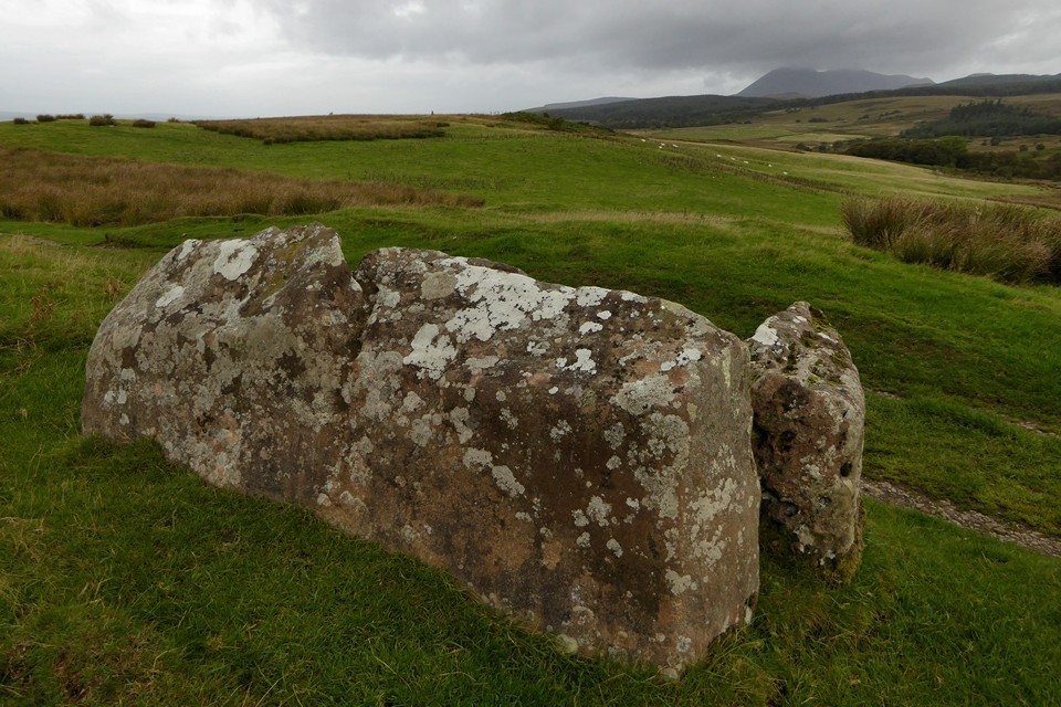
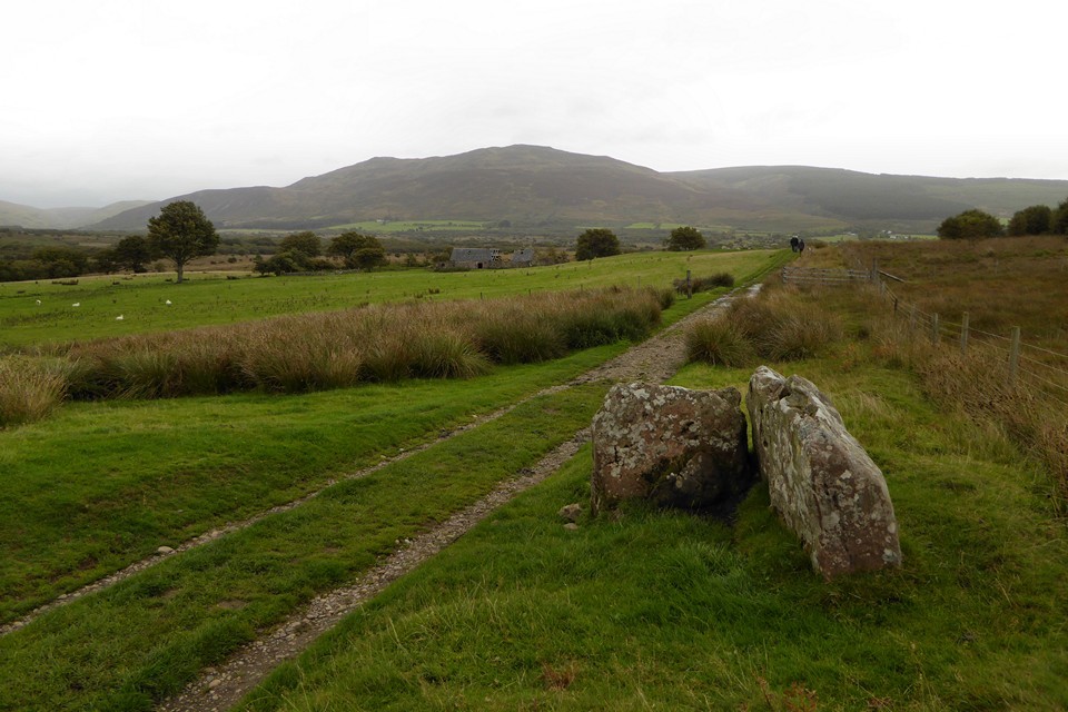
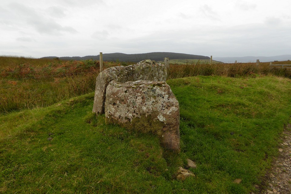
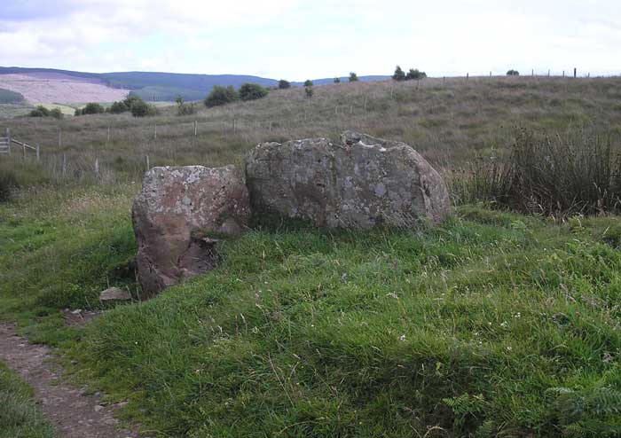
Log in
|
Register
Home
Latest Posts
Forums
Maps
Help
Browse Sites
News
Blog
Contributors
The Books
Select
-
Belgium
Denmark
Eire
France
Greece
Italy
The Netherlands
Norway
Portugal
Republic of Malta
Spain
Sweden
Switzerland
United Kingdom
Scotland
Central Scotland
North Ayrshire (incl. Arran)
Arran
Machrie Moor
Moss Farm II
Chambered Cairn
Moss Farm II (Chambered Cairn) on The Modern Antiquarian, the UK & Ireland's most popular megalithic community website. 1 image, plus information on many more ancient sites nearby and across the UK & Ireland.
Image © baza
Nearest Town:
Campbeltown (22km SW)
OS Ref (GB):
NR90753237 /
Sheets: 68, 69
Latitude:
55° 32' 23.81" N
Longitude:
5° 19' 0.5" W
Added by
baza
Images (1)
0 discussions
Start a topic
Show |
Hide
Web searches for Moss Farm II
Flash Earth
Flickr
Google
Google Images
MAGIC
The Megalithic Portal
Bing
Stone Pages
Streetmap.co.uk
Wikipedia
Show map
(inline Google Map)
- Sites within 20 km -
-
Moss Farm (0.16km WSW) (10 posts)
Moss Farm North (0.2km WNW) (9 posts)
Tormore II (0.23km SW) (4 posts)
Machrie Moor (0.25km ENE) (75 posts)
Moss Farm Road (0.69km W) (16 posts)
Machrie Moor (0.69km WNW) (2 posts)
Tormore I (1.34km SSW) (5 posts)
Shiskine (1.64km ENE) (3 posts)
Machriewater Foot (1.89km WNW) (4 posts)
Auchagallon Cairn (2.6km WNW) (22 posts)
Machrie Farm (2.73km NNW) (4 posts)
King's Cave (2.76km WSW) (15 posts)
Cnoc Ballygown (3.49km SE) (1 post)
The Doon (3.73km SW) (4 posts)
The Doon (3.82km SW) (4 posts)
Druid Auchencar (4.25km NW) (17 posts)
Monyquil (4.44km NE) (7 posts)
Allt Cul Corrriehiam (6.64km ESE) (3 posts)
Allt Cul Corriehiam 2 (6.95km ESE) (3 posts)
Sliddery (8.32km SE) (4 posts)
Torr a Chaistell (9.26km SSE) (1 post)
Oscar's Grave (9.59km SE) (2 posts)
Glenrickard Chambered Cairn (9.96km ENE) (3 posts)
Aucheleffan (10.17km ESE) (3 posts)
Brodick (carvings) (10.33km ENE) (44 posts)
Carn Ban (10.35km E) (4 posts)
Stronach (11.05km ENE) (10 posts)
Deer Park (11.07km ENE) (11 posts)
Lamlash Stone Circle (11.15km ENE) (15 posts)
Moyish (11.45km ENE) (6 posts)
Monamore (11.47km E) (7 posts)
Lagg (11.8km SE) (3 posts)
Dunan Beag (11.92km ENE) (5 posts)
Dunan Mor (12.02km ENE) (7 posts)
Torrylin (12.2km SE) (17 posts)
North Blairmore (12.2km ENE) (2 posts)
Kildonan Bay (13.4km WSW) (4 posts)
Kingscross Point (14.16km E) (4 posts)
Baile Meadhonach (14.22km E) (2 posts)
East Bennan (14.43km ESE) (8 posts)
Brackley (14.77km WNW) (7 posts)
Black Cave (14.83km ESE) (5 posts)
Ballochgair (14.88km WSW) (2 posts)
Ardnacross I (15.07km WSW) (4 posts)
Torr an Loisgte (15.2km E) (13 posts)
Giant's Graves (15.65km E) (26 posts)
Beinn an Tuirc (15.85km W) (2 posts)
Glenlussa Lodge (16.12km WSW) (4 posts)
Largybeg (16.33km E) (8 posts)
Sannox (16.52km NE) (4 posts)
Sannox (17.06km NE) (9 posts)
Gort Na H-Ulaidhe (17.08km WSW) (5 posts)
Mid Sannox (17.09km NE) (5 posts)
Kildonan (17.32km ESE) (6 posts)
North Sannox (17.73km NE) (3 posts)
Greenland (18.36km WSW) (1 post)
Creag Ghlas (18.97km N) (6 posts)
- Add -
-
Add news
Add an image
Add fieldnotes
Add folklore
Add miscellaneous
Add a link
-
Add a site
Add a nearby facility
Add an alternative name/spelling
Images
(click to view fullsize)
Add an image