|
|

|
|
TroldkirkenLangdysse
|
||||||||||||||||||
|
|
|
Images (click to view fullsize) |
|
|
Fieldnotes |
|
|
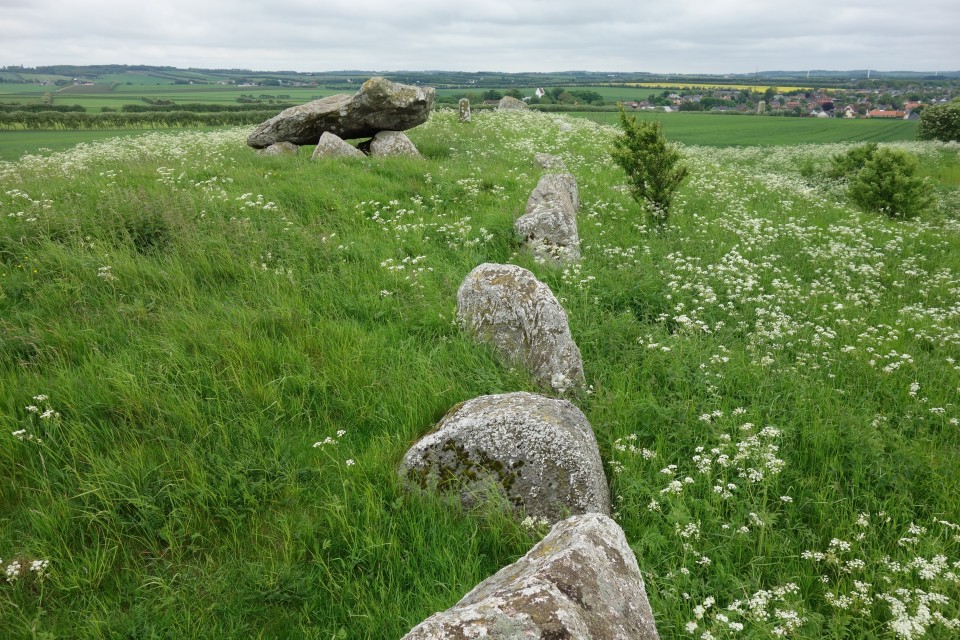
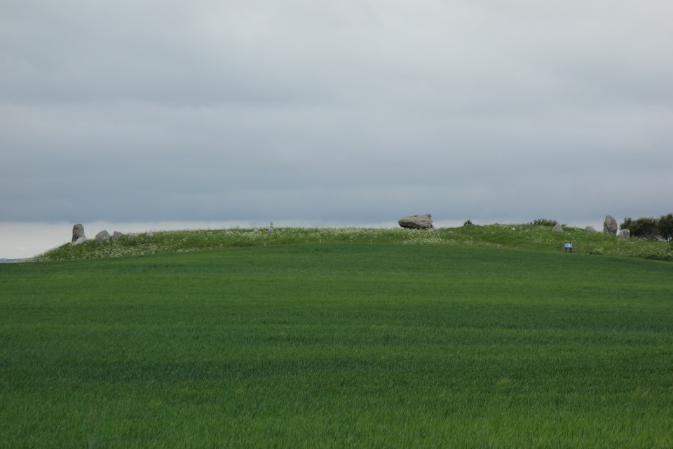
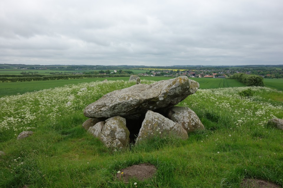
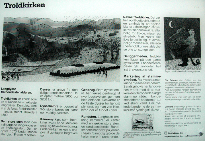
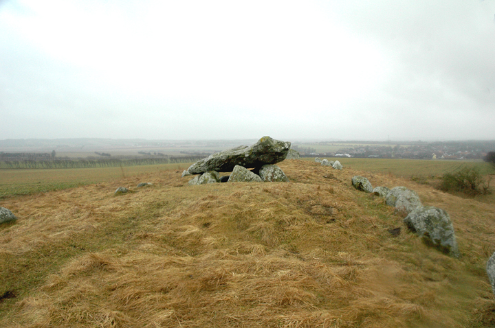
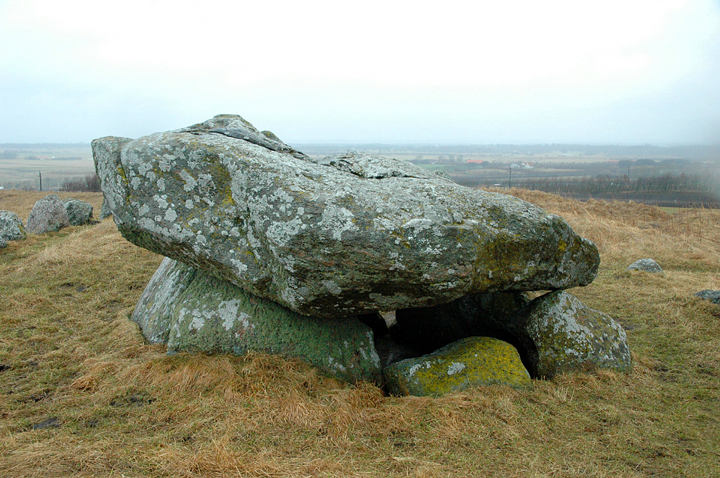
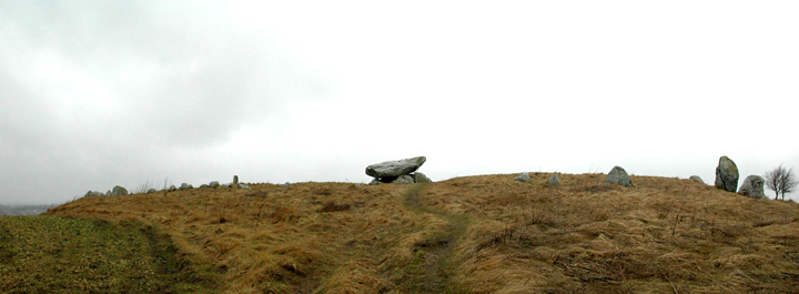
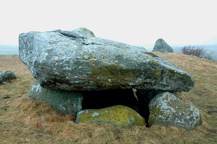
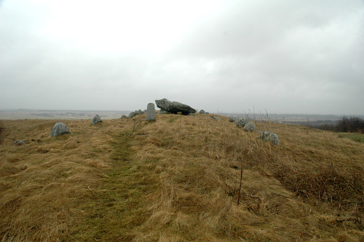
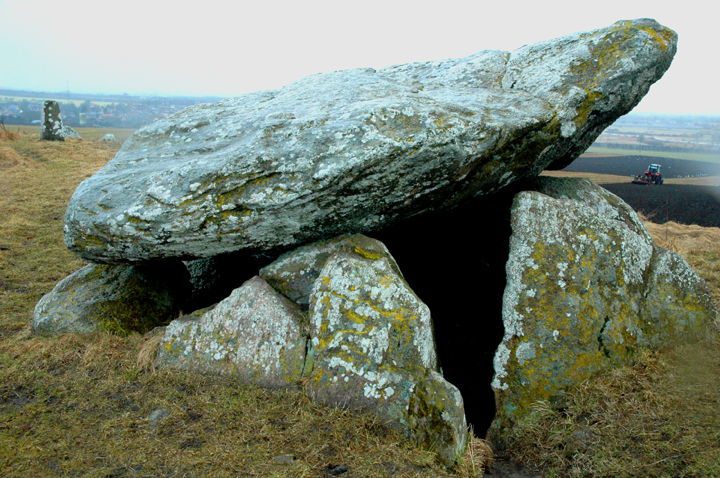
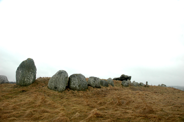
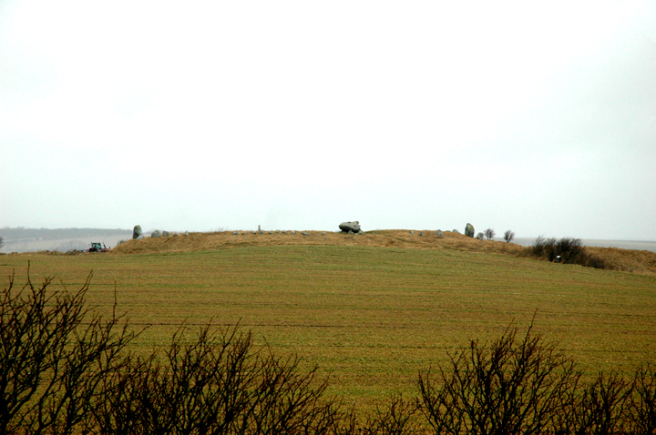
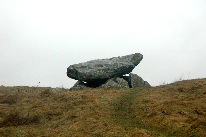
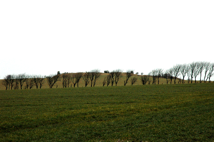
Troldkirken (Church of trolls // Troll`s church) is a truly magnificent long dolmen (Danish: Langdysse) in North Jutland. It is one of Jutland`s most famous megalithic monuments. The tomb was built on a hilltop ca. 15 km west Ålborg 1km NE of Sønderholm. From the site you have a splendid view over Limfjorden and parts of Himmerland. The barrow is approximately 50m long and 7m wide. Despite some erosion barrow's height is still appr. 1m. Orientation is NE-SW. The barrow is surrounded by 47 kerbstones (according to literature....I did not count them). Some of them are still in situ, others were moved out of place when the earthwork eroded in the course of the time. The one at the northeastern end of the barrow is the largest at a visible height of appr. 2,5m. The chamber is situated some meters northeast of barrow`s centre. It is a large hexagonal dolmen chamber with short passage (Typ IV) covered by an enormous capstone. Access is easy, it is only a short walk uphill. The site itself is a landmark and cannot be missed. It is marked on most maps and signposted. Reference: Ebbesen, Klaus, Danske dysser – Danish Dolmens, Attika, København 2007, p.199, Pl. 177B |
 Posted by Martin_L
20th March 2008ce |
|
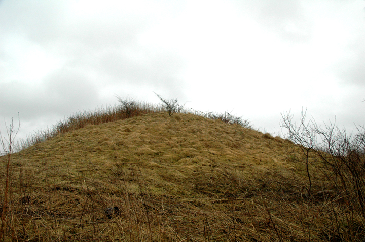
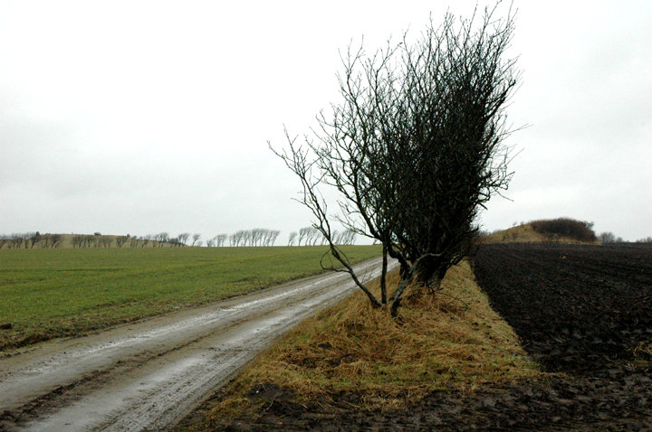
Featured in The Megalithic European (TME) page 159. Access: Walk of around 500m along clear and reasonably even track, gently climbing. Very muddy in the weather I was there in! The final section is a path across a field, which may be slippery and is a good bit steeper. Troldkirken is about 9km west of Aalborg. To reach the monument, take the 187 E-W between Aalborg and Sønderholm. Just to the east of Sønderholm, turn south to Store Restrup (St Restrup). When you reach a crossroads with a more major road, turn right (west) and continue for about 1km - when the road is going uphill you are close. There is a layby on the north side of the road for parking, and a signpost for Troldkirken - but it's so huge you'll be able to see it clearly on its little hill from the road. Visited 6 April 2006 'The Troll's Church' is a big 'un!! On the day I saw it, it was a big wet 'un! (Please excuse the raindrops on the photos!) The small hill (exaggerated by quarrying in the past) it stands on is visible from miles around. From the south, the langdysse, and particularly the huge chamber are clearly visible. As a matter of fact, I'd forgotten that there is more here than just the dolmen. Although reduced to the level of the bottom of the chamber, this is still an impressive earthwork, 90m long, with plenty of big kerbstones to impress. (Bit of a shame they've been joined by a concrete 'trig' point!) You have plenty of time to get to appreciate its positioning on the walk up Troldkirkenvej, and there is a very nice round barrow 'høj' to add some extra interest to the walk. The view of Troldirken itself to the NW from the top of the høj is superb - I recommend it highly. By the way, if you look at the 'inline map' for Troldkirken by clicking the 'Show map' link near the top of this page, there are some interesting cropmarks around the site, most noticeably some immediately to the SW of Troldkirken itself. |
30th July 2007ce Edited 24th June 2008ce |