|
|

|
|
Ness of BurgiCliff Fort
|
||||||||||||||||||||||||
|
|
|
Images (click to view fullsize) |
|
|
Fieldnotes |
|
|
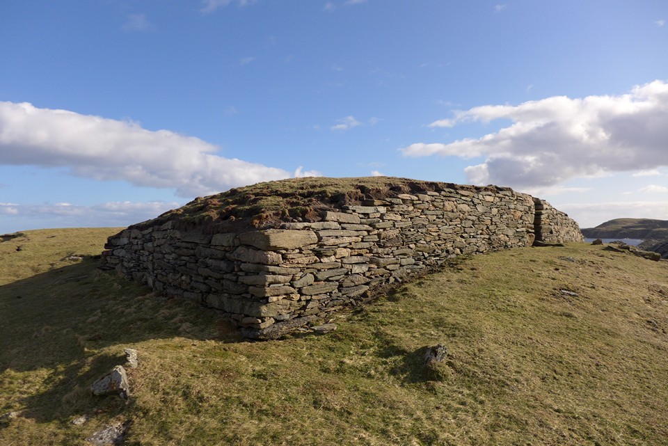
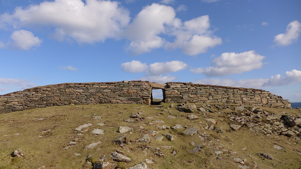
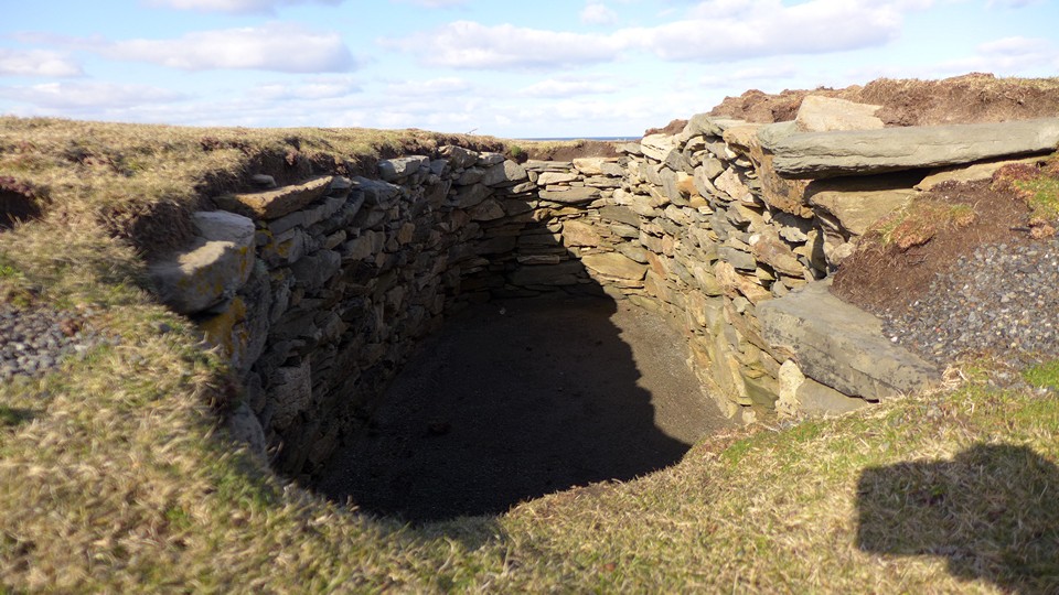
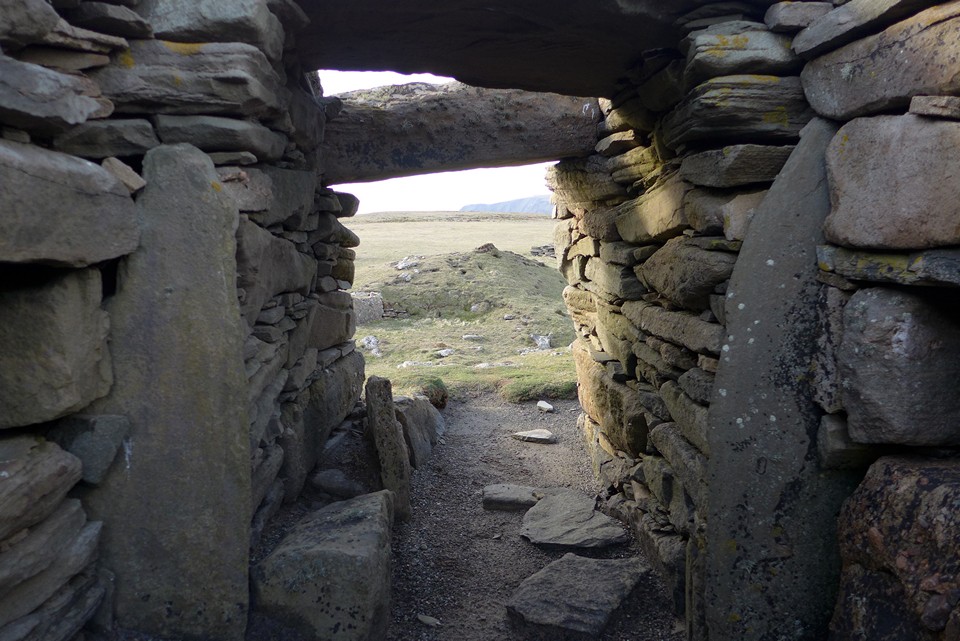
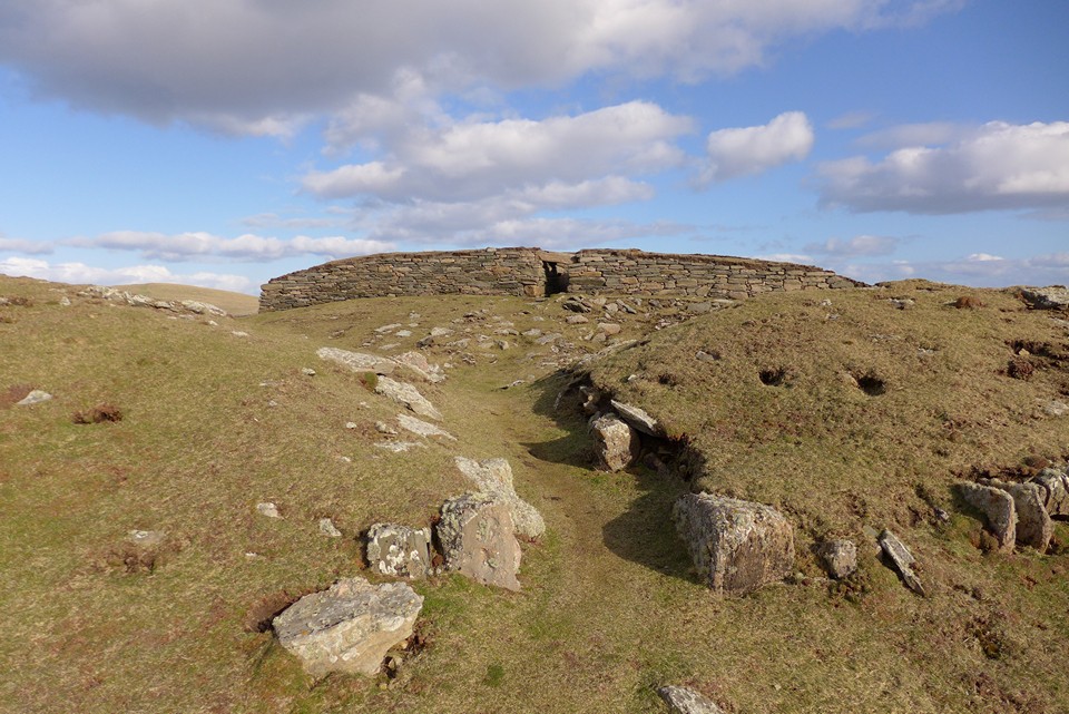
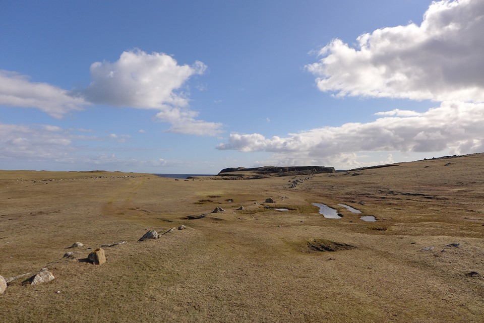
16/04/2017 – Just over three weeks ago I was in Somerset, making my way up to Lype Hill. I remember at the time thinking I bet that’s where Carl parked by the entrance to the field which contains the cairns. A few weeks on and at the other end of the British Isles, as we passed the end of the public road, south of Scatness I thought again I wonder if Carl parked there? It’s like I’m following his shadow. Always good to think about fellow TMAers and their trips whilst visiting a site. Probably would have missed this one if I hadn’t read about it on here. Anyway I’ll stop waffling and get on with my thoughts of the trip and site. It had been a long day so far with a trip to Fitful Head and a lovely walk round the sea cliffs there. Great for birds and top views. After a walk along the beach at Bay of Quendale and then through Toab we got to the turn off for Scatness. I was tired but really wanted to see Ness of Burgi so a quick bit of chocolate for power and off we headed south. The walk isn’t that long and it’s quite gentle. As others have mentioned it gets a little narrow near the end but no problems in good weather. I really liked this site. Location is fantastic with great views over to Sumburgh Head and back to Jarlshof (a place this site is surely connected with?). The Blockhouse is defended by two ditches with a bank. It contains a passageway and two cells which you can go into (hands and knees job). The walls are good and the site has a nice blockiness to it. Really worth a visit alongside Jarlshof and the broch at Old Scatness if you are in the area and the three together make for a good day out. |
 Posted by thelonious
19th April 2017ce Edited 19th April 2017ce |
|
Visited 11.6.12 It’s a bit of an adventure visiting this H.S site! This is one of those places you want to visit in nice weather. Luckily for me it was a beautiful day of blue skies, white fluffy clouds and light wind. We parked where the road ends, south of Scatness, and Karen stayed with the children while I headed out towards the headland. It was a pleasant 20 minute walk through green fields of little pink flowers. The walk is flat and the ‘path’ across the fields is easy enough to follow. That is until you get further out towards the site when you have to clamber over rocks with the help of a chain-link fence. This would only be possible for those who are fairly mobile. Certainly not suitable for anyone with walking problems or young children. This would not be a good place to cross in rough weather. Upon arrival at the site the first thought to strike me is that this doesn’t seem much of a fort. It doesn’t seem very defensible – but there again what do I know? There is an outer rampart and two ditches. The reconstructed walls are about 1.5m high and there is a walkway through the middle with a ‘guard’ chamber each side. This is one of those places where the location is greater than the remains. I sat down between the rocky crags out of the wind. Above me birds were hovering in the pale blue sky. Below me dark blue waves gently lapped on the rocks – the sea glistened in the afternoon sunshine. I looked across to Sumburgh Head and observed white sand beaches in the distance. On a day like today this is a great place to be. |
Posted by CARL 20th July 2012ce |
|
Access is by a fairly obvious track out along the promontory from the end of the minor road signposted 'Scatness'. Its about a mile to the fort, part of which is along a narrow rocky strip with chain hand rails. It was a fine day when I visited, but this would be very dangerous in rough weather. Please avoid the pool to the left as you start off if visiting in the nesting season, as it is home to a tern colony. The Historic Scotland guidebook for Shetland suggests that the fort is contemporary with the brochs, but represents the efforts of a community with less resources than those who could 'afford' brochs. The fort itself consists of a double ditch and bank, once stonefaced, which cuts off the headland. There's a stonelined passage through this and into a 'blockhouse' with two cells and the remains of a third. Please note that the first assemblage of stones you see is the misguided result of 'tidying' the site. |
Posted by Ubik 18th June 2007ce |