|
|

|
|
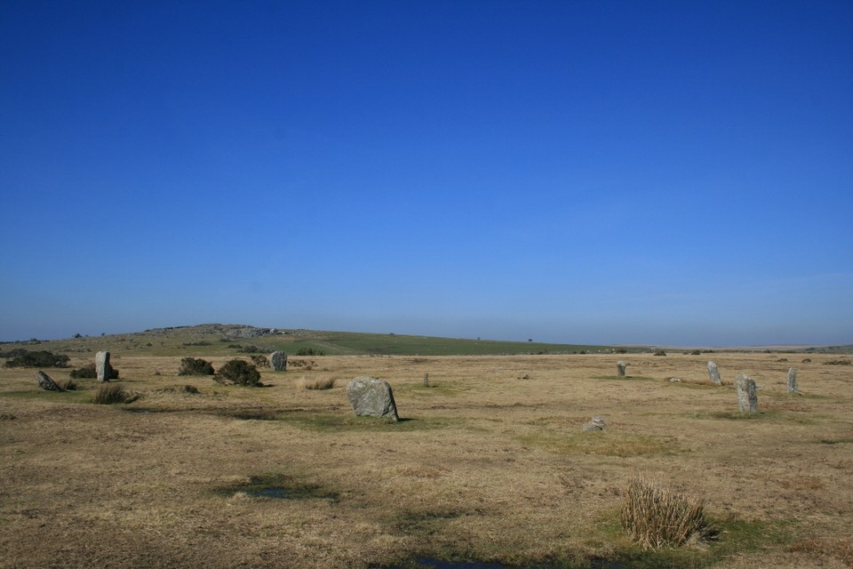
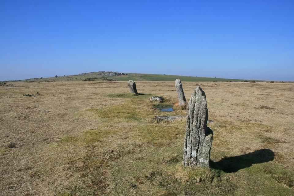
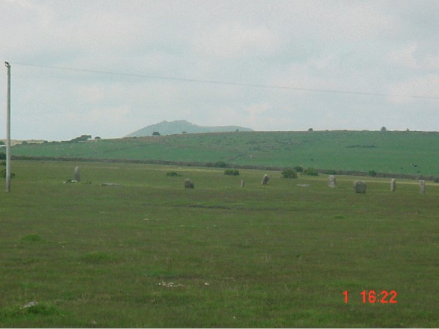
Trippet StonesStone Circle
|
|
|
|
News |
|
The Trippet Stones and an unrecorded piece of Cornish rock art?Roy Goutte writes today - "After wandering around the Trippet stone circle for a few minutes we came across two smaller stones that on first impression had that look that suggests that one part was the remaining stump of an upright, and the other, a broken section off it! In this instance however, on closer inspection, they were both f... continues... |
 Posted by The Heritage Trust
23rd June 2014ce Edited 23rd June 2014ce |
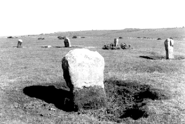
Trippet Stones 'repaired'"One of Bodmin Moor's most attractive and accessible stone circles is to undergo repairs this week.The Trippet Stones stand on Manor Common, between Bodmin and Blisland, just a mile north west of the A30... continues... |
 Posted by baza
12th October 2006ce |
Images (click to view fullsize) |
|
Photographs:


 Artistic / Interpretive:
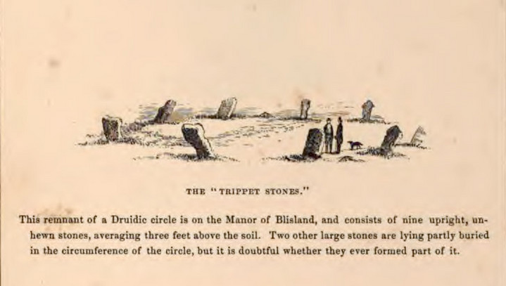
|
Fieldnotes |
|
|
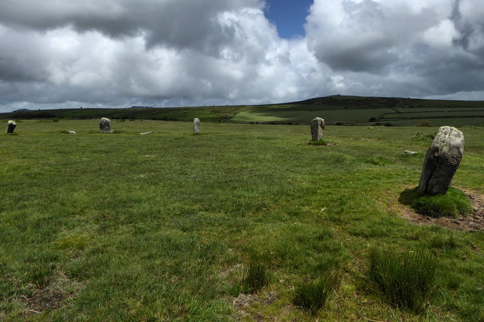
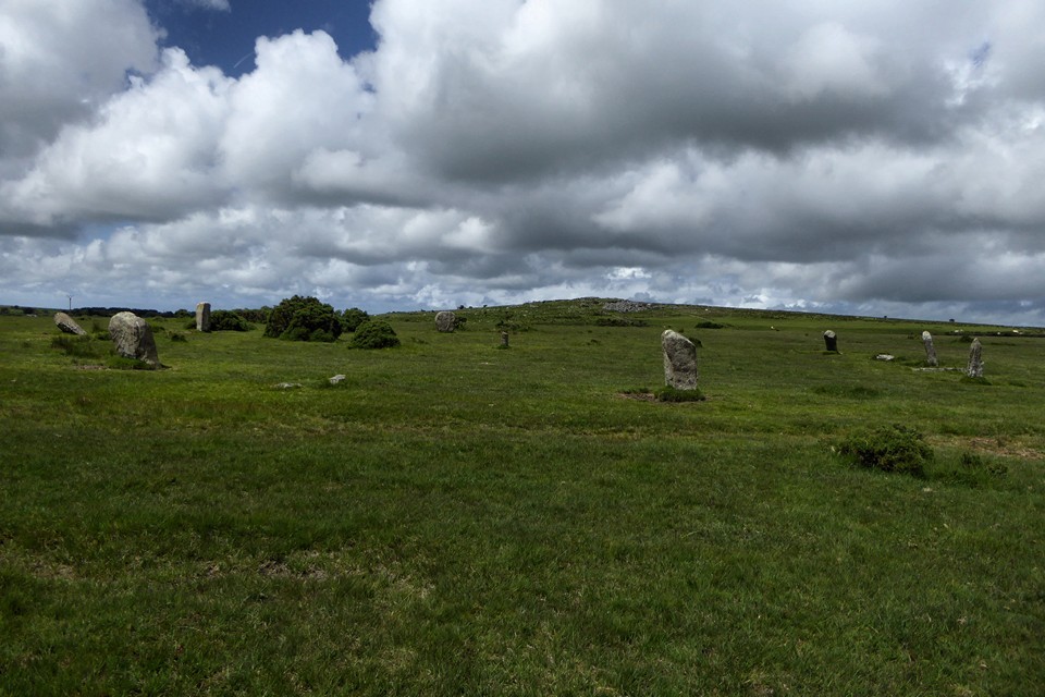
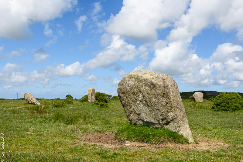
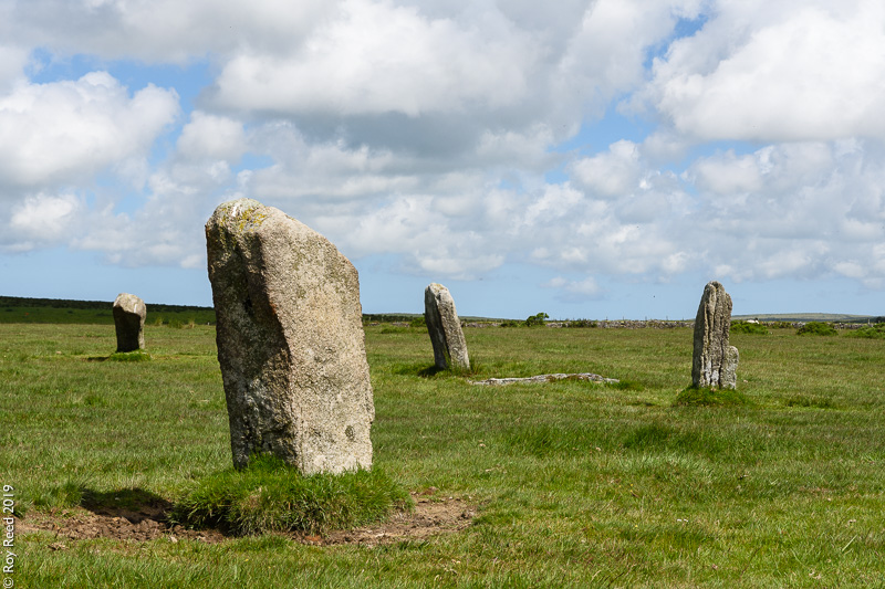
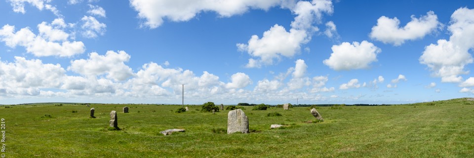
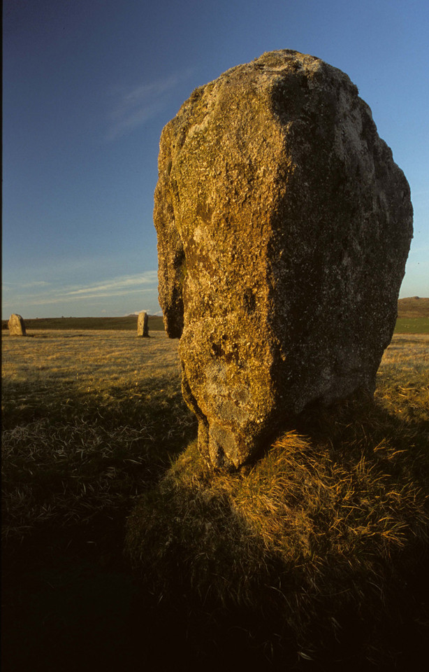
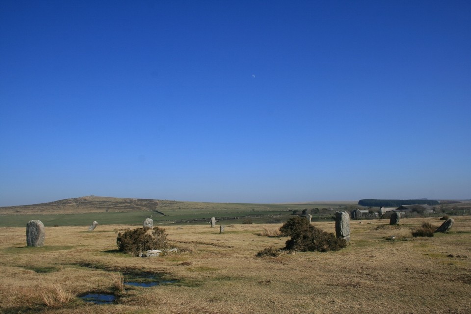
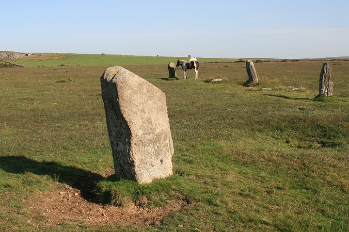
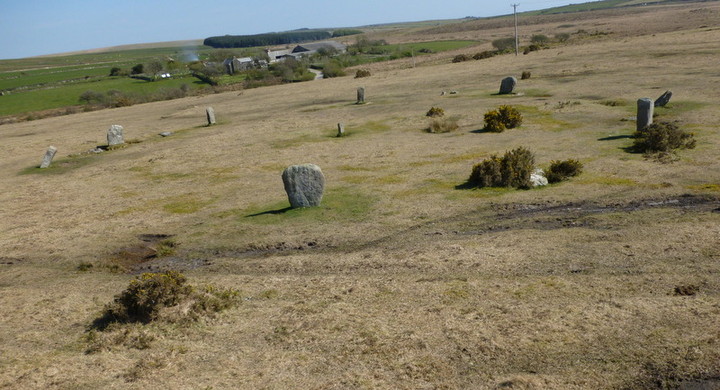
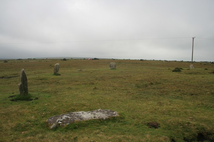
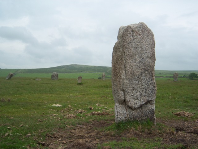
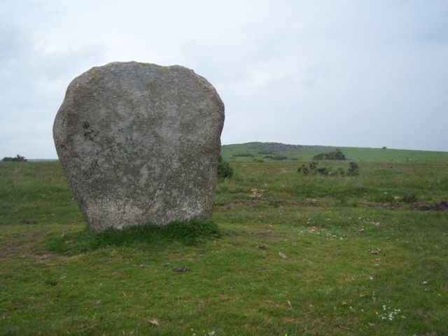
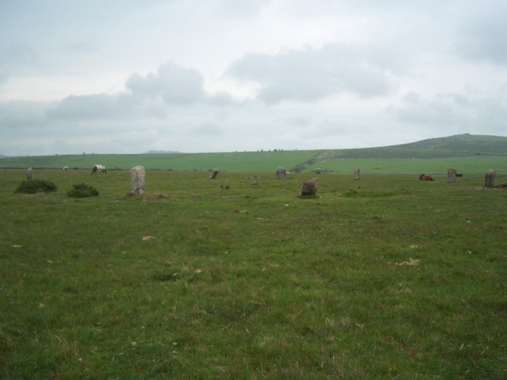
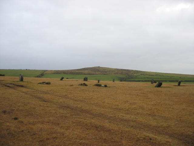
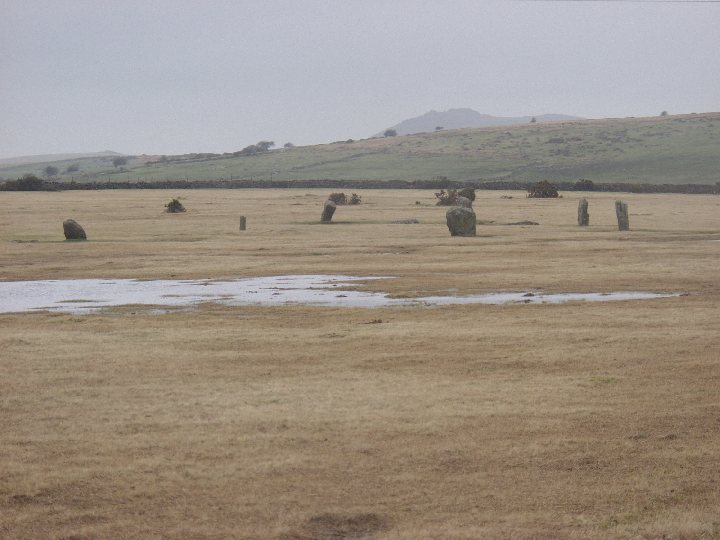
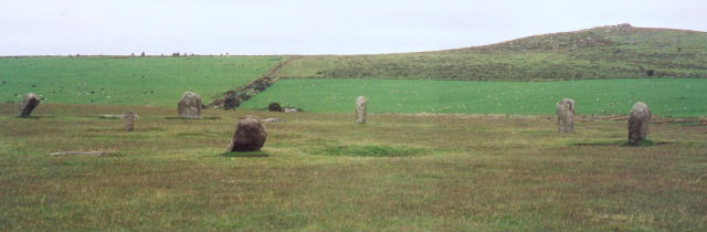
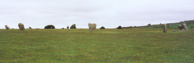
Visited 9th March 2014 Another session of Google Earth scrying along with Ocifants excellent directions, led me to believe this site would be easily to visit on the way home from our holiday in Cornwall. So with the sun blazing down from a clear sky, and with the car packed and ready for home, we started our journey north with at least the promise of a stone circle on the way to keep our spirits up. Heading north we took a left turn off the A30 signposted ‘St Breward 4’, which I recognised from my earlier Google reconnaissance, and heading across the small moorland road, we first saw what appeared to be several small standing stones dotted about, along with a variety of other interesting looking lumps and bumps. Soon we spotted the circle itself off to our right, the telegraph pole right next to it providing an unmissable landmark. I’d intended to turn right at the first crossroads up the farm track towards the circle and park near Hawkstor farm, but on arrival the track looked in a poor state, a huge gouge out of the surface leaving a nasty dip to be negotiated in order to pass. Fearing for the car’s suspension, and with still another 250 miles to drive before getting home, I decided not to risk it and instead turned left towards Treswigga, and taking the example of another couple of cars, pulled up on the spacious verge. No maps were needed today, the visibility perfect, the stones of the circle beckoning to us across the moor. The pull of a previously unvisited site causes me to hurry past what looks like a small stone row, but I vow to investigate on the way back, and soon I’m here in the centre of the stones, looking out over the empty moorland and soaking up the atmosphere. As Postie says, there is a feeling of ‘bigness’ here far out of scale with the actual size of the stones or circle, probably the wide skies and open moorland give it a sense of a larger landscape. The circle of eleven remaining stones (or is it twelve, we seemed to get different results each time we counted!) looks as if it’s had a battering over the ages, but I’m pleased to see that currently there are no signs of erosion by livestock around the stones themselves. A small central stone, and two further outliers which line up to it intrigue, but on closer investigation it’s clear that they don’t fit with the rest of the circle, the carvings of ‘M’ and ‘C’ on them pretty much confirming their use as boundary stones across the moor. Normally this sort of interference with a site would annoy me, particularly when it’s a result of the imposition of artificial fences or boundaries that impact on things (I’ll stop there before I start on a rant about the ‘ownership’ of land!), but here it just sort of fits in. In fact there is an absolute air of relaxation about the whole visit. Maybe it’s the unseasonable warmth of the sun, maybe it’s just the vibe of the place but I’m feeling particularly laid back, and just suffused with an aura of happiness and wellbeing. Ellen feels it too, so it’s not just me coming over all hippyish, and we sit in the circle with a flask of coffee and some very lovely chocolate muffins from the bakers in St. Just, and just chill out. On a day like this people will be flocking to the Cornish beaches, but nice as it is to be beside the seaside, I’d rather be here on a lonely moor, away from the crowds at this lovely ancient place. A couple of dog walkers are visible in the distance, but no-one else seems to pay the circle any mind, or intrude on our blissful solitude. While Ellen goes off to take photographs I recline on a recumbent stone and feel so completely relaxed I’m almost drifting off to sleep, the gentle susurrations of the traffic from the nearby A30 and the tweeting of birds providing a soothing soundtrack, and from my prone position looking around it’s almost as if the circle sits within a natural amphitheatre of hills, with the rocky outcrops of Carbilly and Hawk’s Tor looming large on the horizon, and the moon visible in the sky hanging over the circle only enhancing the numinous atmosphere. I’d love to have visited the nearby Stipple stones while we were here, but we’d already spent nearly two hours at the circle, and with a pint at the Jamaica Inn calling, and a further four hours of driving ahead of us before reaching home, we had to drag ourselves away. This place has been a revelation though, probably the perfect combination of fine weather, the endpoint of a great holiday and the giddy excitement of going to a site for the first time, means it’s exceeded all expectations. Knowing now how easy it is to get to, I can see this being a regular stop off when we come down to Cornwall again. |
28th March 2014ce |
|
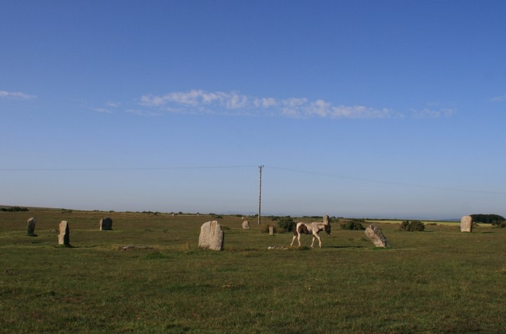
After a good meeting with the Stripple stones and a good sit upon Hawks Tor I came here, not through the farm but more to the west and then coming at the stones from the north east over the forded stream. The Trippet stones are now, by default, my most visited ancient site in Cornwall, I say default because I have no real attachment to them per se, I don't love them any more than any other stone circle, it's just they always seem to be in the way of where I am going or coming from., last time it was King Arthur's hall, and as its so easy to get to them , well, you just have to go over don't you? A lovely little foal was among the stones when I got there, but she went over to her mum who was very similarly coloured, leaving me to once more inspect the stones. There is no sign of any tractor tracks going through the ring, who knew the ground could be so resilient ? I don't know why, but I always expect the stones to be bigger than they are, they always leave me with a memory of bigness. |
 Posted by postman
25th August 2013ce Edited 25th August 2013ce |
|
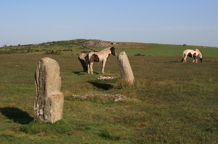
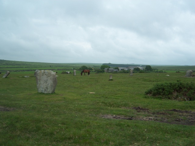
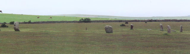
Visited 20.4.12 Now here’s a problem you don’t encounter very often trying to visit an ‘old stone’ site (particularly in Cornwall) – a Highland cow!!! Yes, as odd as it sounds it is true. Making our way to the Trippet Stones we approached the hamlet of Bradford. As we turned a corner, there in the middle of the lane, completely blocking it was a Highland cow! Luckily Karen wasn’t driving fast and immediately opened the window and got her camera out. At this point Hannah stated to scream to close the window. ‘What are you expecting it to do?’ I asked her ‘climb in?’!! We stared at the cow – the cow stared at us. Eventually the cow started to move towards us and tried to squeeze past the car. I was concerned his/her long horns would take out a window but luckily the cow leaned in towards the drystone wall and took a couple of stones out! Phew…. (try explaining that to Auto Glass!) We continued onto the stones and parked on the grass at the junction of the cross-moor roads a little to the east of the circle. What did we then see? A small heard of 5/6 Highland cows! Karen jumped out of the car, camera in hand, whilst myself and Dafydd headed off towards the stone circle. (Hannah decided to stay ‘safe’ in the car) As we walked along the track towards the circle (and Hawk’s Tor Farm) we were approached by the farmer on his quad bike but he passed by without saying anything. The circle itself is wonderful – a great setting – very atmospheric. We took turns touching/counting the stones to see if we came up with the same figure – we didn’t! The Trippet Stones are easy to access and well worth a visit. Unfortunately our visit was cut short when my phone rang and Karen asked if we could come back to the car asap as a man needed help. When we arrived it turned out a chap was lost and despite having an O/S map wasn’t sure where he was. I was happy to help but slightly miffed as we had left the circle a lot sooner than I would have liked – but there you go. Karen and Hannah were very excited as the chap was a photographer for a fashion designer label (I can’t remember the name but needless to say meant nothing to me!) and that he was looking for photo shoot locations. I did suggest the standing stones but he said he was looking for something with ferns!! |
Posted by CARL 10th May 2012ce |
|
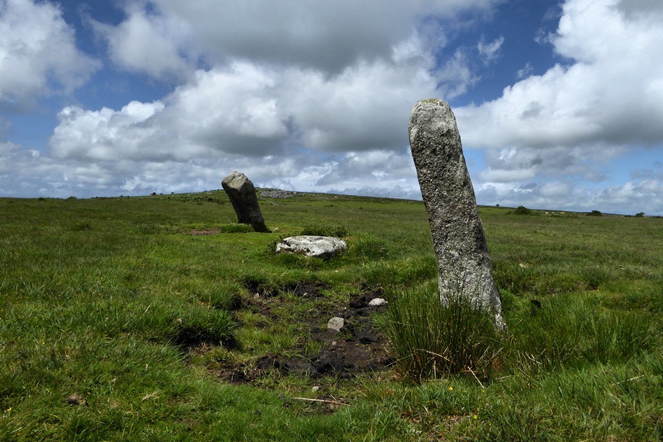
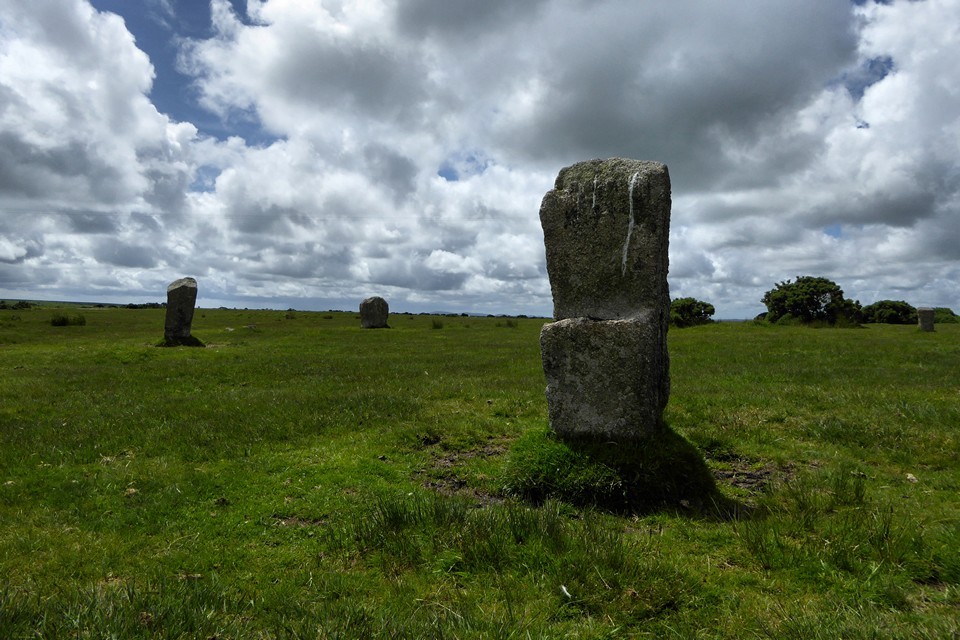
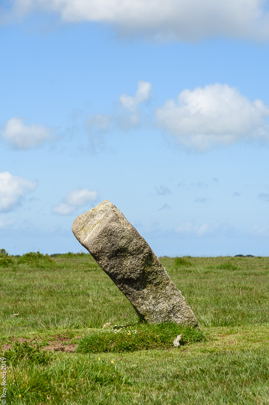
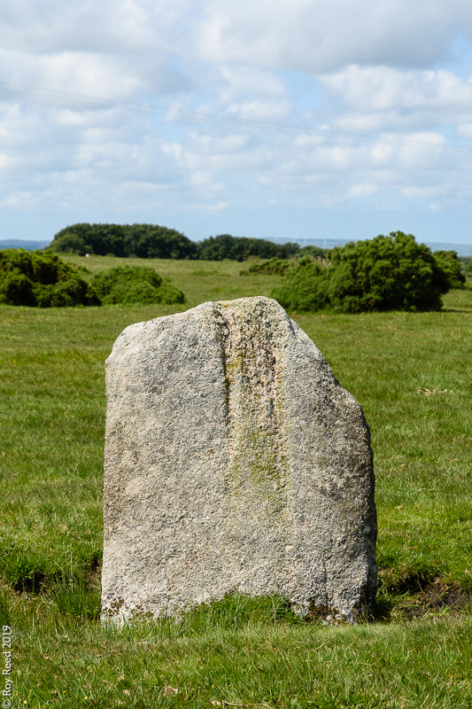
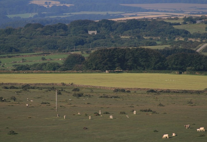
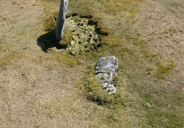
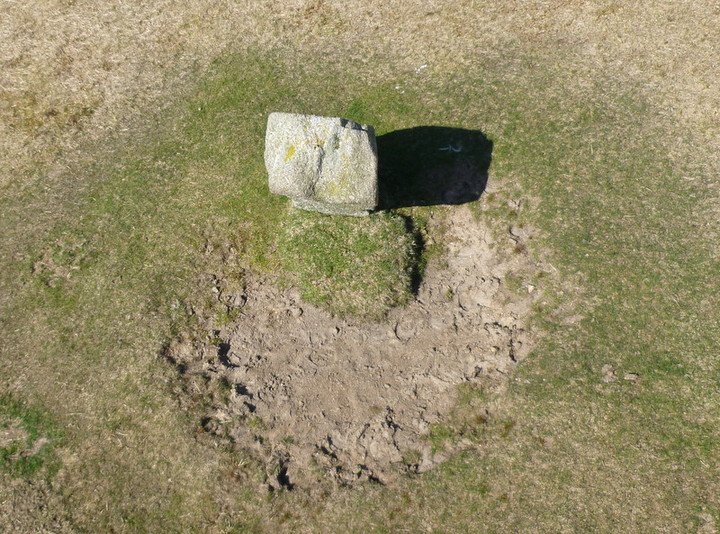
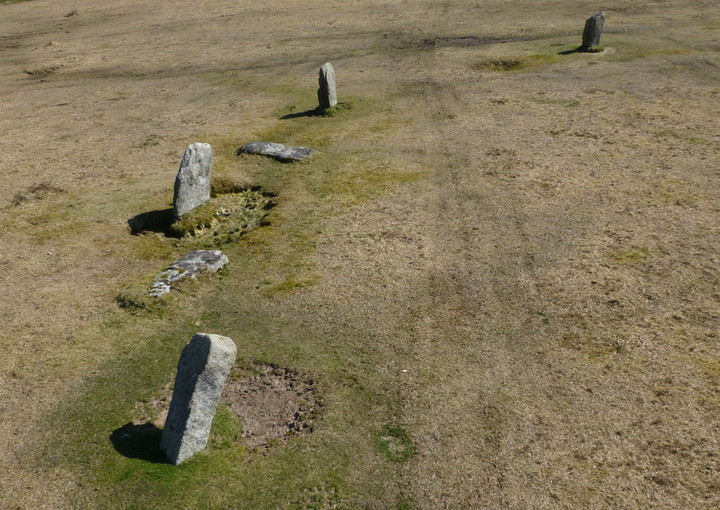
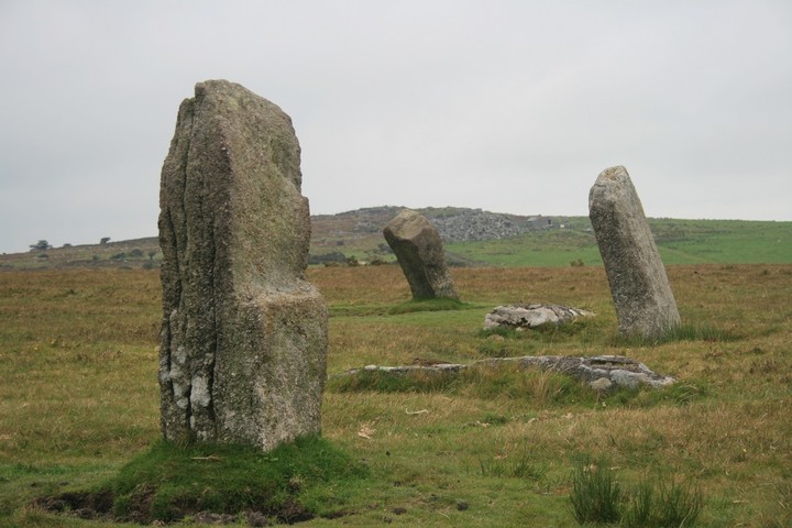
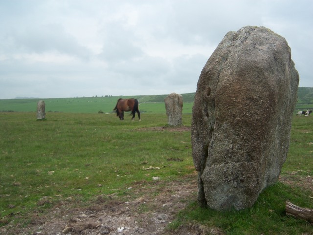
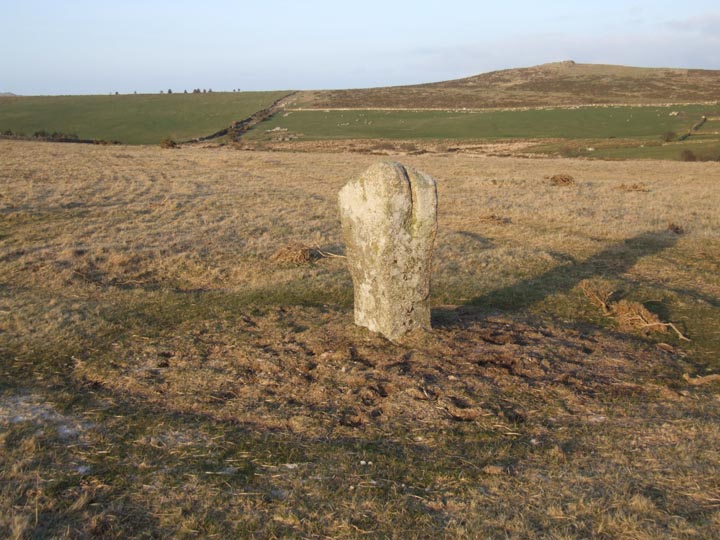
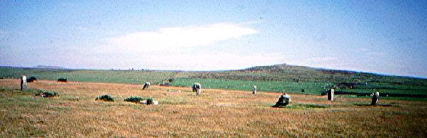
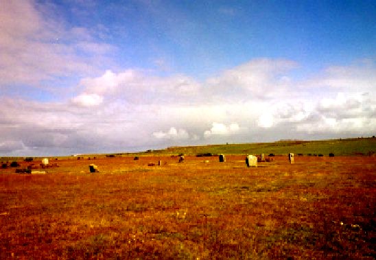
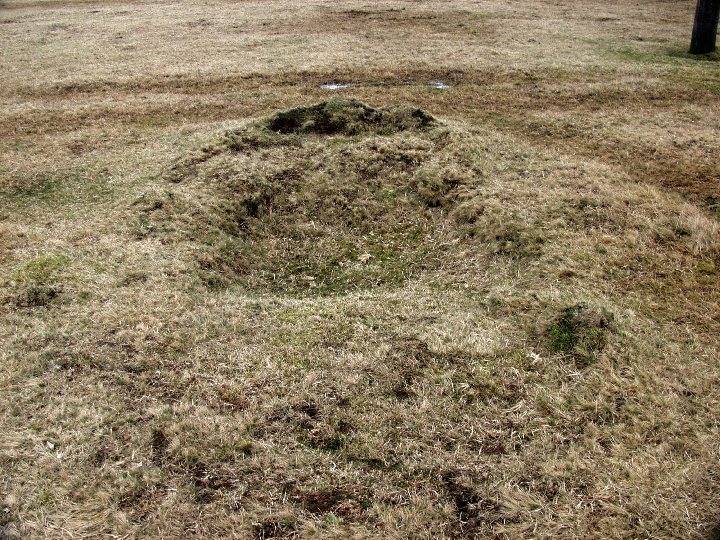
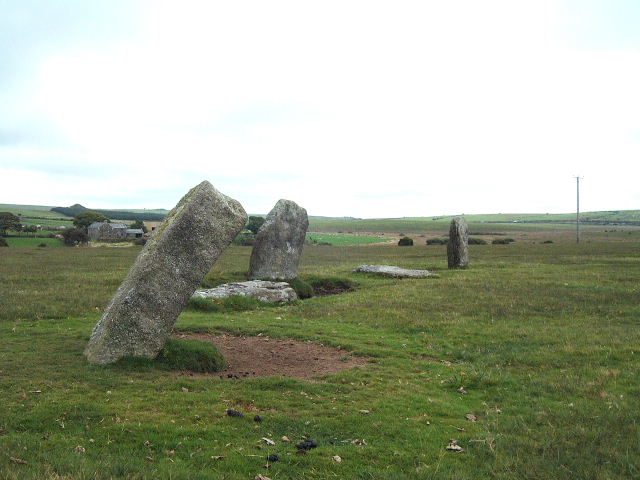
Paid my first visit to the Trippet Stones today on the 1st April 2012. A fantastic day all round with wonderfully sunny weather and clear views in every direction. Took OC's directions which were spot on and easy to follow. For such a lovely day there were few people out when I arrived but plenty later as I was leaving. As usual my first thoughts were, 'What on earth did they want to build a stone circle out here for?', but we all know full well that we may never know the answer to that question! I didn't concern myself so much with how many stones were left standing or fallen, but how many there may have been originally. I calculated it at 28 and not allowing for any 'entrances'. What I found a little strange was that many of the craters that were formed around the stones by sheep while they were still in place are still there even though the stones themselves have been gone for many many years I would have thought that as the soil is very peaty and wet for most of the year it would have encouraged the craters to backfill, especially as cattle/sheep/ponies walk aross there as a matter of course on a daily basis! The central stone is interesting but I wondered if it was an original feature or a boundary marker because it has the letter C carved out on one face and M on the opposite face. I wondered about this for some time until I noticed, as I was walking away, two outlying stones reaching away from the circle and about 100 yards apart on an ongoing line. On investigation I discovered that they also had the letters C and M carved into them, so it increased the possibility of them being BM's. Quite why the central stone was a marker opens up a question so one can only speculate on the 'ownership' of the circle being in dispute so the landowners settled on half each! If so then does this mean that there was never a central stone to the original build? Took loads of pix and video but have added some aerials to get a different perspective to those already contributed. Summing up, a cracker of a circle in lovely surrounds and east peasy to find and park up. I could have driven right up to the circle but common sense and respect tells you to stay next to the road itself which leads direct to Hawkstor Farm. |
Posted by Sanctuary 1st April 2012ce |
|
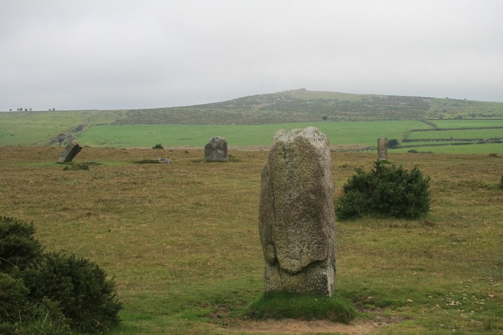
These stones are easy to find as long as you have an OS map and can read it whilst driving, I can, which is why Ive been here twice now, but unfortunately not to the Stripple stones henge located on the south flank of Hawks Tor, it looks a fair old yomp from the Trippet stones here past the farm and up the hill, i'll definately be back, my day on Bodmin has been wild, strenuous, wet, enlightening and sometimes scary. As I approached the stones I heard a noise behind me, upon turning I saw a big red pickup truck and farmer, the cynic in me groaned. But it shouldn't have for the red faced rotund agrarian was not only a comedic genius but a life lesson all in himself, we talked of the stones themselves, the government, new agers and of course the weather, after twice using my lighter to relight his gnarled roll up he coaxed the old truck back into life and bid me good day, I watched him drive away whilst removing my camera from it's bag, I thought to myself something had just happened, something to remember. The stones as ever are widely spaced, grey, tall and shapely, the two nearby tors are Carbilly and Hawks and both need you to clamber over and explore every rock and crevice, but the star of the day was either King Arthur's hall or the old farmer chappie. |
Posted by postman 24th November 2010ce Edited 13th November 2012ce |
|
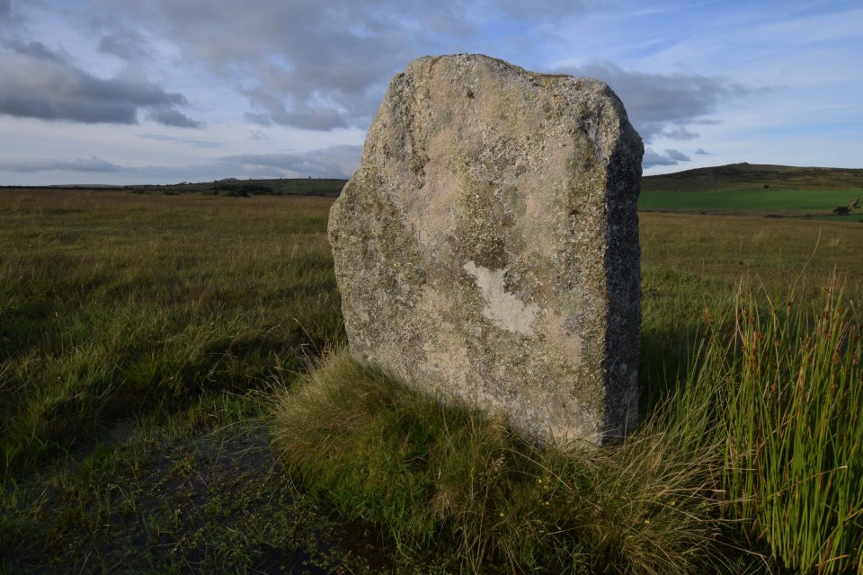
I had stopped and asked for directions from Blisland and told to go up to the hamlet of Bradford, right at the phone box and follow the road toward the A30. This I did, although locating the stones was going to be trickier now I had killed the GPS and the map had gone missing. I nearly crashed trying to keep an eye on the road whilst looking along the sight line for the circle. The rudimentary A-Z of Cornwall's Visitor's map I was working by listed the stones near the track but I knew it wasn't so straightforward. I'd headed down the track towards the farm but couldn't see anything so headed back and over toward Hawkstor. Again nothing. I spent over an hour searching, my eye led toward any stone formation, which when you've been up there, you'll see is a lot. Finally they revealed themselves, as if having grown bored with mocking me were now prepared to grant me an audience. They were further away from the road than I had expected but I raced the 300 or so metres to the circle. What a place! A good mile from the A30 they are located ¼ mile to the left of the road, 100 metres before you hit a cross roads. Luckily I was upwind from the main road so couldn't hear the traffic. Just the silence of the moor. I had to brave a herd of bison but having heard they're vegetarian, walked past them with no incident. I counted nine stones and a smaller central stone with a carved 'C'. To me it looked as if they were alternate male and female stones. The beauty of this place is overwhelming and even the weather felt sorry for me and relented, the sun prying out to see what I was doing, allowing me to take some pictures in peace. The only company were the bison and ponies and this suited me as I acquainted myself with my new friends. I was sorry to leave, I could have stayed there all afternoon. This post appears as part of the weblog entry Jacksprat's Big Old Tour of Mistakes: Cornwall, June 2007
|
18th June 2007ce Edited 14th July 2007ce |
|
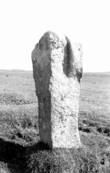
7.3.04 After spending most of the day hunting down 19th C archaeology on the western edge of the moor there was just time to take a walk over to this wonderful circle. Easy to reach from the A30 but still gives a feeling of being away from the modern world (if you turn your back on the telegraph pole). The sun came out for me to take a few photo's (won't bother submiting, same as others on already), but then the rain came down and I had to run for the car. Such is March on Bodmin Moor! Has anyone found out what the M and C carved on the centre stone denote? I would think it has been used as a boundry marker, any idea's? |
11th March 2004ce |
|
Trippet Stones- 4.10.2003 On the way back to London I only had time to go to something close to the road, so the Trippet Stones were an ideal stop off. Really easy to access circle, and a very lovely looking one, with good views around bits of Bodmin Moor. It was also blowing a gale for me, but was worth it. A tip - the turnoff from the A30, when travelling eastbound is the last turn-off on this single carriageway, just a few metres before the dual carriageway starts again. This post appears as part of the weblog entry Kernow again - Part 2 - Land of the Giants
|
 Posted by pure joy
15th February 2004ce |
| Tanx to ocifant and excellent directions. These stones are really unassuming and a slight breeze whistling across the moor is enough to drown or a least disguise the distant roar of the A30 and you're deceptively secluded. Spectacular panorama. Not enough time to explore and walk to Stripple Stones/ Henge. Must return. |
 Posted by dickie
15th September 2003ce Edited 9th August 2013ce |
| Spent a good hour looking for this site and never found it - wish I'd read the previous entry first as it gives great directions! Another time maybe???? |
 Posted by Vicster
17th June 2003ce |
|
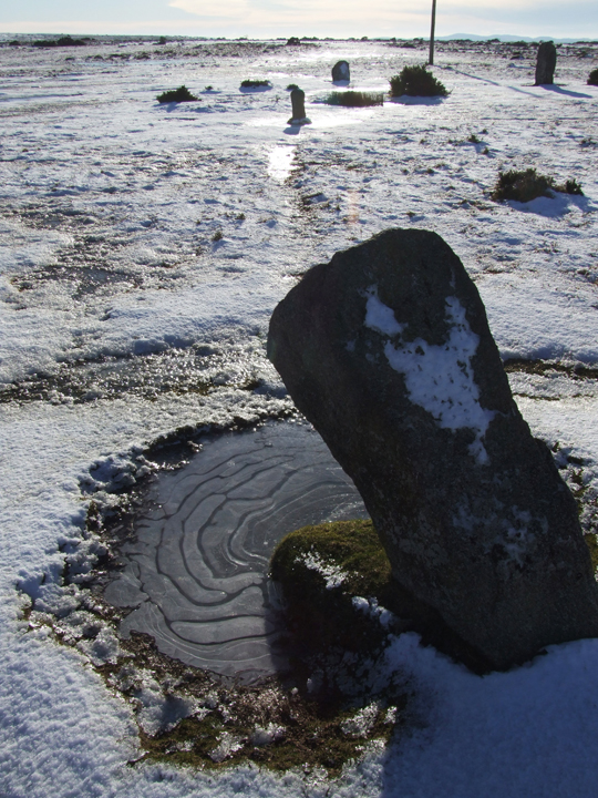
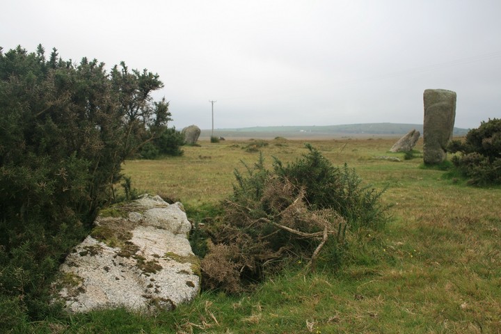
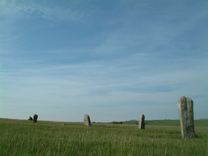
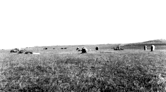
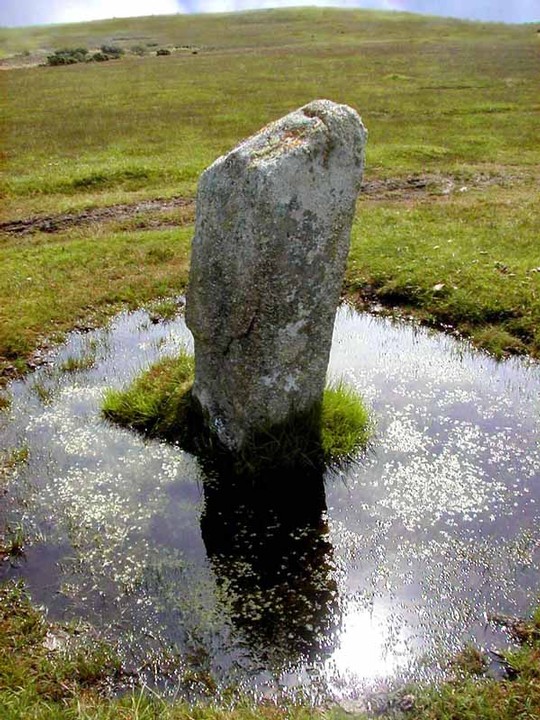
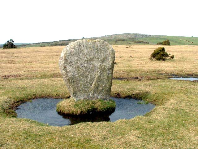
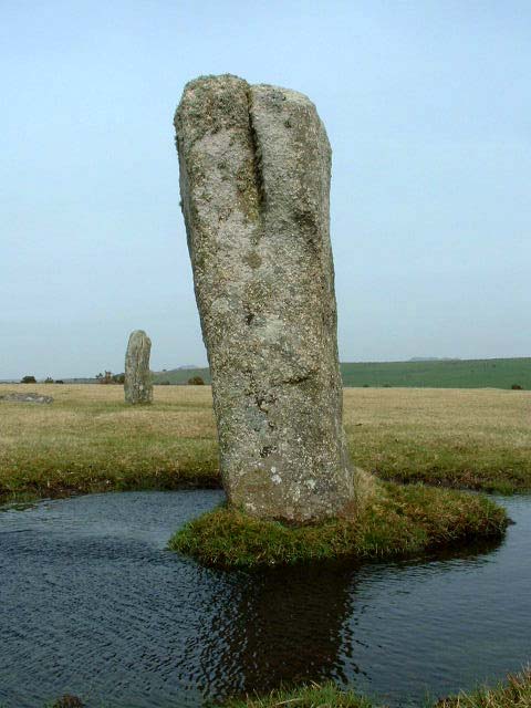
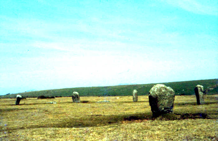
Yay! I get to write the first notes for this site! Coming from the East, the stones are easy to find. Having passed the Jamaica Inn, continue west on the A30 to the end of the dual carriageway. Opposite a left hand turn to Temple, turn right (signposted St Brewards). Pass over the cattle grid and continue along the single-track road for about half a mile. At the crossroads (signposted Treswigga), turn right onto a farm track. The stones are on the left about a quarter of a mile along. The earlier rain having stopped, the wind was blowing a gale, and the telephone wires which run close to the stones were really singing, giving an eerie feel to the site. Each of the stones was in its own small pool of water, like so many islands, having obviously been used as rubbing stones by the local ponies. The circle consists of 7 uprights with a few recumbent/fallen stones, and a small centre stone. A cist lies just outside the circle to the southwest. This post appears as part of the weblog entry A Week in Cornwall
|
16th March 2003ce |
Miscellaneous |
|
|
Whilst reading "The English Year - A month-by-month guide to the nation's customs and festivals, from May Day to Mischief Night" by Steve Roud, I came across an item in the section about traditional sports which could point to a possible origin of the name of the Trippet Stones. "Tipcat was once and internationally popular game with children and adults alike, but is now largely forgotten in England. The 'cat' was a piece of wood, placed on the ground, so shaped at the ends that when a player hit it with their bat (or catstaff) it would fly into the air. As it came up, the player tried to hit it as far as they could. A large ring had been marked out, or agreed, and if the player failed to hit the cat out of the ring they were out. If they succeeded, then a score was awarded, depending on the distance the cat had travelled. Variant names for the game are 'Cat', 'Trippet', 'Nipsy', 'Piggy' or 'Peggy'. The earliest reference to the game so far discovered in Britain is in an Anglo-Latin lexicon of c.1440, but wooden 'tipcats' were found in the ruins of Rahan, Egypt, dating from about 2500BC. In a variant form, a number of evenly spaced holes were made round the circumference of a circle, and a player was placed by each hole, armed with a stick. The cat was thrown to the nearest batsman and if they hit it the players ran on from hole to hole until the cat was retrieved, scoring a point for each hole reached." Holes with people in? In a circle? Sounds like a Pipers-/Hurlers-/Merry Maidens-/etcetc type legend to me! |
 Posted by goffik
18th August 2010ce |
|
..just visible, the circle known as the Trippet Stones, 105 ft in diameter with nine stones in situ and the rare adition of a central stone. "Is there not some ancient lettering on the central stone?" I asked " a C or a G?" The farmer smailed. " I mind the time" he said, "when that C was put there by Mrs Collins, the landlady" C Lewis-Hind: Days in Cornwall. Methuen 1907 |
13th March 2006ce |
Links |
|
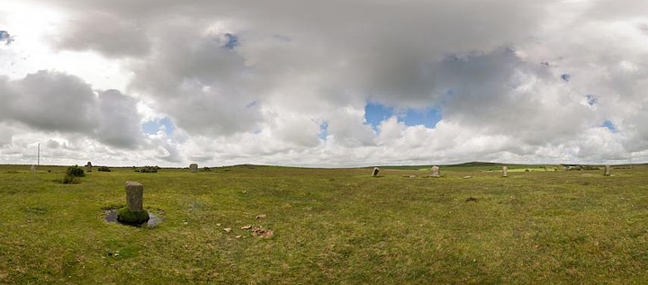
Trippet Stones PanoramaA 360° panorama of the Trippet Stones |
Posted by RoyReed 29th September 2017ce |
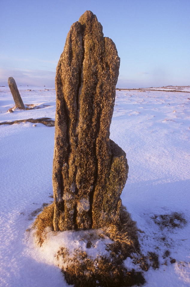
Trippet Stone re-erected in 2007PDF file by James Gossip for 'Erosion Repair' |
 Posted by moss
3rd May 2014ce |
The Heritage TrustCornwall’s Historic Trippet Stones: Under siege by cattle… On the 5th of July 2013 this was the astonishing scene filmed at 2pm when, as the video shows, cattle were purposely driven across Manor Common causing them, on the whole, to enter and pass through the circle thus creating a situation where a Scheduled Monument was seriously put in danger. |
Posted by The Heritage Trust 12th July 2013ce Edited 12th July 2013ce |