|
|

|
thesweetcheat’s TMA Blog |
|
A Crack In The Clouds (2) – Porthmeor to Madron 18 June 2011
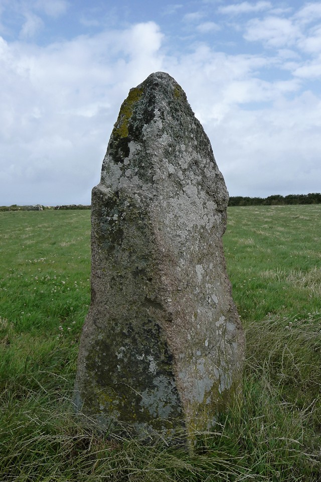
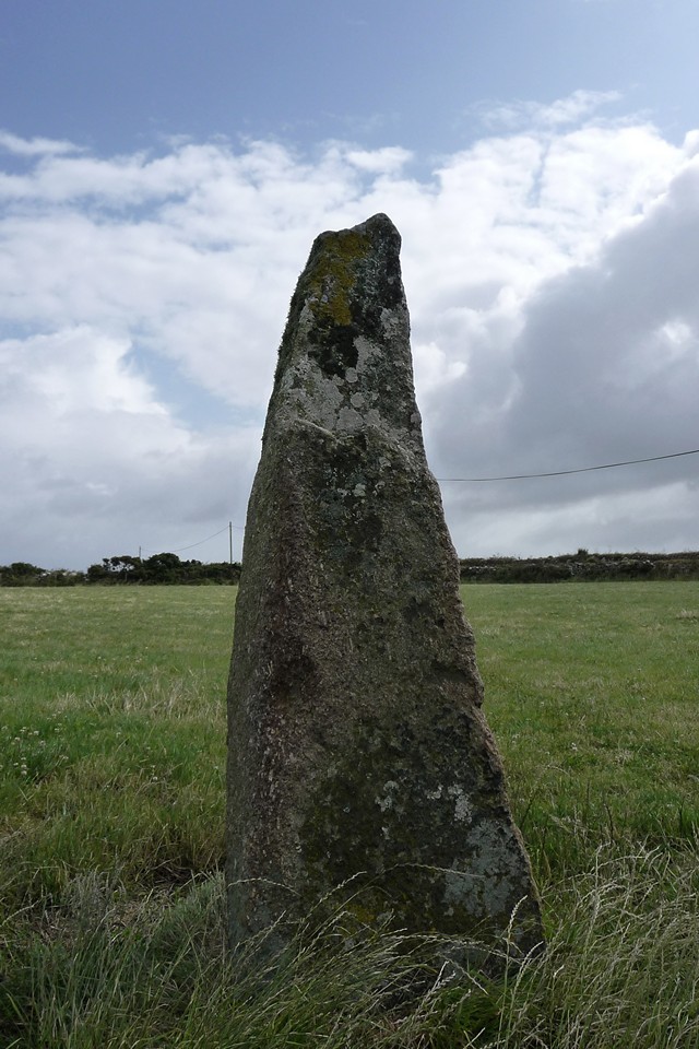
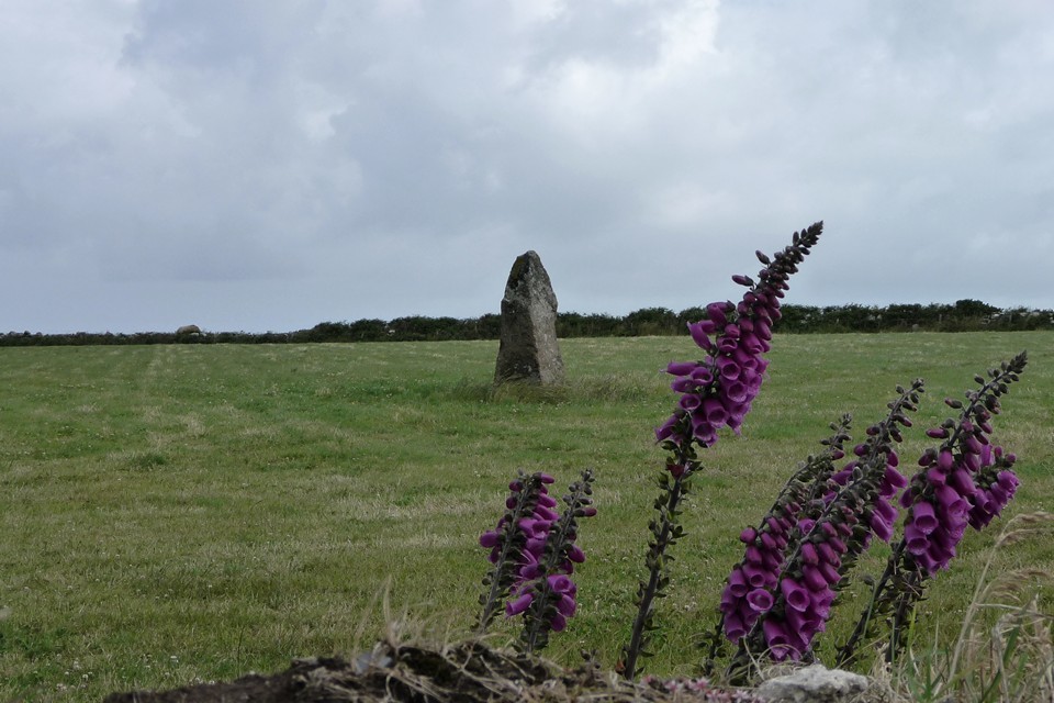
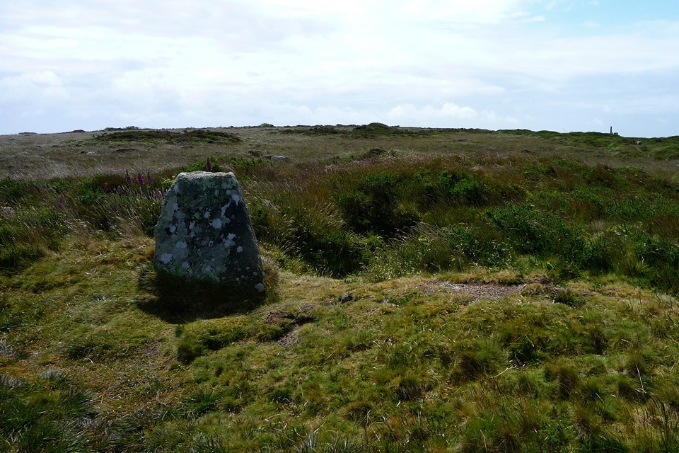
| The mixed weather is in full swing by now and we decide that another trip out onto the West Penwith moors can be braved. An obligatory visit to Nine Maidens is already overdue, so I plan a route around that and the bus timetables. We get dropped at the Gurnard's Head hotel (a decent pub indeed) and then it's a short walk along the coast road to our first stop of the day. Porthmeor — Fieldnotes14.07.11ceThe stone at Porthmeor is one that we've seen dozens of times, as the bus ride from St Ives round the coast goes straight past its field. Despite that, we've never once gone in for a closer look. Animals usually surround it – cows, horses, chickens, geese, dogs, cats and a fox have all been seen in its company over the years. But today there's nothing, just us. A footpath runs across the field, right past the stone, so access is as easy as can be. From the road, the stone presents a chunky, but gently curving aspect. Once closer at hand though it becomes apparent that this is one of those great standing stones that changes its appearance from each direction (not as markedly as Boswens Croft, but nevertheless). The close proximity of the houses and farm buildings does detract somewhat from the setting and atmosphere, but this is still a fine stone, worthy of your attention. Looking inland, the craggy northern edges of the moors form the backdrop, and over from that direction the sky takes on an angry complexion, promising that rain is not far away. Porthmeor — Images07.07.11ce
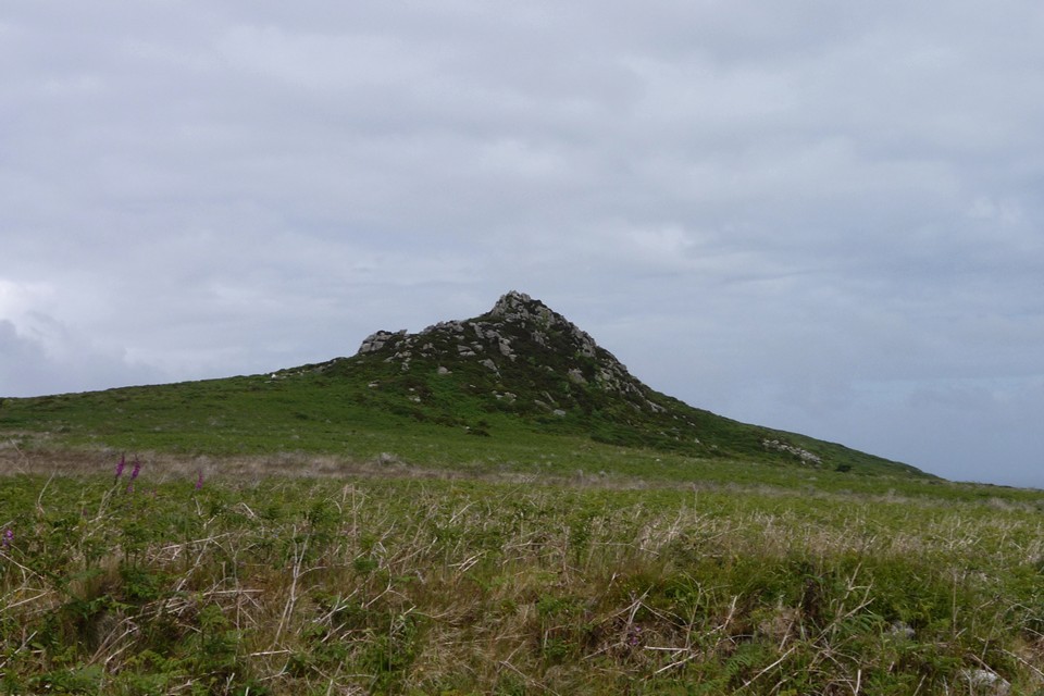
We carry on westwards, along the winding, windy coast road. As we approach the turning for Bosigran Farm, it absolutely chucks down. Although we are wearing waterproofs, it's a pretty grim couple of hundred yards to the semi-shelter of a bush at the end of the farm drive - and a reminder that for every gloriously sunny day on the moors, there are as many drenchingly wet ones. At the farm, we turn inland along a narrow path that runs between the granite outcrops of Carn Galva and Hannibal's Carn. It's all access land here, but in truth it's easiest to stick to the path as once off it your ankles are immediately beset by the attentions of gorse and heather. I had hoped to climb Carn Galva today (haven't been up there for over a decade), but the promise of getting wetter makes it less of an attractive option, so we head onwards instead. Carn Galva — Images07.07.11ce
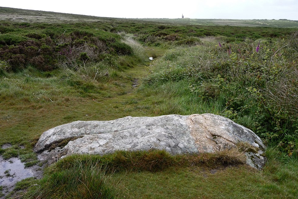
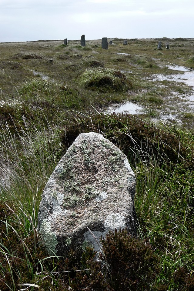
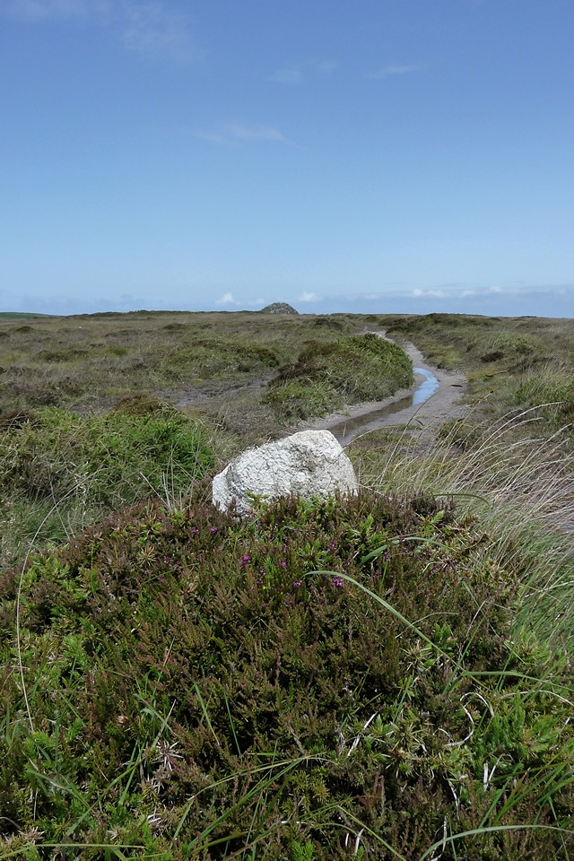
Once past the Carn, the path carries on between low field walls with the moor stretching away ahead. The iconic engine house of the Ding Dong mine comes into view beyond the Nine Maidens ridge. The rain has temporarily been replaced by large patches of blue, peering through the ragged clouds that rush, wind-powered, across the moor. Men Scryfa appears in a field over to our right (west). We'll be back for that later. The Four Parish Stone — Fieldnotes14.07.11ceFirst though, a quick stop at a minor landmark that many visitors to the area pass without a glance. At the meeting of several paths, a large recumbent boulder marks the boundaries of four parishes, hence its name. A crude cross has been carved into the surface of the boulder, but I strongly suspect that it has been used a meeting point – either of people or of territory – for a Very Long Time. Both Men Scryfa and some of the barrows up towards Nine Maidens are visible from here. The Four Parish Stone — Images07.07.11ce
And it's the latter direction that we take, making the gentle ascent up onto the ridge – an overgrown round barrow can be seen on your right on the way up. Boskednan Cairn — Fieldnotes14.07.11ceWe stop off briefly at the best-known barrow, north of the Nine Maidens stone circle and boasting an impressively pointy array of kerb stones. It is cleared regularly now by the CASPN volunteers, making it much easier to see than in years past. The "V" stone (which has an angular quartz vein running through it) is easy to spot now. Boskednan Cairn — Images07.07.11ce
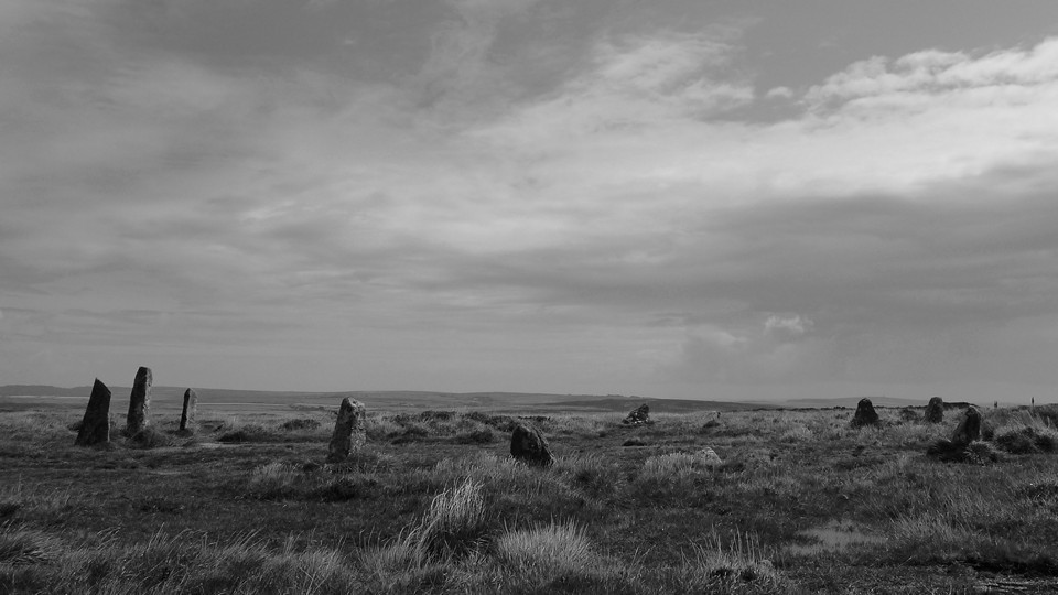
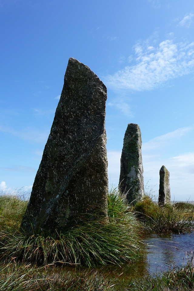
Nine Maidens of Boskednan — Fieldnotes14.07.11ceAnd then it's on to the stone circle itself. Despite many, many visits over a dozen years, this circle never fails to bring a big grin to my face. It remains my favourite of all, lonely and windswept on its moorland ridge. This is my first visit since I watched the sun setting here on my birthday the previous autumn. But first, the bad weather. Within seconds of arriving at the circle, the next band of rain has caught up with us and we spend five minutes trying to shelter in the excavation scoop of the round barrow that intrudes into the side of the circle – not the best place to get out of the rain. But don't you worry, it's only a shower. Blue skies return as quickly as they went and we spend a good while here. In any weather, this circle delivers on its promise. The re-erection of the stones on the northern arc has greatly added to the feel of the site. The setting is wonderful, with Carn Galva the most obvious feature of the surrounding landscape. There are views eastwards to Mulfra Hill (where Mulfra Quoit is visible) and further to Castle-an-Dinas. On a clear day you can see beyond Penwith, upcountry towards Carn Brea. To the northwest, the twin summits of Watch Croft, the highest point in the peninsula, are close by. Further west Chun Castle sits, flattening the top of its hill. Only to the south are views obscured by rising ground – the top of the Ding Dong chimney peeks out. Over the years we've seen dog walkers, dowsers and horse riders up here, but in truth we rarely see anyone and today is no exception to that. Although close to Men-an-Tol, the circle remains a largely stone-head destination. Nine Maidens of Boskednan — Images07.07.11ce
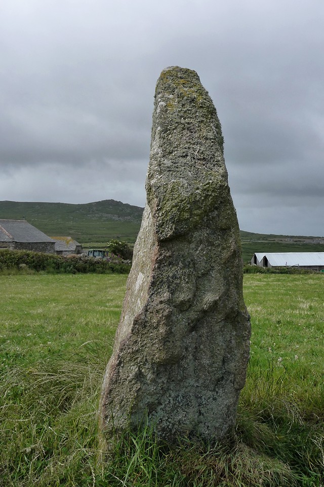
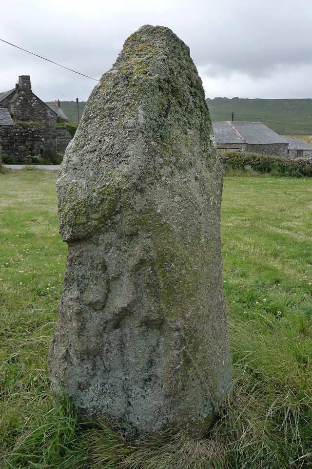
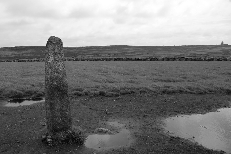
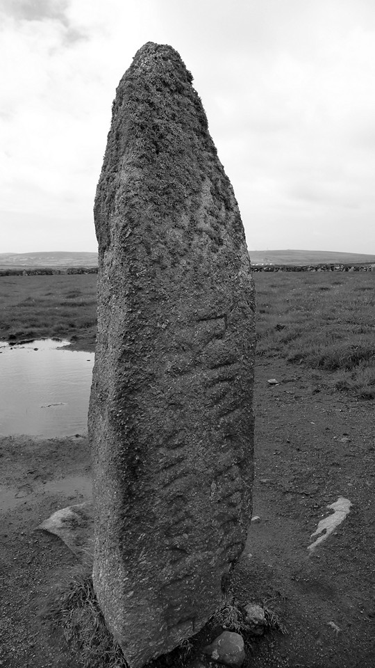
Men Scryfa — Fieldnotes14.07.11ceEventually we head off back the way we came, past the barrow and down to the Four Parish Stone again. From here a track between low hedges leads southwestwards. Men Scryfa is in the first field on the right, with a gate at the southern corner allowing access (there is no public right of way into the field and there are often cows pastured here). Today is a cow-free day, so we pop in to say hello. There's no doubting the stone's Dark Ages provenance – it's written all over its face. But in truth is also makes a very convincing Bronze Age menhir, shapely and tall, set in a landscape bursting with the remains of the period. Men Scryfa — Images07.07.11ce
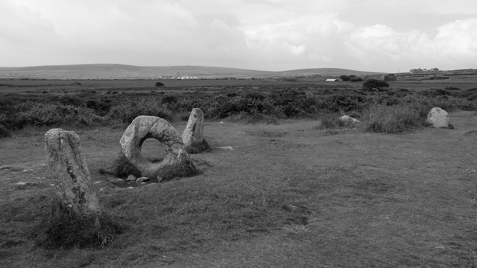
Men-An-Tol — Fieldnotes14.07.11ceWe return to the path and carry on south-westwards. Here we see the first people we've seen since getting off the bus – it's time to visit Men-an-Tol, where you rarely get a summer visit to yourself. We seldom come here for that very reason and today I almost take us past the stile before deciding to brave the contact with Other People. The other people in question turn out to be Germans – it's an internationally renowned site, this. When they leave, we have maybe ten minutes to ourselves before the next visitors and we leave them to enjoy it – the ones after that are probably five minutes behind on the path. So don't expect peace and quiet, but it's still an intriguing site. The famous holed stone and flankers are generally accepted as being part of a stone circle now, and other stones in the arc are readily visible. Men-An-Tol — Images07.07.11ce
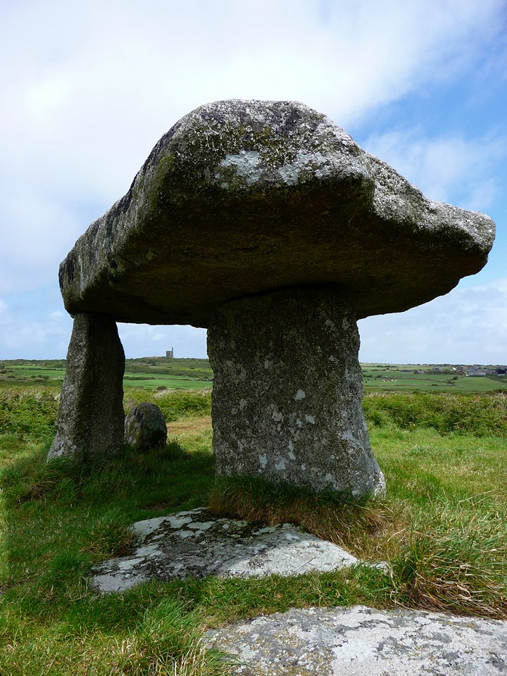
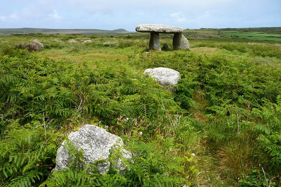
From Men-an-Tol we head off to the road and head south-eastwards. If you're walking this way, it's a busy road. But there is a tea-room at Lanyon Farm (too early in the day when we pass, sadly). The road kinks right, then left, and then Lanyon Quoit is visible, straight ahead. There are already visitors here too, but we stop off anyway. Lanyon Quoit — Fieldnotes14.07.11ceAlong with Merry Maidens and Men-an-Tol, Lanyon Quoit is the most visited and most picture postcard perfect of West Penwith's many ancient sites, despite being the least authentic of the four upstanding Quoits that the area boasts. Not much remains of its original mound and the capstone's supports are rather shorter than they used to be. But so what? This is still a great spot and what's not to like about a giant stone table? At the western end of the mound, a cluster of stones may mark the position of a cist or small chamber that was built into the mound. But there's too little left to really get any sense of what there might have been. Lanyon Quoit — Images08.07.11ce
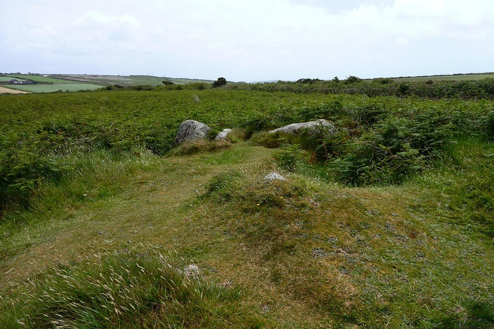
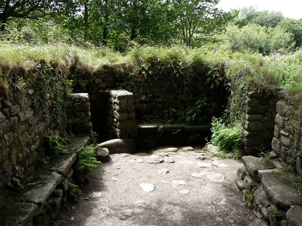
A short section of road later and then a footpath across fields near Boswarthen gives extensive views of Mounts Bay. The footpath descends into a narrow passage enclosed by summer vegetation, before eventually emerging onto a narrow road, where it passes the neat wheel-headed roadside Boswarthen Cross. From here it's a short distance to the small parking area for Madron Well and Chapel. It's many years since we last came, so we head off for a quick look. Past the cloutie tree, I remember that the well is not behind it but further on. We stop at the chapel, sun-dappled and quiet, for a while. But I can't remember where the well is and end up in a near-bog (too far north in truth) before deciding to call it quits for this trip. One for another, dryer, time. Madron Holy Well — Images08.07.11ce
We carry on to Madron village (pub and shop) from where a bus takes us down into Penzance. A great day out on the moors, accompanied by a full range of Penwithian weather. Yay! |
 Posted by thesweetcheat
14th July 2011ce Edited 14th July 2011ce
thesweetcheat's TMA Blog
Latest TMA Blog Posts
|
Comments (0) |
|
| You must be logged in to add a comment | |