|
|

|
thesweetcheat’s TMA Blog |
|
Offa's Dyke Path II – Rhuallt to Denbigh
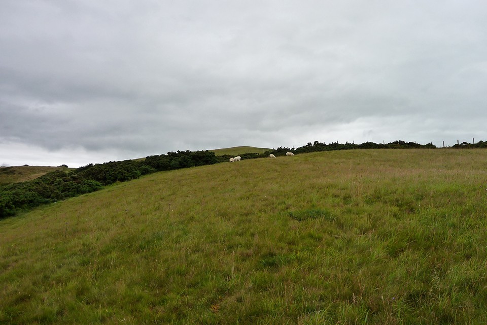
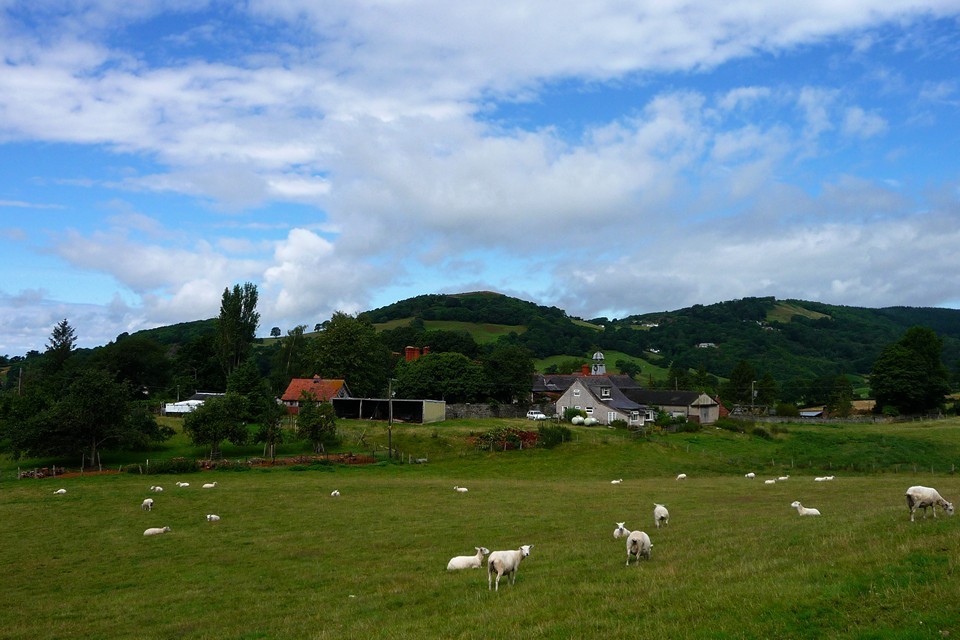
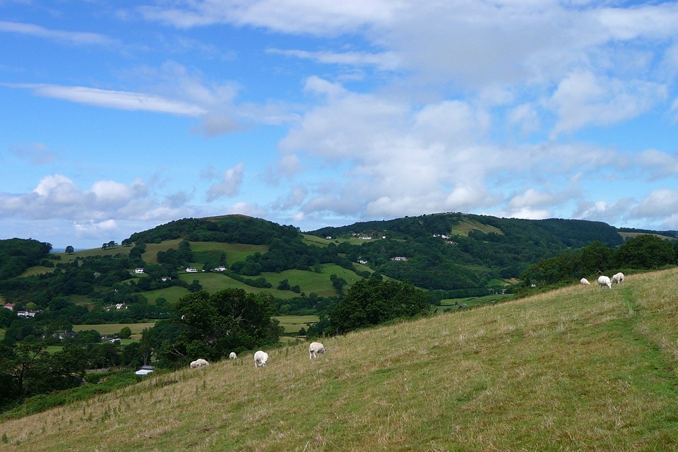
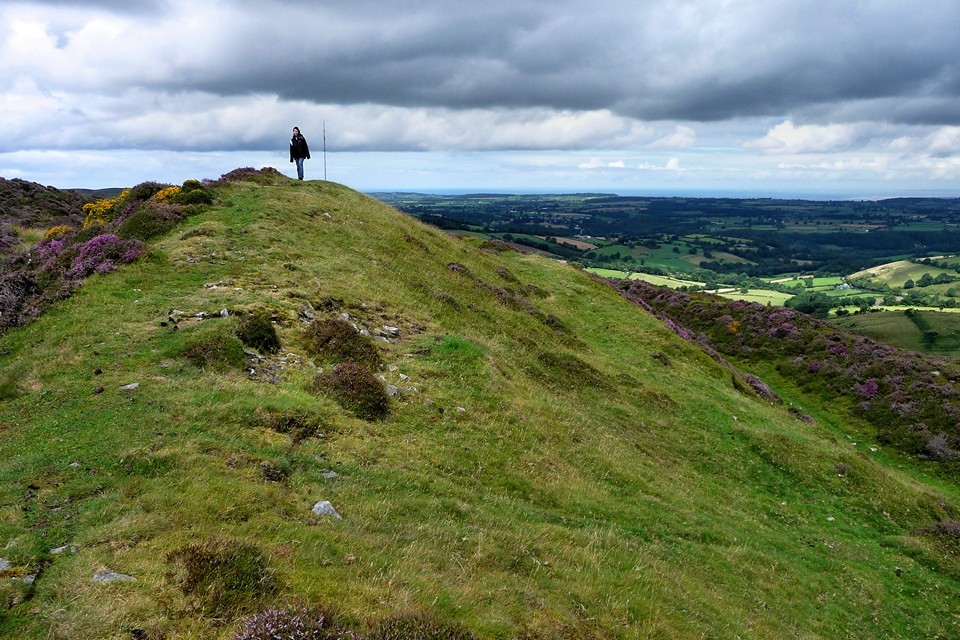
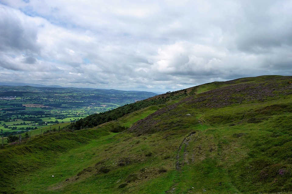
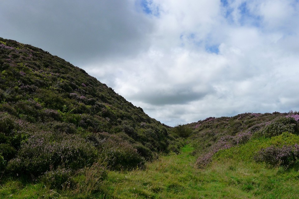
| July is coming to an end, and I'm keen to progress with the Offa's Dyke Path mileage. Our first attempt back in May saw us manage a paltry 7 miles of the 177 mile Path itself, mainly due to incorporating those miles into a longer circular walk back to Prestatyn, taking in The Gop. This time we hope to get a bit further. We're staying in a B&B outside St Asaph, only half a mile from where we left off last time at Rhuallt. We arrive on the Friday afternoon, giving a good opportunity to walk into St Asaph (in what turns into a torrential downpour) and have a look at the cathedral. St Asaph is no longer a city, although the signs tell you it is, but it does still have a bona fide cathedral, the smallest in Wales. It has a very pleasant feel to it, although heavily restored, worth a look if you're in the area. Saturday morning dawns cloudy and overcast. We head along the old route of the A-road to Rhuallt, taking a moment to look north to Moel Hiraddug, which we climbed last time out. The path climbs through a series of muddy fields of wet grass and some friendly horses, before heading around the steep-sided Moel Maenefa. Moel Maenefa — Fieldnotes13.12.10ceFrom here the much bigger hills of Moel y Parc and Penycloddiau become visible to the south, setting the scene for the walk ahead. I scoot off-Path temporarily to have a look at the barrows on the hilltop, but they're over fences and not much more than low, grassy mounds, so I don't make too much effort and we're soon back on our way. Moel Maenefa — Images13.08.10ce
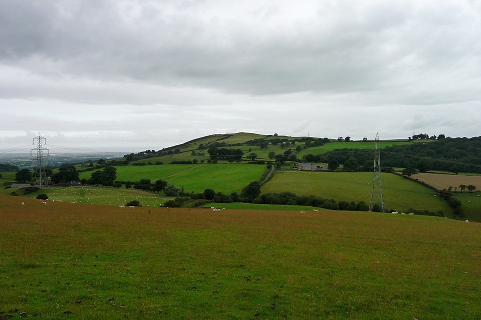
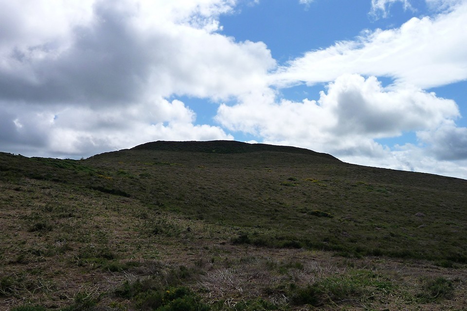
Snowdonia looms grey and storm-topped to the west, and there's plenty of cloud to suggest that some of that weather is coming our way. And so it proves to be. As we reach Cefn Du, the rain starts to fall and before long it's heavy and unpleasant. We stop for a while as the path heads under trees, allowing the worst to pass over. Emerging from cover at Sodom, the first of the day's hillforts, Moel y Gaer, looms ahead. As seems to be the local theme, it boasts multiple lines of defensive earthworks. Unfortunately our progress is slow as it's raining again and the fort is not on publicly accessible land, so we skip the tour and press on. The Path does wind its way round the steep eastern side of the hill, which gives a pretty good idea of the defensive positioning. Moel y Gaer (Bodfari) — Images13.08.10ce
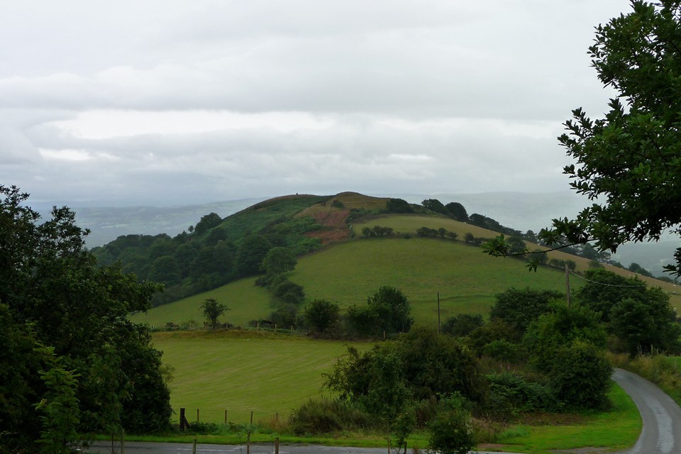
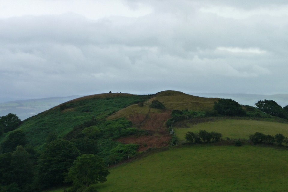
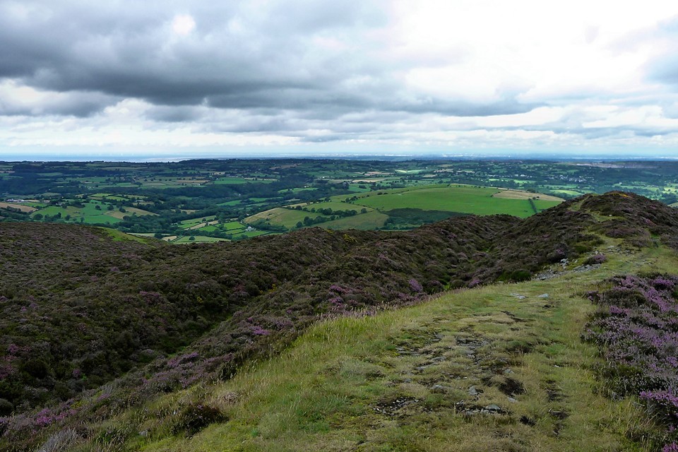
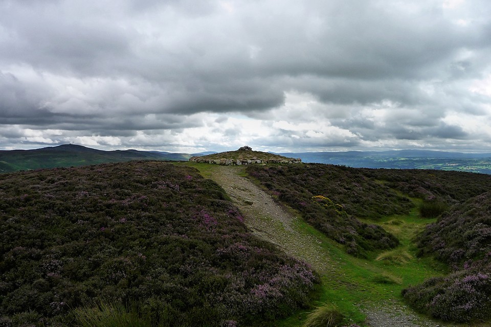
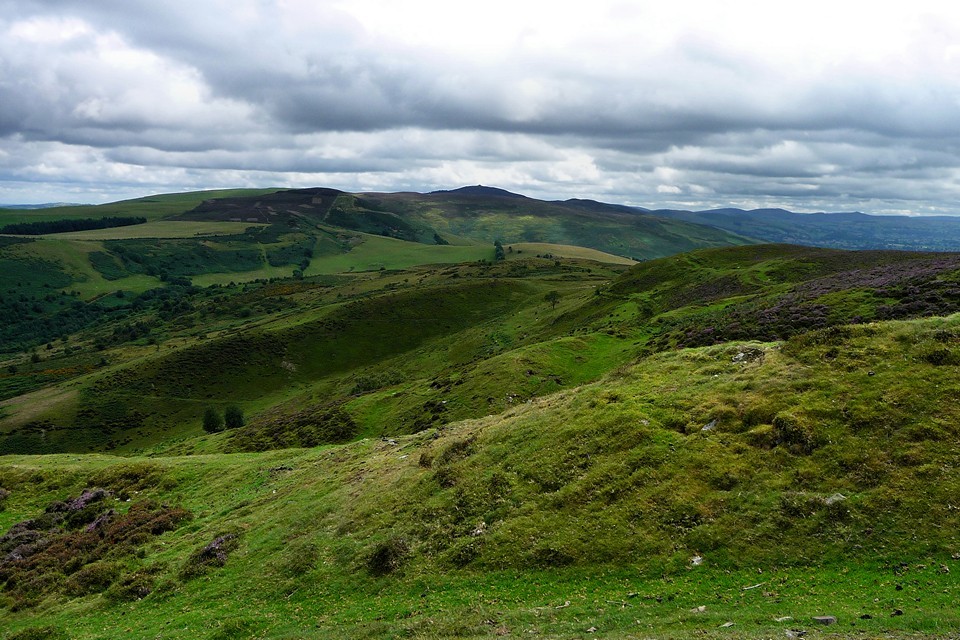
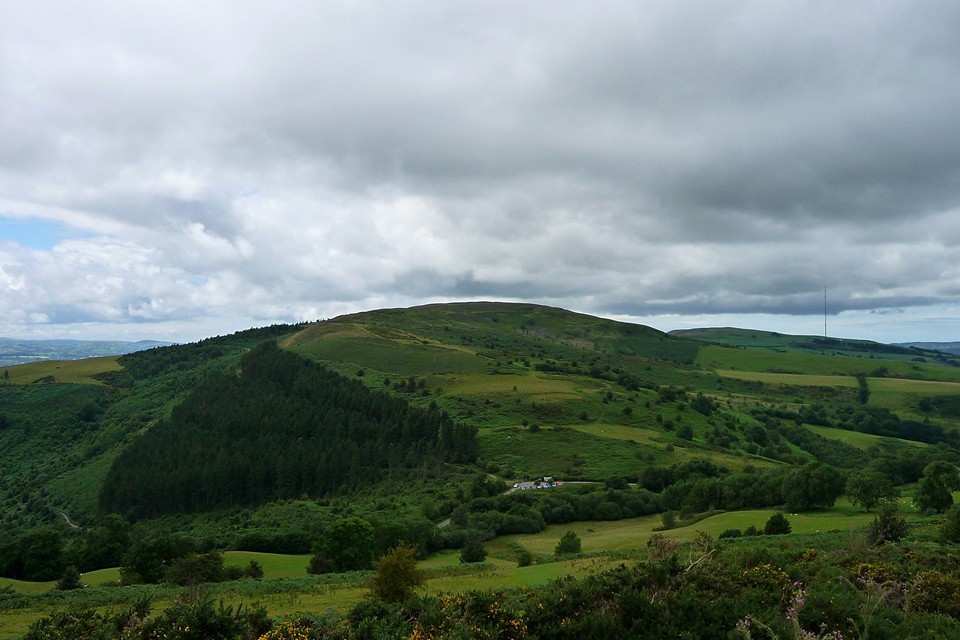
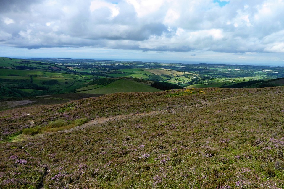
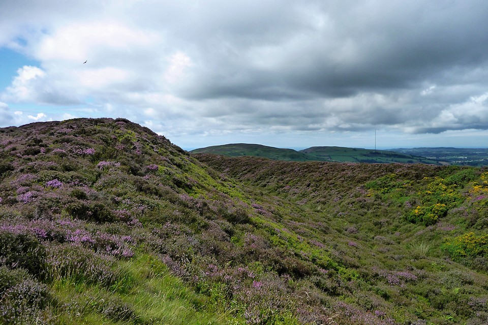
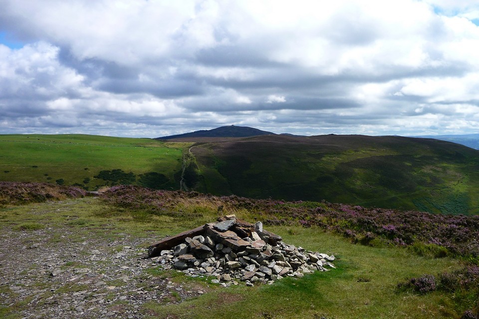
The rain stops as we hit the road at Bodfari (handy pub and bus service for Path-goers). After a section along some windy lanes, the Path reaches the shoulder of Moel y Parc. A little voice in my head suggests a detour up to the summit, where a cairn and round barrow are marked on the map. But it's a fearsome uphill from here and we have a long way to go still, so I suppress the voice and we stick with the Path, which is now starting its own long uphill to Penycloddiau under an increasingly blue sky. Penycloddiau — Fieldnotes13.12.10ceOnce we hit the 300m mark, the climb becomes less steep and it's a steady climb up to the northern ramparts of the fort, via a couple of false crests. Green grass gives way to purple heather as we approach. The multiple lines of defence are immediately apparent, in what would have been a pretty off-putting sight to any would-be attackers. One of the ditches is deep and sufficiently intact to be filled with a scummy green "moat" (presumably not an original feature?). Having crossed four lines of defensive banks, we emerge into the fort interior, where a rather immaculate cairn greets us. I assume (mistakenly) that it's modern as it's not marked on the map, but a post-trip check of Coflein reveals it to be a genuine, albeit heavily restored, Bronze Age cairn. It marks the highest point of the fort, at around 440m above sea level. The wind here is pretty fierce, making for a fairly inhospitable stop and we don't hang around very long before electing to take the eastern rampart of the fort. I have the usual delusions of doing a complete circuit, but this is a big fort! From its northern end, the eastern rampart sets off in an impressive triple-line of banks, with a sharp drop away to the east beyond (the drop on the west side of the fort is much steeper though). Moel Famau, highest point in the Clwydian Range, looms into view to the south, but we won't be getting near that today. The rampart steadily drops away from the northern end of the fort and just before the halfway point the triple banks end, presumably at what would have been an entrance. South of here the rampart drops further and is marked by a single (still impressive) rampart. The nearest neighbouring fort, Moel Arthur, is now in sight, its height comparable with our own. We eventually reach the southern end of the fort, and walk a little way along the (very windy) western rampart before rejoining The Path as it starts its descent from the hill. Penycloddiau — Images14.08.10ce
Penycloddiau cairn — Images14.08.10ce
Penycloddiau — Images14.08.10ce
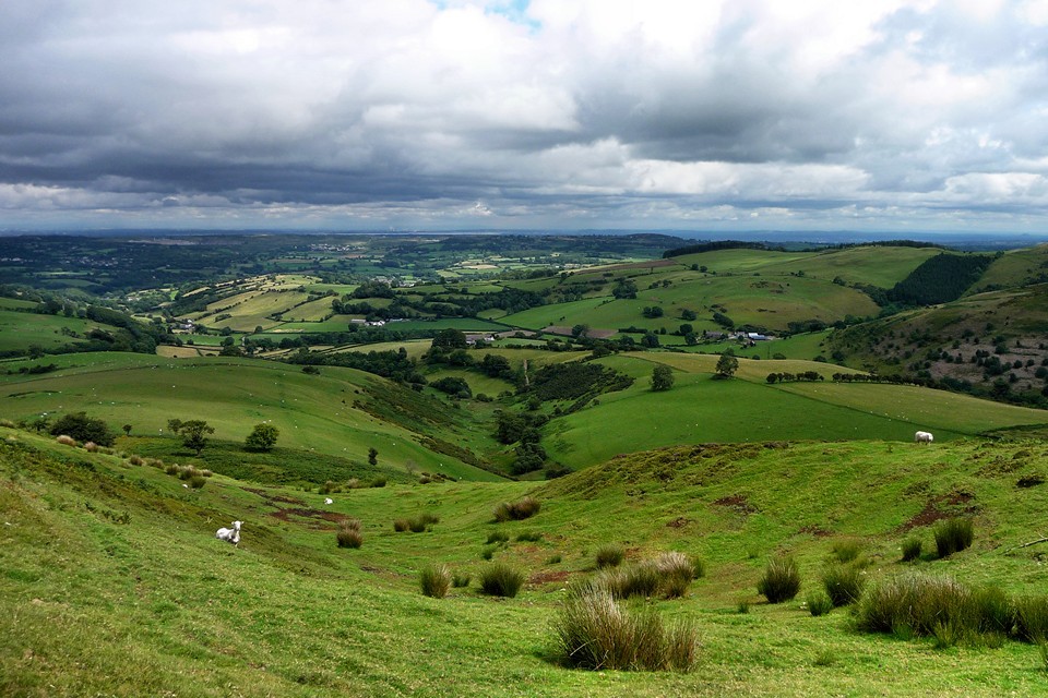
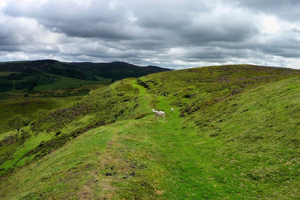
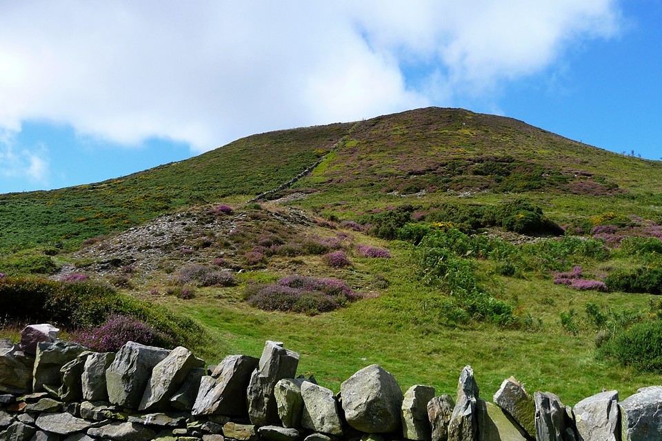
Moel Arthur — Fieldnotes13.12.10ceThe further we drop, the steeper the climb up Moel Arthur starts to look. By the time we get to the parking area between the two hills, it's clear that there will be a pretty sharp uphill to come, and so it proves. But it's the last climb of the day and the ground levels out a little before it reaches the fort. A track leads off The Path to the fort itself, at which point G/F decides to stop while I go for an explore. This is a lovely fort, roughly circular and surrounded by multiple lines of banks and ditches in the style that characterises these Clwydian forts. Once into the fort's interior, the views open out on all sides, taking in Moel Famau to the south, Penycloddiau to the north and the extensive vale of Clwyd to the west. At its highest point (456m) the fort is higher than its northern neighbour. A quick tour of the concentric heather-clad ramparts reveals a very steep drop away to the south, making this small, compact fort a much more defensible proposition than the much larger site to the north. Unlike its neighbour though, there's no obvious water supply within the fort itself – perhaps the North Walian rain provided enough! Moel Arthur — Images14.08.10ce
Penycloddiau — Images14.08.10ce
Moel Arthur — Images14.08.10ce
Back to G/F and we carry on along The Path, down the steeply sloping hillside to a parking area, which marks the end of our second Path stretch. The sun is shining by this point, a welcome change from the downpour and high winds of earlier. We walk from here to the village of Llandyrnog, where a bus takes us into Denbigh, from where we will start our next trip. |
 Posted by thesweetcheat
13th December 2010ce Edited 13th December 2010ce
thesweetcheat's TMA Blog
Latest TMA Blog Posts
|

Comments (0) |
|
| You must be logged in to add a comment | |