|
|

|
sals’s TMA Blog |
|
Sardinian Seconds
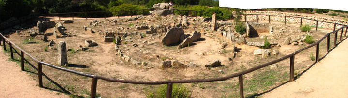
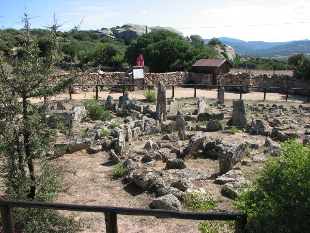
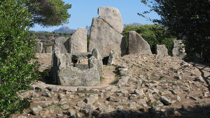
| Seeing as we were only a few kilometres away, we decided to forego a lunchbreak (again!) and continued a short way west from the Coddhu Vecchju turn on the SP14, and turned off north following the signposts to Li Muri and Li Lolghi. By now it was obvious that several groups of people were following the ancient trail, and we saw the same cars and visitors at the next two locations as we'd done at Coddhu Vecchju - some sharing our giggling at bumping into them again, and some entirely humourless. From the turn off the SP14 (clearly signposted) it was 1.8 km to a fork in the road, with one site each way - we decided to head to the left to Li Muri first. Li Muri — Fieldnotes28.09.07ceFrom the fork in the road where the directions to this site and Li Lolghi split, it was 1.2km to the car park and information building (closed when we got there) just past the site, and about 120 metres up a gentle incline to get back to the site itself which has a gate and wooden hut at its entrance. The site has wooden posts and rails to keep people off the stones, and viewing platforms similar to those we'd seen at Coddu Vecchju. There are 5 cists; 4 of these have a menhir and stone slabs arranged around them to form a circle; cist number 5 to the far left on my panoramic photo has an incomplete circle with an open front. This is believed to be the oldest site on the island, at around 4000 BCE. Tickets are 5 euros to visit both here and Li Lolghi, payable at the information office just down the slope - the guide was at the circles when we arrived and we followed her down to pay after our visit. As usual for the "pay" sites, there were toilets, and a range of info, drinks and snacks on sale. Li Muri — Images28.09.07ce
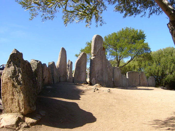
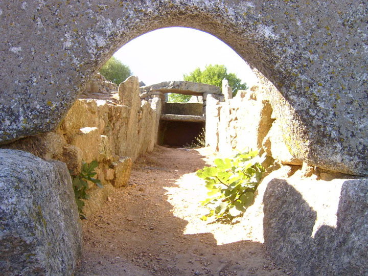
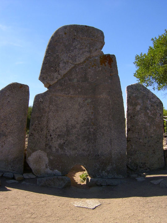
My research suggested a domus de janus nearby, but the guide (bearing in mind she spoke very little English and my Italian is extremely basic!) told us that as far as she was aware there are none of these rock cut tombs in Gallura. We turned round, after encouraging a group of mature British tourists to visit the sites, and retraced our route to the fork in the road, and this time headed east for less than half a km to the car park for Li Lolghi. Li Lolghi — Fieldnotes29.09.07ceLi Lolghi has ample parking, a wooden information and ticket hut (we'd paid at Li Muri so just picked up our guide leaflet) which has the usual range of info, postcards, ice creams and drinks - including beer! The slope leads up to the tomba - orientated to face south east - and again was originally an allée couverte as at Coddu Vecchiu, extended circa 1300 BCE. The giant stele has been broken at a 45° angle and repaired, and has relief carvings on it; the stone slabs of descending height on either side mark out the esedra. Looking through the portal, you can see along the funeral corridor to the remaining capstone and shelf at the end, before the earlier tomb. The rear of the monument is gently fenced with posts and rails, and viewing platforms are provided. The whole thing is a massive 26 metres long! Li Lolghi — Images28.09.07ce
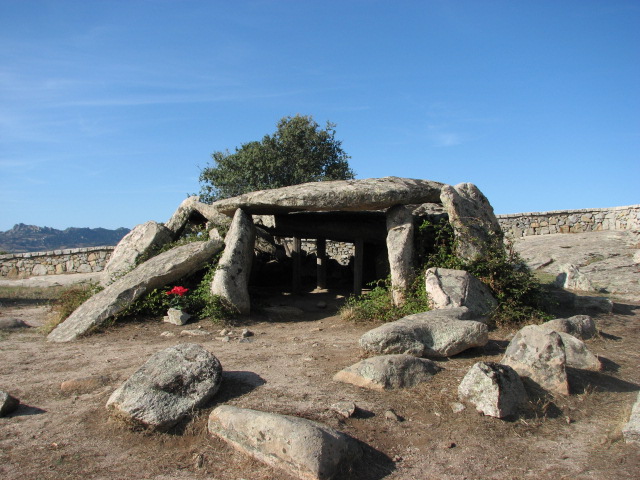
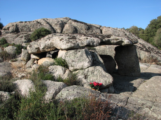
The sites we'd visited were so close to each other that the petrol gauge on the hire car had barely moved and there was plenty of daylight left, so we decided to continue our trip and headed south west towards the village of Luras, which promised 4 (out of originally 9? I'm sure I read that somewhere!) dolmens. A brief stop for a drink in Sant' Antonio di Gallura (a one horse town, and the horse was out) and 25km or so from Li Lolghi brought us to the narrow, winding streets of Luras, with some precipitous drops to the side; fortunately the dolmens are all signposted from the main street. Follow the road and watch out for the brown signs! We parked at a T head and turned first to the left for about 120 metres along the road and then up a path to our first dolmen. Ladas — Fieldnotes29.09.07ceThis dolmen has a huge main capstone - over 3 metres by 4 metres - supported by stone slabs on 3 sides with some wooden posts to help out too. A separate, smaller capstone creates a porch area, and the underside of both stones have been carved in to. Someone had been recently, and left a potted plant (cyclamen maybe?) tucked safely at the left of the entrance. Free and open access. Ladas — Images28.09.07ce
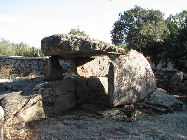
Back past the car and about 120 metres curving gently downhill past T head and we turned through the gate to the left to the next dolmen. Ciuledda — Fieldnotes29.09.07ceThis dolmen is smaller than, but similar in construction to Ladas - both have been dated at 3rd millennium BCE. It's situated on a rocky outcrop with great views from its south easterly facing entrance across the valley below. Again, a plant had been left to the left of the entrance. Free and open access. Ciuledda — Images28.09.07ce
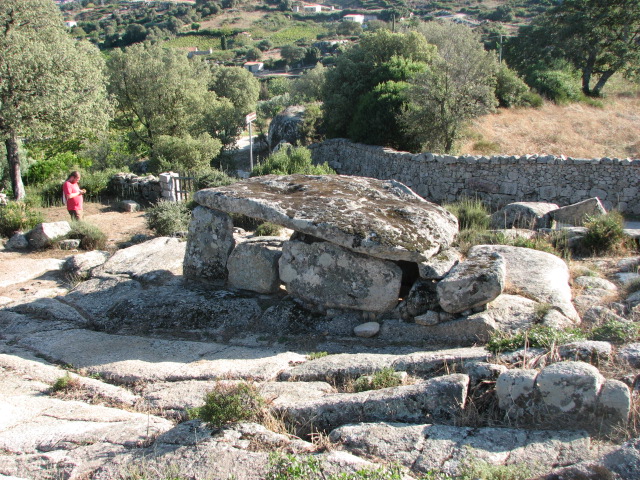
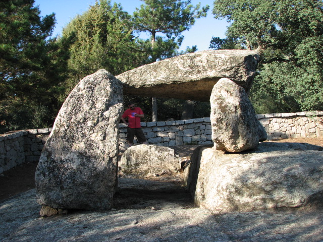
We jumped back into the car and headed (after a quick turn round and retrace our steps to retrieve Beardy's expensive (£7.49, you know!) sunglasses from Ladas) back and then across the main street, following the signposts to the other two dolmens. Bilella — Fieldnotes29.09.07ceBilella (spelt like this and as Billella on the same information board) is signposted off Via Boccaccio in Luras - it's actually about 1.2km from the turn off. Free and open access. Yet again, a plant had been left as an offering! A curious construction - built on a cut shelf of rock - and looking from one side like a transformers toy climbing a stair! It's the tallest of the group of dolmens at about 1.65 metres. Bilella — Images28.09.07ce
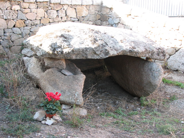
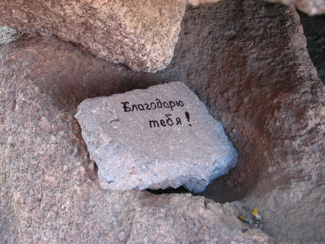
We retraced our path back to Via Boccaccio and turned right - signposted again - down the side of the football pitch to a dead end, facing an information board - and then looked to the right in a walled but open entranced area next to someone's house and garage - and found the 4th dolmen. Alzoledda — Fieldnotes29.09.07ceThis is the smallest of the group of dolmens, standing about 90cm high and consisting of a capstone of about 2½ metres square balanced on 3 other slabs. Free and open access. Yet again, a plant had been left recently, but this time there was also a message (on a separate piece of stone, not on part of the actual structure). Can anyone translate it? Alzoledda — Images28.09.07ce
What a packed day! Unsurprisingly tired and hungry, we decided to head for home over the slalom hill roads towards Arzachena, leaving the temptation to head towards the town of Tempio, and yet more treats, for another day. |
28th September 2007ce Edited 29th September 2007ce
sals's TMA Blog
Latest TMA Blog Posts
|
Comments (0) |
|
| You must be logged in to add a comment | |