|
|

|
Moth’s TMA Blog |
|
A dash round the dales
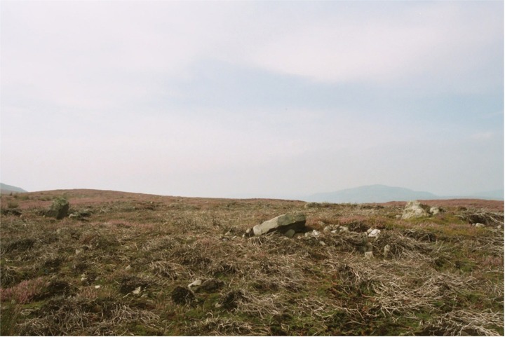
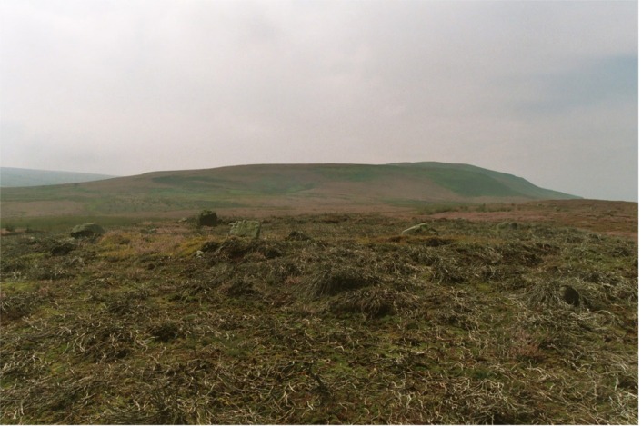
| 10 August 2003 Last week I failed to find Appletreewick Stone Circle for the third time, even with the help of our own Jane's uncanny 'rock detection' skills. So, having sought advice from fellow TMAers who had been there, I made it my mission to nail it this time. (Thanks Fitzcoraldo and Iron Man!) This time it's personal I collected Ginger John and we headed off to the dales from Leeds. We picked up the B6160 north near Bolton Abbey and then turned right at Barden, onto an unclassified road, before turning left onto the B6265 near Grimwith reservoir. John reckoned he'd been shown the circle some years ago, but couldn't remember much about it. He came equipped with a brand spanking OS Explorer map of the area (298 I think). Just as we arrived at the gates at SE060630, the weather turned from overcast to VERY WET, as if the world was telling me it wasn't going to help me find this damned circle. We paused to look at John's 1:25,000 map and I could immediately see where I'd been going wrong! The first twice I'd tried to find the circle I'd used my trusty Landranger 99. The third time with Jane, I'd printed out what Streetmap claimed to be the 1:25,000. I now realised it wasn't. It was just the 1:50,000 I already had – I HAD noticed the absence of field boundaries, but had assumed there just weren't any in the area. How could I have been so naïve? Last time I'm too stingy to buy a proper map…. There was the circle on the map, clearly just to the east of a field wall. A field wall I had seen on the ground previously, but had hardly crossed – believing the circle to be to the west of any nearby field boundary…! After waiting for the rain to abate a little, we entered the field, this time by the gate next to the tiny 'quarry' (more like a small hollowed out area on the hillside) at around SE065629. We picked up the wall running roughly north south along a spur of higher ground and followed it uphill and north. As we reached the top of the hill, there it was…. At last, Appletreewick Stone Circle – my bête noire! See Appletreewick fieldnotes below. A short detour We headed off past Grassington to rejoin the B6160 at Threshfield, not stopping at the Druid's Altar which we have both visited several times – a week before, to the day in my case. (See Jane's fieldnote on the page for the site.) As we approached Kettlewell behind slow traffic caused by a couple of vintage Austins, I mentioned to John that I had hoped to show Jane the Yockenthwaite cairn circle the week before but we had not had time. To my astonishment John said he hadn't been, so at Buckden we forked left to go through Hubberholme and on into Langstrothdale Chase. Yockenthwaite is about 4 miles from Buckden. (The George at Hubberholme is a wonderful hostelry by the way, though we did not stop….) See Yockenthwaite fieldnotes below. Fitz's (non-)folly Next up then, was a trip to my 'favourite' dale, Swaledale, to have a look at a possible stone circle spotted by TMA stalwart Fitzcoraldo. We reached Wensleydale and headed along to Leyburn. Lesson learned at Appletreewick, I insisted we call at the big newsagents there to grab the 1:25,000 OS map for the Reeth area!! (Explorer OL30). Leaving Leyburn by the road out of the 'top' of the village, we followed the primarily military road towards Grinton and Reeth, in search of Harkerside Moor Circle. See Harkerside Moor Circle fieldnotes below, which also include detailed directions. Castle walls Having seen the circle and returned to the car, we had a couple of hours to kill. I told John about TMAer Brigantesnation's posts for the enclosure at Castle near Reeth. We had the map, so off we went! See Castle, Nr Reeth fieldnotes below. After returning to the car, we sank a leisurely pint at the Bridge Inn at Grinton (another favourite of mine) and then home. A busy weekend complete. Appletreewick — Images12.08.03ce
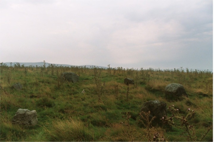
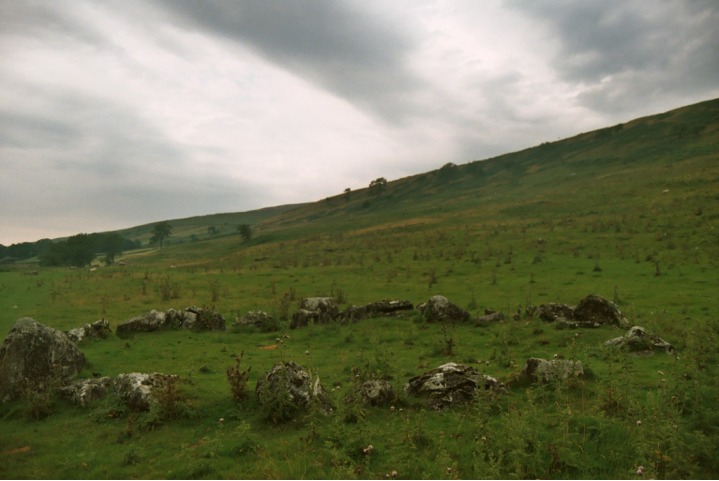
Appletreewick — Fieldnotes14.08.03ce10 August 2003 Got here at the fourth attempt in about 2 years, having thrashed about within a few yards of the damn thing on every single previous occasion…. Well worth all the trouble it was though! A distinct circle of stones including one pretty big boulder, which looks as if it's possibly in the position where it was found by the ancients, with the other stones placed to make a circle…. This is the 'inner' circle of what is allegedly 2 concentric rings. The outer ring, however, is so irregular and ruined that I don't think I'd have suspected it if I hadn't known in advance – especially as the whole area is littered with 'random rocks'. John and I spent some time pacing out distances to surrounding rocks and to be honest, remain slightly sceptical. Ironically, the site did remind me very faintly of the double concentric ring I'd visited the day before, the Druid's Circle of Ulverston. This had more to do with its size and atmosphere than the possibility of a double circle though. Well, who cares? Single ring or double, the setting overlooking 3 dales is beautifully remote and infinitely calming. It won't be long until I'm back now I know where it is! Yockenthwaite — Images12.08.03ce
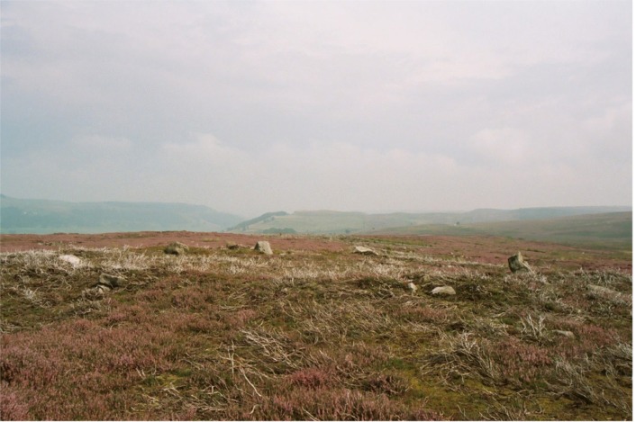
Yockenthwaite — Fieldnotes14.08.03ce10 August 2003 I can't believe how unknown this place is, despite being right on the Dales Way alongside the Wharfe. But I'm glad. And the OS will have helped by seemingly having removed it from the 1:25,000 Explorer – my friend John is sure it was on the previous 1:25,000 of the area! (And I'm sure it's never been on the Landranger.) The position is beautiful, and having previously visited, I have to say it has a wonderfully open and light atmosphere on a sunny day, but it's worth a visit in any weather! Being a cairn circle, it's certainly not a stone circle in the 'true' sense, but if you want a picturesque but accessible and peaceful circle of stones to sit and chill at, look no further. Because of showery weather and time constraints, we parked by the road on the opposite (west) side of the river and leapt and splashed across. But it is vastly preferable to park near Yockenthwaite farm, cross the Wharfe by the bridge and turn left (north west) along the Dales Way for 10 or 15 minutes or so…. Back in the car we watched the 'world' passing the circle by for a while, wondering what the walkers and cyclists would have thought had they known what they were passing…. The circle is easy to spot from the road, but only if you know roughly where to look and what you are looking for. If you don't have time or inclination to walk from Yockenthwaite, drive west with the river on your right. Keep an eye on the wall separating the river from the fields on the far bank. The circle is right next to a place where the wall has (mysteriously?) tumbled…. Be prepared for damp toes unless you want to spend a goodly amount of time looking for a really dry crossing point! *Also see weblog More Moth meanderings (starring the squid family).* Harkerside Moor Circle — Images12.08.03ce
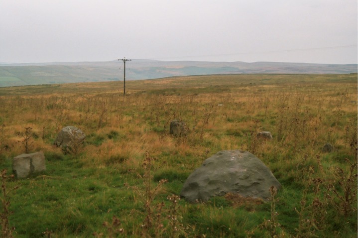
Harkerside Moor Circle — Fieldnotes14.08.03ce10 August 2003 I went up to this one following Fitzcoraldo's comments... and am in WHOLEHEARTED agreement. Just my opinion, but if this really is what the OS has marked as a hut circle, all I can say is "is it HELL a hut circle "! We all know the OS are flawed on this sort of thing – stone circles marked as cairns (Druid's Altar to name but one), cairns marked as stone circles, you name it…. I was accompanied by my mate John, a man not easily impressed with 'alleged sites', having like most of us here, seen plenty of stones. He thought it was a stone circle too. That's 2 more necks out with yours Fitz! The circle stands on a slight platform and is much wider than any hut circle I've ever seen or heard of. It shows no signs of ever having been even vaguely contiguous, which for me pretty much says it isn't a cairn circle either. Some of the stones aren't firmly seated and may possibly not be in their proper positions, but some have what looked like very clear packing rubble and stones around them. Looks pretty damn authentic to me. As well as the impressive 'earthwork' nearby, there are also what we thought looked like a few ruined cairns on the way to the circle. To find the circle, we approached from Leyburn, heading for Grinton. Descending towards Grinton, we took a left turn signposted (I believe) to Redmire, a short distance after passing Grinton Lodge on the right. This road goes gently uphill and pretty soon there is a sharpish bend left at approximately SE044974, by a barrier gate onto the moor. We parked here. A track heads WSW onto the moor. We found that the simplest thing to do was to follow this until it crosses a small stream called Grovebeck Gill just after passing a fence leading off to the right. Cross the stream and leave the path to the right and follow the fence, leading just about north. You will soon come to a very clear and quite spectacular earthwork ditch and bank. Follow the earthwork left (WNW) and where it peters out, continue straight on, along a projected line from the earthwork. On the nearest crest almost exactly in front of you should immediately or soon see the outline of some small rocks. That is the circle. Oh, and by the way, try not to jump out of your skin when the grouse shoot out of the undergrowth! I reckon I lost a good few minutes off my life…. Castle, Nr Reeth — Fieldnotes14.08.03ce10 August 2003
We drove through Reeth up into the bottom of Arkengarthdale and parked around NZ027006, on the verge by the track to Castle Farm. We followed the track down to the river amongst trees (beautiful spot). Across a bridge, back out into the now blazing sun and up the gentle slope towards the farm buildings. In the fairly small enclosure to the right of the further farm house (Castle Farm itself according to the map), you can immediately see the 'orthostatic' walls of upright stones that the more modern walls seem to have been built onto – if I understand correctly. As I know absolutely NOTHING about the subject, I suggest you read Brigantesnation's fieldnotes. Just to the left (north west) of the farm buildings is a stand of trees, on a bank littered with massive rocks, presumably from field clearance. At the bottom of the bank where you approach it from the path leading along the valley, is a kind of 'kerb wall', possibly related to the orthostatic walls Brigantesnation talks about, or perhaps just a more modern effort to support the bank. We sat in perfect peace for a good few minutes before the walk (mainly uphill!) back to the car. |
14th August 2003ce Edited 18th August 2003ce
Moth's TMA Blog
Latest TMA Blog Posts
|
Comments (0) |
|
| You must be logged in to add a comment | |