|
|

|
ocifant’s TMA Blog |
|
Ireland Excursion - Pt 5
| And so the story finally ends… Final full day in Ireland – 4th July Today is our last full day on Ireland's shores. We head back to Rosslare tomorrow for the overnight ferry. Slept much better last night, having switched to the other bedroom in the cottage, with a firmer bed. My shoulder and neck were still troublesome, but bearable today. The plan was to hit Skibbereen market before hitting the stone trail for the penultimate time here - lots to see on the way back tomorrow, with any luck! On the way to Skibbereen, I diverted slightly to take a look at the Gurranes stone row. This looks magnificent from the road, but I had no time to try to traverse what looked like a very boggy climb from the road. Arriving in Skibbereen for 10:30, we discovered that the market didn't start until 12:30, so we set off on the first leg of today's stone trail. First stop was a wedge tomb at Cappaghnacallee, which looked to sit just behind a house. On reaching the house, there was impenetrable gorse and bracken at the back of the house, so I knocked to ask the owner, who told me that it was a fine wedge tomb, but that access was via the farm (at V976332) and I'd have to ask the farmer. The old boy was a bit deaf so communication was not easy, and he managed to blag a lift into Skull off of us, so we had no time to visit the farm… Cappaghnacallee — Fieldnotes09.07.03ceThis is apparently a fine wedge tomb, and access can be gained via the farm at V976332. I didn't have time to enquire on my visit, having been talked into giving a local a lift into Skull. Just outside of Skull, at around V937315 I spotted a 'faux' circle in someone's garden – all very modern. Not worth a separate listing, but I'll add a photo under the Skull Stone site. Skull Stone — Images09.07.03ce
Skull is a busy little town, apparently famous for yachting – the Fastnet Rock lighthouse, a few miles off the coast can be seen from above the town. Once in Skull and rid of our passenger, there was a small stone row I wanted to take a look at in Rathcool a couple of kilometres outside town. Two smallish stones, hidden in the undergrowth, were both about 5 feet high, and easily visible from the road. No obvious alignments. Rathcool — Images09.07.03ce
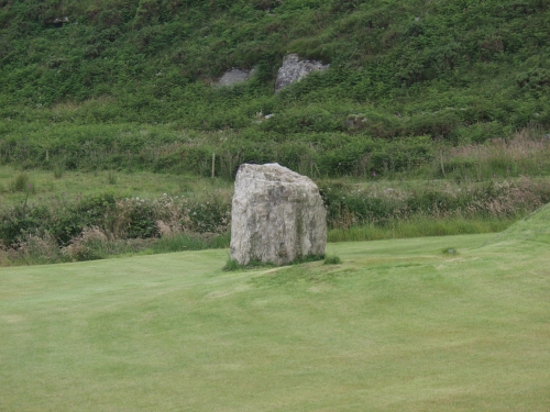
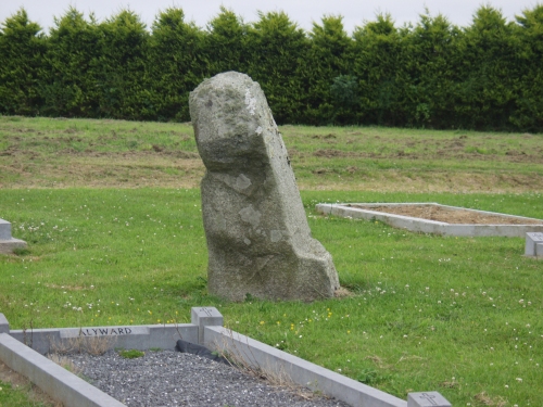
In Skull itself is a standing stone on a lane leading to the Standing Stone Studio – a private artist's residence that welcomes visitors. Skull Stone — Images09.07.03ce
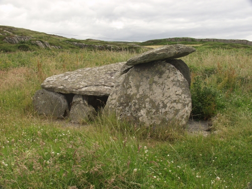
We then moved on to Toormore where a couple of tombs (at last!) awaited us. The first we visited was actually the most westerly of the two, and is located behind the Altar Restaurant. I'm not too familiar with the tomb types, but believe this is a passage tomb. The capstone only covers the back half of the tomb area (and is sadly held up by an iron girder). It is obviously well tended by the restaurant owners as the grass around it was freshly mown. Toormore — Images09.07.03ce
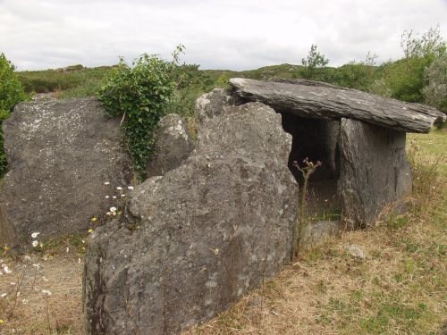
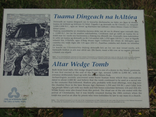
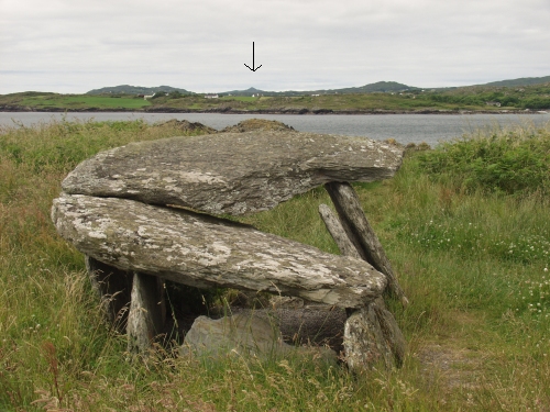
The other tomb is known as the Toomore Altar Wedge Tomb and is aligned across Toomare Bay directly pointing to Mizen Peak. Altar — Images09.07.03ce
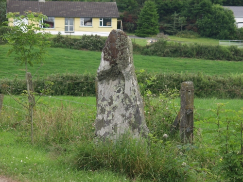
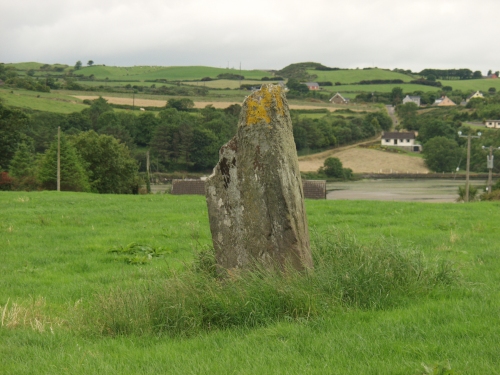
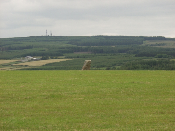
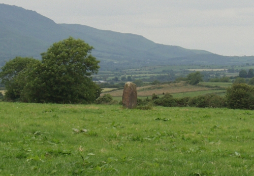
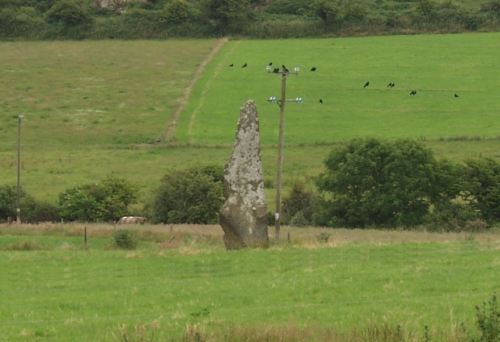
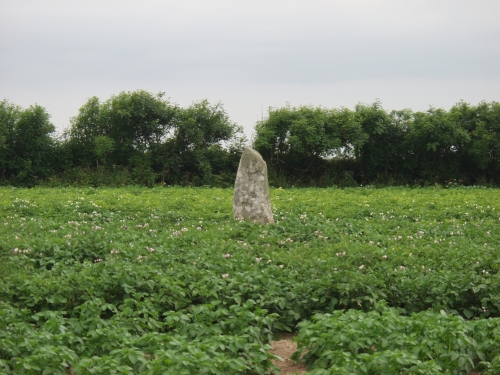
Satisfied that I'd finally found some tombs, we headed back to Skibbereen and a somewhat disappointing market. Not so much a country market, more a W.I. display of home made pies and pickles. We stopped for lunch in the Eldon Hotel, which is apparently the last place Michael Collins left on the night he died. On the way back to the cottage, I was determined to spot the Rosscarbery stone, and finally did so, although attempts to find a couple of other single stones in the area proved fruitless. And so we returned in good time to plan the stops on tomorrow's long journey back to Rosslare. Rosscarbery — Fieldnotes09.07.03ceThis stone is easily visible from the N25 heading into Rosscarbery from the east, although it actually took us several days before we found it, spending most of our week either west or north of Rosscarbery. Rosscarbery — Images09.07.03ce
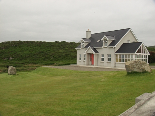
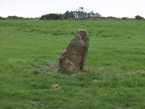
Homeward Bound – 5th July We had to leave the cottage by 10am, and our ferry from Rosslare wasn't leaving till 10:15pm. Allowing for feeding and check-in time, that gave us nearly 10 hours to travel across the south of Ireland, seeing as many sites as possible on the way! Just down the road from the cottage, a stone was marked on the map at Tullig crossroads. We'd failed to locate this all week, but it looks as if the stone has been moved to the garden of a new property, currently up for sale. The garden has three large stones, but Mikki felt that only one was 'genuine and full of energy'. And so we were on our way… Tullig Stone — Fieldnotes09.07.03ceThis stone (or its site) is just down the road from the cottage we'd hired for the week. On the final day of our holiday we determined to find it. The only stone of any size in the area is in the grounds of a new house, currently up for sale. There are a couple of other large stones in the garden, but the one furthest from the road looks most genuine. Tullig Stone — Images10.07.03ce
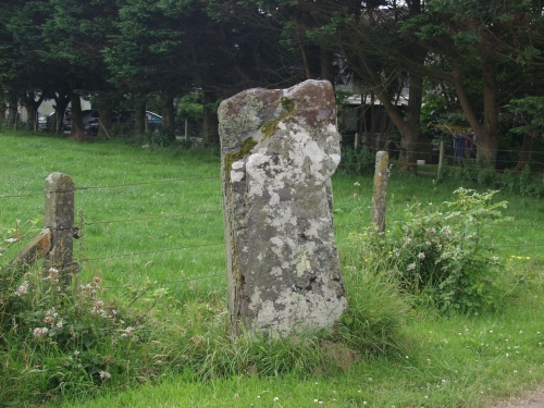
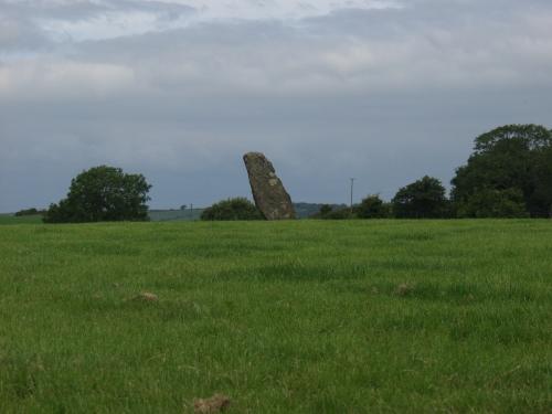
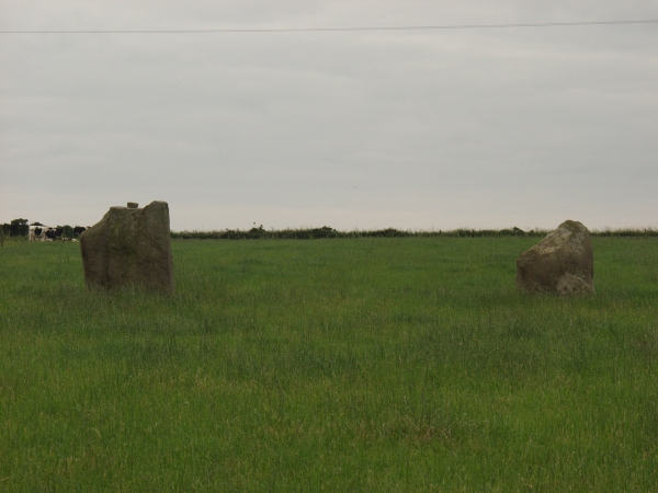
We were now working solely off the maps, and picking sites on the way – I'd circled several of interest on the route when planning last night. First up was just south of Bandon, at Corravreeda, a majestic looking stone, with a slight lean. Next was marked 'standing stones' at Parkaghadallaun. I'd expected to see a stone pair here, but was delighted to find a three stone row! Corravreeda — Images10.07.03ce
Parkaghadallaun — Fieldnotes06.07.03ceMarked as 'standing stones' on the OSI map, I'd expected to find a pair here. What I actually found was a three stone row. Two of the stones are similar in size, and about 5 metres apart. The third is much smaller and about 25 metres to the NE of the other two, but in line with them. The middle stone had a small boulder placed atop it. I didn't enter the field due to the presence of cows nearby. Parkaghadallaun — Images06.07.03ce
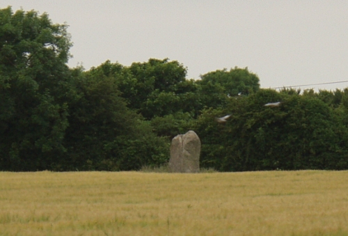
Leaving County Cork behind, we continued on the N25 toward Dungarvan, stopping briefly for lunch in Youghal, a pleasant enough seaside town. A few miles SW from Dungarvan, we spotted the Boherboy stone from the main road. Moving slightly south, was an interesting stone at Kilcolman, and another at Ballyvoyle to the east of Dungarvan. Boherboy — Fieldnotes06.07.03ceSpotted this from the N25 on our way home. It looks to be around 5 feet tall. Once again, cows in the field prevented a closer look. Boherboy — Images06.07.03ce
Kilcolman — Images10.07.03ce
Ballyvoyle — Images10.07.03ce
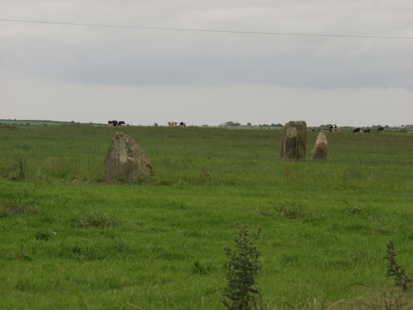
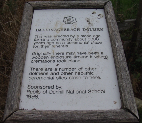
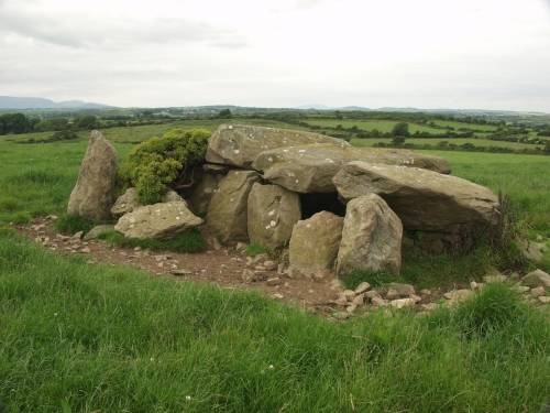
Our next few scheduled stops were tombs, starting at the Ballynageeragh dolmen, which is sponsored by the local school! The ruined tomb at Dunhill was next, closely followed by that at Matthewstown. The Ballymote stone followed, but I didn't get close, due to my, by now, pathological fear of ruminants. Ballynageeragh — Images10.07.03ce
Matthewstown — Images10.07.03ce
Ballymote — Images10.07.03ce
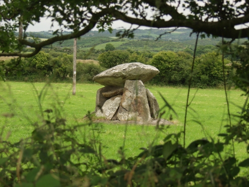
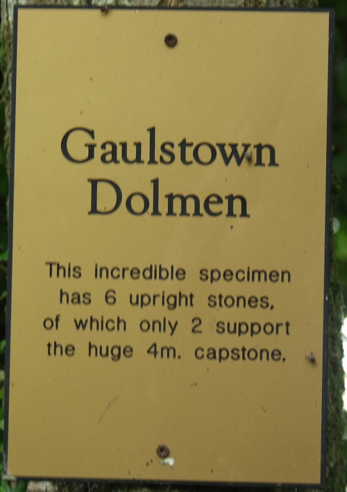
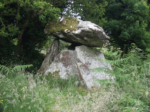
The Gaulstown dolmen reminded me distinctly of Carreg Coetan Arthur, but with an additional concrete base, and in a very different setting. I had to fight my way through shoulder high ferns and bracken to get to the stones, although the ground immediately surrounding the stones had been cleared. Gaulstown — Fieldnotes10.07.03ceThere's a sign screwed to a tree nearby that suggests the huge capstone is only supported by two of the uprights, but I saw at least three in contact during my visit. The pathway to the dolmen was incredibly overgrown, but the area immediately around the dolmen was clear. Gaulstown — Images10.07.03ce
We entered Wexford County still with three hours to spare, and a quick glance at the map showed a few promising sites near to the harbour, so off we went. The Ballyboher stone had previously been visited by Fourwinds, but we had real difficulty in spotting the stone, despite its size. An impenetrable hedgerow some 9 feet high did all it could to bar our way. I did eventually find a gate to the field and managed to spot the stone in a far corner. It really is a large stone. Buncarrick — Images10.07.03ce
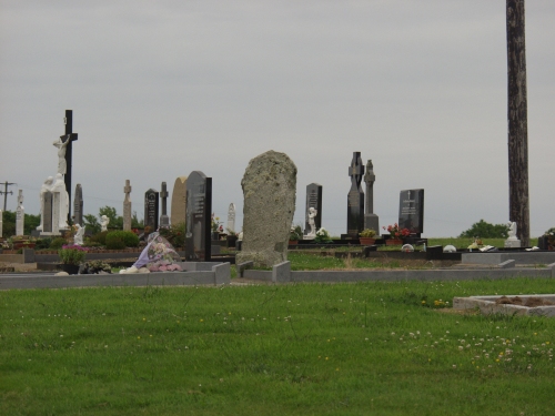
We then carried on down to Lady Island and the Buncarrick stone in the graveyard. I also took the opportunity to follow a sign to 'Our Lady's Holy Well', (the only one of the holiday I actually visited) which turned out to sit in the middle of a golf course! Buncarrick — Images10.07.03ce
Our final call was to continue down the road to Castletown and the phallic stone there, which was in the middle of a field of crops, before turning and heading for the ferry. Castletown Stone — Images10.07.03ce
We managed to board the ferry early and grabbed a cabin so we could get some much needed rest. Being an overnight ferry, it was only half full, despite the time of year, and we made good time, docking in Fishguard 30 minutes ahead of schedule. A tiring drive through the night with a brief stop for breakfast saw us arrive home at 6:30am. I did try to persuade Mikki to let me see the sun rise at Avebury, but she threatened GBH if I even tried to turn off the motorway! So our holiday adventure was over. Our next planned break is a return trip to Cornwall. There's lots I haven't seen there yet, plus some old friends I'd like to see again. Summary Three words to sum up Ireland on this trip? Foxgloves, Cows and Potholes! All three were in abundance everywhere we went. And it's very easy to quickly run out of superlatives when describing the scenery. Everywhere you look is simply breathtaking in its beauty. As for the stones, they are everywhere you look! Many of them are inaccessible, and I'm not familiar enough with the law in Ireland to know which I could approach and which I couldn't, so I tended to err on the side of caution. The agriculture of the country tends to high, deep hedgerows which makes sighting the stones difficult. Those that aren't in the agricultural areas are in inhospitable regions, up mountains, in peat bogs etc. So if you go there, be prepared for some serious off-road terrain. The roads themselves are scary – much worse condition than English roads once you get off the main drags. Irish drivers are very courteous in the main, but seem to have no concept of safe speeds or speed limits, despite an ongoing road safety campaign. Ballyboher — Images10.07.03ce
|
9th July 2003ce Edited 10th September 2004ce
ocifant's TMA Blog
Latest TMA Blog Posts
|
Comments (0) |
|
| You must be logged in to add a comment | |