|
|

|
ocifant’s TMA Blog |
|
Ireland Excursion - Pt 3
| The third part of our travels to Ireland... Some successes, and some failures - 30th June. Torrential rain during the night meant that it wasn’t really the right conditions to go tromping across fields, so I picked a few circles that could, in theory, be seen easily from the car. First up was Carrigagrenane. The NE stones apparently aren’t that spectacular, and difficult to get to so I plumped for the SE circle for the start of the day. Another plan shot down at the first hurdle. Despite being on the spot on the map, we couldn’t see the stones from the car, so we moved on to the next junction and Maulatanvally. We did spot these, but a couple of fields away from the car, with a stream and hedgerow in the intervening space. Likewise the next stones at Lettergorman (South). No easy way to get to the stones without getting (at least) ankle deep in mud (on arriving back home later, I re-read Fourwinds’ notes on this site. Apparently there’s a gate which makes crossing the stream unnecessary. Maybe later in the week). I had slightly better luck at Lettergorman (North). Parking by a gate and walking up the rise of the hill, I spotted the stones just on the crest. However, just as I broke the crest of the hill I also spotted a few cows in the far corner of the field. I quickly took some snaps from afar of the circle and outlier, before the cows noticed and started to saunter over. After yesterday’s events, I have no problem in admitting that I turned tail and ran back to the safety of the car. So, 9:30 in the morning, most of the day’s targets already spotted, but no contact with the stones themselves as yet. Our original plan was to take a slow drive up to Dunmanway, make our way across to Skibbereen for lunch before heading back home again. We actually encountered some reasonable roads today, so decided to pop up to Bantry for lunch instead. Mikki did her usual faultless navigation routine, and spotted a stone circle at Inchybegga, so we turned off onto a small track at Dromore once again to find the stones. Outside Dromore School is a fine standing stone, 6-7 feet tall, but leaning at quite an angle. Carrying on up the lane to Inchybegga, this time I had to ask some locals, who directed us to a house a little further down the lane to ask for directions. They even phoned ahead so the woman was waiting for us as we came around the bend! Her partner not only pointed out the way to the Inchybegga circle, but suggested that I leave seeing the Cullomane stones as they “aren’t that great. Baurgorm is better”. Sadly, I took him at his word and avoided Cullomane, to make my way up to Baurgorm, just off the back road to Bantry. A long walk up a steep lane, then a leap over barbed wire put me into the kind of landscape I’d envisioned in Ireland: boggy ground all around, interspersed with huge stones. I wandered around for a bit, taking care where I trod and not getting too wet, but I couldn’t find the circle. I should have tried for Cullomane… So we set into Bantry for a very nice lunch indeed, at O’Connors fish restaurant on the main square. Well recommended! Stonechasing done for the day, we just relaxed and took a slow drive back along the N71 through Skibbareen (where Mikki enjoyed an ice cream), stopping to take in the scenery at Glandore before popping into the tourist tat office at Drombeg for some postcards and information leaflets. They’ve got a nice scale model of the circle complex in there, which made the slight diversion worthwhile. Back at the cottage, the weather had cleared and I managed to get a clear view of the Reanascreena circle from the upstairs window, only a mile as the crow flies. Only four days left before we have to head for home again! So much to see and do… Mountain trails – 1st July I’d spent some time last night putting together a very optimistic itinerary for today. A total of some 16 sites, but I knew in my heart of hearts I wouldn’t see them all. And so it proved. We spent most of the day on very minor roads, driving at 10 mph at best! Clodagh was our first stop, but despite tramping uphill through long, wet grass, I couldn’t find the circle at all. I know I was in the right spot, maybe the stones were just hidden in the waist-high grass. Luckily on the way back to the car, at least I saw the Clodagh Stone Row just poking above the grass by the side of the road. I was apprehensive about the next stop at Cullenagh, because Fourwinds had reported a ‘demon dog’ at the site. But no need. I got into a long conversation with the house owner and made friends with the dog(s) too. Bullocks in the field meant I couldn’t get too close to the stones, of which only two remain. Inchireagh was next. A nice small circle, in a lovely setting - the only sound was of the nearby Garrown River, running water near the stones being a recurring theme for several of the sites on this holiday. On to Cousane, but the stones weren’t visible from the road, there was no real place to stop, and no obvious way down the hill, so I had to pass. Second failure of the day, soon to be followed by the third. Maughanaclea NE was easily found. I knocked at the farmhouse, but there was no answer so I shimmied over the rusting fence to visit the stones. Maughanaclea Centre should have been as easy, but I couldn’t get the car up the lane (it grounded a couple of times before I gave up), and there was nowhere obvious to park to allow me to walk. Strike three. Someone more intrepid than I could doubtless make it up there easily. We continued on the road for one of my major targets for the week, Kealkil. I parked halfway up the lane, outside a friendly woman’s house, who came out and pointed out the Breeny Mor and Kealkil circles, and explained that roadworks further up the lane would prevent me taking the car any further anyway. I started up the lane, and opted for the Breeny Mor turning first. A steep walk, but I eventually got to the gate leading to the stones, only to find the way barred by a herd of some dozen or so bullocks. With horns. After the Cow Episode on Sunday, I wasn’t about to tackle bullocks. With horns. So I had to content myself with a brief glimpse of the stones through the herd before moving back down and then up the lane again to Kealkil. I had to dodge through a JCB digging up the lane, but I got there, and it was well worth the climb, and even better than the anticipation. I could have spent all day up here, but I had to think of Mikki waiting patiently below for me in the car. For lunch, we stopped briefly in the Brown Pub at the bottom of the hill, where the barmaid was hand rearing a 1-month old sheepdog puppy, Sally, who had been orphaned at one week old. Inevitably, Mikki wanted to take the puppy home, especially after she started suckling on Mikki’s finger while her milk was being prepared, so I dragged her away after a swift half as the pub didn’t serve food (to humans) and we needed to eat. After a toastie at the Ouvane Falls pub down the road, we departed from the plan. Instead of working up to Maughnasilly, Knockbreteen, Derrynafinchin and Borlin Valley, we popped along to Mill Little (another circle near running water) so I could take a look at a boulder burial before turning toward Glanbannoo Upper. We missed the turn for Glanbanoo driving into Bantry and had to turn back. Thus today’s adventure began in earnest. Once we’d found the correct road, we needed a small, minor turn off, which led to the stone. Unfortunately, the road we were travelling was undergoing extensive roadworks, and we either missed the turn, or I’d refused to take it as the turnings we saw did not appear suitable for cars. We therefore took the first turn-off that did look suitable (at first glance). Big mistake. The road led sharply uphill (up-mountain?) and soon narrowed to a very narrow single lane. With sharp drops off on one or both sides. I was now in first gear, driving up a steep hill with lots of sharp bends, and no visible means of support. And the weather was closing in fast. It was now getting scary as we reached the peak of the mountain. “Ah”, I thought, “it’s all downhill from here”. I should learn to keep my mouth shut, as it got seriously downhill. The weather also caught up with us, reducing visibility drastically. I joked to Mikki that I was running out of petrol. She wasn’t amused. Up till now, she hadn’t realised she had a problem with heights. We were nearly 1000 feet above sea level at the highest point. Eventually we came back to earth safely, by Castle Donovan. Both slightly shaken, we were ready to forget about any more stones for the day (although I did want to swing by Gurranes stone row), but on the way we passed Cullomane and I couldn’t resist an attempt. I walked up the lane to the house, where a bunch of young kids were playing. I asked if their parents were home, but just got blank looks. I then asked if I could walk up the track to look for stones and the oldest, a lad of no more than 7 shrugged “s’pose so”. I walked further but encountered a gate and couldn’t see any stones at all. Looking back, the group of kids had doubled in number and they were all watching the weird stranger who’d walked into their lives. I gave up, and returned the way I’d come. As I got to the house, all the children had disappeared, shunning any contact with me. As I returned to the car, I looked back and they were all out playing again. Weird. Tired from the day’s journeying, we made straight for the cottage, another day’s adventures complete. Maulatanavally — Images07.07.03ce
Lettergorman (South) — Images07.07.03ce
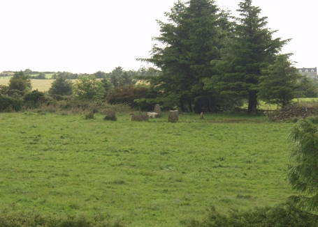
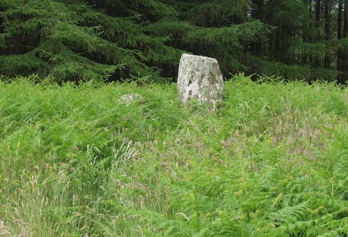
Lettergorman (North) — Images07.07.03ce
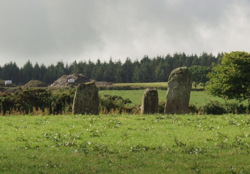
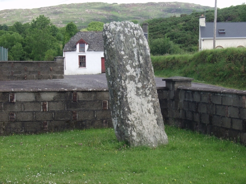
Dromore School — Images07.07.03ce
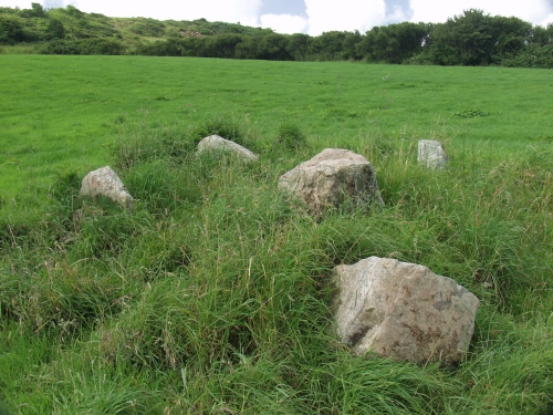
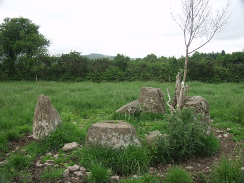
Inchybegga — Fieldnotes07.07.03ceParking in the farmyard, follow the track through the farm, which eventually snakes up the hill (it’s marked on the OSI map). The stones are beyond the second gate on the track. I found it difficult to make out the form of the circle, which doesn’t seem to follow the Irish RSC pattern. I may just not have seen it, as all the stones are quite low, only about a foot or so high. A nice setting though, even if the stones aren’t that great. The map also shows a Standing Stone and Burial Ground close by, but I didn’t spot them. Inchybegga — Images07.07.03ce
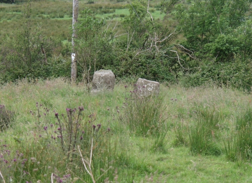
Cullomane — Fieldnotes07.07.03ceLooking at the map, this sits beyond a farmhouse at the end of a trackway. I followed the track past the house, but couldn't see anything of note. I was being watched by a clan of kids, so couldn't go past the gate to see what was further in the field. Clodagh Row — Fieldnotes07.07.03ceI could barely make these out from the road, above all the vegetation. It's no surprise I couldn't find the Clodagh circle on the ridge on the opposite side of the road with this level of growth... Clodagh Row — Images07.07.03ce
Cullenagh — Fieldnotes07.07.03ceFourwinds reported on his website that a ‘demon dog’ from the adjacent house guards this site. As I parked the car, a dog did indeed come bounding out, barking aggressively. The dog’s owner soon followed, and I explained that I wanted to see the stones in the adjoining field. She was very friendly, coming from London (Wembley) herself, and was amazed when I told the story of the ‘demon dog’. I made friends with both her dogs, and used her garden to take photos of the stones themselves. Sadly, I couldn’t get into the field to see the circle close up, due to the presence of a couple of young bullocks, but it’s plain that only two stones remain of the circle. If you do visit here, the house owner desperately misses a good English cheese and I’m sure would appreciate someone dropping some in! Cullenagh — Images08.07.03ce
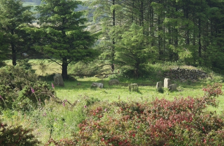
Inchireagh — Images08.07.03ce
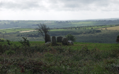
Maughanaclea NE — Images08.07.03ce
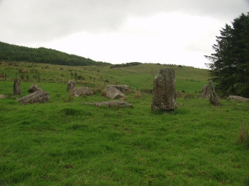
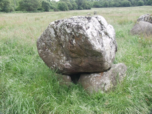
Breeny More — Fieldnotes08.07.03ceI could only get the barest glimpse of these stones. The cows I saw weren't as friendly as the ones in the pictures here, and had horns. Bullocks! Kealkil — Fieldnotes08.07.03ceA wonderful site, well worth the climb up the hill. There is now a rather obvious unlocked sprung gate, with the now obligatory 'No Trespassing' sign attached, leading to the site from the top of the hill. It took some time to traverse the boggy ground leading to the stones, and approaching the site I was sure there was a recumbent sheep guarding the way. It turned out to be a smooth boulder, outside and away from the main complex. The cairn has a couple of bushes growing well in the middle, but I was amazed at the intricacy of the cairn and the sheer number of stones. The uprights have a very pronounced male/female aspect to them, but I couldn’t spot any glaring alignments to them in the surrounding scenery. I’ll confess I was so blown away by the cairn, uprights and views, I didn’t really take much notice of the circle at the time. I did notice the gradation appeared to be opposite to other circles in that the stones increase in height toward the axial stone as opposed to the more usual decrease in height. I must study my photos closer. Mill Little — Fieldnotes08.07.03ceA confusing site. I’d come here for the Boulder Burial, but other aspects intrigue. There appears to be a ruined circle, what looks like a ‘mini-cove’ enclosing a cairn, and a couple of large boulders which may have been burials in their own right at some point in the distant past. All accompanied by the sound of running water from the nearby river. Too much for me to make sense of. Mill Little — Images08.07.03ce
|
7th July 2003ce Edited 7th July 2003ce
ocifant's TMA Blog
Latest TMA Blog Posts
|
Comments (0) |
|
| You must be logged in to add a comment | |