|
|

|
thesweetcheat’s TMA Blog |
|
Lakeshore and dark peak – Carmarthen Fan 26 February 2011
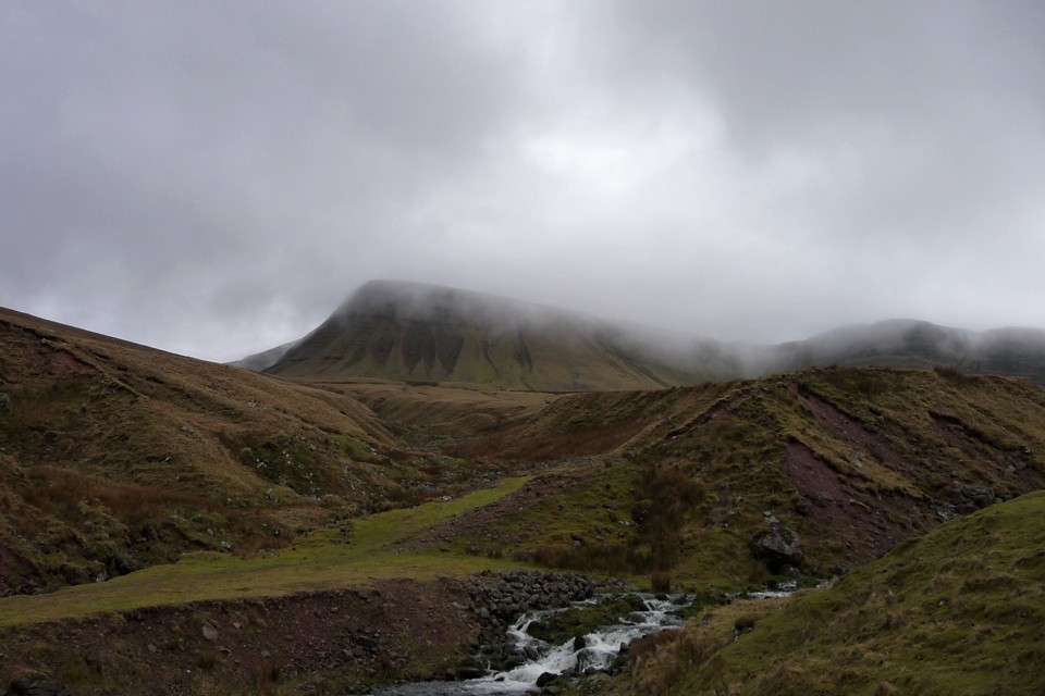
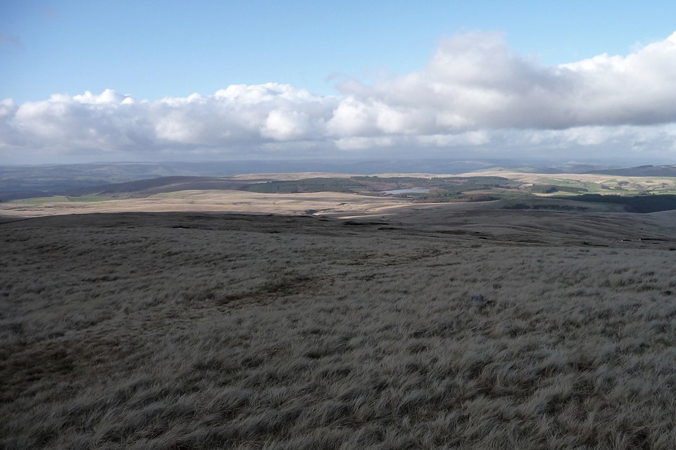
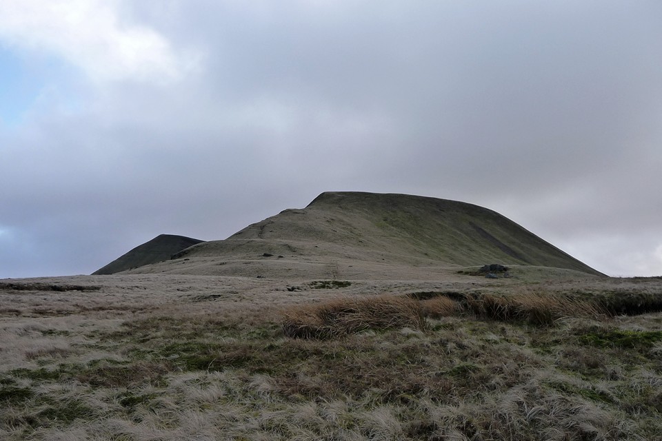
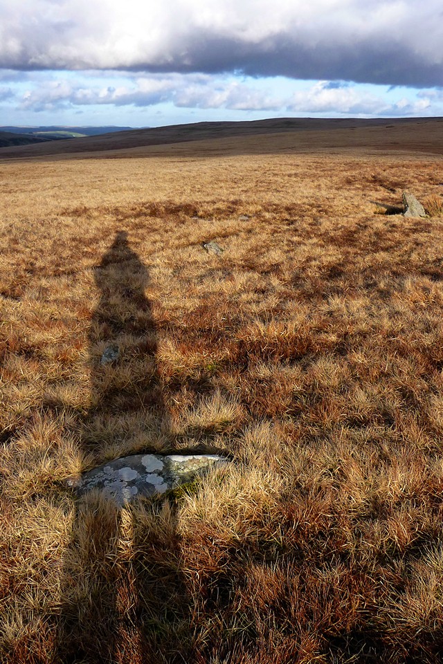
| An invite to join some friends on a late-winter circuit of the Carmarthen Fans, the most westerly of the four mountain ranges in the Brecon Beacons National Park, is one not to be sniffed at. I first visited the summits of Fan Hir and Fan Brycheiniog on a summery solo walk that took in Cerrig Duon & the Maen Mawr, but on that occasion the next summit of Picws Du looked a long way off. A month ago I made the long trek to the isolated and wonderful Nant Tarw circles, in a bitter cold that enveloped the peaks in an eerie blue and only served to increase my desire to get back out into these hills. Visiting this area on foot is difficult, the bus routes don’t come that close and are in any case infrequent, catering for a limited amount of passengers on their way to the hubs of Llandovery or Brecon. It becomes apparent from our circuitous route to get here, via Trecastle, that even by car this is a remote place, roads into the vast tract of open countryside north of the mountains being largely absent. We park up just past Blaenau, at the end of the narrow road that follows Cwm Sawdde. This, incidentally, is the start-point suggested by Gladman, and it’s a good place to begin. From here a broad track will take us southeast then south alongside the tumbling, white-water stream that leads eventually to the first of today’s objectives, the legendary lake of Llyn y Fan Fach (“Small Lake of the Beacon”, to distinguish from its larger sibling, Llyn y Fan Fawr). As we make our way up the track, a steady climb, the mist to our south parts occasionally to reveal glimpses of a black wall of towering rock. This is the escarpment of Y Mynydd Du, the Black Mountain, playing hide and seek with us for the moment, but revealing enough to show us that there is a formidable climb ahead. Over to our left, the unmistakable fork-tailed shape of a red kite swoops and glides as it quarters the empty moorland below the escarpment, looking for sustenance in this inhospitable landscape. Picws Du, Y Mynydd Du — Images27.02.11ce
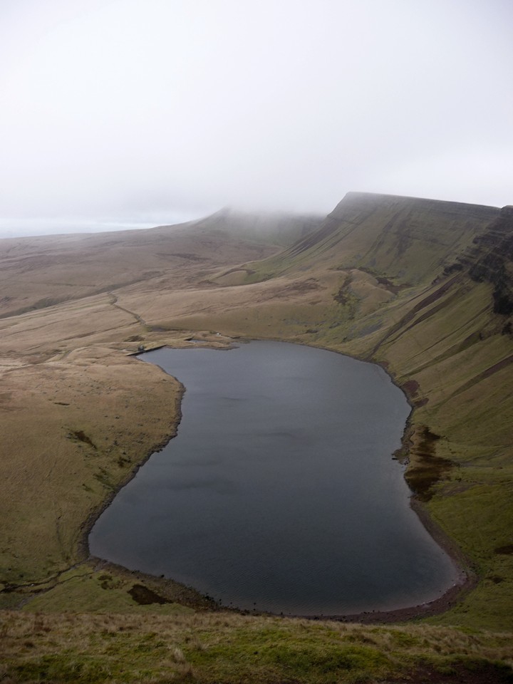
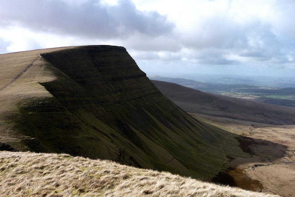
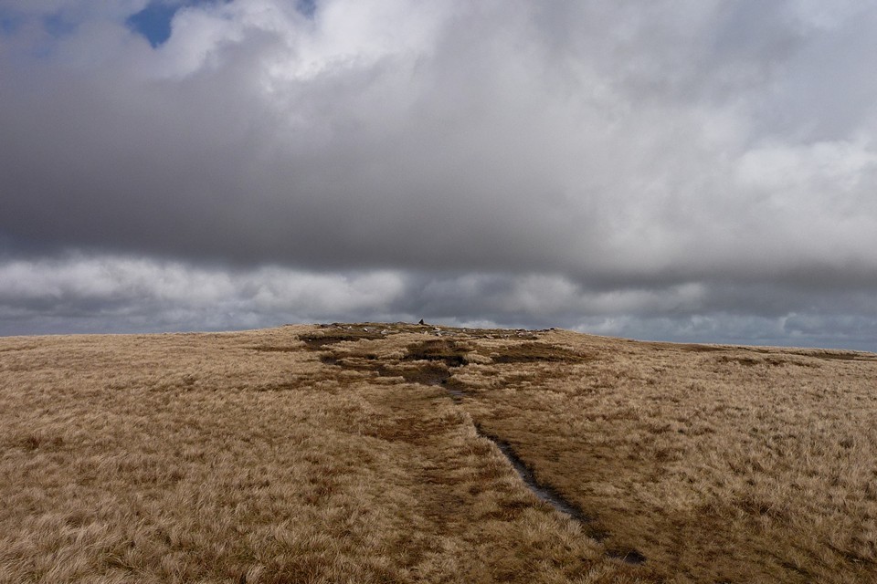
The lake itself, when at length we reach it, is grey and opaque today, not yielding any of its secrets to casual visitors. Above tower the cliffs of Picws Du, topped with a Bronze Age cairn that cannot be seen from below. So I guess we’ll have to go up if we want to see it. From the little single-roomed stone bothy next to the lake, a slight path heads almost due east up the flank of Waun Lefrith, steepish at first and getting steeper as the top is approached. I temporarily leave my companions behind here, not for any reasons of competition or nonsense like that, just because I’m keen to get up to see the views and also to seek a little solitude in this enormous landscape. Looking back as I pause for breath, the top of Picws Du is now emerging from the mist as a flattish summit, jutting forward from the escarpment and providing a backdrop for Llyn y Fan Fach, already seeming far below me. Picws Du, Y Mynydd Du — Images27.02.11ce
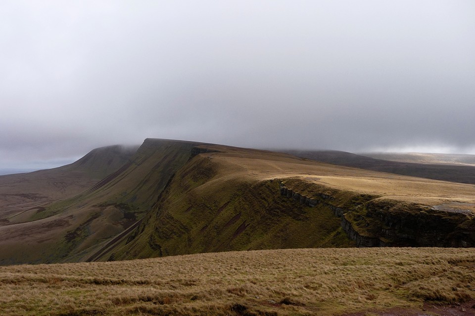
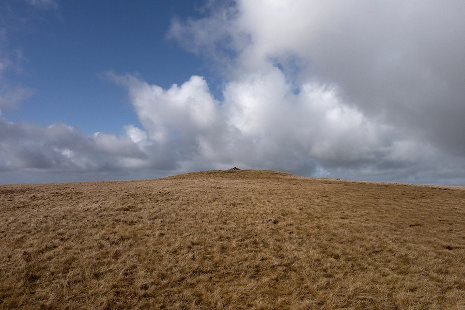
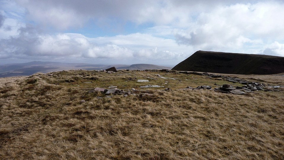
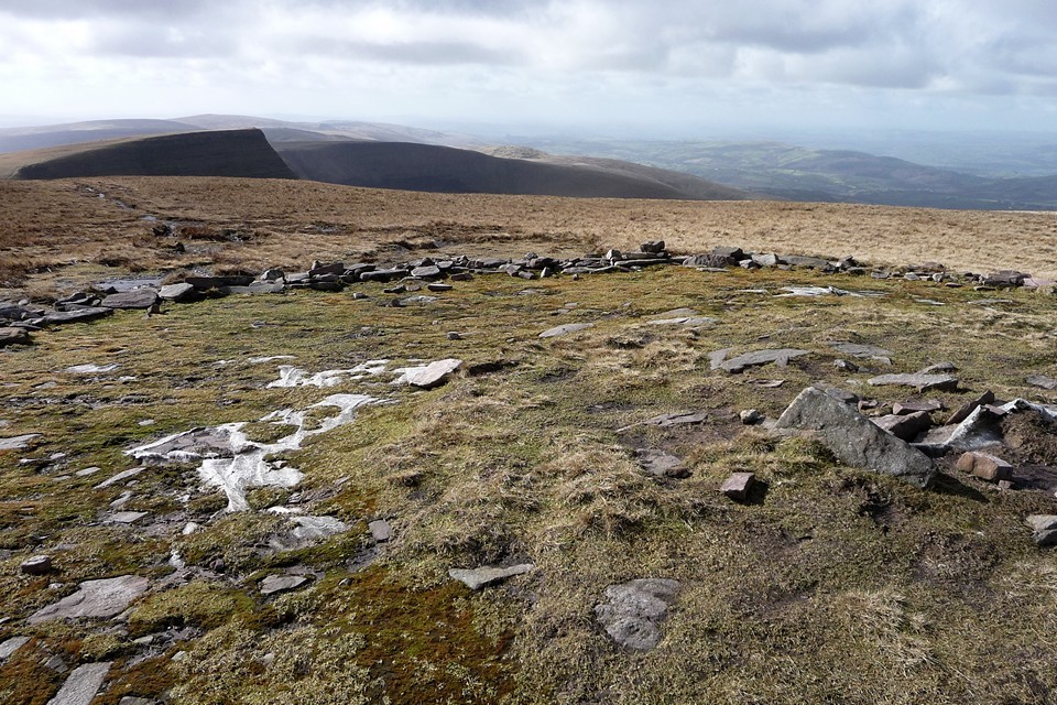
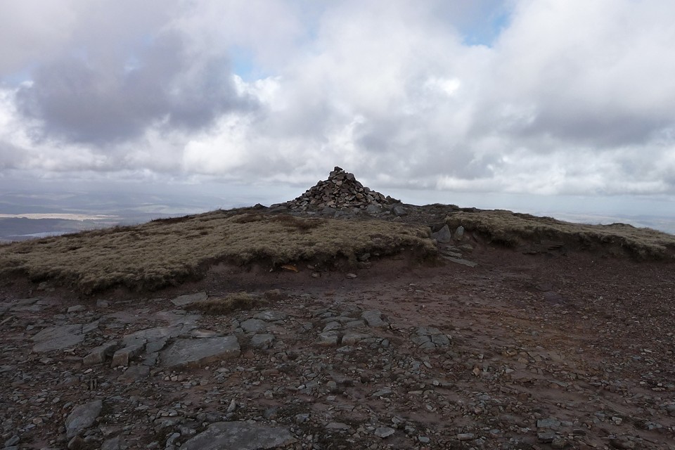
The walk from here to the summit of Picws Du, with its attendant cairn, is gentle enough, with little descent and re-ascent between the two peaks. The views are terrific though, especially from the cliffs of Cwar-du, where the ground drops dizzyingly to the lovely lake below. An awesome spot, especially as the sun bursts through the mist to paint a patchwork of light on the browns and greys of the uplands below us. Picws Du, Y Mynydd Du — Fieldnotes27.08.13ceAs the Picws Du summit cairn comes into view, it becomes apparent that it has a very decent sized footprint, but is now quite low, with a smaller walkers’ cairn plonked on the top, possibly/probably made from stones from the original monument. There are some pretty big blocks in the original though and the footprint suggests it would have been a big cairn. In any case, the setting more than compensates for any deficiencies in the cairn itself. The views north over the escarpment edge are awe-inspiring, even on a day of fairly short visibility like today. And as we stop to take it all in, the mist lifts properly and blue skies open above us. Ah, what a wonderful world. And what a place to be interred. Incidentally, the name is obscure – the Nuttalls translate it as “Black Peak”, but I’ve not managed to find a translation for “picws” in any Welsh dictionary yet, so I’m not sure of this. Any ideas? Picws Du, Y Mynydd Du — Images26.08.13ce
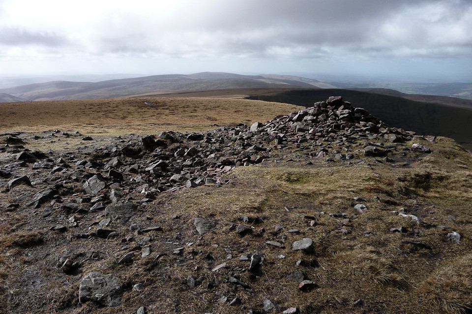
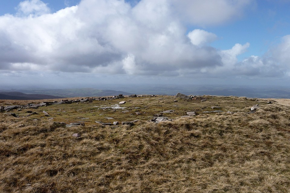
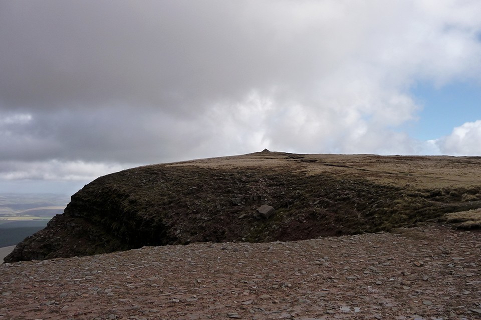
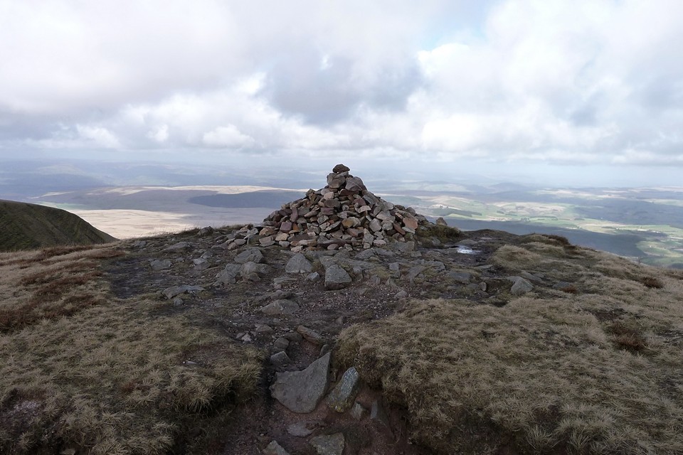
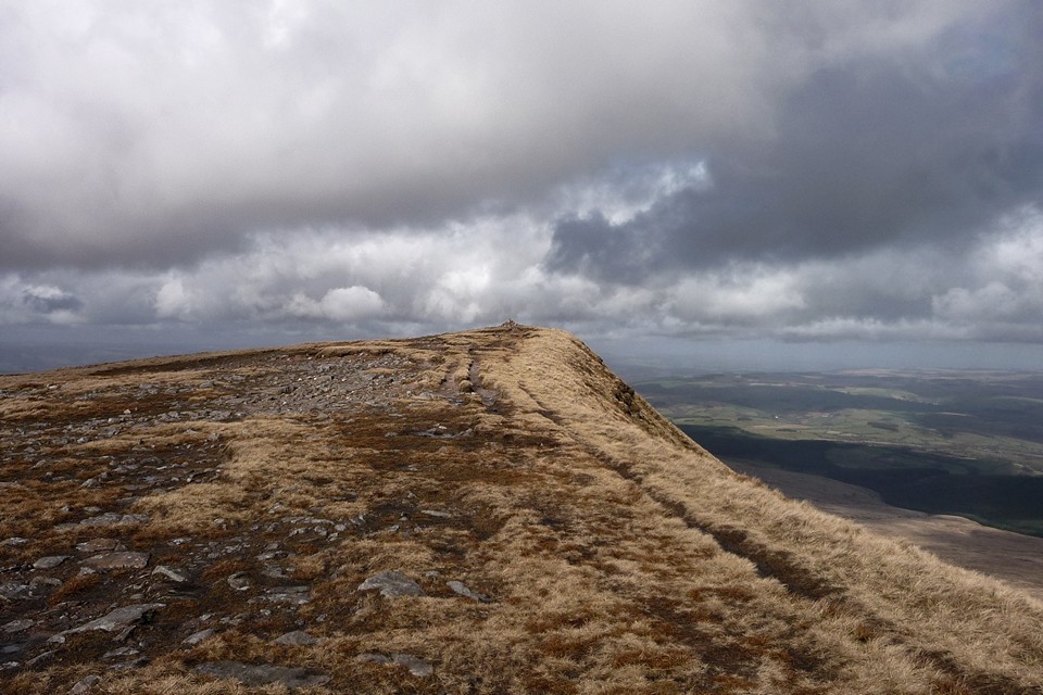
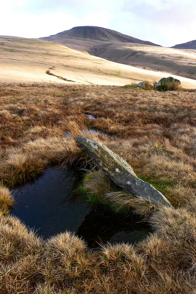
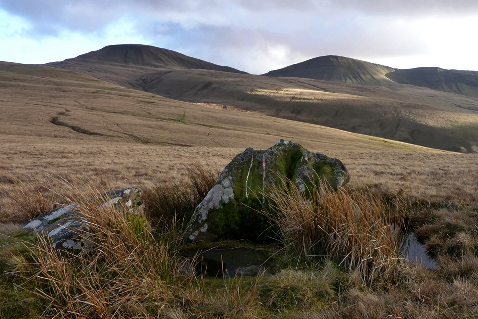
Fan Foel — Fieldnotes27.08.13ceThe route from Picws Du to the next cairn, on Fan Foel, is easy enough but includes a fairly steep up-and-down, via Bwlch Blaen-Twrch (“pass of the boar's summit”). Once negotiated, there is a fine high-level retrospective view of Picws Du summit before we head over to the magnificent cairn placed right at the apex of the escarpment, the point where Carmarthenshire meets Powys/Brecknockshire. Was this always a territorial marker? If it was, it’s a high place for the people of power to agree upon their frontier. And perhaps such a person was laid to rest here, interred within a sizeable kerb of red sandstone blocks. If he or she were the monarch of all they surveyed, they certainly ruled over a far-reaching territory, for the views are extensive indeed, stretching eastwards to the twin summits of Pen-y-Fan and Corn Du then further away to the Black Mountains, with many other cairned summits in between. And yet the archaeological record reveals perhaps something rather more intriguing and human than a story of powerful warriors. A child was buried here, possibly garlanded with meadowsweet flowers. If only these stones and mountains would share the memory of that little sliver of history, what a tale they might tell. This cairn is ignored by many walkers, hurrying between the “tops” of Piws Du and Twr y Fan Foel/Fan Brycheiniog. But sadly enough come here to cause damage to the structure, which is what prompted the excavation and exposure of the magnificent kerb and half-buried cist. Probably the best of cairns on the main escarpment of Y Mynydd Du, this place will richly reward any TMAer making the trip. Fan Foel — Images27.02.11ce
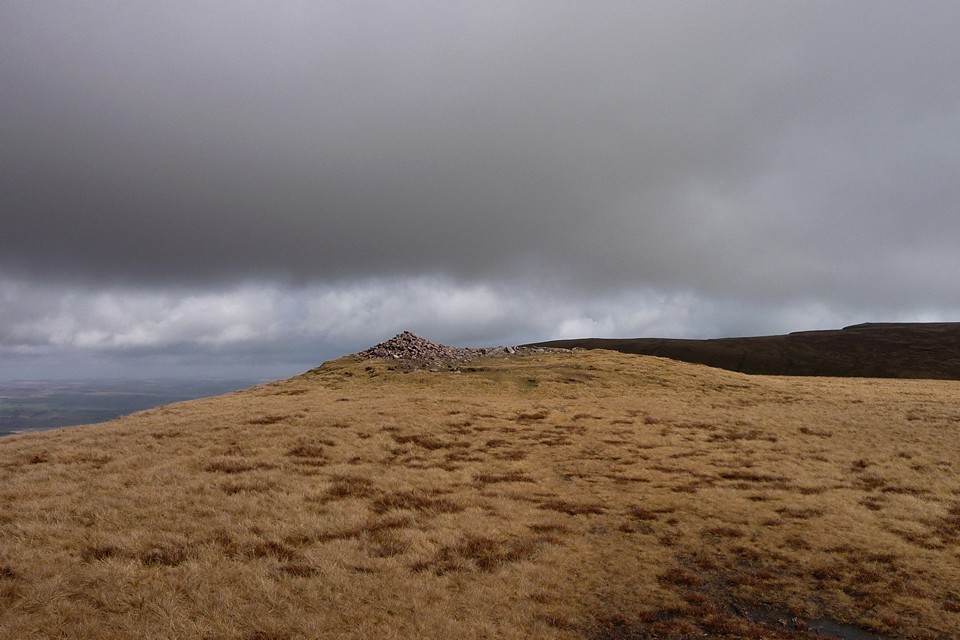
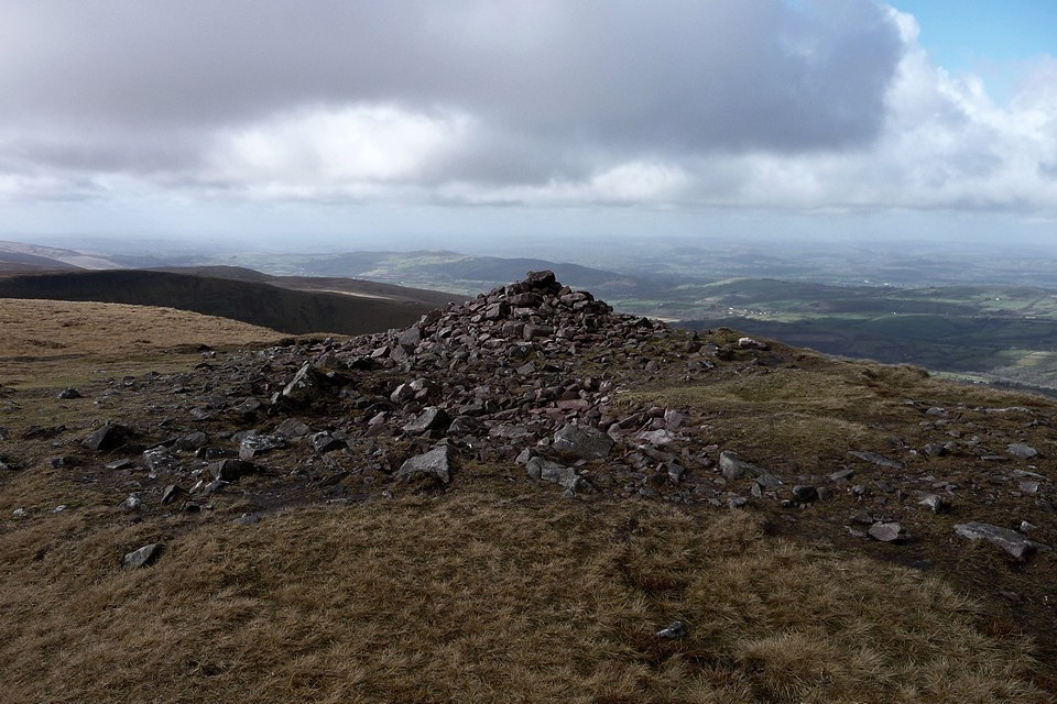
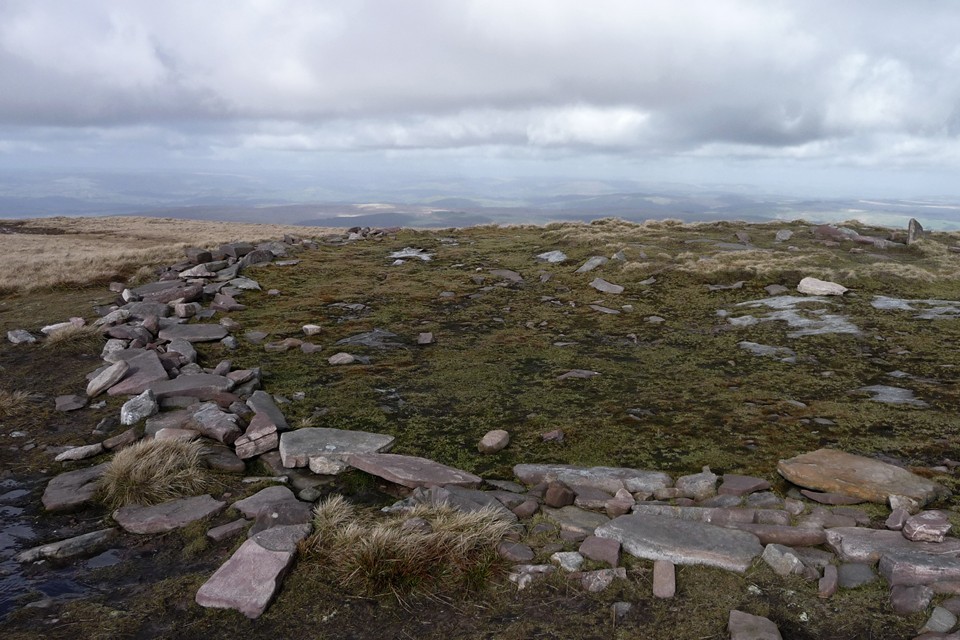
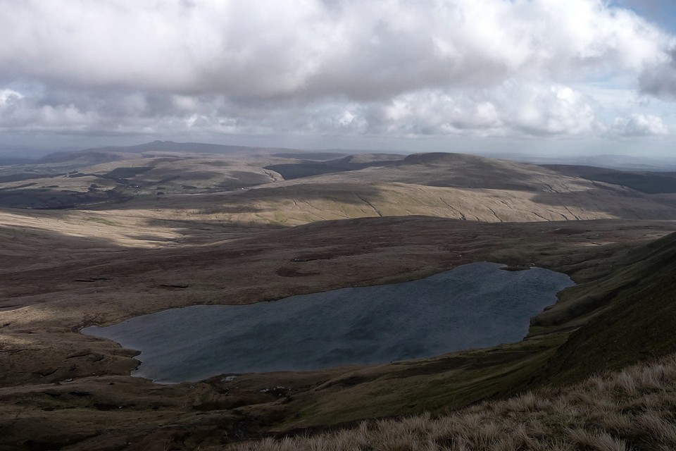
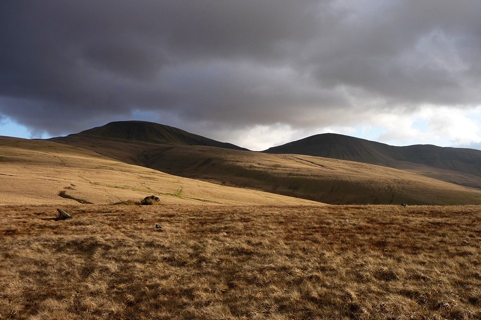
Twr y Fan Foel — Fieldnotes27.08.13ceFrom Fan Foel, it’s not far at all to the next of today’s cairns, Twr y Fan Foel. Last time I came here from Fan Hir, a walk that is do-able using the Neath-Brecon bus service, but there’s no doubt that today’s approach is more satisfying. The cairn itself is a bit of a wreck, eroded at its base and piled into a silly cone. Purely as a structure of earth and stone, it lacks the charm of the wonderful ring on Fan Foel. But the view is astonishing. The ground drops away to north and east, and this is perfect viewpoint for the second of today’s mountain lakes, Llyn y Fan Fawr. From up here, it’s hard to believe that the lake itself is located at as-near-as-dammit 2,000 feet up. The cairn is at the highest point of Y Mynydd’s Du magnificent escarpment and boy, what a place for a monument. Worth every bit of energy and effort to get up here. Sadly we don’t linger so long at this one, my companions are getting hungry and a bit further along the escarpment, at the southern summit, there is a drystone shelter that has been identified as our lunch spot. There’s nothing on Coflein to suggest that this shelter has been fashioned from an ancient cairn, so I can feel relaxed about making use of it. For all that the sun is shining, it’s still bitterly cold up here and a stop of any duration is going to see a sudden drop in body temperature. It’s here that we meet the only other people that we’ll see today. Not far to the SW of the summit is the spot where an Avro Anson crashed in thick cloud and rain, back in peacetime 1939, a stark reminder of just how bad the weather can get in and above these mountains. Twr y Fan Foel — Images27.02.11ce
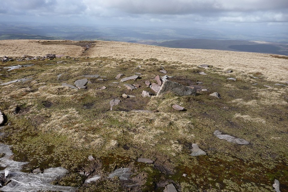
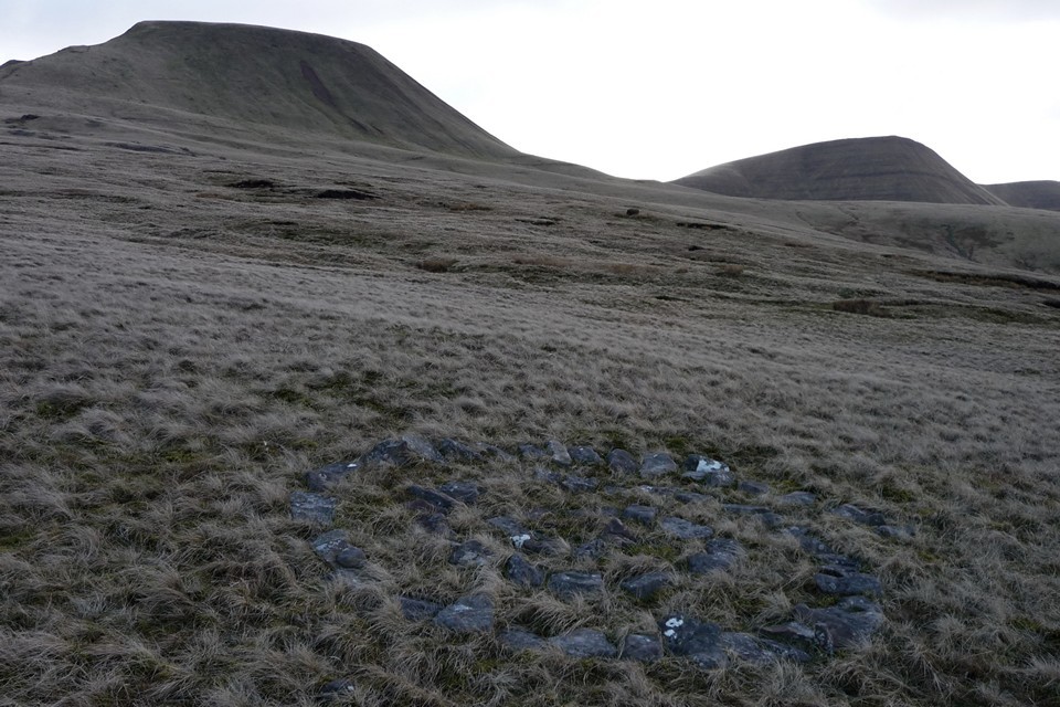
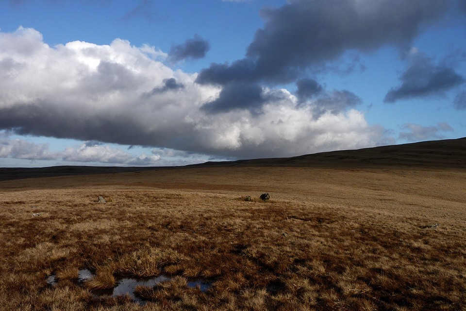
Suitably refreshed, it’s time for the big descent. We follow the escarpment down to Bwlch Gledd, from where the Beacons Way basically goes over the cliff! Luckily the path has been resurfaced recently, but this is still a tricky, slippy route that takes us, rather gingerly, down to the edge of lovely Llyn y Fan Fawr. Everyone has rubbery legs by the time we get to the bottom! We follow lakeshore and escarpment foot, basically retracing our earlier route, but 200m lower down. Rhyd-wen Fach stone setting — Fieldnotes27.08.13ceOne of the main attractions of this walk for me, apart from the brilliance of the summit cairns, is the two stone circles shown on the OS map along our return route. The second, Bannau Sir Gaer, is the better known, already visited and chronicled by Postie. But the first is virgin TMA territory. Coflein are dismissive of the site, and on getting here it’s easy to see why. We found the narrow track that the OS map shows as bisecting the site easily enough, but it crosses an area of plentiful small stones. Some are vaguely upright, but it would take a determined eye to be convinced that there is a circle here, unless we’ve missed something. My companions were certainly not impressed! Not far from the site, we came across a neat little spiral of blocks, half-hidden in the tufty grass. Someone has spent time here, to make that. To be fair, the setting is lovely, with the pointed prows of be-cairned Twr-y-Fan Foel and Fan Foel providing the main focal points. To the north, the land gradually slopes away towards Nant Tarw, although the circles aren’t visible from here, as far as I could tell. We head away from the setting across the tussocky, peaty moor of Waun Lwyd, close to the source of the river Usk/Afon Wsyg, one of South Wales' major rivers, which passes close to the Nant Tarw circles as well. It may be significant that the Tawe, another important river, rises not far away to the east, before passing Cerrig Duon & The Maen Mawr. There’s certainly plenty of scope for water-based theory and speculation about the siting of these monuments. Rhyd-wen Fach stone setting — Images01.03.11ce
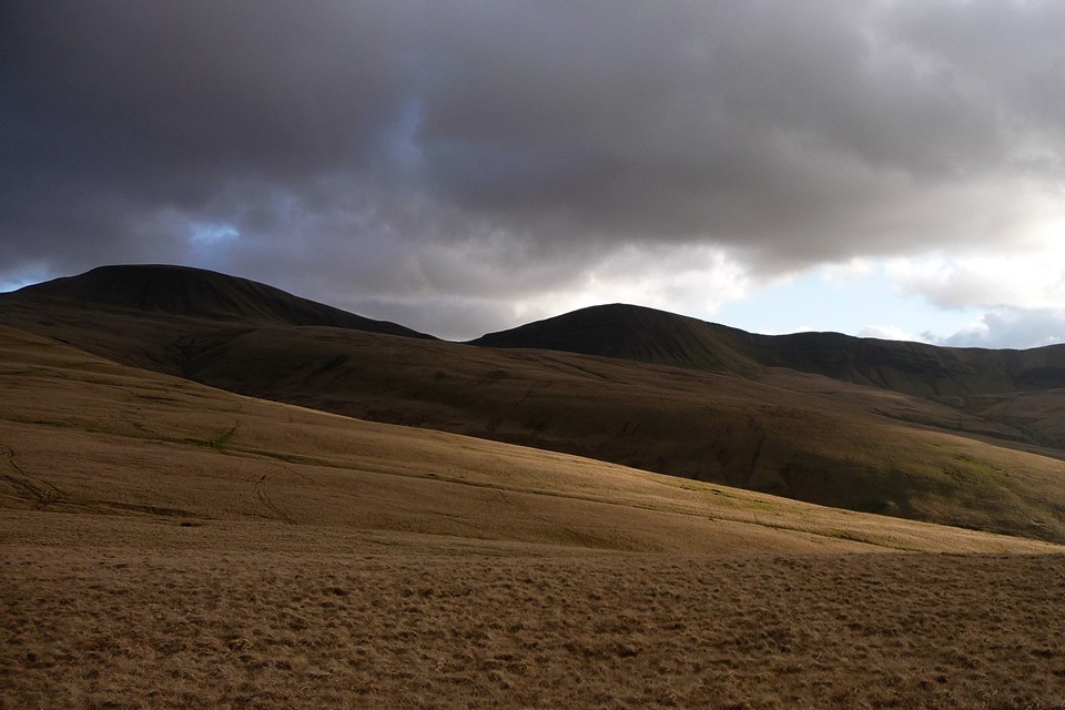
Bannau Sir Gaer — Fieldnotes27.08.13ceThe final site of the day proves to be a winner. By the time we reach Bannau Sir Gaer, all but one of my friends has had enough, and don’t even make the effort to leave the path the look for this. The one who is left at least comes to the circle, but isn’t massively impressed, to be honest. Which just shows that this game isn’t for everyone! And so it comes to be that I’m left here on my own for a while, just as the sun re-emerges to illuminate the site in a golden glow, while the mountain backdrop is silhouetted into a wall of dark browns and black shadow. Spectacular. The circle is a wreck, it doesn’t matter a bit. A fine addition to the utterly compelling megalithic complex spread across these wild uplands. Picws Du, Y Mynydd Du — Images01.03.11ce
Bannau Sir Gaer — Images01.03.11ce
|
 Posted by thesweetcheat
27th August 2013ce Edited 1st February 2023ce
thesweetcheat's TMA Blog
Latest TMA Blog Posts
|
Comments (0) |
|
| You must be logged in to add a comment | |