|
|

|
thesweetcheat’s TMA Blog |
|
The Cotswold Way I – Chipping Campden – Broadway 16 March 2013
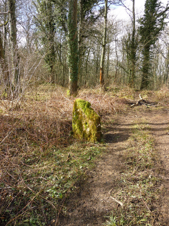
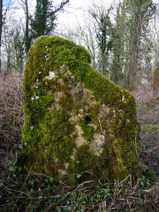
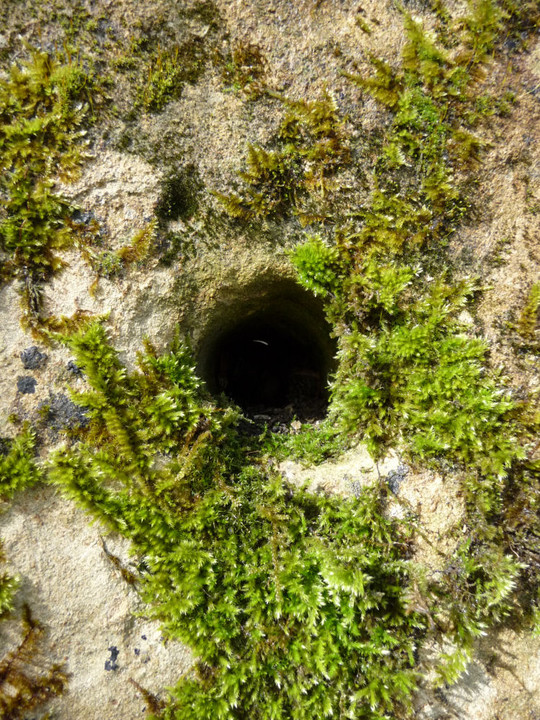
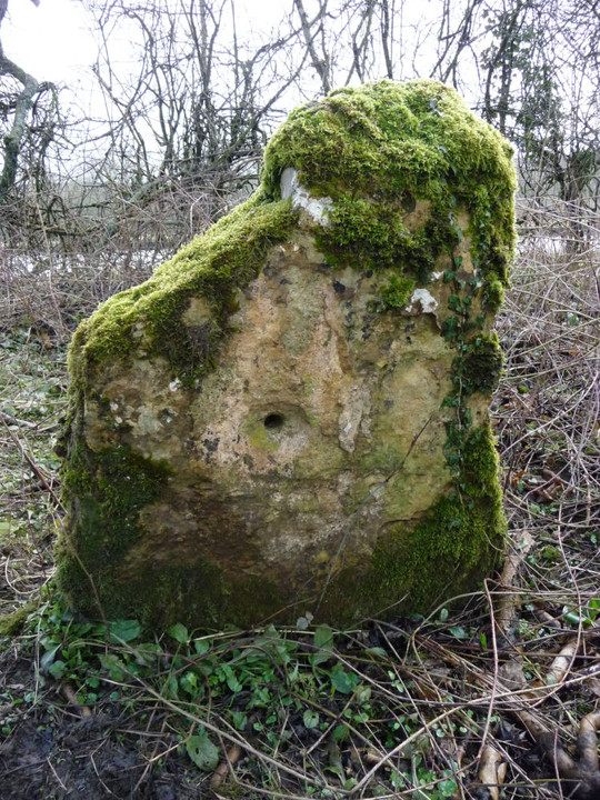
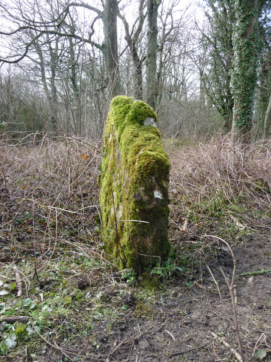
| After ending my recent trip to Meon Hill in the pretty town of Chipping Campden, I thought it about time that I made a bit more effort with the Cotswolds again. Despite living below the edge of yellow escarpment for almost 7 years now, my gaze has tended to be drawn away to the west. Part of the reason has been the constant fascination of Wales, but it’s also partly due to the effects of farming on much of the Cotswolds’ prehistory, from access difficulties to endlessly ploughed barrows and earthworks. But there is also much to enjoy and so I thought I’d have a go at the Cotswold Way, 102 miles along the Cotswold edge from Chipping Campden to Bath. The Way passes close to a large number of prehistoric sites, some familiar to me, some not. While the Wales Coast Path is the main objective for G/F and I over the next few years, this can be my experimental side project, to dabble in occasionally. Hopefully more enjoyable than a drum opera or earnest acoustic set at least. The promise of an unsettled weekend with heavy showers sounds like a good time to get on with it. Getting to the start is a bit of a faff involving two buses, and heavy rain all the way to Moreton in Marsh. By the time the second bus drops me in the centre of Chipping Campden, it’s clearing and the sun is threatening to break cover. Chipping Campden has plenty of amenities and makes for a good start (or end) point for a walk, but I don’t linger today, hoping to make the most of the good weather while it lasts. Out of the town it’s a steady climb along a rather muddy lane to Dover’s Hill. Dover’s Hill enjoyed fame in the early 17th century when the enterprising Robert Dover instituted an annual games here, called the Olimpicks, a couple of hundred years before the better-known Much Wenlock version. There’s no games going on up here today, but there is a superb view. To the northeast, the flat-topped Meon Hill, to the west the bulk of Bredon Hill, with the unmistakeable ridge of the Malverns beyond, all topped with hillforts. To the north, the Vale of Evesham stretches away as far as the eye can see on this rather gloomy morning. There’s a handy toposcope on the highest point of the hill and a cute little limestone seat that reminds me of a miniature chambered tomb. It’s nice to back in the hills, as ever. Kiftsgate Stone — Fieldnotes17.03.13ceAfter drinking in the views for a while, I carry on off the hilltop. Here the Cotswold Way follows a busier road and has been moved off the verge and slightly down the slope, out of sight of the road. But I choose to stick to the verge instead, because my first stop-off of the day beckons. I remember Carl having trouble finding this stone, and as I pass a locked and chicken-wired gate I wonder if it’s going to be particularly accessible. I’m therefore very pleased to see it from the road, through a little gap into the trees. Access is as easy as can be, the stone is only yards from the road (it’s quite a way northeast of the layby that Carl refers to). I didn’t really know what to expect from this “disputed antiquity”. It turns out to be a dinky little irregular limestone slab, heavily moss-covered and orientated with the long side SW-NE, parallel with the road. As reported, it has a (blocked) hole through it. On the NW face of the stone, the hole has the appearance of being counter-sunk, although whether this was intentional or caused by something inserted into the hole being turned and causing wear I can’t say. Apart from the hole, it’s not obviously worked, but the thick moss and the years of wear could easily mask any signs that might be there. I really like it, hidden away and passed by lots of unsuspecting drivers every day. I wouldn’t want to commit to its antiquity, but it’s worth paying your respects if you come this way. A promising start to the day, anyway. Kiftsgate Stone — Images17.03.13ce
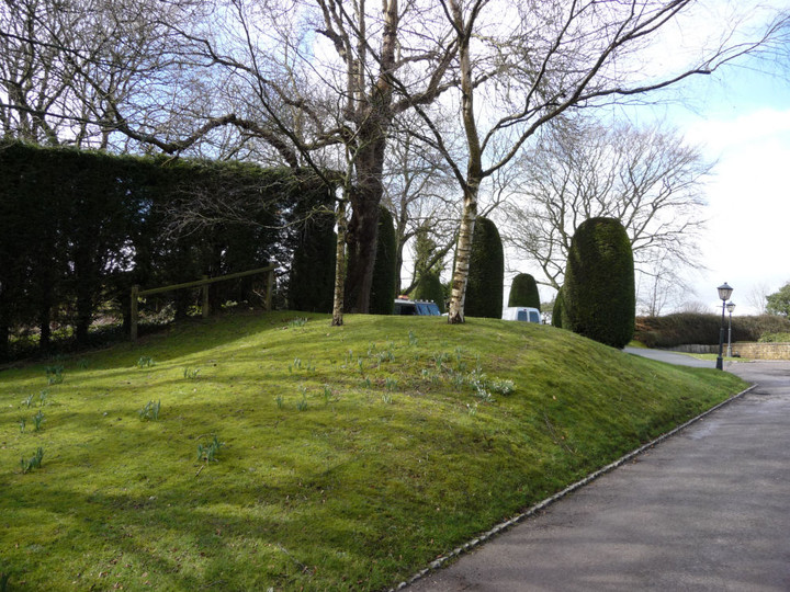
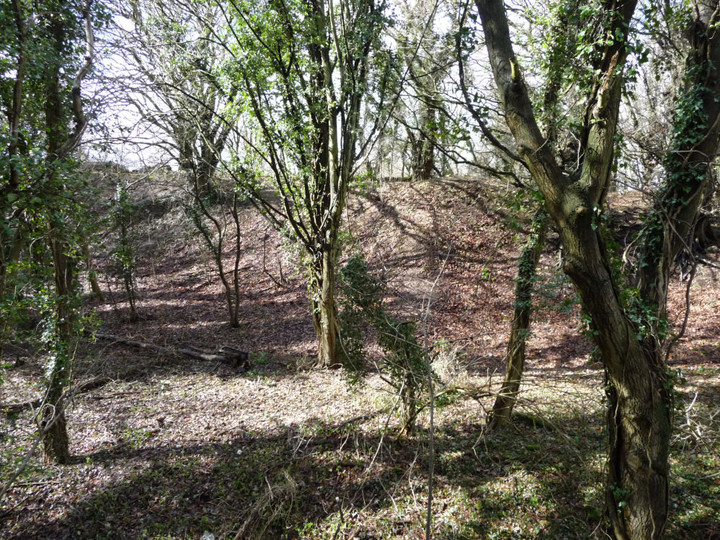
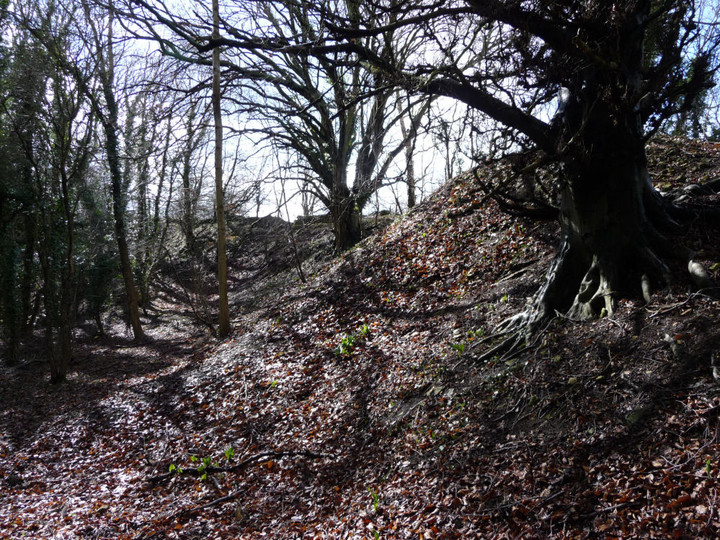
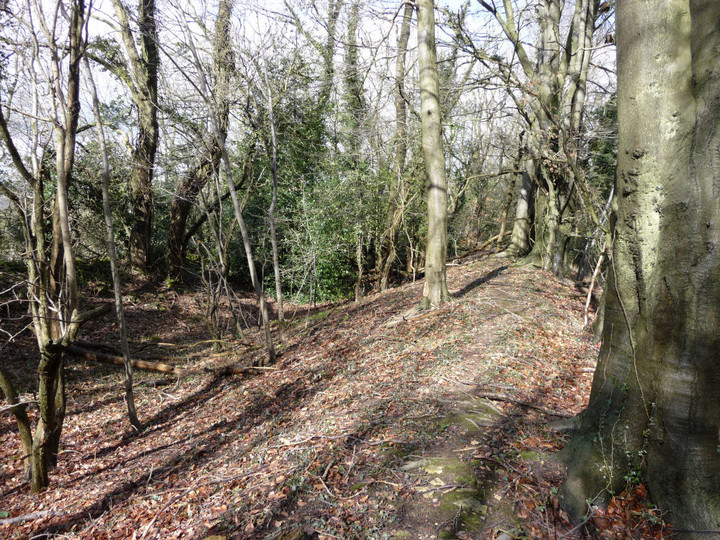
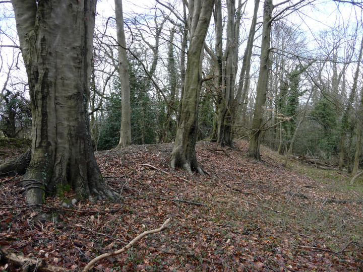
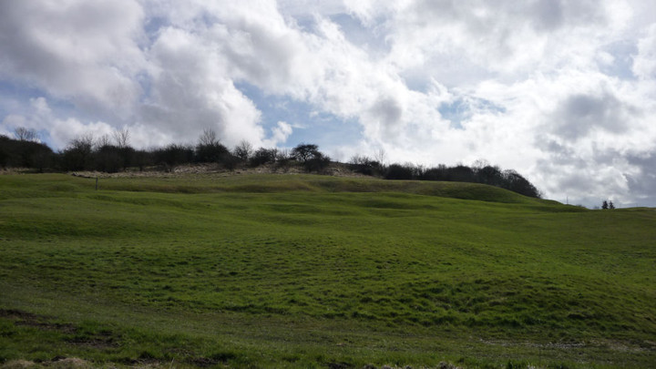
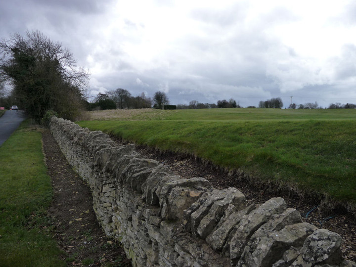
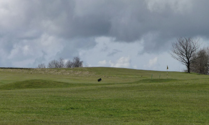
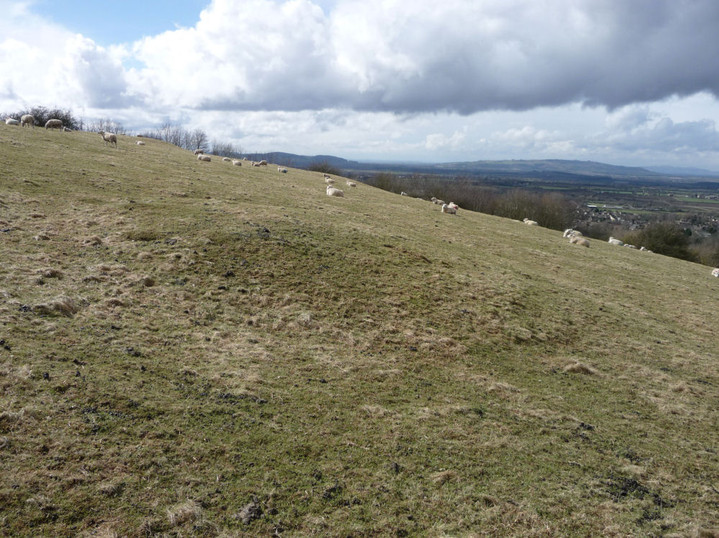
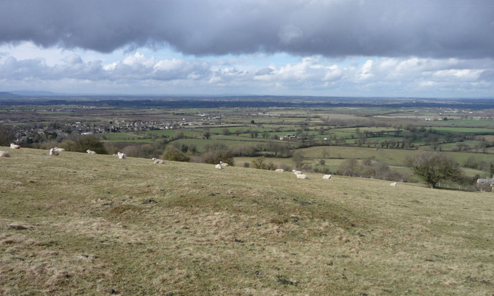
Willersey Camp — Fieldnotes17.03.13ceLeaving Kiftsgate Stone, the Way follows the Mile Drive, a broad, grassy path that would make for easy walking if less wet underfoot. At the end there are two fields of mud to cross (lovely), after which I take my main detour of the day, heading north alongside the Roman Buckle Street. My next site is one that I am not by any means hopeful about. Despite being a very decent-sized fort, Willersey Camp has had the misfortune of having a golf course dumped onto it, the construction of which, according to Pastscape, caused “considerable damage” to the fort. Approaching from the south, any views are obstructed by a thick screen of leylandii, that well-known native Cotswold species. A bit further along the road is the Dormy Hotel, built right on the SE corner of the fort. I walk up the drive towards the reception, hoping to get a bit of rampart action. The drive cuts through the bank and I manage to get a picture in. However, the CCTV signs don’t lie and it’s barely a minute before a uniformed functionary emerges to ask me if I need any “help”. I get the impression that the response “I’d like to have a look at the hillfort” would be as well-received as “I’ve come to steal your silver teaspoons”, so decline the offer and return to the road. The road follows the old line of the eastern rampart, but apart from a bit of “rough” (in the golfing sense) there’s nothing to see here. A low mound can be seen silhouetted on the skyline in the middle of the course and I think this is probably the poor remains of the long barrow. Having been accosted once, I’m not keen to have another go, so I don’t follow Carl’s admirable example. In any case, I’m not acceptably attired for the course, wearing neither a turtleneck shirt, tailored shorts, or golf shoes. I imagine there would be a scene at such a blatant breach of the dress code. I carry on past the clubhouse. As Carl said, the wooded area alongside the road is the place to come. There is indeed quite a bit of litter (tut) but the ramparts here are very impressive. The outer rampart is several metres high, with a slighter, inner rampart that hasn’t been encroached upon by the golf course. It’s a shame the rest of the fort has been so badly treated in comparison, because it must have been a fine site. Willersey Camp — Images17.03.13ce
Willersey Long Barrow — Images17.03.13ce
Meon Hill — Images17.03.13ce
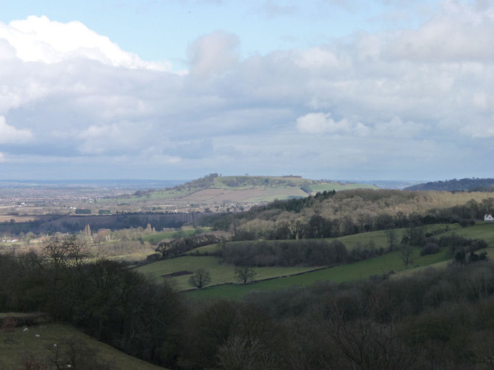
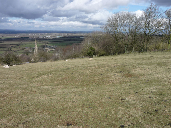
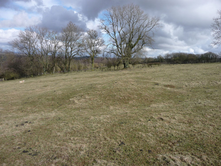
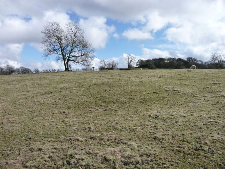
Saintbury Barrow — Fieldnotes17.03.13ceContinuing north, I take a left (west) at the crossroads. A few yards on, a metal right of way sign points south for a bridleway and north for a footpath. I take the latter, for this leads very conveniently to the Saintbury round barrow. This could easily be overlooked as just another ploughed down barrow in the Cotswolds, but Carl’s previous notes indicate that it’s worthy of attention. He climbed up from Saintbury to the north, whereas my route takes me northwards downhill to the barrow. It’s very muddy and the hill seems to teem with springs, so I’m glad to be wearing my waterproofs, even as the sun has now come out. The barrow is quite a way down the sloping field, and is not visible until I’m practically on top of it. Before it comes into view, there is the rather surreal sight of the top of the lofty (ha) spire of Saintbury church appearing below me. The barrow itself is small, but quite well preserved for these parts, with the possible remains of an infilled ditch around it. As Carl notes, the positioning is terrific. Perched just above the steeper part of the scarp, the views are wonderful indeed. To the northeast, trees block Meon Hill fort, but otherwise there is an expansive panorama, from Bredon Hill, the distant Malverns, across into Mid-Wales and at the furthest limit of my sight, Titterstone Clee and Brown Clee, maybe 60 miles away and near where I grew up. The darker, wooded hills in front of them possibly even include Croft Ambrey, the fort I used to visit on Boxing Day walks. Breathtaking. Saintbury Barrow — Images17.03.13ce
Heading back up the slippery slope, I manage to fall over as the mud takes my feet from under me. Luckily it’s all very soft and squidgy, so only my dignity is bruised. Back at the road, I cross over and take the bridleway, which runs parallel with the northern rampart of the fort. Unfortunately, a screen of vegetation and yet more golf fairways block access to this part of the fort. The bridleway is also incredibly muddy and after a while I turn back, caked in mud and feeling a bit deflated. Retracing my steps past the clubhouse, I head south again to rejoin the Cotswold Way. The trip to Saintbury barrow has provided reward enough to justify the detour, so the relative disappointment of the fort doesn’t detract too much. It’s now clouded over again, and back on the footpath across yet more mud, the rain starts again in earnest. I stop off at the Fish Hill picnic area (tables, toilets, car park, weird arrangements of upright limestone) where there is a particularly fine toposcope, carved with a relief map of the Cotswolds and I learn that aligned with Tewkesbury (15 miles away) is New York (3370 miles away). Some ley-line that. From here the path crosses the busy A44 before climbing gently up through woods towards the highest point of today’s walk, at Broadway Tower. The weather doesn’t lend my visit to the tower quite the views it deserves, but I do learn that there is a decommissioned nuclear bunker up here. Hopefully not something that will be needed again! From the tower it’s a very steep descent off the escarpment down to Broadway, with good views of the western flank of Willersey Camp to be had from the path. I’m quite wet and very muddy by the time I emerge onto the streets of Broadway, but nothing coffee and caramel shortbread can’t cure. It’s been a fine start to the Cotswold Way, with a good variety of sites for the TMA-er on the way. I’m looking forward to my next side project dabble. |
 Posted by thesweetcheat
17th March 2013ce Edited 17th March 2013ce
thesweetcheat's TMA Blog
Latest TMA Blog Posts
|
Comments (0) |
|
| You must be logged in to add a comment | |