|
|

|
thesweetcheat’s TMA Blog |
|
On The Hollow Hills – Twr Pen-cyrn 8 January 2011
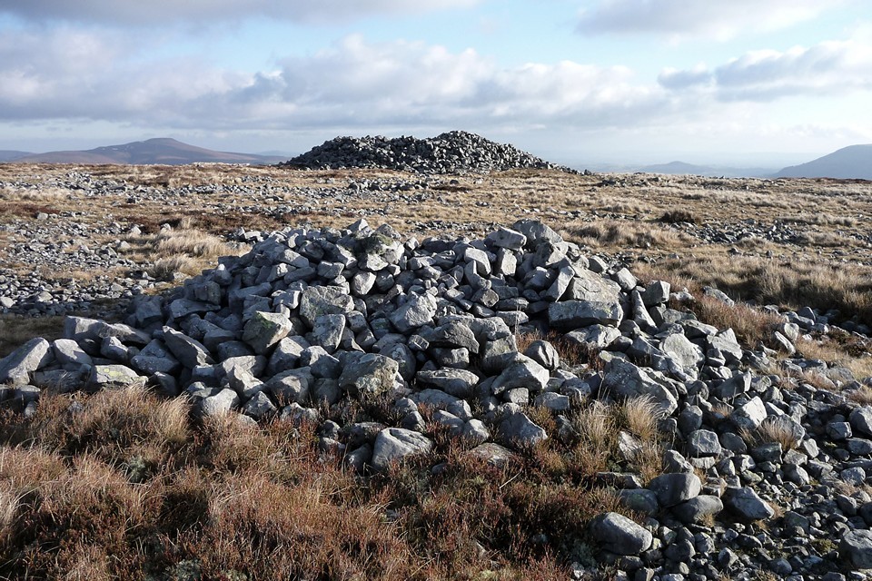
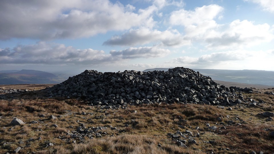
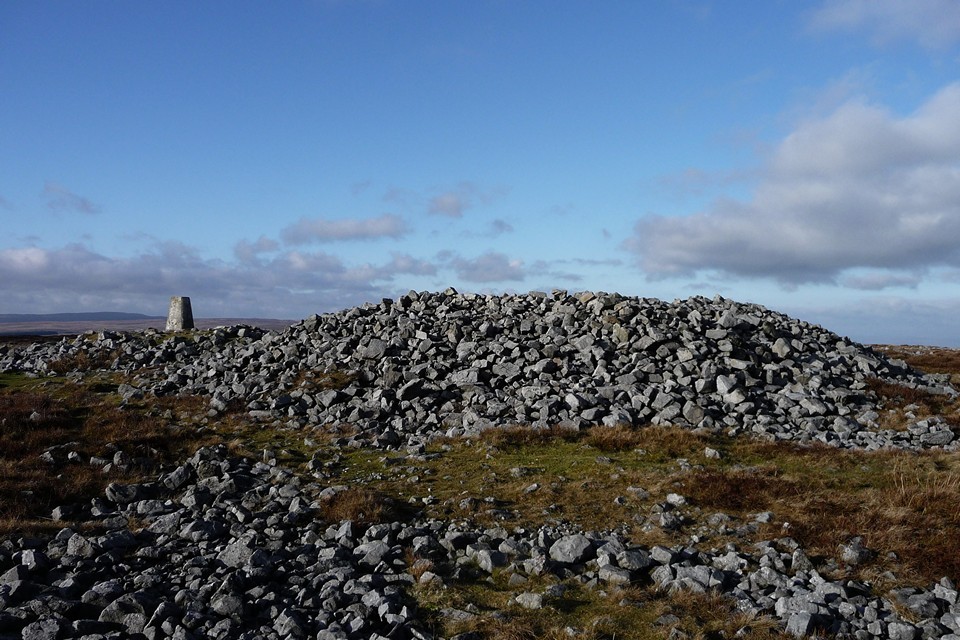
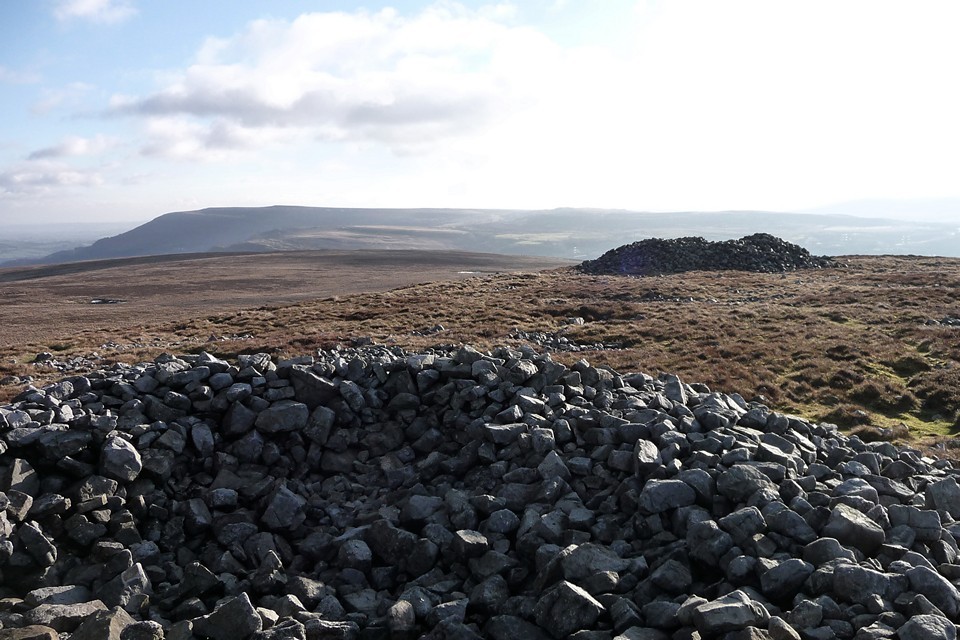
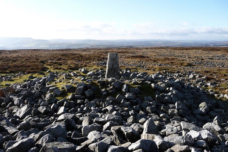
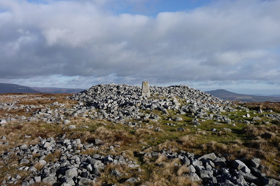
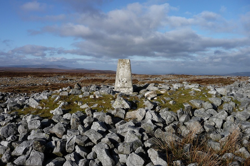
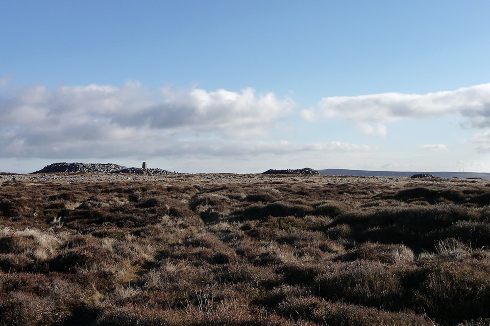
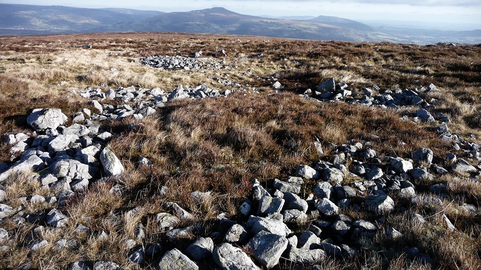
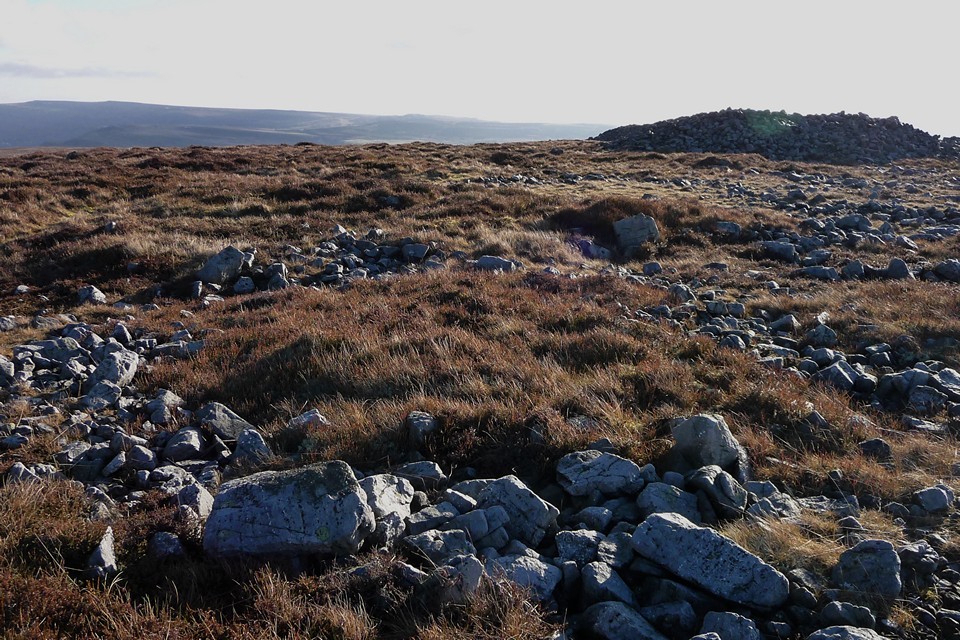
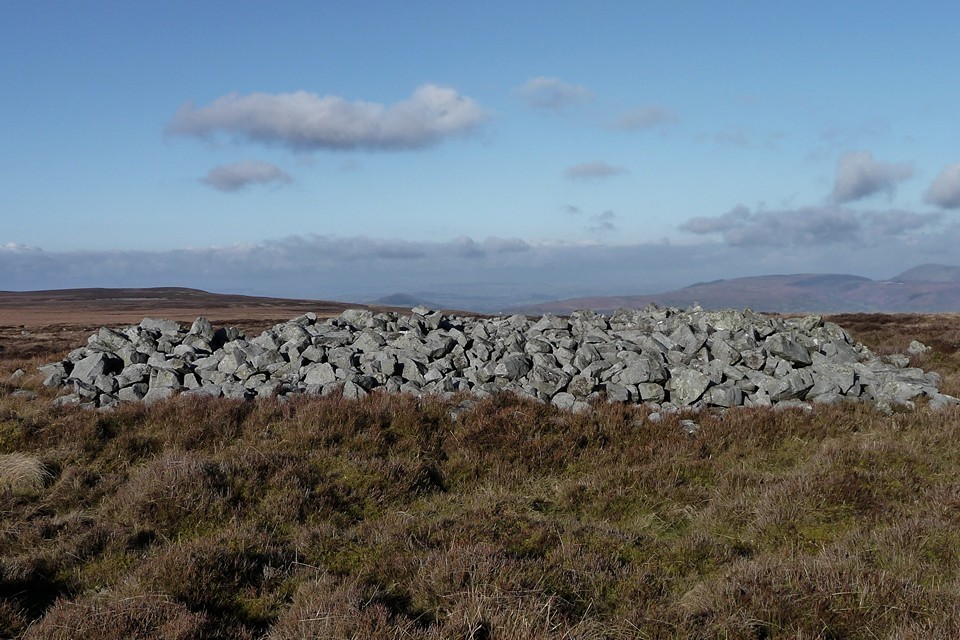
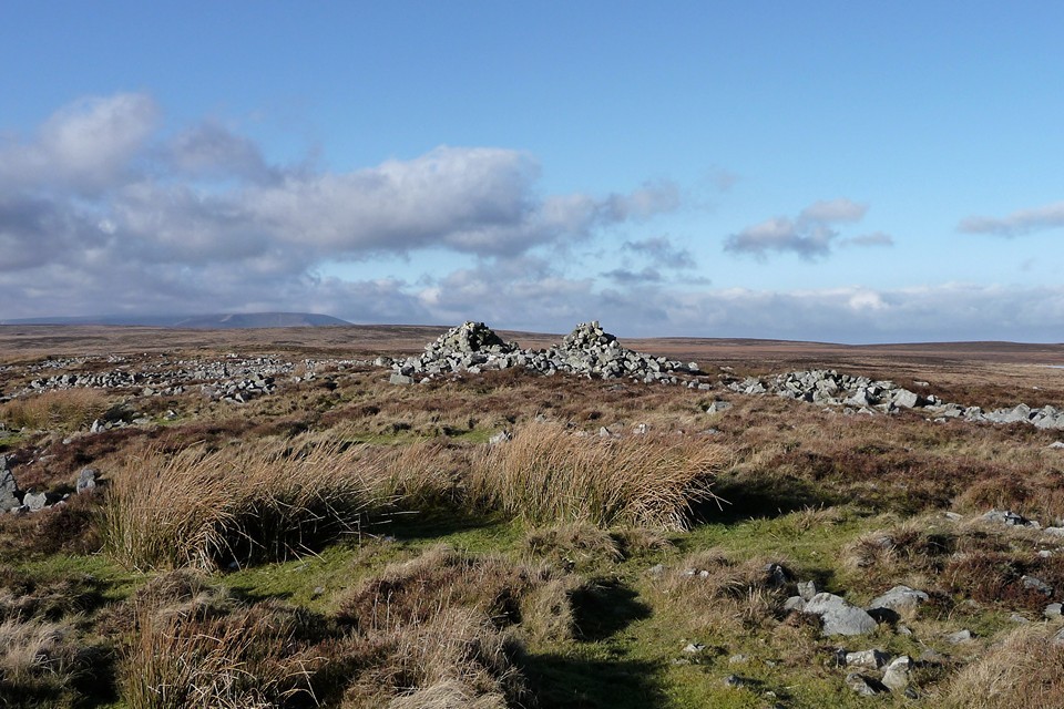
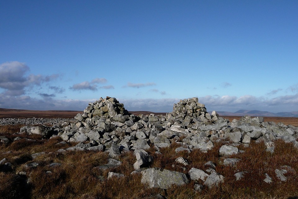
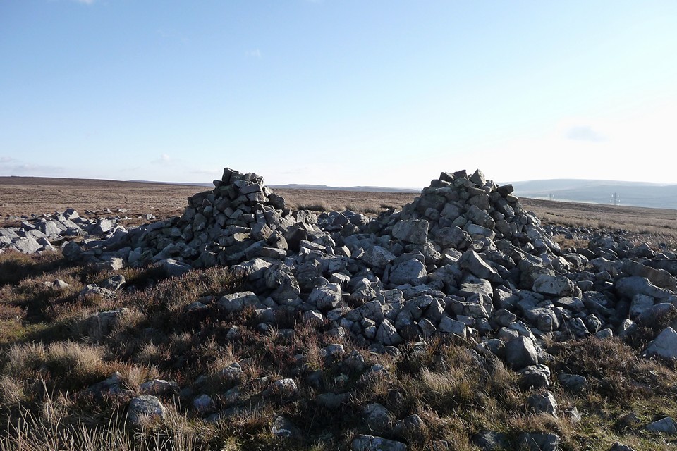
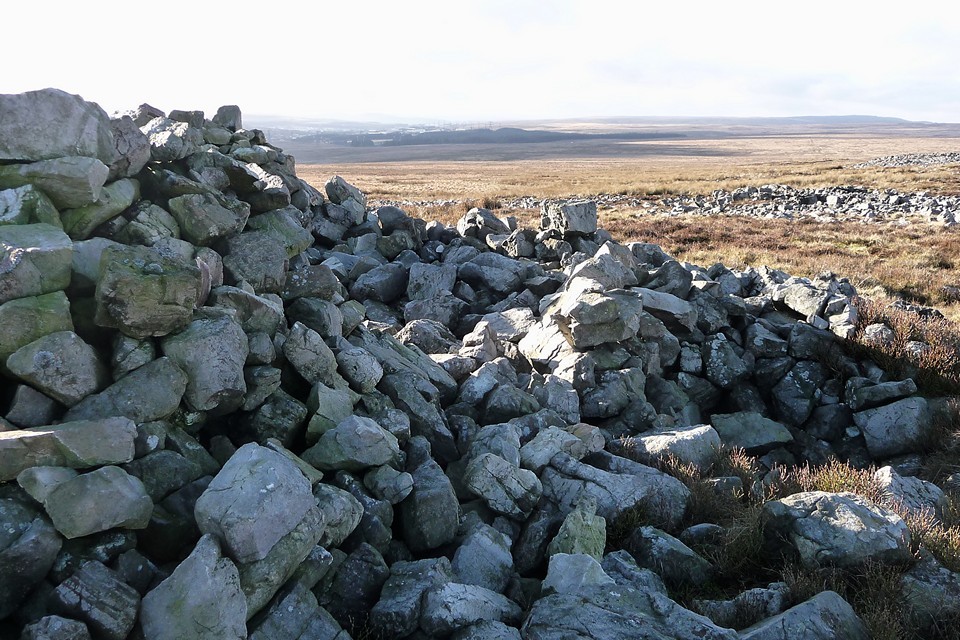
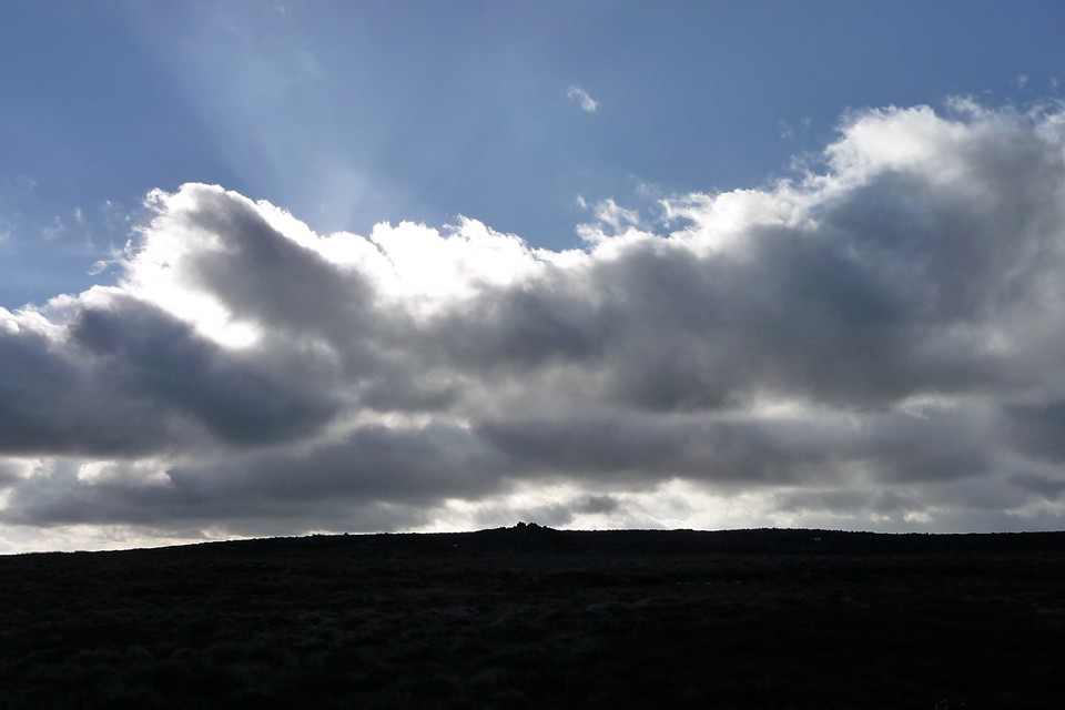
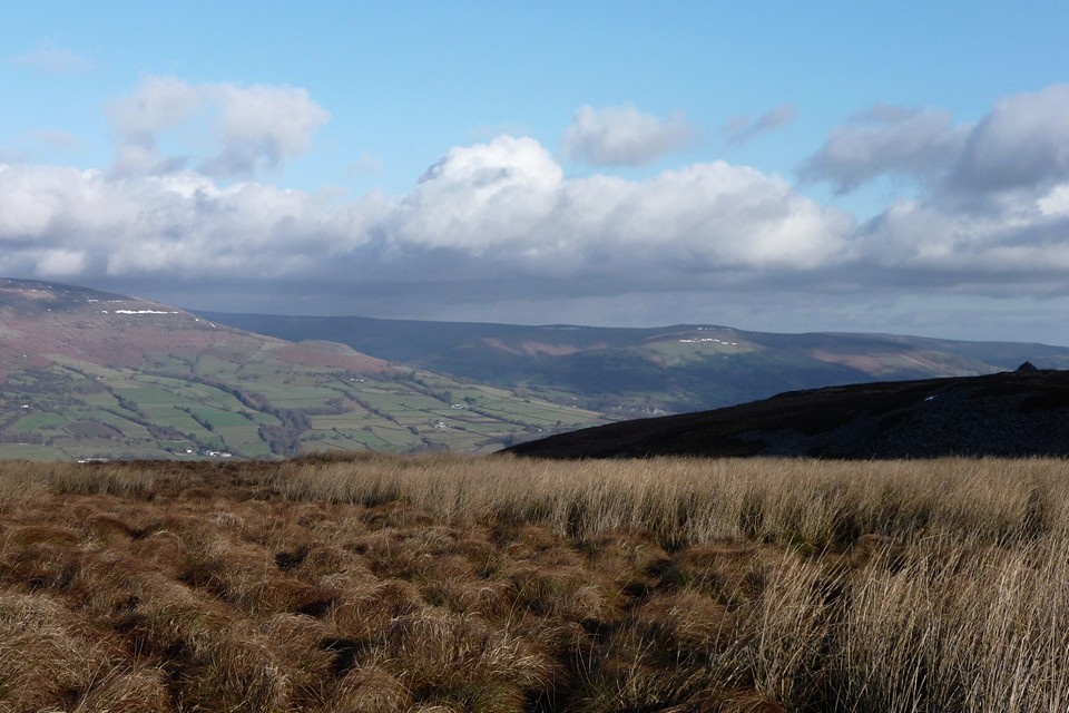
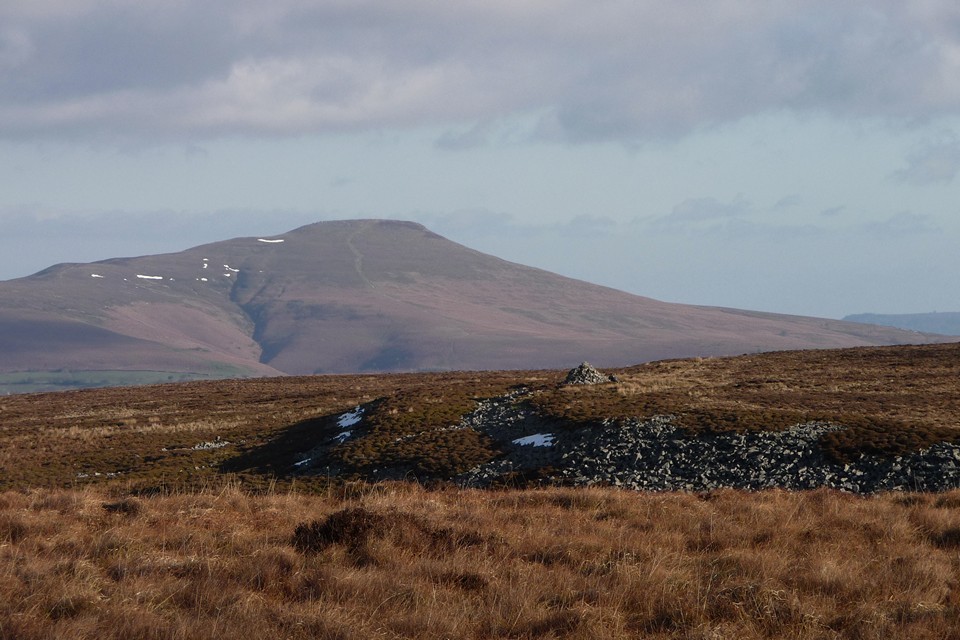
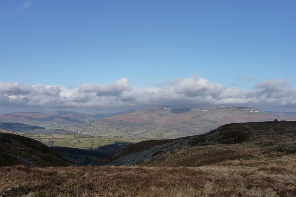
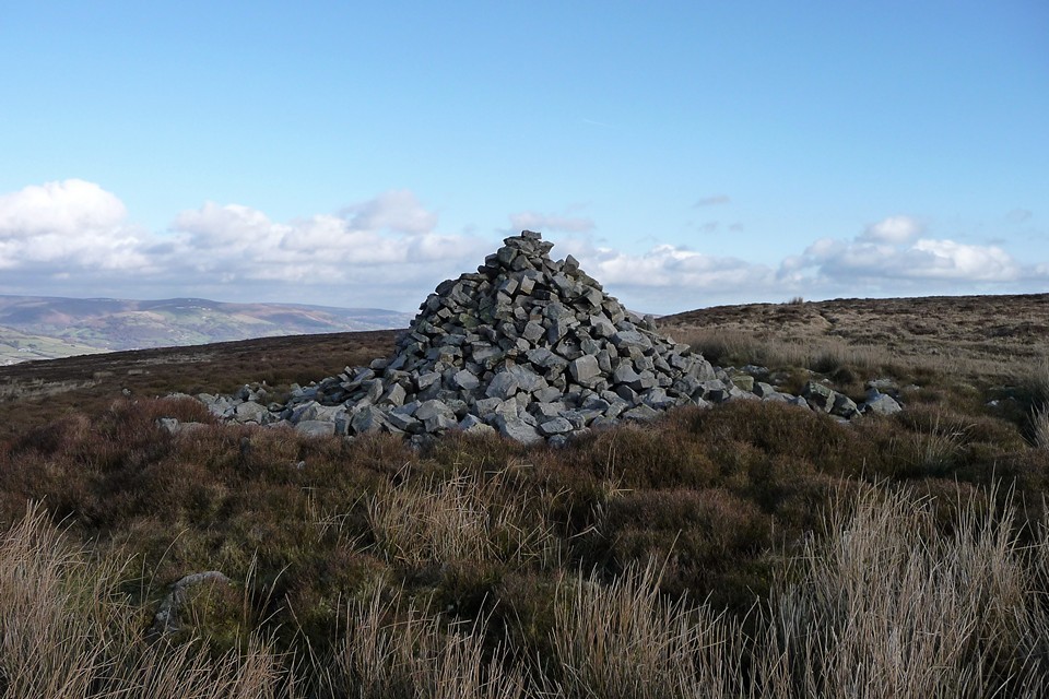
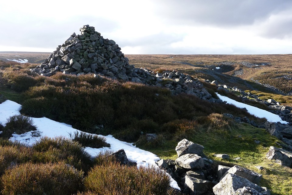
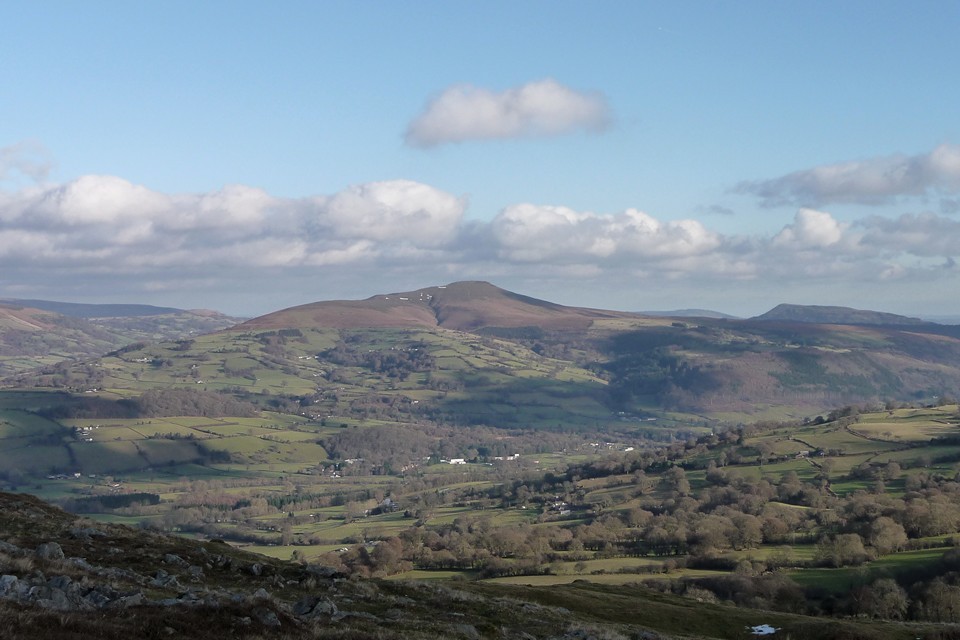
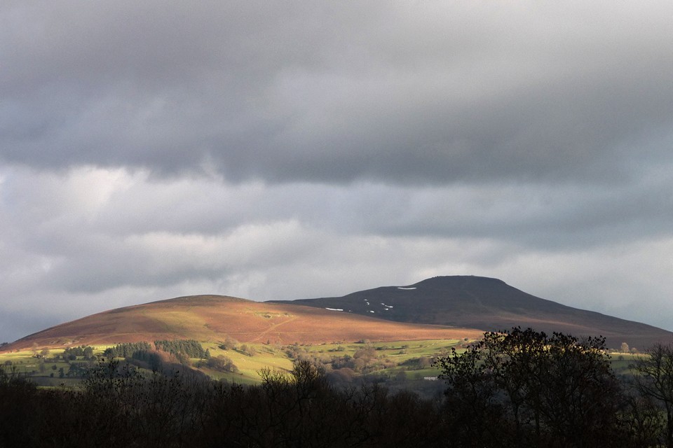
| One of things I love about this obsession is how one thing leads to another. I had a winter wonderland walk through deep snow up to Crug Hywel on Christmas Eve, which afforded an excellent high-level view of the shapely peak of the Sugarloaf/Pen-y-Fal. So for our first walk of 2011, girlfriend and I climbed up there on a freezing cold and somewhat gloomy day, which included a rather frustratingly unsuccessful attempt to find the Mynydd Pen-y-Fal cairns. Whilst on our way up from Abergavenny, a good view across the Usk valley to the flat mass of Mynydd Llangatwg revealed a couple of cairns, big enough to be visible to the naked eye and thus worthy of a visit sooner rather than later. Once home, a scoot across Coflein’s blue dots revealed a bewildering array of cairns, some of which appear to be the result of duplications on separate surveys. One of the blue dots, completely unexpectedly, revealed a putative stone circle. So with this background in mind and the prospect of reasonable weather, less than a week later I’m on the bus to Brynmawr. First though, a quick note about the landscape either side of the River Usk/Afon Wsyg. The Black Mountains, to the north of the river, are principally composed of Old Red Sandstone. They rise above the 2,000ft mark, putting them firmly on the mountain-bagger lists. The ridges remain largely untouched by industry, keeping to sheep farming and low-intensity agriculture. The towns and villages at their feet along the Usk and Rhiangoll valleys, like Crickhowell, Llangattock, Llanbedr and Tal-y-bont, are attractive and well-kept, with their economies boosted by tourists either coming to stay or passing through on their way to Brecon and the Beacons. The story is somewhat different to the south of the river. The northern scarps of Mynydd Llangatwg are composed of limestone, riddled with caves and shake holes. The terrain makes for hard walking, rough and boggy, with little in the way of fertile vegetation. At its highest point, the flat top reaches the 530m mark, keeping it below magical “mountain” height and thus off many a hill walker’s radar. It has also been washed by the tides of South Wales’ industrial past, where mining and quarrying scarred the landscape and where, sadly, the economy has been hit hard over the last few decades. Even the oddly named Cairn Mound Impounding Reservoir, on the southern slopes of the hill, has been abandoned and is slowly filling itself in. Brynmawr, my start point for the day, sits beside the Clydach gorge and has the feel of a town in decline. Yet this is an area rich in prehistory and deserving of more attention. Evidence of Palaeolithic occupation has been found in the extensive cave systems hollow beneath the hill and there are Bronze Age cairns by the bucketful. I leave Brynmawr via a bridge over the busy A465, passing a sports field before finding a well-defined metalled footpath running alongside one of the fast-running streams that feed the Clydach. I’m glad of the overnight freeze, which has rendered what would be quite a muddy route into something firmer. As the path climbs steadily, a decent retrospective view of the steep slopes of Cefn Coch, Mulfran and Mynydd Carn-y-cefn opens out to the south. These are some of the hills that separate the industrial heartland of the Valleys, crowned in the last case with a further Bronze Age monument. As I continue, the squat bulk of Blorenge appears to the east, then Ysgyryd Fawr beyond Abergavenny. By the time I reach the Reservoir, the top of the hill, flecked with lingering patches of snow, is in sight. Twr Pen-cyrn cairns — Fieldnotes30.12.12ceThe very top of the hill slopes more steeply in a little crest. Once onto this, the wind increases dramatically and the chill becomes noticeable, even after the heat generated by the steady climb. Views open to the west, to Waun Rydd and the cloud-shrouded central Brecon Beacons. Of more immediate interest is the collection of cairns on the hilltop, hidden from view until now. The name of the top, Twr Pen-cyrn (pronounced too-er pen keern) defies my translation efforts, settling on either “Tower [of the] head of the peak”, or “Peak-head Tower”, which seems too clumsy to be right. I have a little hand-drawn plan and notes taken from Coflein, but the numbering (and indeed the number) of cairns on Coflein doesn’t readily associate itself with what I’m seeing. The entire summit area is liberally scattered with limestone blocks, making for plentiful cairn-building material. The first cairn I reach is small and to the southwest of the main summit group. I think, if it follows the Coflein numbering and descriptions, that it’s Cairn VII. Beyond it, framed by an impressive backdrop of the Sugarloaf, Ysgyryd Fawr and Blorenge, is the southeastern cairn in the group. This is a monster, about 15 metres across and a couple of metres high. It has been messed about, inevitably, but remains a truly impressive monument. The ground falls away from the cairn to the east, leaving a fine, unobstructed view across Monmouthshire. To the north, the Black Mountains ridges, centred on Pen Cerrig-calch from here, glower darkly. I wonder whether the geographical and geological divide between the limestone plateau of this hill and the sandstone ridges of the mountains across the river were reflected in tribal divisions when these monuments and the comparable cairns of Pen Cerrig-calch were constructed? The other big cairn of the group is right on the summit, next to the trig pillar that itself surmounts a further, smaller, cairn. The summit cairn is a match for the southeastern neighbour. The be-trigged smaller cairn rejoices in the name of “Hen Dy-aderyn” (Old House of the Birds), which Coflein suggests might be linked to use as a shooting hide. The group certainly make for a great – if windy – spot for a cup of tea and contemplation. The clouds to the west briefly part to reveal the sawn-off tops of Corn Du and Pen y Fan, 15 miles or so distant. These four cairns are the only apparent cairns here, so I can only conclude that the Coflein records include a degree of duplication. Twr Pen-cyrn cairns — Images09.01.11ce
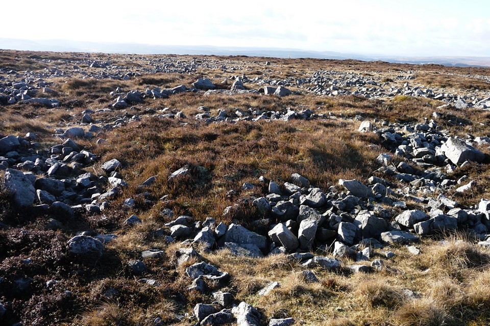
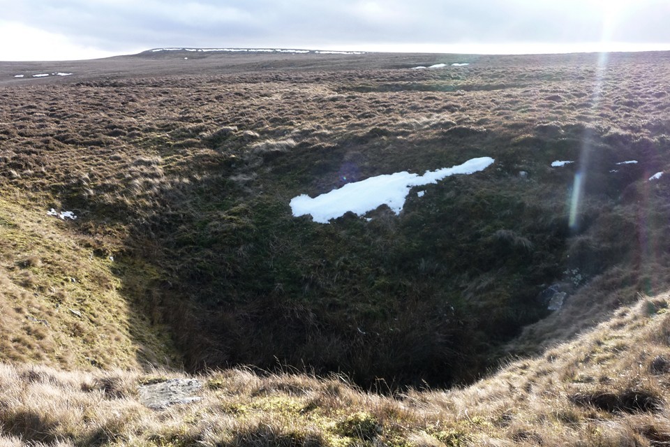
Twr Pen-cyrn Circle — Fieldnotes30.12.12ceHowever, there is also the small matter of the “stone circle”, one of the main reasons for coming here today. This proves a rather harder task to find. As mentioned, the whole hilltop is covered in scatters of limestone blocks, a crazy jumble of swirls and fans. I wander about for a while in the area where Coflein suggests the “circle” is to be found (slightly north and west of the main cairn group). Eventually I find a circular feature that pretty-much matches the description and location. I would never have described this as a “stone circle” though. I looks more like a ring cairn of some sort. More visits by more knowledgeable people might help decide. It’s somewhat churlish to complain anyway, as the location and the main cairn group make this place more than worthwhile for a visit. Twr Pen-cyrn Circle — Images09.01.11ce
Mynydd Pen-cyrn — Fieldnotes30.12.12ceAt length I head off west, following a narrow track through the tussocks of reedy grass and whin. Although the top of the hill is pretty flat, the terrain is still quite hard going, with boggy areas to traverse and ankle-sapping vegetation as soon as you step off the “path”. Luckily the next cairn, a little less than half a mile from the summit group, is right beside the path and it’s another biggie. Slightly smaller than the two main summit cairns, with a scooped-out centre now filling with vegetation, Mynydd Pen-cyrn cairn sits on the saddle between the Twr Pen-cyrn cairn group and the solitary Mynydd Llangatwg cairn. It’s an easy stop-off between the two, serving to liven up what would otherwise be a bit of a slog, truth be told. Mynydd Pen-cyrn — Images09.01.11ce
Mynydd Llangatwg — Fieldnotes30.12.12ceThe most westerly of today’s cairns, Mynydd Llangatwg is a wreck. What would have been a fine cairn, comparable with the larger monuments already visited, this has been properly buggered about with. Instead of a smoothly curving dome, the top of the cairn has been sculpted into two ridiculous horns, while sheep shelters eat into the sides below. What a shame. The location is excellent, with a great view of Waun Rydd, the Brecon Beacons, Mynydd Troed, the Black Mountains and the Sugarloaf. There is an enormous limestone scatter immediately to the west of the cairn, once again providing plentiful material. The ground drops away in every direction but east. Yeah, a great spot for a cairn, shame about the idiocy that has so distorted its shape. Mynydd Llangatwg — Images09.01.11ce
Eglwys Faen — Fieldnotes30.12.12ceI head north, as I have one further cairn to visit on this inhospitable hilltop. Again, the going is surprisingly tough, the paths are faint and before long I’ve stumbled into a much boggier area, where clumsily leaping from tussock to tussock is the only hope of keeping dry feet. Eventually I get towards the edge of the scarp, and the cairn comes into sight, another weirdly rebuilt shape, apparently hanging right on the edge of the void. There’s a small stream to negotiate first, narrow but fast-flowing, swollen by the melt from the heavy snows before Christmas. Here I meet the only people I’ve seen for hours, but as I follow the top edge of the scarp, the views become superlative and breathe is taken away. Whereas the view from the other cairns was of a gently receding slope in front of a long-range mountain backdrop, from here the drop is steep and the Usk valley appears, dizzyingly far below. Crickhowell is a toy-town, white against the fertile farmland of the valley. Crug Hywel fort is now in view, very different to the snow-covered vista of my recent visit. The cairn, Eglwys Faen (“stone church”, pronounced egg-lewis vine) is indeed perched above the drop. The stones have been fashioned into an odd pyramid, belying the larger footprint below. That said, for some reason this seems less appalling than the damage inflicted upon Mynydd Llangatwg cairn. Perhaps the wonderful placement makes up for any damage, perhaps in truth the landscape really is the thing and the cairn is merely intended to be the draw, the bait. If this is indeed a stone church, the beautiful, epic vista across the valley is worthy of worship, whatever your views about gods. Crug Hywel Camp — Images09.01.11ce
Eglwys Faen — Images09.01.11ce
Sermon over, I follow the scarp face round to the west, passing enormous shake holes that no doubt lead through labyrinthine passages into the vast cave system beneath the hill. Eglwys Faen — Images01.01.13ce
Mynydd Pen-y-Fal — Images10.01.11ce
Eventually I reach Llangattock village, where I stop by for a quick re-visit to the Garn Goch chambered tomb in its incongruous play-park setting, before wending my weary way across the river to Crickhowell. Garn Goch (Llangatwg) — Images10.01.11ce
There is much indeed to draw the stone-head visitor to the hills south of the Usk. Come prepared for a fairly arduous walk across unforgiving countryside, but the fine upland cairns are ample reward, especially if you pay your respects at the altar of the stone church, hanging high on the edge of these hollow hills. |
 Posted by thesweetcheat
30th December 2012ce Edited 28th December 2022ce
thesweetcheat's TMA Blog
Latest TMA Blog Posts
|


Comments (0) |
|
| You must be logged in to add a comment | |