|
|

|
Latest Posts — Weblog |
Anglesey May 21 & 22 |
Anglesey May 21 & 22Just a couple of nights in Angelsey. Limited time & mobility due to partner's broken hip! First visit Caer Lob an iron age settlement nr Brynsiencyn. Rectangle shape, with double ditches, could have been moated. Real clear delineation. On the way to Bryn Celli Dhu; a beautifully shaped burial mound with a little henge. There's a replica ? sentinel stone with carvings; zig zags & spirals. In the chamber there's a free standing stone that the chap from " Standing With Stones" series thought could be a fossil tree-I wonder if this has been investigated. There are 5 little stones placed in front of one of the entrances. Inside some of the stones had perfect little circle holes where you can fit your finger. The adjoining field has a large stone in alignment. At midsummer solstice the sun rises and shines through the chamber. Beautiful walk to the site. The hawthorne & bluebells out in force. Then to Plas Newydd ( a gorgeous stately home, worth seeing in itself, looks out over the Menai Straits. Has a large trompe l'oiel by Whistler covering one wall - footprints of Neptune emerging from the sea onto the patio; an avenue of tall pines leading to the house which scent the air on the right day.) Saw the Plas Newydd dolmen which looks like it's been plonked onto the grass in front of the house as a tourist attraction! It's striking. Had to stop the car & wait while two beautiful red squirrels crossed the road. Only had one day of exploring so off to Trefignath, nr Holyhead on Holy Island. It's mighty, a cairn. One chamber partially supported by an out of place bricks & mortar column. Another section reminded me of an old fashioned box bed; three large stones as a megalithic head board, absolutely gorgeous. The monstrous aluminium works across the road is easy to ignore, just turn your back to it. Some lovely pinky red lichen on surrounding stones. In neighbouring field stands Ty Mawr, a solitary standing stone which looks like a cowled figure (Julian says a druid) & next door to that another field which looked like it had placed stones ( to me that is.) On to Penrhos Feilw, two huge standing stones; the ground they're on looks levelled. This place reminded me of sites like Sunkenkirk & Castlerigg in that it has glorious panoramic views, off to the bay & up to the majestic Holyhead mountain. This site is tucked away off a single track road. It's beautiful all around this area; shimmering little bays & rocky outcrops, not many folk about. Breathtaking. On to Holyhead Mountain where I walked in awe around the hut circles. They are delightful, so wonderfully situated perched together on the side of the hill. Stone circular buildings with entrances and pathways linking. I could imagine the homesteads there and found it powerful and moving. The paths were ablaze with bluebells and ? white stitchwort and ? maiden pink. Tried to look the flowers up in my wild flowers book, but not sure. TJJ May know. The views were fantastic. It must be wild in Winter. Holyhead Mt looms above & the distant bay glimmers in the sunshine. Went looking for Lligwy dolmen but partner's leg sore & time running out. It was a great visit with so much more to see. Angelsey is such a beautiful place; wild and in the past somehow, even with the jet fighters zooming about overhead. To TJJ, happy holidays and travels. |
Posted by carol27 28th May 2015ce |
Stone out of song – Bwlch y Ddeufaen and Maen y Bardd 9 July 2011 |
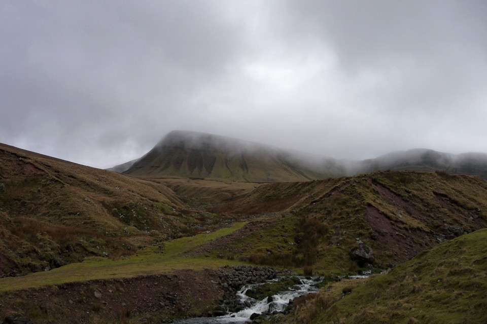
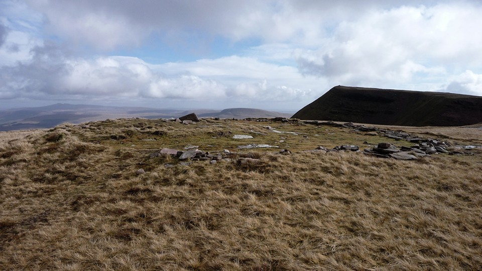
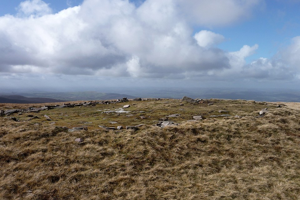
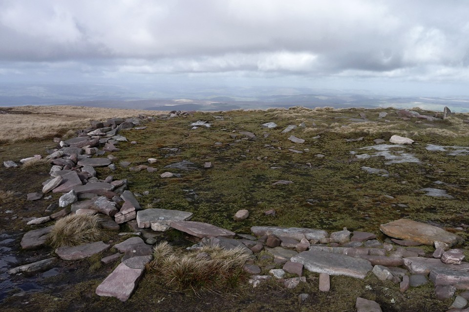
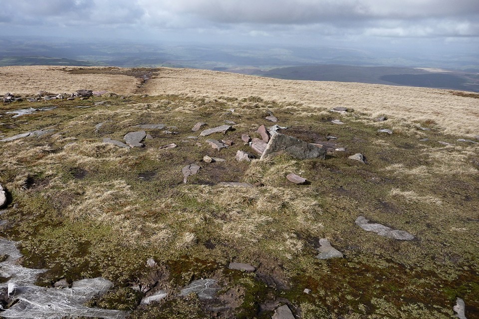
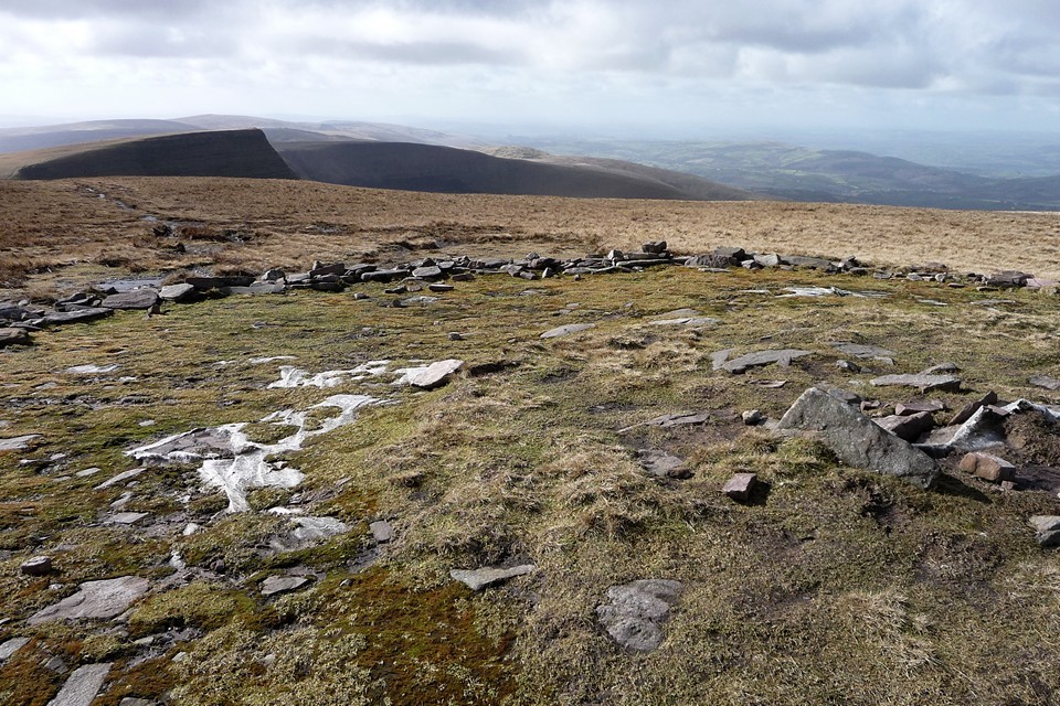
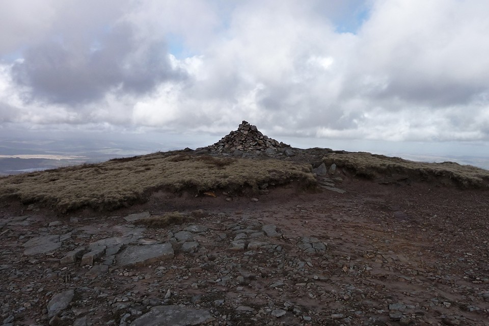
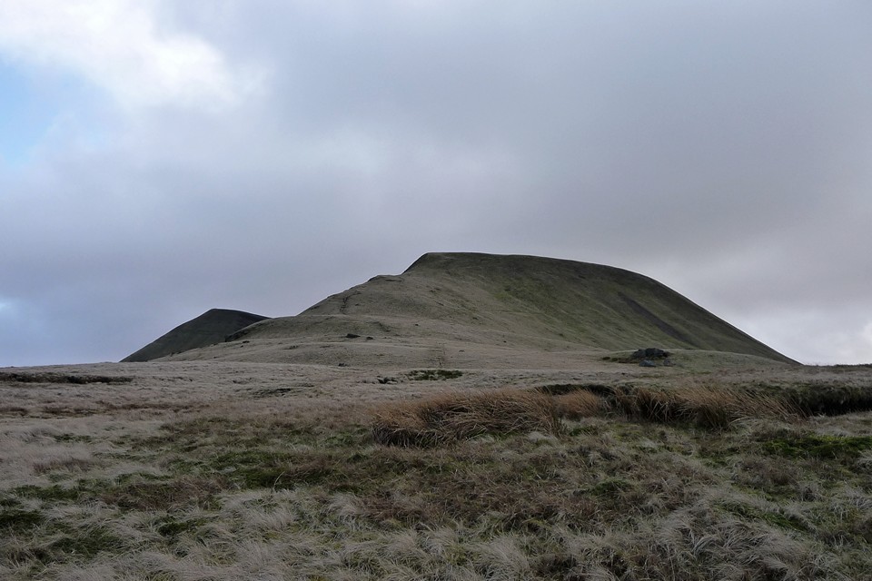
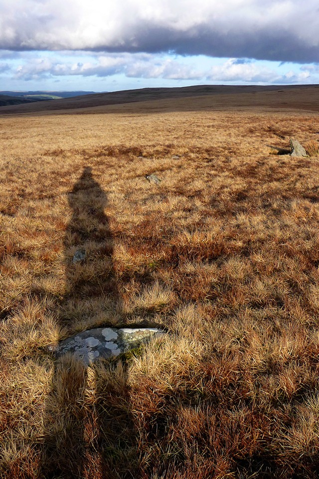
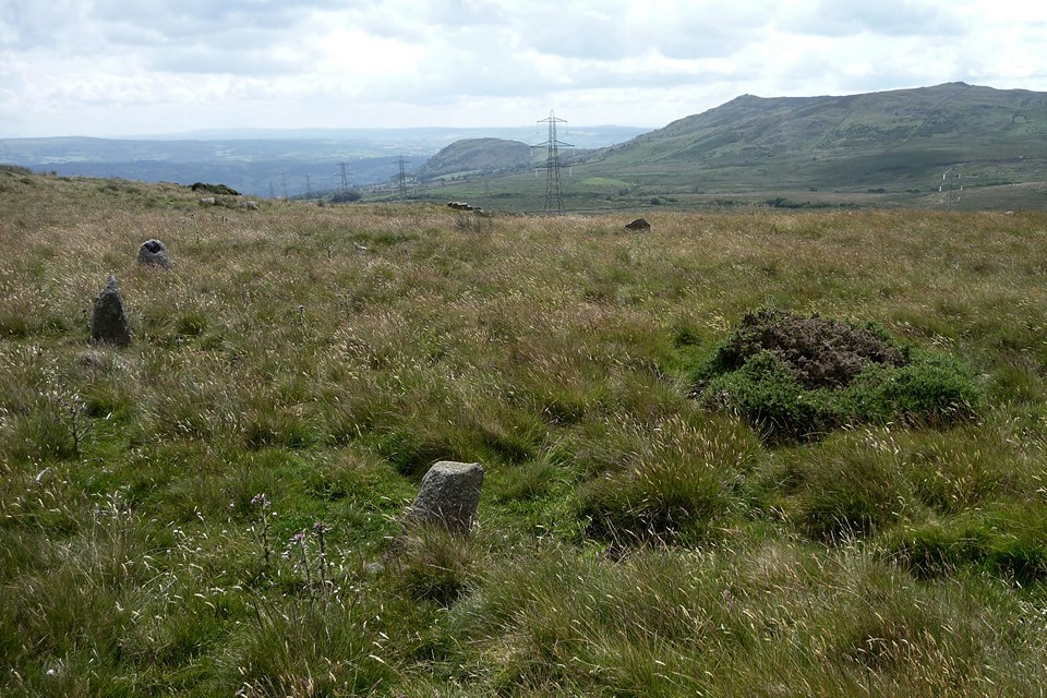
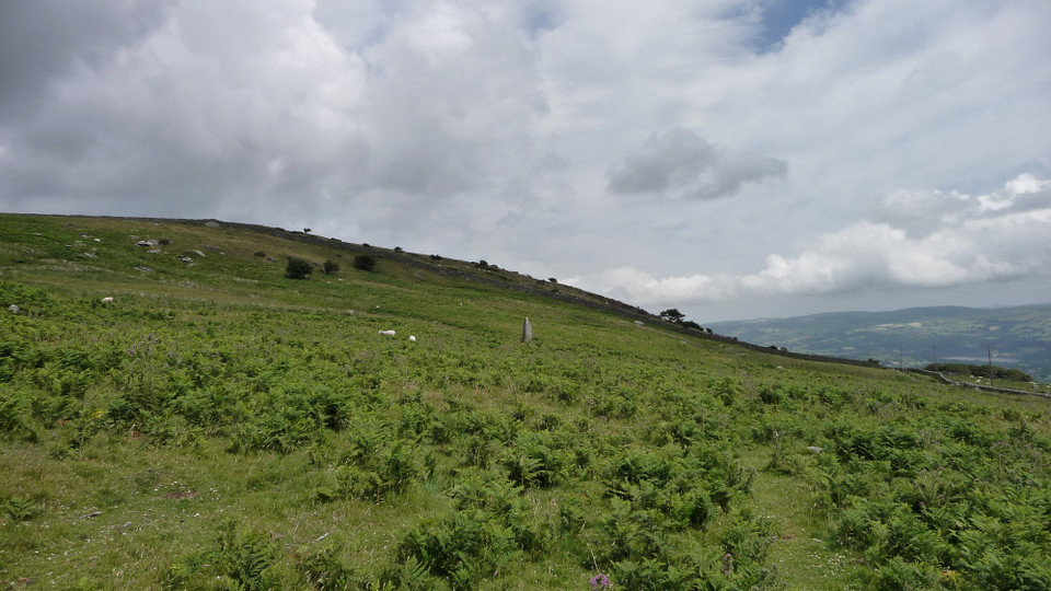
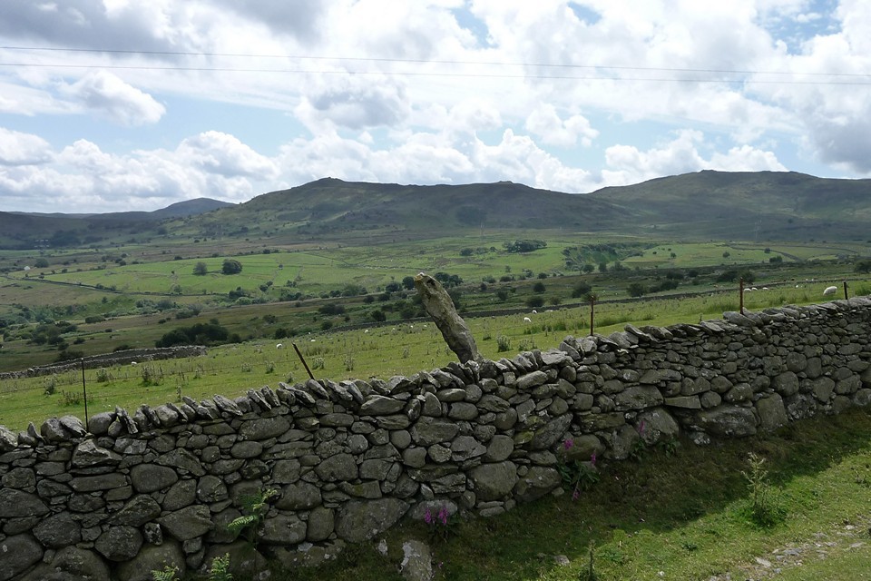
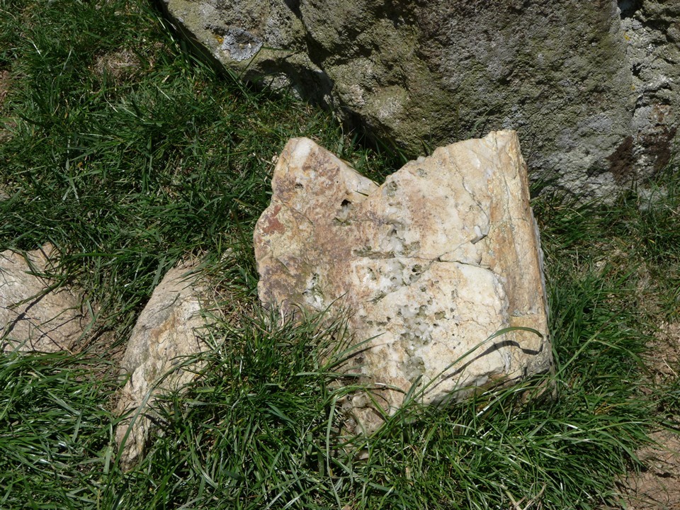
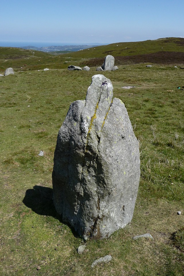
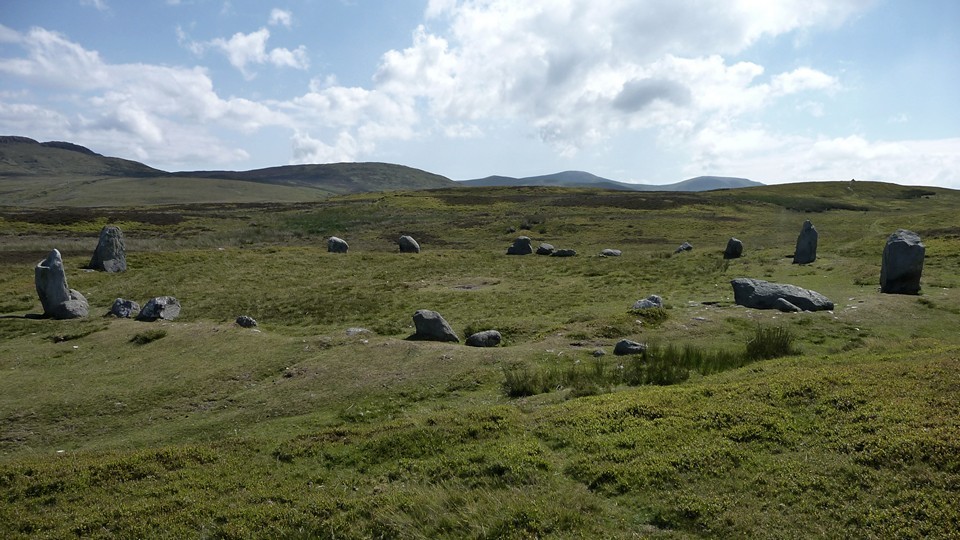
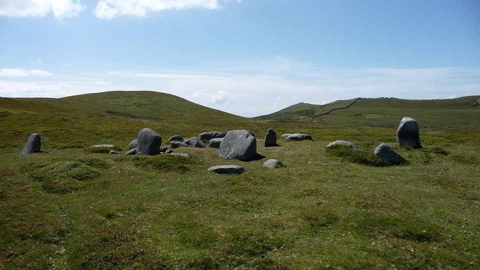
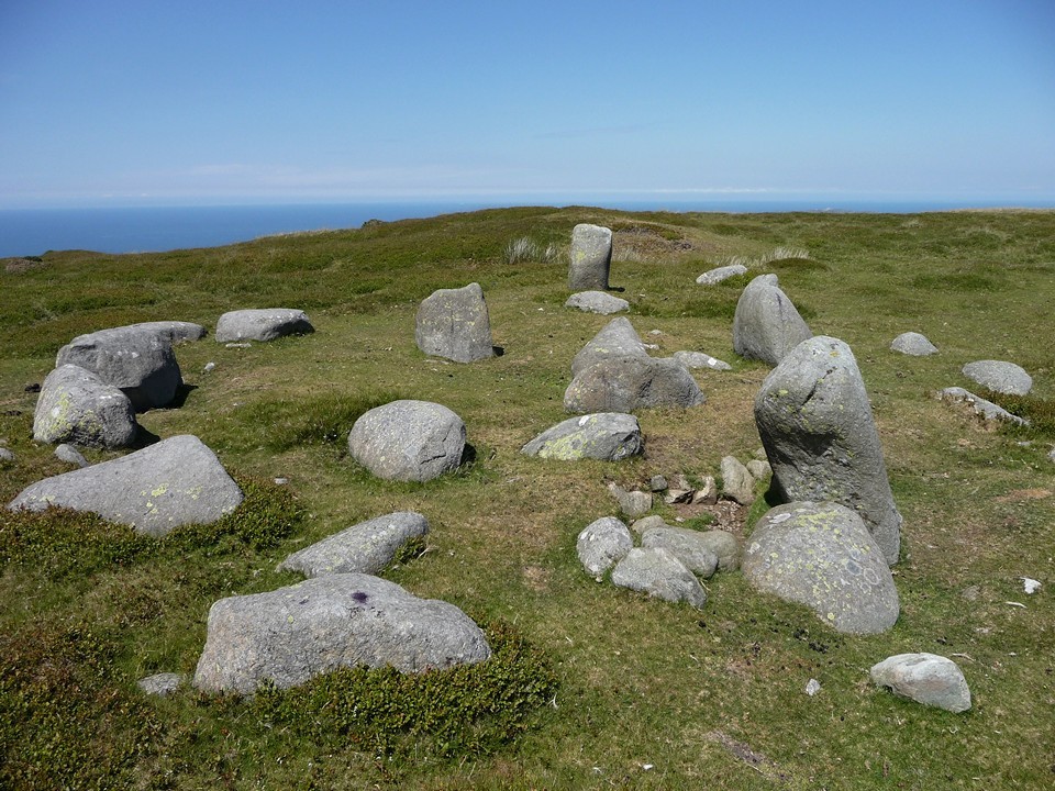
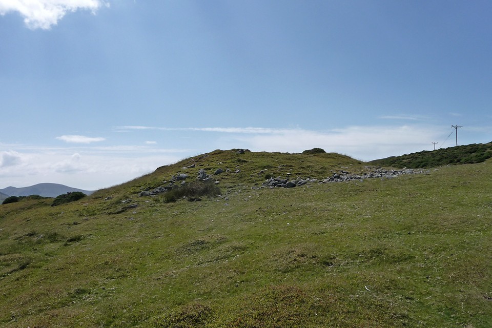
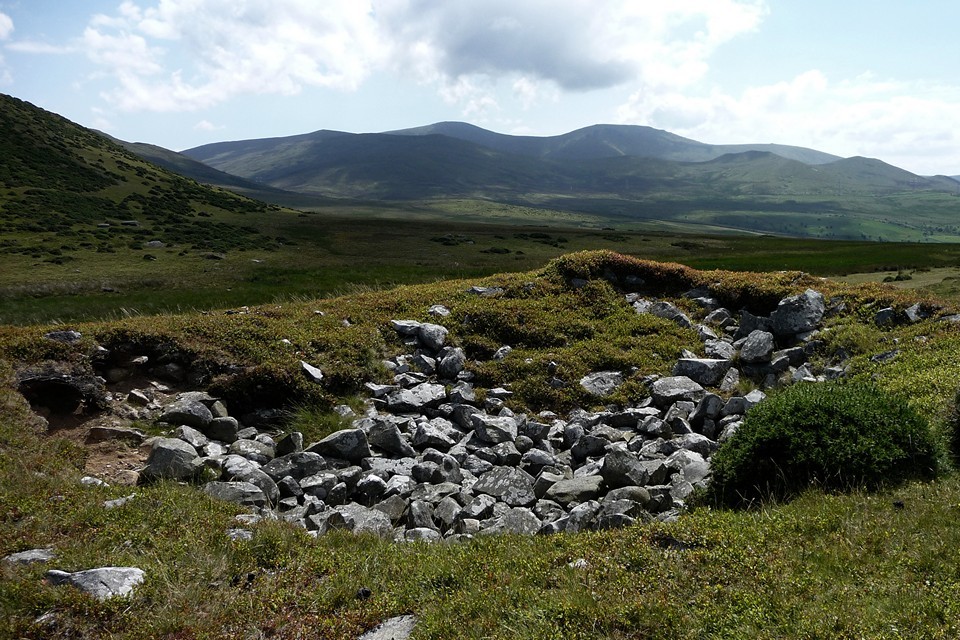
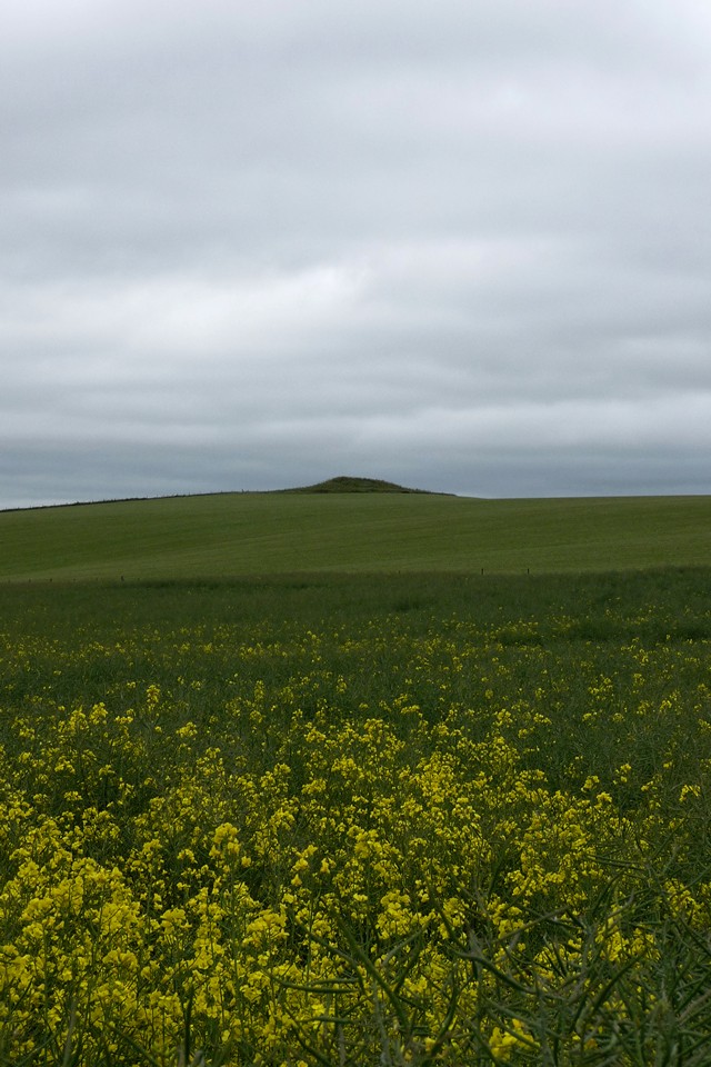
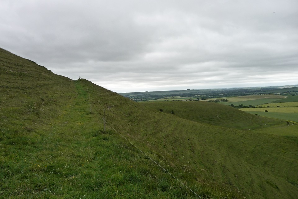
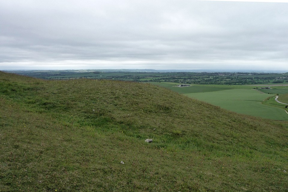
Stone out of song – Bwlch y Ddeufaen and Maen y Bardd 9 July 2011Leaving the broad plain of the Conwy Valley, lanes wind steadily upwards, bound tight by stone walls and occasionally gated against errant stock. The blunt form of Pen-y-Gaer (Caerhun) rises steep on the right, but that will wait for another day. Today Blossom and I head towards the lower slopes of Tal y Fan, a mountain separated from the massive bulk of Y Carneddau by an upland pass. The pass was used by the Romans, but its name and origins are much older – Bwlch y Ddeufaen (“Pass of the Two Stones”). The sites we’ve come to see today line the track that heads east from the pass, contouring the southern flank of the mountain. They come in a rich profusion, an elongated string of megalithic jewels, in a concentration to rival any you might find in West Cornwall or North-east Scotland. Cerrig Pryfaid — Fieldnotes18.05.15ceIt’s always exciting to start the day with a stone circle, especially one you’ve not been to before. Composed of diminutive stones, Cerrig Pryfaid is certainly no Avebury in purely megalithic terms. But the setting elevates it to something quite special. The near-perfect circle sits in an amphitheatre of rock, broken only to the southeast where Pen y Gaer overlooks the wide sweep of the fertile Conwy Valley. Even here the longer view is filled with rank upon rank of high hills. The southwestern prospect is entirely blocked by the towering wall of the Carneddau mountains, crowned by Bronze Age cairns on the summits of Carnedd y Ddelw and Drum. To the north Foel Lwyd, the western buttress of the Tal y Fan ridge, rises in a jagged jumble of boulders and outcrops. Two small outliers stand to the west of the circle, both with tantalising sunrise alignments (midwinter, autumn equinox). But today it’s getting towards midday, in July. So we make do with the earthlier delights of the landscape and views before heading back towards the Pass and our next site. Cerrig Pryfaid — Images27.07.11ce
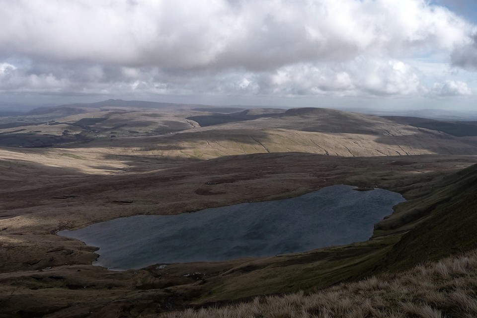
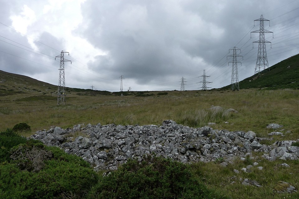
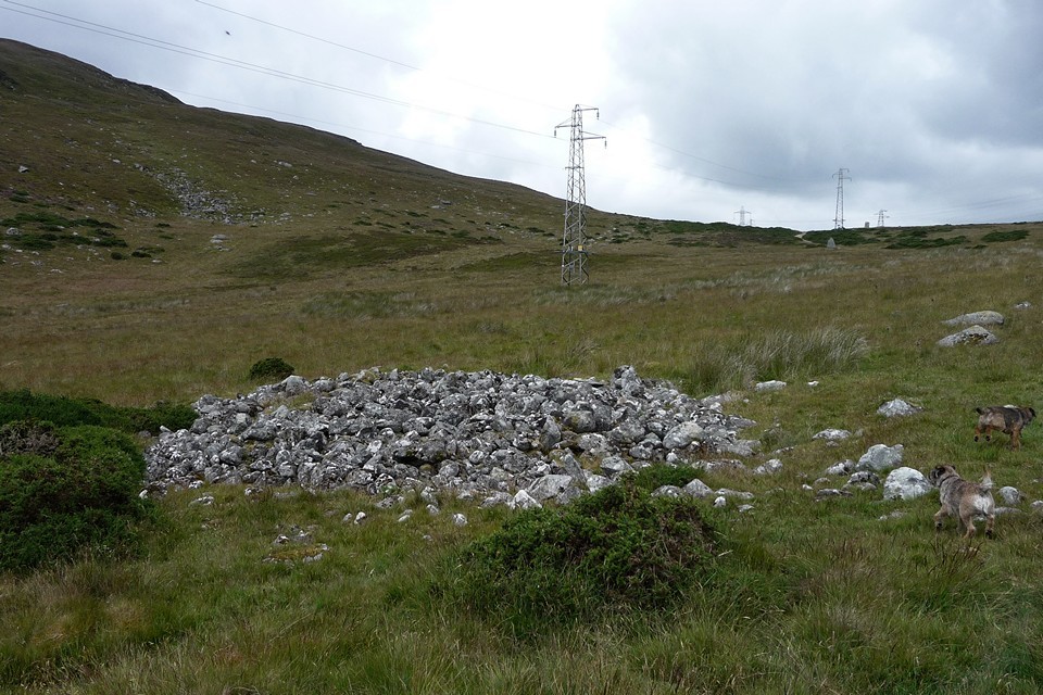
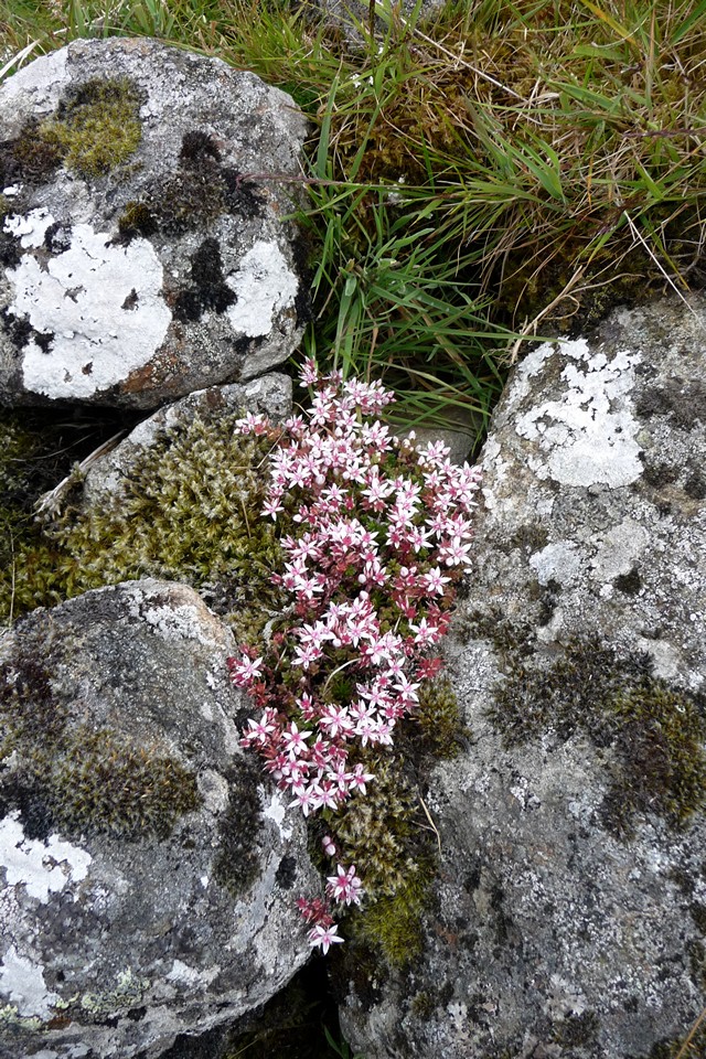
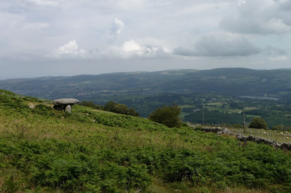
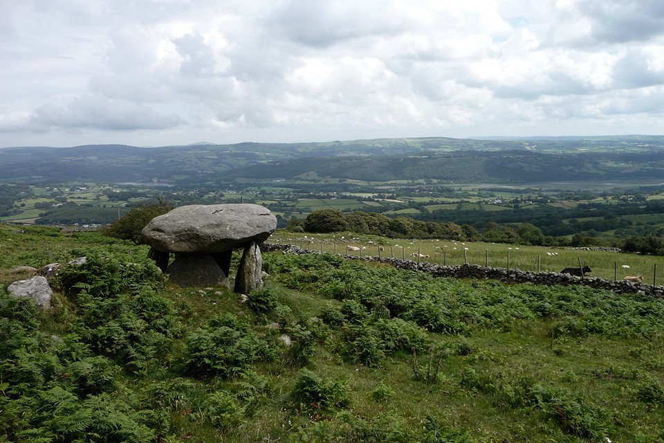
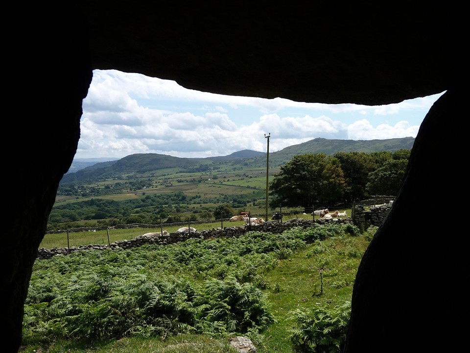
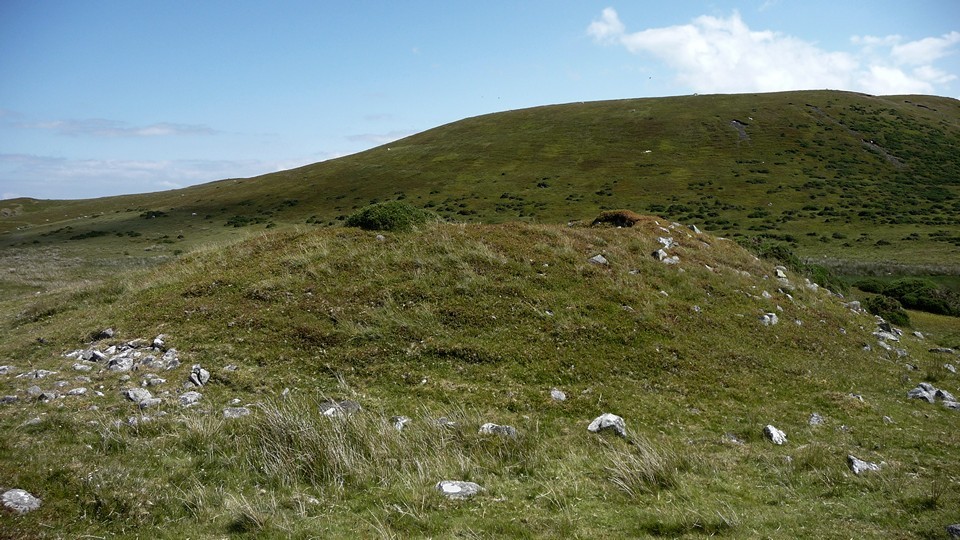
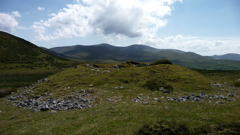
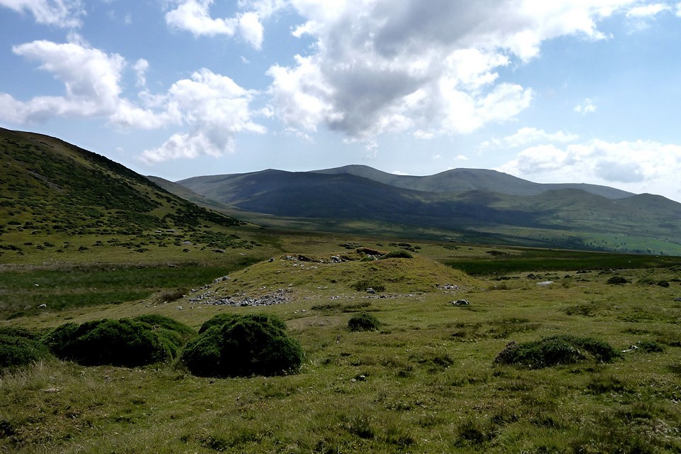
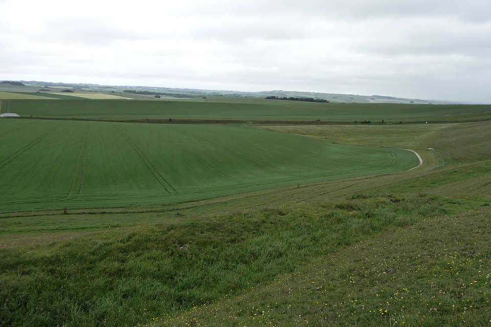
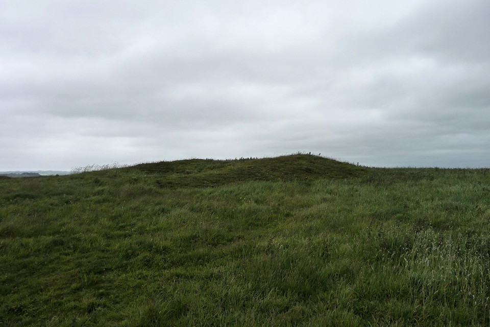
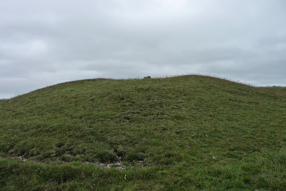
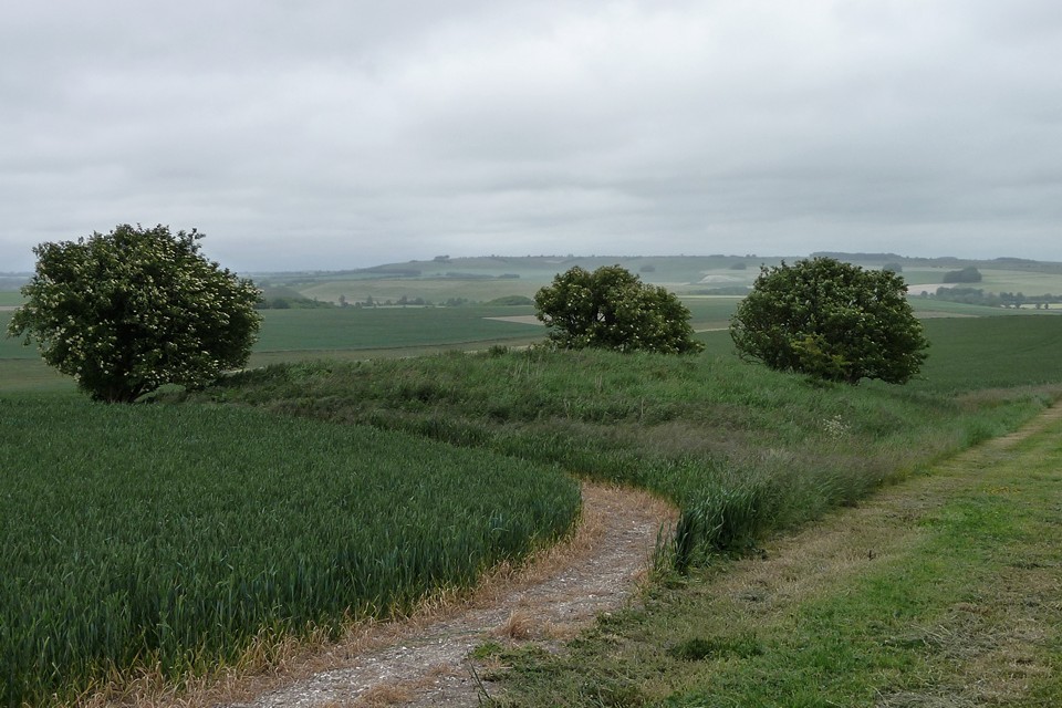
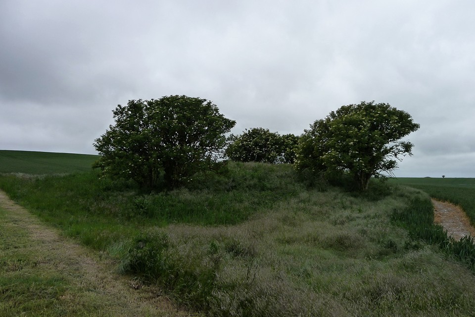
The Giantess' Apronful — Fieldnotes18.05.15ceFrom stone circle to cairn. Barclodiad y Gawres is a good size (15-20m irregular diameter), composed of large cobbles with a central scoop. It’s dotted here and there with clumps of stonecrop, the pink-white five pointed flowers a splash of summer brightness against the grey stones. We entirely fail to see the cist, or either of the other cairns that are supposedly close by. A little way to the southeast we come across a small arrangement of stones, which look like they’ve been placed deliberately but not as anything obviously identifiable. Blossom’s dogs find nice big boulders to stand on and survey the area. The visual focus is the prominent Bwlch-y-Ddeufaen standing stones, visible from here, nestled in the v-shaped pass between the ridges of the Carneddau and Foel Lwyd. The flanking pylons fail to detract from the setting, despite their best efforts. Elsewhere this cairn would be worth a proper stop, but here it’s probably the least arresting of the day’s sites. And we can see the next one already, so it’s time to head off. The Giantess' Apronful — Images27.07.11ce
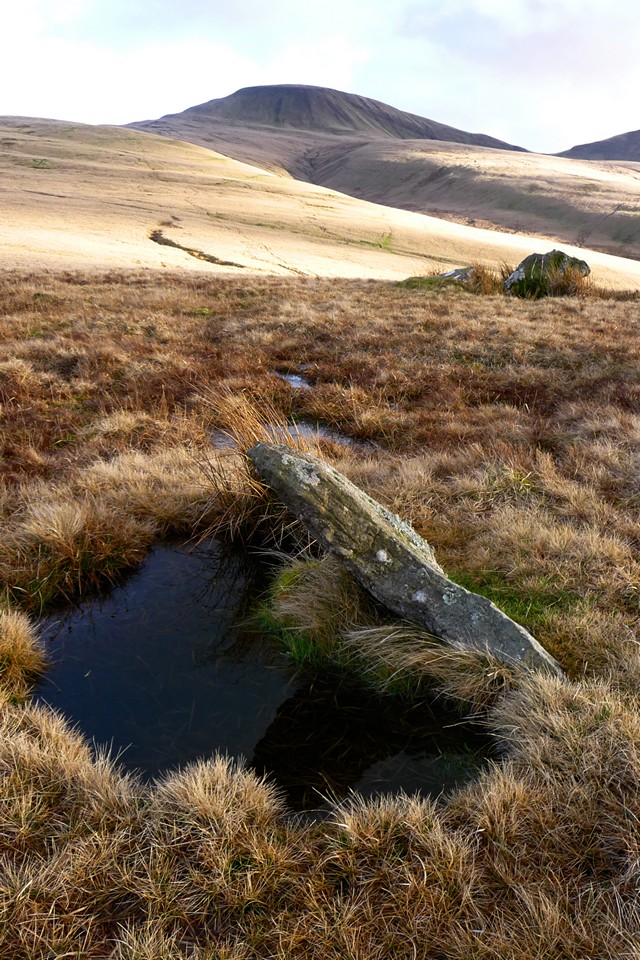
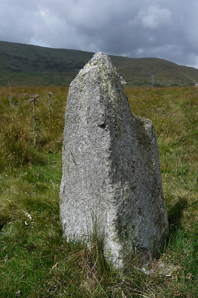
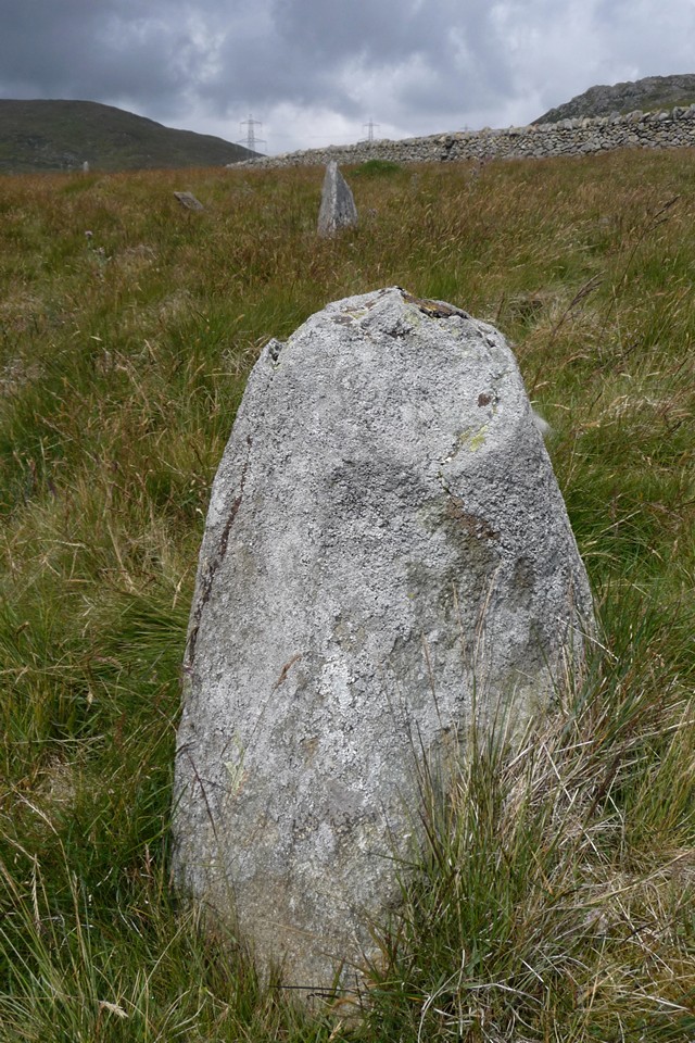
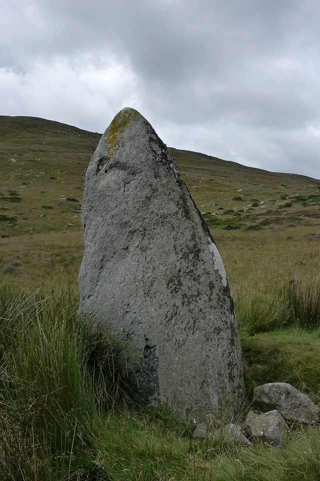
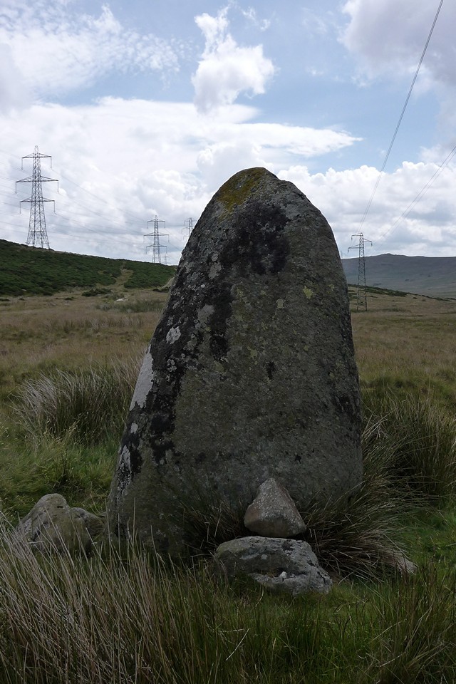
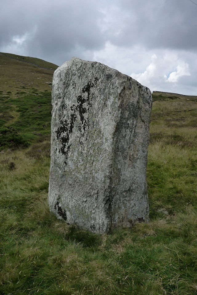
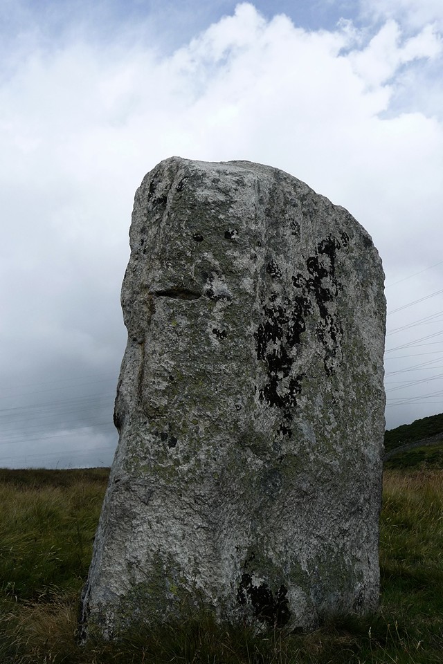
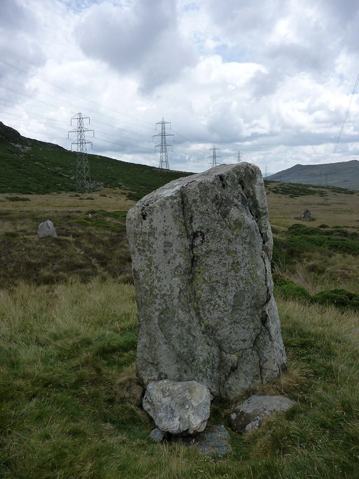
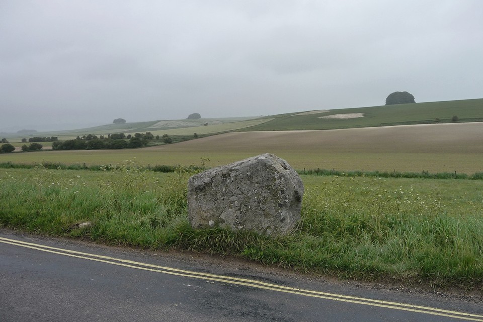
Bwlch-y-Ddeufaen — Fieldnotes19.05.15ceThe two stones that give the pass its name are a big step up in size from the ankle biters of Cerrig Pryfaid. Both are taller than me, and there’s some serious girth going on too. The tapering southern stone is a beauty, Blossom and I struggle to reach round it with our combined outstretched arms. There’s a small, shallow drill hole on one side, as if someone foolishly attempted to convert this into a gatepost and was struck dead for their temerity before getting very far. I’ll leave Rhiannon to find some suitably doomy folkore to confirm the point. By contrast, the northern stone is flat-topped and appears to shine out its whiteness against the dark heather. On closer inspection, the whiteness is entirely illusory, the stone isn’t quartz at all but a light grey. There are two further, shorter uprights close to the northern stone, one of which is indeed a quartzy rock. Their placement isn’t obvious but reminds me somewhat of a scaled-up version of the little followers of Maen Mawr in South Wales. In amongst the chocks at the base of the northern stone is one very dark rock, a matt coal black in colour. It’s not clear whether this is a later addition as it doesn’t seem to be doing much chocking. We don’t realise that there’s a fan of much smaller uprights close to the southern stone, and in truth a visit in summer vegetation isn’t the best time to look for them. It is a great time to admire the purple flowers adorning the heather though. Once again, the setting is excellent. The views are similar to those from Cerrig Pryfaid, but with added elevation giving a fresh perspective to the outcrops of Pen y Castell. The stones are not set on the crest of the pass, so there’s no view northwards to speak of. Instead they turn their impassive faces resolutely southeast, looking down the valley of the Tafalog, heading off to join the great Afon Conwy three or four miles away. Surrounded now by pylons and cables, yet they retain their dignity against these huge, transitory metal giants. Time is on their side after all. I’m really taken with these stones. The sense of deep time seems to hang around them, from the ageless mountains, through the monument builders, the tramp of Roman soldiers, into a hinterland of iron and wire. Rather than detracting, the pylons add to this sense that we’re standing in the midst of a palimpsest, layers of time and people still there, just below the surface. And perhaps we’re a shadowy presence in earlier and later times, too. Bwlch-y-Ddeufaen — Images28.07.11ce
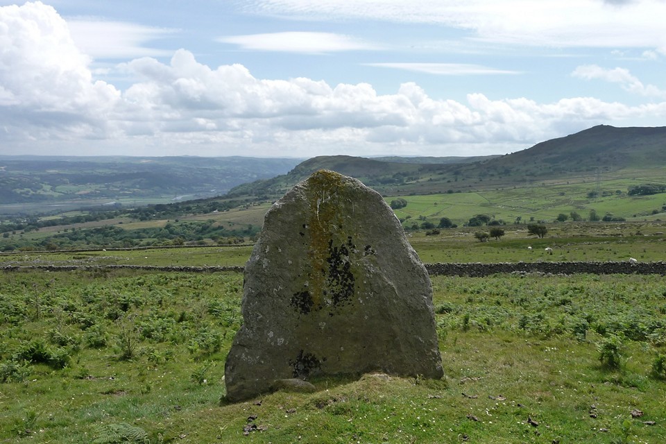
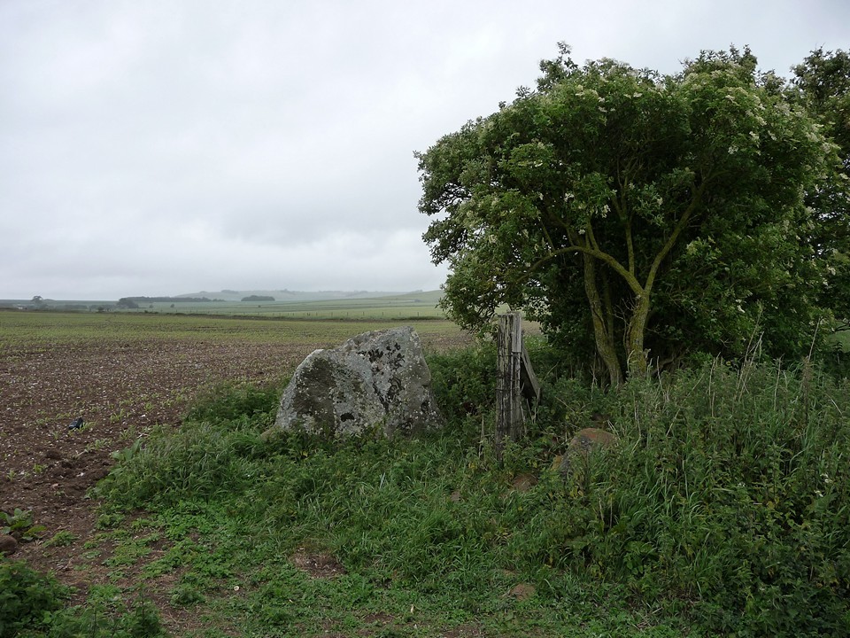
Reluctantly we head back to the car for a very short trip eastwards. It’s blue skies and sunshine as we get out again a mile on. The ribbon of sites continues on along the southern flank of Tal y Fan, a mountain almost completely encircled by cairns, standing stones, burial chambers and stone circles, yet itself devoid of monuments. Surely a deliberate omission? Cae Coch — Fieldnotes19.05.15ceCae Coch standing stone is first, just a short pull up a bracken and grass covered slope from the track. It’s one of those eternally pleasing stones with a completely different aspect depending on which side you view it from. The broad face is turned towards the track and is perpendicular to Pen-y-Gaer (Caerhun) hillfort, but side-on the profile is slender with a bend in the middle. The views across the Conwy valley are worth the visit alone. An unexpectedly good site. As we approached the stone the blue sky had turned unexpectedly dark, and now looks like night has arrived early. It rains, just for a moment. And then it’s gone, so that by the time we regain the track much of the blue has returned. Cae Coch — Images19.05.15ce
Ffon-y-Cawr — Images28.07.11ce
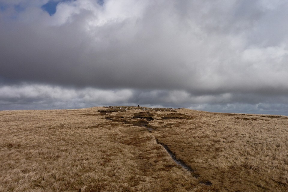
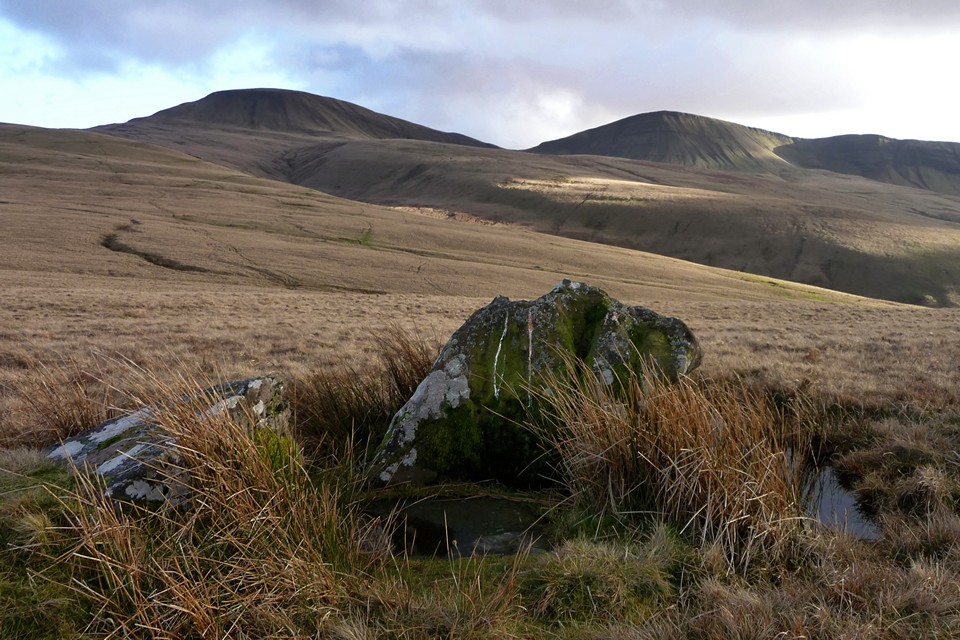
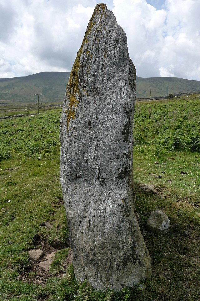
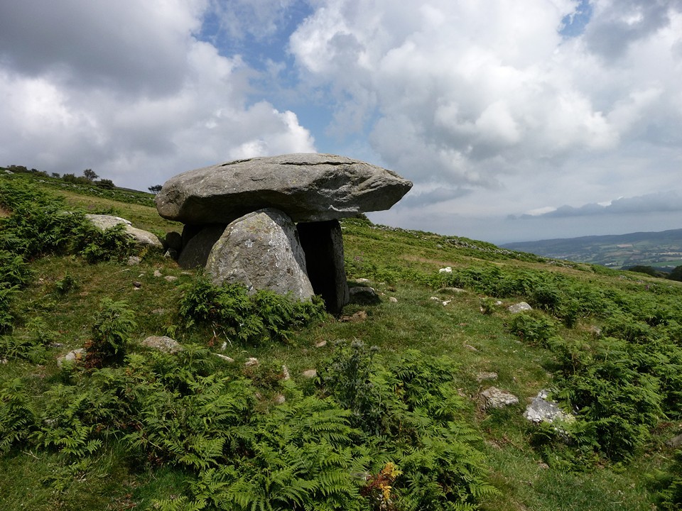
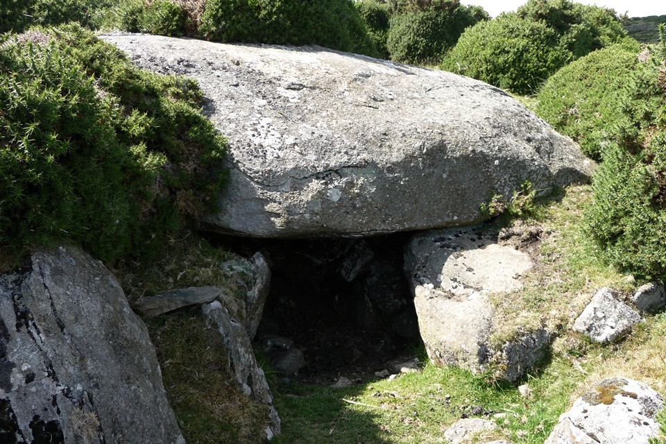
Maen-y-Bardd — Fieldnotes19.05.15ceEven the track feels ancient, a deep green channel between collapsing drystone walls enlivened by vibrant purple foxgloves at this time of year. We pass Ffon-y-cawr, leaning crazily on the other side of the wall. Another one to save for a proper visit, because from here we can see the main objective for today. Maen-y-Bardd is at once bigger and smaller than I expected it to be. It’s perfectly proportioned and looks out over the wide valley of Afon Conwy, the river itself winding lazily through the centre. And there are mountains, and hills, and little fields, and a huge cloud-filled sky. What a place. “Stone out of song” goes a poem I hold very close to my heart. But did the song come first, or the stone? Was a bard buried here, or did the place make poets of its visitors? We stop for a good while. Even the dogs seem content to sit here. At length an interruption comes in the form of a farmer in his tractor, cutting the bracken in the field next door. The spell is broken. We head uphill. Maen-y-Bardd — Images29.07.11ce
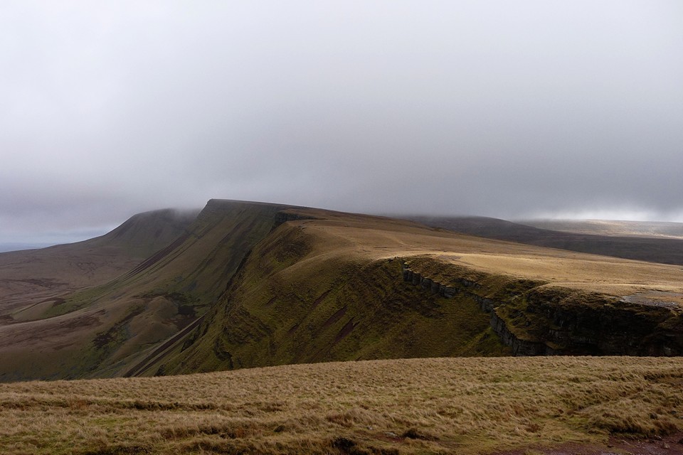
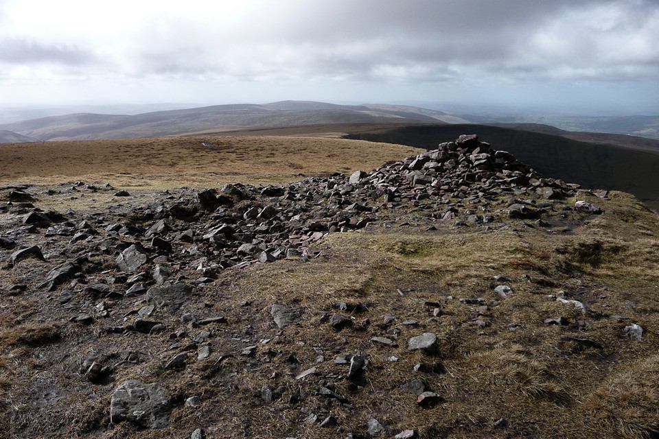
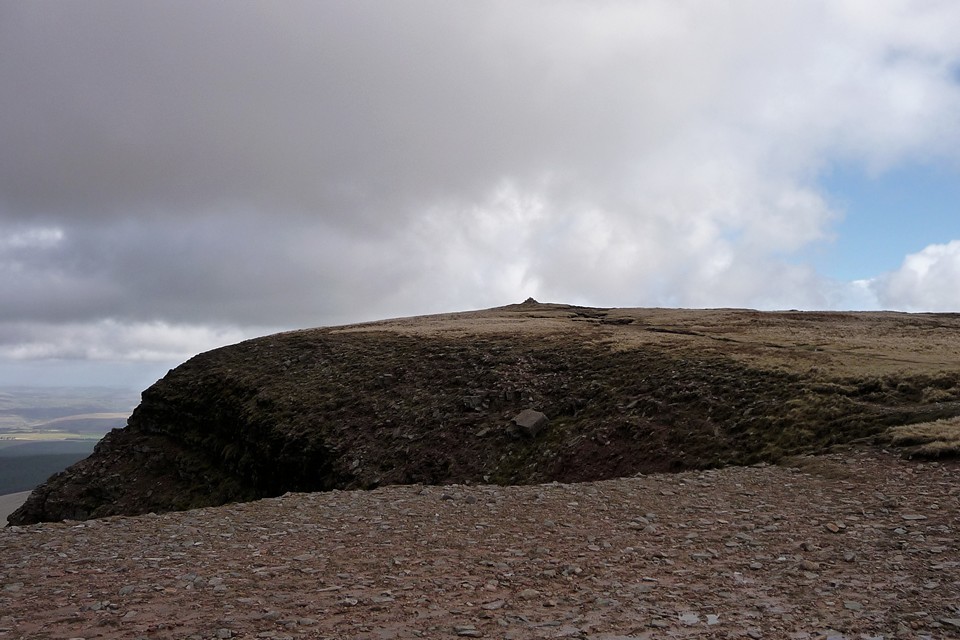
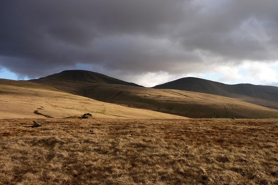
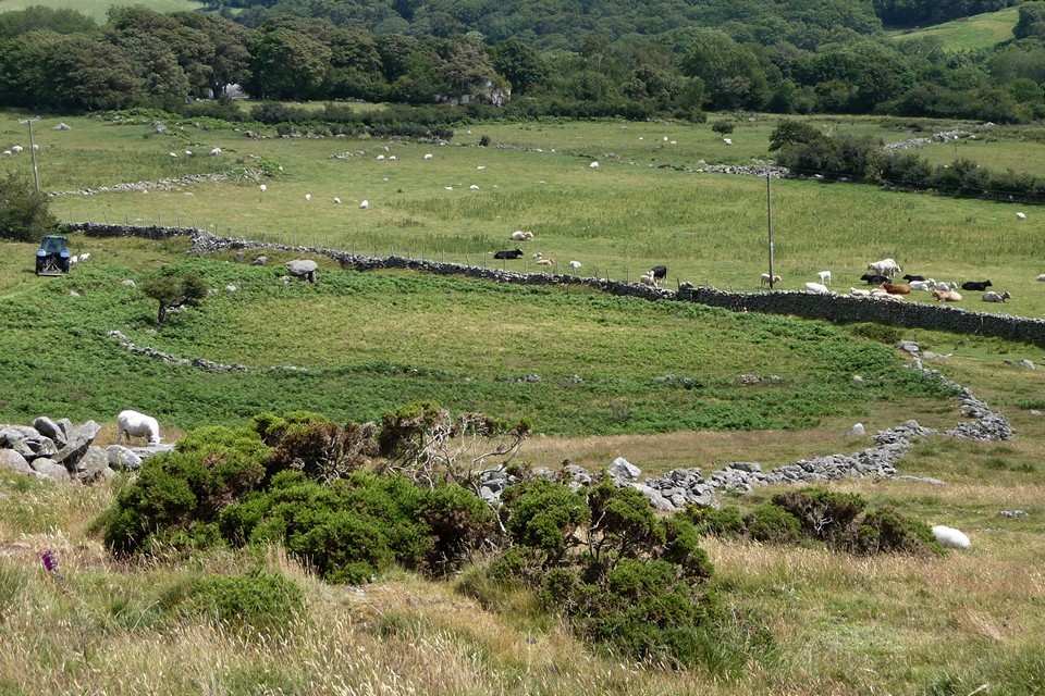
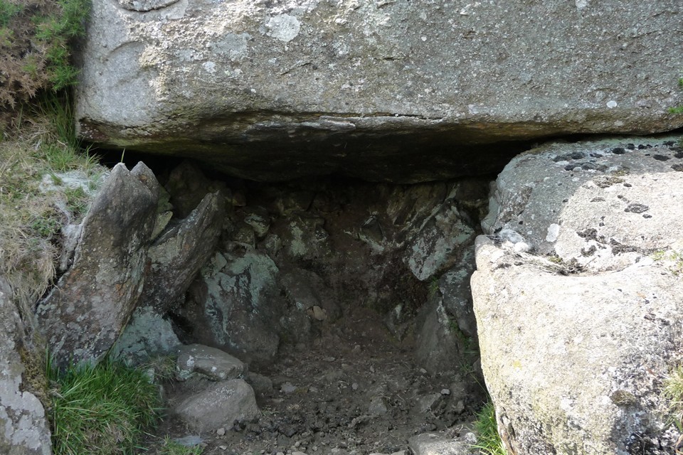
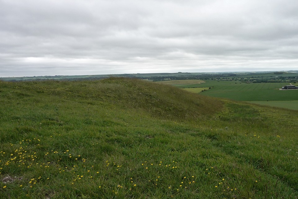
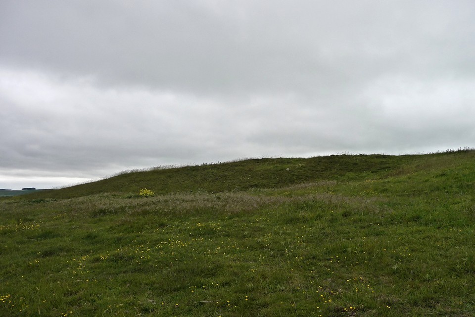
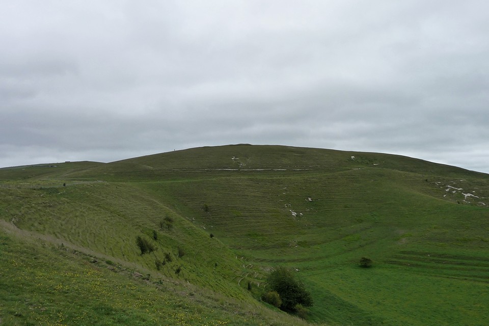
Caer Bach — Fieldnotes19.05.15ceClimbing directly up the grassy slopes of Tal y Fan’s southern flank, we pass a ruined homestead and regain a proper path. The map shows some cairns here, but we fail to see anything obvious. [Postie’s subsequent visit shows we weren’t missing much.] Caer Bach now rises in front of us, flat-topped and dotted with gorse. Just before we get there, we come across a very strange “structure”, consisting of a huge oval boulder apparently placed over some supporting stones to form a small open-fronted chamber, which appears to have been lined with smaller stones. It looks constructed rather than natural, but what it is we have no idea. There’s so much going on in this area that it’s difficult not to imagine it having some significance. Tal-y-Fan’s summit, crossed by a typically improbable drystone wall, now looms directly above us. It looks almost within touching distance from here, but it’s not on the menu today. Instead we head for the fort. The earthworks aren’t the most impressive, but as with every other place we’ve been today the setting is superb. The views extend to Pen-y-Gaer (Caerhun) and Cerrig-y-Ddinas, so whether the occupants were friend or foe they were certainly observable. It’s a neat and compact site, feeling quite sheltered in the lea of the mountain’s flank, despite its lofty position. Caer Bach — Images29.07.11ce
We have a belated lunch, overlooking the Conwy valley. The lonely mountain watches over it all, serene within its encirclement of prehistoric riches. One day I’ll climb it, but today it’s enough to rest in its shelter for a while. The poet dreams on, of the song, and of the stone. |
 Posted by thesweetcheat
19th May 2015ce Edited 11th July 2023ce |


The Mountains Are Singing - Penmaenmawr 2 July 11 |
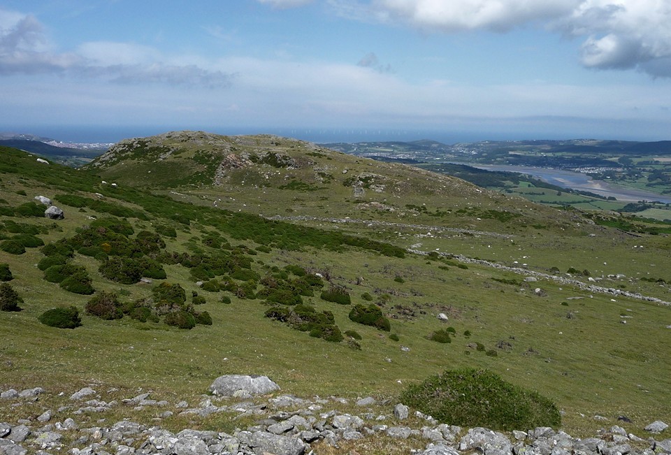
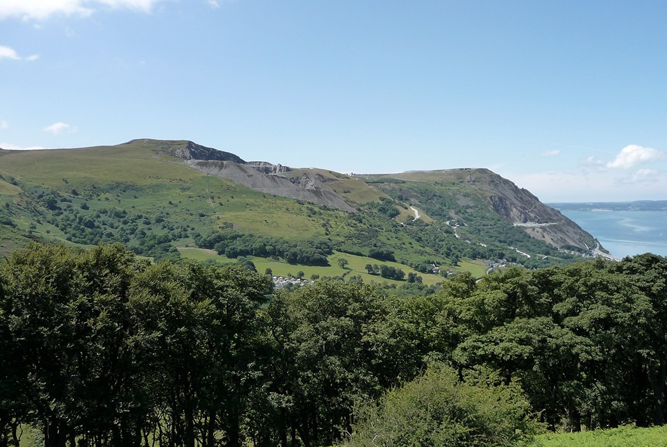
The Mountains Are Singing - Penmaenmawr 2 July 11Dammit, this train is getting later and later. Sometimes a delay is nothing, but today’s a big day of prehistoric excitement, if only I can ever get there. Last night a discussion on the forum led to an offer of a meet up at Penmaenmawr, in a part of Wales I’ve never been to, for a walk to the Druid’s Circle before a climb of Tal-y-Fan. I ring my companion for the day, to tell her that Arriva are doing what they can to stop me ever getting there. Luckily the voice at the other end is one of calm reassurance, unphased by the changing timetable. This is my first contact with Blossom, who has offered the meet up. By the time I get to Penmaenmawr, an hour and a half late, it’s shaping up to be a glorious summer’s day. Blossom is waiting on the platform, her dogs are waiting in the car, and without much ado off we head up the steep and winding road that leads to the Two Pillars carpark, at the top of the prosaically named Mountain Lane. A broad and easy track climbs steadily from the carpark, carefully hiding the views south behind the flanking Foel Lus but providing a grand vista of the quarried and scarred Graig Llwyd and across to Ynys Mon – these are places I’ve longed to see, now laid out between azure sky and blue-green sea. Graig Lwyd — Images20.07.11ce
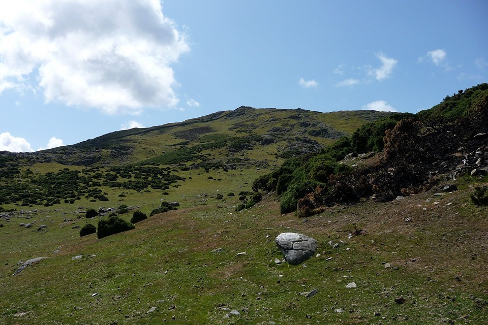
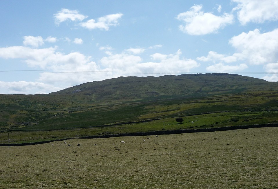
We emerge onto a hillside of well-made drystone walls and cropped grass. The long summit ridge of Tal-y-Fan is the principal backdrop, far off and high above. Red Farm — Images21.07.11ce
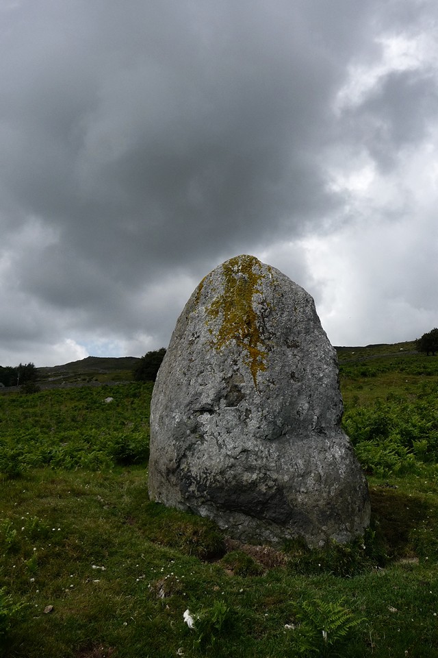
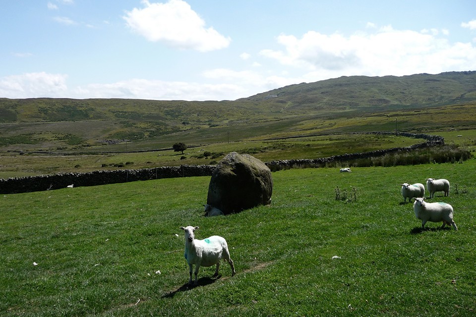
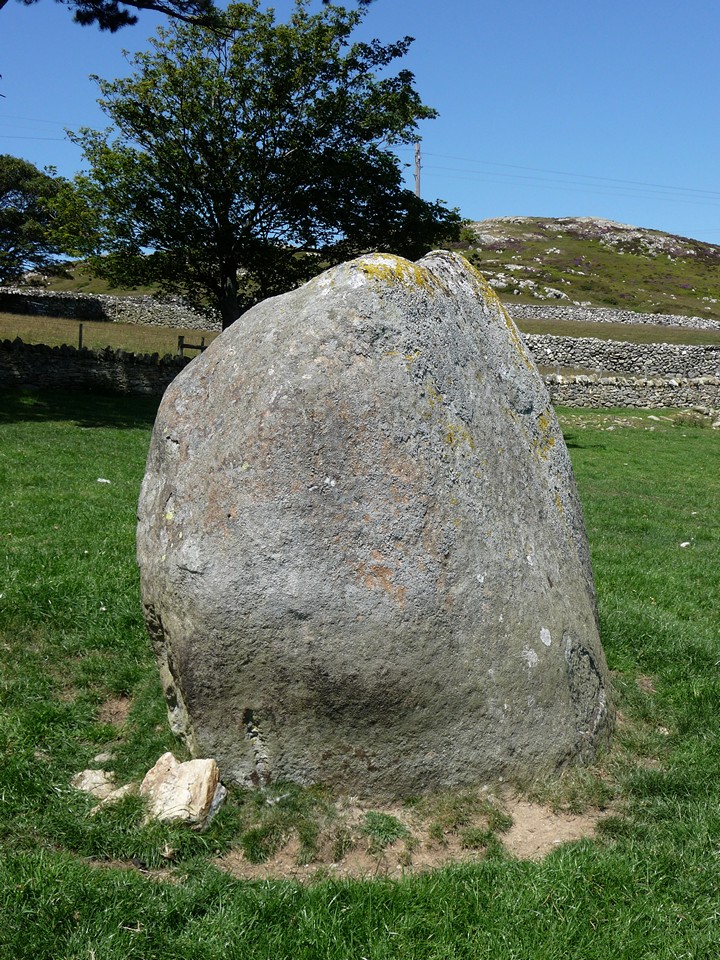
Maen Crwn — Fieldnotes03.04.15ceAfter passing Red Farm stone circle without a proper look, the impressive boulder of Maen Crwn is the first proper stop on the walk up towards the Druid's Circle. Set in the V of a valley between higher hills, the long views are restricted. But it feels like a stone-on-the-way-to-somewhere stone, the kind you often find marking your path in upland Wales when on the way to exciting destinations. And given what waits above, it certainly performs that function beautifully. The pull of the circles is too much to linger though... Maen Crwn — Images21.07.11ce
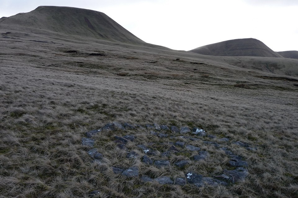
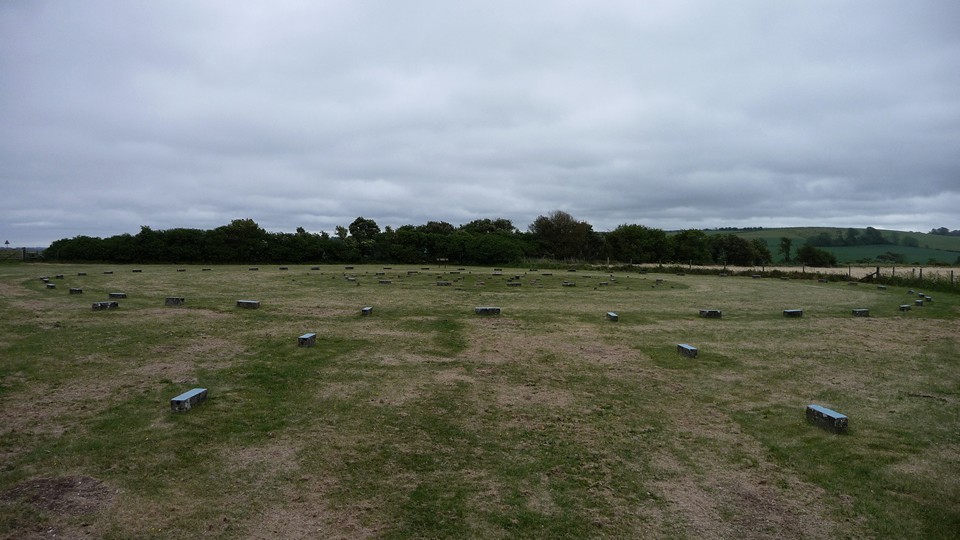
Circle 275 — Fieldnotes03.04.15ceIt’s a further steady slog of a climb up from Maen Crwn, and the excitement levels really ramp up from here on. Druid's Circle is already visible on the skyline above, but it's still worth restraining the urge to get there for a while with a pause at this lovely little circle. Like something someone might build around a campfire, a simple ring of smooth stones, with a wonderful sea view. The dogs are very taken, sniffing around the inside of the ring. If it weren't for the fact that the Big Attraction is so visibly close, it would be easy to stop here for a good while. But we don't. Circle 275 — Images21.07.11ce
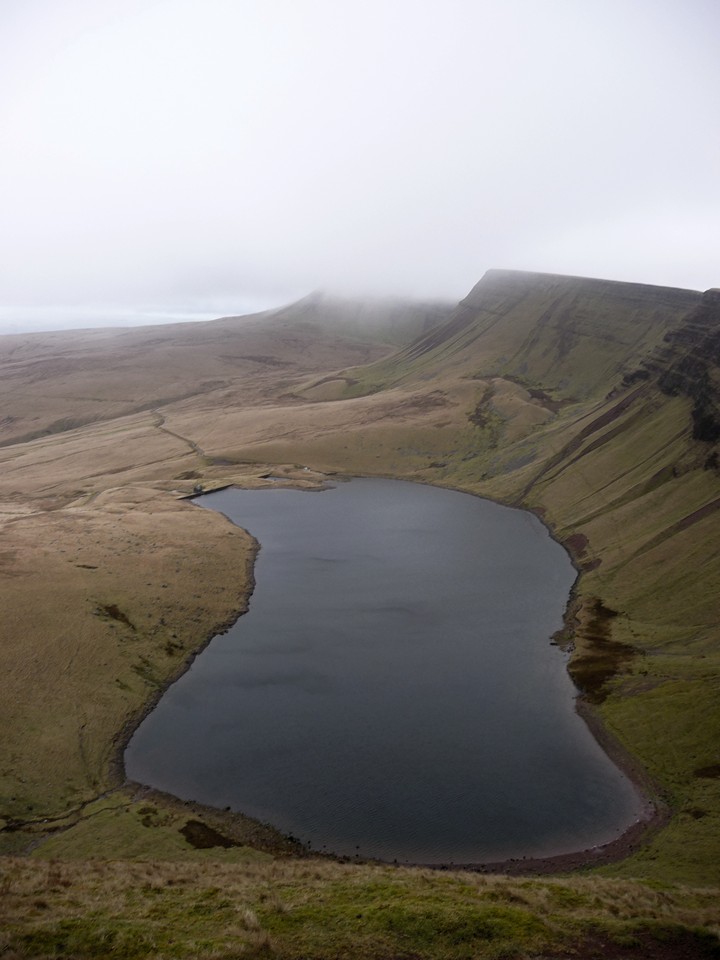
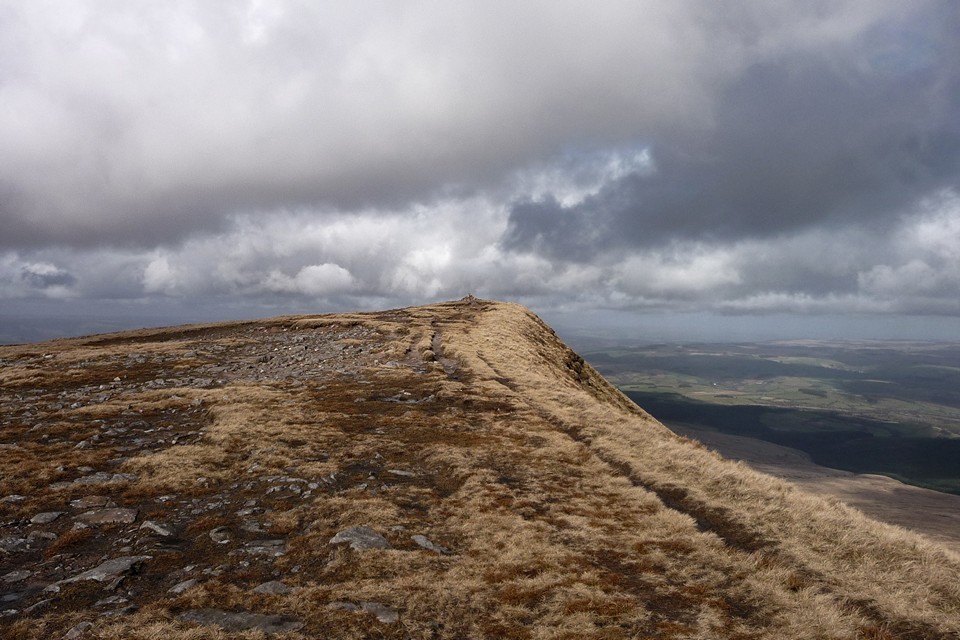
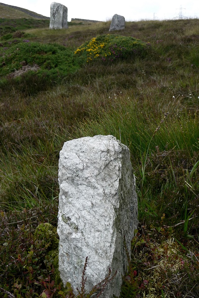
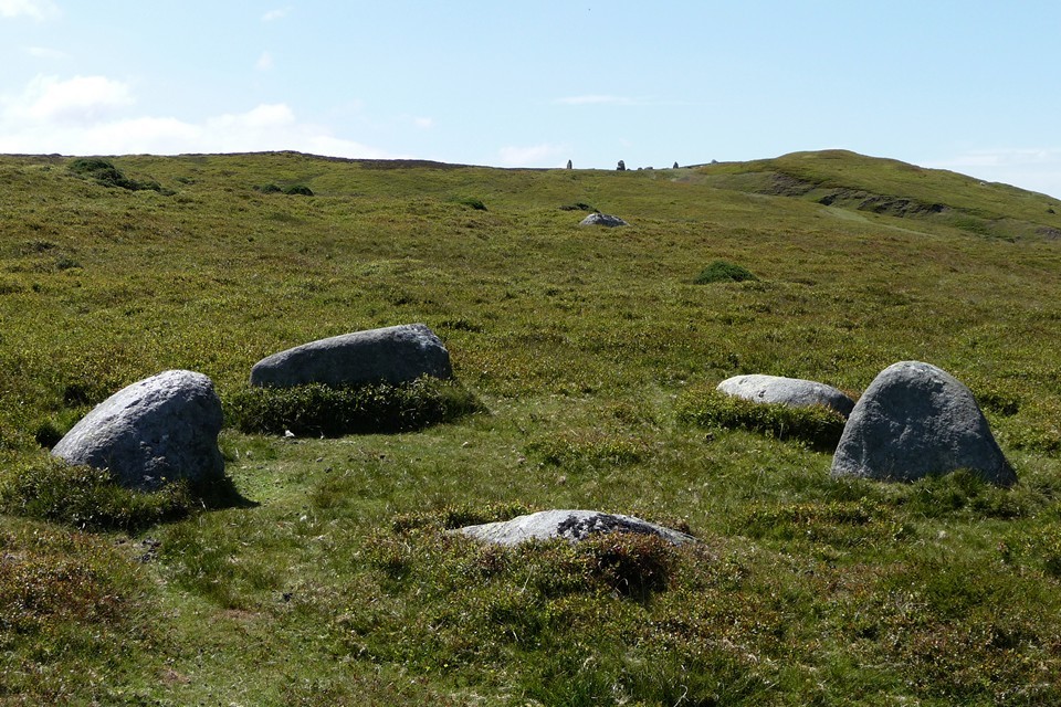
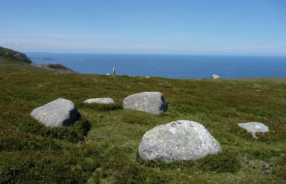
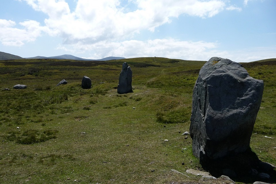
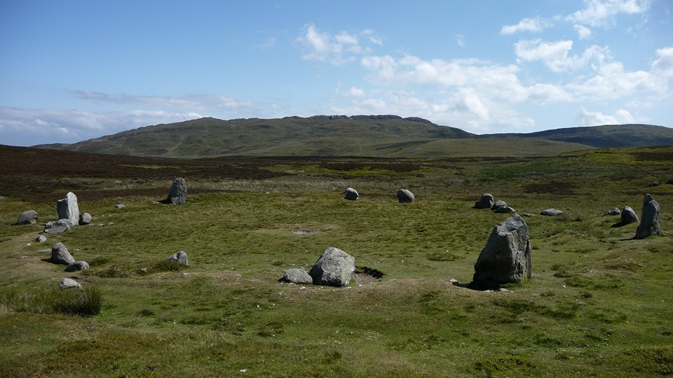
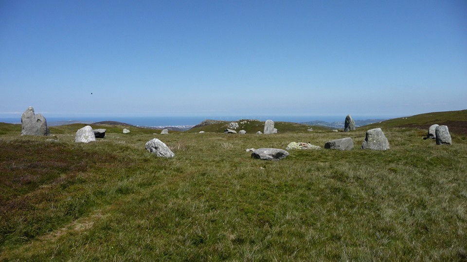
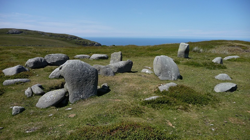
Y Meini Hirion — Fieldnotes05.04.15ceIt’s not much more of a pull upwards to reach the circle. There’s no-one else about so I can savour this beauty properly. The setting is as good as any stone circle I’ve been to, particularly on such a wondrous summer’s day. The sea to the north, the high peaks of the Carneddau mountains to the south. It’s a bit special this. The stones are big, certainly bigger than you’d find in many Welsh circles. Each has character and there are veins of quartz here and there. Although some of the stones have fallen, it doesn’t detract from the overall impression. Mountains, stones, silence, sea and sky. I could write a few pages of superlatives, but really you should come and see for yourself. In the meantime, we have some lunch and take it all in. Y Meini Hirion — Images24.07.11ce
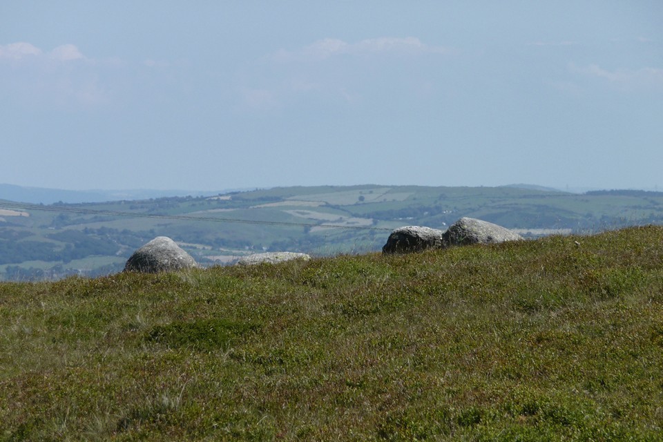
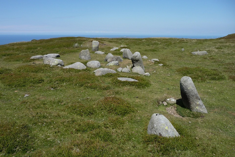
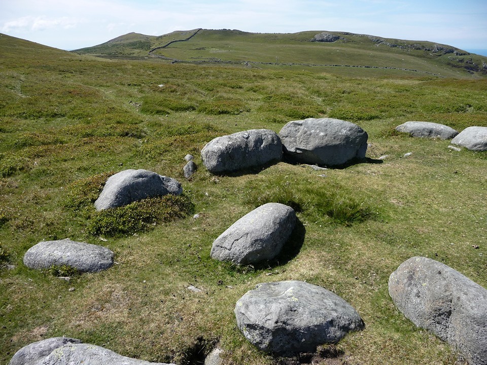
Monument 280 — Fieldnotes05.04.15ceBlossom has Frances Lynch’s excellent Gwynedd guide with her and we have a quick look to see what else there is around here. The prominent jumble of upright stones visible to the west is the most obvious place to head next. Unfortunately we don’t realise that Circle 278 is hidden away over a little crest and miss it completely. Drat. Monument 280 (these numbers suggest a spectacular profusion of other sites crowding around us) is very difficult to get a handle on, even when you’re standing in its midst. A row of four uprights run north-south across the monument, while on the west an apparent kerb forms its edge. Shapes and patterns can be discerned, but are contradicted by other patterns. Truly an enigma. Monument 280 — Images24.07.11ce
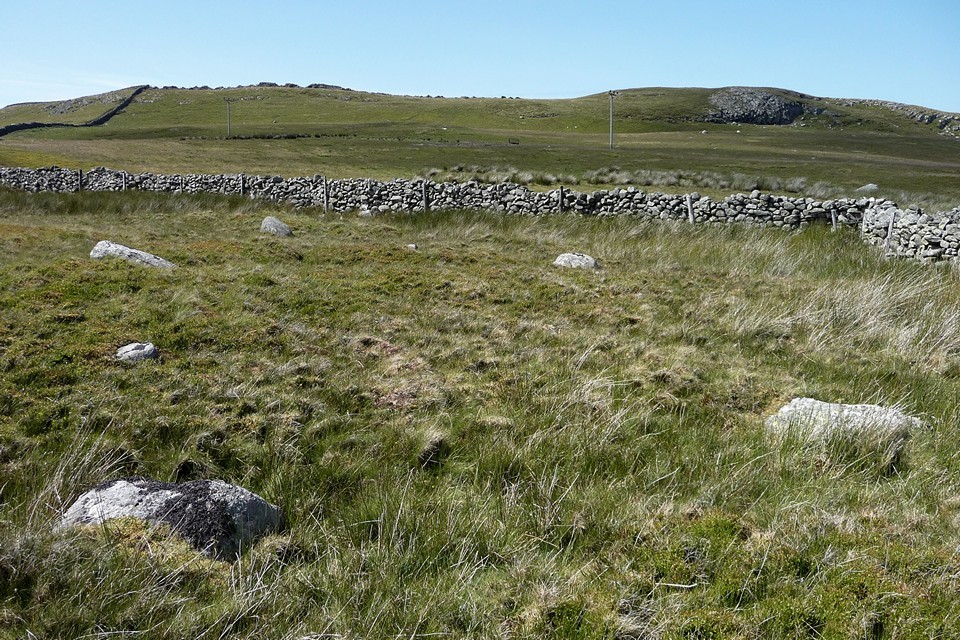
Cors y Carneddau — Fieldnotes05.04.15ceHaving singularly failed to realise we’d missed Circle 278, we continue west along the main track. Cors y Carneddau circle is supposedly on the north side of the track. Surely this should be easy to find? Well, no. Part of the problem lies in the fact that there are quite of lot of random stones in the grass here. Which ones do you choose? Eventually we decide that a group quite near to the drystone wall, just east of a corner, is the best bet. There are at least four stones in a sort-of arc, with a couple of additional possibles close by. But I could be persuaded otherwise… Cors y Carneddau — Images24.07.11ce
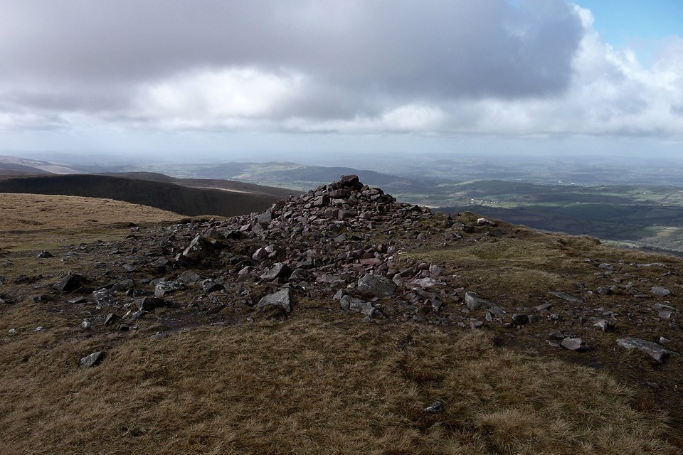
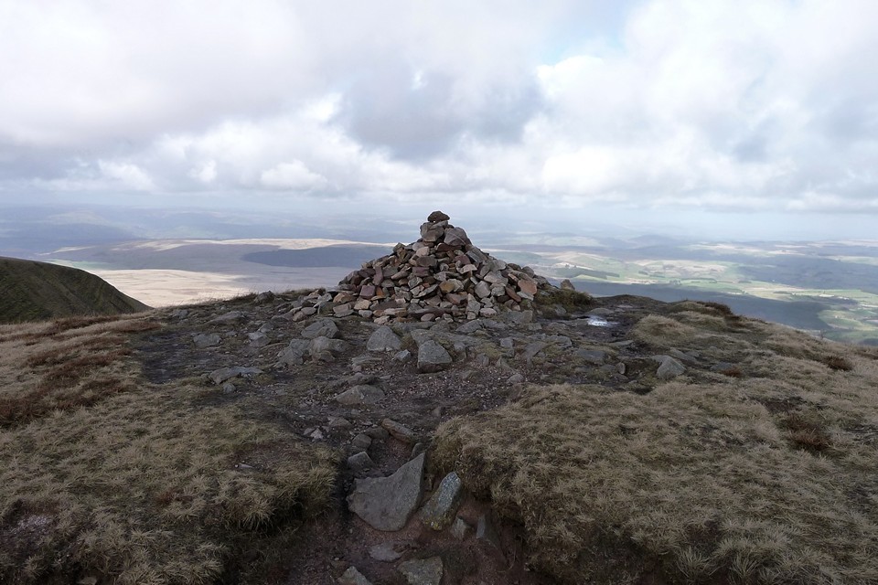
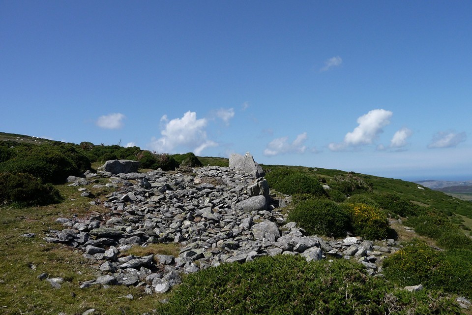
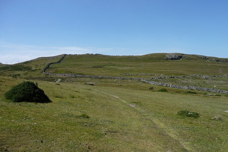
Cefn Coch (Penmaenmawr) — Fieldnotes05.04.15ceWhat is entirely certain though, is the massive Cefn Coch (“Red Ridge”) cairn. It would be impressive anywhere, but what sets it apart from comparable sites is the stunning backdrop of the Carneddau. Turning its face resolutely from the sea hidden behind a ridge to the north, the cairn unquestionably looks inland towards the mountains. The very highest peaks of the range are hidden from here, but the skyline is filled with an array of summits all well above the 2000ft mark, several of which boast contemporary monuments. It's a breathtaking sight and we sit in awe for quite a while. Cefn Coch (Penmaenmawr) — Images24.07.11ce
This stunning place will be our final outpost of the day. It’s getting on and my plans to head on to Tal-y-Fan, already compromised by the train delays, were abandoned as soon as I reached the circles. A first visit to this wonderful complex in such amazing weather deserves time to savour. Today I’ve had good company to savour it in. We retrace our steps to the car and I know I will surely be back. What a perfect day. |
Posted by thesweetcheat 5th April 2015ce Edited 14th June 2023ce |
49 Adventures - Wansdyke Wandering 28 May 2011 |
49 Adventures - Wansdyke Wandering 28 May 2011The previous weekend I used the 49 bus service to walk to Avebury from the north, so a walk from the south seems a fitting follow-up. I get off at Shepherds Shore, the handy point where the post-Roman Wansdyke crosses the A361. There’s a gentle climb up the shoulder of Roughridge Hill, following the earthwork and allowing an unfolding view of Cherhill Down and Oldbury and the extensive North Down barrow cemetery. Cherhill Down and Oldbury — Images17.03.15ce
Roughridge Hill — Fieldnotes22.03.15ceThe first stop off is Roughridge Hill long barrow. Well-defined on the OS map, the reality is rather less impressive. Unless you know it’s there, you’d pass by without a glance. All that remains is a low rise in the grassy field, hard up against the edge of the much bigger Wansdyke. The proximity of the dyke may suggest that the long barrow was a reasonably obvious landmark, perhaps a boundary feature, made use of by the earthwork builders when they were planning their route. Sadly it’s not so prominent now, not really worthy of much of a pause as I head across the hill. Two lithe brown shapes dart into my path, then rise on hind legs to survey their route – it’s the first hares I’ve seen this year, always a great pleasure to encounter. Roughridge Hill — Images30.05.11ce
Easton Down — Images30.05.11ce
Kitchen Barrow — Fieldnotes22.03.15ceFrom the strip fields there is a great view of Kitchen Barrow Hill to the east. The south-facing scarp is steep and the presence of an intervening dry valley heightens the impression that Kitchen Barrow was placed to be seen from the neighbouring slopes. The area around the barrow is open access land, so there are no complications in getting to the site. Pastscape records show a round barrow to the north of the long barrow, at a point where the fence changes direction. However, although there are several bumps alongside the fenceline, none is particularly obvious or convincing as the round barrow depicted on the OS map. The long barrow is certainly obvious though, 30m or so long and a couple of metres high at its southern tip, with well defined flanking ditches. It lies along the sloping crest of the ridge, with its northeastern end almost blending into the hillside. The views south are extensive, as the ground drops sharply to the farmland and the valley of the Kennet & Avon Canal below. To the west there’s a great view of the multi-phase west end of Tan Hill, where more strip fields lie below a linear prehistoric earthwork and a group of Bronze Age round barrows are silhouetted on the skyline. A good place to stop for a while and let the world turn, especially on a Wiltshire big skies day of fast-moving cloud. Regrettably today’s visit is under a rather more leaden variety. Kitchen Barrow — Images30.05.11ce
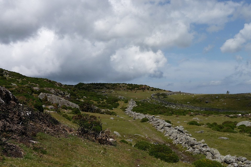
Tan Hill (west) — Fieldnotes22.03.15ceLeaving Kitchen Barrow it’s an easy walk around the rim of the escarpment to the western flank of Tan Hill. The first encounter is with the linear earthwork running just below the top of the slope. Presumably part of the same thinking that constructed a much longer section of bank and ditch on the northwestern side of the hill, it’s pretty well-preserved, with the hillside falling steeply away below it. A bit of further uphill huff and puff and I’m in the midst of the round barrow group that crowns the western spur of Tan Hill, a promontory separated by a narrower neck from the main bulk of the hill to the east. Tan Hill is the second highest hill in Wiltshire, only fractionally lower than nearby Milk Hill and part of the same long east-west ridge. As you’d perhaps expect from such a prominent place, looking out across the downs in all directions, the ridge is covered in a timespan of prehistoric sites from the Neolithic long barrows of Kitchen Barrow at the western end and Adam’s Grave at the eastern end, through numerous round barrows and Iron Age earthworks, with Rybury hillfort on a southern spur. There’s a great view westwards, taking in King’s Play Hill and Morgan’s Hill, each topped with further barrows, as well as the unmistakable Cherhill Down and Olbury with its obelisk. The barrow group includes three bowl barrows, in a NW-SE line, with a much larger disc barrow close to the two northern bowl barrows. All are clearly visible, if rather reduced by ploughing. The bowl barrows (particularly the one at the SE) bear clear excavation damage. They are all covered by sheep-cropped grass, so there’s no seasonal vegetation problem to contend with in a visit. Although it’s the most damaged, the SE barrow is still pretty impressive and boasts very extensive views. The central barrow is bigger, well over a metre high despite the ravages of time and barrow diggers. The NW barrow is the runt of the litter, clinging to its sloping setting like a barnacle. All have well defined surrounding ditches. The adjoining disc barrow is great too, almost 20m across, including its outer bank. All in all well worth the effort of the walk. Tan Hill — Images30.05.11ce
Tan Hill (west) — Images31.05.11ce
Wansdyke is most impressive here, snaking its way across the northern slopes of Tan Hill. There’s also a decent view of a single, large round barrow on Horton Down, surrounded by gallops but covered in a darker green mantle. Horton Down — Images01.06.11ce
Allington Down — Fieldnotes22.03.15ceSadly the barrows on Allington Down have been rather less well-treated than their neighbours up on the ridge. Once a group of six, there’s nothing to see of all but one now. The plough has taken care of the rest. However, the one that does remain is very decent. It’s quite overgrown with nettles and long grass, topped with three shrubby May Trees in bloom, making it difficult to see whether there’s damage to its top. I can see Silbury, peaking out from trees and indicating how far I still have to go to get to Avebury today. So I go. Allington Down — Images01.06.11ce
West Kennett — Images01.06.11ce
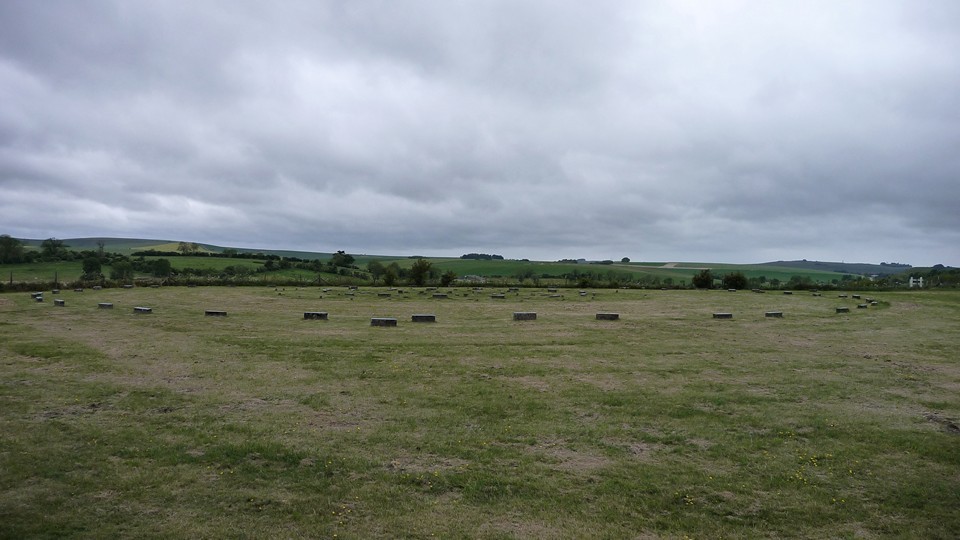
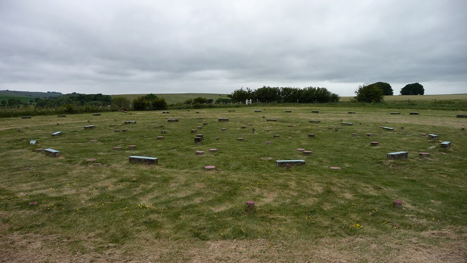
The Sanctuary — Fieldnotes22.03.15ceI visited The Sanctuary once before, on my first trip to Avebury. On a day of first contact with heart-stopping monuments, the concrete-marked circle seemed an anticlimax, a curio and little more. Today I’m more receptive, especially after the long, peaceful walk over the downs to get here. The place is deserted when I arrive, allowing a better appreciation of the layout and in particular the size of the rings. The outer circle is a wide 40m across, as big as almost any stone circle I’ve been to. Although the little concrete blocks are no substitute for stately sarsens or hefty timbers, there’s still much to enjoy here, if you can block out the steady roar of the busy A4 just over the hedge. Looking south across the low Avebury 23 round barrow, the tree-covered form of East Kennett long barrow can be seen from the circles. Such a shame that the original grandeur is lost forever though. The Sanctuary — Images02.06.11ce
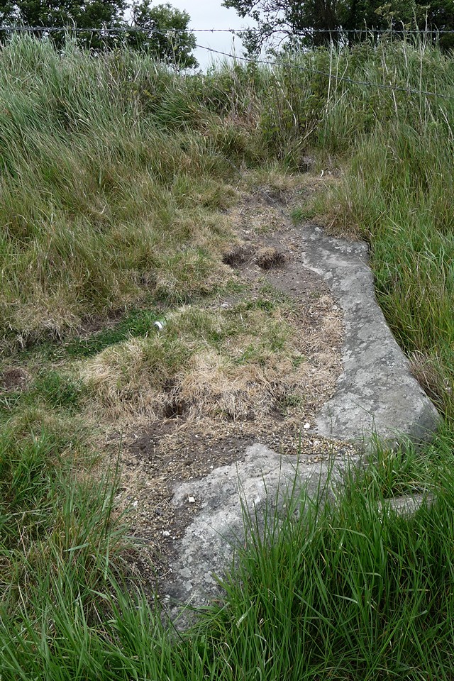
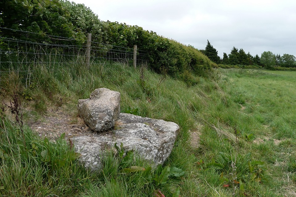
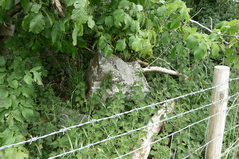
West Kennett Avenue — Fieldnotes22.03.15ceFrom The Sanctuary, a permissive path allows access to the remnants of West Kennett Avenue on the south side of the A4. This part of the monument seems to receive little attention, probably because of its separation from the better preserved section running northwestwards to Avebury. However, it’s well worth a visit to make sense of the relationship of The Sanctuary and the henge complex. The first stone encountered is an enormous fallen slab, jutting out from the hedgeline. Beyond that is another fallen stone, apparently broken with a smaller piece placed on its top. The final stone in this group still stands, buried in the hedge and trapped behind barbed wire. It has been broken, leaving a short stump in place. Screened from the busy A4 by the thick hedge, this is a hidden spot, remarkably quiet for somewhere so close to the Avebury tourist hub. It doesn’t have the atmosphere or obvious draw of the well-known northern section of the Avenue, but it’s another part of the jigsaw that makes up this fascinating landscape. Risking life and limb I cross the A4 onto the B4003, a narrow but busy road that runs parallel with the Avenue on its way to the henge. It’s worth stopping off at the single upright stone, separated from its companions by the road and hedges, looked down upon by the linear cemetery of massive round barrows along the Overton Hill ridge to the east. West Kennett Avenue — Images02.06.11ce
Falkner's Circle — Fieldnotes22.03.15ceBy now the threatening skies of earlier have turned to a persistent drizzle, and contact with any vegetation leads to an immediate soaking. I decide to leave the road and Avenue and instead head east to look for the scant remains of Falkner’s Circle. A path leads round the margin of the field, eventually reaching a gateway where a single standing stone marks the position of the poor old circle. Nettles surround it, neglected and lost, a sad survivor with no-one to talk to. I’d like to come back on a less gloomy day, perhaps in the winter when the nettles have gone. It doesn’t feel like a place to linger today though. Falkner's Circle — Images03.06.11ce
Avebury — Images03.06.11ce
A final embrace with the Cove, and the 49 is back, to take me homewards from another glimpse of the vast landscape surrounding the beating heart of Avebury. |
Posted by thesweetcheat 22nd March 2015ce |

19thC Shetland Archaeology in Orkney papers |
19thC Shetland Archaeology in Orkney papersBressay July 18th 1865 "The Orcadian" George Petrie and Dr Hunt excavate 65'D 10~11' high bowl barrow. Near the centre 5-6' below the apex were fond a "peculiar" stone tool (similar to one found at Sefster on same trip), potsherds and ox bone fragments. Tumulus made of burnt stones, having a circle of stones just inside the perimeter with the remains of an encircling circular wall a few feet inside that. On the wall's inner face, roughly 15' inside the north perimeter, a large edgeset freestone block was found facing the centre. This was held up by a wall either side and had a large perforation near its upper end. Not far from the mound, but unconnected, were found two inscribed stones, each with a different kind of runes. These were taken to Lerwick. . Brindister Voe HU25NE 6 July 18th 1865 "The Orcadian" Broch of Brindister at edge of steep cliff and defended by double earthworks landward. George Petrie and Dr Hamiltton saw doorway and traced galleris in the circular wall but didn't examine inerior as choked with debris from broch tower. Broch of Burraness HU58SW 1 October 31st 1865 "The Orcadian" described. In 1854 one of the best preserved broughs in Shetland but a lot taken for cottage building in Burraness. The Brough HU48NW 3 31st 1865 "The Orcadian" llttle left of Brough of West Sandwick's wall. Brough of North Garth ~HY547005 October 31st 1865 "The Orcadian" brough below house, at beach's N end, almost entirely gone. Brough of Stoal HU58NW 1 October 31st 1865 "The Orcadian" at least 3 ditches cut off brough at stole/chair of Awick, very high banks. Brough of West Yell October 31st 1865 "The Orcadian" name mentioned. Burgi Geo HP50NW 2 October 31st 1865 "The Orcadian" description of approach to brough on Burgar Goes, a site mentioned by Hibbert. Burra Voe HU57NW 2 October 31st 1865 "The Orcadian" little left as most of Brough of Burnavoe stones taken to build house at Burnavoe by owner Mr Henderson, entrance to underground passages now blocked by stone. Charlotte Street, Lerwick February 12th 1886 "Orkney Herald" stone cist with remains, probably previously disturbed, found near surface in clearing site for Mr Ogalvy's houses at bottom of Charlotte Street. Clickhimin HU44SE 2 July 18th 1865 "The Orcadian" Broch of Clickimin [sic] in worse state than Mousa but wall restoration more in keeping with design.. April 11th 1888 "Orkney Herald" Stones removed from causeway by local butcher for building material. Fillicomb Point HP50NW 3 October 31st 1865 "The Orcadian" some ditches of brough in heads of Toft remain but part of broch fallen into the sea. Foula June 27th 1883 "Orkney Herald" report from "Shetland News"; man on Foulis [sic] finds fresh-looking but headless female body, lying on an o.g.s. of stunted heath, after digging 6' through solid peat. Giant's Grave, North Yell July 29th 1871 "The Orcadian" close to St Niniian's Kirk site (Papil Bay) is a N/S aligned low mound called giant's grave and never built upon, though slight attempts to excavate seem to show natural sandstone only. Gossabrough HU58SW 1 October 31st 1865 "The Orcadian" chambers visible in Brough of Gossaburgh ruins, graves reported nearby. Graveland HU49NE 3 October 31st 1865 "The Orcadian" remains of buildings at Brough of Bergaard on small peninsula. Greenbank HP50SW ?53 July 29th 1871 "The Orcadian" two stone fragments with worn lettering found at Clinsara Reggs on the meik of Papal by Margaret Craigie of Millby Cottage servant, near the St Ninian's Kirk site. Head of Brough HU48SW 2 October 31st 1865 "The Orcadian" description of Brough of Brough. Holm of Coppister HU47NE 1 October 31st 1865 "The Orcadian" Brough of Cuppister mentioned (name only). Levenwick HU412NW 3 August 21st 1869 "The Orcadian" recorded by Dryden.Broch excavated down to the foundations within the last fortnight by Gilbert Goudie and described. Only finds part of a handmill and bone fragments. Loch of Huxter HU56SE 1 June 17th 1879 "Orkney Herald" described in notice read to Society of Antiquaries of Scotland. Mailand (Unst) HP60SW June 10th 1876 "The Orcadian" D Edmonton's men digging May 31st on area long dug for peats discover 4 cast metal items together mouth down in the peat, a large basin and 3 fire-pots different sizes. Mousa HU42SE 1 July 18th 1865 "The Orcadian" description of Mousa-Borg, where restorations have been made to the walltop and the doorway but those to the latter has greatly changed the appearance. Muckle Heog East HP61SW 12 September 27th 1864 "The Orcadian" burnt human bones from crouched people found in cist 18" below ground level in digging hole for flagstaff, 2 skulls sent by Mr Edmonton to Mr Roberts at Somerset House. Papil Bay HP50SW 4 July 29th 1871 "The Orcadian" St Ninian's Kirk site at the Kinwail 'gard of Weeping' close to mound called giant's grave. Sefster HU35SW 14 July 18th 1865 "The Orcadian" celts and stone knives found by minister Bryden several years ago in underground passage at Safsetter/Safester. Passage re-opened and many more tools found, including one similar to that already found in a Bressay mound. Potsherds and stone vessels also found. St Ninian's Church HU32SE 4 ? August 26th 1885 "Orkney Herald" letter from the "Scotsman" describing situation of unenclosed disused St Ninian/Ringan's graveyard: ~6 miles from Fitful Head on E side of tidal outlet on W side of mainland's southern part. Soil is loose light sand to a great depth. Trebister HU43NW 13? March 28th 1883 "Orkney Herald" preparations on Saturday for a graveyard at a grass-covered mound belonging to Rev Mr Walker bring to light a 'Pictish castle', 40' of a circular section 4' high surviving from what is likely to have been a ~140' outer wall of the building. Stone dyke encloses mound. Large quanities of dark red peaty ash in several places and a man's jawbone found. Other discoveries were a few stone celts, several 12x8" ovoid polished stones (some with oval cavities) and four pottery varieties - 2 dark red soft earthenware sherds, a hard brick red sherd, and a very hard modern looking highly polished grayish sherd with light green spots. Uyea, Shetland HU69NW 7 March 18th 1885 "Orkney Herald" article includes extra to P.S.A.S record of meeting, being mention of 3 steatite urns found in tumulus and 4 polished oval porphyrite knives found by Mr J Leisk, all exhibited. |
27th November 2014ce |
Walking with Owls in the rain at Drannandow |
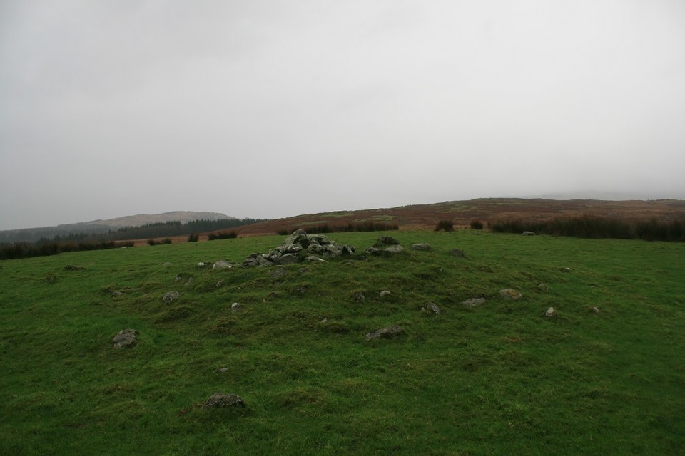
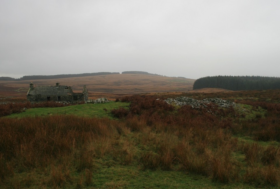
Walking with Owls in the rain at DrannandowAbout three miles north west of Newton Stewart is the tiny village of Penninghame easily reached by following the A714, but the megalithic complex of Drannandow is across the River Cree and there is no bridge here. Either keep going to Clachaneasy and use the bridge there or start from leaving Newton Stewart by going to Minnigaff. Look for an eastern turning to the less than a mile away Drannandow Farm. We parked just the other side of the farm. It was still persisting down so Eric decided to let me have a wander round the wilderness on my own, suited and booted in waterproofs from heaven I set off up the track at my briskest pace. Several gates need to be opened and closed and after less than a mile turn right onto another track. On the highest ground immediately right of the farm track is the stone circle and cairn of Drumfern. I was looking for the cairn first as it would be I hope, the easiest to spot. It was, the rain and poor visibility didn't add much to the atmosphere, the atmosphere could best be described as drizzly. About one meter high and occupying a good lookout position the cairns extremities have grassed over leaving the cairns high parts open to the air. My dad once said "seen one stone circle seen them all" I disagree strongly but with cairns he might have got away with it. Drumfern — Images10.11.14ce
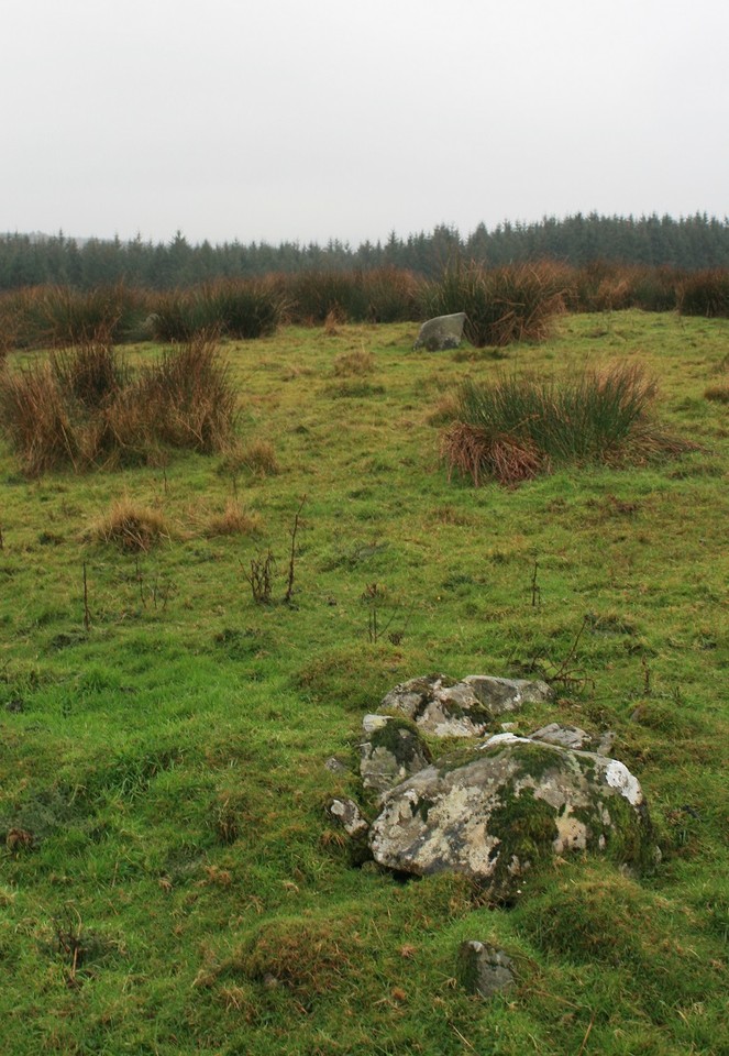
About fifty yards away going back to the track I eventually found the remnants of Drumfern stone circle. There are many stray small boulders that may or may not have once been part of the circle, this makes pinpointing the ring a touch less than easy. But it is there, Only three or four stones are still up standing, hiding amid the long reedy grassy bunches that like to hide circle stones. One rough stone is almost a meter high the other two or three are smaller smoother boulder like stones. I quite liked it despite it's near destruction, finding the stones that describe the circle is a bit like putting an easy jigsaw together, or doing a child's crossword, maybe. Drumfern — Images10.11.14ce
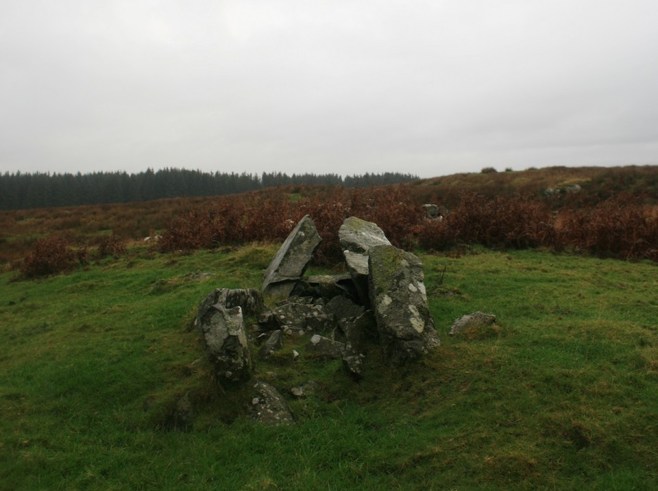
Seeing as I found the circle quick and easy enough I decided to try and see all that was here in this little complex. Heading further east along the farm track I enter the forestry part of the walk. Creepy places at the best of times, strange sounds followed me round, one time I thought I heard a car behind me but there was nothing there, creepy, at least the trees shaded me from the incessant rain. Coming out of the other side of the forestry block keeping to the track for another four hundred yards I came to Drannandow chambered cairn right next to a ruined cottage apparently called Nappers cottage. This was the scene of my all time bestest nature moment, as I approached the cairn and the cottage a big white bird launched off the ruin and flew away, at first I thought it was a seagull, but then another one flew off, this time closer, I could clearly see that it was a Barn Owl, 45 years and ive only seen Barn Owls twice, now ive doubled my tally in a day. The spirit of Nutkins came over me and I walked over to the ruined cottage in a trance, looking through a window I decided it was too perilous to go in it so I walked round and looked through another window and there on a roof beam was another Barn Owl not ten feet away from me, it screeched at me as it flew away looking me in the eye as it went past, I have not been that close to a raptor outside of a falconry display. I reckoned it would not matter what stones I saw that day, that Owling moment would be the highlight. (Barn Owls are the quietest fliers, even their feathers have feathers). One of the Owls perched on a nearby gatepost and watched me looking over the chambered cairn, oh yeah right, focus, stones. Drannandow — Images10.11.14ce
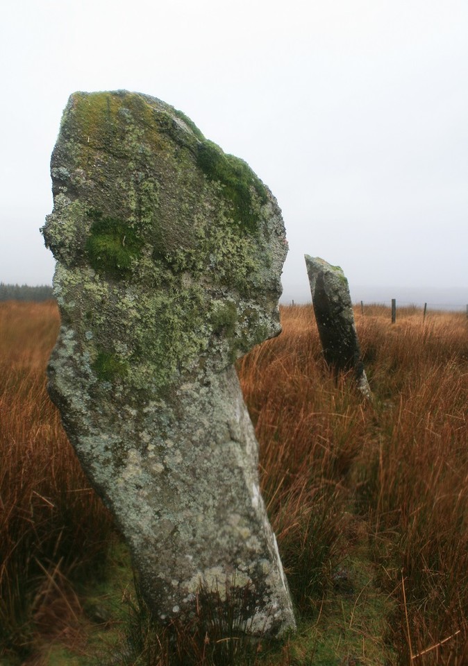
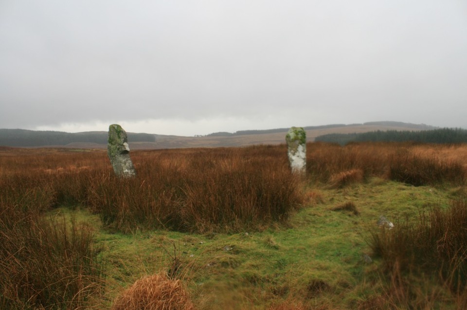
Five, yes five chambers there are in this cairn, the eastern chamber is the biggest, but it looks like it's been tacked onto the side of a roundish cairn and made it into a longish cairn. The north west chamber is pretty good too, but the other three are full of rubble and covered in ferns, making them hard to distinguish. The whole thing is on the large side and really quite impressive, long views south across the moor. From here there are two other cairns on a south south west alignment, the furthest can just be seen on the tree line of the forestry block I just walked through, and the other is nearer to the cottage, but because of the crappy weather and time constraints I decided to let them go, which was a stupid shame because the middle cairn has a cist, still with it's capstone in place, I now wish I'd gone over for a nosy. But at least there's still a couple of large standing stones to be seen, I'd glimpsed them as I came out of the trees, so I knew where to head for. But it didn't make getting there any easier, bogs, streams and springs all wanted to soak me or even break a leg. On approach to the stones they looked very dark, black almost against the moors light brown colour. Standing next to them they are both taller than me, 6ft 8' and 7ft 4', and covered in mosses and lichens. Big brown cattle eyed me suspiciously as I stumbled this way and that, I put on my best Scottish accent and told them not to worry I'm a Postman. The Thieves they are called, it says so on the map very clearly, traditionally they're said to take their name from the fact that several free-booters were executed at them in the 14th century. Kill them all I say (what is free booting?) Whilst I was there I could see a very clear rubble bank, like what you get on embanked stone circles, the two tall stones stand on this bank 14 feet apart, research later explained the bank away as modern, but, well, what could it be for? mysterious. Blair Hill — Images10.11.14ce
The two stones are very good menhirs, one of them is a very unlikely shape, I like unlikely shaped standing stones, they are so......unlikely. But that is all the time I can spend at Drannandow, Eric, food, and Glenquicken await. Owls are brilliant, but seeing them is better. |
 Posted by postman
11th November 2014ce |
more early Orkney newspaper accounts summarised |
more early Orkney newspaper accounts summarisedHaving gone back to Orkney's 19thC newspapers to extract accounts of non-Orcadian sites I found more Orcadian ones too. So here are more summaries Birsay October 27th 1886 "Orkney Herald" decorated 8/9th century box found previous year on exhibit in temporary museum in Kirkwall Town Hall along with contents Blomuir (not one of the known sites) December 7th 1896 Orkney Herald" account of chambered mound near house of Blomuir (built of stones from mound) excavated few weeks before by owner, producing 8 skeletons and a polished gneiss hammerhead. Half skeletons found in E/W aligned corbelled chamber measuring maximum 10' x 3½', walls standing up to 2½' with entrance half-way along S side. Stone ball stone B.1914.594 found at mound a few days ago Braehowar June 11th 1867 The Orcadian" new road cut through small part extensive stoney mound ruins revealing bone fragments and shells Burrian Castle HY75SE 3 December 6th 1882 "Orkney Herald" recovered relics donated by Mr Traill of Woodwick to the Antiquarian Museum Corquoy (Mansies Knowes) HY43SW 17 November 2nd 1880 "Orkney Herald" account in The Scotsman of previous excavation of a Manx nound producing same knd of urn Hillhead HY40NW 12 April 19th 1882 "Orkney Herald" full description of ornamented stone ball found draing a field - only other example found in Ireland several years before. Cast being sent to the Antiquarian Museum. Ivar's Knowe HY74SW 10 October 31st 1894 "Orkney Herald" rising Ivar's Knowe and a few mounds ¾ mile to its W mentioned as full of burnt stones Knowe of Taft HY22SE 8 January 20th 1880 "Orkney Herald" on rise called The Taft farmer George Garson of Hamar breaks through 3~4" thick slab roof into space 2½" square extending in a circular direction. Bones have been found near this January 24th 1880 "The Orcadian" George Garson of Hammer [sic], Greenie, excavates opening 2'6"~2'9" broad by a foot deep (above a yard of soil containing bone) thought part of a broch. Taken to about 30', 2 'cists' are found and also red pigment a decorative circular glass piece.and rude pottery - Samian sherd found here some time ago Lingrow October 27th 1886 "Orkney Herald" perforated serpentine macehead found on property of Mr Graeme of Graemeshall on exhibit in temporary museum in Kirkwall Town Hall Little Howe of Hoxa ND49SW 2 June 21st 1871 "The Orkney Herald short account of dig on concentric walled ruin begun previous Wednesday and finds to date Munkerhouse, Papay HY45SE 26 August 22nd 1874 "Orkney Herald" Mt Traill of Holland allows dig of broch remains in cliff-face near Established Church. Most of large tower gone but extensive outworks, with some lintels remaining, proceed undergorund towards kirk. Ness of Brodgar HY21SE 16 October 10th 1888 "Orkney Herald" visitors dig tumuli near Ring of Brodgar. One covered by 6" of peat, under which fine light brown earth, then after ~2'6" large stones cover dark ashy earth intermixed with small bone fragments. Mound lies on bed of clay North Town Moss, Burray ND49NE 5 May 1st 1889 "Orkney Herald" very detailed description of silver hoard found on April 22nd by George Petrie of Little Wart 3' deep while diigging peats at "head of green slade" on N side of North Side Moss [sic] roughly a mile NW of school Old Town Hall, Kirkwall HY41SW 142 November 12th 1890 "Orkney Herald" tombstones found in demolishing old walls of the old town hall, said to have re-used stone from Ear's Palace December 17th 1890 "Orkney Herald" 2 12" white sanstone balls unearthed Peterkirk (Tresness) HY74SW 7 October 31st 1894 "Orkney Herald" at St Peter's Chapel a fine well having been removed previously a narrow well-like vault with two recesses has been found and various stone tools and combs. The mound was originally at least 25' high Pier of Gill HY44NW ?23 October 27th 1886 "Orkney Herald" Two polishd serpentine celts found in mound along with a skeleton on exhibit in temporary museum in Kirkwall Town Hall Pisgah x2 HY44NW 7 August 22nd 1874 "Orkney Herald" description of 2nd earthhouse excavated in previous week by George Petrie a few hundred yards N of Pisgah souterrain, discovered at same time as that 25 years before but left undug nr Sandwick Parish church August 24th 1886 "Orkney Herald" unusually hig seas remove beach below church for some distance to reveal forest remains in a considerable depth of peat moss near where deer horns have been found Saverock HY41SW 5 June 12th 1869 The Orcadian" October 27th 1886 "Orkney Herald" two polished celts found in field where cists had been destroyed on exhibit in temporary museum in Kirkwall Town Hall Thistle Brae, Sanday June 11th 1867 The Orcadian" new road cut through small part of large mound "under the sands of South Myres" revealing bone fragments and shells. Thistle Brae conceals several buildings on 'western shore' and shows ruinous wall length of 38 paces roughly parallel to the road some parts burnt Tofts Ness HY74SE October 31st 1894 "Orkney Herald" reference to Picts Houses at Toft Ness Ward Holm June 22nd 1881 "Orkney Herald" apparently ecclesiastical remains on Kirk Holm [sic] and distinct cultivation traces all over the island |
30th October 2014ce |
New discovery from Robin Heath |
New discovery from Robin HeathOn Sunday 22nd June 2014 myself , and several other interested parties, were at the “Small World Theatre “ in Cardigan , for Robin Heath's talk on his new book; Proto Stonehenge in Wales . As I was the only one who owned a pen ( and knew how to use it ) I was volunteered into writing a review of the talk, which I am delighted to do. The room was soon full of interested people, and more chairs were needed to accommodate the crowd . We got going with a short talk about a wide variety of sites , from Nazca in Peru to Stonehenge , and how an aerial view is important in understanding the sites . Robin then told us that his new discovery was a second link between Preseli and Stonehenge that predated the monument itself. We moved onto the atmosphere that researchers operate in when investigating Stonehenge and similar monuments , with characters such as Jaquetta Hawkes, John Michell, Magnus Magnusson, Alexander Thom and Clive Ruggles to name a few . The widely differing views of these individuals and their “muckers” has coloured the debate about Neolithic man for a long time, and it's still going on now . Robin stressed the role that Astronomy, Geometry and Metrology has played in the design of Stonehenge, and the Archaeological establishments refusal to consider these in the study of ancient man , and now we have Mike Parker Pearson and the ongoing Bluestone transport debate . This melting pot is the backdrop to the situation today , and it's into this that Robin's discovery will be dropped . The cornerstone of Robin's work is measurement and this is where Alexander Thom's excellent plan of Stonehenge comes in , along with the implications that are contained within the long lost meanings behind these measures. By marrying Astronomy, Geometry and Metrology Robin, along with those that came before , has found some answers that may explain the earlier phases at Stonehenge, and now it's proto counterpart in Wales. We then moved onto a brief history of Stonehenge , through it's earlier phases, before the large stones moved in . It soon became apparent that there was a lot more to it than the simple monument that was seen at the time. He took us through the car park post holes, onto the heel stone , and how the name actually means “appearance of the sun”, found through Astronomy, folklore and the Welsh language, a taste of things to come. Then we had a short description of the Aubrey holes and their geometry, and how the 56 holes are curiously unevenly spaced around an accurate circle. We were then taken briefly through the remaining phases of Stonehenge, with the appearance of the Bluestones, onto the first complex linear geometry at the site in the station stones, and finally onto the structure we see today, and the re-use of the Bluestones. This brought us to the main reason for A Thom's accurate plan of the monument , for without some confidence in the plan any understanding of Stonehenge was always going to be incomplete. Once the plan was completed , at the request of Richard Atkinson , a much more detailed analysis of the monument was possible. This made it possible for Robin to give us a proper explanation of the Aubrey holes, and , among other things ,their possible use as a calender device that was calibrated by the sun/moon cycles, and an eclipse predictor . All made possible by the use of the number 56. We then came to the Station stone rectangle, and how, with the aid of A Thom's plan it is possible to see that the original surveyor's of Stonehenge knew their stuff. The accuracy of this rectangle is impressive , and telling. What was showing up was geometrical concepts that were supposed to have been invented far into the future and thousands of miles away , not in Neolithic Britain. Stonehenges designer's were using Geometry, Astronomy and some form of Metrology. All of which are Anathema to the establishment. The rectangle turned out to be either the centre of an Octagon or two Pythagorean 5:12:13 triangles. Research from the 70's , this time involving the heel stone, confirmed that the ratio 12:13 was already evident in the monuments design. A picture was emerging of an ancient people that were familiar with geometry , and they had a means of passing this knowledge on. This is where Robin introduced the contentious Megalithic yard , and how it is the most likely unit of length used as the basis of Stonehenges Metrology. We were then given a grounding in the Astronomy of Stonehenge , and the uniqueness of it's latitude, which again showed a long standing knowledge of the heavens by our ancestors. After what had been a whistle stop tour of the main background to Robins discovery , and quite a lot of information to take in, we came to the real basis of his talk , the Station stones , and their hidden gem , Robin's “Lunation triangle”. Robin explained that the Station stone rectangle has the proportions of 5:12 , and the diagonal is another whole number of 13 , which makes it two Pythagorean right angled triangles . The 5:12 and 13 are in unit lengths of 8 megalithic yards/unit . In Neolithic Britain this should never be, according to established wisdom . But it's there anyway. Even without the stones in the middle the monument was proving to be impressive , but for scientific and not sightseeing reasons. We were treated to a look into the problems of calender making , and how day counting alone is not enough as the solar year is 365 and just under a quarter day long, so an accumulating error builds up, which is why we now have leap days. It needs both the sun and moon and their different cycles to calibrate each other in order to keep track of the year Robin took us through the Lunation triangle , and it's unique property as a calender device that marries the Moon to the Sun. It does this by treating the units in the side length's as Lunar month's, which makes the 12 and 13 sides just under and just over the length of a solar year. By splitting the 5 side into 3:2 , and joining this position to the pointy end , you have a new length of 12.369 lunar month's, which is also precisely the length of the solar year . This length , 12.369 , of units of 8 MY , contains 99 megalithic yards , and there are 99 lunar months in 8 solar years, fancy that , what a coincidence. Robin showed us how knotted a rope with 30 equal divisions could , quickly and easily , be turned into a lunation triangle, by pegging the 5 point and the 17 point, and joining the two ends together. This automatically forms a right angled triangle, and by bringing the 13 side down the 3:2 point on the 5 side the length of the solar year is automatically defined . Phases of the moon can be predicted , as can eclipses , with this device , without needing to watch the horizon . A very simple and clever device , and accurate to 1 day in 46 years . Robin summed up the picture so far; The station stones are set up accurately on the same perimeter as the Aubrey holes . They are aligned to the solstices and the moons standstills . They contain the Lunation triangle , which also uses the Sun and Moon. They are set out using the megalithic yard as a time measure converted to a linear measure. All this done at a latitude that is unique in it's property of matching the Sun and Moon rise and set positions into a right angle . This was the work of extremely clever people , who must have had a long history of observing the skies behind them , and some way of recording that information for future generations. If the Lunation triangle is real it should exist outside Stonehenge , and Robin showed us other examples from Britain and France , again set out with significant alignments and the megalithic yard. We then moved onto the new discovery , and the reason for all the excitement. Robin's latest find is appropriately in the land of the Bluestones , and it's significance is probably that it's linked to Stonehenge by science , and not by stone . This one is quite difficult to quantify really , because the link is a cultural and scientific one , and not a geological one , but it's there , large as life . We were now intoduced to the new discovery , and something that has been staring Robin in the face for a long time . Right on his doorstep , contained within monuments he has studied for a long time , is what he has dubbed " the Carningli triangle ". A huge Lunation triangle that connects 3 prehistoric sites over several miles , all intervisible . So there it was , Robins discovery, bigger and less obvious than the English one , but Welsh versions do tend to be like that . Robin explained the different sites , all megalithic , and the assessment process he went through in order to clarify just what he had found . It has turned out that, in the home of the Bluestones , is possibly the home of the Lunation triangle , which turns the Bluestone at Stonehenge question on it's head , as there is now an ancient scientific link as well as the more familiar geological one . Robin took us through the evaluation process, and the accuracy is impressive , as is the scale , with sides of 9647 feet, 23,136 feet and 25, 070 feet. It's a big one , and the reason for such a scale is not easy to comprehend , but it's there , and it takes some explaining away. A Lunation triangle, on a grand scale , in the home of the Bluestones. You couldn't make it up , but it's there . Robin has thrown another bomb into the debate about the Bluestones , and our scientific heritage . Could he be right about this . He has certainly found the possibility of something very special . Cerrig July 2014 |
Posted by cerrig 23rd July 2014ce |
RSPB Cottascarth in Blubbersdale JUNE 19th 2014 |
RSPB Cottascarth in Blubbersdale JUNE 19th 2014Though the Orkney Blide Trust's Out and About had once been due to visit the RSPB's biird reserve in Rendall this han't come about. Then I received an e-mail from the RSPB for volunteers, saying that a hen harrier viewing centre is to replace the hut there, and they need to record the standing buildings of Dale before the builders incorporate them into the new fabric. Nine months working with the archaeologists over two seasons I had managed to avoid drawing plans, now was time to bite the bullet (though the work turned out to use very different methods, as I should have figured out). Over further e-mails we arranged that Julian Branscombe would give me a lift to Finstown and RSPB Scotland's archaeologist Jill Hebden (formerly with the National Trust) take me the rest of the way. In the event Julian gave me a lift all the way in as he had to provide proof that there is enough water in case of a muir burn whilst the builders were on-site. Heading out on the Evie Road at the edge of Norseman 'village' you turn left onto the Lyde Road (a 90 minute walk from Norseman to the Harray Road by the way), Then as it starts to climb a farm road takes you all the way to Lower Cottascarth. On our way from the inside the car we saw an arctic skua above us, but alas nary a sign of a harrier all day ! Instead of continuing to Blu(b)bersdale/Bluebersdale (blae-berries dale) you turn left and park just beyond the last of the farm buildings. A new car park is to be made a little further up and the road tarmacked. Looking to my left I noticed a small but hefty mound to my right around a field corner. Though covered in green it also looked oddly dark. This is the Black Knowe, NMRS record no. HY31NE 5 at HY36951988, which sits on the shoulder of a low hill called the Tooin 'tower/ward' of Rusht. On the 1st O.S. it marks a boundary corner and I was told that at the moment it is disfigured by a hash of fencing. In the dawn of archaeology George Petrie and Captain Thomas found ash and burnt bone under an inverted 10"x7" broken clay urn, of coarse fabric with stone inclusions, in a short cist 18"x12" and 8~10" deep. The kistvaen was six foot down in the mound. Pure sandy clay lay beneath a foot of peat, covered by hand-sized flat stones to hold the mounds shape. As first described this bowl barrow wouldn't have appeared that different from a burnt mound I think, called roughly semi-circular. It is thought that two orthostats at the top are what is left of said cist, in which case the excavated mound would have been four or five metres high as in 1966 it still stood to about 2.2m high and fourteen across. Twenty years earlier RCAMS describe its composition as earth and small stones. Hurried measurements in 1993 show it reduced to 8 by 9 metres across and 0.75m high. It certainly looked higher than that from the Dale track - the Orkney Barrows Project notes it can be seen from as much as a kilometre away. An aerial view shows Black Knowe as a really circular patch of green, which raises several questions. There's further archaeology northwards. Two chains west of the house of Blubbersdale is the site of the Harray Mans Grave, HY32SE 13 at HY37182000, traditionally the burial place of Harray men who died during the famine of 1740 after shellfishing at the Bay of Isbister. In 1856 John Skea found two (or three) cists during land improvements. The cists contained bones and ashes, but the skeletal remains mouldered into dust after meeting fresh air. If they had been under a tumulus, unmentioned in the account itself, this would have been removed to allow for the construction of the two land drains thereabouts. I myself think the name came from elsewhere, for in 1932 there is a description of the Harraymen's Graves located no great distance away, being 22 chains SW of Queenamidda. Seven E/W stones showed through two feet of peat from three to twelve inches in 1932 but with global warming are probably out of sight now I guess. The closest of them are two six foot apart, but despite the rest being seperated by greater distance they formed a row aligned roughly NE/SW.These are shown with the legend Graves on the 1st O.S. map at HY36702037. Here the tale is that that a man finding bones there took fright, though the only person to dig found nothing. Finally for Blubbersdale there is a clutch of bowl barrows, HY32SE 2, the 'original' 1880 Orkney Name Book one a burial place by tradition (RCAMS couldn't find this earthen mound). For it there are contradictory locations. First 34 chains from Blubbersdale and about 30 W of Castle (Ellibister), second 650 yards ENE of Blubbersdale on the O.S. (nothing at that spot the record states). The Orkney Barrows Project reports that only the second of three barrows 'A' 'B' 'C' reported in 1967 was locatable, but that the vegetation could well have hidden the others at the time of the visit : 'A' and 'B' had slightly mutilated tops ('B' cut for peats), 'B' and 'C' were covered by heather and 'A' turf-covered ; dimensions are 'A' at HY37862023 roughly 10x0.7m, 'B' very prominent from several directions at HY3784020320 10.0x10.9x1.2m, 'C' at HY37952025 roughly 6x1m high. As the land levelled out an old steading hoved into view, and this is Dale where the hen harrier viewing centre is to be. The first thing you come to is a stone scrap heap. They think that it is formed of flags used to roof the place, but one of these is several inches thick. Dale itself consists of two buildings, one pre-1880 and the other 1880~1900, and continued in use well into last century. There are also later concrete structures in the angle between them. This is a sheep control station the farmer had to build during a liver fluke scare, and is to be removed. And behind that a squat tree with lovely bark and moss and lichen drenched branches shrouds the rest. A volunteer extensive local knowledge had been there since 7pm, and even he had seen no harriers. Whilst we waited for the others Julian went into a little more detail about what the builders would be doing in a fortnight to the E-W later building, showing us on the plan how it would be 'made good' then added to. There will be skylights in the new roof so folk can see inside the centre and viewing 'windows' at the front to see the birdies. Jill Hebden arrived with Lorna Dow and a student who also lived locally. Jill said that the RSPB had found this site held more than first thought, and the downhill part of the N-S building had a mill. Unfortunately we wouldn't be planning the machinery inside the mill as the nettles were especially rampant here, though she did the rest of us a favour by tramping them down elsewhere (as the only one with a hard hat only she could do the room of the later building where some of a flag roof hung on). Standing Building Recording is, as I should have guessed, nothing like the planning I saw at The Howe. No metal frame divided into a grid here ! Instead you use a surveyor's tape, with the beginning starting before the structure and away from the wall. Then what you do is you measure from the tape to the wall at set intervals - every 2m in our case, except where we came to features. Once you have done the first line comes the difficult bit of setting up the next at right angles. Luckily Jill set up these for us, as when we tried we were pants at it. Even she found it difficult because of all the reeds and tussocks still standing way high. And the pins to hold the tape kept hitting stone at the older structure. Eventually I figured that part of this is owing to the fact that the flag paving so obvious near the house part actually went all the way along the front. There also appeared to be the remains of a path going towards the tree. The long central home has fireplaces each end. One has the chimney breast exposed whilst in the other it is still covered by a large flag, which now is mostly secured by one nail, so we kept clear. A starling had a nest somewhere behind the latter, and spent ages slanging us off each time it returned with a beakful of food for them (a pied wagtail appeared one time similarly annoyed. But Willi's nest is somewhere in the semi-roofed building as it coninually popped up on the old eaves before flashing inside. Oh. and in the 'dinner break' I heard my first ever cuckoo in the big [for Orkney] tree where twa burns meet). Each fireplace had a cupboard space beside it. Though the room looks positively mediaeval despite the blocking you can see bonny fine wooden moulding still in place at a couple of the windows that belies this. My memory is hazy on whether the number of rooms including this and the mill is three or four, but there is one with two tall vertical flags that might be animal stalls. At the back of the building the mill lade/leat meets the building under the home's central window. For some reason it 'hits' at an angle before the channel continues alongside the hill - we tried to backtrack but where it is before this is a stromash. Where the leat turns there is also a feature at right angles, including an orthostat. Short of the millwheel what look to be bits of the pulled down roof cover a small structure that must be part of the system. Its walls are orthagonal to the building but on the outside there is an arched section facing downstream. The wheel is of undershot design and had 24 buckets. Unusuall, again, it has only a single metal wheel. No-one could recall having seen a millwheel like this anywhere in Orkney, let alone the parish.Hopefully this can all be resolved if, as hoped, the RSPB and the OIC can engage community groups to further record Dale. A few low orthostats can be seen by the sides of the outflow before this reaches the burn. The 'old house team' stayed on after the others because of the unexpected complexities. I was much relieved when Jill said she could actually take me all the way back, as she was headed for Kirkwall. Indeed she even knew where my street was ! Thank you for the lifts Julian and Jill. When I reached home and used Google Satellite the image showed a large rectangular enclosure taking in the front of the the old building and explaining why the newer one stood at right angles to it. So I then had another look at the first O.S. maps and found in the angle betwen them a roughly circular garden and/or drying area with a path bisecting it diagonally. So I think that the pins hit a low bank like that at Rowhall in Sandwick (which in turn could be wall footings - from the bus you can see what this may have looked like from a ruin east of Binscarth House). As for the mill, the aerial view shows the lade starting just short of a fence uphill then after a short distance taking a turn that takes it onto the alignment we observed. It goes a long way, then short of Dale enters a distinct sub-elliptical area that I take as being what's left of a milldam. |
6th July 2014ce |
CHURCHILL BARRIER No.1 TO ROSE NESS April 5th 2014 |
CHURCHILL BARRIER No.1 TO ROSE NESS April 5th 2014Took the bus to the start of the first Churchill Barrier. The driver was good enough to set me down quite close. As this counted as a Lamb Holm return I thought about crossing over the barrier. Not for the Italian Chapel, where I've been a few times with others, but for the Orkney Winery shop. Even then the draw for me isn't the wine itself, it is the like of chutneys, preserves and sweets that are made from them. A little too rich, in the monetary meaning, for my tastes alas. My reason for going to East Holm was twofold; firstly that I had taken good views of it from Burray and wanted to return the compliment, secondly that having seen the recent storm-damage to the sea-wall I wanted to see if the nearest cliffs had given up anything (I had chosen low tide at St Mary's). In the bright light the coastal batteries opposite me resembled a landscape-sized art installation, surely intended as more than form following function. Too good not to photograph several times along the way. By the road are the Graemeshall properties. Here a 15th century dwelling was replaced in 1615 by Meil House, which after being sold on became Graham's Hall then Graemeshall (for what it's worth there is a Graemshall, one 'e', in Evie). And I imagine that the name Meil is an early designation for this whole area as we have the Muir of Meil between Hamly Hill and the B9052. A nice quiet road runs up between house and farm by Graemeshall Loch, which is well known to birders. However my attention was caught by the site to my right , two swans on the waters of Scapa Flow - obviously this near the burn outlet the sea is only slightly brackish. Loved the way they practically surfed the waves close inshore. A gentleman in a long motorhome was parked up with a huge camera pointed to the loch, but I still had the best of the deal from my view I think. No damage looks to have been done to the cliff-section below Mass Howe, certainly the body of the mound must be accounted natural. Because of the name it is said that the structural remains on top are from a church, allegedly a local tradition, especially given the nearby Mass Road track. But it seems more likely to me that Mass=moss and refers to the once extensive Muir of Meil heath. Besides which Mass Road bypasses the mound - if anything the road goes up towards the nearer of the mounds below Hestakelda(y) 'horse well', now Hestimuir, and most likely went to the well as with the Tieve Well Road above St Nicholas Church. Took more photos of the coastal batteries. At the far edge of the nearer and larger one a roughly triangular piece of ground normally rather damp strucki me as positively parched this day. Here what is now marked as a burnt mound is below a wellspring (one of five Wells shown on this length of hillside on the 1882 O.S.). Not wishing to disturb the kie I moved on. Beyond and left of the burnt mound the long ruin roughly parallel to the coast is labelled Old School on the same very large scale map. Which is strange as at the roadside end of the trail the buildings to the left are also named Old School. Perhaps seperate schools for boys and girls (or children and sub-adults maybe). Alternatively as East Schoolhouse [in 1882 labelled as School (Boys & Girls)] lies over from Hurtiso they might be for the three Christian denomination hereabouts. Or more simply the lived-in Old School is named after the ruin. Does anyone know ? Still intrigued by an outpost of the wartime stuff. A narrow piece of land not many metres long sticks out of the body of the cliffs, with a rather precipitous neck at the end of which is a structure resembling the top of a pillarbox. In shape it is an hexagon with a hexagonal plug. There are two holes set close together, and my guess is that this had been a machine-gun post. At the east side of the neck is what I take for a section of wall or walling composed of slabs. Eventually the coastal path section ends. Just beyond this point there is a long second wall, below the present fieldwall, that is either set into the cliff or hanging on grimly, made of the same material. Now the path runs straight up to the main road, running past Newark (wonder where the old Wirk had been). This is another usually sodden track. Which is hardly surprising as it is bordered by three of the wellsprings mentioned earlier ! If you can, use the Orkney Gate at the top of the track as the trail's style is a monster that is liable to swing you off. Across the road is Manse, which had been a manse for the Free Church. It is safe to assume that both mounds were used by the church but the Flagstaff Mound right of the building has no traces. On the other hand I have actually been on the Sundial Mound and there is a big scatter of stones on its top, though my theory is that some come from a previous structure re-used as I have seen no such remains on any other sundial sites and nor did they surmount big mounds. Where the road turns to go to St Andrew's is the farm of Hurtiso. It is on Hurtiso land that the famous headgear came to light during peat digging. This appears to have been an antient heirloom, as what had started off life as a piece of neckwear was by stages transformed into a cozytrot, a kind of hooded shawl (except this item has half-metre long tassels on it. The Hurtiso Hood 'moved' into a Kirkwall collection, hence the next newspaper account gives it a St Ola origin instead of Holm. Someone must have pointed out it came from the next parish, because the third newspaper article places its finding in Tankerness, part of St Andrew's ! And so a tentative association with finds on Groatster/Grotsetter land has entered the record. Now that the truth is out the name has been changed to the Orkney Hood (to spare blushes I assume). I used to be puzzled by a niche in the roadside wall until I realised this space had been left by an old postbox ! There is a bench and viewpoint here. One day nearing sunset I photographed a beam of sunlight that from here ran straight across the Italian Chapel, truly wondrous to behold. Continuing over the green and going by East Schoolhouse and Vigga, the Cornquoy and Greenwall roads part just before the hill descends. From here I had distant views of the Burray brochs strongly illumined by the sun. A little too strongly for clarity but enough to show the proper distance between them (other views I'd had of them they had always appeared so close together I had imagined them in a much tighter framing of the chambered tomb that had lain just behind behind them on Northfield farm). Tried to make out St Lawrence's Church on Burray then and later to no avail. But my thinking at this vantage point was that whether brochs were for defence or lookout Laurenskirk plugged a gap that the East and West Brochs didn't cover, the other side of Burray having the Iron Age settlement on Hunda. Turned left onto the Greenwall Road and then down the Tieve Well Road to the Cornquoy Road. There are two mounds either end of the Howes Wick shoreline. Closest is the broch mound under the older section of St Nicholas' burial ground (there was also a well/wellspring beyond the northern well. formerly bounded by a ring of stones). In the late 50's a farmer took 40 trailers of stone from a drystone wall, including a cup-marked stone, and emptied them onto the shore. Near the eastern end of the wick is Castle Howe, where a small Viking wirk has been built over a D-shaped chamber. There are no reports of a circular structure here, but one could make a case for the lower chamber being [part of] one of those controversial IA structures labelled 'semi-broch' by some [no longer ??]. Perhaps I might compare it with North Taing on the Head of Holland that shows at the cliff edge as a dee-shaped bank with stones. There I have noted clumps of large stone coming up in the nearer side of a field during deep ploughing, indicating that the centre of a larger structure could have been removed. And this or an incomplete build are generally accepted as the origin of those 'semi-brochs'. Turning left I continued all the way to the crossroads near the old St Nicholas Manse. Turned right here. Seems a long way from the church it serves, but the same is true of the Tankerness manse next to Northwood House and the North Church (that church now hosts the material worshippers of Sheila Fleet Jewellery). I felt fairly sure a track runs by the west side of the manse enclosure, but being uncertain from this end carried on to The Cottage. Alas the lawn seems to have taken over much of the track since my previous visit (when I walked the Sand of Cornquoy undisturbed) so I'll leave that for a weekday when I disturb none. Back up to the crossroads and decided to continue over to the Roseness trail. Before you reach the tiny car park Ducrow along the way is a perfectly lovely house and garden. My only intention had been to merely have a peek, but cresting the hill before Upper Cornquoy found me stunned by the clarity of Copinsay and the other Deerness on the distant horizon. A well-kept track runs between fields to a signpost marked for Stembister and Roseness paths. Take the right and it is a long way to Stembister in St Andrew's, with its standing stone moved slightly back from the cliffs edge to a drying green. Along the way the path sweeps down a steep decline before climbing equally steeply back up. From Stembister the road to the Deerness Road is only short by comparison, simpler the other way as you would need a lift ftom St Andrew's or know the few buses that way very very well ! Turn right at the signpost for Rose Ness. No, of course I didn't. Headed straight for the nearest cliffs to snap those islands. This is the Bay of Semolie. Nice place for a picnic. The cliffs are stupendous, the views likewise. Don't think you can get down to the beach at all. Here stands the King of Semolie. Sadly the Queen of Semolie passed about the midpoint of the last century. A rather bigger rock stack further along Rose Ness is nameless, so you wonder why they both had names - maybe some lost event took place in the vicinity involving a rig [or perhaps a tale like the "Queen of Morocco" relates]. Walked along the cliffs until I came upon a fence ending right at the cliff edge. Definitely low enough to swing over, but even I didn't risk it. Watched the waves down below crashing up and over the rocks of a small geo. Followed the fence up to the trail proper. The gate there is rather fiddly and most folk would find it quicker to climb the gate rather than open it. Be careful as this is not standing vertical. Instead of going back to what I think is Tur Geo (whereabouts lies a Bruce's Hole) my feet took me a little further along to where there are rocky plates between the heath and the cliff edge, good for a bit of a clamber. Came upon Rosalind, one of the Orkney Blide Trust support workers. She had come here with a group of youths to do some actual rock-climbing. The day being very blustery they had had no look and contented themselves with scampering amongst the rocks in hope of a climb somewhere not dashed by the high spray. From there I went to the Hole of The Ness, simply The Gloup on the 25" maps. Imagine the gloup in Derrness turned ino a circle form. To my dismay this feature is now fenced in. And not narrowly at that, and in fact the fence struck me as more distant from the rim at its safest point. You can hear the the sea still rushing in and out, and walk over the arch at the cliff, but the most you can see sttod on tippy-toes is the top couple of metres of exposed rock. Didn't complete the walk as it became too overcast for the pictures I wanted. Anyway, the forecast had been for rain later, and fearing it earlier now went back to the start of the trail. Down on the main Cornquoy Road the climbing party soon approached behind me. Even though I had a return ticket I was only too happy to accept a lift back in the circumstances - seemed to take me half the way to Kirkwall before I had the safety belt gone, so I was obviously near the end of my endurance. Fortunately the Out and About planning of Orkney Blide Trust's trip gave me the opportunity to do the headland full justice a short time later. After leaving the gloup some of us kept closer than the others to the land's edge, and treated ourselves to peering down the sheer sides of long and narrow Pantie Geo. We reached the angular monument that I have seen from miles away at various places, a tall truncated pyramid topped by a cross. It sits on the site of one of two Rose Ness beacons. They both dated to the modern era, but at this one there is a large level mound of stones that speaks of an earlier vardr. Or something more, as during its construction in 1867 the men found a well-preserved skeleton and re-buried most of this under the stones dug up. Down near the far end of the ness the slightly later light beacon (1905) still stands. It is where we all finally fetched up.Long ago a neighbour took me here and, by prmission, let me up inside. These beacons are low affairs. Meant only to be seen in daylight they don't 'shout' at you like lighthouses, their human scale most appealing. By it are two concrete foundations that have to be wartime remains. Two of our party sat on the smaller one, about two metres square. A quick glance saw possible earlier stuff there too. The trail ends at The Riff, so there must be an obstacle between there and Roy [brief speculation - roy/roi. is the King of Semolie the Row/Roo 'rock' of Semolie]. Didn't go that far but returned by way of North Cairn. In the hollowed top of this cairn are a number of large stones and a single orthostat, a survivor. Further on we met a member who had arrived late on her own. We were all lucky enough to see a wader up omn the headland barely a small room's length away. The bird ran along the straight edge of a shallow ? peat cutting. Must have had a nest nearby we guessed as it made several passes. Lovely little thing. Jeff and I thought it could be a dotterel. Put rwa photos on the Facebook page of the Orkney Nature Festival and had it identified as a dunlin |
31st May 2014ce |
Red stones, blue stones and Black Mountains 8 March 2014 |
Red stones, blue stones and Black Mountains 8 March 2014A long walk walked, today. I’ve not been to the Black Mountains for too long, but the call of the high ridges has finally got my attention again. By the time the obliging bus driver lets me out at Glangrwyney, the last drops and drips of the morning’s early rain have given way to low cloud, hiding the hills and cloaking the valley beneath a dull and deadening blanket. I walk the quiet lanes to Llangenny, crossing the lovely old bridge over the Grwyne Fawr, rushing and tumbling towards its confluence with the Usk/Wysg, into a pretty village seemingly marred with an abundance of “private keep out” signs, which dampens my spirit more than the rain ever can. I’ve come here for my first site of the day, a small standing stone that’s been on my radar for a few years but never sufficiently prominent to warrant a journey. Until today, when I plan to combine it with a few other local delicacies. Llangenny — Fieldnotes12.05.14ceLlangenny/Llangenau standing stone is smaller than I was expecting, a rather grey sandstone with a small, irregular and presumably natural hole near its top. It is set on a small rise, below a much steeper slope, a little to the west of the Grwyne Fechan – another of South Wales’ many waterside stones then. Chickens abound, belonging to the house next to the stone, which has been kept obligingly unfenced although a lot of new fencing has appeared since Elderford’s earlier picture. Despite this, I don’t feel overly at ease here. Perhaps it’s the oppressive cloud cover, perhaps it’s all the signs proliferating in the village, but I don’t feel like lingering. Perhaps just as well, because I have more stones to visit and a big hill to climb. Llangenny — Images02.05.14ce
Coed Ynys Faen — Fieldnotes12.05.14ceFollowing the Grwyne Fawr valley north, the next village is Llanbedr, but before that there is the small matter of a pair of standing stones in a little wood, once again a little to the west of the river. The Coflein record suggests that the smaller, southern stone of the pair may have been destroyed or lost during tree felling some decades ago. I passed here once before, in very deep snow on my way back down from a visit to the wonderful Crug Hywel fort. On that occasion everything was hidden beneath a mantle of snow, with black tree stumps punctuating the pristine surface – not really ideal conditions to look for little stones and I went by without stopping. Today presents a much better chance. The undergrowth that will carpet the woodland floor come the late spring and summer is only just beginning to make its presence felt, so despite some bramble-tangling to negotiate, it’s reasonably easy to get through the trees. Taking the OS map at face value, I head into the wood and straight uphill in the direction of where I hope the smaller “lost” stone would be. The sun has started to get through the cloud now, filtering through the light foliage in a way that never fails to lift the heart. And, halfway up the slope, there it is! Not lost, not destroyed, but exactly where the map shows it to be. To find this stone, lost but found, will be enough to make my day worthwhile even if all else fails. It’s a very small stone, rather less than a metre tall and embedded into a bank with what looks like a old trackway running down to it from the southwest. A slab of old red sandstone, almost completely covered in moss and easy to miss as a tree stump. It is particularly angular for a prehistoric stone and it would be easy enough to believe that it might have a later date. Having said that, the abundance of other standing stones along the valleys of the Grwyne Fawr and Fechan give credence to it being part of the same family, aspected to the watercourse. I head north below the tree cover, angling slightly downhill and closer to the road as I pick my way under the low branches. Not far on, I see a regular shape below me, nearer to the road than I expected. Closer inspection reveals that it is indeed a large, recumbent slab. Carl records that the northern stone has fallen and it looks to me as though this is a fairly recent occurrence. The scar left as it tore away from the sloping setting is still visible, and small stones and earth lie on top of the stone’s base, presumably left from its fall. It’s a shame, as this would be a fine stone if put back up again. Like its southern partner it’s a slab, much wider than thick. Its top is pyramidal, very similar to the shape of other stones in the Brecon Beacons National Park, the nearest example being at Standard Street, only a mile or so distant from this site. The northern stone is visible from the road, through a gap in the trees. Coed Ynys Faen — Images04.05.14ce
Pen Cerrig-Calch — Images05.05.14ce
Disgwylfa — Fieldnotes12.05.14ceI head up to the top of Blaen-yr-Henbant, ignoring the more obvious scar of the Beacons Way to get the best of the views. The breeze up here is very stiff, but worth enduring to reveal the nearby hillfort of Twyn y Gaer Camp and the unmistakeable summit of The Sugarloaf/Pen y Fal. The best view is behind me, where Crug Hywel and the domed summit of becairned Pen Cerrig-calch form the backdrop to the valley now far below. The route drops briefly before rising again, steeper now as it reaches the final pull to the summit of Crug Mawr, at 550m OD the fingertip of the Gadair ridge, the third and highest of the five ridges forming the “hand” of the Black Mountains. It is very blowy at the summit trig, so I press straight on – the principle objective of today’s walk is now directly ahead. Dropping from the top, the path turns darker and wetter, grassy slopes replaced with peat and a surrounding cover of heather, mercifully low at this time of the year. A trio of ponies block the path, but they are young and skittish, scampering away as I prepare to divert around them. It’s not far from Crug Mawr to the Disgwylfa cairn, though I miss the turn off the main path slightly, as the cairn disappears from view briefly, blocked by the intervening ground. As I cut across the heather, the stone pile atop the cairn appears first. Some of the boulders in the pile have been painted red or blue, inexplicably. But the mound beneath is much bigger, prominent despite the covering vegetation. The centre has been scooped out and presumably provides the majority of the material for the stone pile. There is no sign of a cist or central structure. The views are brilliant, taking in the splendid summit of Pen-y-Gadair Fawr along the ridge, while the beehive’d cairn of Garn Wen can be seen on the next ridge to the east. The top of the Sugarloaf peaks out behind Crug Mawr, although the hazy sunlight makes visibility limited in that direction. Disgwylfa — Images05.05.14ce
I decide that the bus timetable will let me fit in a climb of Pen Twyn Mawr at least, so I find myself carrying on northwards along the ridge. Nant yr Ychen — Fieldnotes12.05.14ceThe distance between the Disgwylfa cairn and the various “piles of stones” marked on the map seems too long, despite the easy walking involved. One of the piles looks like a candidate for an older cairn, although Coflein doesn’t agree. By contrast, I pass what turns out to be the Nant yr Ychen cairn with barely a glance. There is no sign of an obvious mound and the pile marks the junction of footpaths. There are yet more terrific views though, except to the north where my day’s highpoint, Pen Twyn Mawr, blocks off everything beyond. Nant yr Ychen — Images05.05.14ce
Instead of returning back to the last footpath junction, I elect to pay a visit to the lovely Maen Llwyd, my favourite site in the spread fingers of the Black Mountains. I head straight to it, angling down the side slopes of the ridge using barely-there sheep tracks, losing height quickly and fairly easily. A deeper fold in the land with a bubbling stream at its centre provides the only obstacle, a drop and re-ascent and I’m there. Maen Llwyd (Twyn Du) — Fieldnotes12.05.14ceSince my last visit, almost four years ago, the stone has been penned behind a new barbed wire fence. But nothing really detracts here. The stone itself is tall and shapely, interesting with its hollow shoulder. The setting, in the amphitheatre of the ridges, is sublime. It’s taken a little over four hours to get here from Glangrwyney, including earlier stops on the way. I settle with my back to stone and let the peace and beauty of the place sink in. Maen Llwyd (Twyn Du) — Images05.05.14ce
Leaving the forest I join a muddy bridleway down to the road at the old hermitage, apparently once home to the mistress of a wealthy local landowner. It stands in ruins beside a bridge and ford across the Grwyne Fechan now, though no doubt ghosts re-enact the dramas played out within its walls. After this it’s five miles of twisting, turning lanes to negotiate against a clock that gets less forgiving with each aching step. For all that, adrenalin and a bus timetable give you wings and I have time to enjoy the view of the Sugarloaf dominating the village of Llanbedr and the wonder of Crug Hwyel fort, prominent as a flat-topped Silbury commanding the Usk valley falling away to the south. Mynydd Pen-y-Fal — Images05.05.14ce
Crug Hywel Camp — Images05.05.14ce
|
Posted by thesweetcheat 12th May 2014ce |
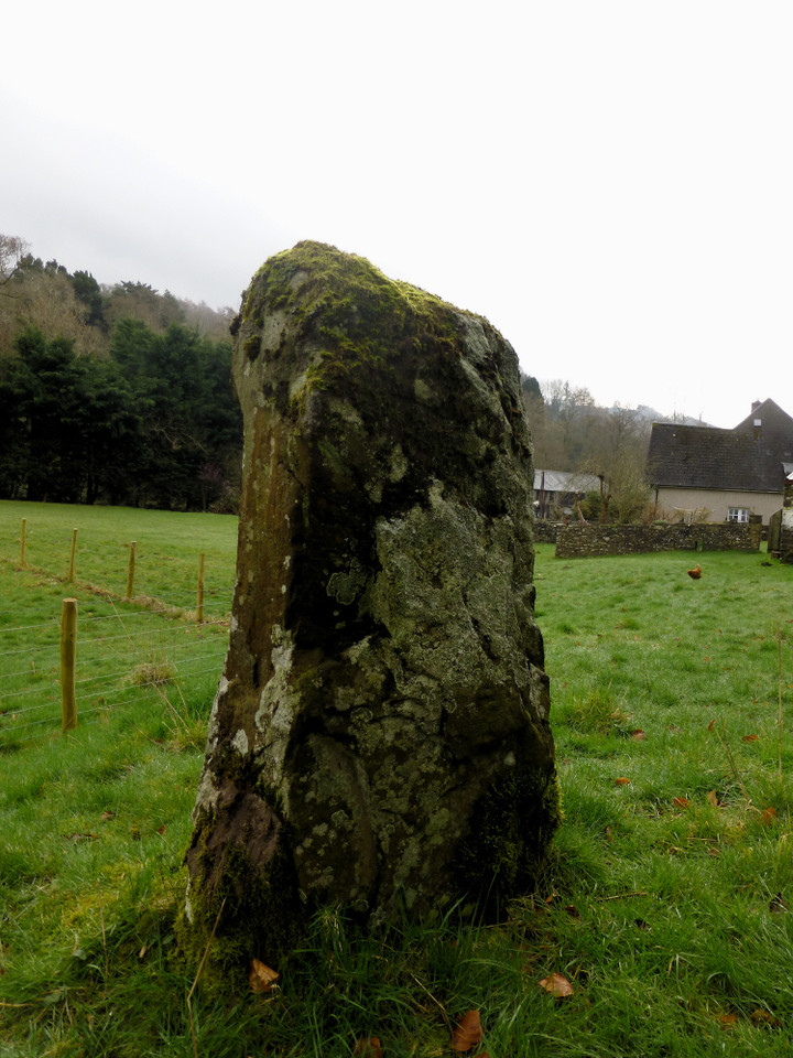
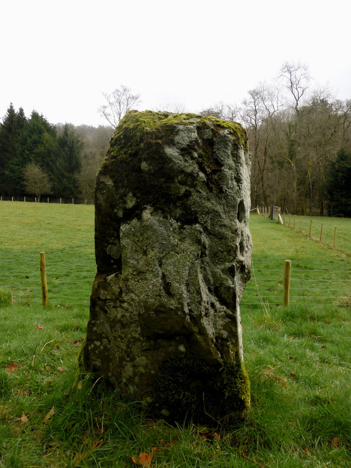
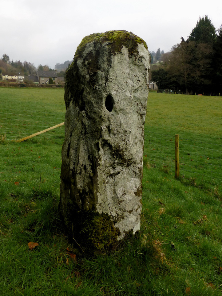
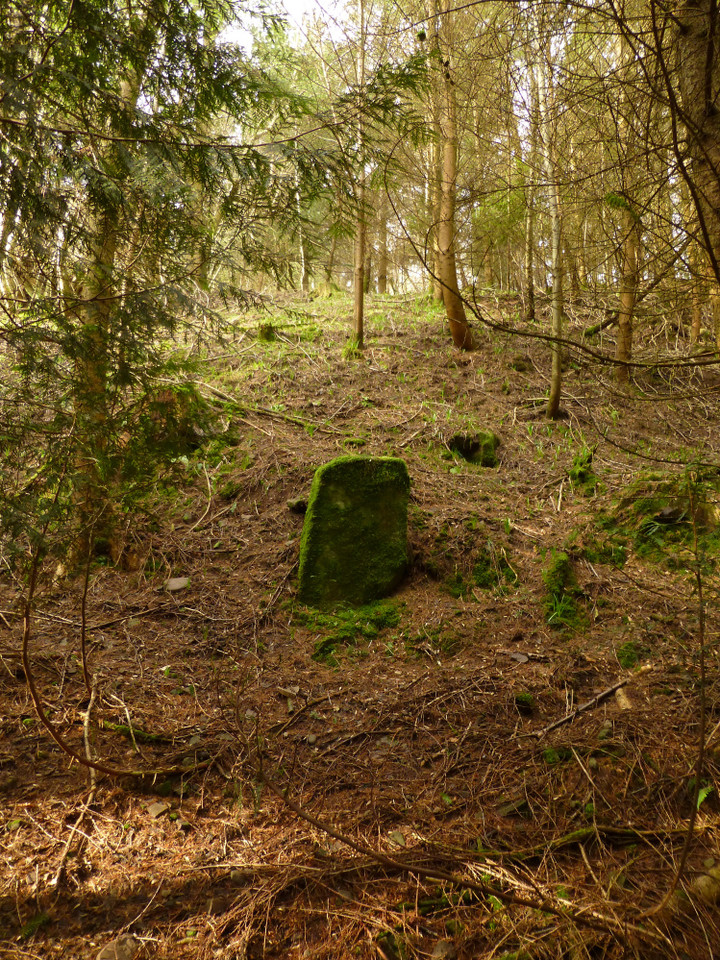
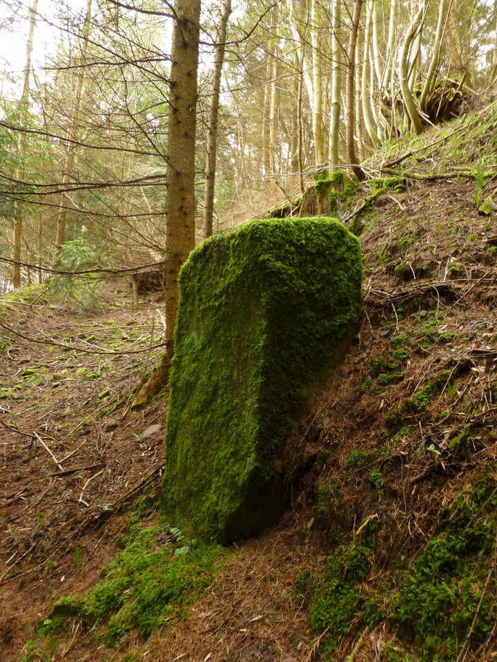
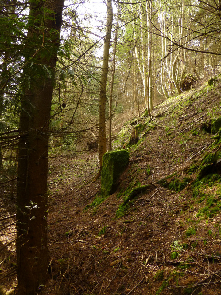
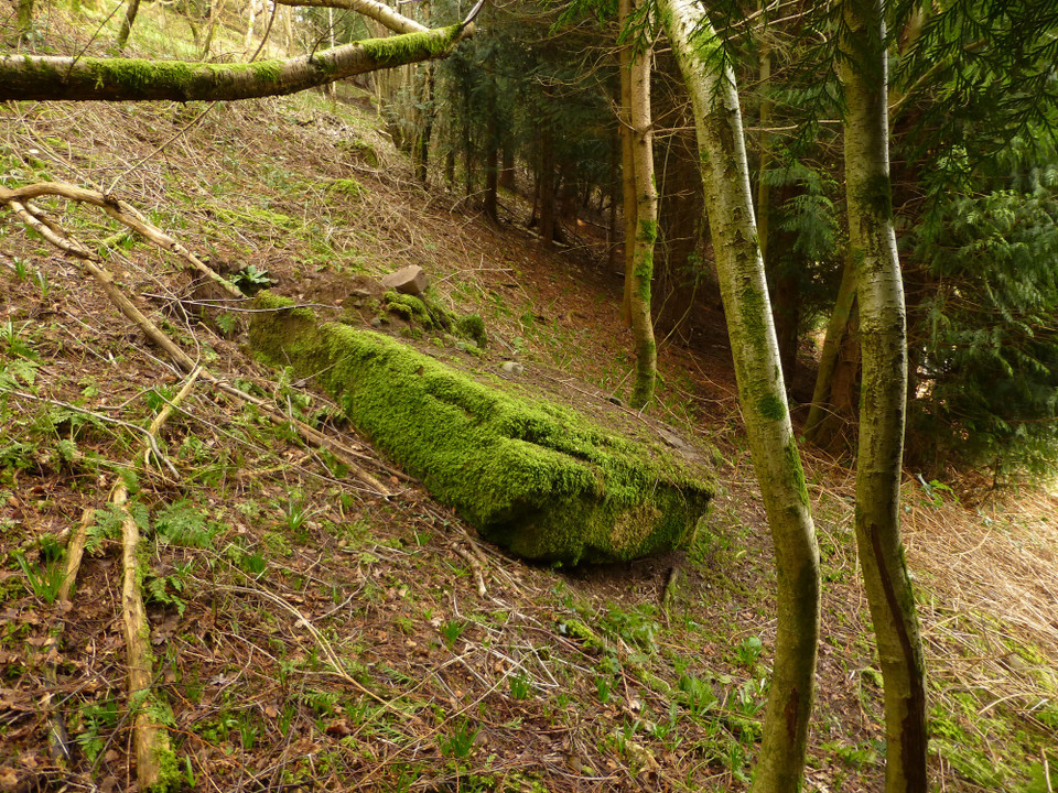
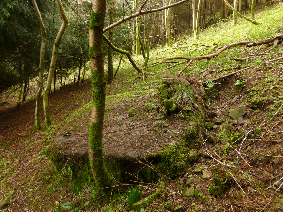
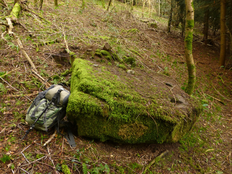
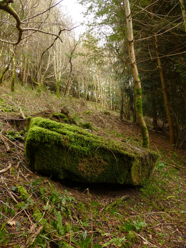
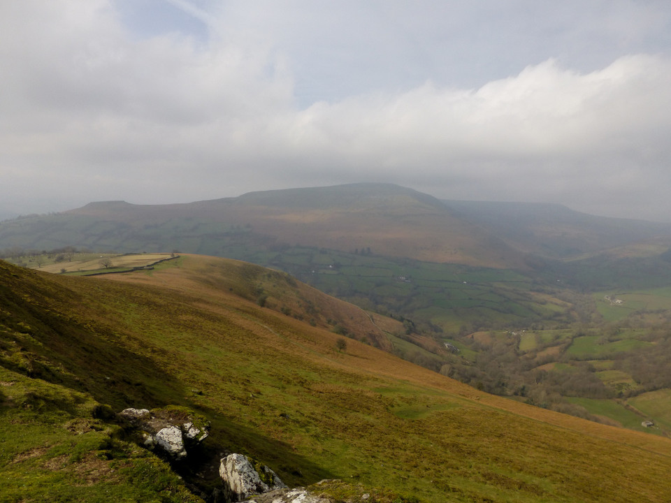
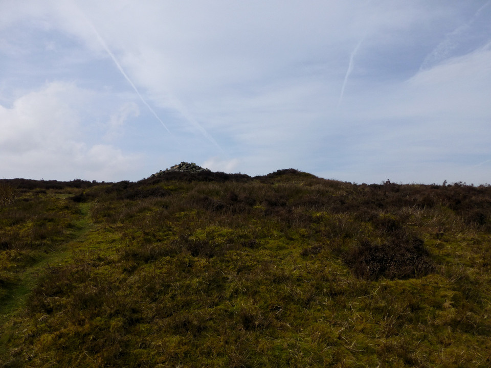
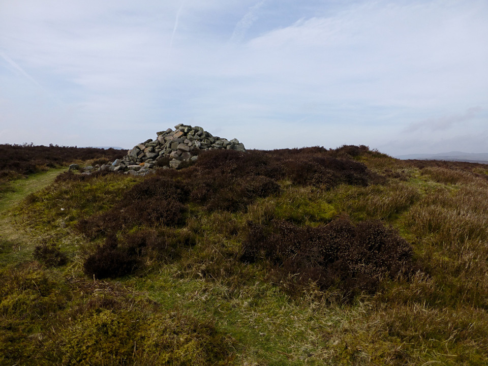
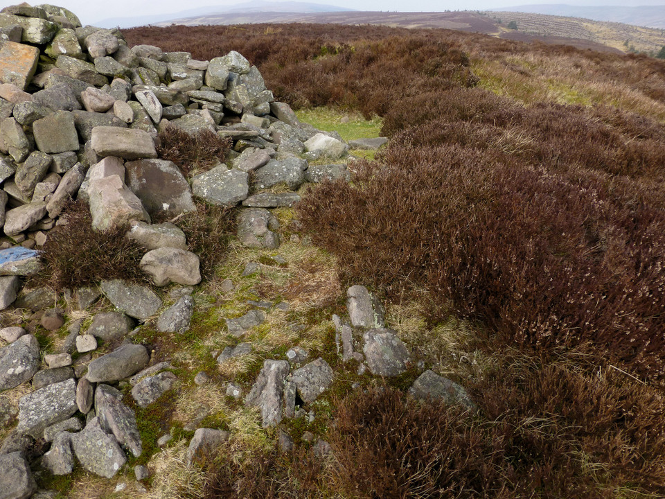
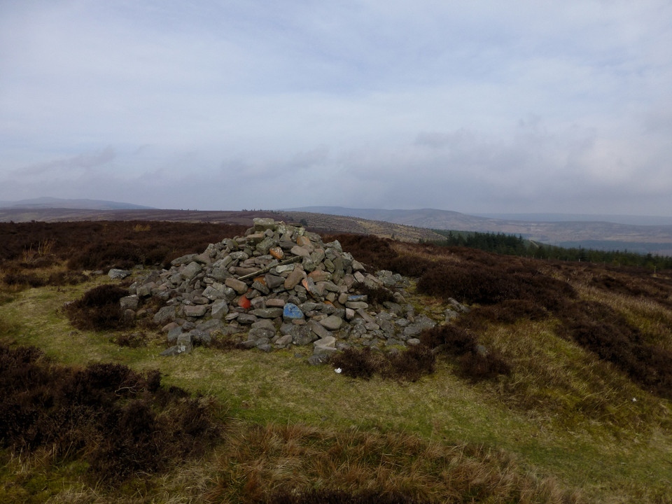
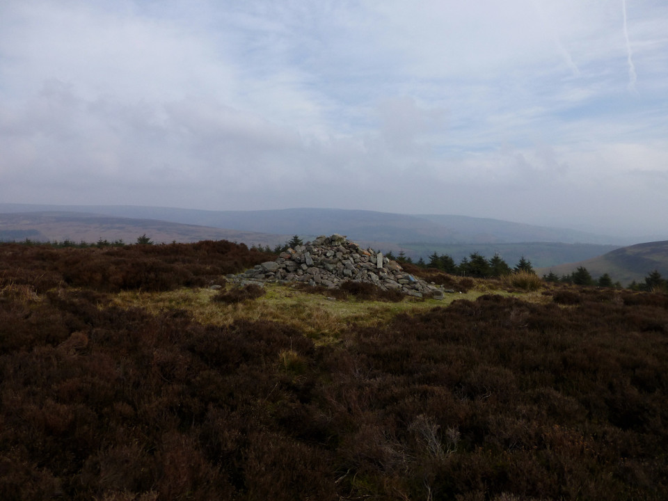
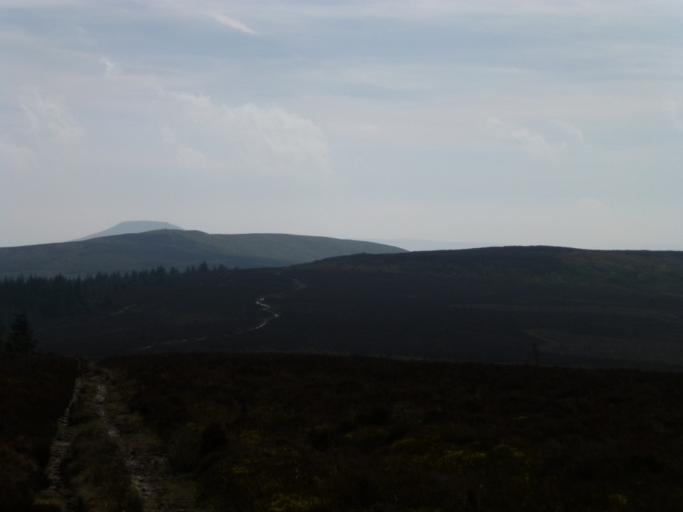
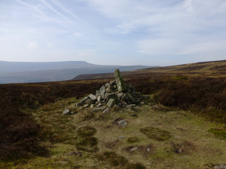
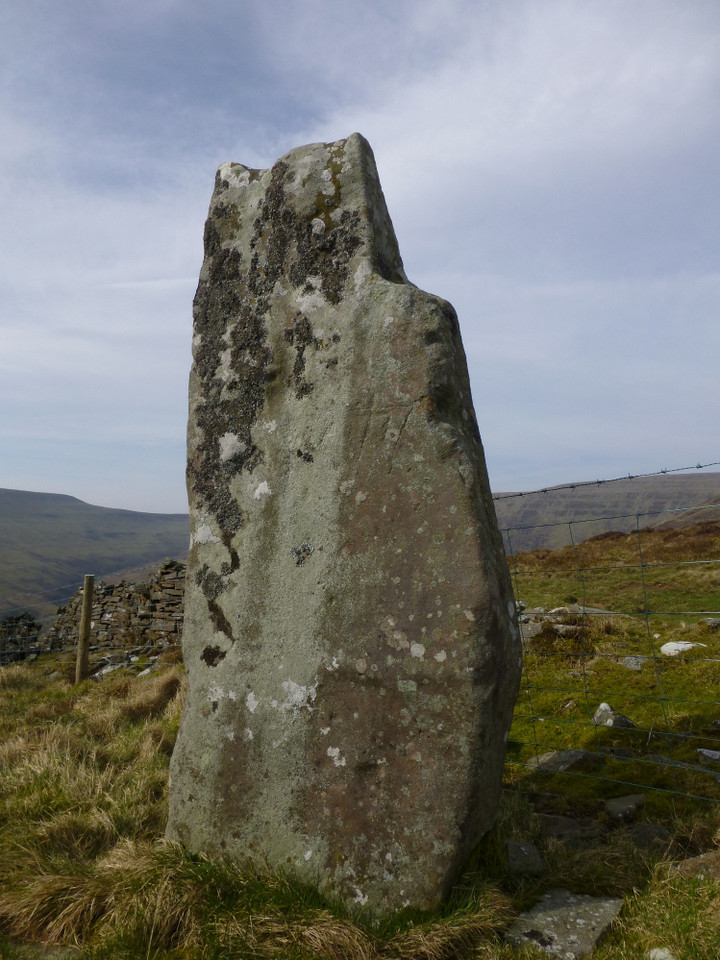
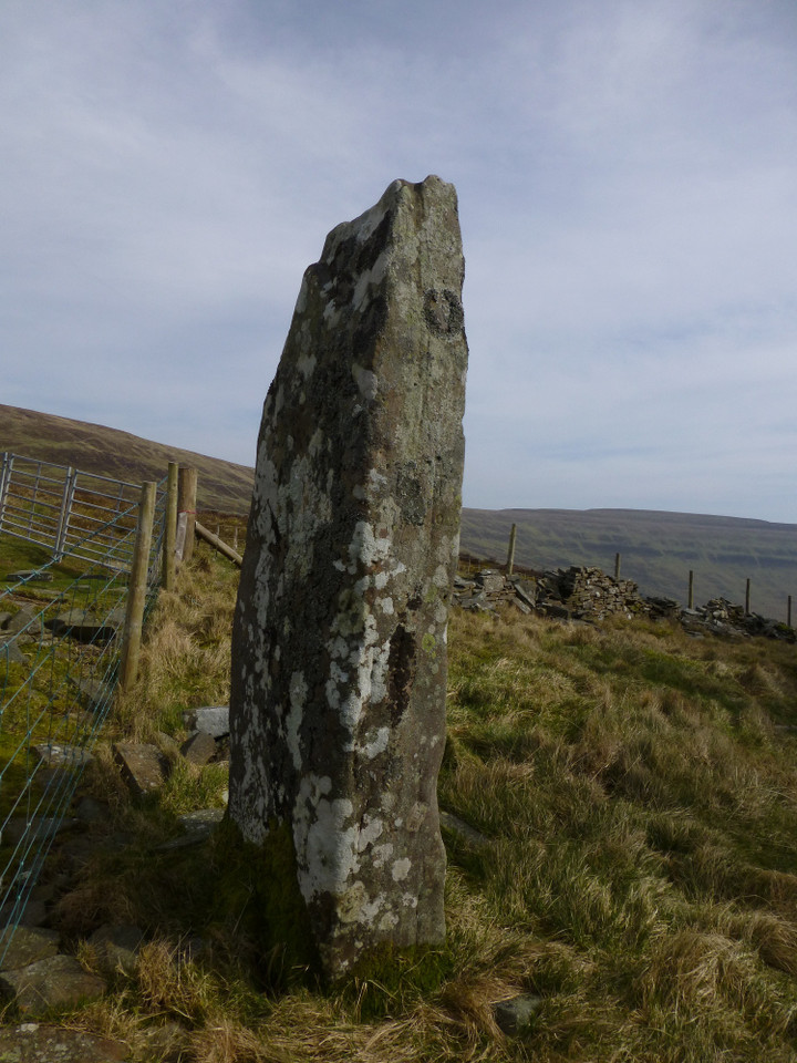
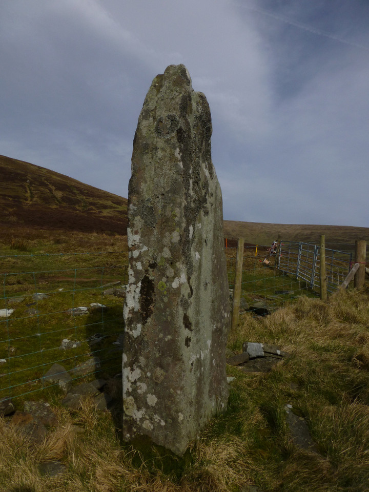
THE HOPE TO HOXA January 23rd 2014 |
THE HOPE TO HOXA January 23rd 2014Only three for the Out and About today; the volunteer driver Patrick, me and the labradoodle Star. In St. Margaret's Hope we parked the minibus at Cromarty Square, went onto Shore Road and took the second road on our left, much steeper than School Road. Good way to build up to the walk, get the 'big hill' out of the way. First thing we come to is a set of tall walls roadside, with steps in between to take folk up to the level ground above and through step-topped gatepillars sans gate. Here is Bellevue, built in the last two decades of the 19th century. This angular two-storey house with blue-grey slates is the only one I've noticed in Orkney built of pale pastel red stone. More likely my memory let's me down. And mistakiing the house for Angle Cottage (which is by the site of St Margaret's Chapel) I thought the big walled enclosure it is part of was the school. Braehead behind is already on the 1st 25" map, though I think not much older. In the field on the other side of the road disturbed ground is all that is left of the the site of the Brough of Ontoft. Cresting the hill we looked down at Heatherum where a modern double path of modern flags shone in the sun, more striking than any open air art installation. Turning left here takes you swiftly to Widewall Bay. Nah, that won't do. Turn right past the fine farm of Grutha and go around the coast we shall. This is the way I came when I stayed at the Murray Arms. On this road to your right look down onto the farms of Lowertown and enjoy Scapa Flow and its islands spread before you. On the map Hunda seems small, but from here it took a while to identify it as the causeway is much longer than on photos I've seen and we were looking at Hunda broadside on - explains why the circular walk from the Burray village takes as long as it does ! Not long to reach the other side of Hoxa Hill. As we made our way down to the ayre we were much taken with the 'boathouse' at Mayfield (formerly the name of a dwelling back up the hill). This modern 'boathouse' is one of those modern conceits, a hoose made to resemble an upturned boat, but awfu' bonnie and rather large. The drystone wall divided seaside garden is pretty too. Somewhere hereabouts are believed to be the remains of an authentic boathouse, yer actual housing for boats. Next the shore this side of the Dam of Hoxa sits Longhouse farm range with its corn-drying kiln. Longhouse, Hoxa Mill originally, is now a residence. Something I only realised after I strayed onto the lawn to snap the kiln ! There is a track that takes you from the Dam of Hoxa over the old ayre to the Sand o'Wright. At this time, going by the overflowing pools either side, it struck us as maybe not the best route for now, might only get so far before being 'pushed' back. Tread the shore. Continue on to the road end at Howe. On the eminence above is the Howe of Hoxa. Which is a doubling as Hoxa is haugsheid referring to the broch. You can only see the top of the tower, and until you reach the spot it looks just a weird fieldwall. Then there you are with a topdown view. Which is a good thing, because the last time I went the interior had way too many tall nettles for one to venture in. From the broch a long mound heads doen the hill, and tradition states that Earl Thorfinn Hairsakljuf was hoy-laid here after his death in about A.D.960, However all archaeologists can say is that there are traces of settlement in the lower section. Passing by the broch I contented myself with a few shots from the road as I had used my SLR up close some time ago and we wanted to be back on time. Had my first glimpse of its small 'companion' by the shore, which will be a lot easier to resch than I had assumed. 115 paces/yards from the broch is the Little Howe of Hoxa, though it is possible the name is that of the mediaeval ruin rather than the (supposedly) prehistoric structure. In June 1871 George Petrie excavated this, and after he left Mr Gray of Roeberry (who had partialy dug the chambered mound on Warthill the previous year) continued to clear it out and (it was believed) make further exploration. Petrie found an approximately circular structure with two concentic wall enclosing a space of ~21'D. The 4' thick outer wall was seperated from the inner by a 2' high passage tapering from 18~20" below the covering stones to 16" wide at the base where it met bedrock at one place.. A 20' long passage and doorway went all the way through the structure, standing 4' high and being 2½' wide. Traditionally a passage connected with the Howe of Hoxa, but no trace found of this at the time or since. Presently the site is called a homestead and thought to be either early broch or pre-broch, but the finds made seem to me to be as likely from a Viking wirk or borg - perhap not a "green site" still. It is notable that none of the newspaper reports refer to it as a broch. There is a way in still, an archaeologist friend of mine entered the hole even though it is generally considered dangerous to do so. A wall post-dating the excavation goes across the homestead. Little Howe of Hoxa may simply be a name used to differentiate the ruined dwelling. There is a slip near Howe and a couple of derelict buildings mentioned on the NMRS, what appears to be a roofless croft and a small square building of just four walls. There are plenty of other early settlements in the area. Just back up the hill is Swart(e)quoy where excavations starting the same month found a probable earthen encampment suurounded by a strong rampart of earth and stone. Also at the same time some trenches made in a sandy knoll called Kirkiebrae on the other side of the isthmus found another 'encampment'. Though the name implies a church connection the finds don't bear witness to this, and the St Colm's dedication is a thoroughly modern fiction or the papers at the time would surely have said. One of the trenches turned up a fine red and yellow clay/pigment intermixed with ashes along with a huge number of bones from the same fauna as that at Little Howe. On a hearth of burnt stones one of the relics was a piecemeal bone comb held together by iron pins and having a central dot surrounded by small concentric rings. It stood comparison with examples from Hampshire and other English counties, bringing to my mind the recent theory that there had been Angles resident on Orkney in Pictish times. Situated close by where caravan park it doesn't look much to me, being more impressed by a mound in the elongated field triangle on the hillside. Wouldn't be the first time the slight repositioning of a boundary has put a site on a different side to that on maps, as happened to me with Brodgar's Fairy Well. A short road section goes across the hill, and here is the junction with the road to Head of Hoxa - carry on to this and eventually arrive at the Hoxa Tapestry gallery and then a fine reastaurant with glorious views (when the mists clear), beyond which a lovely nature walk takes you around the wartime camps and emplacements. Another time. Arriving back onto the main road the pillbox you can make out in the land between the shores has been moved from its original location, so possibly an alternative explanation for what I see in the field corner. East of the toilet block are several hut bases and foundations from a small camp used by REME. As we came by the farmer was dropping hay fodder on some for his sheep. Very well behaved they were, staying in the field even after he left the gate open to get more fodder. Not enough time to tread the Sand o'Wright, so off up to Roeberry. A couple of interesting buildings on the farm.The ends facing us had wide ornate multicolour stone block archways, one open the other blocked off. Patrick and I spotted a very small belfry on the roadside building and thought this to be an old church, no, no, schoolhouse. Then at the other end spotted a big external staircase. So most likely a storehouse, with that 'belfry' housing a pulley system for hauling goods up to the next floor. The first O.S. shows something peculiar, apparently where Roeberry Cottage is now. I like the cottage gateway, framed by softly curving walls. And way above Roeberry House are the sad remains of The Wart tomb. Now we were up the other side of Hoxa Hill overlooking the Oyce of Quindry. I wonder if it is a coincidence that tidal inlets attract Ba' games, but of course they provide (or occur in) big level patches of land e.g. Oyce of Quindry, the Ouse and the surviving Ba and the Ba ' Green of Orquil (probably the Ouse at Finstown and the head of Hamnavoe for Stromness too). Anyhoo, on the uphill side of the road a Nissen hut sits in complete isolation. Incredibly this is all that's left of Hillside Camp (ND49SW 33 in the region of ND435923) - some 500 men from the Royal Engineers and Royal Artillery stayed at the accomodation camp. At the head of the Oyce of Quindry a road goes by the shore to Ronaldsvoe. Near the junction with the main road I spot another Nissen Hut, though even through binoculars this resembled a small cottage.with a chimney at each end. My next thought was that a wartime building had been turned into a dwelling, but further observation showed the structure had been covered in concrete like many an engine house. So I suspect it provided power for Hillside Camp. However, no matter how far I drill down on PASTMAP absolutely nothing is shown there, never mind a site pin !! Most curious. Of a sudden coming down the hill into the Hope headed for School Road, to the east is Stonepark. In the 19thC several cists were found in a mound at Stonepark [?ND444932 by a field bend], and in another fired stone and earth mound on the same farm of Blanster (near the farm buildings) a single cist held some ashes under an upturned urn. A little further down, somewhere near the playing fields on the other side of the road had been yet another small military camp, this one for the RASC with only a few hut foundations left to mark the endeavour. But the next thing to grab my attention is what I think is Angle Cottage, an L-shaped two-storey mansion house with crow-stepped gables. Though with a date of 1893 visible on a photo I take it that it has been re-modelled if so. When I wrote up this walk for the Blide Blether because I had mixed up the roads I had applied the name to Bellevue !! In 1866 at a spot 20~30 yards from the shore (that had been under cultivation for almost a century) men digging for office house foundations near the Established Church manse uncovered a skeleton 2-3' down, prior to which 5-6' of mound material had been already removed. I'm not sure whether this was U.P Church property as this is much further back, and all I can find on RCAHMS are several records for warehouses [offices is Orcadian for farm labourer accomodation at this time]. Another mystery. Patrick, Star and I got back in the minibus and returned to the Blide in order to be there at the alloted time, but the two humans agreed it would be a fine walk to extend into a full day by adding in a tour of the Head of Hoxa military sites. Petrie's excavations in local papers :- June 21st & 28th1871 "The Orkney Herald", June 24th & July 1st 1871 "The Orcadian". Swartiquoy, ND49SW 11 at ND431940 - lost site of tumulus with cist and urn. Enclosure almost definitely that down as Mayfield, ND49SW 91 at ND 43150 94238. The modern Mayfield farm's former name Swartiquioy, with East Swartiquoy near Kirmareth. Howe of Hoxa. ND49SW 1 at ND4252693962, mentions. Little Howe of Hoxa, ND49SW 2 at ND4243 9403 St Colm's Chapel / Kirkiebrae, ND49SW 8 at ND42229369. My own suspicions lie with the stuff in the field corner at ND42189371, rather than ouside, even so. |
6th March 2014ce |
Ridgeway to heaven – Barbury Castle to Avebury 21 May 2011 |
Ridgeway to heaven – Barbury Castle to Avebury 21 May 2011My first trip to Wiltshire of the year, and summer is a comin’-in. The ever-handy 49 bus drops me just north of Broad Hinton, as today I’ve decided to approach Avebury from the north along the Ridgeway, as recommended by Mr. Aubrey Burl. The quiet walk along minor roads to Uffcott reacquaints me with the joys of wide Wiltshire skies, with the downs rising over to the east, topped by the long line of the Ridgeway. The Ridgeway — Images06.02.14ce
Barbury Castle — Fieldnotes06.02.14ceWalking from Uffcott gives a slow and steady approach to Barbury Castle, today’s first objective and the proper start of the walk. A week or so earlier, G/F and I had a wander round Old Oswestry, which frankly blew me away in its scale and ambition. As a result, I’m not expecting quite so much from Barbury, but you should never, ever, underestimate what you might find at a prehistoric site. You’d think I would have learned that by now. As the rampart looms above me and the climb steepens, it’s already becoming apparent that this is going to be a good ‘un. The first thing properly encountered is a fine disc barrow set below the western entrance to the site, constructed on the slope and facing westwards over the edge of the down. The disc is actually easier to see from the approach than close-up. A smaller round barrow lies to the northeast, closer to the bottom of the hillfort rampart. On another day, in another place, these two would be enough to linger over. Here though, the pull of the earthwork is too much and I make my way up onto the bank. I make my way clockwise around the outer ditch. Up close, the earthworks really are very impressive indeed, the ditch still deep despite 2,000 years of silting. There are terrific open views from here. Liddington Castle, the next substantial hillfort to the northeast, can be seen on the horizon. Over to the east the views stretch across the Marlborough Downs, while to the south the fort commands views of anyone coming down the Ridgeway. Once inside the splendour of banks and ditches, there is little else to be seen. The real joy of the visit is undoubtedly in the perimeter and the views from it. A week after Old Oswestry, Barbury Castle is certainly holding its own. A gem of a fort, all in all. Barbury Castle — Images23.05.11ce
Finally dragging myself away from the wonderful fort, I join the Ridgeway as it heads southwest. After an initial drop back down the road, the gradient climbs steadily, which provides a decent retrospective view of the fort. A couple of sizeable sarsens, marked on the OS map as BSs (boundary stones) point the traveller on their way. The weather has been fairly dry and the Ridgeway itself makes for pleasant walking without huge amounts of mud. Apart from a couple of horse riders and a group walking in the opposite direction, it’s pretty quiet along here. The steady rhythm of walking, the open landscape and the tranquillity of an English summer lift the heart and clear the head. Begone dull care! The Ridgeway — Images06.02.14ce
At length I reach a fork in the track. The Ridgeway carries on its stately progress due south, but I’m leaving it here and taking the other fork, the White Horse Trail towards Clatford. Not without regret, as the section of Ridgeway between here and the Herepath junction would provide the first views of my ultimate objective, Avebury. My chosen route will delay that pleasure for quite a bit longer, but there are other pleasures ahead, less well travelled than the great henge. The track skirts the very edges of the Grey Wethers sarsen drift on Fyfield Down. As it passes through Totterdown wood, it becomes apparent that some of drift has been subsumed into the shade of the trees. It’s rather odd to come across the great stones here, mossy and green, when in the mind’s imagining they stand exposed to wind and weather on the open downs. Fyfield Down — Images23.05.11ce
Long Tom (Fyfield) — Images24.05.11ce
Devil's Den — Fieldnotes06.02.14ceSouth of the Clatford Down gallops I finally part with the White Horse Trail, taking a bridleway southwest towards the second site of the day. As the path follows the contour of the hillside, Devil’s Den comes into view. This is one of those sites that you’ll already have seen, even if you’ve never been to it. Something of a celebrity, even in a county that boasts some of the biggest A-listers of them all. It’s great to see it first from afar, how it sits in its valley, tucked away below the windy downs. Devil’s Den is something of a triumph in another way, as although the OS map shows it standing off the right of way, the little triangle of land is subject to permissive access, which means you can go and spend as long as you like there without worrying about any confrontation. This is a relief, because it’s a site I want to savour. No rushing here. The chamber sits on top of a little mound, all that remains of a much larger structure. The field is turning to meadow, and will be a haven for chalkland flowers and insect life. Beneath the low spread of grasses, the surface is completely littered with chalk and bits of flint, presumably turned up by years of ploughing but now left discarded in the sun. I love this site. The whole structure looks poised, as if about the march away across the Wiltshire landscape. The sky has turned somewhat cloudy now, but rather than diminishing the visit it adds an extra drama to the backdrop. I could stay here a long time, and so I do. Time passes, not a soul approaches. Just how a site visit should be. Devil's Den — Images24.05.11ce
Fyfield Down — Fieldnotes06.02.14ceThe next part of the walk is a bit less straightforward. I’m hoping that I can find the Polisher, but I don’t actually know where it is. I know photos on TMA show a gallops fence nearby, but that’s about all I’ve got. Most significantly, I don’t know which side of the Herepath it’s on. The only thing to do is to wander. Wandering in the drifts of Fyfield Down is a good thing though. After entering the Down at its southeastern corner, I’m immediately confronted by the scale of the drift itself. I’ve never really seen anything quite like it. I have a quick look at the Fyfield 1 and 2 barrows, but really even these are overshadowed by the natural landscape here. From here I follow the ribbon of the Mother’s Jam, coming across The Monster Stone as I wander. Yep, it really is a monster. Other treats here include the experimental earthwork, slowly decaying as intended. Overton Down (south) may be just about the least impressive round barrow I’ve seen in Wiltshire, a barely-there mound under nettles – get the sheep in, someone. Fyfield Down — Images24.05.11ce
Fyfield 1 and 2 barrows — Images24.05.11ce
The Mother's Jam — Images25.05.11ce
Overton Down — Images25.05.11ce
Experimental Earthwork — Images25.05.11ce
The Polisher — Fieldnotes06.02.14ceMuch wandering later, just as I’m on the verge of reluctantly giving up, I spot a pointy stone, which looks familiar. And so it proves to be, the unmistakable grooves of the Polisher lying just beyond. I’ll be honest, I’m feeling a bit pleased with myself at this point, but even without the extra euphoric boost, this would be a winner all day long every day. I won’t try to describe the stone, the pictures do that better. Instead I’m going to lie down with my head resting on its smooth surface and enjoy the peace for a few minutes. The Polisher — Images25.05.11ce
..... That’s better. Where was I? Oh yes, on my way to Avebury (just in case you’d drifted off too). Back on course then, after what has been quite a detour. From Fyfield Down the Herepath cuts across Overton Down and starts its descent to the great centre below. There are some decent barrows to be seen en-route, on both sides of the path. As always I get the feeling I’m only scratching a very superficial depth into the chalky surface of this landscape. Avebury — Fieldnotes06.02.14ceBy the time I reach the eastern entrance of the henge I’m tired and the sky has turned much darker. As always though, meeting the huge stones of the circle boosts my flagging energy in a way that Red Bull will never be able to replicate. I don’t take the full tour today. Today’s efforts have been focused on getting here through the landscape, the journey being the reward for once. Instead I have a mooch to the Cove (still my favourite setting in the whole complex) and the southern quadrants. I finally take up residence on the sloping bank above the ditch of the southwestern quadrant, not quite at the bottom but on a level with the stones. Arriving at such a busy place after the quiet of the Downs would usually irk me, but today I enjoy watching the different interactions people have with the stones. Some stand in awe, some touch, some just have their picture taken. From where I sit, the voices are muted and the words don’t carry, except one who is expounding something about the electrical properties of the stones. Ah, Avebury in the summertime. Long may it be a focal point, the builders would surely approve. Avebury — Images25.05.11ce
|
Posted by thesweetcheat 6th February 2014ce |
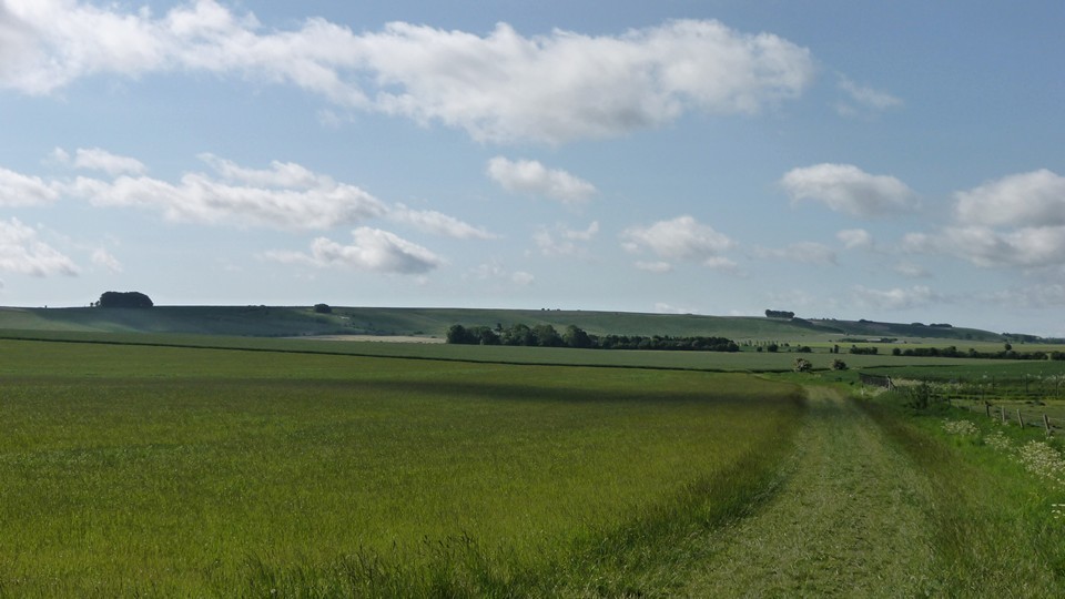
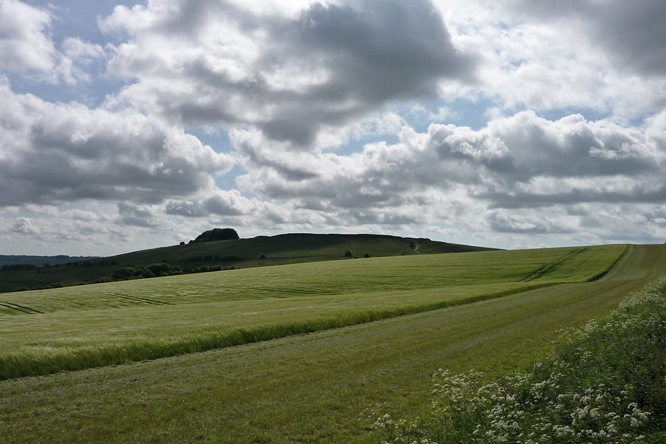
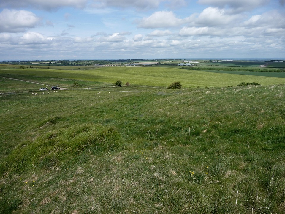
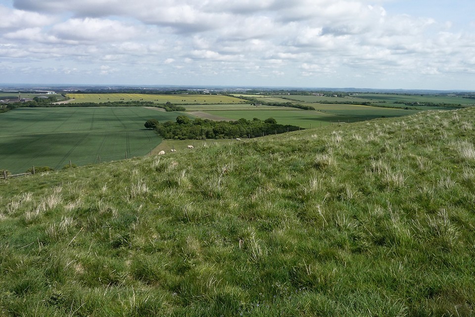
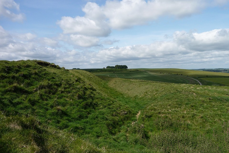
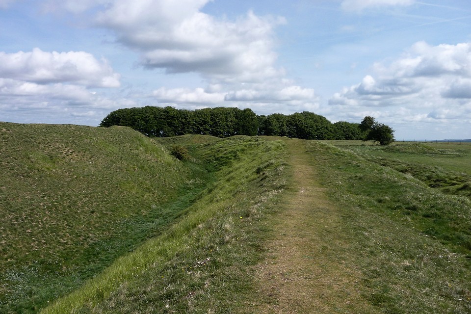
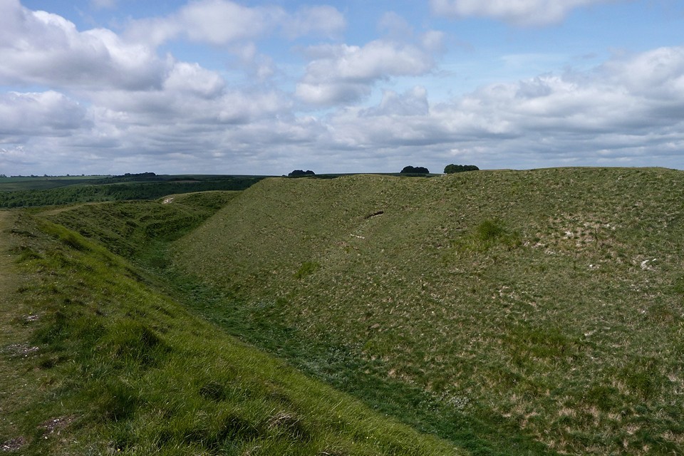
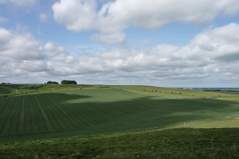
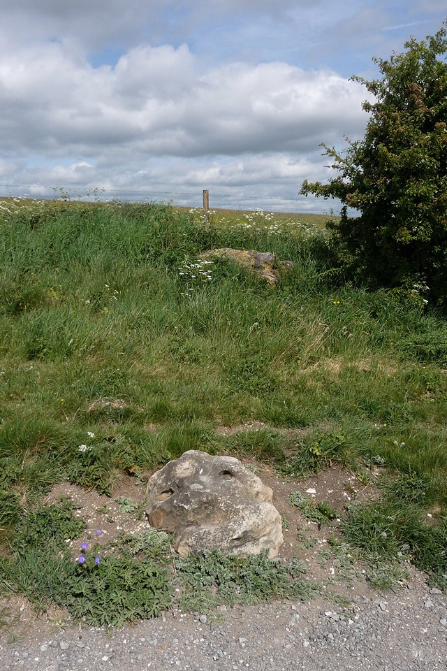
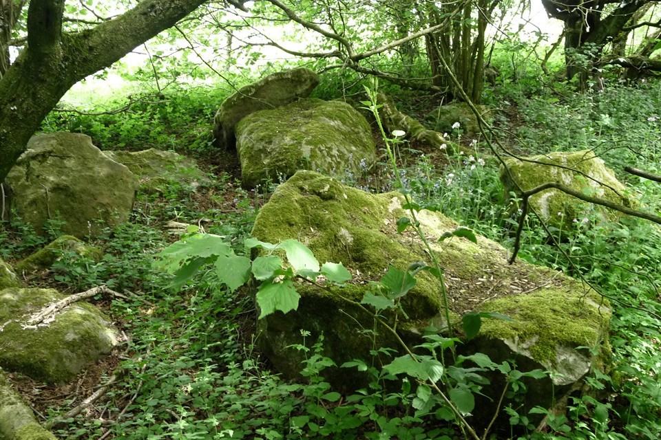
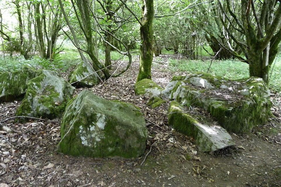
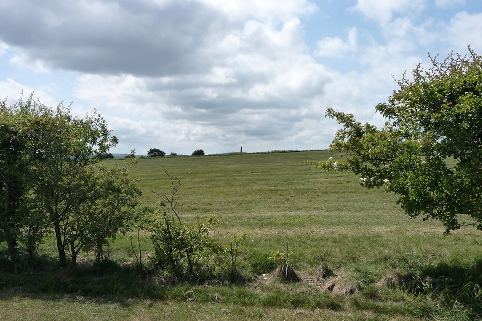
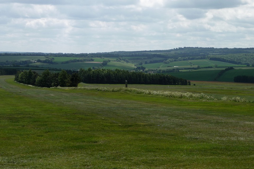
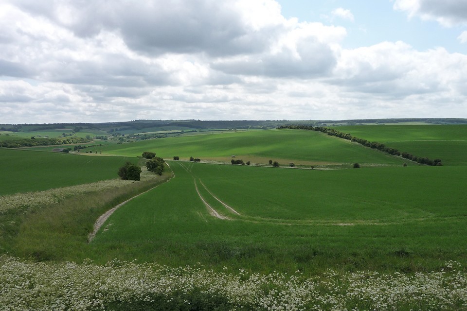
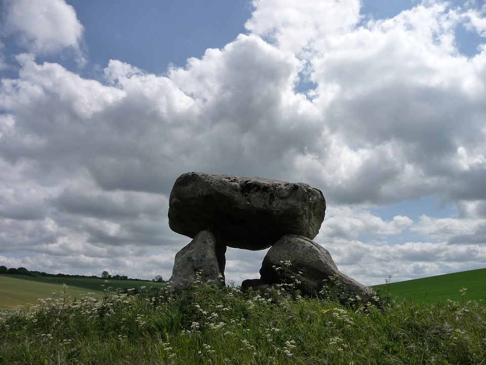
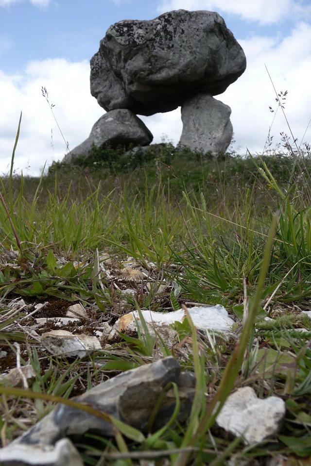
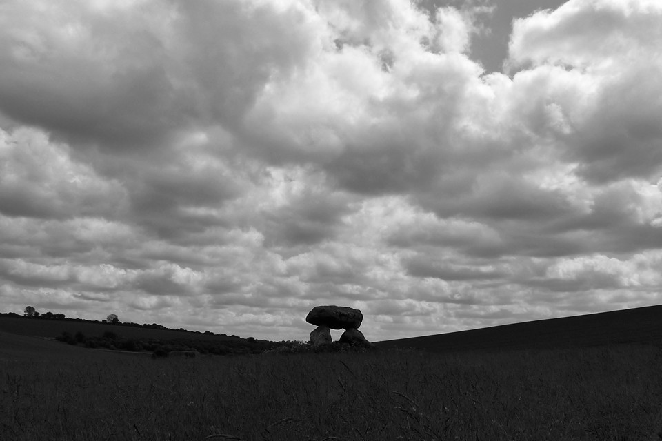
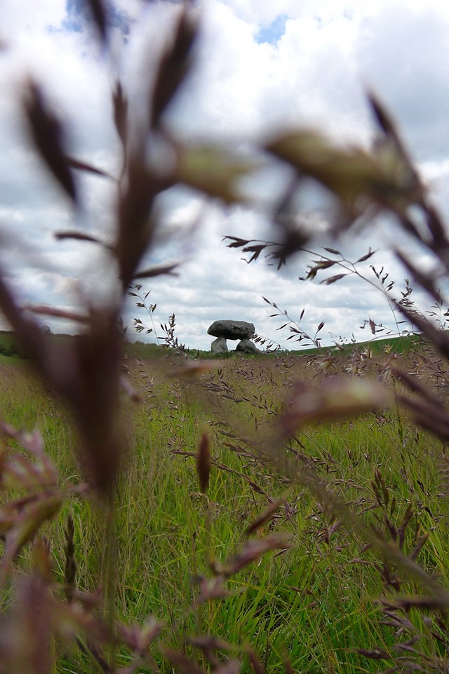
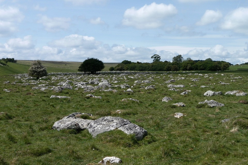
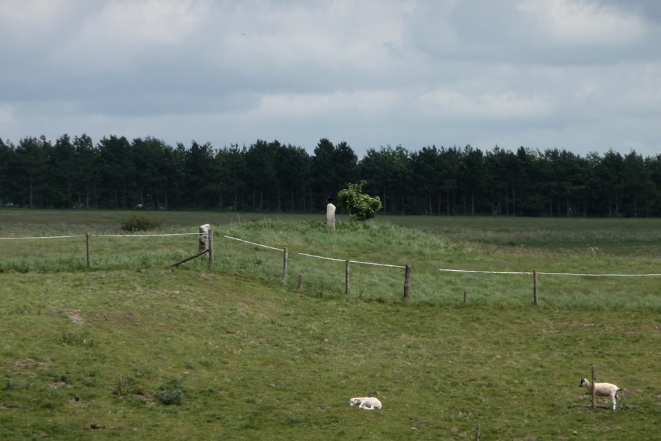
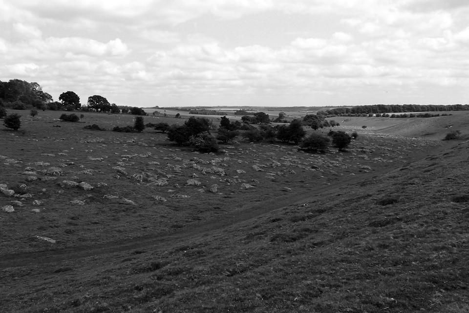
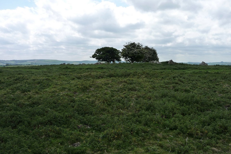
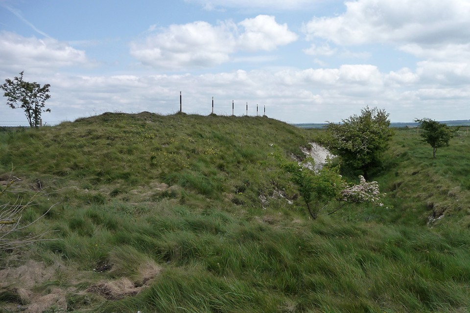
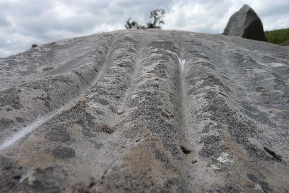
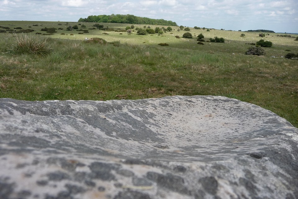

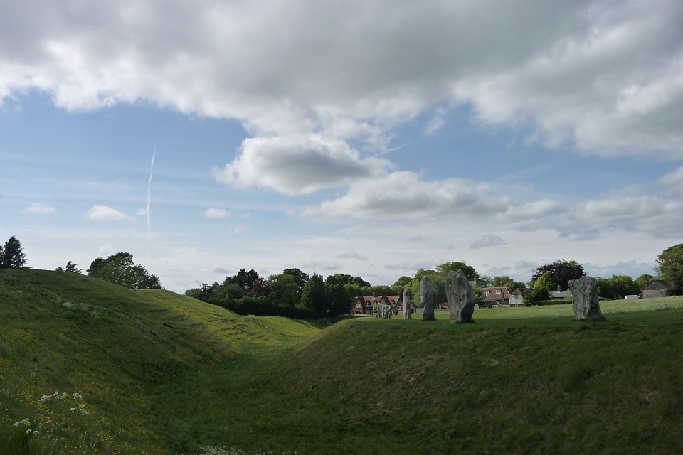
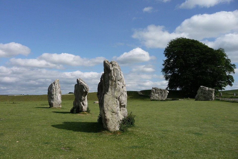
MILLDAM IS GREENTOFT |
MILLDAM IS GREENTOFTWent back to the original newspaper article, and finding out who found the cists could establish the whereabouts more precisely. In the 1850s John Delday brought some Deerness land into cultivation at what became Greentoft,.His son George found the "Milldam Farm" cist barrow in 1861 when extracting clay (one of two mounds on the summit) whilst Petrie was excavating a settlement on the hillslope. In 1869 George Delday found Bloody Quoy whilst bringing land at Greentoft into cultivation for his son-in-law. As there was a milldam behind Greentoft Farm the inevitable conclusion is that Greentoft and Milldam are one and the same, and highly likely that Bloody Quoy is the Milldam site even though this is on a false crest rather than the 'true' summit.. In 1861 during the time Petrie was digging the low hill Mr Delday found eleven cists in assorted sizes. They contained burnt bones in quantity, and outside the cists more in a couple of "crudely fashioned clay urns". One fell apart on lifting, the other being too fragile measured in situ 17" deep and 12" wide diminishing to 6", the average thickness 5/8 of an inch. Altogether the barrow held eleven cists. One near the centre, described as level with the surface, had its crude coverstone topped by a stone block some 5' by 4' by 7" thick ! The flag sides were neatly fitted together. The other cists. not as well formed, surrounded this cist but with their bottoms level with the central one's top. Petrie only saw three in the west side of the mound for himself, and his rough drawing only shows five of the total. The largest of those he saw, three foot square and about 2¼' deep, held another some one foot square which contained burnt bone. The second, adjoining cist, was narrower and the third smaller yet. Both of these also contained burnt human bone, and shingle and loose stones surrounded them both. In 1869 either side of the road is the site of Bloody Quoy ( HY50NE 6 at HY56670696, also Anglicised as Blood Field). Also called after nearby Greentoft. I think the record is a little confused about the other find - in May 1869 at Delday a G Delday found a long cist whilst ploughing, 5' long, 3'6" deep but only 1'8" wide. The heaped bones of two skeletons were found at either end. A polished granitic cushion mace-head was found here, probably on the northern side and measuring 4 5/8" long by 2¼" wide by 1¼" thick. A later farmer reported near the cist site an ~20mD cairn-like feature straddling the road included burnt earth and stone. Amongst the rough stones of which this was composed one strongly resembled a trough quern, which is another indicator of a Neolithic date. Regarding Petrie's investigations on the slope, he found building traces and vessel frogments under the soil to which he attributed a Broch Age date. More specifically he mentions a wedge-shaped stone tapering in thickness with deep notches at the thinner end, perhaps a stake he thought, of a type found either in or about brochs. Mind you, they thought Skaill to be Iron Age (or later !!) well into Childe's investigations. |
25th January 2014ce |
Offa’s Dyke VII – Oswestry – Four Crosses 14 May 2011 |
Offa’s Dyke VII – Oswestry – Four Crosses 14 May 2011Spring is wending its way slowly towards summer as we return to Offa’s Dyke. The last section brought us into Shropshire and we will continue to criss-cross the border between that county and Wales on this part of the route. Staying in Oswestry last night gave us a perfect opportunity to visit Old Oswestry hillfort, one of the premier Iron Age sites in the Marches, if not the country. A tremendous place, awe-inspiring in every way. By contrast, today’s archaeology will be rather more modest, a mixture of smaller Iron Age remnants and industrial leftovers. The Path crosses an area heavily scarred by quarrying and mining, together with the means of transporting the winnings away in the form of old railway lines and the arterial Montgomery Canal. It’s thought that some of the mining dates back into prehistory, and there is certainly evidence of Roman copper and silver mining at Llanymynech Hill. Setting off from Oswestry early, we’re up at Racecourse Common just after 9 o’clock, on what is shaping up to be a decent spring day of fast-moving cloud and patchy blue sky. A toposcope at the racecourse informs us that we can see the volcanic bulk of the Breiddins, a range of hills topped with various forts and settlements. Further away Shropshire’s spine, the Long Mynd, Brown Clee and Titterstone Clee, signpost the way to the countryside of my childhood, inching ever nearer. The grassy folds of the hill are carpeted in a brilliant spring bloom of bluebells as we head into the shade of Racecourse Wood. The various short stretches of wood on today’s walk are lovely, mixed woodland sun-dappled and airy under the light spring canopy, yet to be filled in and darkened by the heavier foliage of summer. Less than a mile to the west of here is the Cynynion standing stone, but regrettably it would be a steep descent and climb back to pay a visit to it today, so we have to forego the pleasure. One day… Out of the woods, then back in again at Craig Forda, we come face to face with Offa’s Dyke itself for the first time today. It no longer forms the frontier of English/Welsh border at this point, which instead follows the Cynllaith valley some way west, beyond the nearby hillfort at Coed-y-Gaer. However, any loss of notional status is made up for by the size of the remaining earthwork as it makes its way south through Candy Woods, an uninterrupted section the best part of two miles long and standing to a height of two metres or so. Leaving Candy Woods, the path drops very steeply to the hamlet of Tyn-y-Coed, with the fine section of dyke our constant companion. The path runs along the bank here, which won’t be helping prevent ongoing erosion of the earthwork, but does at least give an opportunity to view the impressively deep ditch on the “Welsh” side and to marvel even further at the scale of the undertaking involved in building the thing. It’s something else, well worth your attention even if very much outside TMA’s remit. Path and Dyke part company at Fron, with our route turning westwards while the Dyke, now more fragmentary, continues its inexorable way south. The detour is hugely rewarding though, as after a gentle climb we emerge onto the open hilltop of Moelydd, one of the outstanding viewpoints of Offa’s Dyke Path despite its relatively modest height. The views stretch away in every direction, taking in the Berwyns and distant Cadair Idris, across the endless hills of mid-Wales to the west and the Shropshire hills to the south and southeast. A steep descent takes us down to Nantmawr, then quiet lanes drop us towards the Tanat Valley. We will never actually encounter this particular river, reaching the end of its independence and soon to join the far broader River Vyrnwy/Afon Efyrnwy. Of interest to the TMA-er is the fact that the Tanat has been swelled on its journey by the waters cascading down the magnificent Pistyll Rhaeadr close to Rhos y Beddau stone circle. Blodwel Rock — Fieldnotes22.01.14ceAfter crossing first one then another disused railway line at Porth-y-Waen, we have a view of the today’s first prehistoric site, the wooded Blodwel Rock fort. It looks like a fairly stiff climb up from the valley floor, and so it proves to be. The fort occupies the top of the ridge, the steep scarp face of which we climb from the northwest. Offa’s Dyke has been an absent friend for the last couple of miles, but we reacquaint ourselves here. The fort is just in England, but the frontier has curved back eastwards again and we are poised on the edge of Wales here. In truth it’s not the most impressive of forts, the woodland cover is quite dense and the tangled vegetation underfoot anywhere off the main paths makes it difficult to really get a sense of what’s what. This is compounded by the fact that Offa’s Dyke runs along the lip of the scarp, although Pastscape (see Misc. post) suggests that the Mercian earthwork stopped short of the fort and simply made use of what was already here and at neighbouring Llanymynech Hill. Blodwel Rock — Images16.05.11ce
Llanymynech Hill — Fieldnotes22.01.14ceNo sooner have we left the wooded cover of Blodwel Rock than we’re across the Welsh border and into Llanymynech hillfort. Sadly our emergence from the trees takes us slap into the middle of a golf course. Immediately we’re scowled at by plus-foured types and the visit becomes an exercise in avoiding plummeting golf balls rather than looking for the remains of the fort’s earthworks. The whole interior has been moon-scaped by older quarrying superimposed by bunkers and hazards. Bah. When we get a moment to look anywhere but heavenward, it turns out that there’s a decent view of the whaleback of The Wrekin, a very fine hillfort that dominates the north Shropshire plain. Our route ducks back into the trees and alongside Offa’s Dyke, a.k.a. the northwest rampart of the fort. As at Blodwel Rock, the tree-cover makes it difficult to really get a sense of the site. We follow the edge of the escarpment and the earthwork round to the southern tip of the hill. Here the gentle terrain gives way to the towering cliffs of Asterley Rocks, much quarried and mined over the centuries. There is a very fine view south featuring a number of neighbouring hillforts on The Breiddins, Beacon Ring on Long Mountain, and the lowland sites of Bryn Mawr and Gaer Fawr but overall the feeling from the visit to Llanymyech Hill is one of frustration, both from the general destruction caused by industry and from the irritating placement of a golf course across the interior. Llanymynech Hill — Images17.05.11ce
Below the fort there are extensive remains of mining and quarrying buildings and equipment, much to appeal to the industrial archaeologist. At Llanymynech we cross back into England briefly, then straight back into Wales before swinging southwest along the towpath of the Montgomery canal for the next mile or so, a pleasant if rather dull stroll which does at least offer up a fine retrospective view of Llanymynech Hill. Llanymynech Hill — Images17.05.11ce
Bryn Mawr — Images17.05.11ce
Soon it will be summer, and we will be back. |
Posted by thesweetcheat 22nd January 2014ce Edited 26th April 2023ce |
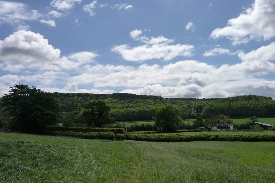


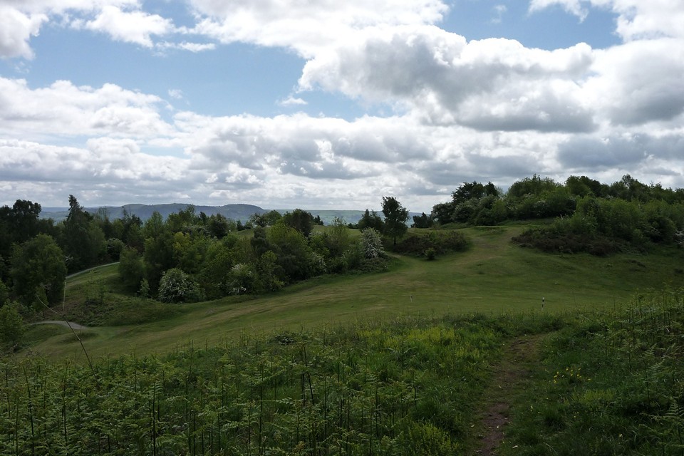
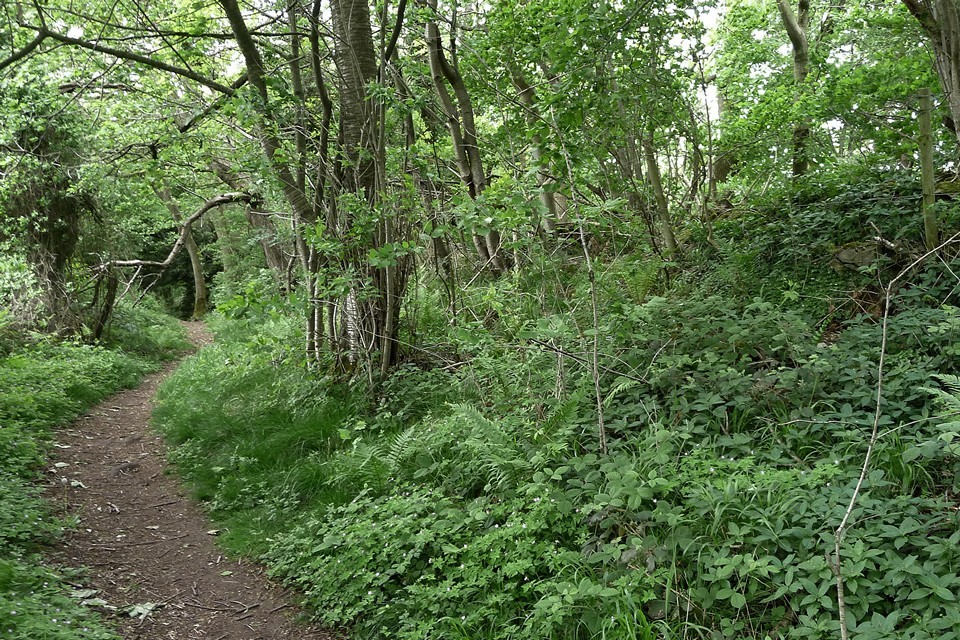
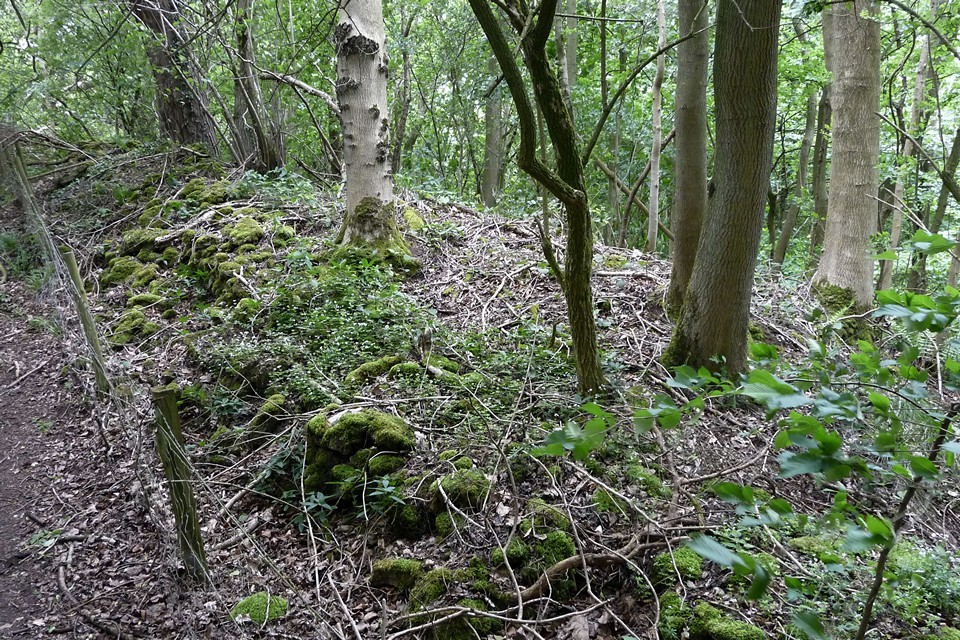
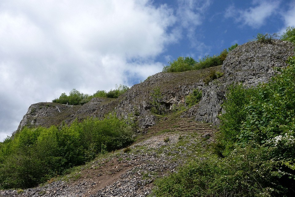
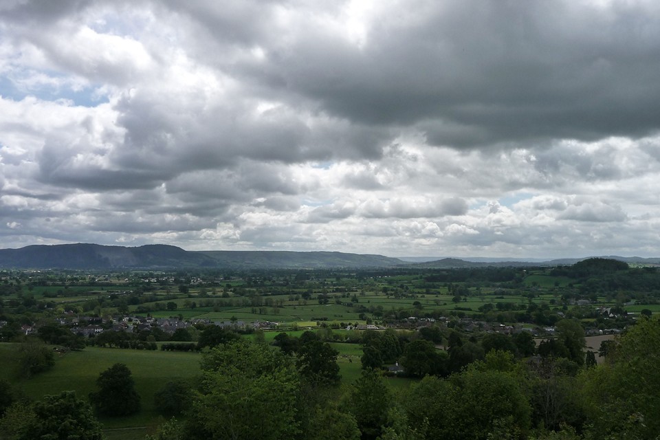
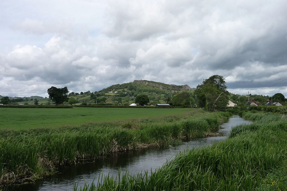
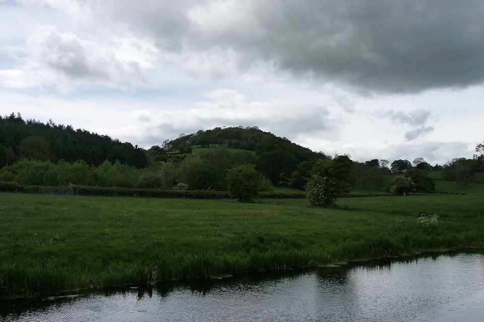
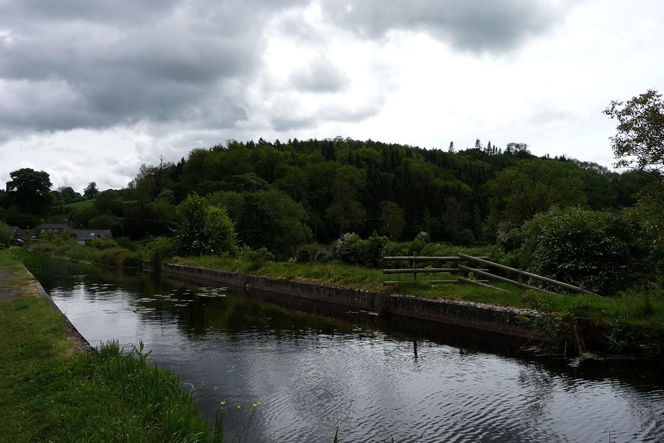
Buxton Museum - a taster |
Buxton Museum - a tasterI recently tried to occupy a hyperactive 18 month old with Buxton Museum, then got very distracted and decided to a take a few photos for here instead. The 18 month old did not approve so apologies for the slightly blurry photos towards the end :) I've tried to lay these out in the approximate order they are in the museum which is kinda chronological within arbitrary time periods. Dating governed entirely by the labels. It does unfortunately mean finds from multi-period sites which range from iron age to palaeolithic are separate but gives a good idea of artefacts from similar ages. Iron age: Thirst House — Images14.12.13ce
Frank I' Th' Rocks — Images14.12.13ce
Thor's Fissure Cavern — Images14.12.13ce
Elderbush Cave — Images14.12.13ce
Late Bronze age bronze implements: Derbyshire — Images15.01.14ce
Probable Bronze Age: Beeston Tor Cave — Images19.01.14ce
Thor's Fissure Cavern — Images19.01.14ce
Bronze Age: Ravencliffe Cave — Images19.01.14ce
Early Bronze Age: Stoup High Edge — Images15.12.13ce
Late Neolithic - Early Bronze Age: Green Low — Images15.12.13ce
Arbor Low — Images15.12.13ce
Five Wells — Images15.12.13ce
Stanton Moor — Images24.12.13ce
Reynard's Kitchen — Images19.01.14ce
Elderbush Cave — Images19.01.14ce
Thor's Fissure Cavern — Images19.01.14ce
Fox Hole Cave — Images19.01.14ce
Late Neolithic: Arbor Low — Images15.12.13ce
Neolithic: (I have a few axe images for Derbyshire to upload into this section as well...) Arbor Low — Images15.12.13ce
Earlier Neolithic: Lismore Fields — Images15.12.13ce
Fox Hole Cave — Images19.01.14ce
Shown at this point are two plans of lismore fields which I have combined: 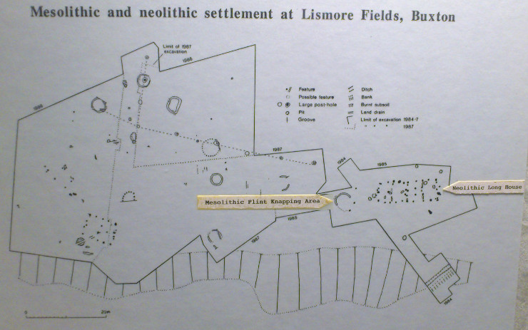 Late Mesolithic: Lismore Fields — Images15.12.13ce
Mesolithic: Wetton Mill Upper Cave — Images19.01.14ce
Fox Hole Cave — Images19.01.14ce
Late upper Palaeolithic: Fox Hole Cave — Images19.01.14ce
Thor's Fissure Cavern — Images19.01.14ce
Elderbush Cave — Images26.01.14ce
Middle Palaeolithic: Ravencliffe Cave — Images19.01.14ce
|
 Posted by juamei
20th January 2014ce Edited 26th January 2014ce |
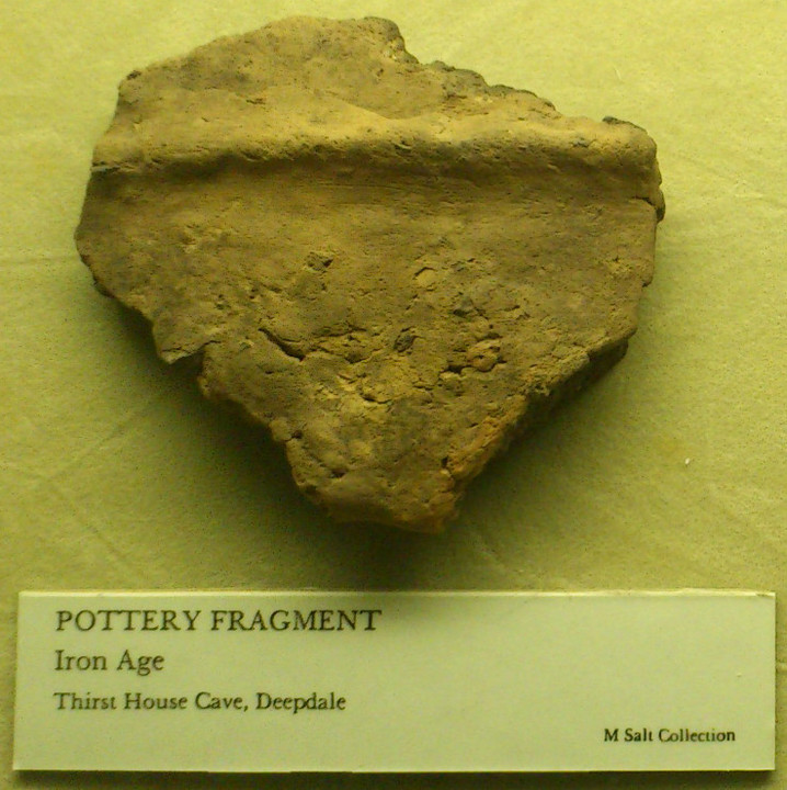
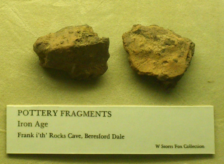
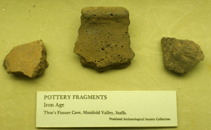
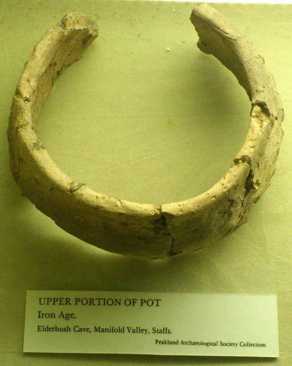

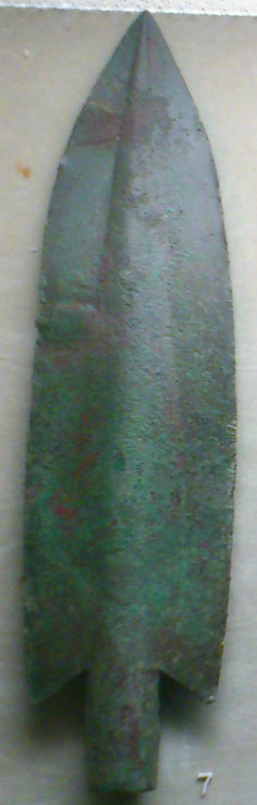
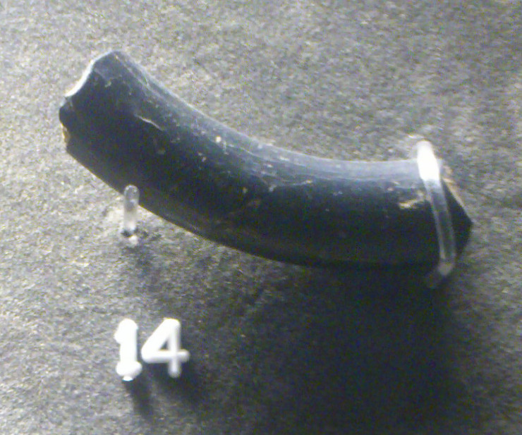
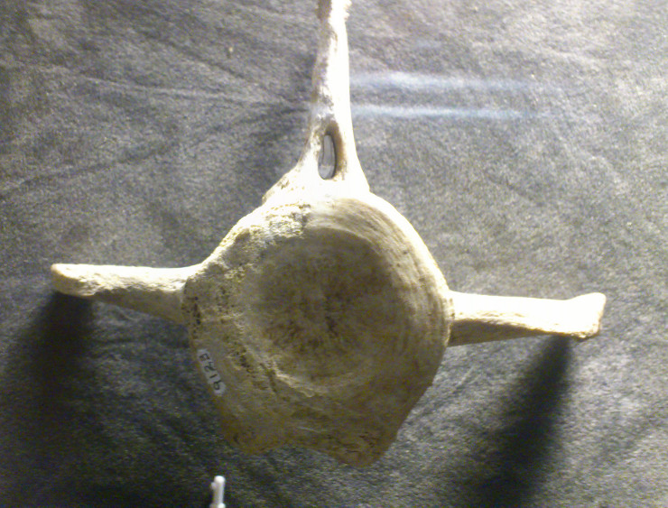
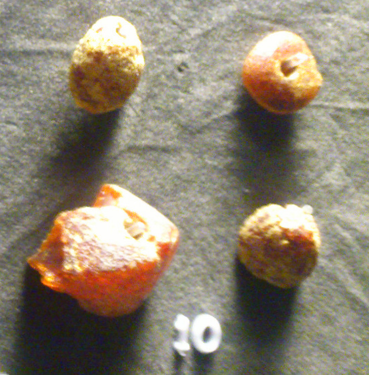
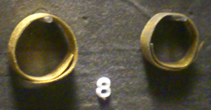
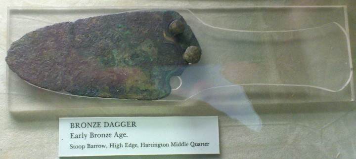
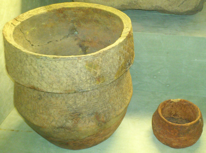
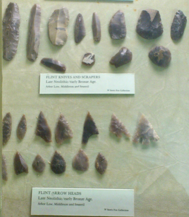
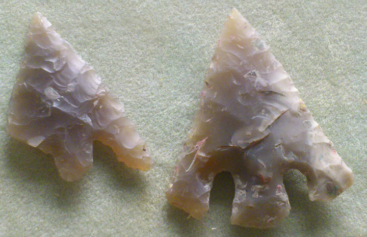

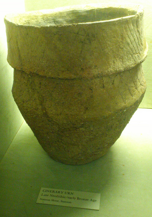
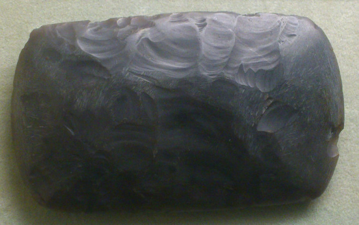
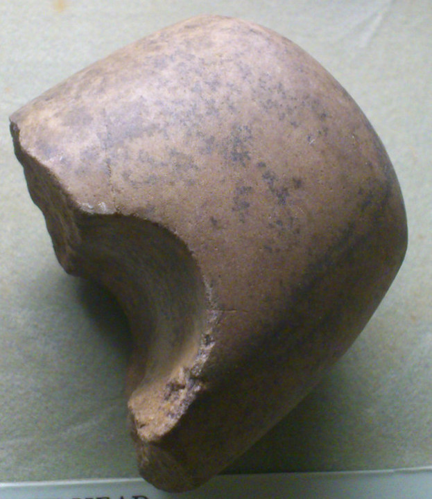
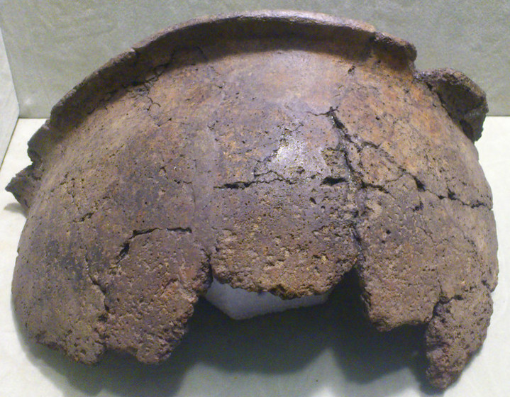
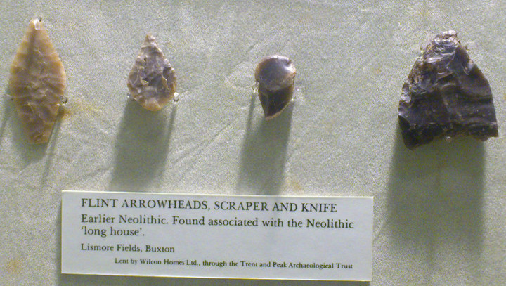
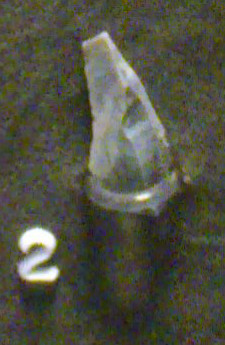
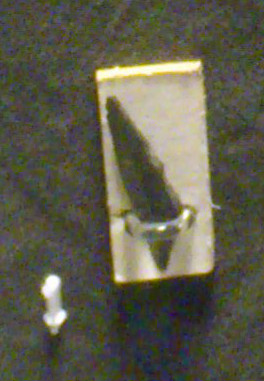
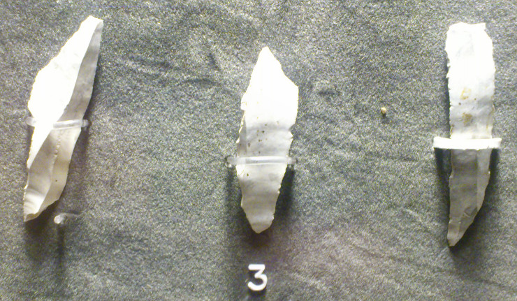
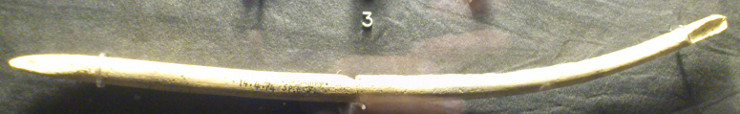
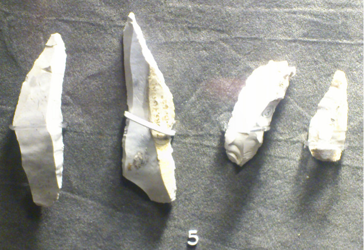
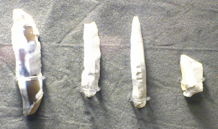
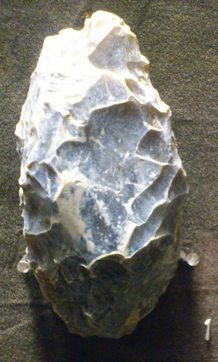
DEERNESS BURNT MOUNDS & OTHER ANTIQUITIES February 23rd 2013 |
DEERNESS BURNT MOUNDS & OTHER ANTIQUITIES February 23rd 2013Took the bus to Lighthouse Corner. Had tons of time so went down to have a look at Skaill. The church has only been called St Ninian's since a steamship of that name ran aground in 1903. Going between the farm and the kirk are two steep-sided nausts. One of these has next to it a wooden vessel of the kind I later saw near Balfour Castle. It is mounted on a pair of wheels near the sloping front, which hinges down. I'm sure I should know what this object is, but cannot remember. Lookin past it I see a curving bank between the kirkyard wall and the sea and in the distance the Horse of Copinsay. After a brief walk on the beach I climb up onto the cliff and between the burial ground and the sea is a broad flat area. I feel that I am walking some early modern farm track (perhaps to the gravel pit on the 1st O.S.), with the bank cast up to protect it from the waves. However it would seem I am looking at part of an ancient sand-dune called Howan (HY50NE 21 at HY 5889 0633) that had produced Iron Age tools long before a trial trench was was excavated. In 1964 the OS reported a thin layer of dark silt in a grass-covered "inner circle" bank that would have been about 7m in diameter (which seems smaller than what I saw). Visible in the cliff-face, the deposit included a little domestic midden but produced ard marks of possibly Late Bronze Age date. So despite earlier finds not Broch Age. However I just cannot believe that this bank came about simply at the hand of Nature. Knowing how ancient Orcadians loved to use the natural to form structures etc I wonder if this could be a ringwork like that hypothesised for Campston/Venikelday over in St Andrew's. In 1982 Mr Foubister found fragments of prehistoric buildings between the Howan and the kirkyard's (present?) SE corner. Retracing my steps to Lighthouse Corner I turn left onto the road running along the base of Esnaphy Hill. On the lower slope a whole heap of hedges and shrubs sit below the buildings at Copady (I presume it is called that still). Up ahead is a dirt track. I quickly establish that this isn't the way to go, it simply turns back to the farm slightly upslope of Copady at Diamonds. At the next corner I turn right and past Watermoss before turning uphill on a bearing for Seatter. A ruin on the right is Millfield. As far back as 1880 the Orkney Name Book records that stone tools had been found at various times on this croft. There were two mounds (what is now) two fields to the east, west of Nether Stove, in what are now two fields. And to show that one should always take reports of site destruction/loss with a pinch of salt - especially out in the field - though supposedly gone by 1930 through cultivation they were only hidden by pasture, one sited at HY57450693 and the other surviving as a low mound at HY57430704. This 9mD 'eminence' is only 0.6m high, so probably hidden by grass until you're right on top of it - what with climate warming the grass never stops growing in winter even in Orkney now, so glad I managed some slight sites before this happened as you can barely make them out now even when you remember where they are !! Seatter has quite a lot of buildings. I suspect some to be wartime as the structures on top of Ward Hill are the remains of a Chain Home Low radar station called grandly R.A.F. Deerness. On top of this Warthill, at Deerness highest point, is a burnt earth and stone mound of uncertain date. It is suggested that this,HY50NE 7 at HY 5689 0739, is the varda 'beacon' itself rather than something truly prehistoric. Nothing to stop it being both, like e.g. The Wart on Hoxa Hill. The mound is aligned E/W and measures 23 x 14 x 2m. Near the northern side of the road at HY56910705 an old well is capped at ground level by several thin slabs. I suspect not all are original. At some stage late on a primitive (?concrete/conglomerate) covered drain has been made from this to the road, where the end is capped by a single thin slab. When this field is waterlogged the water will discharge over the road. Probably always has, as the field on the other side coming up to the next turn contains two burnt mounds of similar dimensions, some 10 x 7 x 0.4m each. They're both covered by grass and I only identify the further one because of the visible stonework. Go under the names of Millfield or Greentoft, HY50NE 3 at HY56860698 and HY56920699. One, hopefully the further west one that I spotted, went by the individual name of Koffer Howe. The archaeologists are puzzled by the name. However it could be coffer as in a burial or perhaps Khaffir as a reference to dark burnt material. Turning the corner all of the previous mounds are dwarfed by another mound on the same side of the road with its longer side facing it. HY50NE 41 at HY56700682 also goes under the name Greentoft, stands over a man' height at a little over 2m high and is 50m long by 17m high. When under the plough not only burny material comes up but red stones too. The grass-covered slopes appear gentle to me, with the faintest hint of a cresecent face. The rusty gate to the field stands between erect stones. The left one is marvellously gnarled. Before you come to the corner the Denwick road branches off upslope on the right. Either side of the road is the site of Bloody Quoy ( HY50NE 6 at HY56670696, also Anglicised as Blood Field) which preceded its creation by millenia, going by the polished granitic cushion mace-head found here, probably on the northern side, measuring 4 5/8" long by 2¼" wide by 1¼" thick. Also called after nearby Greentoft. I think the record is a little confused about the other find - at Delday a G Delday found a long cist whilst ploughing, 5' long, 3'6" deep but only 1'8" wide. The heaped bones of two skeltons were found at either end. A later farmer reported near the cist site an ~20mD cairn-like feature straddling the road included burnt earth and shells. Amongst the rough stones of which this was composed one strongly resembled a trough quern, which is another indicator of a Neolithic date. Coming to Noltland it is a fine tidy piece appealing to the Romantic view. Part of the enclosure is a curving stone wall by the road. There is a short tree with sparse spreading branches making it wide like some pollard, which I'm sure it isn't. Next to that ivy shining brightly the day fills the space between two doors either side of the end of a stone block building that looks to be free-standing. The romantic ruin comes after that. Or maybe it's two ? This blends seamlessly into a roofed bit. Finally there's the present dwelling by the road clad in white. Taken altogether it does have the feel of buildings mostly enclosing the central space. At the crossroads I turn left again. Here we are, back in the formal 19thC with a church, manse and school [the Free School House started off as Rosevale].I am intrigued by a place called Malisburgh about which I can find nothing. A grand two-storey house but not a mansion house. From the main road it appeared to me to have a low walled garden in front and to the sides, however this is an illusion caused by dark bushes bordering the fences of a ?field and other pieces. Looking up to the former United Free Church of Deerness there is a long natural mound called Howan Blo (HY50NE 5 at HY571060). It is some hundred yards south of the kirk but looks closer from the main road. Here over the course of a few years Mr Aim, the farmer at Blow(e)s, came across internments near its crest in 1929 and 1932 (the record says 1933, but Callendar's article from that October refers the discovery to "January last"). On both occasions he covered the finds until the archaeologists came. In early March 1929 whilst digging into the clay his plough lifted the coverstone of a short cist containing an eight inch high dolomitic steatite urn and potsherds from a small urn. The cist was hollowed into a circular depresssion 4-5" deep in the centre, floored with stone flakes averaging some 5" square and ¼" thick. In plan it was approx. 20" by 16" with sides of bluish Orkney sandstone slabs each 18" deep and 1½" thick. There was a layer of burnt human bones 5-6" deep. After excavation the farmer put the remains back and covered the find. in January 1932 Mr Aim made another find only a few feet away. This consisted of a Bronze Age cinerary urn and fragments of a smaller one, both of clay. The large urn held bone ash and potsherds. When the archaeologists came and did their excavation they found an urn-shaped cavity under a coverstone just five feet away, though it had never held an urn. It measured some 15" deep and 12" wide diminishing to 5", and was almost completely filled with the dark greasy remains of bones. Though the urn passed to the museum the rest was re-buried as before. Later attempts to locate these proved unsuccessful. I'd love to know when the church was built, because with names such as Millhill just to the east and Little Millhouse not far to the SSW this could be a candidate for the Milldam Farm site. Reaching Lighthouse Corner again I find myself with time still before the next bus. And even though it will be the last of the day I decide for a quick walk, sort of, and head down the Aikerskaill road for the coast. Only one corner survives intact of a drystane building near (I think) Grundigar. Apparently this was Steinflett. There are piles of stones in proximity, only they come from several sources. And there is a modern standpipe by the corner. I love that corner honeyed by the low light. The next ruin is probably of Howes, near Aikerskaill if I remember aright. It survives roofless but pactically entire, with several stone block buildings of different sizes and some with high pitched gable ends. Finally reaching the coast I thought about going east, along the track that conceals the foundations of a linear settlement to the Point of Ayre, because it looks as if you could continue anti-clockwise and on to the Ayre road. But owing to my uncertainty I opted for the safer, if longer, walk west. Along the way I pass the How(i)e o' Backland, most likely a broch. Presently divided by a farm track there must have been only one field once as for the site we have the name 'enclosure of the broch' Quoyburing, which, or was, pronounced Quoyburrian (a Quoyburray is close to Round Howe in Tankerness). HY50SE 8 at HY58040402 is a 3m high mound covering a little over half-a-hectare even now, covering a broch and probably outbuildings. A Dr D Brothwell excavated an almost full height curving wall when digging a trial trench. There is only room for such at the west side as the east is lower and dips down to a pool, possibly modern. In the NW a portion of external ditch mentioned in the record can be made out by 'the eye of faith' and a little further west by a jagged little pool is a suspicious small bump. At Newark I made my way back to the main road, I think using that nice Oback road. If memory serves I reached New Lighthouse in time to catch that last bus back. Phew ! |
15th January 2014ce |
Milldam in Deerness |
Milldam in Deerness"Anderson's Guide to Orkney" of 1884 refers to excavations on Milldam Farm in Deerness in the summer of 1861, and the "Orkney Herald" of June 11th 1861 gives more detail for these. Though the newspaper does not name the site it does say it is in Deerness. Which is confusing as the only place of that name in the parish of St Andrew's & Deerness is in St Andrew's, where there is a Millbrae site with two burnt mounds recorded, the same number as the Milldam barrows. So I was delighted to find that there is a mill dam behind Greentoft farm and hypothesise that there has been a name change between 1861 and 1880. Petrie is on record as having excavated five cists from within a barrow near Warthill in 1861. Though this is less than the eleven in the paper, he only saw three himself and might only have sketched those he knew the location of. Or they are from the second of the two barrows. It has been decided that the Warthill barrow is now the large mound fragment on the Ward's southern spur at 75' Ordnance Datum, between the reservoir and Seatter farm HY50NE 10 at HY56760717. There is another mound on the Ward, HY50NE 7 at HY 5689 0739 at the highest point in Deerness (85' OD). Seems strange to me that this is ruled out as a burnt mound precisely because it contains burnt earth and stones, but there you go. This supposed varda 'beacon' is aligned E/W and measures 23 x 14 x 2m. So on to the original reports. Anderson sums it up as the excavation of probably Iron Age ruins (Greentoft= green-steethe 'site of old buildings') in the slope of a low hill on top of which were barrows containing cists with burnt bones "and clay urns outside these". Petrie started off investigating traces below the surface of a large settlement accompanied by stone vessels similar to those found in brochs. There were two barrows on top of the low hill, and while extracting clay from one of these the tenant farmer found many cists in assorted sizes. They contained burnt bones in quantity, and outside the cists more in a couple of "crudely fashioned clay urns". One fell apart on lifting, the other being too fragile measured in situ 17" deep and 12" wide diminishing to 6" [similar to the dimensions of the Howan Blo cavity], the average thickness 5/8 of an inch. Altogether the barrow held eleven cists. One near the centre, described as level with the surface, had its crude coverstone topped by a stone block some 5' by 4' by 7" thick ! The flag sides were neatly fitted together. The other cists. not as well formed, surrounded this cist but with their bottoms level with the central one's top. Petrie only saw three in the west side of the mound. The largest of those he saw, three foot square and about 2¼' deep, held another some one foot square which contained burnt bone. The second, adjoining cist, was narrower and the third smaller yet. Both of these also contained burnt human bone, and shingle and loose stones surrounded them both [the Howan Blo cist had a floor of loose stone]. |
9th January 2014ce |
The Uffington White Horse and Wayland's Smithy |
The Uffington White Horse and Wayland's Smithy"I write with very cold hands, the White Horse twenty to thirty yards below me to my right ... and the sun breaks through suddenly and warms my aching soul. Long shadows across the man-made fortifications below - long shadows and a Blakean arc of rays cuts the cold and draws me into its eternal glow ... Earthworks abound and I cannot help but scan the horizon ... The shadows lengthen and more peace ... White chalk routes cut these hills and stalk out this endless greenery. Greenery. Ha, ha! A delirious man awake and awash in a sea of green." So reads Julian Cope's entry for Uffington White Horse in his survey of the sites of Megalithic Britain, The Modern Antiquarian; and I share Cope's cold hands and sense of awakeness as I view the same scene on a day of equally long shadows and arcing sunlight... Read the full blog post at: http://landscapism.blogspot.co.uk/2013/12/landscape-in-particular-uffington-white.html |
 Posted by Landscapism
12th December 2013ce |
High ridges and deep caves. |
High ridges and deep caves.An hours drive east of home is Buxton, one of the main towns of the Peak district. Ten minutes south of Buxton is a village called Earl Sterndale, it's two nearest neighbors are Glutton Bridge and Hollinsclough, it is to this area, with it's distinctive hills many cairns and archaeology rich caves that my mind and wheeled wagon has been turning. I first came here one drizzly morning seven years ago, principally to locate and explore Dowel cave. But not knowing it's exact whereabouts I blundered around looking here and there, scrambling up and down sheer cliffs, coming face to face with a fox and sheltering from the incessant showers, during these blunderings I came upon a small cave entrance, it wasn't the cave I was looking for, I had a poke at the metal shield that kept stuff out and it fell over, on it's own, it came off in me hand, so I went in. The cave entrance has been deliberately blocked, in it's natural state you could just walk in, now you must crawl worm like down and through. It's bigger once you are in, there is a sign pointing to the back of the cave on it says Staffs L D W A Leek moors, I was taken a back that's for sure, the leek moors must be five to ten miles away, can this cave go that far. I didn't test this assertion. So I left. Etches Cave — Images30.11.13ce
Eventually I found the cave I was looking for, Dowel cave is more open than the other, you can walk straight through the ahem...vagina shaped opening, but the further you go the more you must crouch and in the end go on all fours. I didn't go further, my only light was the camera's flash. That was my first time. The cave turned out to have a name it was Etches cave. The next time I came the weather was much more conducive to climbing the two main hills here Parkhouse hill and Chrome hill. I started with the latter. Chrome hill has had songs written in its honour, by a Norwegian jazz group no less. Map doesn't say how high it is, but it is Glastonbury tor sized or a little bigger, cut in half long ways, and right at the very top my legs shake and I must crawl around on hands and knees lest gravity pull me over the side. It's from here that I watch a perfect summer sunrise, the suns warm glow slowly filled the valley below me, across the valley I can pinpoint Etches cave. Turning north is the long side of Hollins hill with it's very obvious cairn on top, I make a mental note that it's imperative to climb it one day. But not today, south from here is Parkhouse hill, a truly great and over sized giant whale breaking the surface of the sea of grass, this hill turns out to be harder to get up. After some aborted attempts I find the easy way up, from the east. Although this raised ancient coral reef, is lower than the other, Chrome hill, for both are such, it is much more perilous, the narrow ridge that one must traverse is like a grassy mellowed out Crib Goch, certain death one way, presumed death the other. The summit is two rocky prominences, that I wedge myself between, lest gravity get it's way, the whole place no bigger than a small kitchen, I move about very carefully. From here the two main points in view are the very obvious cairn on the next hill over, and High Wheeldon and it's Fox hole cave, all places I must go to if i'm to know and understand this place better. Too many years later, Eric and me are up at Hatch-a-way hill cairn, the next hill over from Parkhouse hill. It is a very good cairn, like a Llyn Brenig platform cairn, wide, high and much stone, but the view down to the valley below Chrome hill, as the sun sets and the nearest moon for a century rises behind us, is a site that words do no justice, if an over chatty nine year old is silenced it must have been pretty good. Hatch-a-way — Images19.03.11ce
A year later Eric and his mate Luke accompany me up to the cairn on Hollins hill, a large grassy doughnut, with some stone showing through in the scooped out area. The sun was out but the wind was high, and with two energetic ten year olds this was never going to be a long hang out. Perhaps the two caves could hold there attention for a little longer. The two things I took from Hollins hill, was the good cairn, and the sensational view down to Chrome hill, and beyond it to Parkhouse hill. Hollins Hill — Images01.07.13ce
Armed with torches and the go anywhere attitude of children sadly lacking in a sense of self preservation, we got back into Dowel and Etches, and went as far as we could without crawling on hands and knees, both caves undoubtedly went much further than I dared take my two carefree charges. Interesting to note is the list of the things freed from the soils in both caves...... From Dowel cave, It had been used in the Mesolithic, Neolithic, Beaker, Bronze Age, Iron Age and Roman periods, but mostly used as a Neolithic burial-cave. Under these deposits was found Late Upper Palaeolithic material, which included flint tools, charcoal from a hearth, fragments of antler, and pieces of bone showing marks of cutting, radiocarbon dates from an Antler showed the cave was used around 9200 bc. And from Etches cave, Finds included three pieces of worked flint, sherds of a Bronze Age collared urn, two worked antler fragments in association with some animal bones, a range of faunal remains including bear, reindeer, hare and cat, and a bone point of possible Upper Palaeolithic date. So both caves were important places in the past, all of the past apparently, especially Dowel cave. Also worthy of note, just a few tens of meters from Dowel cave entrance is the site of water pouring from a very small cave, a strange thing, water spontaneously gushing from the ground itself, a gift from the Mother. Just a couple of months ago I took Eric and the dogs up High Wheeldon, it has a cave, barred to the public by iron gates and bricked up interior. Another Neolithic burial cave, with the oldest known bones from the White Peak, also used in the Paleolithic, plus much more. So another special place, one that was passed down through the generations, perhaps becoming more special over time. Barrows begin to be built on all the hill tops in the Bronze age, yes they are all on hill tops but they do have a view of a cave or Chrome and Parkhouse. From Pilsbury cairn High Wheeldon takes on a Pyramidal form, but from Cronkston Low the hill has it's side to us. Fox Hole Cave — Images23.10.13ce
Pilsbury — Images30.10.13ce
This last Thursday was my latest visit to the area, Harley Grange barrow had pointed itself out to me so I made a special trip there to see what was where. Harley Grange — Images01.12.13ce
The barrow itself is perhaps the largest in the area, it has an old wall crossing lowly over it's back, and many badger holes, I presume them to be badgers only because I've never heard of Red Deer digging burrows. The positioning of this big barrow at first puzzled me, it occupies the end of a downward ridge, why wouldn't they put it at the top of the hill ? I wondered, so up I went to see if there was already something there, there wasn't. Its positioning could only be reckoned from where it could be seen from or what could be seen by it, it was definitely projecting it's presence southwest to southeast, so that's from Fox hole cave to Chrome hill. After the big barrow I decided I've enough time to re-climb Parkhouse hill, perfect parking and knowing the way propel me there quickly, and soon my legs are wobbling as I traverse the narrow way up. The summit has two rocky prominence's that I wedge myself between for safety, all in all it is a small place and down there wants you to come to it very quickly, I try to keep still. From up here it all becomes clear, North is Chrome hill and looking over its shoulder is Hollins hill, not all of it just the bit with the cairn on it. Turning right we slow down over Stoup High edge cairn, over more still to Stoup High edge cairn Stoup High Edge — Images22.10.13ce
Upper edge — Images21.10.13ce
So why is this place special ? Does it start in the Paleolithic, or the Neolithic when burials were taking place in caves that go on for ever, or the Bronze age when the barrows and cairns were going up. Or is it the very distinctive almost alive hills they have here, the perfect dragons back of Parkhouse hill, the higher half dome of Chrome hill, the Pyramid of High Wheeldon. Or is it the water that magically flows through the valleys. Or is it all these things. It is most assuredly a special place. |
Posted by postman 1st December 2013ce |
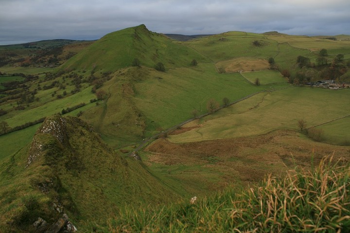
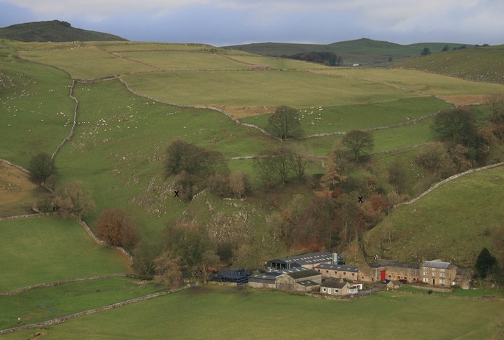
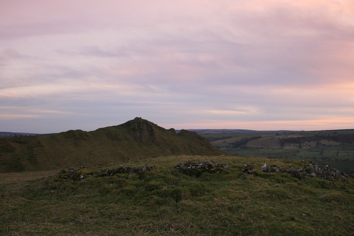
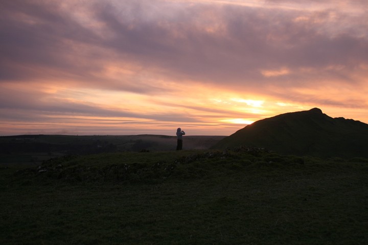
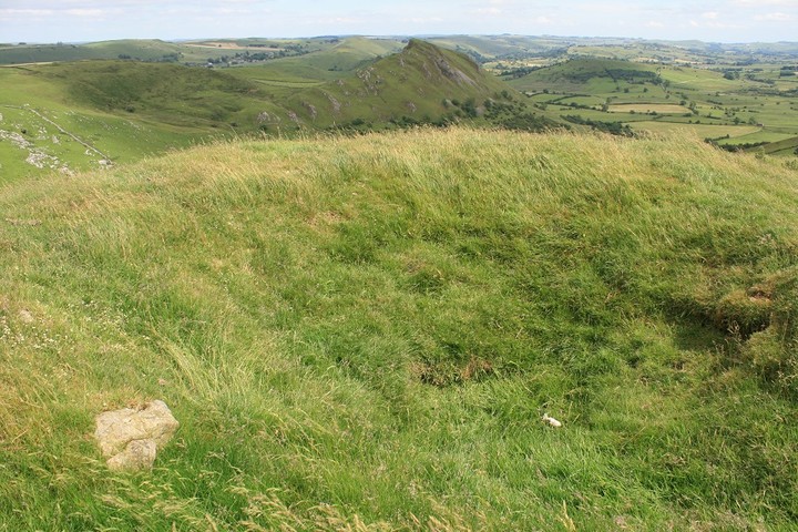
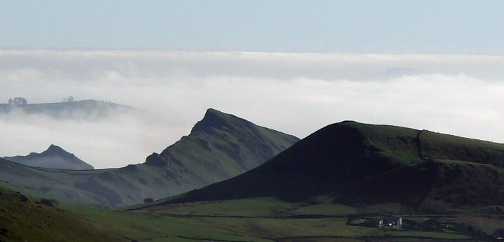
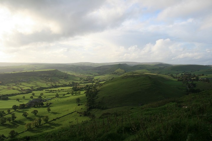
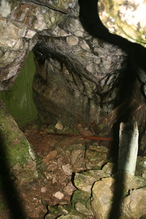
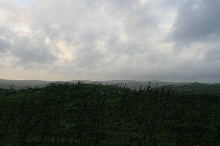
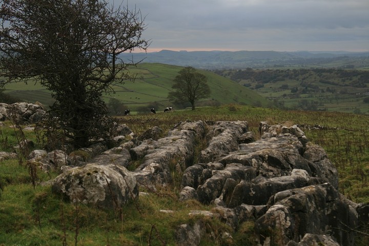
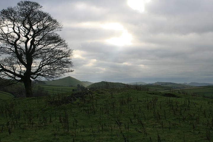
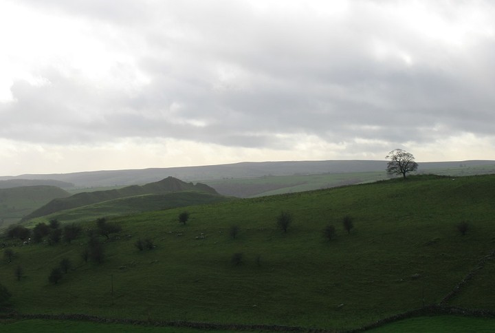
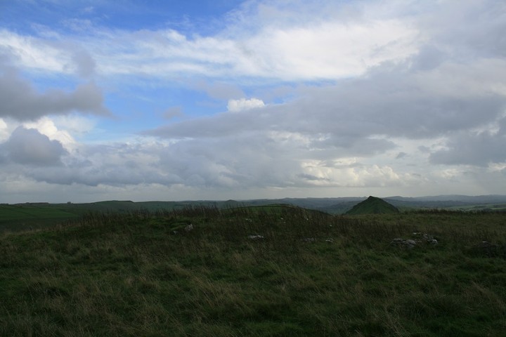

ELWICK BAY TO GRUKALTY, SHAPINSAY May 15th 2013 |
ELWICK BAY TO GRUKALTY, SHAPINSAY May 15th 2013The tall crenellated cylindrical structure to the left as you come into Shapinsay is called the Dishan Tower from its use in the 19thC as a primitive shower called a douche-house, hence its other name of The Douche. However this use must have been late in the century as the first O.S. still marks it as a doocot. It dates back to the 17thC when Cliffdale held court over Shapinsay. The obvious dovecot on top is decribed as a corbie-stepped cap-house in the NMRS. presumably more pigeons came in through the long narrow vertical slots in the seaward side. It does seem a strange setup, even with an entrance up on the landward side you wonder if the dovecôte didn't somehow come before the tower. And if it is as was, what of the Rendall Doocot's claim to be the only circular one in Orkney ? Everything in excess. As you come into the harbour the slope-roofed structure to the left of the pier, topped by three large slabs, used to be a kind of toilet block. You entered round the back, between it and the harbour wall, and the tides took away the effluent. Simples. Left of this structure a small circular tower is actually set into the harbour wall, with a side-on entrance having a long lintel of pale red stone keyed into the wall and a small window aperture in the centre of a deep oval depression in a stone block. Inside is equally pretty but the step up still gives no indication of any utilitarian use for this tower. This side of Shapinsay/Shapinsha goes by the name of Sound. And we were sounding out the coast, first passing between the slim Phrygian cap-ped pillars and by the side of the early 17thC gatehouse, yet another ornamental design from when the Balfours took over the Cliffdale lands. Following the path coming close to the Dishan Tower on the landfacing side of the track is a large wooden object resembling a chipboard boat or landing craft (the front sloping forward), though the first thought in my mind is narrow boat [in non-PC terms barge]. The bottom is slightly curved, like one of those herb choppers chefs use on telly. If I come this way again I must see if I can locate the prehistoric stuff eroding out of the shoreline southwest of the castle. This Iron Age site is called Setter Noost [sic]. HY41NE 13 at HY47301621 is believed to cover an area of about forty metres square by including more midden and various lumps and bumps above the shore. In 1972 in the low shore twenty metres west of a ruined lime kin in a seventeen metre exposure the O.S. saw several orthostats and bits of drystane wall as well as a midden 1.3 metres thick. At the west end of this an obvious external wall-face was in 1985 thought to be from some kind of round house, and quite a large one at that. In 1998 the Setter Noust site is described as walling indicative of an early structure and tumbled stone, with pot and bone and burnt stone in the extended midden [burnt mound ?]. Where was the Seatter farm, is the obvious question ? It is certain that there is more prehistory to the area. Balfour Castle is based on an earlier grand house called Cliffdale, and sometime prior to 1796 house-building nearby, close to the site of several failed lead mines, an erdhus came to light out of the blue. The present location of HY41NE 12 is unknown, most likely swallowed up by the much enlarged grounds. Sunk about a yard deep it had a roof of large slabs set on four foot high pillars, also called masonry piers. It comprised twin hexagonal cells, each about 8' across, and a rectangular one. The relative position of the components isn't given and that the latter is described as "as large as both" the hexagonal cells is rather ambiguous.This unusual design is listed as a souterrain. A finger-ring of gold came from this passage. A little further on there are the lower walls of some mediaeval structure, stones peeking out through the grass to form a rectangle of sorts. Actually, now that I look again, it is in a similar state to the Doo Kirk. Online I found this site called Lady Well. But no wellsprings are show on the 25" map. What is shown is a pump inland, which must be the sub-circular drystane well that the NMRS says could be the well for the chapel site whose legend lies some thirty-five metres to the south. Lady's Kirk, HY41NE 5 at HY47071643, shows no visible signs of being there. However, a gradiometric survey ahead of permission to dig a borehole detected two 11m long parallel lines about 5m apart. Of course with a known pump here could this be a pumphouse using that well ? The Lady Well that I saw could be a small wellpark all the same, but how about it being the chapel instead (and some are built over springs). It strikes me as odd that there were two establishments on this island dedicated to the Lady, so perhaps the dedication strictly belonged to the well itself or merely attributed later (we have no dedication for the similarly placed Kildinguie in Stronsay). Coming back on the ferry I see in/against the Balfour Castle wall on this side two more fun towers, both low and each surmounted by a cannon facing seaward. As one is circular and the other hexagonal or octagonal were these defensive or just more follydom ? What I did see is far more interesting than either of these, and as it isn't of a piece with anything else and as such appears to be an earlier house re-used (or else a much later addition knocked about a bit). An image on Geograph calls it a window looking out from the Balfour walled garden, but just inside the grounds the plain reverse of a 1674 gateway towers above it, belaboured with armorials and such on the front - unless I have the wrong perspective I would say the two are too close together, but the gateway faces out to this rather thab to Cliffdale and the castle. It juts out with two angled side framing the wide front and thin slabs for a 'roof'. Its stonework is not the same as the wall. The multi-paned wood-framed window is inset to an arch whose rounded top is formed by red bricks pointing inward. Unfortunately with the 'castle' being of such a late date the red brick doesn't help with chronology. I'd love it to have been the location of a house of course ! The next headland is covered by a mound. Twi Ness rather than meaning twin-ness is said to be tongue-ness as there is no double headland, but the name Point of Dishan can only go as far back as The Douche so could well have been the other half of a Twi Ness (Doocot Point is shown seperately). Makes sense as you would otherwise expect a narrow tongue not what is there in front of you, a rocky circular headland. Atop this HY41NE 19 at HY46761625 is a slightly hollowed 7mD cairn a mere point-six metres high, with an orthostat on the north side that might be, or have been, part of a cist. This upright slab actually runs radial to the mound centre, which sounds like it might be summat else to me, more a divider than an encloser. Anyways it is now a small grassy peak. Are the large stones in the cliff face part of a stoney outcrop on which the mound is placed or placed stone ? If it were one of these then the mound goes deeper than 0.6m or sits on something earlier. Only my guesses. After this comes a piece of the coastline called Stromberry. Here I and one of the newer Orkney Blide Trust members dallied to photograph the bonnie flowers including some on short plants. There was a lot of dwarf willow in bloom still - I am used to encountering this in spots along cliff edges on coastal paths but here it carpeted the ground in irregular ground-hugging clumps along where water gathered. Can't remember whether it had been before this or when we rejoined the group that I pointed out sets of straight lines slightly uphill of us, the ghost of a run-rig system I think. Between here and a line through Grukalty and Balfour Mains lies the legend Back of the Ness. The first 25" map shows a Pict's House here. On the 2nd 25" it is formalised as Site of Ancient Dwelling. In 1972 the O.S. could not find this site, HY41NE 4, but in 1984 the Royal Commission found a place where dark earth and a scattering of shell midden comes up under the plough (at HY46961702). If this is the same site could it be part of a settlement, which would explain why the land is didfficult to drain. Difficult to believe the midden is all there was if the identity is correct - in my experience they only put Pict's House on an early map if something of age had been excavated in modern times, usually tombs (like Wideford Hill Cairn) or 'gallery graves' (such as Rennibister souterrain where skulls were found). Outside chance this was the Cliffdale earthhouse. Grukalty is supposedly derived from Agricola, from his voyages around Britain, but the nearby coastal arc called the Furrow of Agricola started life as the Furrow of Grikalty [sic] so one might question how long the traditional identification dates back to. To back up the assertion the finding of Roman coins on Shapinsay is mentioned, but these and other Roman artefacts are found in many places in the Orkneys. The Hillock of Breakna being seen as the Earl's Palace in Orphir is an example of scholarly speculation transforming into a "traditional site of" statement. The intention had been to go up as far as the Loch and Ayre of Vasa on our circular route. Having gone as far as the Grukalty pier the group leader weren't sure we could do the whole walk, and so we reluctantly headed onto the track to Balfour Mains. I have to confess that I mistook a large pool for the lochan, it is quite big with twa bits o' land in it. Doesn't seem to appear as owt on the maps. Over on the right a small windowless modern structure with a steeply pitched roof sits on a small mound outside the castle grounds. Maybe the mound it barely occupies on is a trick of perspective, otherwise my feeling is it predates the building. Next to grab my attention, alongside the farmtrack, is what must surely once have been a wellhead. On the 1st 25" it bears the legend "pump trough", by the second there is only a p for pump even though everything survives. Another ornamental piece. Slightly faded but still a grand piece of work in white. In shape it resembles a settee with a drystane back and a long arm out to the left, gently curved and all topped by 'pillow-shaped' stones. At the front are two long orthostats. Behind these is the earthen seat. The iron pump with its handle sits centrally, backed by a short length of much less white wall at 90 degrees topped by a single thick slab. The closest comparison I can make is to the well beside the road along the Stromness Loons. Whilst I am snapping away the rest of the Blide part are already coming the Balfour Mains itself, a long building which has recently been renovated for a fresh purpose - the new wood window frames stand out.. At the front of the roof is what resembles a small belfry [I have read recently what these structures are actually called, x-tower I think] built with stone blocks the size of bricks, which has later been topped with several courses of different composition. Turning around the corner there are other ornate buildings about the farmyard too. And looking now at the two-storey building from a different angle I see that rather than a flat top the different material is an angled roof to the 'belfry'. There is a large curve-topped archway partway along the side to let a horse-and-cart in (that at Binscarth Farm is on the end. A low short structure joins the end to a single-storey building a little higher that I would have said had been either a school or a chapel - there are several entrances at the front and three ?pediment-projections with a peedie oriel window in the slightly larger central one. The oddest thing is an isolated long stretch of stone-block wall running roadside in front of all. In it are two fairly narrow entrances topped by thin slabs - one's been blocked off by a single vertical slab, the other still gives access to steep stone steps going up to farmyard level. A course below their tops more thin slabs run the length of the wall, a horizonal division with the rest of the wall above topped like the pump trough wall by 'pillow' stones. The slab course minds me on another on the west side of Binscarth Farm, though that is at a higher level and seems to mark where a building was removed to make way for the farm road. It is a shame that as yet Balfour Mains does not really figure on the National Monuments Record or Historic Scotland. There's a pro's photoshoot begging to happen ! Coming down the main road we realised we still had time for a spot more tourism, and so turned left to Elwick aka Ellwick and Ellswick. It would appear that anciently all this part of Shapinsay was named after an Eliander and included the holm - Jo Ben called Helliar Holm by the name Eleorholm and it has been known by several variations of these, such as Ellyar Holm and Elhardholm (I strongly suspect that the intrusive modern haitch is from some outsider thinking this comes from halye 'flat rock'). Though this personal name is said to have been something like Elland or Elland surely in that case the balance of probabilities suggests the Orcadian name Erlend. Shapinsay as a name also has a disputed origin, with the first bit usually seen as another personal name or 'sheep' or 'ship' and the last syllable as either 'island' or perhaps 'hall'. One man thought that Shapinsay is a Saxon name, which I suppose would explain scalpandishay>shapinsay. Scapa, another disputed name, took another route, having once been Scalpa 'isthmus'. Perhaps the last element of Shapinsay is 'isthmus' too, a reference to the Riff that connects the holm to it but now only appears at low tide ?? Throwing my hat in the ring the last element can also be 'howe' or a 'Height' - and mebbe Shapin was a giant/trow ?. They went to see Shapinsay Pottery inside a converted meal mill. Ellwick Mill only dates from 1883. It is at least as high as the tallest Balfour Main structure and is entered by a gateway with a gently arched top too. But the shop doesn't interest me when there's archaeology about, a lovely lade and a neat water-wheel with its enclosure surviving complete. From there I went to the millpond above the shoreline. Down on the shoreline assorted domestic ducks foraged near the water's edge. Perfect pastoral primacy. Turning back I had a wander inside the enclosed space next to the road where pottery starts, girt by earthen banks and a wall. A comfy place for creation, hidden from the outside. Well, apart from what looks like a long drainpipe on end. This tops a tall narrow column of pale pastel refectory bricks, much of which is encased by a rusty iron framework. Part of a small kiln I thought. Connected to this by twa rusty arms is a squat iron framework housing tightly packed bricks of an even paler hue. Against that is a table with two chairs backed against it, an intriguing tableau (groan). With the flowers in tyres ectetera this is so much nicer than a pottery shop. Just as I was getting going the others arrived for a quick look around, breaking my solitude. Coming by the school I had time for looking at my final curiosity. The Gas Tower sits just above the shoreline and is made to ape a low wide castle tower complete with wall slits. This antik gasometer surely sits on the site of an old hoose, for built into the fabric are architectural fragments. One of the three bears the date of 1725, taking it back to the time of Cliffdale. Inside is a majestic panorama of towering drystone walling, seperated by thin slabs from an icing of several courses of red sandstone. At the bottom the structure is concrete with a 'walkway' about the circumference. I would like to have stepped down onto the floor if there had been some way to do this. How does its size compare to that earthhouse found digging for a house near Cliffdale, is my thought now. Daydream away. The splendid gatehouse ceased being the way in a long time ago. Now a long winding road goes by the trees within the grounds of Balfour Castle [hope they are on top of the Robin's Pincushion]. It is a very understated entrance, framed by rectangular pillars with elongated pyramidions, and these in turn framed by the exceptionally tall chimneys at the end of the buildings either side. Finally came the time for the other purpose of our visit. After an Out and About to which no locals came we fared better with the Reach Out at the Smithy reataurant (pardon pun - I didn't see it coming I swear). Several folk showed up. One of them had been with the Blide some time ago and shared her reminiscences of Orkney Blide Trust's beginnings. Again the owners put on a fine spread ; cakelets to tease the tastebud and lovely lilies to feast the eye upon. And up on the wall lovely boutique clock caught my attention. |
24th October 2013ce |
EASTSIDE, SOUTH RONALDSAY September 11th 2013 |
EASTSIDE, SOUTH RONALDSAY September 11th 2013Coming to St Margaret's Hope (from Kirkwall) instead of turning down into the main body of the place go a little further and by the war memorial, barely outside The Hope turn left at the junction. On reaching a crossroads continue on over and down past Wheems terraced Campsite. Just past Weemys (sic) the Sorquoy Standing Stone, fourteen foot high, can be seen on partway along a field boundary on your left. NMRS record no. ND49SE 3 at ND46919140 once stood bigger, reported as sixteen feet high in 1805 so perhaps reduced by replaced soil exploratory digging in the following decades (though standing stones are apt to change their exposed height over the tears - some gain, some lose - making the identification of lesser specimens occasionally hit and miss). Three foot from the present base it's 2'6" broad and 18" deep, with a maximum thickness being 21~22" above that height. No mention is made of the projection on the top which reminds one that the Stonehenge trilithons are seen as using woodwork techniques and that it is now seen that the original Wessex influence came from Orkney. This stone has been postulated as the one referred to in regards to the ?souterrain ND49SE 13 found near Manse, so at ~ND473915. This is described in an 1875 work as a two-foot wide underground stucture having a fine floor of water-worn stone and measuring 11' long and 2'6" high. Nearby was a stone, in height 11'. So not Sorquoy. However, whilst the Sorquoy stone is up on the bottom of a scarf slope the Papar Project were told of another standing stone closer to the shore, unfortunately de-stabilised by post-war drainage work. There are other such passages known as having been in proximity to standing stones, Near the Yinstay cairn in St Andrew's for instance is an equally little recorded one (stone one now). The Blide mini-bus parked by the kirkyard. At one time they intended to develop the land about it, only to discover this area to be fair riddled with archaeology just under the turf. Whilst the others walked the sandy beach on this Bay of Newark I did a photographic tour around the outside of the kirkyard. Certainly lots underfoot between the shore and the two southern sides. Coming through the 'gateway' right of the wall towards Kirkhouse Point are two upstanding structures, one a roofless building with what looks like a low-walled garden the other a conical stone cairn. The latter is the base for a post-mill type windmill, ND49SE 18 ND4710190745. The former appears on the 1st O.S. with the name Millhouse, but ND49SE 38 at ND47089078 had been the storehouse for an 18th century fisher - a stone dated 177 comes from there. Seen from here here it looks two-storey, but it is built on a slope and the 'attic' is reached by stone steps at the back. First I walked around the coastline. Here, right by the edge, there is a large deep hollow masked by vegetation Then what had seemed a random stone assemblage from a distance resolved itself into three lines of large stones, some dresssed. I assume these were the boat nausts, though overly straight-sided to my mind, but later read about seven mortared walls that were supports for a wharf, so perhaps these are them eroded further since 1997 - this inlet itself is thought to have been touched by the hand of man. At the inter-tidal end a shag sat mere metres from me. On this side of the point there are three hand-operated boat winches, of which one has the remains of a wood frame. The storehouse outside has been turned into a sort of patio and the enclosure is now a walled garden for real. Of course it is now locked and barred. There are two reclaimed benches. The shorter of the two has an ornate back inset with huge sunflowers in fretwork. Next in my itinerary is the windmill base. The question that occurs to me is was there also a 'proper' mill nearby, now under the turf or is Millhouse simply a name given to the storehouse simply from proximity to the post-mill ? Probably the right place in my journey to say what lies beneath, or at least is suspected to from the 2007 field visit ahead of planning permission. West of the kirkyard is a sand quarry (alternatively sand dune) at ND470908 which has a wall and midden at the north end and, more importantly, structures accompanied by occupation layers at the south. There is a length of curving wall at the kirkyard's east side at ND4712790892 and to the north-east at ND4716490920 a low turf-covered mound of some kind. Only little further along the coast there is a mound on the storm beach which appears heavily quarried at the south-east. ND49SE 16 at ND47249084, aligned NE/SW and measuring some 17m by 10m roughly, is traditionally a burial ground. Because of the presence within of a similarly aligned orthostat,only 0.9m long and projecting 0.6m, and two more on the west margin in 1973 the visiting O.S. raised the possibility of its being a chambered mound. Another visit in 1981 had the O.S. discount this. Unfortunately in 2007 the mound's slabs could not be found. There are other structures and some orthostats in the vicinity. The presence of a likely kelp-pit means any more ancient remains were probably destroyed during the kelp boom. Behind the kirkyard at Kirkhouse Point is the Millenium Stone, decorated all the way around like a standing stone totem pole – I’d much rather have a replica of the Pictish symbol stone that once resided on a church windowsill !! There was WWII activity at the east side, though the ground is a little damp. I couldn't spot the searchlight remains recorded as being "immediately" NE of the kirkyard wall, all I saw was a concrete floor with its divisions being crowded out by invasive grass and a recent mound (well away from the wall and IIRC three-sides with an open-end, so agriculural I suspect. As well as the searchlight emplacement ND49SE 54 had been the site of three huts and several likely machine-gun posts. But I did find a personal reminder in a block of concrete resembling a mooring-point. On top it has engraved RKHOUSE with curlicues top and bottom, though on a photo there may be other words badly eroded. It doesn't strike me as official, buth then again it is no scribble or idle doodle. Nice. A noisy flock of birds were inside the kirkyard, then a few sat temptingly on the wall to provide only enough photos to know they were worth the effort ! Then the flock flew down into the grassland about me. Only time I saw them was when I disturbed them - why do birds fly up when they are invisible to you ? We have two dates for North Kirk set in stone above the seaward door, 1642 and 1801. I would think the renovation came about through money from the fishery. Another name for it is St Peter's Church, and a year after its building the presbytery burned a wooden effigy of the saint - did this come from an ealier kirk on the site or had this been a re-location ? It has been remarked that this is an anomalous location for a Peterkirk, there being no broch nearby. However there is that short wall arc, and there is the mysterious Danes Fort eastwards. At last came the time for me to catch up to the others. In the mid-60s Mr. A.Laughton of Kirkhouse had reason to cut into a sandy knoll (the intention being to enlarge his farmyard) and on reaching a depth of some six feet came across bones in what he thought to be a stone coffin. Before uncovering any more of it he simply put the soil back, well enough that it could not be found by investigators forty years later. The track to the beach is cut deep, and above it there is what strikes me as a rather long mound with stones poking through near the top (ND469908). Coming near the bottom end I found definite walling, with a corner including a fine long stone. Gaining height the other side of a short stream I could see a rectangular mound that used to be a walled structure abutting my corner it seemed to me. On the 1st O.S. there is another building south of the present set of Kirkhouse buildings. I eventually found a record for this, it being shown at the farm's other end on PASTMAP ! ND49SE 68 at ND4689190963 is described as a drystone structure with a corn-kiln's remain attached (this shown on the 2nd 25" O.S.). Also mentioned are indications of further archaeology below ground. On a satellite image the eye of faith sees a possible circular enclosure. But that could just be the track's effect I suppose. Attention diverted again, almost as soon as I started along the Bay of Newark my companions were coming back. Tried to walk faster but the sands suck you in. So trudging along where small plants at the edge provide more grip. The next burn along is more of a normal size and does come with a name, though my guess is that Stromispuil comes from there having been a drained pool above the strand. If puil means pool that is, though certainly Stromisuil is attached to a drain section on the 1st O.S. To avoid Sheena's dog Star charging me as I photographed my fellow travellers I stayed on the near side of the burn. She was unable to fathom that it she could just go round. So being scared of water she spent several minutes searching for a way over before throwing in the towel and jumping almost cleanly over a shallow section. Ailsa simply loves the water. She went so far out a new member thought she wouldn't come back ! Over the months this has increasingly irked Star, who stands on the shore barking like mad. Didn't take long enough to get back to the mini-bus. As we started going uphill I could see a mound the colour of hay three fields north-east of the initial bend. A long time ago this was either on the margin of a shallow lochan or actually in it. If the latter I would bet on it being the islet one presumes gave its name to the Papley district of South Ronaldsay. I know there is a well in close proximity, but then brochs in similar positions had them too. The Kirk Ness mound, ND49SE 7 at ND47289130, is an example of a site with changing opinions. Traditionally it is a 'Danish' Fort, but last century they opined the remains were simply the homes of fishermen, which is some turnabout in fortunes. And now the locals are back to the ancient edifice viewpoint again - you can't simply ask any old locals, you need to ask locals with long ties to the land you are investigating. Like The Cairns at Eyreland/Ireland (another "Danish Fort") copious stones have been removed from this greened stony knoll at some time. In 1929 structural remains coul still be detected, but being slight were not found in 1973. This vaguely circular mound stands 2m high and is about 30m across. On the other side of the former lochan appears to have been a burnt mound, ND49SE 15 at ND47169119, as Mr Laughton often turned up black earth and burnt stone in large amounts whilst ploughing. Fancifully I think on the Wasbister burnt mound and the disc barrow on the same side of the Dyke of Seean in Stenness. Very fancifuly I'm sure. Sheena had been keeping off chocolate until Kirsty, the new member, mentioned that by the track to the Italian Chapel the Orkney Wine folk have a peedie shop selling wines and related comestibles – you can even try a nip or two. As we had a look around I found myself sorely tempted by the chutneys, and the jams even more so. Have to plead poverty over deliciousness. Fortunately back in the minibus Kirsty gave us some to sample. Coming into St Ola a thick mist came down, horrible haar obscuring the verges. The road overlooks Scapa Flow of course, but anywhere in Orkney you are no further from the sea than seven miles, no great distance for a rolling fog (though this wasn't that dense, more of a mist like I said). |
23rd September 2013ce |
Offa’s Dyke VI – Chirk Castle Mill – Oswestry 2 April 2011 |
Offa’s Dyke VI – Chirk Castle Mill – Oswestry 2 April 2011It seems like ages since our last trip took us across the Dee to finally meet Offa’s Dyke itself. If that river crossing represented an important landmark in our North-South crawl down the Welsh border, today will throw in a few lesser ones. For a start, we’re now on our third map (Explorer 240 – Oswestry, Ordnance Survey fans). Rather more significantly, we will leave Wales for the first time. This is the first section of Offa’s Dyke Path we’ve attempted in a daytrip, rather than having to arrange accommodation. This is possible due to the relative proximity of the railway, so that we can get the train to Chirk and finish at Gobowen, about 7 miles plus a short bus trip at the end (albeit only 5 miles on the Dyke Path itself). Weatherwise, the contrast to our last walk, in misty February, is stark. Spring has come to the Marches and the sun is shining on semi-industrial Chirk. We walk up from the station to the castle, as a permissive route across the grounds has just re-opened for the Spring. This takes us past an extraordinary set of wrought iron gates, then round to the castle itself, a fine example of an Edward I stronghold designed to keep the Welsh in their place. We rejoin the Path as it drops down to the Afon Ceiriog, the next in the long series of waterways that we will cross on our route. The Ceiriog starts its journey on the slopes of Moel Fferna, the be-cairned mountain we visited on a memorable (not entirely in a good way) walk back in February. By the time it reaches us on the Path, it has flowed past numerous hilltop barrows and the hillfort at Cerrig Gwynion and will soon be joining the Dee on the other side of Chirk. For us it marks the crossing, for the first time, of the border between England and Wales. The border follows Offa’s Dyke itself, but the frontier was contested long after the Mercian king had shuffled off. Close to our crossing, a skirmish known as the Battle of Crogen took place in 1165, when a force led by Welsh king Owain Gwynedd attacked the Angevin Henry II’s army. Henry was fortunate to escape with his life, but soon after abandoned his plans to conquer Wales and went back to dealing with turbulent priests instead. A plaque on the bridge commemorates the action. Climbing up from the valley on its south side, a sign welcomes us into Shropshire. The Dyke forms the border all the way past Selattyn Hill, so we will be treading the frontier for a few miles now. I grew up in the Marches and crossing into Shropshire is starting to have the feel of heading home, for all that my heart generally lies in Wales these days. Once we’ve climbed back out of the valley, there is a great view of Chirk castle behind us and also of some prominent hills to the northeast, which I think must be the Mid-Cheshire Ridge and Beeston Crag, but our way lies southwest. The Dyke here is really impressive, especially compared to what we’ve seen up until now, with a deep ditch on the west (Welsh) side. It must be said that the path would benefit from being taken off the earthwork itself though, the erosion is not good. The Path drops steeply into Nanteris, then up stairs on the other side. Once back up onto the hillside above, there is a terrific view across North Shropshire and Cheshire, while the impressive section of Dyke continues onward. Over on a hillside to our west we can make out at least one of the cairns on Graig Wea, too distant and lacking in public access for a practical detour on this trip. After passing Plas Crogen, the countryside ahead of us emerges as a rolling patchwork of hills and fields, with the views opening up to the southeast across Shropshire, towards the Long Mynd and Brown Clee, which must be about 40 or so miles away. We stop for lunch and metallic tea at a roadside picnic area after passing some well-preserved old lime kilns at Craignant, where the daffs are in full, splendid bloom. Selattyn Hill — Fieldnotes16.09.13ceNow comes the biggest hill of the day, one I’m looking forward to greatly as it boasts the first prehistoric site we’ve been to since leaving Castell Dinas Bran. It only requires a short diversion off the Path to reach it, through an area of recently felled forestry. Standing at a reasonable 372m, the summit of Selattyn Hill is high enough to command excellent views into Shropshire, as well as of the Berwyns to our west and (I think) the Breiddins to the south. Seeing the former gives me much pleasure, as we sure didn’t see much when we were on them! The monument here is a ring cairn, sadly much trashed by the plonking of a stupid Victorian tower (now itself ruined) in its centre. However, traces of the stonework that comprised the ring can still be seen protruding through a heather covering. The construction is a wide bank of large blocks of stone, and would have been pretty impressive without the tower. It is best seen on the northern arc, the southern being very overgrown. It’s a great spot though, now that the surrounding forestry has been felled to open up the views, and should be even better once the resulting debris has started to break down. There is another cairn (Orsedd Wen) on the next hill to the west, but we can’t make this out today. It is also noticeable how few footpaths there are on the Welsh side of the border here. Whatever the post-Roman politics of the Welsh border, Selattyn represents a natural frontier, as the last hill above 1,000 ft before the drop down to the Cheshire/North Shropshire plain to the east. Certainly a worthy place for the twelve urns containing burnt human bone, found here when the tower was built. At length we head off south, alongside an ancient field boundary composed of huge boulders and an equally large field clearance heap. I find a small sliver of flint on the path, apparently worked (but broken) and certainly not native to this part of Shropshire. Selattyn Hill — Images06.04.11ce
Carreg y Big (Selattyn) — Fieldnotes16.09.13ceThe Path rejoins the Dyke south of Orsedd Wen. The next section of the earthwork is once again particularly fine. Just after it passes through a little wood, a footpath heads off eastwards and will take us to the second Bronze Age treat of the day, which can be seen from the Dyke. Standing 2m tall, Carreg-y-Big is probably Shropshire’s tallest standing stone, just topping the large pillar at Mitchell’s Fold to the south. The name looks like it should mean “The Big Stone”*. Damn accurate with their names, these Welsh folk (I know, it’s not in Wales). I was mainly aware of this one from Postie’s lovely snow-bound pictures from a year and a bit earlier, but it looks equally impressive in watery Spring sunlight. I’m particularly taken with the quartz vein running through the stone, being a sucker for a bit of quartz. There is also evidence of packing at the stone’s base. The positioning is slightly obscured from the east due to a hedge, but otherwise the stone would be prominent and just the kind of thing that could be used as a way marker, perhaps pointing the way to nearby Selattyn Hill ring cairn. Cynynion, a further, very similar, stone lies a mile and a half SSW. Carreg y Big (Selattyn) — Images06.04.11ce
Although we’ve only managed another 5 miles of Path, this takes us just over the 50-mile mark overall. The southwards progress feels palpable now that we’ve reached Shropshire and are heading towards countryside I know (or at least once knew). Rather than the tail between legs retreat of Henry II, we can stride onward with renewed confidence. Our next trip will take us to one of Shropshire’s - and indeed England’s - premier hillforts, so there’s much to look forward to. ---------- *Not true, sadly. Rhiannon suggests "Peak(y)/Point(y) Stone", which seems more likely. |
Posted by thesweetcheat 16th September 2013ce |
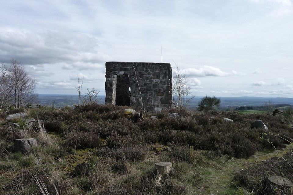
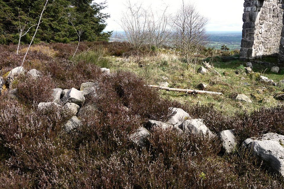
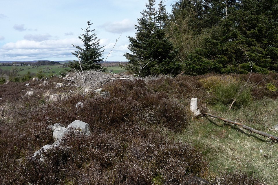
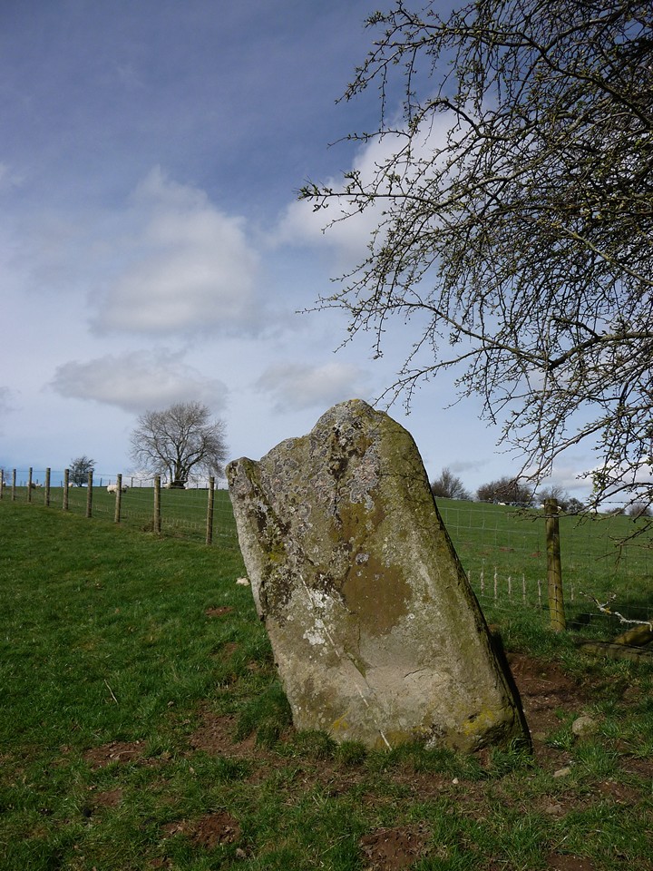
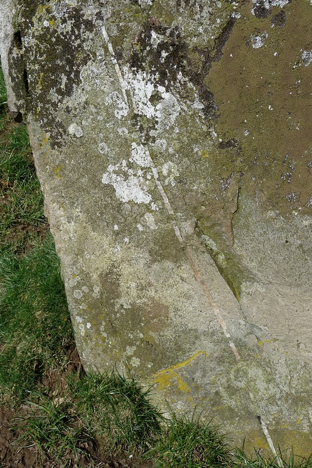
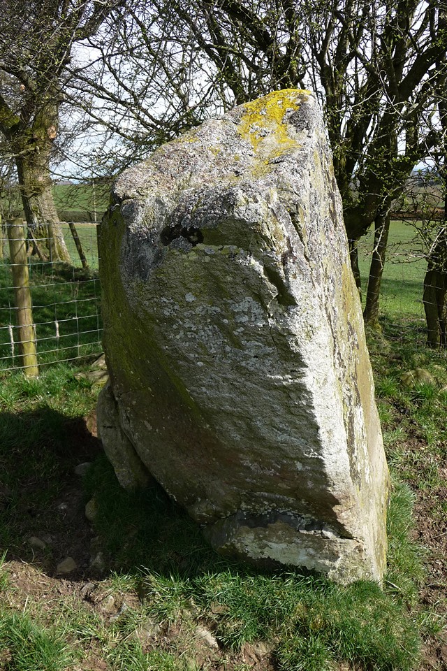
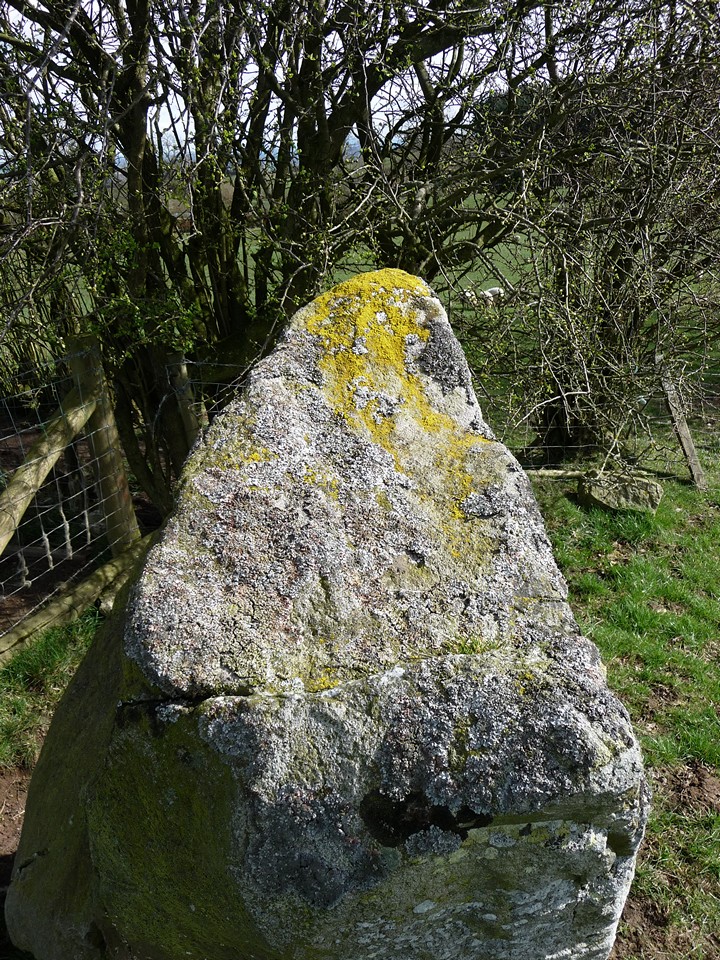
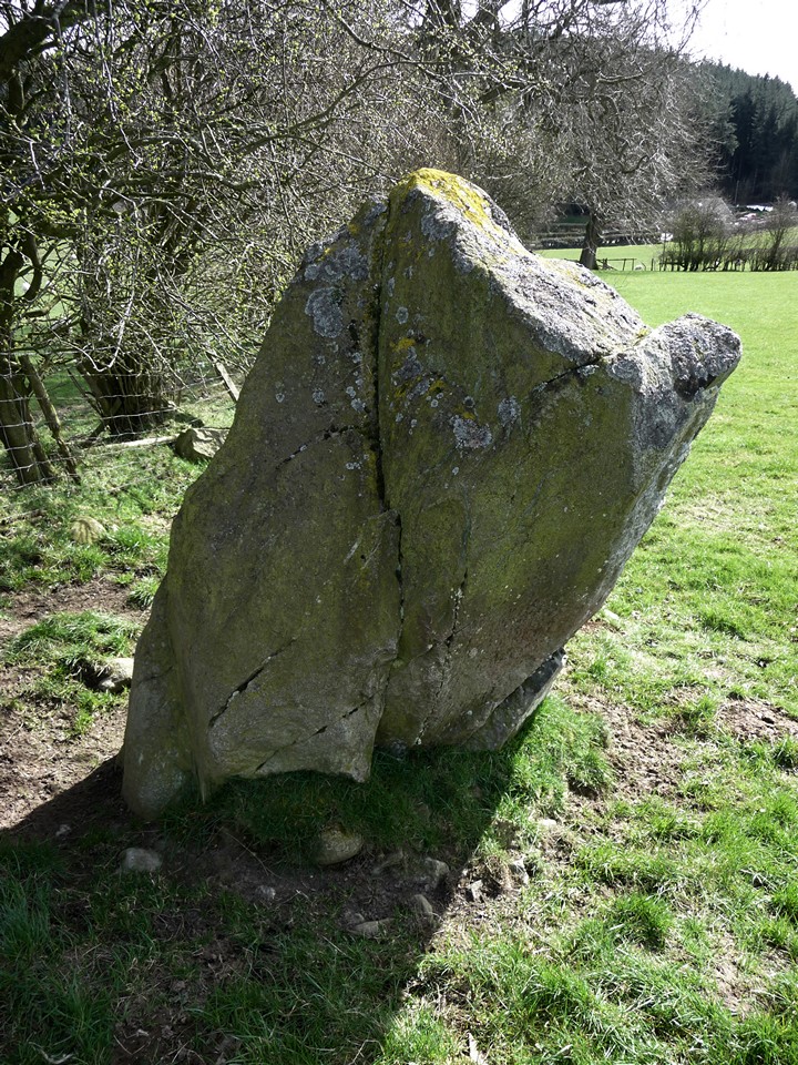
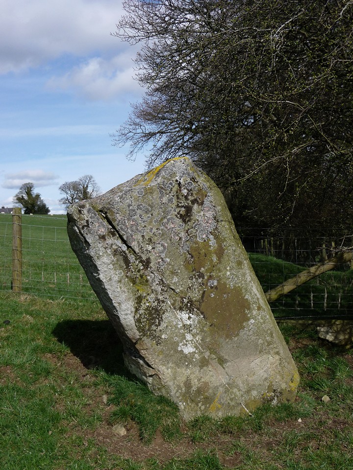
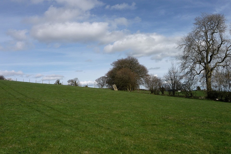
SAND O'WRIGHT & ST MARGARET'S HOPE August 28th 2013 |
SAND O'WRIGHT & ST MARGARET'S HOPE August 28th 2013Another grand day in paradise as the Blide group of Out and About folk headed down to South Ronaldsay in a full minibus again, picking up a member in the south isles. The road to Hoxa we used starts in the centre of The Hope by the Smiddy museum which one member expressed an interest in seeing sometime (its actually attached to the bus waiting room, so even in the worst of weather those travelling by public transport have a no-brainer !). Along the way we passed the Oyce of Quindry, a tidal inlet where they used to play the Ba'. Arrived at the Sand o'Wright aka Sands of Wright. Even though it was only an hour off high tide the beach looked expansive, and at extra-wide I still had to take three shots with my camera to capture it all.between the headlands. Most of the group headed east to the high cliffs at the Roeberry Taing, where they looked like tiny dolls at their foot. I suspect another Groatie Buckie hunt took place, these cowries as emblematic of good luck as their Pacific cousins. A few of us headed over the other direction where a fine swell washed the shore my much lower cliffs (though still too high for those with an aversion to owt much above a man's height). There is meant to be a 'new' track along the low cliffs, but I couldn't make this out from the below. Along the way the sparkling swell sometimes caught me out! Some waves rose glassy green, elsewhere they alternated plain with foam as if designed so. After a while the main body came towards us and we three set off to meet them. Several stranded jellyfish littered the sand, as did a peedie still-living crab missing all legs but one - Kev took pity and threw it into the sea. Coming up off the beach I was intrigued by a long low mound set against the base of the hillside in the sharp corner of a field and covered liberally with stones. On top an area of sand has been exposed but still with some stone. At the mounds downhill side I thought lines of dark grass might show where walls had been, though I have since read in a Current Archaeology report of "buried ditches forming dark green lines during dry conditions". In June 1871 the sandy knoll called Kirkiebrae was trenched in several places to reveal a likely encampment, with burnt stones forming a hearth and containing a large number of animal bones. On the hearth was found a stone quern ("rubber"), a piece of deer bone and a broken fine toothed iron pin fastened bone comb with a set of concentric circles paralleled in southern England. At one spot a fine red and yellow substance was mixed up with a large quantity of ashes. None of which sounds ecclesiastical, but this is traditionally the site of a St Colm's Chapel established by Columba's disciple Cormac from Iona in the early seventh century (Ladykirk down at Burwick had the same dedication). It seems strange that this building has disappeared completely. Anyway the piece that had attracted my attention is not the one on record. Instead they have a hillock above the beach on the other side of the wall as it - ND49SE 4 at ND42229369 - though Kirk Geo is nearer my candidate. The owner of Roeberry Farm called Kirkie Brae a natural grassy knoll with sand exposed in the top from having been used in the wartime (an aerial photo indicates the putative machine-gun post faced the Dam of Hoxa, though it looks as much a broch to my eyes). The dimensions given are 2.5m high and roughly 17m NW/SE by some 13m on the other axis. It is described as having a modern wall about the north and east edges and at the top of the NE side what might be signs of a former building in an outer face of yard-long foot-high drystane walling. To the north is the Howe of Hoxa, a long sloping mound near the west end of the Dam of Hoxa with an elevation at the high point hiding the broch just behind the house. Climb all the way up and you see into the broch from top to bottom as put back together by George Petrie after he excavated it. Many years ago since I have been there. Then the interior was full of nettles, and global warming will have made matters worse since. Definitely view from the top. Traditionally the earl Thorfinn Skullsplitter lies buried in Hoxa, with the mound being identified as the spot. But archaeologists can only find indications of settlement at the lower end. However near the east end of the Dam of Hoxa an empty long cist came to light in the vicinity of Swart(e)quoy/Swartiquoy, and early Christians were wont to re-bury their pagan ancestors. Waters are a little muddied by a reference to the discovery of graves, plural, outside the enclosure excavated in 1871 as no remains are mentioned in connection with the cist (ND49SW 11 at ND43099413). This NNE/SSW aligned cist, came from 2'8" deep inside a mound and mostly formed from slabs. At a distance of 4'6" from it another slab stood parallel to the east side's south end slab, both of which rose to a foot above the mound, and he found a 12" by 9½" whalebone vessel. A strange layout it seems to me. Anyways, Petrie believed the Swartquoy enclosure had been "an earthen encampment" because of its being within a strong rampart of earth and stone. This is undoubtedly the same site as Mayfield (ND49SW 13 at ND 43079416), though as described it may include the cist location too - in 1973 the OS talks of a D ~45m in diameter whereas in 1997 Moore and Wilson give us a sub-circular enclosure 'only' 30m across. But more easily reconcileable as area blocked off by the feature's two semi-circular ramparts though. The inner rampart is the better surviving at a maximum height of 1.3m, especially at the north side where it is 5m across (but 1997 account gives bank dimensions as 1.5m high but only 3m wide). At the widest point of the inner rampart a probable eastern entrance (NE in 1997 account) is indicated by two earthfast slabs 0.8m apart. The outer rampart isn't so obvious, and even then can only be seen in the NE quarter and some of the SE quarter. A 0.6m deep ditch across the middle of the enclosure had been some 2~2.5m wide. The enclosure's western end barely survives but is likely to have extended to where you can now see a boat shed's ruined foundations as rubble and peaty deposits lie in a 2m wide vertical cut at the cliffs. Must go there sometime. Back on firmer ground, and after taking photos of my candidate for the kirk I realise we would not be going any further. Beyond the toilet block are the large foundations of a wartime camp (the pillbox elsewhere is not in its original position, by the way). Running slowly ahead I think I have spotted the other end of the trail I would have taken them on, except you'd have to negotiate a field-gate. Once back onboard the minibus I persuaded our leader to go to W. Hourston's smithy museum, as sufficient time remained to do so. In the event a different member came with me to the smithy - the rest went to see a craftshop (where for once Sheena garnered no wool!). Hourston's smithy is in a long low building with the old forge in the central section. Go through to the right and there is a large collection of black-and-white photos. The bus waiting-room is seperate. Its wall is a round sweep at the corner of the road, preserving the original curve made to accomodate horse-driven vehicles. At the back a further, lower, building abuts the central section, continuing the roof line. Alas the garden behind has its gate roped up now because it was bonnie when I went. Entering the middle section there's the forge on your right and a selection of instruments in front of you and overhead. Most obvious are two hand-driven pedestal tools, a drill and a lathe operated by turning a wheel. In the low room behind the forge I saw a large thin-rimmed metal wheel and a pneumatic bellows operated by a long handle. As I came out of this room the lady in charge showed me a big bellows you work by hand to light an imitation fire on top of the forge, which felt satisfying to operate. Seeing the room full of antique photographs attracted my attention but didn't spike it this particular day. On leaving I had time to walk towards the Doctors Road, which I remembered fondly from a previous visit (from before all these new roads). Up from the museum above the other side of the road the stone walls of an old (?abandoned) building drew me to it. Small stone slabs making up the roof, with two peedie window-holes, and a knock-down imitation of crow-stepped gables. At the front the stones had more honeyed tones and I saw the usual slop-roofed abutting shed that goes with such Early Modern homes. The doctors hoose, Bankburn, sits at the end of its road and is a small late.mansion house with square gate pillars topped by stepped pyramids of more stone blocks. Directly before Bankburn I took a turn up a footpath running outside the walls. Here along the path I chanced upon a long patch of bonnie pale purple/pink flowers, a member of the Dead Nettle family with toothed lanceolate leaves held on a tall stem. Possibly a garden escape but very we;lcome scattered there.The path ends in what I would have thought could be a small dump except for the 'cabin' there. Could have walked over to the new road if I hadn't born in mind my propensity for a wander too far ! Going back a graceful grey-and-white pusser sat in the road, watching. She had a lovely face, so I took a few photos. As I neared she finally departed without so much as a peep. Back in the centre again there were a couple of members already back at the Blide bus. No-one else yet, so I went to the sea-front to look at an old slipway, the central portion is built using edgeset slabs just like you see in some of the cathedral arches in the upper section. Its quite a common technique in Orkney and seems to have been used for a long time for various structures - the top of the old Toy Ness pier in Orphir is made in the same way. By what used to be a damn fine place to eat (now up for sale) there is the eye-catching sweep of a row of traditional shorefront houses, now let down by the brash white of the new buildings at the far end. Finally the others came back from a cafe - lucky beggars, I didn't even get into the nearby shop for a look-see - and we were off backski. |
8th September 2013ce |
Lakeshore and dark peak – Carmarthen Fan 26 February 2011 |
Lakeshore and dark peak – Carmarthen Fan 26 February 2011An invite to join some friends on a late-winter circuit of the Carmarthen Fans, the most westerly of the four mountain ranges in the Brecon Beacons National Park, is one not to be sniffed at. I first visited the summits of Fan Hir and Fan Brycheiniog on a summery solo walk that took in Cerrig Duon & the Maen Mawr, but on that occasion the next summit of Picws Du looked a long way off. A month ago I made the long trek to the isolated and wonderful Nant Tarw circles, in a bitter cold that enveloped the peaks in an eerie blue and only served to increase my desire to get back out into these hills. Visiting this area on foot is difficult, the bus routes don’t come that close and are in any case infrequent, catering for a limited amount of passengers on their way to the hubs of Llandovery or Brecon. It becomes apparent from our circuitous route to get here, via Trecastle, that even by car this is a remote place, roads into the vast tract of open countryside north of the mountains being largely absent. We park up just past Blaenau, at the end of the narrow road that follows Cwm Sawdde. This, incidentally, is the start-point suggested by Gladman, and it’s a good place to begin. From here a broad track will take us southeast then south alongside the tumbling, white-water stream that leads eventually to the first of today’s objectives, the legendary lake of Llyn y Fan Fach (“Small Lake of the Beacon”, to distinguish from its larger sibling, Llyn y Fan Fawr). As we make our way up the track, a steady climb, the mist to our south parts occasionally to reveal glimpses of a black wall of towering rock. This is the escarpment of Y Mynydd Du, the Black Mountain, playing hide and seek with us for the moment, but revealing enough to show us that there is a formidable climb ahead. Over to our left, the unmistakable fork-tailed shape of a red kite swoops and glides as it quarters the empty moorland below the escarpment, looking for sustenance in this inhospitable landscape. Picws Du, Y Mynydd Du — Images27.02.11ce
The lake itself, when at length we reach it, is grey and opaque today, not yielding any of its secrets to casual visitors. Above tower the cliffs of Picws Du, topped with a Bronze Age cairn that cannot be seen from below. So I guess we’ll have to go up if we want to see it. From the little single-roomed stone bothy next to the lake, a slight path heads almost due east up the flank of Waun Lefrith, steepish at first and getting steeper as the top is approached. I temporarily leave my companions behind here, not for any reasons of competition or nonsense like that, just because I’m keen to get up to see the views and also to seek a little solitude in this enormous landscape. Looking back as I pause for breath, the top of Picws Du is now emerging from the mist as a flattish summit, jutting forward from the escarpment and providing a backdrop for Llyn y Fan Fach, already seeming far below me. Picws Du, Y Mynydd Du — Images27.02.11ce
The walk from here to the summit of Picws Du, with its attendant cairn, is gentle enough, with little descent and re-ascent between the two peaks. The views are terrific though, especially from the cliffs of Cwar-du, where the ground drops dizzyingly to the lovely lake below. An awesome spot, especially as the sun bursts through the mist to paint a patchwork of light on the browns and greys of the uplands below us. Picws Du, Y Mynydd Du — Fieldnotes27.08.13ceAs the Picws Du summit cairn comes into view, it becomes apparent that it has a very decent sized footprint, but is now quite low, with a smaller walkers’ cairn plonked on the top, possibly/probably made from stones from the original monument. There are some pretty big blocks in the original though and the footprint suggests it would have been a big cairn. In any case, the setting more than compensates for any deficiencies in the cairn itself. The views north over the escarpment edge are awe-inspiring, even on a day of fairly short visibility like today. And as we stop to take it all in, the mist lifts properly and blue skies open above us. Ah, what a wonderful world. And what a place to be interred. Incidentally, the name is obscure – the Nuttalls translate it as “Black Peak”, but I’ve not managed to find a translation for “picws” in any Welsh dictionary yet, so I’m not sure of this. Any ideas? Picws Du, Y Mynydd Du — Images26.08.13ce
Fan Foel — Fieldnotes27.08.13ceThe route from Picws Du to the next cairn, on Fan Foel, is easy enough but includes a fairly steep up-and-down, via Bwlch Blaen-Twrch (“pass of the boar's summit”). Once negotiated, there is a fine high-level retrospective view of Picws Du summit before we head over to the magnificent cairn placed right at the apex of the escarpment, the point where Carmarthenshire meets Powys/Brecknockshire. Was this always a territorial marker? If it was, it’s a high place for the people of power to agree upon their frontier. And perhaps such a person was laid to rest here, interred within a sizeable kerb of red sandstone blocks. If he or she were the monarch of all they surveyed, they certainly ruled over a far-reaching territory, for the views are extensive indeed, stretching eastwards to the twin summits of Pen-y-Fan and Corn Du then further away to the Black Mountains, with many other cairned summits in between. And yet the archaeological record reveals perhaps something rather more intriguing and human than a story of powerful warriors. A child was buried here, possibly garlanded with meadowsweet flowers. If only these stones and mountains would share the memory of that little sliver of history, what a tale they might tell. This cairn is ignored by many walkers, hurrying between the “tops” of Piws Du and Twr y Fan Foel/Fan Brycheiniog. But sadly enough come here to cause damage to the structure, which is what prompted the excavation and exposure of the magnificent kerb and half-buried cist. Probably the best of cairns on the main escarpment of Y Mynydd Du, this place will richly reward any TMAer making the trip. Fan Foel — Images27.02.11ce
Twr y Fan Foel — Fieldnotes27.08.13ceFrom Fan Foel, it’s not far at all to the next of today’s cairns, Twr y Fan Foel. Last time I came here from Fan Hir, a walk that is do-able using the Neath-Brecon bus service, but there’s no doubt that today’s approach is more satisfying. The cairn itself is a bit of a wreck, eroded at its base and piled into a silly cone. Purely as a structure of earth and stone, it lacks the charm of the wonderful ring on Fan Foel. But the view is astonishing. The ground drops away to north and east, and this is perfect viewpoint for the second of today’s mountain lakes, Llyn y Fan Fawr. From up here, it’s hard to believe that the lake itself is located at as-near-as-dammit 2,000 feet up. The cairn is at the highest point of Y Mynydd’s Du magnificent escarpment and boy, what a place for a monument. Worth every bit of energy and effort to get up here. Sadly we don’t linger so long at this one, my companions are getting hungry and a bit further along the escarpment, at the southern summit, there is a drystone shelter that has been identified as our lunch spot. There’s nothing on Coflein to suggest that this shelter has been fashioned from an ancient cairn, so I can feel relaxed about making use of it. For all that the sun is shining, it’s still bitterly cold up here and a stop of any duration is going to see a sudden drop in body temperature. It’s here that we meet the only other people that we’ll see today. Not far to the SW of the summit is the spot where an Avro Anson crashed in thick cloud and rain, back in peacetime 1939, a stark reminder of just how bad the weather can get in and above these mountains. Twr y Fan Foel — Images27.02.11ce
Suitably refreshed, it’s time for the big descent. We follow the escarpment down to Bwlch Gledd, from where the Beacons Way basically goes over the cliff! Luckily the path has been resurfaced recently, but this is still a tricky, slippy route that takes us, rather gingerly, down to the edge of lovely Llyn y Fan Fawr. Everyone has rubbery legs by the time we get to the bottom! We follow lakeshore and escarpment foot, basically retracing our earlier route, but 200m lower down. Rhyd-wen Fach stone setting — Fieldnotes27.08.13ceOne of the main attractions of this walk for me, apart from the brilliance of the summit cairns, is the two stone circles shown on the OS map along our return route. The second, Bannau Sir Gaer, is the better known, already visited and chronicled by Postie. But the first is virgin TMA territory. Coflein are dismissive of the site, and on getting here it’s easy to see why. We found the narrow track that the OS map shows as bisecting the site easily enough, but it crosses an area of plentiful small stones. Some are vaguely upright, but it would take a determined eye to be convinced that there is a circle here, unless we’ve missed something. My companions were certainly not impressed! Not far from the site, we came across a neat little spiral of blocks, half-hidden in the tufty grass. Someone has spent time here, to make that. To be fair, the setting is lovely, with the pointed prows of be-cairned Twr-y-Fan Foel and Fan Foel providing the main focal points. To the north, the land gradually slopes away towards Nant Tarw, although the circles aren’t visible from here, as far as I could tell. We head away from the setting across the tussocky, peaty moor of Waun Lwyd, close to the source of the river Usk/Afon Wsyg, one of South Wales' major rivers, which passes close to the Nant Tarw circles as well. It may be significant that the Tawe, another important river, rises not far away to the east, before passing Cerrig Duon & The Maen Mawr. There’s certainly plenty of scope for water-based theory and speculation about the siting of these monuments. Rhyd-wen Fach stone setting — Images01.03.11ce
Bannau Sir Gaer — Fieldnotes27.08.13ceThe final site of the day proves to be a winner. By the time we reach Bannau Sir Gaer, all but one of my friends has had enough, and don’t even make the effort to leave the path the look for this. The one who is left at least comes to the circle, but isn’t massively impressed, to be honest. Which just shows that this game isn’t for everyone! And so it comes to be that I’m left here on my own for a while, just as the sun re-emerges to illuminate the site in a golden glow, while the mountain backdrop is silhouetted into a wall of dark browns and black shadow. Spectacular. The circle is a wreck, it doesn’t matter a bit. A fine addition to the utterly compelling megalithic complex spread across these wild uplands. Picws Du, Y Mynydd Du — Images01.03.11ce
Bannau Sir Gaer — Images01.03.11ce
|
Posted by thesweetcheat 27th August 2013ce Edited 1st February 2023ce |