|
|

|
Latest Posts — Weblog |
Harold, Elvis, Athur and Samson - The men of Wales |
Harold, Elvis, Athur and Samson - The men of WalesI had been grounded for the rest of this year when a few days expectantly opened up and my wife urged me to make the best use of them, however, it meant setting of the very next morning. The weather was foul with snow forecast across the hills so I reluctantly left my van at home at took the car, which had the bonus of 4 wheel drive, and I would have to rely on finding budget hotels along the way. This turned out to be overcautious as the weather was glorious with sunny autumn days making it a pleasure to be out and about. I picked out a route which skipped along the South Wales coast and after an easy journey cross country started at the Harold Stones just South of Monmouth. Interesting alignment of 3 standing stones, difficult to imagine that that was all there was to it and impossible to guess what it might have been part of. The site itself is not very attractive, nor are the stones, being forged from the local puddingstone and looking like concrete reproductions (if I have offended anyone then apologies all round). Next it was off to Cardiff to see the Tinkerswood burial chamber. Nicely set a field away from the road with the reception and burial areas clearly defined. From here it was a pleasant walk down the narrow lanes to St Lythams. Despite the unfriendly warnings of dire retribution for anyone who steps of the defined footpath it is a pleasant place to visit and the chamber differs in the sense that the capstone is supported by huge stone slabs rather than columns, the right hand one with interesting cup markings (original or added later I don't know). A longish drive from here to the Gower peninsula for a brief visit to Parc le Breos, an interesting site, as if the top half has been sliced off with a huge knife allowing you to look at the inner construction, however, the real, and unexpected, gem was just a few miles up the road at Maen Ceti. The chamber here has the most huge unlikely looking capstone on very small stone pillars. The setting is wonderful with a well preserved cairn alongside and the hillside overlooking the estuary is a treasure trove of fallen stones, lost cairns and other evidence of the importance a scale of development that must have been in existence here. I ended up spending the rest of the day here just wondering around like the proverbial child in a sweetshop. The following morning turned into 'heaven on earth'. I drove into Manorbier in search of the Devil's Quoit and instantly fell in love with the place, down onto the beach up onto the coastal path, the sun was gleaming off the white horses breaking onto the beach, nothing could have been more perfect. Despite deciding I wanted to live there I forced myself on to Solva to visit the interestingly named St Elvis chambers. A longish walk down the farm track, through ankle deep shit and there they are, two chambers next to each other, nastily fenced off, however, they did include some information and I was glad I had made the effort. Carrying on around the coast I next visited Carreg Samson near Abercastle. I drove a little too far and ended up in the farm yard and decided to park there anyway, as it turned out right outside the gate that led into the field where Samson sat making it a pretty easy trip. This is a great site despite being intimidated by the local herd of cows, and a setting to die for overlooking the bay in one direction the hills behind. Next the road took me up to Carreg Coetan, now set within a modern development of houses and bungalows, however, afforded its own little garden and a pleasant place to visit. Further around the coast and I was at Llech y Drybedd. There is nothing to indicate its existence and I was pleased I had noted the name of the farm. I parked on the main road opposite the farm track and set off up the path past the farm and keeping left at the fork. The chamber sits rather lonely, unloved and unmarked in the corner of the field and I hope at least provides some comfort to the dairy cattle in bad weather. It couldn't be put off any longer, time to visit the mighty Pentre Ifan and I was pleased it did not disappoint. A well cared for site down some narrow lanes it is clearly part of some bigger development long since destroyed. This is a site to stop and linger at to walk around two or three times to try and assess the original dimensions, the approach, the landscape 5 to 6 thousand years ago and where the people lived. Before working my way home I had a couple of inland sites I wanted to visit, the first was Craig Rhosyfelin believed to be where at least one of Stonehenge bluestones came from. Parking alongside the Ford there is easy access into the site through a field gate. It is a beautiful site set into a narrow valley and the side wall has crumbled revealing and allowing the texture of the rocks to weather gracefully. To the layman it seemed a huge stretch to call this a quarry as opposed to a natural rock outcrop left behind by the ice age, however, that was not my concern, I just bathed in the beauty of the place and the overwhelming sense of history. My last stop was at the sprawling site of Gors Fawr, rather like a Preseli version of Stanton Moor ie there is evidence of neolithic activity everywhere, stone circles, standing stones and odd stones which may or may not have been part of a larger structure. The area was sodden and I couldn't get as far as I wanted so I left behind the perfect excuse to go back to this wonderful part of the country, if only to visit the Devil's Quoit one more time. A dash down the M4, M5, M6, A14, A1 and I was back in Lincolnshire in time to throw the cat out. |
Posted by costaexpress 12th November 2016ce |
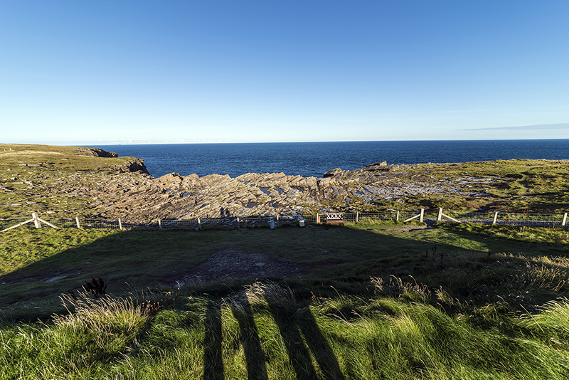
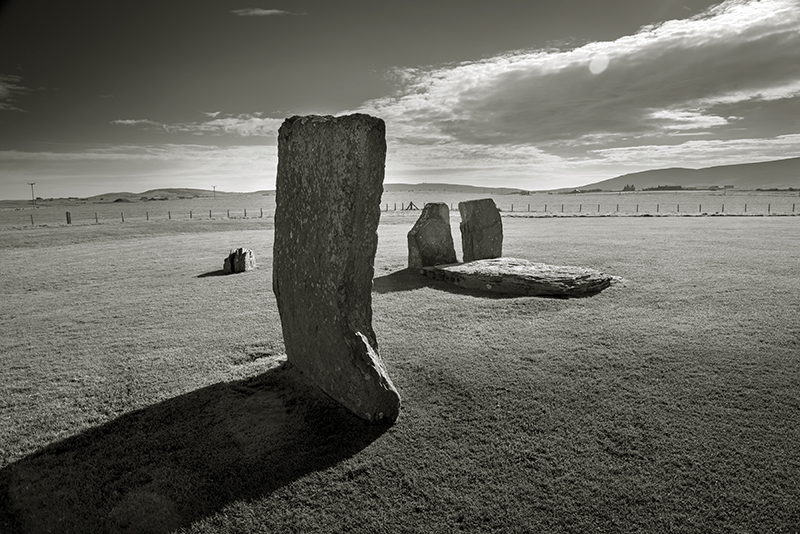
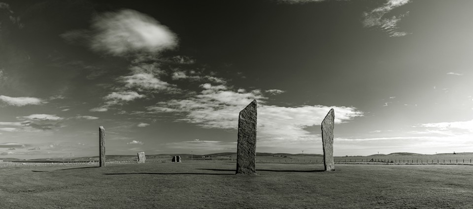
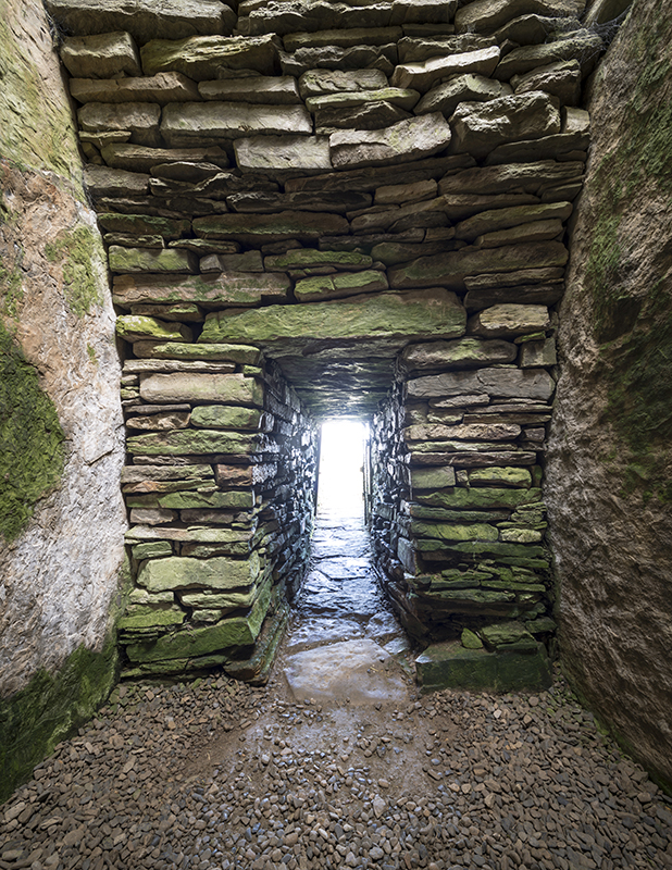
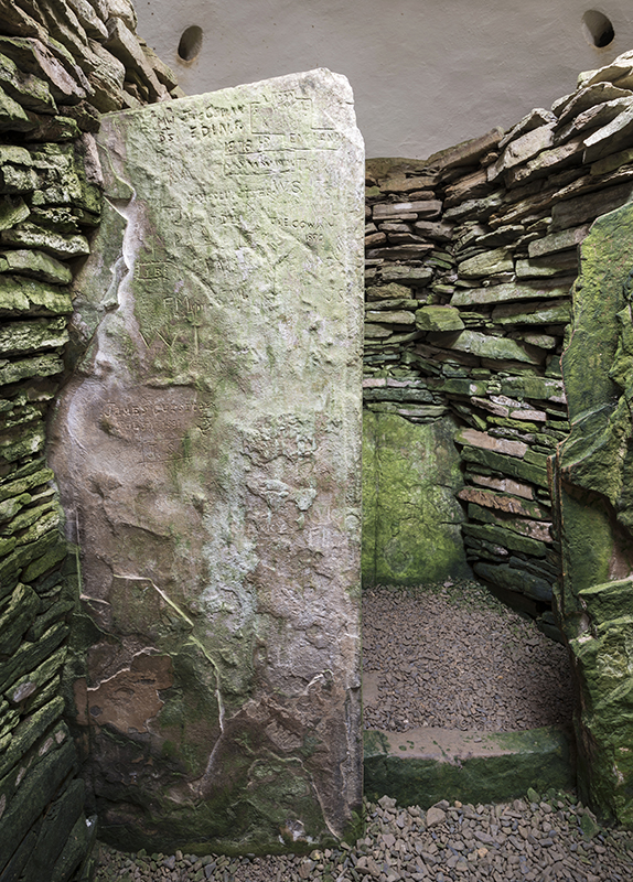
The Orkney Saga |
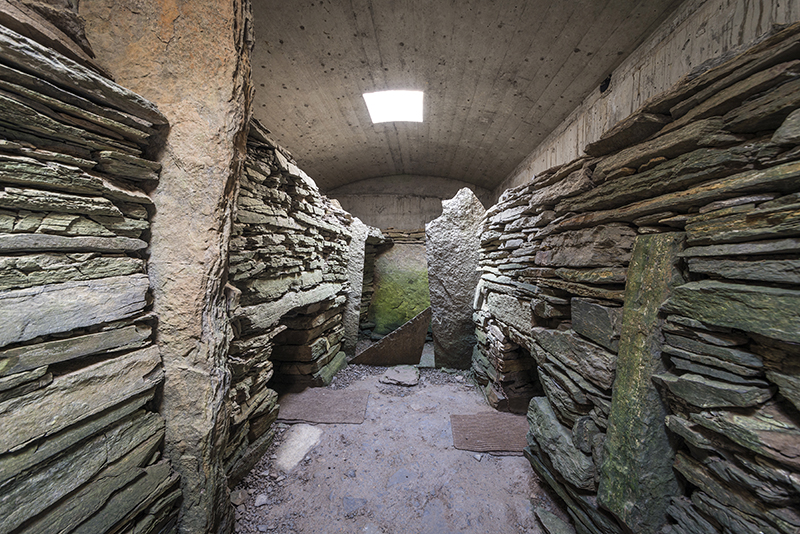
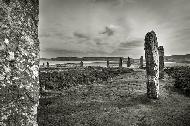
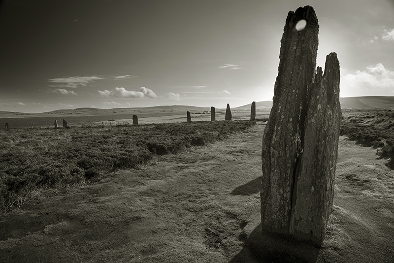
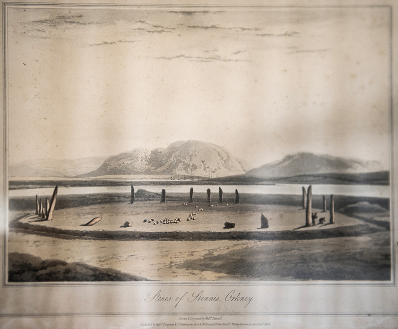
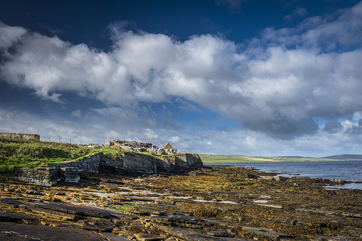
The Orkney SagaThis is a journey that’s taken two years to come to fruition and seemed like it might never happen at times. Two years ago we were all set to go, ferries booked, camper van sorted and routes planned and then a week before departure Mrs Cane slipped a disc and was advised not to travel. So we postponed and waited and waited and then work got in the way and then it was nearly 18 months before we thought it might all be back on again. So, literally a few weeks before a prospective date was selected, we started to re-plan the whole merry dance. As we were driving all the way from the South Coast we knew we couldn’t do it all in one day so we contacted our friend Karl the Viking in Derbyshire and another old friend Pip near Hadrian’s Wall as possible campsites en route. Day one and we’re driving up the M1 when the van’s automatic gearbox starts to misbehave. We come off the motorway at Chesterfield and by a stroke of luck there’s a Mazda dealer with a service department in the town centre, (Perrys - if you ever have problems with your Mazda ask to speak to Nigel He’s your man!) Luckily they diagnose it and say that the gearbox doesn’t appear to be wrecked, but can’t fix it today. So we have to ring up International Rescue who come and pick up our van, lend us Thunderbird 6 (like a Citroen C1) overnight so we can get to Karl’s and assure us that they’ll do their best to allow our Orkney dream to thrive. The next day we call International Rescue and Mr Tracy says that the van should be ready by mid afternoon dependent on a quick road test. I decide that a trip to nearby Mam Tor is in order as we’ve never actually climbed up it, merely gazed longingly from a distance. Boy is it windy up there today and the higher we climb the worse it gets to the point where you feel you could almost lie on it, though not too close to the edge obviously. I’m not entirely sure about pavements up hills, even if they’re nice stone sets tastefully placed, but as Mrs C only has sandals on I’ll let that one go. You really can’t beat the Shivering Mountain for views, even the cement factory in Castleton looks enigmatic today and all around is a green heaven of loveliness. For a week day it’s surprisingly busy up here with people coming and going in every direction, well actually either up or down. We descend to the car park to continue our journey back towards Chesterfield and wonder how things will pan out over the next hour. Luckily the camper van is fixed and seems to have no further problems so we continue our expedition Northwards. Th,th,th,thanks Mr Tracy! We arrive at Pip’s near Haltwhistle just as it starts to get dark and decide that we’ll stay an extra day rather than jump straight back into the van the following morning. We ring the ferry company to move our crossing date and luckily that’s ok. The next day we wake to a hot and sunshiny day and plan a days walk around the local area with a picnic and a chance to catch up on seven years of news. During the walk we find and pick a lot of wild mushrooms and bring them back with us to use in that evenings meal. Fungi collecting is something we’ve done for almost thirty years and never had a problem with so it’s a real shock to have Mrs C being violently sick at 2.00 in the morning. Eventually this stops and we all go back to bed but wonder who might be next, having consumed the same mushrooms. Thankfully it doesn’t happen, but Mrs C is still feeling a bit odd and we try to get medical advice. After numerous calls to local chemists, hospitals and NHS Direct, but not International Rescue, we are advised by RVI Newcastle to come into A&E and get some blood tests done in case something like kidney failure strikes 3 days later. Thoughts of making it to the Orkneys are now beginning to fade, but that’s really the last thing on our minds at this stage. The wonderful people at RVI Newcastle take good care of her but insist that she stays in overnight so they can keep an eye on her and get the results from their numerous blood tests the following morning. A tense 12 hours later Mrs C is feeling much better and the test results are fine. They think she probably picked and then discarded a particularly virulent mushroom (might have been a Destroying Angel) and should have cleaned her hands before we had our picnic, which might explain why she was the only one to get ill. So, off we go again. We know we can’t make it all the way to Gills Bay by this evening but we get as far as Inverness and decide that we’ll over-night it at Clava Cairns. This is our first visit to a Scottish prehistoric site and what a great opener! This really is quite a spectacular place; cairns, stone circles, cup marked stones and all neatly contained in a leafy glade. I wander around excitedly photographing what’s on offer while Mrs C reads all the info which is conveniently supplied next to each cairn. After a while she heads back to the camper van in the car park to prepare our evening meal and I have to resort to flash and long exposures as the light dies. Then the first stars begin to shine through the cloudless sky and a real magic takes hold of the site. The next morning the magic is sustained with low raking Autumnal sunshine giving another chance to amble around the place viewing it afresh. I hadn’t realised the evening before that the road alongside the site actually passes through the stone circle of the Southernmost cairn leaving one of the standing stones isolated from it’s brethren. After a quick breakfast we do the last part of our journey through the Highlands and get to Gills Bay at lunchtime. It’s so well timed that Pentland Ferries allow us to travel on the next sailing in 45 minutes even though we’re 2 days late arriving there, though we had kept them informed of our predicaments and they are a very understanding and flexible company. After disembarking we immediately head to the bottom of South Ronaldsay Island to visit The Tomb of the Eagles. One of the great things about this site is that you get a comprehensive talk with it and are allowed to handle some of the finds from the tomb. After that you make your way to the tomb via a Bronze Age building which once functioned as a sauna! It’s difficult to know whether this theory is true or not but considering the burnt mound next to it and that it was connected to a source of fresh water, that would appear to be a reasonable bit of guess work…or maybe they were just steaming their vegetables to retain some of the vitamins that we modern people simply boil away. Clever. The tomb itself is quite impressive with great sea views from the edge of the cliff and you have a choice of rolling through the entrance passage on an oversized skateboard or squatting down and shuffling through while banging your camera against the wall. Sadly I chose option two. You can only truly appreciate the space once everybody else has departed, which after about 20 minutes they do, and then you can marvel at the workmanship and thought that went into this 4500 year old architecture and the man hours it took to produce it. They either took a very long time with few people or maybe life was good and the population relatively high during this period? Judging by the sheer amount of monuments and settlements spread throughout the Orkneys you’d like to think it was the latter. Walking back to the museum you can take the cliff edge route which gives you an insight as to the building supplies available, i.e. tons of stratified sandstone that was easily quarried. Back at the museum we enquired about Banks, another nearby tomb, only to be told that it had just closed for the season. Damn. The next day is the Autumn Equinox (timely!) and we head off from the campsite at Kirkwall for Maeshowe. Due to it’s extreme popularity and the fact that it’s about to be closed down for some time we have to reserve a time slot 2 hours later. We’re also advised that there’s a ‘no photography inside the tomb’ policy in place, which although making sense in terms of crowd numbers, leaves me feeling a bit dis-heartened. I’ve driven 750 miles and this was on the top of my list! We head off for the nearby Stones of Stenness and that too is fairly brimming with people, but at least you can take photos. These are rather fine stones that wouldn’t look out of place in a sculpture park; tall, thin, elegant slabs with interesting angles. Were they always that shape and where are the rest? Presumably once a beautiful circle, now a whimsical arrangement. It just doesn’t seem to look old, though apparently it pre-dates it’s neighbour The Ring of Brodgar and that’s where we’re off to next. By the time we’ve parked up at the Brodgar Neolithic car park we only have time to walk to the ring, circle it once and then head back to the car park and back to Maeshowe. We’ll return to Brodgar later. Maeshowe. Well what can you say? It really is something else. Firstly there’s that amazing tunnel entrance, which I avoid banging my camera into, and at first assume it to be modern and quite tastefully rendered, but no, it’s four very long slabs of stone set at right angles delivering you to the heart of the huge mound. Once we’re all safely in and our eyes have adjusted to the weak light we can begin to understand this marvel. Yesterday I’d been impressed by The Tomb of the Eagles, but Maeshowe makes it look like a Wimpey home, but to be fair, it’s not as old and the Orkney tomb builders had probably had a decent amount of practice by then. Precision seems to be the order of the day here and every slab of stone fits neatly to produce perfect recesses for the remains of the ancestors (again like the entrance way with single slabs for walls, floor and ceiling), perfectly arced walls head to what would originally have been a beautiful, high corbelled dome. It is stated by the guide that the four upright stones that make up the corners of the tomb are actually not supporting anything and of no architectural importance and there is the possibility that they were there before the present tomb or were at least nearby and had some significance and were incorporated into the tomb. Again they’re all of a similar size and shape. Also of interest are the Viking Runes and pictures scratched into some of the slabs during the 12th Century which can only be properly seen by the guide sweeping the light from her torch across them. If there was ever anything of interest or value within the tomb it had certainly disappeared by 1861 when it was first excavated and there is the possibility that it was never used at all, though to my mind that seems doubtful with all this dextrous handiwork and a Winter Solstice sun shining brightly down it’s passage. Probably those pesky Vikings. After a brief chat with the guide at the end of our session I’m surprisingly permitted to take a few pictures of the interior, but only on condition that they don’t appear anywhere and are just for my own personal use. Fair enough. After this we continue our whirlwind tour with a quick stop at Unstan, yet another chambered cairn which is smaller and more cute than either Maeshowe or TTOTE. The interior is very similar to Eagles with its stalls but, in this case, only a single recess off the main chamber. I have the whole place to myself, which is nice, until I hear voices outside, a woman urging her partner to go inside and have a look and his reply with an Estuarine twang of “Nah, looks f**kin’ borin’ ”. They’re obviously having a great time on the islands. Our final destination for the day is Skara Brae just a few miles up the road from here. We arrive to find a car park almost full to the brim with coaches and cars and I’m beginning to think this is not such a good idea. However, once we’re through the visitor centre, cafe and shop we realise that they’re not really that interested in the main attraction which is almost deserted. Strange! Why would you pay to get in and then blow all that money on the side shows? My first impressions are that the village is actually quite small and incredibly compact. Were there any other similar structures nearby I wonder? The preservation of the interiors is quite amazing and it’s a real shame you’re restricted to viewing it from a short distance. Why don’t I have long black, flowing hair, a Scottish accent and a film crew behind me? Then I’m sure it would be just fine to have a good nosey around. I wonder how dark this semi-troglodyte world would have been with it’s narrow openings into restricted alley ways and probably only a fire to light the interiors and a tiny opening in the roof to let the smoke out, rather like the tombs they built for their dead. Before we leave there’s just enough time to have a quick look around Skaill House, home to the discoverers of Skara Brae on whose land it sits. There’s an illustration there of the ‘Stones of Stennis, Orkney’, dated December 7th 1820, which is a little mystifying as on closer inspection it’s quite obviously The Ring of Brodgar. When did the names change? Or were both the circles generalised as the ‘Stones of Stennis’? Answers on a postcard please to…… As it’s now getting late and I think Mrs C probably can’t take a revisit to The Ring of Brodgar today without serious matrimonial breakdown we head to Stromness to find a camp site for the night. The next day is mostly taken up by a visit to The Pier Arts Centre in Stromness which is a fantastic building and has some very interesting work on show. Thoroughly recommended, but it lacks a cafe. After lunch we head off to the Brough of Birsay in the North West of Mainland. This is a small island separated from Mainland at high tide, but at low tide you’re afforded a few hours to cross by foot onto the island where you can frolic around the remains of a Pictish/Viking settlement and a wee church. When we arrive at the car park there are a number of Norwegian tourists (Vikings I believe) waiting for the tide to go out while consuming local whiskey. I ask them what they’ve done with the contents of Maishowe, but they just look at me blankly, or drunkly. A nice evening is spent at the Brough of Birsay watching the sun set. We awake to leaden skies, have our breakfast and head off to the Broch of Gurness. It’s not open when we arrive and we make a mug of tea and wait. Eventually a man on a bicycle arrives and opens up and let’s us in. Luckily the sun breaks through and all is wonderful. Being a Broch virgin I take my time wandering around noting the double skin walling of the broch itself (what’s that all about? Insulation? Storage? Somewhere to hide should your enemy penetrate the inner sanctum?). I’ve noticed previously from photographs that they’re all built in almost exactly the same way and probably similar sizes and proportions. The interior layout and stone furniture doesn’t vary much from what was evident at Skara Brae, but possibly 2-2,500 years separate them and things won’t change significantly until the Vikings and IKEA arrive. The siting of the broch is nice too, with views across a narrow stretch of water to Rousay Island. It seems that nearly all brochs and ancient settlements were situated at the waters edge and that all communication between people was by boat and, in fact, that carried on until fairly modern times. Just before we leave Mrs C points out a strange piece of stone furniture in one of the outer dwellings which can really only be interpreted as a ‘sofa’. Well I never. Our fleeting Orkney saga is almost complete now, but we have one more crack at visiting The Ring of Brodgar. By now the sun has disappeared into a murky, flat grey sky and although that’s not conducive to interesting photography, it’s still nice to wander around the circle and some of the surrounding mounds. We know we have to make the most of this moment as this evening is going to bring heavy rain and local people say that most of August was wet and windy, so we’ve been tremendously lucky with our weather. The afternoon is spent in Kirkwall and a visit to the Museum, which is excellent and has a huge amount of prehistory on offer. The rain arrives as predicted and the next morning we head back down to St. Margaret’s Hope to get the ferry back to the Scottish mainland and start the long journey South. We’ve enjoyed our stay and it would have been good to explore some of the smaller islands and also some of the lesser monuments in this fascinating place, but that’s for another time. Clava Cairns — Images03.11.16ce
Tomb of the Eagles — Images06.11.16ce
Ring of Brodgar — Images11.11.16ce
Comet Stone — Images11.11.16ce
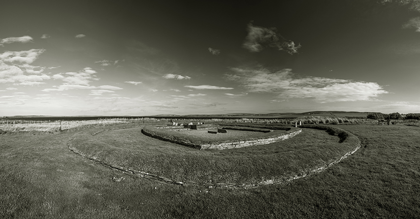
Barnhouse Settlement — Images17.11.16ce
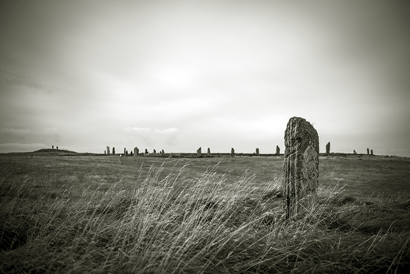
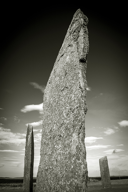
The Standing Stones of Stenness — Images23.11.16ce
Unstan — Images30.11.16ce
Maeshowe — Images08.12.16ce
Skara Brae — Images08.12.16ce
Broch of Gurness — Images14.12.16ce
|
 Posted by A R Cane
30th October 2016ce |
Autumn sun over Brittany |
Autumn sun over BrittanyWell the Tom didn't do what a Tom is supposed to do and so there is no firm date for our new kitten which meant my negotiating power was at a minimum just at a time when the sun was due to shine over Brittany for a full week. So, rather nervously and with a slight twitch I approached my wife and said 'weather good in Brittany and it will be quiet, perfect time to go on a field trip' 'Whatever, just don't forget I have my own trips planned in November and I am expecting you to be Homo Domesticus for the full month' so, slightly reeling from this response I packed my things, watched Peterborough beat Bury 3-1 and set off for the eurotunnel straight after. Following an easy run through Normandy there was two sites I wanted to visit near St Malo before heading deeper into Brittany, the first was the Menhir of Champ Dolent, a huge standing stone set on open ground making it look even bigger, then on to the House of Fairies neat Tresse, the first of many Allee Couverte Graves I had planned to see on this trip. Set 150m or so into the forest it was a true fairy glen and a great start to the trip. It was now time to head towards the coast to the region around Kerguntuil an area rich in megaliths and in particular covered alleyways perhaps the most famous one being the Prajou Menhir. All the locations were well signposted and the sites well cared for, could have spent days or maybe weeks in this part of France. Next a pleasant drive around the coast to the huge cairn of Barnenez with its visitor centre and paid access. As I was the only person there the security warden was more than happy to show me around in particular focusing on the way architecture changed from megalithic to stone block as the building of the cairn and its extension progressed. This is a wonderful site, however, something about paying and visitor centres puts me off a bit and I decided our very own Grey Cairns of Camster were equally as impressive and won hands down in terms of location and access. The next two sites were to be a minor challenge as they could only be reached at low tide and I would find out if I had read the tables on French coastal tides correctly (available on the web of course as is everything). First stop was Kernic where the covered alleyway is engulfed by the tide twice a day, assuming it wasn't built this way there must have been some movement in sea level, in any case it is an absolutely beautiful site to visit and somehow I read the tides correctly and so off to Ile Carn Island only accessible at low tide. Like a small version of Barnenez you can still crawl into the left hand passage. The tide was out, however, there was no path it is a case of picking your way over the rocks and seaweed, paddling through the tidal pools and finding your own way across all the time worried that the tide would come in and cut you off. On my return to the safety of the deserted white sand beach I felt hugely elated and was punching the air when I noticed an old woman out walking her dog looking rather oddly at me! Time to start heading back taking in a number of inland sites the first being the incredible Kerloas Menhir, the tallest standing stone in Europe, a full 9.5m and that's after having part of it blown off in a lightning strike. Very nicely set in a small thicket very much a must see site (no one there of course). A longish run across country to find the alleway of Mougau Bihan, perhaps the finest I visited complete with decorated stones showing axe and dagger, original or added later difficult to tell. Another longish run to the Necropolis of Liscuis, three covered alleyways sat on the plateau above the cliffs rising from the village. This was a long steep walk and after huffing and puffing for what seemed like miles I was rewarded with the most fantastic views and three wonderful examples of this kind of megalith. Now surrounded by trees and gorse they would have originally been in prominent positions looking out over the valley below. Sadly it was time to head off to my last site the megalithic centre of St Just. There is a megalithic trail here which links a number of the key sites together and forms a most enjoyable walk past standing stones, stone alignments, graves, natural stone block alignments and much more a great way to end what turned out to be one of my favourite field visits. Of course Carnac is incomparable, however, Northern Brittany is certainly not to be ignored. Pointed the van North and home today just trying to find a way to tell my wife I'm heading up to Fleetwood tomorrow for an away game! |
Posted by costaexpress 14th October 2016ce |
Couldn't see ABBA anywhere |
Couldn't see ABBA anywhereAs we were unpacking our suitcases I asked my wife had she enjoyed her stay in Warsaw, she said yes, a fabulous time although it would have been better if you hadn't been humming ABBA tunes all week, you don't even like them. I then asked her did she still want that kitten, she slowly said yes, I replied good, so with that out the way I felt I could finally tell her. 'I'm planning on going off to Sweden before the colder weather sets in'. 'When?' 'Friday' Expecting the normal expletives and abuse worse than a Jeremy Corbyn critic I was taken off guard with 'I see, well say hello to ABBA for me just don't backtrack on the kitten'. (We already have a Dog and an older cat which I think is enough) So come Friday evening with the week put to bed and the weather forecast looking excellent I packed the van up and set off for Sweden. Three immediate points 1) Its a long way, I set off at 8.00pm on Friday and it was 9.00 pm on Saturday before I settled down in in Ystad on Swedens Southern coast. 2) Julians book is unusually light on Sweden and therefore quite a bit of internet planning is required ahead of any visit. 3) It was obvious that if the crops had not been harvested a number of these sites would have been inaccessible. I decided I would follow Julians journey along the Southern coast before heading North to Falkoping, the Neolithic heart of Sweden, and finally pick off a few sites on the West coast as I headed home. Early morning start and I visited two modern sites (estimate around 500AD), Disa Ting a stone square located on the shoreline and the mighty Ales Stenar. This may be a modern stone ship, however, it is a very powerful place. As I climbed out of the van I could feel myself being pulled towards the site, as I moved around and up the mother earth site it is located on I felt my pace quicken and as I ascended the final ridge I broke into a trot and there they were, heart breakingly lonely overlooking the sea and crying out to distant lands. Inside the 'ship' the hairs on my legs, hands and neck all began to feel the static given off by this place, the stones are all different materials, lovingly shaped from bright pink to dark blacks, they begin to morph into people, small people, fat people, tall people, people with helmets, people with beards. I became aware of a dog fighting with my walking boots and decided it was time to return to the van. On the way back I felt strangely emotional, what had taken place back there, had I somehow seen my future, was I to be part of those stones in some way, for ever? Shaking all such feelings off I moved on past the Trollasten, Tagarp Fem and off to Gardlosa, easier to find that reports suggested, and then Gladsax, here it feels a little uncomfortable as you simply drive up to the farmyard, dump your vehicle and set off across the fields, no one batted an eyelid and it was well signposted so assumed everything OK, and what a site, the burial chamber sits on top of a circular stone wall and commands the countryside. Believed to be one of the oldest sites in the area. Quick stop at the huge Kings Grave and onto the beach for Harvangsdosen. A wonderful sight with the sea crashing in as a backdrop discovered after a storm rather like our own Scara Brae. What I had not expected was the whole area was littered with Neolithic to Iron age remains and where ever you walked you discovered something new and unmarked. Time to head North to Falkoping, the town itself has remains of passage graves everywhere, on roundabouts in front of banks and in parks. Just North of the town is the important site of Ekornavallen. Nothing could have prepared me for this. A huge site sloping down to the river just covered in standing stones, stone circles, passage graves, cairns, stone triangle and every sort of monument between neolithic and iron age. Swedens Kilmartin! Like a child in a sweetshop, where do you start, just wallow in the joy of zig zagging from one feature to the next. Too soon it was time to move on which raised an important question, quantity or quality, was I trying to see too much and not spending sufficient quality time at the individual sites? Should I pencil in fewer sites for my visits and get to know fewer sites better, but which ones, how do you know before you get there? Any way I did go on, to Karleby and the Luttra, both multiple sites with prominent megaliths situated atop of small hills and all perfectly aligned. Time to head South to the Varberg area to visit Klastorp and Blotabordet, however, the really fascinating site was the hillside of Grimton, a huge burial ground used from early neolithic and up to 500 AD (or so). Here there was a huge boulder circle, numerous stone circles, cairns, a stone traingle and various other standing stones covering the hillside and clearly little visited, in fact, and as is usual, I had nearly all the site completely to myself. Finally I stopped at Gillog on the way home just North of Malmo. Here it is an easy crawl/stoop down the passage into the main chamber of this wonderfully preserved burial mound. The scale and quality of this site would not look out of place on Orkney and a great way to finish my visit. Sadly time to head home, pleased to be seeing the family again but sad to be saying farewell to this warm welcoming country. I placed the van in the direction of Calais, set the cruise control and let the gps navigate the intricate motorway network back home to Lincolnshire. I never did say hello to ABBA, I did however, stop at Brugge for chocolate and that seemed to work just as well |
Posted by costaexpress 25th September 2016ce |
Tyrebagger |
TyrebaggerI feel compelled to post about this very special place. It's our 3rd day in beautiful Aberdeenshire & we visited yesterday. Now isn't it strange & wonderfully thrilling when some stones knock you sideways. We have seen some stunning places already & have more to come but Tyrebagger stopped us in our tracks & my itinerary flew out of the window. This means that we'll lose out on other sites due to time constraints but what the hell, it's about here & now ain't it. We struggled to get there; there's a lot going on construction wise in Aberdeenshire at the moment isn't there. Ugly gashes across the landscape etc etc, but what do I know? nothing that's what! We drove up a private road & tentatively asked a resident householder if it was ok to park up & search for the circle. He was graciousness itself & said it was fine, but didn't know where it was. He lives not 10 minutes away, how can this be. Anyway he was smashing. It tickles me how most people react when I ask about stones. I find that they most often glance sideways at me with a knowing smile twitching about their lips & their eyes follow you as you march away. Anyway am blathering as per. I immediately felt blown away by Tyrebagger. I felt altered, my being expanded, my brain chatter ceased & I worshipped; now I don't use that word often. I also nearly broke my bloody ankle on the hidden stones underfoot. I started to march around the circle but gave up & sat with my back resting on the carved tree ( somebody's carved "fuck", I mean what the fuck!) My bloke has a loud voice & I noticed an echo. I got him to shout & the echo was astonishing. It felt as though that shout would be heard for miles & miles. Much further shouting ensued; a herd of sheep came to investigate. The echo only seemed to work when we stood opposite the recumbent stone. It truly amazed us. Will the new road ruin this? Eventually he quietened down & I sat with eyes closed. I felt a bit dizzy with exhilaration. Suddenly I smelt a strong whiff of perfume. It wafted around me for a few seconds & was gone. I couldn't identify it;it wasn't either of us & nobody else was there. I'm not given to flights of fancy, I believe something shifted at Tyrebagger; something encircled me. I'll be ringing bells next! We stayed for hours & the sun shone. Sorry nothing about the actual stones which are of course magnificent. I'm glad we got to experience this place before new road starts roaring. I hope the rumbling doesn't render them unstable. A new favourite; thank you ancestors:) |
Posted by carol27 29th August 2016ce |
Medway Megaliths |
Medway MegalithsFor various reasons the last couple of months has seen my wife and I bobbing back and forward to France through the euro tunnel and every time we drive down the M20 I whine about not having time to stop off and see the megaliths. Well with 2 clear weeks before our next trip away my wife suddenly said 'Right, no excuses get yourself down to Kent and take a look at those bricks on the M20' As the shock of what she had just said sunk in I quickly loaded up the van and set off that very evening while the weather was still hot and sunny. Next morning I found my way to a lay by near Kit's Coty House and set off to find it. Not difficult, however, no signage and so you need some idea of where to look, as it turned out it was in a field right next to the track off Pilgrims Way. Nice sight, however, imprisoned by railings and doesn't set the heart racing in the same way say a Cornwall Quoit does but does have a presence all of its own. Next a life threatening walk down the road to find the Coffin Stones which are smack bang in the middle of a very well maintained Kent vineyard. Not sure if I was supposed to wandering among the vines, however, glad I found it, an interesting collection of what looks like the capstone and side supports now collapsed onto each other. Risking life once again I set off further down the road to Little Kits Coty House. A very nice sight next to the main road but completely hidden by hedge and a small pathway. Spent a long time here trying to work out what was support and what was capstone. Next it was off to the White Horse Stone, sorry, no matter how long I looked at it I couldn't see the horse just a large lump of chalk rock, none the less an interesting site, then onto the field where Smythes Megalith once stood. So much is written about it that I thought there must be something there, no, just an empty field. I questioned my own sanity when I found myself taking a photo of the field and made a note to seek counselling when I get back home. Finally went further inland to visit Julliberries Grave long barrow. Nice walk but not a lot to see and I resolved to call it quits for the day. Next day went West to the Coldrum stones. What a magnificent site this is. Wonderful walk to it and the stones are set atop a mound giving incredible views over the Kent wheat fields. The tree overlooking the stones were covered in ribbons, trinkets and notes to various spirits. It was hot and sunny and I didn't want to leave and settled down with my back to the stones. Not sure how much time passed, however, I woke up to find a family peering down at me relieved to find this weather worn old man wasn't dead. I quickly grabbed my things and wandered off down the track and set off for Addington long barrow, another interesting site spread over both sides of the road (who allowed that?) and must have been a huge site in its prime. On to the Chesnuts and rang the number on the gate 'not available today' 'tomorrow?' 'Busy' OK best I leave it then. Not sure whats going on however I didn't encounter the friendly reception I have read so much about. So with that one disappointment I worked my way back up the motorway system to Lincolnshire and thought what a lovely way to spend a few days and how kind of my wife to suggest I just get off and go. The phone went, it was my wife 'About that kitten I mentioned' I just caught myself in time and pretended to be disinterested, thought there is more negotiation to be had here than a couple of days in Kent! |
Posted by costaexpress 20th August 2016ce |
North Wales, a few walks into prehistory |
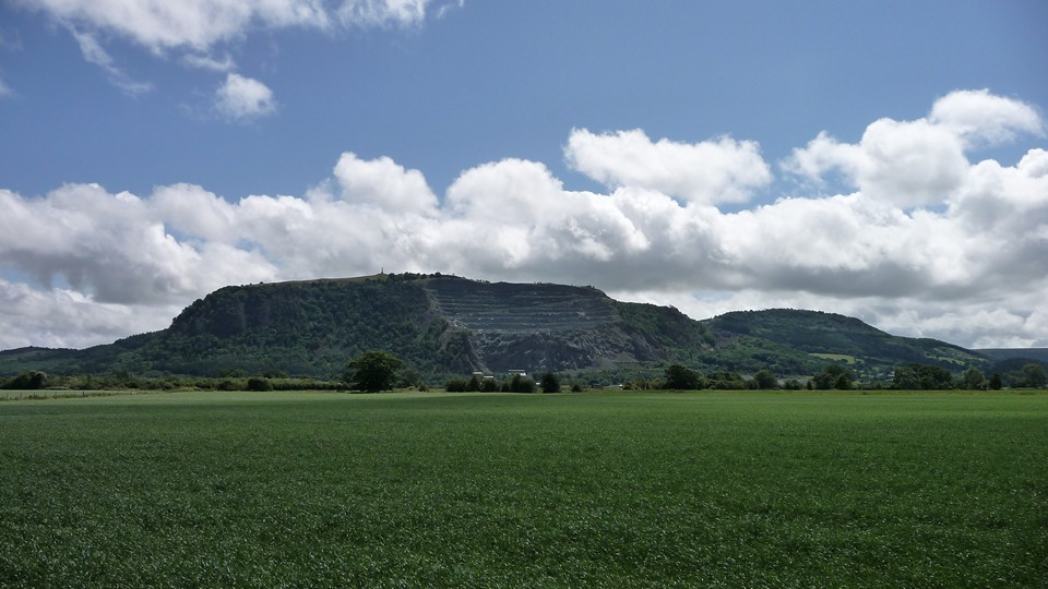
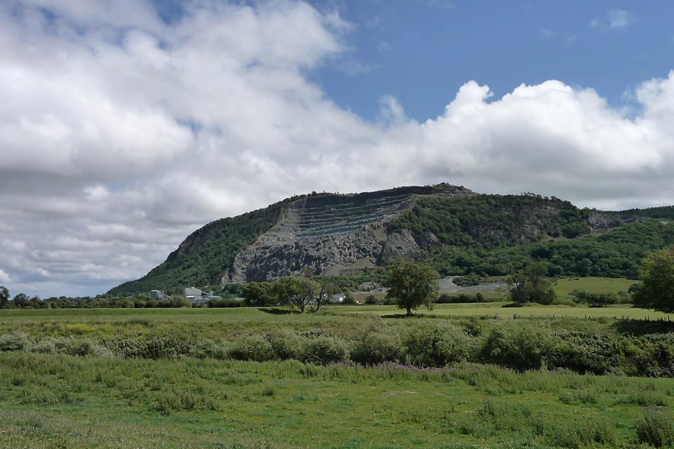
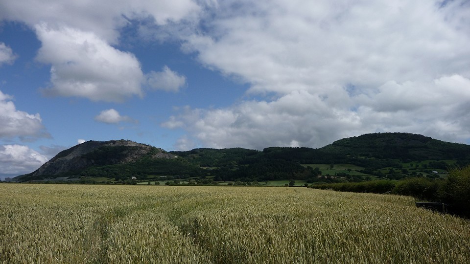
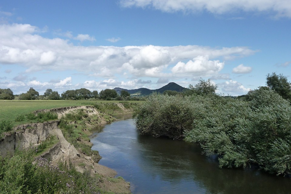
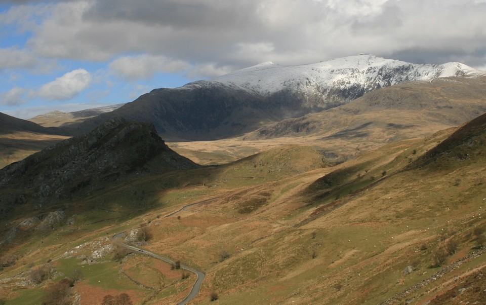
North Wales, a few walks into prehistoryMy wife and daughter were busy helping out a friend which gave me an opportunity to squeeze in a couple of days in North Wales. I wanted to walk some of the tracks I had read about on this site First stop was the small village of Rowen, easy access road and a big layby at the start of the village for the van. My aim was to walk the old road above Rowen to the Cerrig Pryfaid stone circle. A very steep climb out of Rowen sees you gain height very quickly with magnificent views over Conway Valley and the sight of two Buzzards (huge birds, I think that's what they were) circling above it was a great start to the walk. Just about out of breath when I came upon the Carhun stone which marks the start of a series of megaliths close to the track. A bit of looking around (surprisingly well hidden) led to the Caerhun chambered cairn and then on down to the small but perfectly formed Maen y Bardd (thought I was in Cornwall), where the sheep scurried away giving me disapproving glances at being disturbed. The track led on to the Ffon y Cawr standing stone and then to the Cae Coch stone and eventually the stone circle of Cerrig Pryfaid. Very small stones almost hidden by the grass, however, the two outlying stones and potential alignments, the location high above the valley and the true peace of the site makes it a very worthwhile visit. Retraced my steps to Rowen looking out for ancient hut circles a burnt mound which I am not sure I found and back down the steep hill into Rowen. About 3 1/2 hours in all and guessing could be done in less if in a hurry. Next up was a much easier walk, however, very rewarding. I parked up in Conway Falls cafe car park and walked up the steep track opposite, through the campsite and over the hill to Capel Garmon. What a shock, the site is in much better condition, larger and had more to explore than I was expecting and indeed as the sign said was very reminiscent of a Cotswold Burial Chamber. All in all 1 1/2 hours including lingering too long at the site. Next day, it was pouring down and boy can it rain in North Wales, with no sign of let up I pulled into Penmaenmawr and parked the van up, no choice but to get on with it if I was going too see the Druids circle. The ascent was a bit of a shock, easy walk out of PMmawr up through the houses and access through the side of the farm, thereafter it was a steep accent through dark mist and pouring rain to the trackway on the top of the mountain. I could not see anything through the mist and navigation was impossible. I staggered around trying to keep to the well defined paths hoping I could easily retrace my steps if necessary. Eventually no choice but to pull the gps out and hope it was waterproof. As it turned out I was almost at the Craig Lwyd cairns so I started there, took some pretty damp photos and followed the gps up the circle 278 and then on to a very atmospheric druids circle where the mist suddenly lifted and all was revealed, wet feet, well wet everywhere, it was all now worthwhile. On to circle 275 and the weather closed in again as I dropped down to the Maen Cryn stone and the remnants of the Red Farm stone circle. It was hopeless by now I couldn't even see the path in front of me, so I navigated to the mountain road and followed it down into PMmawr, found the van dried off and changed my clothes with an uncontrollable smile as the weather turned to bright sunshine and I thought 'You B@stard'! Next, as a little treat before heading home I visited the Bronze Age copper mine on the Great Orme which I really enjoyed, a final look at the stone row descending down the mountain to the sea (why there?) and time to work my way home. All in all a great way to spend a couple of days, just take a change of clothes. |
Posted by costaexpress 9th July 2016ce |
North East Scotland road trip |
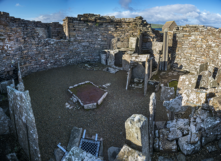
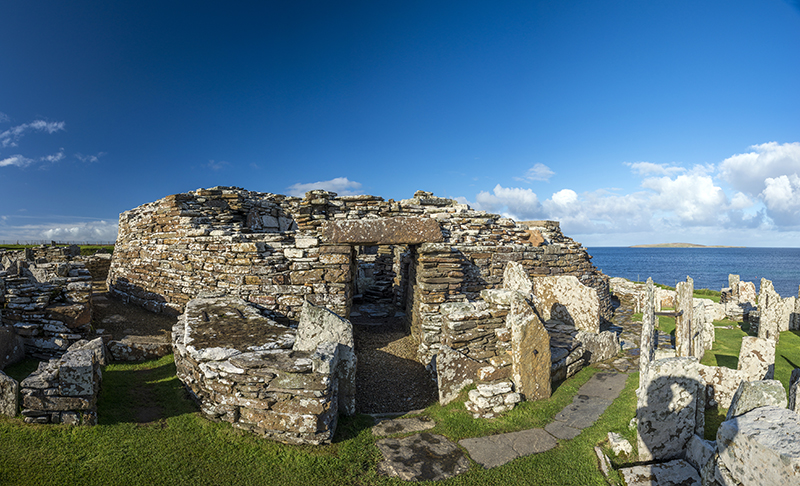
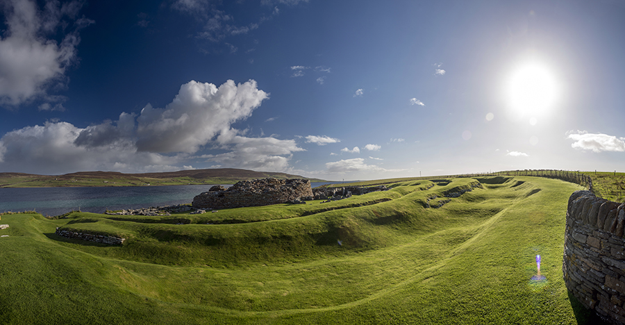
North East Scotland road tripI had been planning this one for a while, however, it was shelved for a number of weeks due to an irresistable urge to go to the Hebrides to see Callanish and its environment. So the day finally came, I had taken my wife away for a short break before setting off to set aside all guilt feelings associated with yet another trip, and I was really focussed. Despite so many sites I resisted all temptation to stop until I got to a Clava Cairns just short of Inverness. Huge site and well cared for by Scottish Heritage, a little sanitised for my liking but a welcome stop. Next up to see the Hill o many Stanes like a Carnac for a model village, a short drive to the unbelievable Grey Cairns of Camster which I crawled into all of the available chambers, this is a real crawl not a stoop. Set in a remote part of Scotland they are still well cared for with a proper board walk across the boggy ground to the Cairns and demand your time and consideration, if they were in Wiltshire I am sure they would be among our most treasured sites. Over the hills to see the Achavanich Stone Circle or U shape to be exact, the stones face inwards rather than sideways and no one knows why. The whole area oozes evidence of a Neolithic presence. Time waits for no one and I needed to be on the 7pm ferry to Orkney. So much has been written about this place I will just comment on what I found useful Get up early, like 5.30 am early and you can have the standing stones of Stennes, the Ring of Brodger and Barnhouse village to yourself Go to Skara Brae after hours by walking up the beach to it, the tourists during the day will do your head in. You can go to the visitors centre and pay if you conscience troubles you (I did) During tourist hours you can visit the fantastic Unstan Cairn, the wonderful walk to Wideford Hill Cairn, and the atmospheric Cuween Hill Cairn. On the South side of the island, and free of tourists whilst I was there, are Tomb of Eagles very much worth a visit for its dramatic cliff top setting and best of all the Tomb of the Otters or Banks tomb as it used to be called. This is a live site only partially excavated and he closest you will come to feeling like Indiana Jones, assuming of course you want to feel like him. Maeshowe is fine, even though on the tourist route you only get in with a timed ticket and so is not overbearing Finally a couple of warnings. I went for a second visit to Cuween Hill very early in the morning and when I crawled in I was shocked to find someone sleeping in their, banged my head on the ceiling when my torch light caught him, and the second warning, under no circumstances descend into the closed Minehowe pit. Pure evil resides their and I will post a seperate forum link about it In summary Orkney is just magical, however, with days running out it was time to drive the van on the overnight ferry to Aberdeen where I wanted to get a first hand view of the recumbent stone circles unique to this area. The showpiece sites like Easter Aquhorthies, Cullerie, Tomnavarie, Midmar Kirk and the Loanhead of Daviot were fabulous, however, more interesting results were to be found at places like Cothiemuir Wood, Old Keig, Whitehill, Sunhoney, Nine Stanes and Esslie the Greater where the stones are scattered and the sites overgrown, the sites felt alive and real rather than recreations. I was unable to make any connections regarding alignment to the sacred mother hills, lunar observations and not in all cases alignment, what I did feel however was a strong sacred presence and a place to grieve for the dead. Time has run out and I am now on my way home, stopping for a coffee and to write a quick blog, hope I have not gone on too much |
Posted by costaexpress 17th June 2016ce |
Wicked Stepmother |
Wicked StepmotherI have spent 4 days in Cornwall recently at the behest of the above; it wasn't pleasant but I managed to escape periodically to a magical land. It saved my soul. The sun shone & everything glittered, like only Cornwall can for me. I'll post my inadequate photos, but really how my eyes & senses continue to be opened. Firstly a thankyou again for the wonderful blogs & pictures on this site. I would never have dreamed as a young girl that I'd switch off the telly & read & marvel at these places. It's soppy, & sounds over emotional ( a woman's lot - joke) but you strangers enrich my life. Ok enough of that. On the way down to Corny, a 7 hour drive, we visited Stoney Littleton. It pissed it down. The brook was overflowing; the uphill walk was slippy; the stiles were tricky for the continuing hop a long ( hip replacement imminent) but we both breathed & laughed. First time for a while. It felt like freedom. From then on in, escaping from a nut job of a non blood related relative became easy & she affected me not. Most vivid memories; a group of women strategically positioned around the Hurlers with a collection of crystals placed in the centre of the biggest circle. A clamber to the Cheesewring missing Rillaton Barrow yet again. Trethevy quoit meister! Feeling decidedly dizzy in Carn Euny fougou. Not being able to brave visiting Brane too closely because of vicious looking bovine creatures ( a first for me, I'm used to benevolent cows, I live in Lancashire!) The Pipers; what! Boscowan Un, a nurturing sanctuary. Lanyon Quoit, the retriever. Men an Tol & I schleped through the hole whilst worrying about whether or not I was adding to potential wear & tear a getting a bit mucky; also whether I was doing it from the right side, & whether once was enough. Is once ever enough? Then the Nine bloody Maidens, Stones, whatever, up the hill from Men an Tol. Yeah, found them TSC! It took me an hour. I knocked on a local farm door (no answer). I asked two delightful locals walking; they'd no idea. I then approached a scantily clad young couple who were out & about & they guided me on my way. A beautiful spot. Unassuming & magical. Like my beloved Sunkenkirk this place swims in & out of view; well to me that is. Now I KNOW where it is. All of a sudden I can see. There's stones all over the place up there, I was bewildered. We met a lovely woman whilst on our travels called Linda, who we took to the stones, she was overcome by the "energies". I liked her, we're still in touch. She asked if I could feel it. I said I felt grounded & happy; I think that was ok, but secretly I kind of knew what she meant; I think. To stop myself from committing step matricide, & to balance my chakras for the journey home I focused on a tiny bit of Dartmoor, which made a 7 hour journey home more like10 hours but it was well worth it. The stone rows, the Plague Market blew me away. How beautiful are they? How exquisitely beautiful. What on earth? I'm aware I'm doing the touristy bits but you've gotta start somewhere. That bloody Plague Market.Wow:) |
Posted by carol27 11th June 2016ce |
Rather blustery at Callanish |
Rather blustery at CallanishI decided, at the last minute, that there was just enough time to squeeze in a visit to the Callanish Stones over the Bank Holiday, I then realised if I travelled over night I could make up enough time to walk Kilmartin Glen on the way up there. And so it was, I made the bed up in the van, threw some food in the fridge, packed my wellies and joined the A1 just North of Peterborough shortly after 10.00pm. I briefly stopped just short of Kilmartin to look at the standing stones around Bridgend and Dunadd Castle although it was still dark, blowing a gale and pouring down and so I didn't really get much done, and being 6.00am there wasnt much light. Drove on a little further to the start of my walk at the Ballymeanoch Stones and Duncraigaig Cairn, up to Ri Cruin and on to Temple Wood. From there past the various ' Nethers' and finally Glebe Cairn behind the church and back to the van via the Nether Largie standing stones and stone row. This is a fabulous walk through history and didn't take as long as I had expected. Temple Wood was particularly fascinating although so well restored it wouldn't look out of place on a roundabout leading into Milton Keynes. Not a sole around as you might expect early on a Sunday morning and really pleased to have spent time there. Onward through Skye and onto the ferry at Uig for a very rough crossing to Harris and Lewis. The morning didn't start well, gale force winds, heavy rain and hail, however, no option but to press on. Callanish 1 was even more inspiring than I had expected, a real temple of its time and definitely felt like there was some huge religious significance to it regardless of all the theories from a Astronomical Clock to a Time Machine. Callanish 2 was a wonderful place to be as you look out over both 1 and 3 and it all feels very interconnected. Both were under water and the wind so strong you needed to cling to the stones for protection. Callanish 4 was just about possible with wellies, however, the more remote sites were going to have to wait for another visit, for which I cannot wait. I went on to see the huge Truishal Standing Stone and a few other sites, however, with little time left I went back to Callanish 1 to spend more time in the central stones and contemplate how the site had been developed over 1000 years and the changes in the outlook and religion of the people involved. Dreaming over, another sick inducing crossing of the Minch and a very long drive home. Would I do it again? Tomorrow (subject to permission from my long suffering wife) |
Posted by costaexpress 6th May 2016ce |
Getting high by staying low. |
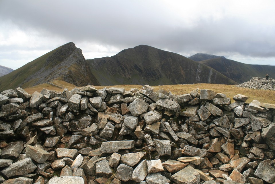
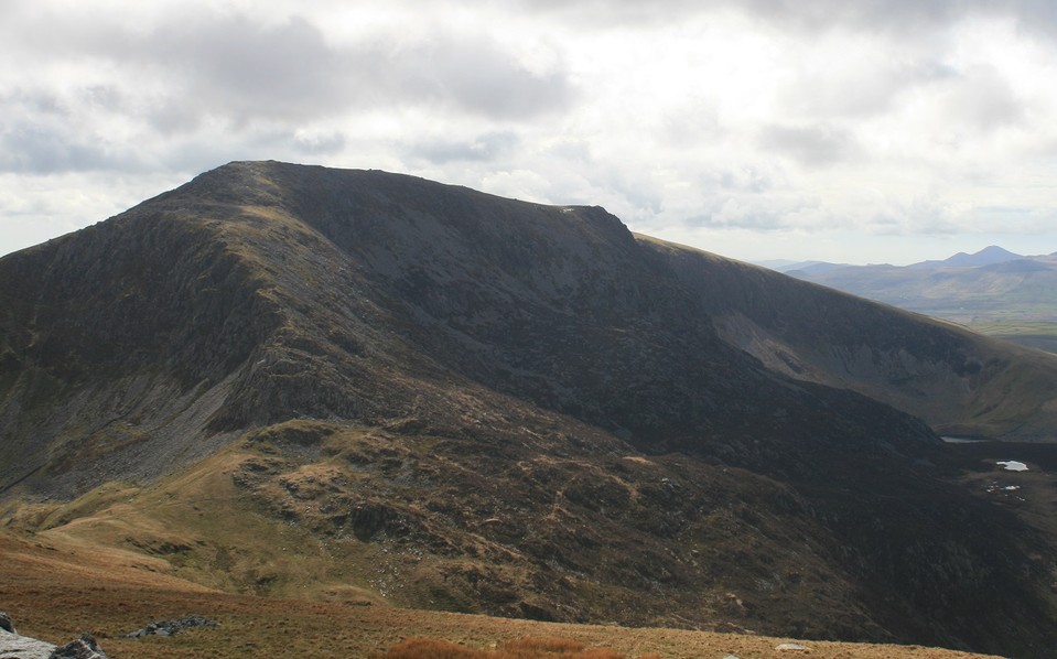
Getting high by staying low.It's been quite a while since the last Sweetcheat/postman mountain excursion, so when asked what do I fancy I went straight to the top of the list and suggested the Nantlle ridge in Snowdonia. The suggestion was greedily accepted so long as the ice and snow line was higher than we were going, there's not much need to risk life and limb in either of us. As the universe works in mysterious ways everything was working in our favour for a change, the snow was higher than we were going and even more miraculous we could see the tops of the mountains, six or seven times out of ten the clouds will be low and we'll be walking in a white out, it's invigorating to say the least but it's not conducive to wonderment at the world. With the car parked in the all but empty car park by the lovely Llyn Dywarchen, the same parking place as an ascent of Mynydd Mawr, we turned to face our adversary, that sounds a bit negative maybe, see it as not an enemy to be fought but rather as an assault course to get through, or even as a beautiful woman to be wooed, because climbing a mountain is a lot like, yes, you've guessed it, making love to a beautiful woman, it's really not, but I could give a pretty good argument that it is. The first twenty minutes are easy enough, hands in pockets dodging wet spots, stop and turn for a slowly getting better view of Snowdon, but then the ground gets steeper and steeper and the legs try harder and harder to propel one forwards and upwards. The way is easy to keep to, but it is still very hard work, I find it all but impossible to grasp the fact that some people run up and down mountains, my job requires me to walk ten miles a day with a heavy bag over my back, but it in no way prepares you for staggering up a mountain. Thankfully, our first stopping point is only 400 meters higher than the car park, a very good pair of cairns upon a summit called Y Garn. Both cairns are taller than me and made up of large blocks of stone of which there are plenty of round here. About forty meters separate them, shallow scoops have been dug into them both by shelter hungry walkers, which is twice as stupid as it sounds seeing as there is a wall right by the cairns, this is where we sat and had butties. Y Garn, Nantlle Ridge — Images01.05.16ce
Y Garn, Nantlle Ridge — Images01.05.16ce
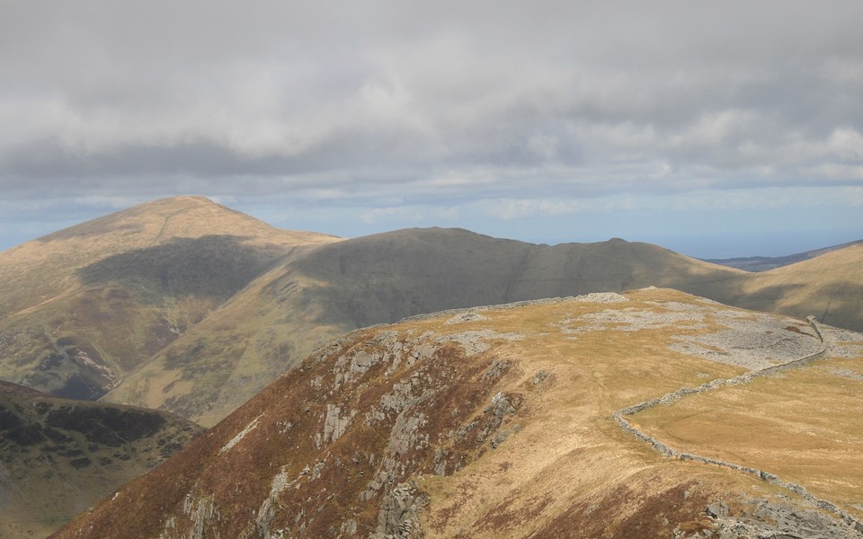
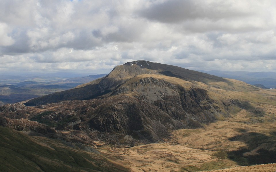
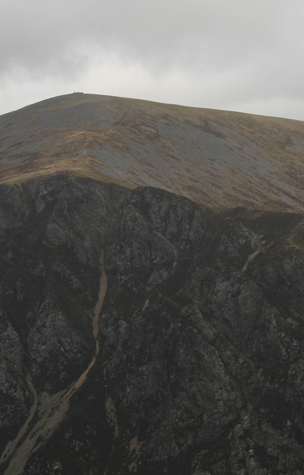
As impressive as the cairns are the eyes are drawn far more to the rocky pyramid Mynydd Drws y coed, iv'e been here before but chickened out of a solo climb, instead I went as far as I dared and just sat there for a bit, but not this time. We approached with extreme trepidation, ten feet to the right of us is a vertical cliff, a direct one way ticket straight down to the inevitable big crunch. As we climb the rocks higher and higher, fear of imminent death makes my legs shake, looking almost anywhere results in overpowering dizziness, we are maybe ten feet from what looks like the top of the rocky pinnacle, Alken somehow has the ability to stand upright, I am now on my belly staying low clinging on for dear life with all four limbs, unable to go any higher, with a note of disappointment I have to admit that I can go no farther this way. So we both come down a little and find an easier way round the rocks of absolute mayhem, legs still shaking, I lean away from the down bits, always having hands on to something, rock, grass, heather, anything to ensure a grip, I haven't been that scared since Crib Goch. But with something like determination and the help of a friend I eventually made it to the top. Analogies with the final act of making love to a beautiful woman aside, this is one of the best feelings in the world, not only did we conquer the heights but also my almost crippling fear of falling, i'm fine with being high up, it's the fall i'm deathly afraid of. The views are brilliant, Snowdon dominates, as only the biggest mountain in the country can, Mynydd Mawr and Moel Eilio to Snowdons left, to its right Yr Aran and further round is Moel Hebog and co. In the opposite direction to Snowdon is the rest of the Nantlle ridge and other mountains with cairns on them, they all have names of course but you need a mouthful of phlegm to pronounce them, I have a real problem with the Welsh language, I believe it was created solely to confuse foreigners, ie the English. Moel Hebog — Images01.05.16ce
Mynydd Mawr — Images01.05.16ce
Anyhow, we continue our walk along the Nantlle ridge, the ridge is not as terrifying as where we've just come from but it does get quite thin in places. At one point the ridge has a hole in it, which has to be climbed down then back up, I employed a method now known as reverse spider walk, basically it's the crab position, getting down is easier than getting up, for me at least. The last peak has now been breached, Mynydd Tal y mignedd, you wouldn't know by looking at that Welsh word but there are two th's in there. This last peak of the day has no cairn, but it does have a Queen Vic obelisk on it, a small point of interest it must be said, but as most mountain tops have nowt on them, you get your interest when you can. The next mountain top along the ridge does have a cairn on it, Craig Cwm-Silyn — Images01.05.16ce
Yr Wyddfa — Images01.05.16ce
|
 Posted by postman
2nd May 2016ce |
Dumfries and Galloway |
Dumfries and GallowayMy schedule for last week took me to Barnsley on the Tuesday and Ashington, Northumberland on the Friday, so I suggested to my wife that it would be a good opportunity to visit a few of the better known sites just over the border. 'Not another Jolly, surely'? 'Its not a Jo...', I realised there was no point arguing and took it as acceptance that it was OK to go, unfortunately I would have to leave the van behind and go by car. A longish drive from Barnsley found me at the Loupin Stones car park in Eskdalemuir. What a beautiful location right alongside the river with a short walk to the Girdle Stone Circle less than 1/2 mile away. The Loupin Stones are particularly fascinating and the circle itself appears to be just part of a far larger complex. The stones appear to be part of something called the 'Prehistoric Trail' which I had not heard of before, not sure where it goes and what other sites are included in the trail, however, resolved to find out more. Spent way too much time in the valley and realised I needed to get a move on if I was to see anything else. Next, I drove down to Dumfries to visit the 12 Apostles. GPS took me right to the site which was fortuitous as there are no signs indicating this huge and significant circle. Very difficult to photograph because if you move back far enough to include all the stones they just appear like small dots on the final print. Left wondering why this circle does not attract more attention, as usual I was the only person there. Next day, sun shining and a very pleasant drive down the coast to Carsluith the visit Cairnholy 1 and 2. These sites have been given the status of a large brown tourist sign off the main road and easy to find although the last 1/2 mile or so is up a very narrow single track road. These are two wonderful sites, well maintained with information boards and designated parking (posh!) and between the stones and the farm wall was a perfect sun trap where I sat and read few chapters of my book, daydreamed a little and eventually realised the day was passing by, so up and off again this time to find the old military road and The Glenquicken Stone Circle. GPS absolutely essential for this one, no signs, no footpath and not visible from the single track road. Very much worth tracking down, a complete circle with a central cuboid shaped standing stone, remote and peaceful setting, a place to linger. From here it was off the easy to find Torhousekie Stone Circle which commands its own layby and information board. An interesting and very well kept site. The OS map indicates a lot of other activity in the area with evidence of a cairn and a stone row, very much worth a visit. From here I decided to visit the Wrens Egg. Once again no signs and GPS essential, although obvious once you get to the road alongside the Egg. Over the stile and across the field, the Egg is accompanied by 2 standing stones and they all sit on a small hill (or barrow?). The Egg is a curiosity and difficult to understand how natural or how much shaping has taken place. A short stop in Port William and the day was gone leaving the only other site on my list, Glentirrow, unvisited, however, the perfect excuse to return to this delightful part of the country. |
Posted by costaexpress 23rd April 2016ce |
Megalithic route of culture - Germany |
Megalithic route of culture - GermanyI wanted to check out this route having been intrigued by its concept, was it all bouncy castle and ice cream, would there be any dignity? It also seemed a natural follow up visit to a recent trip to the Hunebedded in the Netherlands. So, when the Emsland tourist board map and detailed booklet arrived I realised I had no excuse. Prepared the van in a hurry followed by an evening trip through the tunnel and an easy but surprisingly busy run up through France, Belgium the Netherlands and into Germany found me outside the first site waiting for it to get light. There are over 80 sites divided into 33 locations. The general route is over 200 miles long and signposted with more detailed signs once in the actual location. Multiple sites in a location can be either next to each other or spread miles apart, no rules. I found gps best between locations and the road signs best for individual sites. Both gps and road signs readily take you up unmade roads and forest tracks The sites vary from a broken capstone to the mighty Kleinenkneten 1 and 2 which truly rival West Kennet. This site is worth the visit to Germany alone having been restored over 80 years ago and now set within a modern wood it is pure fantasy land transporting your imagination back over 5000 years seeing and breathing imaginary sights and smells. Without wishing to upset the purists this route is just great fun, seeking the next location, hopping out, taking photographs, letting your imagination run riot. The sites for the most part are set in woodland and easily accessible (although my van didn't like bouncing down the forest tracks and I wasn't 100% sure it was meant to be there) The route is well documented on the web and it is well signposted, a tourist trap, however, it is not. At each and every site I was the only person there with the exception of golfers at station 9 (they have built a golf course around 3 of the sites) and people in a car doing unmentionables at station 16. As always it was over too soon, I had promised to take my wife to see the latest incarnation of ELO and it was time for the long slog home. All in all a great fun, fascinating culture and pleased I made the effort, certainly less clinical than I was expecting, however, not the same sense of walking on the shoulders of history as eg walking down the Ridgeway or up to Sunkenkirk at first light |
Posted by costaexpress 15th April 2016ce |
Mendip First - 2 April 2016 |
Mendip First - 2 April 2016It’s six o’clock in the morning, and I’m the only person in this house that’s awake. My bag is packed and ready for a trip over the mountaintops of South Wales, but the forecast is looking uninspiring. Rain until early afternoon, which suggests little enjoyment for most of my walking window. Widen the forecast out though, and it looks like sunshine galore to the southwest. Hmmm. A quick burst of complete replanning, frantic printing of different bus timetables and I’m off to Bristol to catch the “Mendips Explorer” and head into an area I’ve never been to before. A look at the Cheddar Gorge and Mendips West map opens up a huge amount of possible destinations, barrows seem to ooze from every km square around here. There’s also a decent amount of open access land, which promises a day free of the irritations of blocked paths and muddy farmland. The bus climbs out of Bristol, offering a view of Maes Knoll before passing the Stanton Drew turning. I’m tempted, but not enough. The Priddy complex is only a couple of miles west as well, but I’m not in the mood for farms today. One connection later and I’m heading through Cheddar to a little strung-out hamlet called Sandford Batch, not quite on the hills but not right down in the low-lying vale either. A path heads eastwards into community woodland, scarred by quarrying and with an impressive limekiln left as a visible reminder of industry. Further east the woods open out to fields and as the path starts to descend I’m rewarded with a view of my first objective of the day, Dolebury Warren. From here it looks like short climb, but my route drops right down into Dolebury Bottom gorge first, adding significantly to the amount of the steep ascent. The overcast morning is slowly starting to lift, so I shed my coat and fleece before starting on the uphill. Dolebury Warren — Fieldnotes10.04.16ceThe approach is through woods, climbing fairly sharply although not quite taking the direct route up the scarp. I’m anticipating a slog but in fact the ramparts come into sight pretty quickly – after spending so much time in the Welsh uplands it’s easy to forget that the hills here are not very big, for all that they’re very steep-sided. The sun starts to break through as I reach the western entrance. It’s immediately apparent that this is a first rate hillfort in great preservation. There are two lines of ramparts, the inner one much higher than the outer and built of stone blocks. The western entrance is at the lowest part of the fort, which continues to climb steeply towards the top of the hill a good 30 metres higher than where I’m standing. The banks are inturned and the entrance appears to be an original one. I follow the rampart along its northern side, steadily climbing as it goes. The fetish for building shelters that has damaged so many Bronze Age summit cairns is in evidence here too, with the plentiful stone of the rampart obviously being too difficult to resist messing about. Actually, it’s a pretty windswept place. Although the sun is now out, when it occasionally dips behind ragged cloud there’s a serious chill and I’m quickly reminded that it’s still early in the year to be wandering around a hillfort in a t-shirt. As the rampart climbs, the views open out wonderfully in every direction but east. The Severn is the main event, looking towards Steep Holm and Flat Holm islands that we got familiar with walking the coast path on the opposite side. I also recognise Brean Down and assume the urban sprawl to be Weston-super-Mare. Almost due west a wooded hill with open interior is the neighbouring Banwell Plain hillfort. The ditch between the ramparts is overgrown in places, but there is obviously regular clearance of scrub going on. A couple of dog walkers and a couple of walkers are dotted around the fort, but it’s a big place and there’s no sense of intrusion. Reaching the very top of the fort there’s another entrance facing east, also looking like it’s probably original. The views are now magnificent, right across to South Wales – if the cloud and rain lifted there, I’ve no doubt the Brecon Beacons would be readily visible. To the south the high ridge of the Mendips blocks the view, open moorland that will be my next objective once I leave here. But first there’s the southern circuit and interior. On the south side the rampart is less built-up, but the reasoning is obvious as the ground falls very steeply away to a lovely wooded gorge below. Rowberrow church is visible across the ravine, and in a field beyond there is a sizeable round barrow that just manages to be obscured by trees no matter where I stand on the rampart. I head back up into the fort’s interior, which is heavily scarred and pitted. The fort’s name gives the reason away, as it was the site of a huge artificial rabbit warren in the 17th century. At the highest part of the interior, just inside the eastern entrance, there is a low curving linear feature with a square structure inside. This was apparently the garden wall and footings of the warren-keeper’s house. I wonder what it must have been like to live here, surrounded by rabbits and the ghosts of the original inhabitants. Whatever, it makes a great spot for an early lunch before heading east. A final touch as I leave is the way Steep Holm in the Bristol Channel is framed by the eastern entrance. What a great place this is. I reluctantly turn away, hugely impressed by this great fort with its sweeping views. Dolebury Warren — Images11.04.16ce
Rowberrow Warren — Fieldnotes10.04.16ceTo the southeast, the route drops gently towards the upper end of a valley. On the other side is a dense conifer forest that wouldn’t be out of place above the South Wales valleys. Somewhere over there the OS map shows a pair of cairns, which I’m intending to call in on before climbing onto the main Mendips ridge. The first thing that stands out is a large area of felling – the cairns are somewhere in it, which will either make them easy to find or impossible. Luckily there’s not a huge amount of height loss to cross the valley at its head. Bridleways head off in several directions – to get to the first cairn I take the one heading west then a fork to the southwest, which slopes gently uphill into the felled area. The map shows the cairn at a bend in the track, right in the heart of the felling. I could be back in the Welsh forests here. Forestry clearance is a messy business, often leaving deeps ruts from the machinery and then a burst of vegetation as the tree covers disappears. This is no exception. I find the cairn right by the track, hidden at first glance by the high verges pushed up by logging vehicles. It’s in a sorry state, the edge has been damaged by the felling operation and it’s covered in a tangle of brambles and bracken. The only redeeming feature is a single silver birch, left to grow on the western side of the mound. Once over the pitiful state of the immediate surroundings though, the location can be appreciated. The cairn looks down the steep-sided valley between Dolebury Warren to the north and the high Mendips ridge to the south. As with many of the upland cairns of South Wales, there seems to be a definite relationship between watercourses and the placing of these Bronze Age funerary monuments. I head back the way I’ve come to the junction of paths. The second cairn is also in a felled area, this time a narrow triangle of land between tracks. The OS map shows it as right next to a bridleway heading onto Black Down. Unfortunately the felling here has left behind a deep tangle of bracken and water-filled ruts and ridges. I head uphill, but the track seems to follow a slightly different route to the map and after a while of fruitless prodding about in the bracken and tree stumps I reluctantly abandon the search. I’m sure it’s still here somewhere, but I won’t be the one to find it this time. Rowberrow Warren — Images12.04.16ce
Read's Cavern — Fieldnotes10.04.16ceBefore heading on to the open moorland, the map offers one more site: Read’s Cavern. Heading ESE from the junction of paths, the track follows the course of the stream, soon opening onto a small clearing with a seat. The cavern lies immediately to the north, where the fast-running waters, cold and crystal clear, disappear into the side of the hill. The cave appears to be accessible, but only if you’re prepared for a proper caving expedition. The limestone rocks around the entrance are liberally decorated with fossils of sea-creatures from impossibly distant epochs of time. The entrance is very small and the water pouring in suggests an instant soaking. A sign fixed to the rockface above gives an emergency call-out number in case of difficulties. I’m not equipped either mentally or physically to go pot-holing on this trip, so I sit near the entrance for a while and watch the splash and sparkle of the water. Read's Cavern — Images13.04.16ce
Burrington (Black Down) — Fieldnotes10.04.16ceThere are more barrows shown to the northeast, as well as another cave called Aveline’s Hole. I pass various deep sinkholes, glorying in the names Bos Swallet and Rod’s Pot. Some of these are huge scoops in the ground. As the path gives way to a metalled road, a proper look at the map shows Aveline’s Hole is actually on the other side of a steep gorge, so I reluctantly abandon any idea of a visit today. There are however three barrows (the OS shows one cairn and two tumuli) in an open area of common below the northern slopes of the moorland proper. This area is deep with the brown stalks of last year’s bracken, which makes barrow hunting somewhat difficult, although not as much as it would be on a summer visit. I start off looking for the cairn, the northern of the three monuments on the map. After foolishly hacking my way into and back out of a briar patch thinking it was the barrow, I realise that it’s actually a very prominent feature crowned with a stand of silver birch trees. On closer inspection it’s a beauty, lots of stonework and an crisp footprint (although no kerb as such). The trees are no doubt causing damage but enhance the atmosphere immensely, especially as the sun at its zenith is now beating down through a cloudless blue sky. Something of an unexpected highlight, and definitely worth the visit. Heading south the other two marked barrows are less easy to find. The middle barrow is a low mound next to one of the many paths that criss-cross this open area. It’s misshapen and has hawthorn growing on it, assuming I’ve even found the right thing under all the bracken. I can’t find anything in the marked position of the southernmost barrow, although I think it’s likely to be somewhere near a single silver birch, as these trees seem to feature close to many of the barrows in this area. Either it’s deeply buried in bracken or the map has it in the wrong place. Burrington (Black Down) — Images13.04.16ce
Black Down (Priddy) — Fieldnotes10.04.16ceBy now I’m feeling the need to press on, with the biggest hill of the day looming ahead, so I don’t stop very long to search. It is worth pausing to look at the unfolding view of the limestone cliffs across the gorge to the north. Somewhere in that hillside is Aveline’s Hole and there appears to be a hillfort or settlement on the hilltop above it. A good reason to come back to the area anyway. The climb up onto Black Down is not too bad, a good clear path running above West Twin Brook. The excellent views north across the Severn/Bristol Channel give plenty to admire on each pause for breath. At the top of the ridge, the path is very eroded and muddy and I’m grateful that we haven’t had huge amounts of rain recently. The top of Black Down is a sponge that would make for a challenging visit in wet conditions. There are plenty of people up here and it’s easy to see why the main path running east-west along the top of the hill is so churned up and eroded. Unfortunately, the same is also true of the pair of barrows immediately beside the path. The northeastern one has been worn down to its stonework and is in a sorry state, crossed directly by the path. The northwestern barrow has fared slightly better than its companion, not being quite so close to the main line of the path. A sparkly slab lies on the edge of the mound, crystals catching the beautiful spring sunshine. The erosion is a shame as these are excellent barrows, substantial and upstanding, with terrific views. I look down on a now-distant Dolebury Warren and reflect that this walk is probably going to be a bit longer than I thought! Across the Bristol Channel, the hills and mountains of South Wales are still lying under dark clouds and I’m not in the least sorry I decided on the last minute change of plan this morning. I head south across tussocky and damp ground to the possible third barrow in the group. This one is lower and difficult to discern under dense vegetation. So dense in fact that I startle and flush a deer from the side of the mound, watching it gracefully bound across the treacherously boggy ground. Black Down (Priddy) — Images14.04.16ce
Beacon Batch — Fieldnotes10.04.16ceBack on the main path, the summit is obvious straight ahead. The map shows a big group of barrows and it’s coming back to me that Thelonious posted some photos a while ago. The going is not too bad as the weather has been dry, but would be horrible in wet conditions. The first barrow (Burrington 11) is to the north of the path, another substantial mound despite erosion and probable excavation. From it the barrow that the trig pillar sits on obscures the linear group to the east. The summit mound (Burrington 13) has obviously been resurfaced fairly recently with a new cap of stonework to protect it from erosion. This is the highest point of the Mendip hills and a fantastic viewpoint. As well as the views north and west that I’ve had for most of the day, there are now views south that take in Glastonbury Tor as well as Exmoor away to the southwest. It’s a well visited place as you’d expect, and while I’m here there are walkers, cyclists and horseriders at various times. The linear barrow group (Burrington 14-16) immediately east of the summit is also cracking, with wooden signs warning visitors that it is ancient monument and to keep off to prevent erosion. I imagine that the summit barrow itself was always going to be the target for most visitors, so this seems a good way to compromise and keep the other monuments from further damage. Two more barrows (Burrington 18 and 19) lie to the south, providing an excellent spot to head away from the other people and admire the linear group profiled along the skyline. On such a lovely day, with the wind and sun on my face, this is as good a place as I could wish to be. But by now it’s getting on for 3 o’clock, so I bid a reluctant farewell to the barrows and head east. The path has been resurfaced here and initially provides nice easy going after the boggier ridge. There is a last barrow on the south side of the path (Burrington 20) which sets me on my way downhill. Eventually the path comes to the edge of the open access land, with fields laid out to the east and another path running north-south. Right at the junction of these paths is another barrow (Burrington 22), but it’s low and buried in heather, offering little in comparison with the group on the summit. I head north briefly to look for a final barrow (Blagdon 1). It proves to be buried under the fence line and badly eroded. From here my path goes southwest, becoming increasingly wet and marshy. I’m soon hopping precariously from tussock to tussock, and it should come as no surprise to learn that one of the tussocks proves to be less solid than it looked. My tired legs refuse to keep me upright and I’m down on one knee, with an unpleasant feeling of cold, black water trickling into the top of my boot. Gah. Beacon Batch — Images15.04.16ce
Rhino Rift Barrow — Fieldnotes10.04.16ceMy route heads east again, passing one barrow on the map that doesn’t appear to exist anymore, a load of the cutest spring lambs you ever saw, and then the obvious mound of Rhino Rift barrow. It’s perched above the edge of a steep sided wooded ravine, which presumably is the Rhino Rift itself. The barrow is not round, rather it’s an elongated shape, higher at one end than the other. I’m not surprised to read Chance’s post that it has been considered as a possible long barrow, although it’s not that long. Rhino Rift Barrow — Images15.04.16ce
Finally at the top and a narrow path skirts along the north of the gorge itself, over exposed and uneven limestone. The scenery becomes spectacular, looking along the gorge through the cliffs at its end. A little stile with a sign warning of the drop gives access to a sloping grassy area right on the edge of the cliffs. The view drops straight down to the road, where miniature people and cars bustle far below. For the first time I can recall I’m vertiginous, not helped by the family of sheep of some ancient breed that scamper about the hillside around me. I beat a hasty retreat to the stile, pleased to put a wall between me and certain death. The path downhill becomes steeper and steeper and by now my feet are aching from the rough terrain. I had hoped to explore the gorge itself, but I’m exhausted now and just want to stop walking. By the time I reach the village I’ve missed the bus and could do with having a lie down. This last section has proved to be very hard country, especially at the end of a 12 mile walk. But boy has it been rewarding. From the brilliance of Dolebury Warren, the long views of the southwest and Wales, the superb barrow cemetery on Beacon Batch and the spectacular scenery of the gorge at the end, this is definitely an area to come back to. Perhaps with a little more planning next time though. Adios Somerset. Cheddar Gorge and Gough's Cave — Images15.04.16ce
|
 Posted by thesweetcheat
10th April 2016ce |
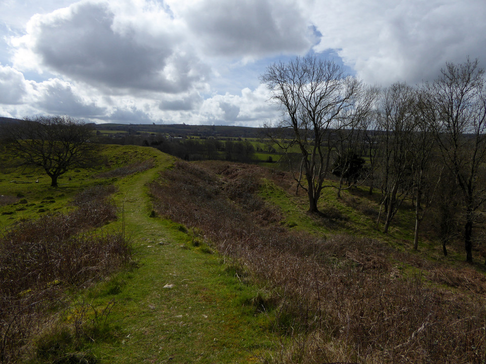

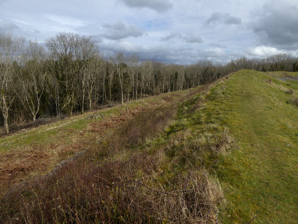
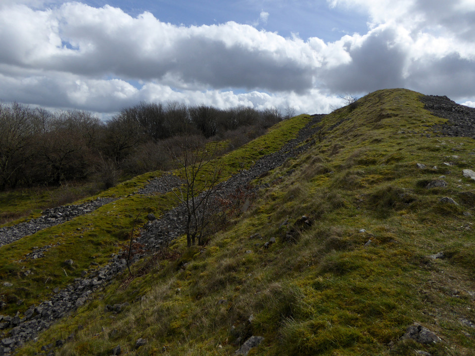
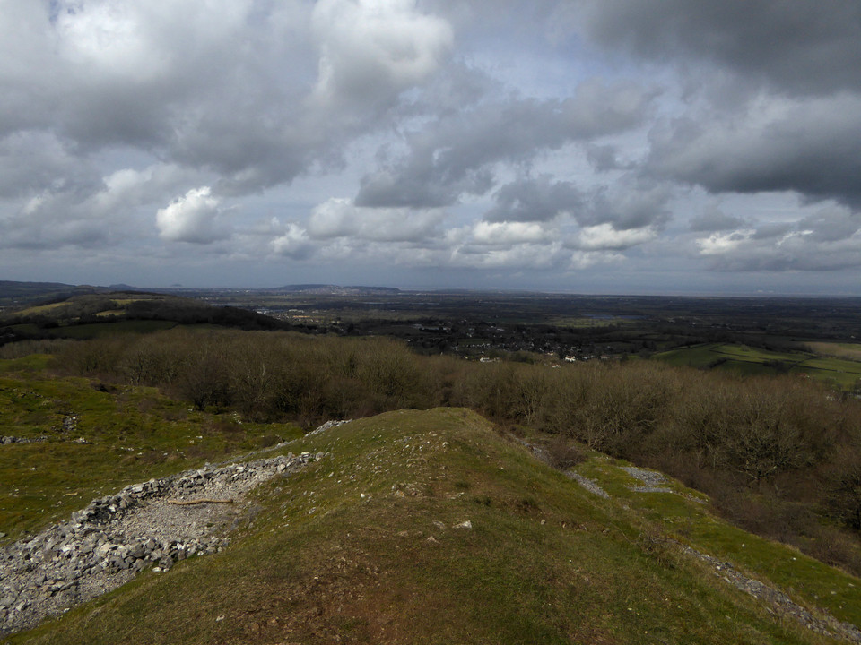
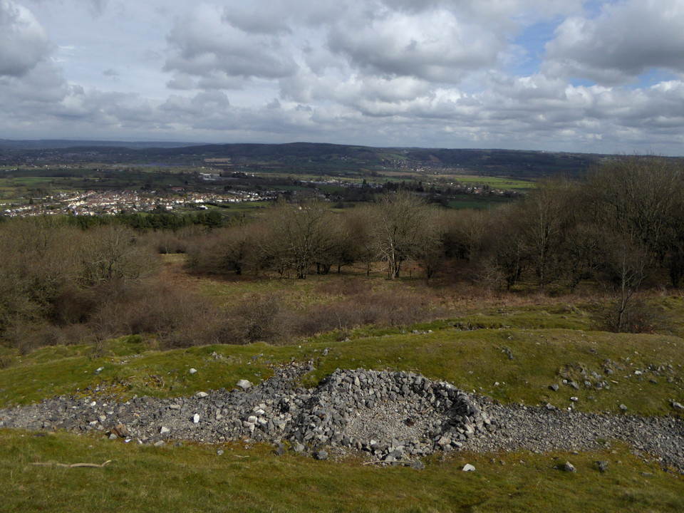
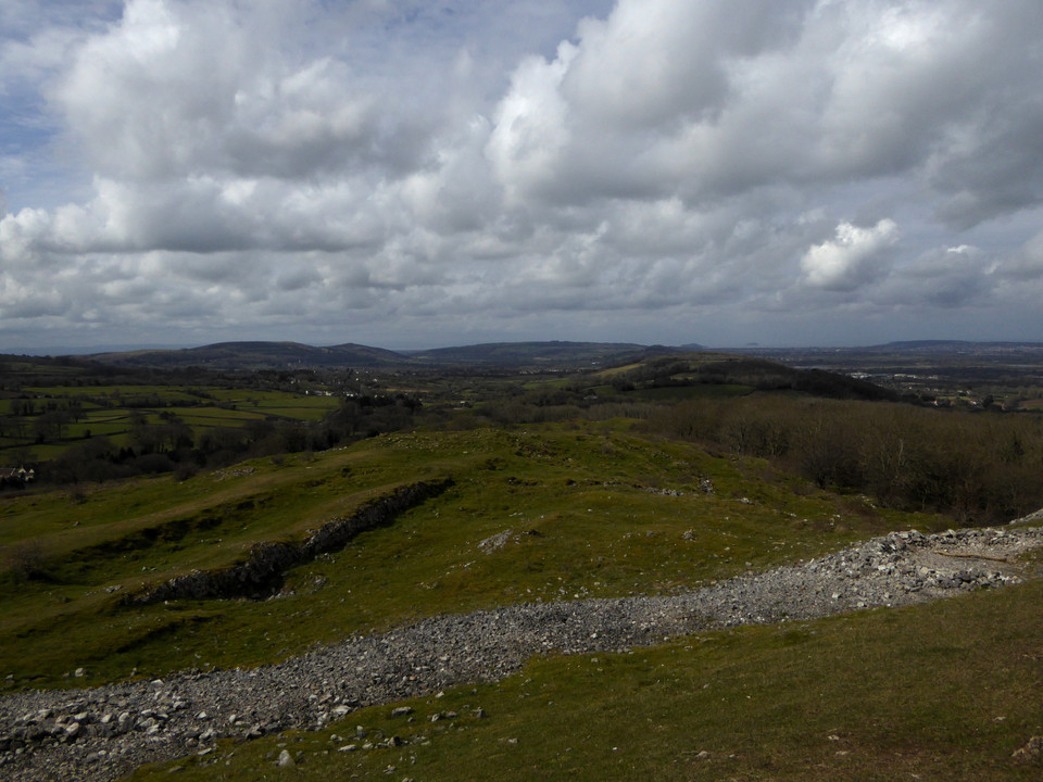
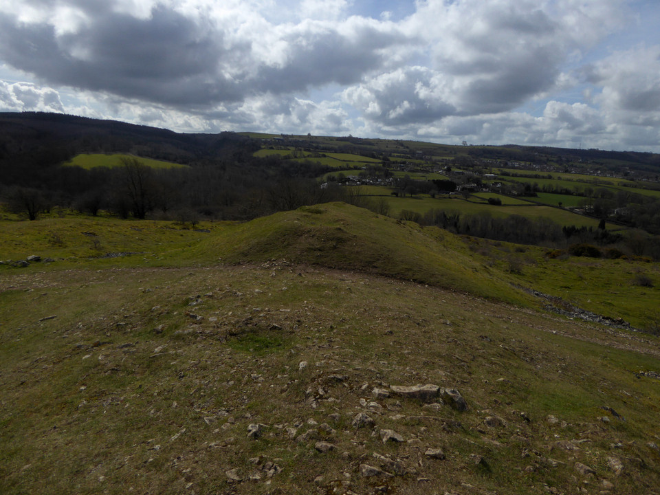
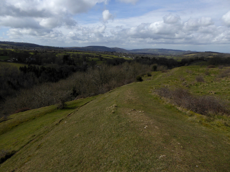
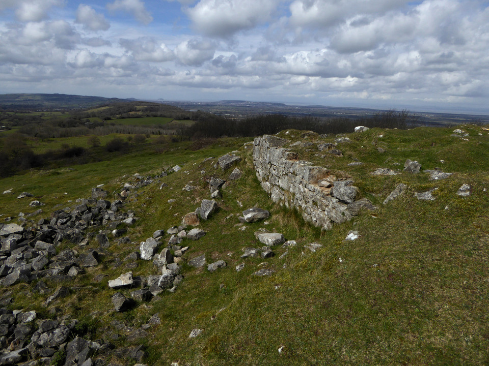
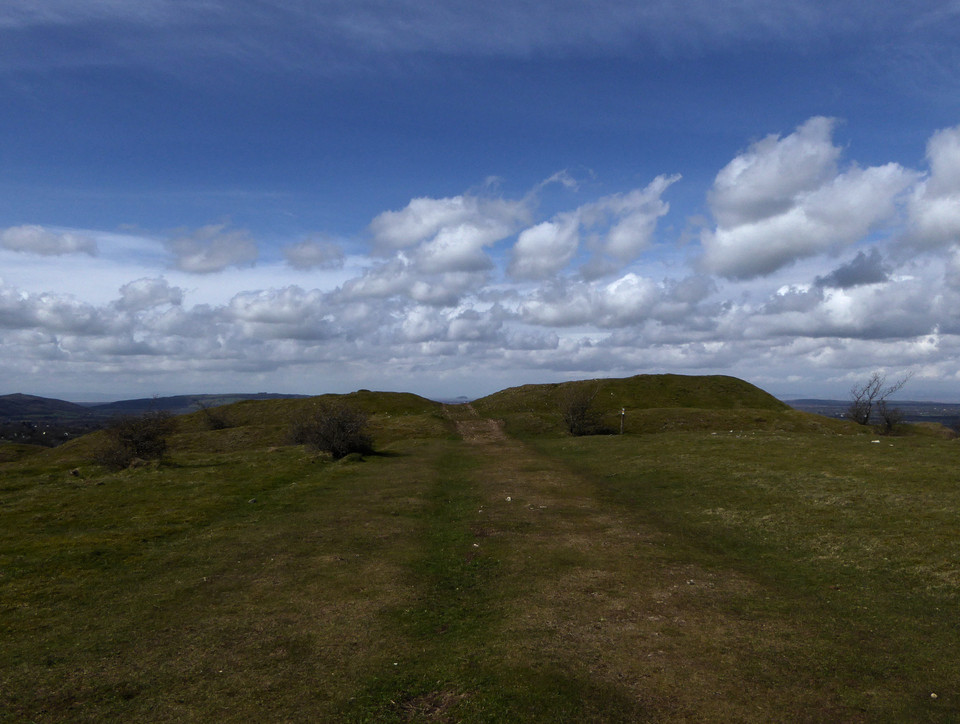
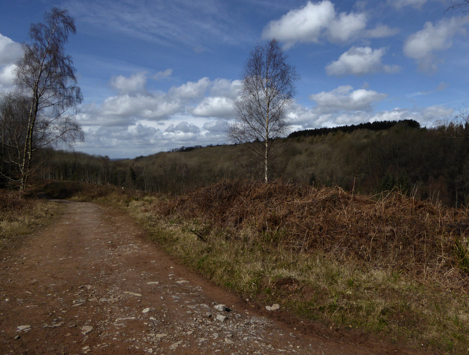
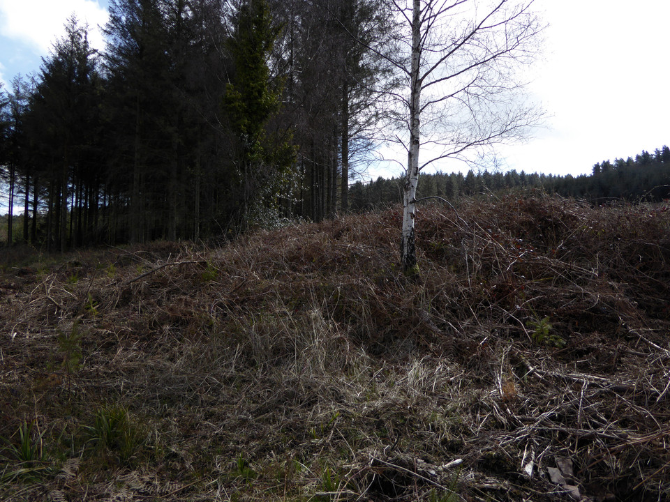
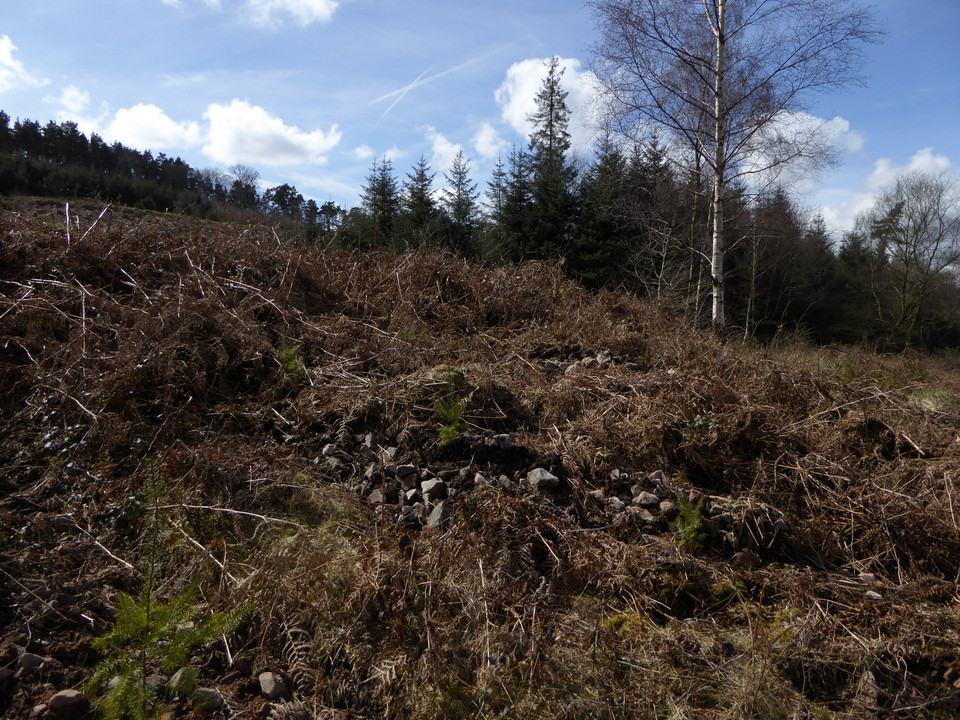
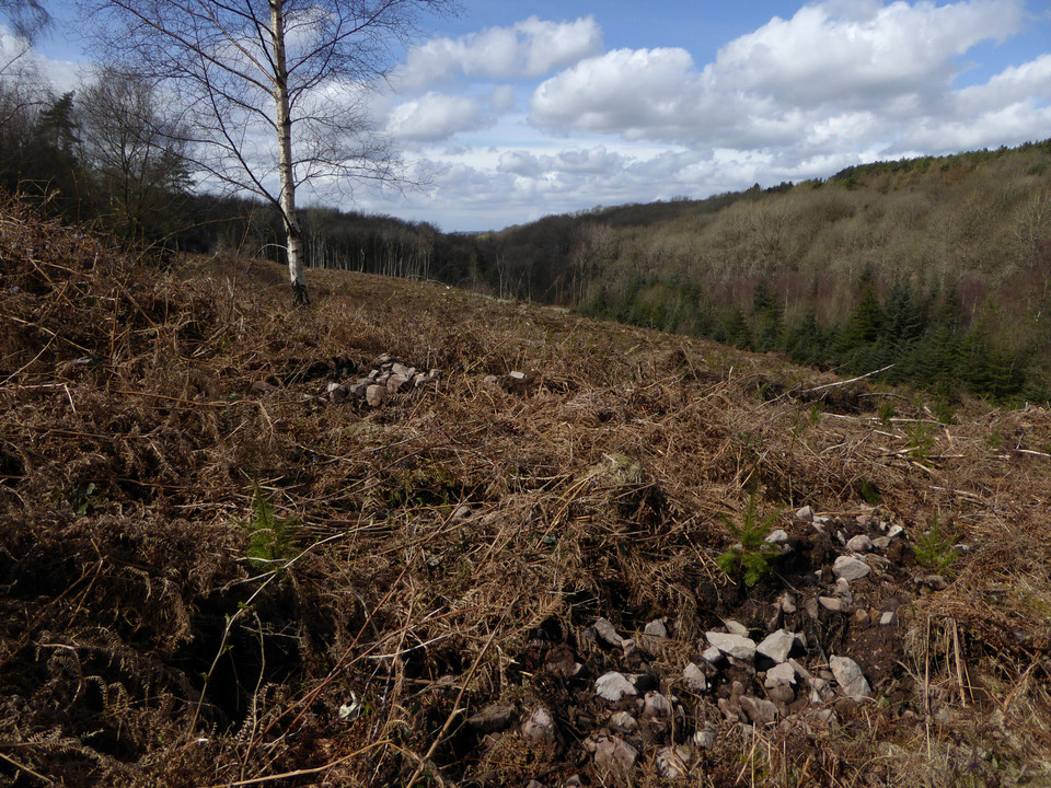
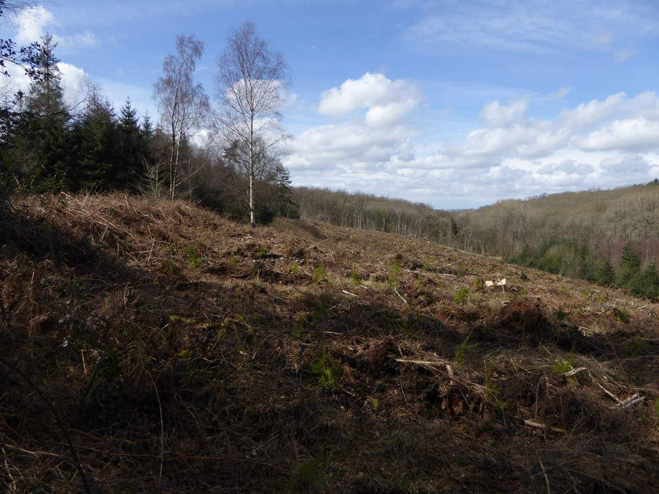
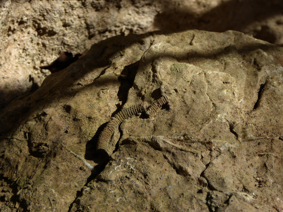
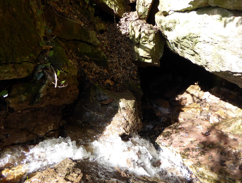
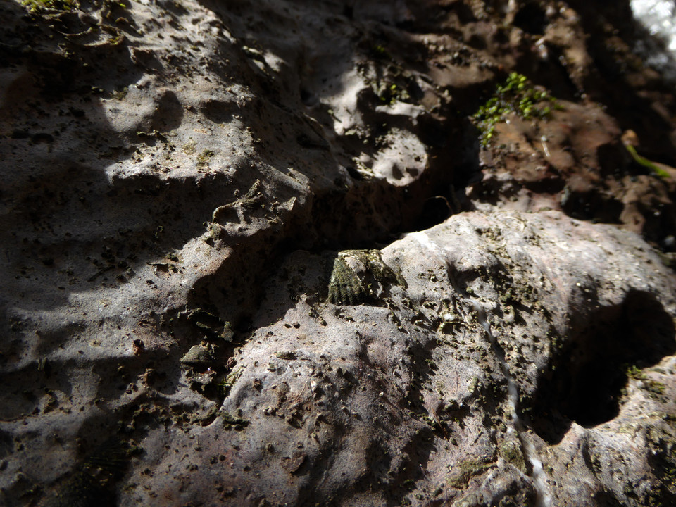
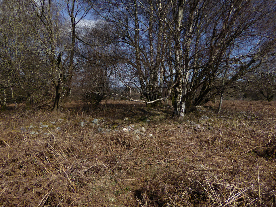
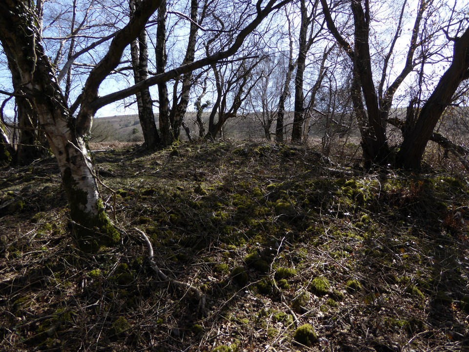
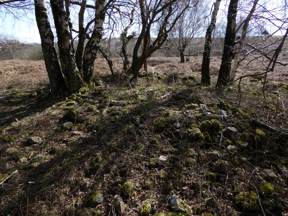
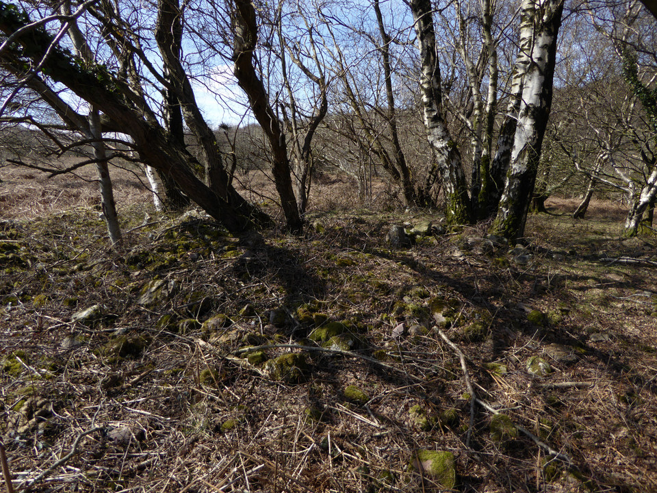
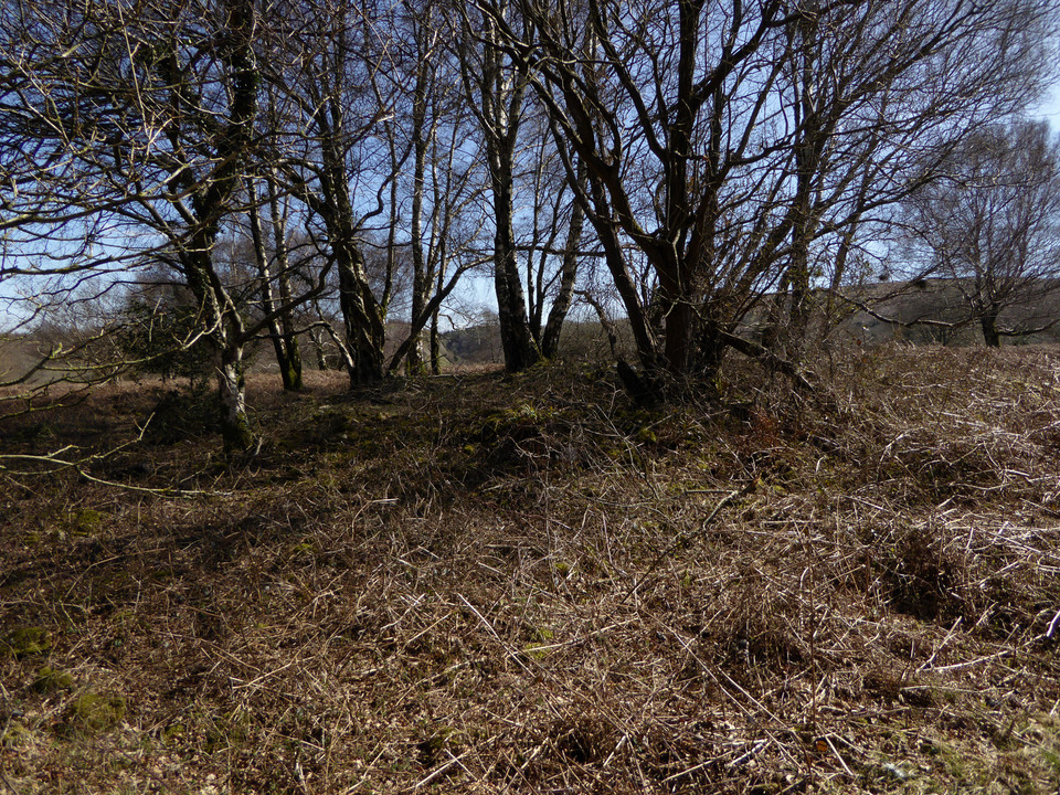
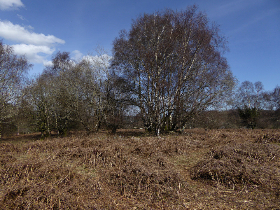
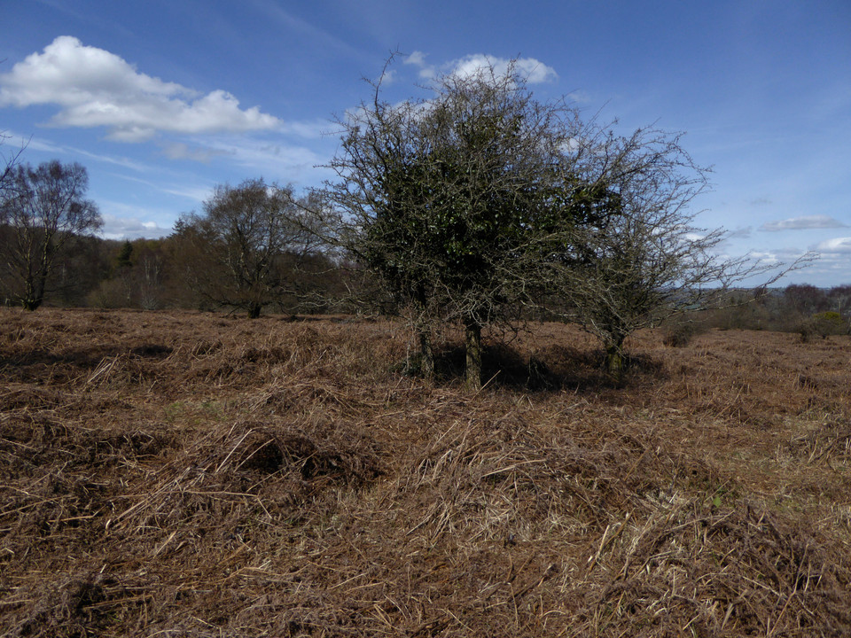
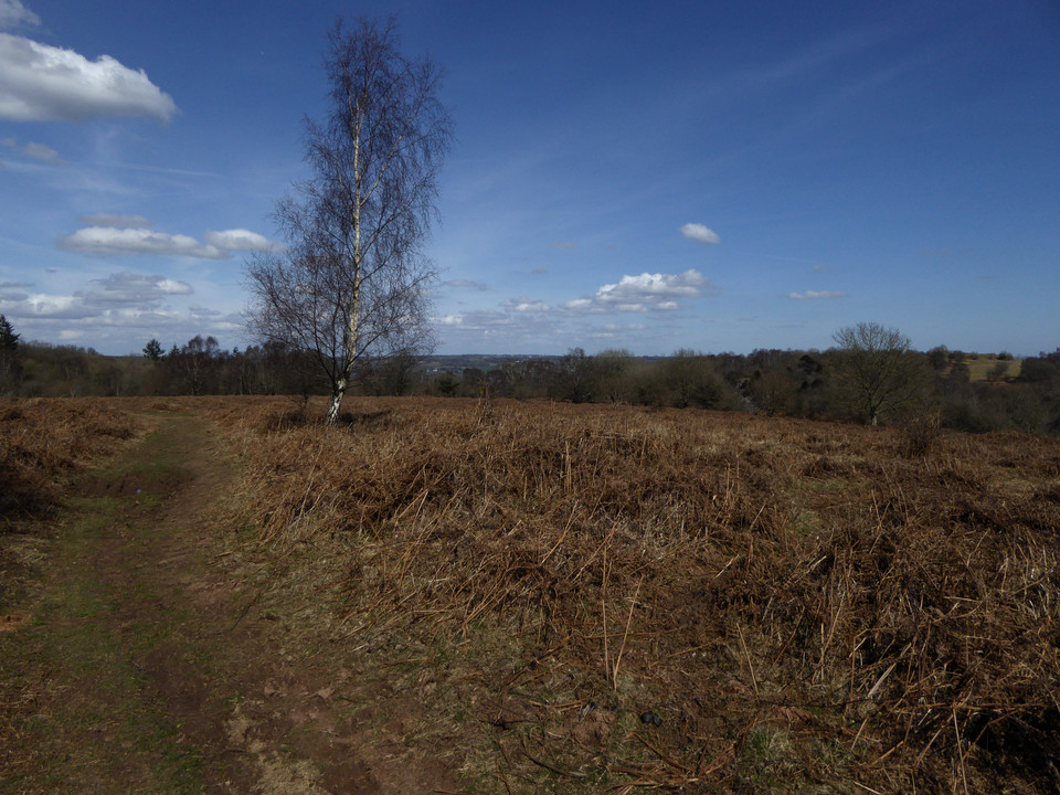
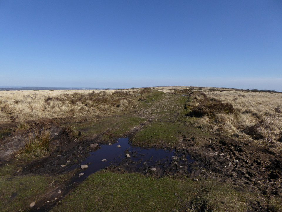
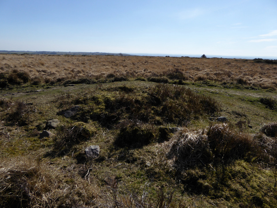
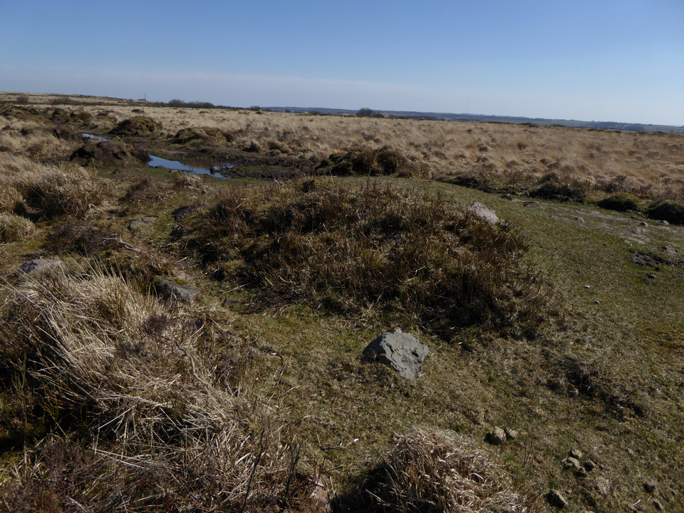
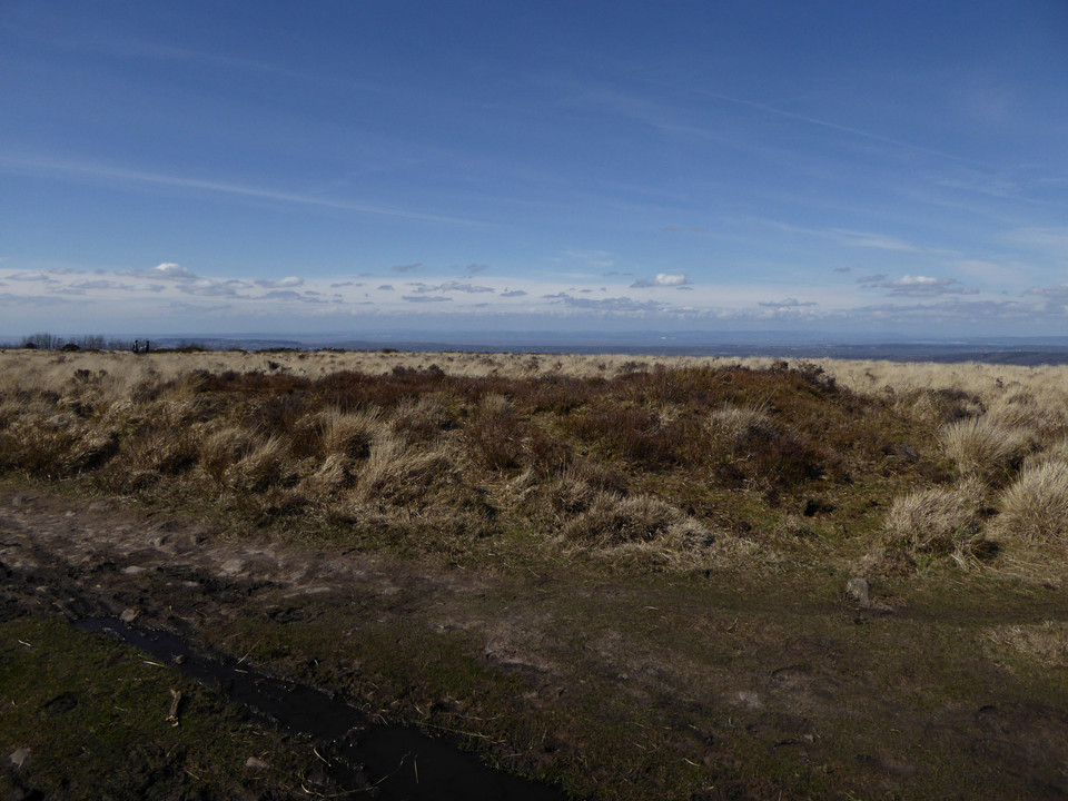
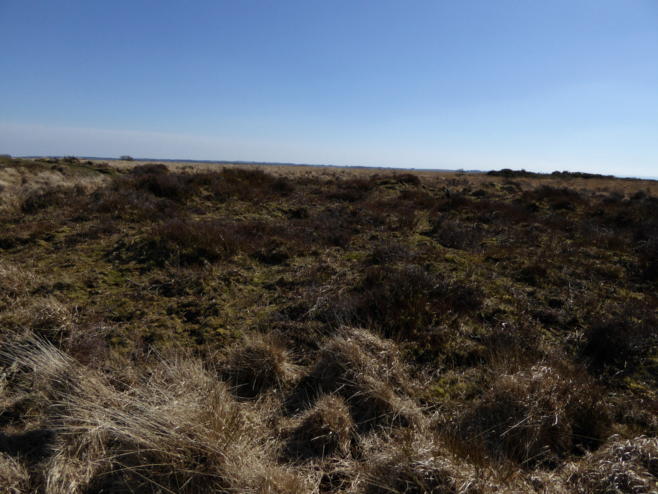
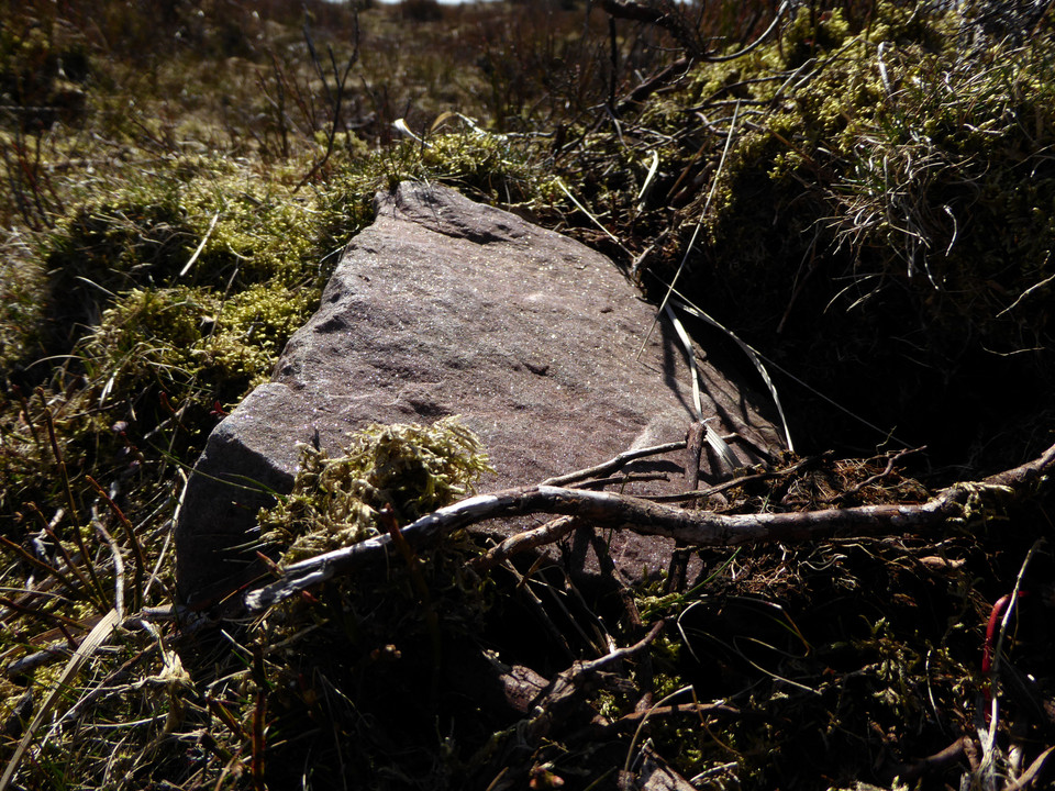
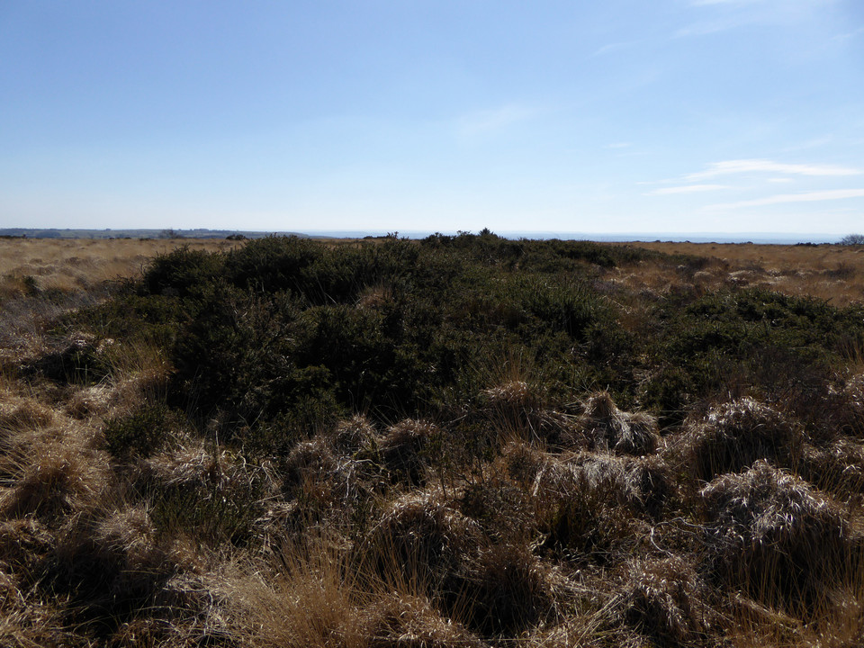
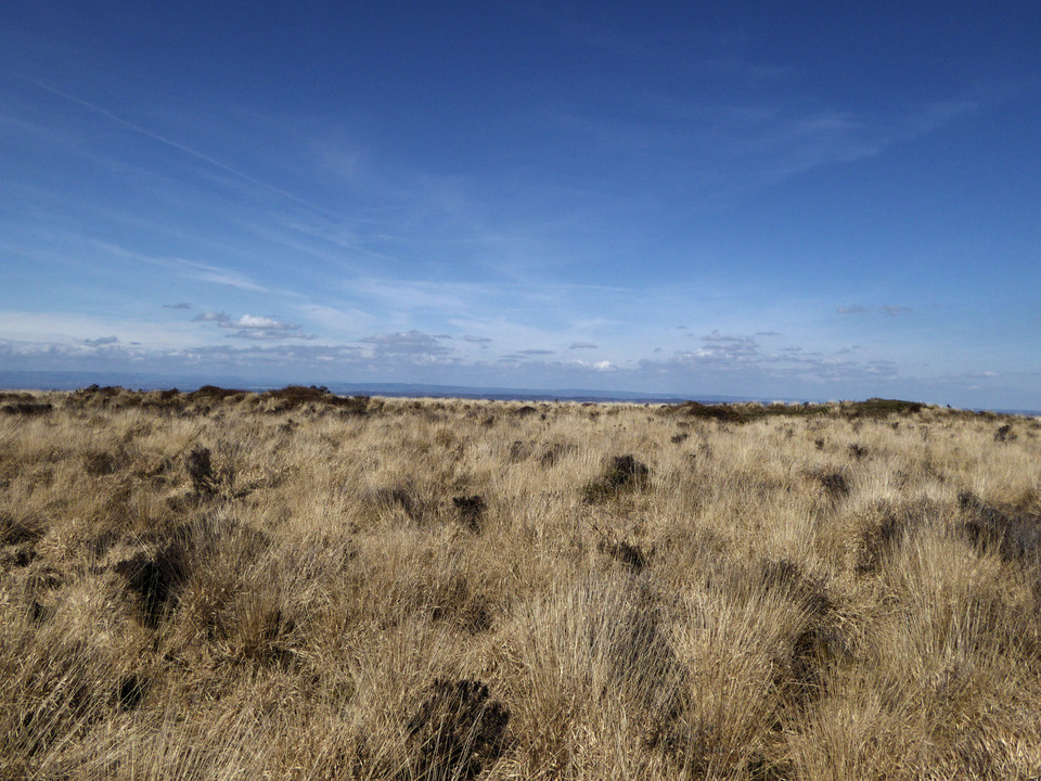
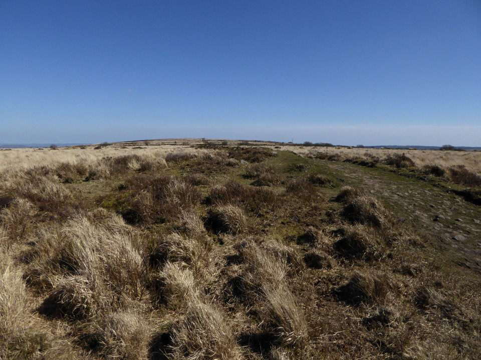
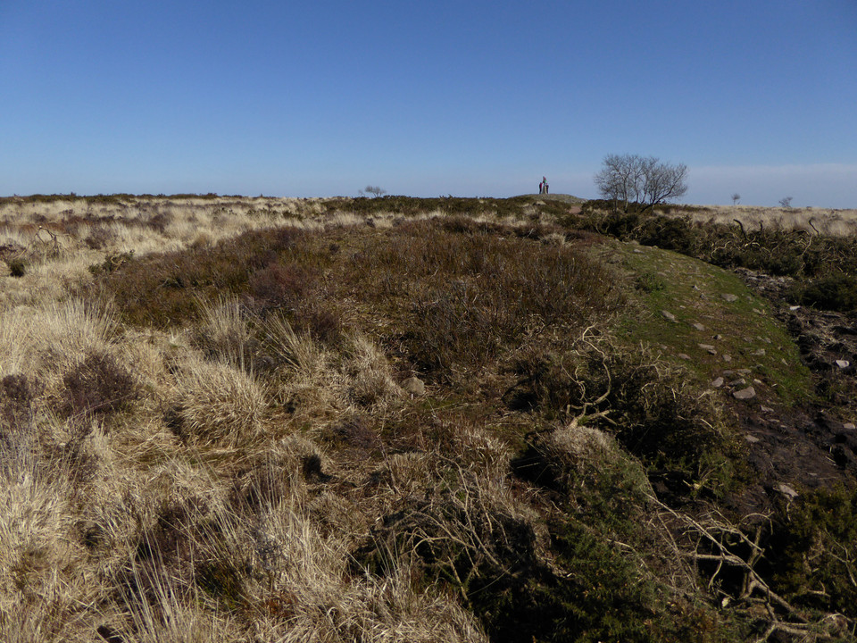
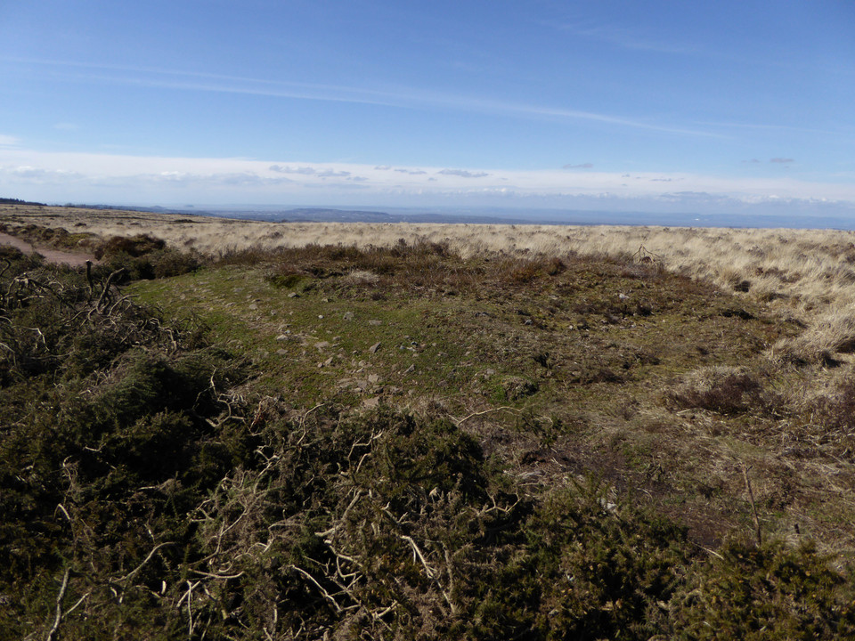
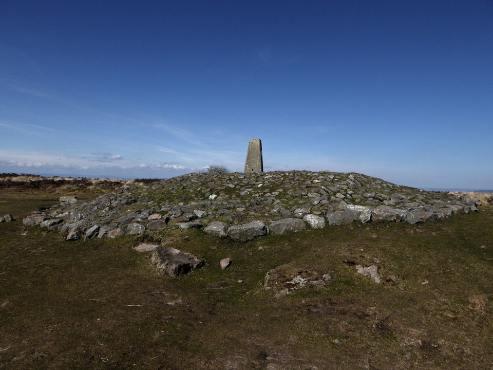
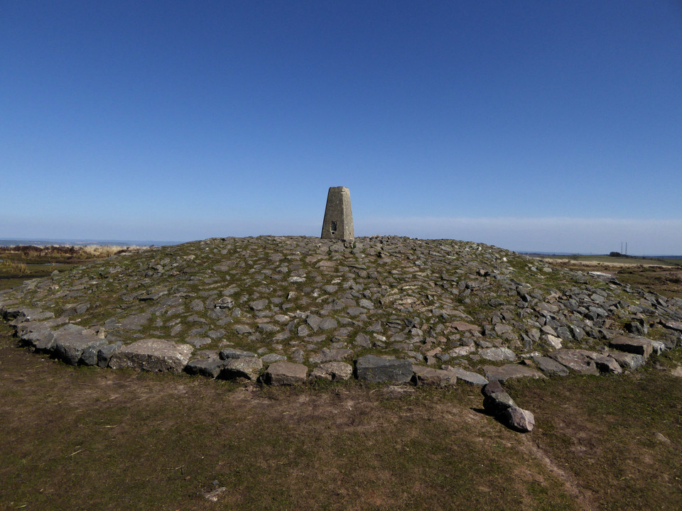
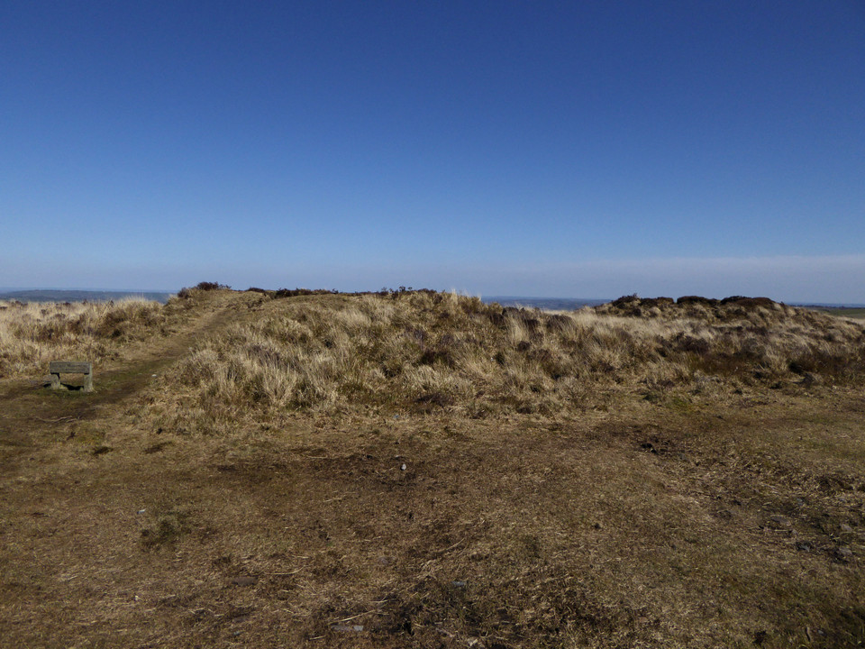
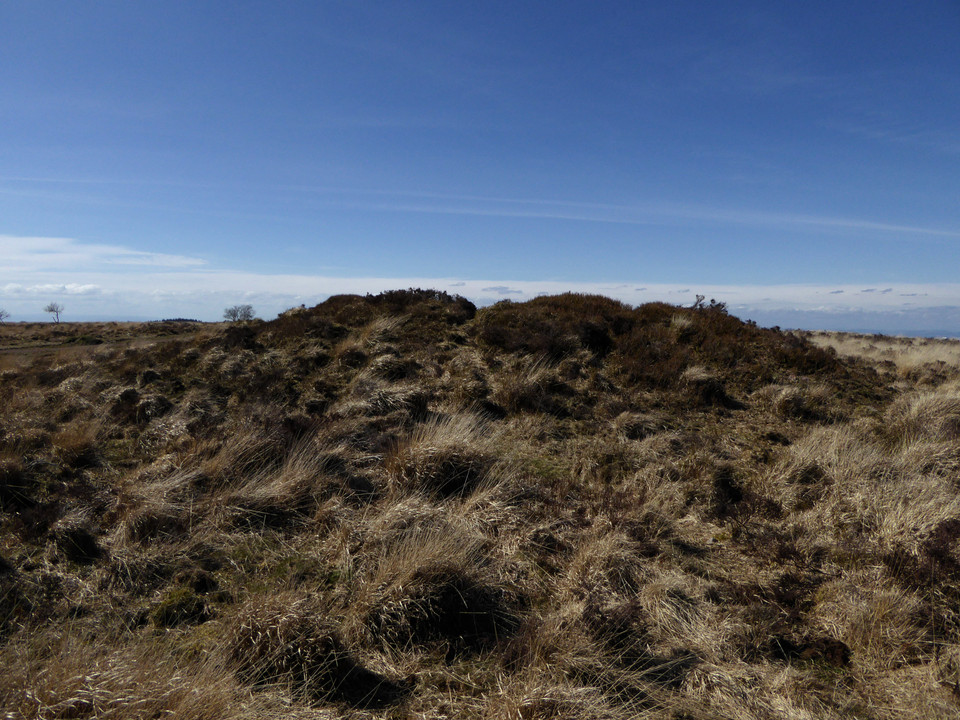
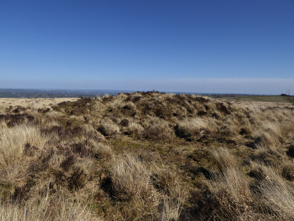
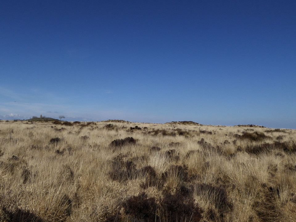
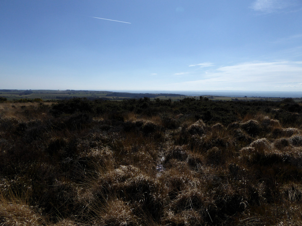
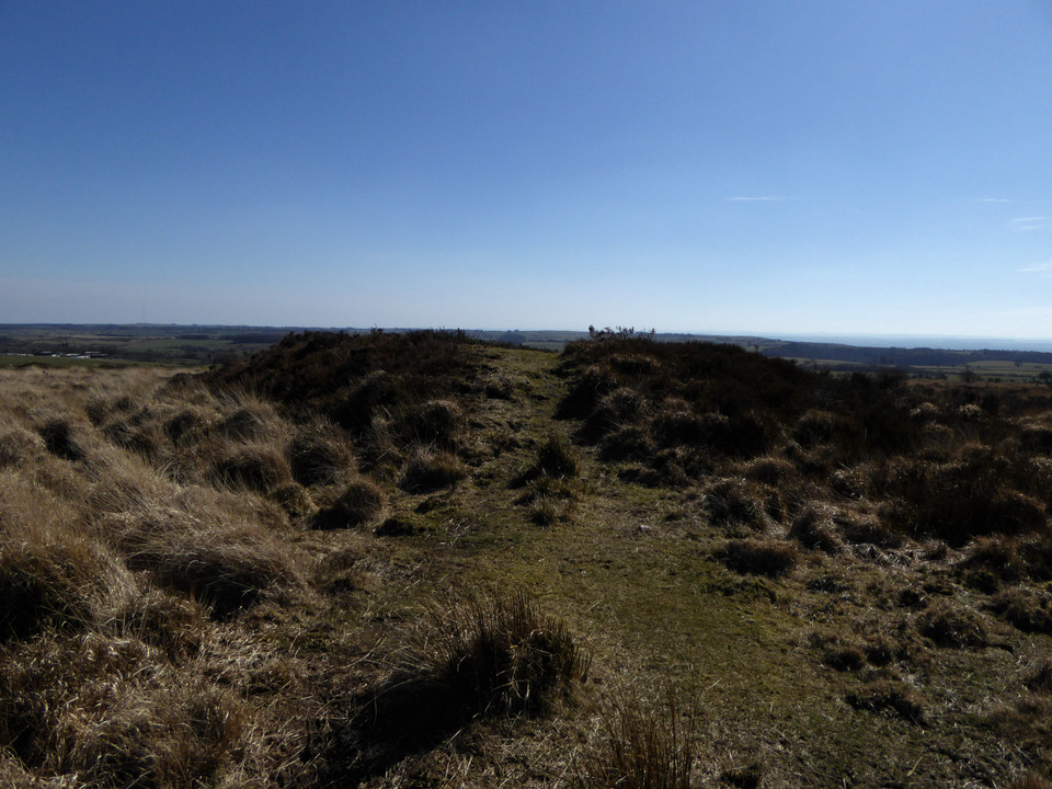
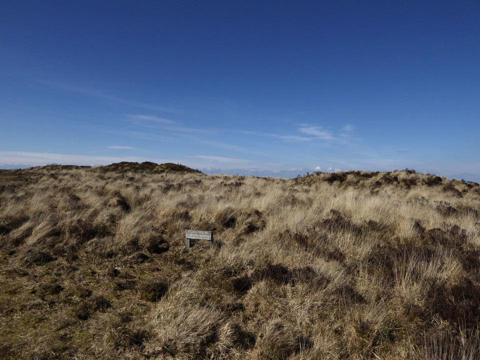
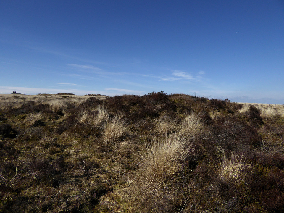
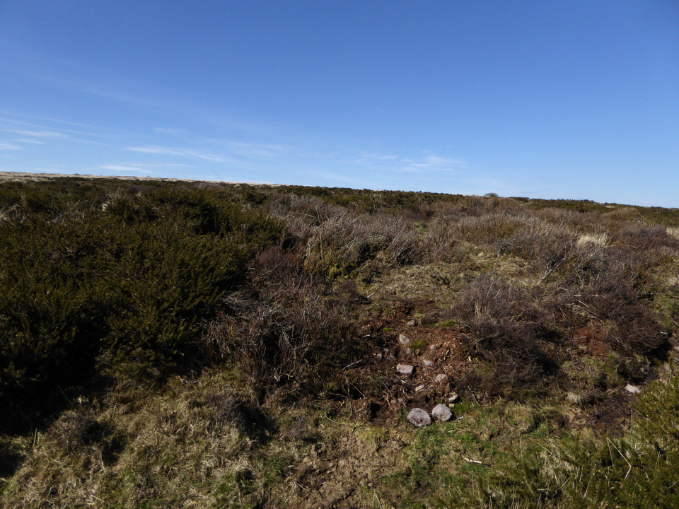
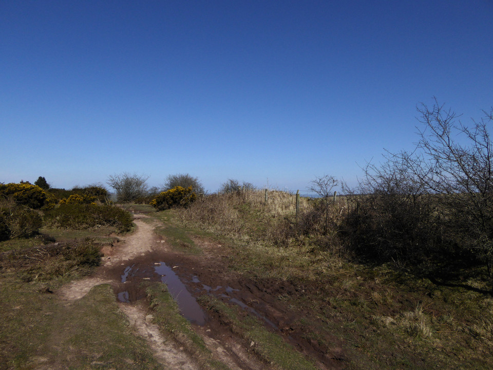
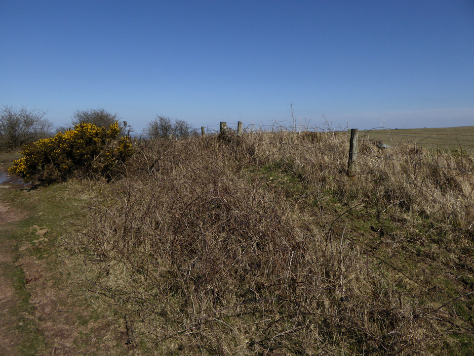
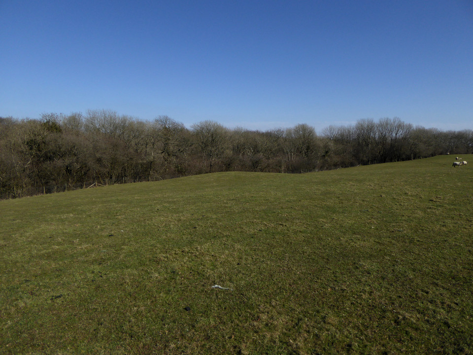
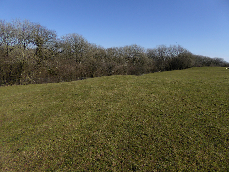
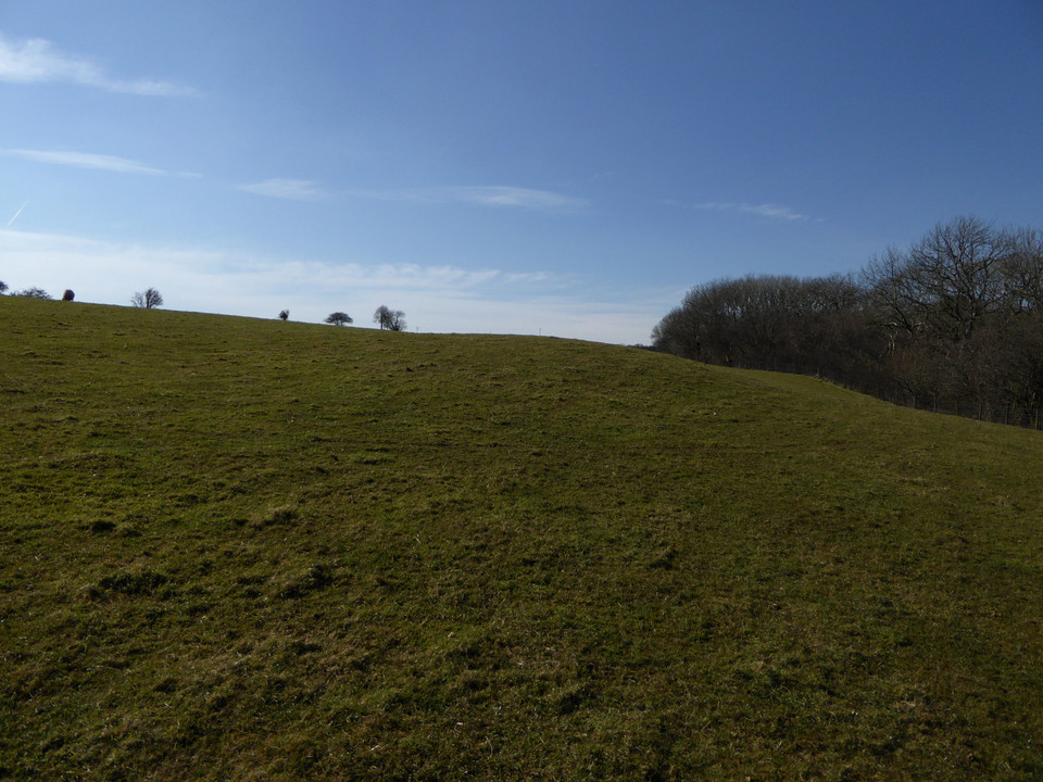
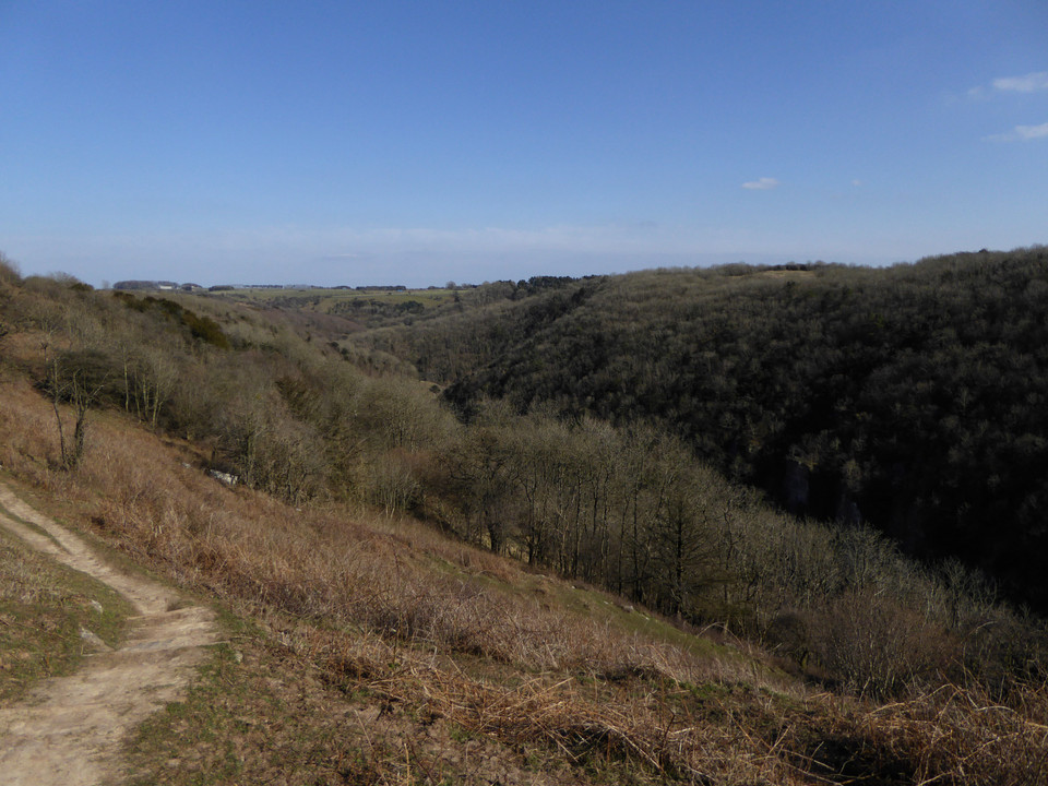
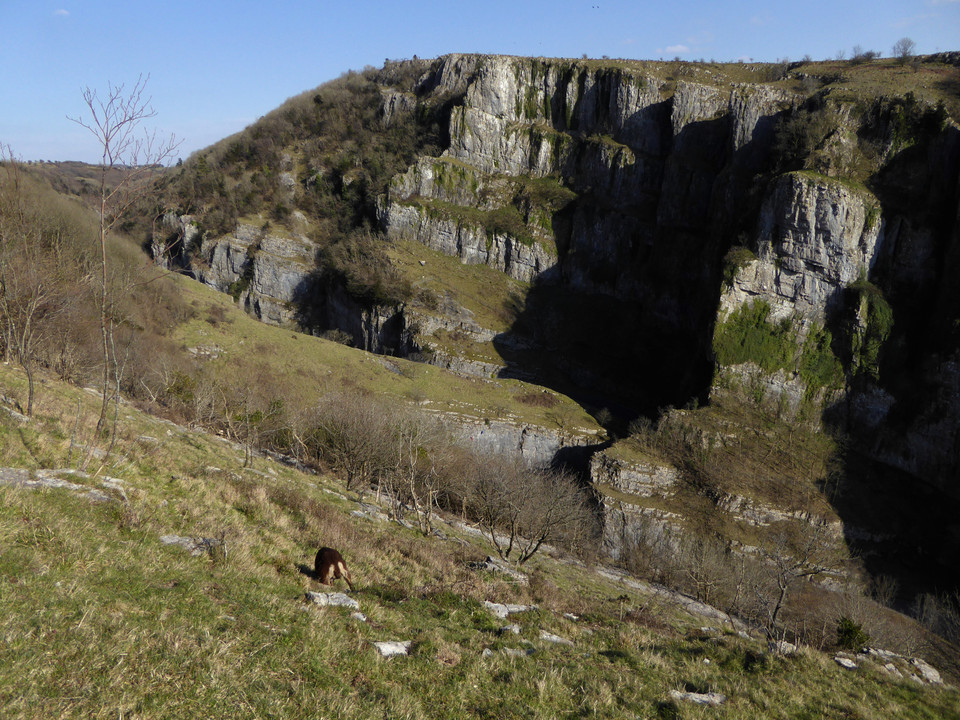
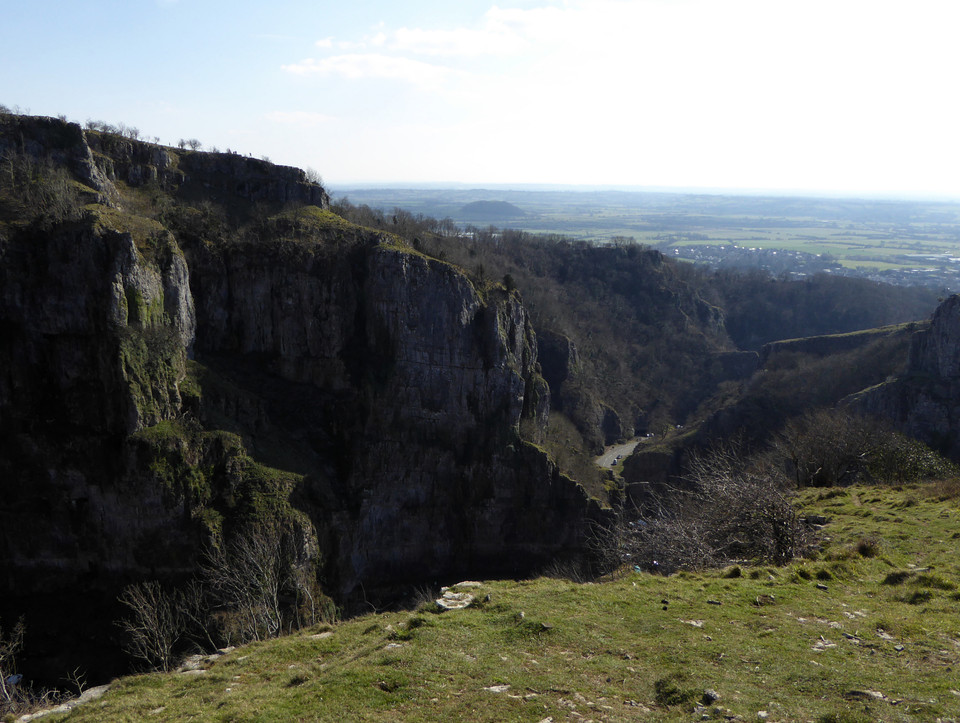
A lot happened on a short trip! |
A lot happened on a short trip!I was heading North on the A1 and decided I would break the journey with a stop to see the Duddo stone circle and the rock art at Roughting Lynn. First I had no idea Duddo was such a major stone circle, I guess I'm getting too used to finding a few fallen stones long hidden by gorse and heather. The 20 minute walk to the stones is an absolute delight with the stones soon visible on the hill and beckoning you forward growing in stature with every stride. The walk back has the Cheviots in the background, covered in snow at this time of year and leaving you with the feeling this part of the world must have many other long lost monuments to the past. There are 5 major stones standing, however, there are a few other partially buried stones within the circumference of the circle, not sure if these are part of the original circle, just dumped there or some form of broken alter like the recumbent stone circles of Aberdeenshire. Secondly, I had no idea that rock art would be so fascinating, are they pictures, hieroglyphics, maps or just ancient artwork. I felt quiet distressed as I am too early in my personal voyage of discovery to visit all the sites outlined in Julian's two books to be distracted by this new area of interest, however, I see no other option than to devote some time to understanding and unlocking the meaning of these works of art. And finally when I arrived at my destination I checked my photo only to discover my camera had failed and I had no photos of my visits. I was strangely annoyed. Although the main purpose of my visits are to take communion with whatever force remains I was still disappointed not to have a record of my visit and know already that I will return just to take photos. I also know that I will not go on a field visit with the phone in the car charger, it will always be in my pocket as back up. Regardless, it was a nice change from stopping at the usual service stations |
Posted by costaexpress 28th February 2016ce |
Weather 1, Man 0 |
Weather 1, Man 0Well we are well into February and still no end to the wet muddy weather, fed up of moaning that I am fed up with the weather I made the bed up in the van loaded the fridge with food, grovelled in front of my wife and set off for Dartmoor to visit Merrivales famous stone avenues and to undertake a reccy ahead of my planned summer walking trip to visit Dartmoor's more remote stone circles. I made my way down there via the A303, not the obvious route from Lincolnshire, however, I just love the way the road sweeps past Stonehenge and soon I was on Dartmoor and ready for a drive around just to get my bearings. The temperature plummeted to -4 overnight and I awoke to heavy continuous rain. Not to be deterred I set off for Merrivale where even the footpaths had been washed out and were now fast flowing streams, on with the wellies, two waterproof jackets and up into the complex, needless to say I had the place to myself, and wow, what a site, multiple stone avenues, stone circle, standing stones, broken cairn and multiple ancient dwellings. I soon abandoned the rough site plan and just staggered from site to site. The complex just keeps giving and despite the heavy freezing rain demanded a lot of time to fully explore and enjoy. I returned to the van and needed a complete change of clothes, glad there was no one else in the small car park. This is one of the most amazing sites I have ever visited, no information boards or visitor centre, no ice cream van (can imagine it is the complete opposite in summer) just a huge window to our past. The weather really dictated what sites I was able to visit and so I moved around to Grimspound as it is only a short walk from the road. I had not expected a site on this scale and once again demanded a lot of time to fully explore, strangely despite the poor weather this site was quiet busy with four or five other people milling around and enjoying all the sites within the pound The weather killed off any more visits that day and I returned in the morning for a wonderful walk in bright sunshine, moving out from Postbridge down to the lovely stone circle/circular cairn called Sousson Pound set into a clearing on the edge of the woods, into the woods to visit the two circular cairns and leave my footprints in the snow that was still lying there, clearly no other visitors pass this way and then the longish haul up to the Challacombe Stone Rows. I was knocked out by this site despite some dispute over how accurately the stones had been re erected. The row appeared to be aligned with the Tor and stretched up hill to a large single marker stone. The avenue itself seemed to have three chambers/cairns/holding pounds built into it. The remote setting coupled with its wonderful views of Grimspound in the distance really made the walk worth while. The following day the weather worsened again and I spent the day around Sharpitor and Black Tor tracking down the stone rows, cairns and settlements, all within easy reach of the road and hence the van for shelter from the squalls as they came in. No footpaths and bog and marsh to negotiate I more than once breached my wellies and started to wonder if I should stick to warmer climates at this time of year. Exhausted, wet and tired I was happy with my few days on the moor and it certainly 'wetted' my appetite for my return in the summer. As I pulled on the drive I realised I had not bought anything for my wife, might just sleep in the van again tonight! |
Posted by costaexpress 21st February 2016ce |
They say Giants built them |
They say Giants built themI was fed up with the mild and wet weather we have been having, every time you venture out the sites are either waterlogged or you have to plug through mud. Anyway, I was browsing Julian's books looking for inspiration, in particular somewhere that is not located on the side of a mountain nor on a remote moor and there it was, the Hunebedden in the province of Drenthe. 54 of them to chose from, all well documented with a rich and interesting history. That was it, mind made up, I booked the tunnel for two days ahead, a day to get the van ready and a day to pick up courage to tell my wife I was off. The research would have to be done on the hoof. It took all day to drive there, however, it left me ready for an early start the following morning. D53/54 came up first and immediately got me thinking. Nicely reconstructed hunebed, wonderful setting in a heath and woodland location, however, something was wrong. The stones were dead, lifeless, soulless, field art, and this set the pattern as I visited the next few Hunebedden. All wonderful places to visit but essentially dead. Then a strange thing happened, as I saw more and more of them I started to feel the history and significance I had not felt before and I started to realise the power of these stones is in the whole and not the individual, as I continued my visit I realised they are not separate sites but one huge site spread over a 30km radius and the trip began to take on a new and exciting interest. Over the next few days I worked my way around 25 to 30 of the sites and found myself eagerly anticipating what I might find next whereas I must confess after the first few sites I was beginning to think they are all the same, just outdoor sculptures. I must just mention that at sites D12 and 13 in the village of Eext I met a most interesting keeper of the local history and believer in ancient religions. He generously showed me around the two sites pointing out interesting carvings and shapes in the stones, explaining the force fields generated by a combination of their locations on ancient pathways and their relationship to each other. He was very old with long white hair and long white beard, in fact he looked exactly like you might expect a wizard to look like in a film, he was of course incredibly knowledgeable and when we parted company he gave me a small stone with a tiny hole in it. He said it would protect me into the future, however, when the time was right the tiny hole would appear like a great window to the Other World and I would be ready to climb through - although hopefully not too soon! All in all a most enjoyable field trip, and a welcome break from the winter blues. I stopped off at Brugge on the way back to buy chocolates for my wife, when I gave them to her she said great when are you off next? Seems I have found the key. |
Posted by costaexpress 5th February 2016ce |
Open Data LIDAR: Henges |
Open Data LIDAR: HengesImage source The following images are obtained from the recent releases of open data LIDAR by The Environment Agency and Natural Resources Wales. I've used this amazing dynamic map which has been created to use the open data. Thank you to all concerned for your time and resources! Picture Selection I have gone through all sites categorised as Henges on www.themodernantiquarian.com checking if a) LIDAR exists and b) they are visible to my untrained eye. This has unfortunately trimmed 70% or so of the listed henges. All henges in Scotland and Ireland are right out. A high percentage of those left are missing LIDAR. Thornborough North and Central, Arbor Low, The Bull Ring and half of Mayburgh are some of the better known casualties. Those where LIDAR exists but we don’t see them can be categorized as small henges less than 20m wide which presumably have shallower ditches, lost to quarrying, buildings and agriculture. Each picture is at maximum resolution, so you can download two (or twenty) and directly compare them. Arminghall Henge — Images03.01.16ce
Avebury — Images03.01.16ce
Castell Bryn-Gwyn — Images06.01.16ce
Castell Mawr — Images06.01.16ce
Castilly Henge — Images06.01.16ce
Castle Dykes, Wensleydale — Images06.01.16ce
Devil's Quoits — Images06.01.16ce
Durrington Walls — Images03.01.16ce
East Marleyknowe — Images06.01.16ce
Ferrybridge Henge — Images06.01.16ce
Ffynnon Newydd Henge — Images06.01.16ce
Flodden Camp — Images06.01.16ce
Gawsworth Henge — Images06.01.16ce
Great Wigborough Henge — Images06.01.16ce
Groat Haugh — Images06.01.16ce
Gunthorpe Bridge — Images06.01.16ce
King Arthur's Round Table — Images06.01.16ce
Knowlton Henges — Images05.01.16ce
Little Argham Henge — Images06.01.16ce
Little Round Table — Images06.01.16ce
Long Ivor Farm — Images06.01.16ce
Marden Henge (and Hatfield Barrow) — Images05.01.16ce
Maumbury Rings — Images06.01.16ce
Mount Pleasant — Images03.01.16ce
Newton Kyme Henge (Site) — Images06.01.16ce
Nunwick Henge — Images05.01.16ce
The Weddings at Stanton Drew — Images03.01.16ce
Stonehenge — Images03.01.16ce
Thornborough Henge South — Images05.01.16ce
Weather Hill — Images06.01.16ce
Woodhenge — Images03.01.16ce
Woolhanger Henge — Images06.01.16ce
Yarnbury Henge — Images06.01.16ce
|
 Posted by juamei
7th January 2016ce |
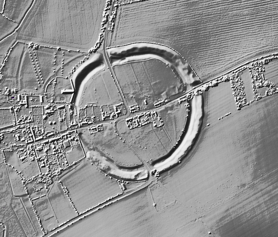
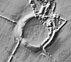
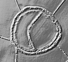

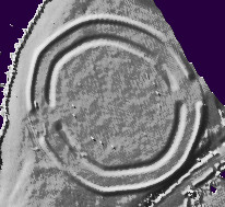
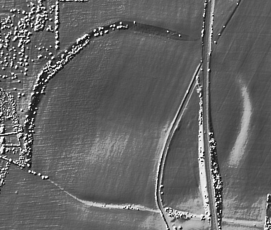

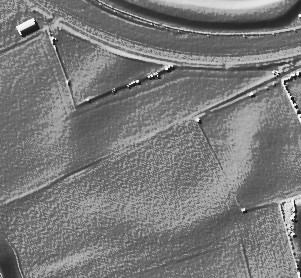
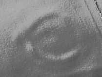

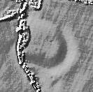

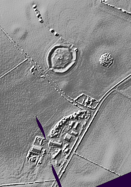
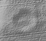
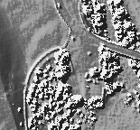

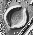
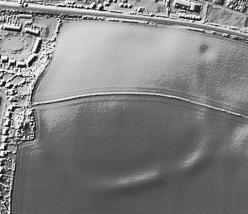
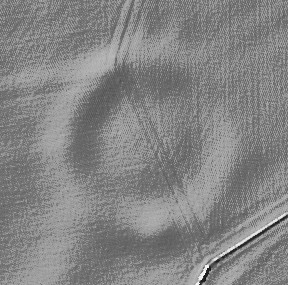
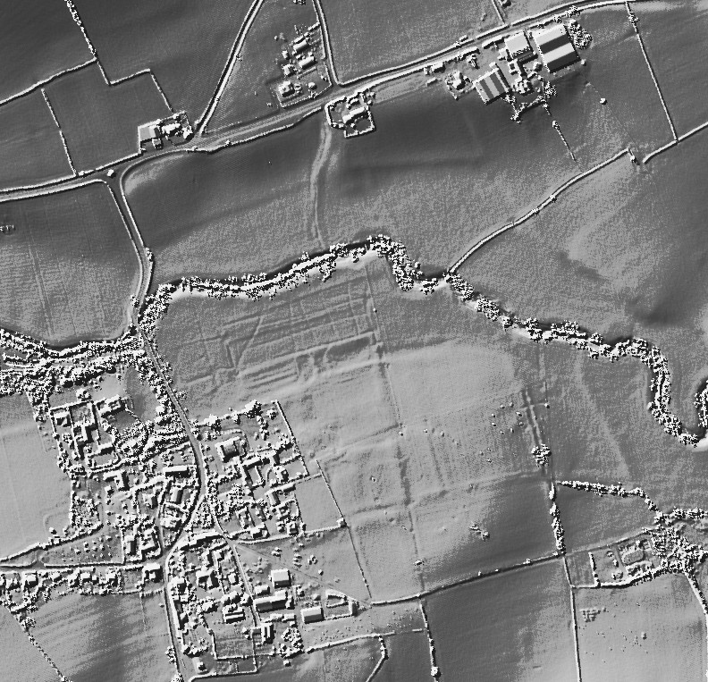
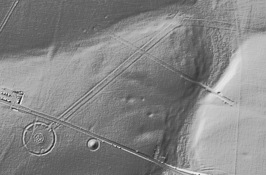
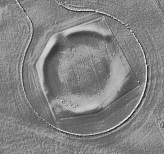
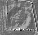


The Gorse awakens |
The Gorse awakensThis year the solstice turned out to be on the 22nd, not the 21st, and most definitely not on the 20th, but seeing as the first two dates are work days and ive not got the option of going off sick, Sunday the 20th will have to do. At least there would be no part time enthusiasts clogging the place up, the place in question being the oh so divine Druids circle above Penmaenmawr, it is a wondrous place, big mountains to the south and west, and north down hill to the Irish sea. Plus it is not alone on these hills, the Druids circle is just one out of at least ten places that are well worth a visit. Also the almost complete lack of gorse is very heart warming. So far, I have witnessed the sunrise here on the summer solstice, an equinox, and one more for the complete set, a winter solstice. The actual moment of sunrise was obscured by a mountain, but even when the sun came above the mountain, clouds got in the way, and it was windy, so windy that just standing up straight was exhausting, even stringing several swear words together didn't help, well not with the standing up anyway. At the summer solstice the sun rises up out of the sea, a spectacle to behold I can tell you, the equinox sun rises above some low hills, more or less marked by Maen Penddu standing stone and Cefn Maen Amor stone circle, that was a good sun rise, but it's no summer solstice. The winter solstice sunrise, some might say that the sight line is blocked by a mountain, but when that mountain is Tal y Fan, the most megalithically covered mountain in Britain, one has to consider the idea that it is intentional. Y Meini Hirion — Images21.12.15ce
Y Meini Hirion — Images10.04.13ce
Y Meini Hirion — Images14.07.10ce
At the stone circle itself there is a couple of platforms from which a view of the circle is best seen from, The highest platform is also the perfect viewing place from which to watch the sun rise in mid winter, the second platform is perfect for viewing the equinox sun rise over the middle of the circle, and the lowest platform, I say platform but it's not really is where the summer sun can be seen best rising over the circle. I cannot say that the platforms are constructed, or meant to be used to observe the sun rises, but it's really too much to put down to coincidence, perhaps the least one can say for certain is that the circle was carefully placed. Possibly. Anyway, I've been up here for five hours now and it's time to go and see some gorse, wonderful stuff gorse, well, it is when you've cut it down and thrown it far into the wind, unlike Han Solo. Carnedd y Saeson is one of the best sites along the North Walean coast but like lots of places it is being choked by and disappearing under gorse. Fifteen months ago Thesweetcheat and I went there and trampled the stuff as best we could, but whats really needed is a flick saw and a few hours. I gave it both. Carnedd y Saeson — Images28.12.15ce
The big gorse bush by the cist is gone as is most of the gorse covering the southern arc of stones, work is ongoing. I myself am in two minds about undergrowth removal, I am aware that the authorities could take a dim view, and I am not unsympathetic to the free growth of all living things, but in some places it just has to go. What I really needed was a big light saber and Anakins lust for cutting down younglings. My arms and chest muscles hurt for several days, and right after the exercise my hands stung like a snake bite, it crossed my mind that I should leave Wales to clear up it's own stone circle themselves, then the inner voice said yeah right and chuckled long into the night Work is ongoing. |
Posted by postman 28th December 2015ce |
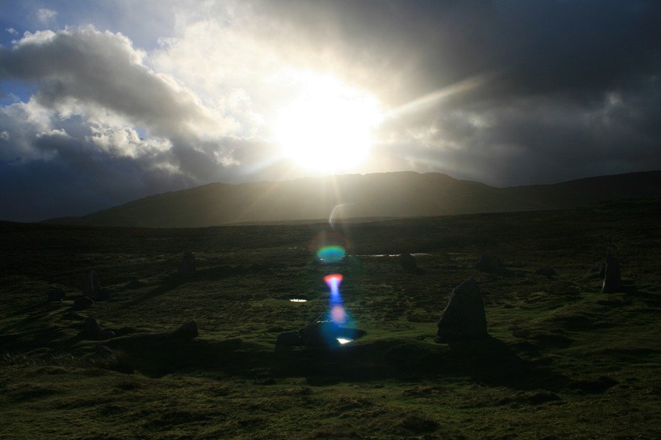
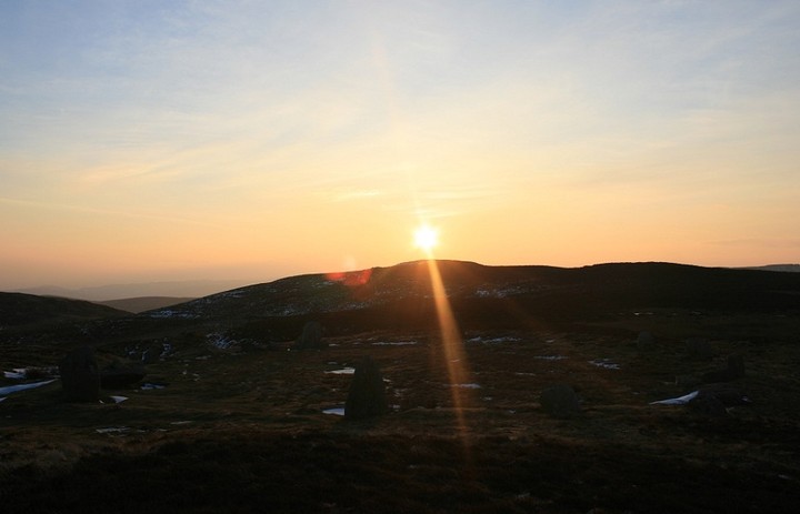
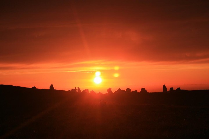
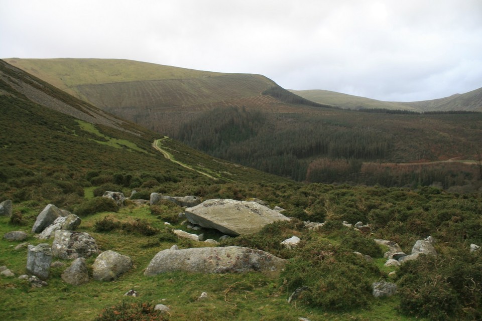
Lanyon Quoit |
Lanyon QuoitWell I painted the spare room and my wife unexpectedly declared she did not mind if I wanted to fit in another field trip, so in a state of shock out came the books, maps, gps coordinates and of course the internet (I really enjoy the planning phase before a trip) and I decided I would like to see Lanyon Quoit as it looked like my Golden Retriever poised waiting for the command to fetch. Van loaded, waves from the kitchen window, dog barking I left Lincolnshire for the run South to St Just where I would hole up for a few days. I had just passed Bristol when the phone went, 'I don't like the colour want to change it to Tunsgate Green, no worries you can do it when you get back' grrr! My first visit was to the complex which includes the Merry Maidens, Tregiffian Burial Chamber, Gun Rith and Pipers 1 & 2. I spent ages trying to figure out any kind of alignment of the stones and eventually moved on to the unexpected highlight of my trip Boscawen - un. a short walk over the brow of the hill and there it is below you looking like a giant sundial enclosed by a stone wall and hedge. I assume the central standing stone was originally straight or is it aligned to a date in the calendar? This was a wonderful place and if it wasn't so damp and muddy I could have spent much longer there. I had read about people experiencing a rebirth down in the Fogou's, reckoned that would be good for me and so headed of to Carn Euny village to search for the mysterious glowing algae and to be reborn. Although blustery and raining I decided to park up at Carn Brea and walk across the moors to the village, this took me past the Holy Well, the adjacent trees suitably covered in multi coloured plastic and cloth ribbons and then I descended down into the Fogou. The mysterious algae was in fact everywhere and not difficult to find and I thrust my way back into daylight arms outstretched - Reborn - Sadly no, I was still old and now also covered in mud. Next day I just had to see the Quoit and it did not disappoint, waterlogged and alone it seemed to pointing somewhere into the distance. Up the road and a good walk up to Men an tol. With no one around I was able to try getting various parts of my body through the holed stone. Remembering the fertility rites associated with this place I decided to leave fearing I might have gotten myself pregnant and set off for the Nine Maidens stone circle further up the moor. I had read it was just up the path, well I can assure you in late autumn it was no stroll. The path was flooded and eventually ran out and I struggled up through the water filled ruts in the heather passing a lesser circle and broken cairn until eventually reaching the circle. It was raining, the site was waterlogged and a more desolate spot on earth I don't think I have come across. The circle was brooding and menacing and I wanted to get away from it. Setting of down the hill through the heather I couldn't stop myself panicking slightly and tripping over from rut to rut and was pleased to make the good path back at Men an tol. I climbed in the van, made a pot of coffee and gave myself a good talking to. Anyway I soon cheered up and walked along the cliff tops to find Ballowall Barrow. Overnight a tremendous storm blew up and my planned walks to Chun, Zennor and Milfra Quiots looked in danger. I set of aiming for Chun, however, the whole moor was now fast moving streams and pools, I got close enough for a photo with the zoom lens but that was it, my wellies had flooded I was wet and beaten. I decided to head East to easier targets and visited the newly erected Quoit at Carwynnen. Nice little visitors area however it is difficult to reassemble ambience and atmosphere so I moved on to see the mighty Trevethy Quiot, very different to the others more like a box with a huge capstone. Whats the hole in the roof all about, original or new? Whilst in the area I visited the Duloe stone circle which was really worth the detour, every single stone in the small circle is of great interest and spent a surprisingly long time there. Next I moved on to the Hurlers multiple stone circle. Looks like a tourist spot in summer, however, deserted today. The rain did not allow me to do the site justice and the whole area deserves a further visit just to this one spot. And so that was it early next morning I set of back for Lincolnshire doing one last detour to Stanton Drew, Wow! Its just there, no fanfare, no gravel pathway, no visitor centre, no mown grass, just this major prehistoric site with huge stones and multiple circles, just an honesty box to let you know its there. This is a full afternoons vist and by the time I found the cove in the pub garden I realised I would be late home. Picking up a couple of tins of Tunsgate Green at Homme e basse on the way back I dropped them on the chest of drawers in the bedroom, my wife looked up with one eye open and asked where is the Cornish fudge and clotted cream, I decided this was not the time to tell her I might be pregnant. |
Posted by costaexpress 20th November 2015ce Edited 21st November 2015ce |
Le Petit Menac |
Le Petit MenacFollowing numerous field trips this year my wife had asked me to hold off any more visits, at least until the spare room has been decorated in time for Christmas. this was not an unreasonable request as I had started to decorate the room some two and a half years ago. So it was with some dismay she caught me in the study with Julians book open at the section about Carnac. 'Trust you are not thinking of going there any time soon because you can think again'. 'no, No, NO!, how could you think such a thing, I know my priorities'. Anyway, over a glass of wine that evening I realised that there was no way out of this mess and I blurted out that not only was I thinking of going but that I had already booked the van and myself on the Eurotunnel leaving Saturday morning. I made the bed up in the van, stacked the fridge with food and beer and waved cheerio to an empty kitchen window and blew a promise on the breeze to paint the spare room immediately upon my return. The 640 miles to the Arzon peninsula (my first port of call to visit the cairn du petit mont) proved easier than I had expected and I was there late afternoon having left home at 1.30am in the morning giving me time to drive past the main alignments as a taster for Sunday morning. I decided to start at the Kerzerho alignment at Erdeven. What an amazing place with the main stone avenue gently progressing down the hill away from the main road. As I walked down the avenue I encountered a large group dressed in Brittany kilts enacting a strange ceremony including a mock beheading on one of the flattened stones, whilst not threatening my presence wasn't really appreciated and I took some photographs and left knowing I could come back later. as I approached the main alignment at Menac I could not believe the car park, everything I hate, kids running around spilling ice cream, dogs barking, groups preparing for Sunday cycling club and adults wondering as far as the information booth. It got worse as I approached the stones and discovered I could only enter with a guide, however, putting all to one side the scale of the alignment simply took my breath away. I knew it would be big, but not this big, where do I start, how do I get to really appreciate it? After a short while I realised I needed to move on and went to the Kermario alignment. Wow, just two cars and totally free access to the stones which wound there way first down the hill and then back up towards Kerlescan. Here I was also able to visit the Dolmens of Kermario and Kercado and a wonderful walk up to the Giant de Manio. It was then on to the alignment at Kerlescan and a walk around to the Menhir behind it. Next on my agenda was to find the alignment of Petit Menac, not as easy as it sounds. Following a few false starts I crossed the main road and followed the path into the forest, and wow what a magical, mysterious place it turned out to be. The stone avenue is clearly visible despite the growing vegetation and the mature woodland slowly winding to the left and then up the hill into the wood. I was there for over one hour and not one other person ventured into the woods it was impossible to compare it with the crazy going ons at the main Menac alignment, so peaceful so full of atmosphere with the suns rays penetrating the trees and illuminating the stones So what are they all about, why are they there? They certainly convey a great sense of ceremony of a grandeur on a scale we do not see any where else. Was one erected for every birth, for every death, are they a silent army or are they standing stations for a grand ceremony? The next day was spent visiting some of the seemingly never ending number of important sites in the area in particular the megaliths of Locmariaquer where on one rather touristy site is the broken menhir of Er Grah, once the tallest standing stone in Europe and the Table de Marchand and the Er Grah Tumulus which at 460 feet long was on a scale I have not seen before. I spent a further day travelling across country to La Roche Au Fees and the Dolmen de Bagnieux. The first being one of the most impressive megaliths I have ever seen on a huge scale in a woodland setting. Once again I had the place to myself to enjoy and to wonder. The Dolmen at Bagnieux was a real let down, stripped of all dignity and a 4euro side attraction to the local café, really wished I had not seen it. I wanted to release it and set it free although I knew it was already long dead. And so that was my short trip, you will be pleased to know I bought a tin of white gloss on the way home, having read the multiple warnings on the back of the tin I have locked it in a cabinet in the back of the garage afraid of what damage it may do and in any case my wife said she would have preffered flowers! |
Posted by costaexpress 15th October 2015ce |
Learning how to see & breathe. |
Learning how to see & breathe.I've tried the field notes thing, but there's really nothing I can add other than my own emotional experience, & I'm not sure that's what field notes are about. I'm in awe of people who can photograph, measure, detail & wonderfully describe these fantastic places. Drew, please take note, how am I to learn? It occurred to me , on holiday in Cornwall, on my last day that I chose, after all the neolithic adventuring, to devote a day to getting in the sea. In fact that is always the highlight of time spent in Cornwall. And whilst in the sea, I found myself thinking what must our forebears have made of this. How awe inspiring must this of been for them, just as it is for me & then I thought how can you leave a lasting testimony to the sea? Sea henge & the footprints at Formby Point? Anyway the whole point of this post is that I drove home from work today & I saw the hills, & the lumps & bumps on the horizon. I watched the bluest sky & the way the sun shone through the greenest tree overhangs. The darkness & the light. The sparkling water. The red & gold turning foliage. The mist, the frost & the stones ancient or not. And I realised that this has been the gift given to me. |
Posted by carol27 2nd October 2015ce |
Sunkenkirk & Long Meg |
Sunkenkirk & Long MegI took my mum, as promised to Sunkenkirk last week. We parked in a little lay by fairly near to the site as she isn't too steady on her pins. I took my wild flower book TJJ & managed to identify a few blooms! She kept asking me what had "happened" to me over the last months & that I'd changed; I was more settled & less giddy. Sunkenkirk really enchants me; twice now on the approach I find myself questioning where it's hiding, & if I'm in the right place. I know where it should be but can't see it when all of a sudden it appears over the slight crest of a rise on the path. Like Castlerigg it sits in the centre of the landscape. She wandered around & around touching the stones & exclaiming at their size & the effort involved in erecting them; & "what are they for?" She told me that she feels about trees the way I feel about stones & that she stands & hugs them; so we hugged some stones together! She commented that if anyone was to see us they'd suppose we were " off our rockers"! On the path back to the car we constantly turned back for one last look & she said she didn't want to leave. When we lost sight of the circle we found a tree & hugged that as well. Next to Long Meg.; she got a fierce hug & some passers by stopped to chat & laughed with us. Mum traced the carvings with her finger & tears came to her eyes as she wondered about who'd gone before. Some ramblers who looked nearer mum's age passed by saying they should strip off & run around naked & find a sacrificial victim! A young goth couple from Italy set to & explained perfectly the known history of the place; the ramblers soon quieted & left with far more knowledge about their own history than when they'd arrived. The Italian couple had been to Castlerigg & I was proud to direct them to Little Meg. We discussed the journey to Sunkenkirk which they also hoped to see. They were to stop at Avebury on the way down South to Dover on their journey home. They were so excited & knew so much about our places. The boy told me they didn't have circles, cairns or barrows in Italy. They looked fantastic with their wild black hair & studded leather. We ate strawberries together which they'd offered me & mum. Their rickety old car didn't look capable of the distances they had to cover but they had every faith. We counted the stones together. My mum was blown away, as was I. Who'd have thought it she says. |
Posted by carol27 6th August 2015ce |
A Holyhead bloodbath |
A Holyhead bloodbathI've just been to the big white stones of Henblas cromlech, and was very disappointed to find the footpath overgrown and never used, but it still didn't take long to beat a path through the undergrowth, I very much enjoyed my time here, until I received a phone call asking if the kids and me wanted to go out for tea at the Plough, I said OK even though it meant a visit to Trefignath was not going to happen, but I was adamant that the burial chamber that no ones ever heard of near Holyhead would not escape my attention. I found the path back to the car more easily on the way back, aint it always the way. Back in the car I put my foot down and soon we were going the wrong way in the mental labyrinth that is Holyhead, god I hate this town, cant really say why, it just seems a hopelessly depressing place, the best thing about Holyhead is the road and ferry out of it. Sorry, perhaps its me, not you. Eventually after much cursing I found ourselves on the wrong side of the island and stuck behind the worlds most inconsiderate motor home driver, ever. I've only got a short time before we have to start back, I can feel my hackles getting up, but happily we parted company at the turning for Penrhos Feilw, which we passed by with no more than a glance. Once the two standing stones were out of view behind us I started looking for a suitable place to park. Having not found one I squeezed in at the side of the road by an opening for a horse paddock, as I wasn't going to be gone long I left daughter in the car with her I phone and two big horses for company. I jumped the gate and started off, over another fence and I was in the open countryside. I could see the upright stones on top of the hill, not far away, 300 yards if that. But getting there was proving difficult, walls of thick gorse blocked my route, and I had to weave a path of my own around and sometimes through, it hurts does gorse, I don't like it, not one bit. The going was hard and time was short, I got to a likely looking rocky outcrop from which to look over the sea of gorse to the site i'd come to see. Crap ! I'm not wading through that lot, I sat for a minute, then decided that I would actually wade through that lot, it's nearly a hundred miles from my house, am I really going to give up when I'm so very close......nope. I sent a text telling them I would be a touch late for tea. I actually found a good path through the vicious barbed gorse, it took me all the way to the foot of the Gorsedd, only to be faced with a twelve foot vertical rock climb, I don't like rock climbing, like football it all seems a bit unnecessary. I struggled through the shaky legs and came out on top, just, I threw my hands up in the air and said out loud nature nil, postman 1. Gorsedd Gwlwm — Images21.07.15ce
This site is not on any map, thanks be to coflein for pointing it out to me. Only three stones remain standing of the chamber or large cist, and maybe a couple of kerb stones hiding among the gorse, by now I've decided not to call it gorse anymore, but by the more colourful name of M*t**r - F*c**r, that's a bad swear word there. All the time I was here a Buzzard circled me overhead screeching, if this was a western film it would soon be curtains for me. The view was terrific, north is the Holyhead hut circle group and the fort on the mountain, south is Angelsey giving way to distant Snowdonia, east and west is the Irish sea, and of course that little town. But, all too soon I must go, I scrambled back down the cliff and followed the path back to where I got on it and then passed that place, only for the path to stop at a dead end, the grass was well trampled, sleeping horses, frolicking humans, or even a Bigfoot nest (they're everywhere you know ). This is where my time in hell began, I could see no way out, there was nothing for it but to simply wade through the m****r - f***r. Growling, shouting and swearing at the top of my voice did nothing to stop the pain. I remember a wally from long ago saying he was impervious to m****r f****r pain, I didnt believe him then and now I know he was lying. It was like being attacked by a dozen Leprechauns with sharp swords. Every now and then brambles would grab my leg and threaten to pull me over, once when I did go down I lay there for a few seconds thinking "oh well, so this is where they find my body, if you're going to die in the countryside this isn't a bad place to buy it, my ghost wouldn't half laugh at the people who come to remove my body, but lieing down and dieing isn't the postal way, get up man, keep going. I imagined myself as a soldier enduring some form of jungle warfare, only without the incredible pain in my legs. Half way back now and i'm so very tired, I look at my hand and it's bleeding quite badly, the sweat pouring off my forehead tastes bloody, and I realise that I've been wiping my sweaty brow with my bloody hand, god I must look a right state. Sometimes it gets easier to move forward, sometimes I'm just stumped and don't know where to go. Continuous swearing seems to have done the trick, I'm nearing the end of my ordeal, my legs are really stinging, I'm dreading having a look at them. Only one barbed wire fence to go, it's covered in brambles, but by now the pain is becoming normal, I bash as much brambles out of the way as I could with my camera bag, lob it over and haul myself over. I've done it, a plain and normal field to cross and I'm back at the road, what I really don't need now is some Welsh farmer telling me i'm on private property, and that's precisely what doesn't happen, a good job too, I think I might have done away with him. Next was the priceless look on my daughters face, Dad ! your covered in blood whats happened, now is the time to have a look at my legs. Oh shit look at that, I took a picture of them because in time the scratches will be gone and all this will be a memory. What I really need now is medical attention of some sort, instead I think I'll drive a hundred miles to a posh pub for a well deserved pub meal. One of the good things about going out with my Ex wife and her mother is I can turn up stinking like a torture victim. So, in summary. This site is a good one, you will have the place to yourself, views are good, but for the love of god come from the north. M****r f*****g gorse should be wiped out, extinctified, by flamethrower, bagsy first on that. |
Posted by postman 21st July 2015ce |
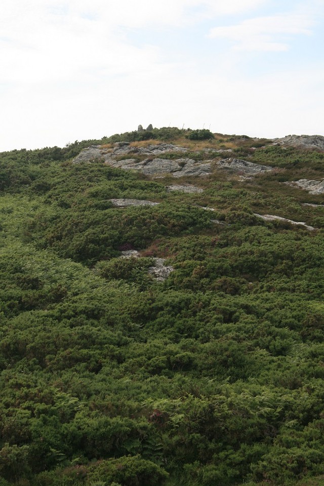
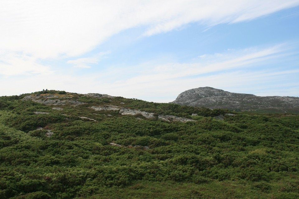
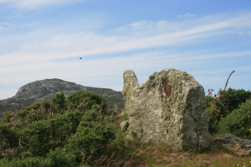
Offa’s Dyke VIII – Four Crosses to Buttington Bridge 16.7.2011 |
Offa’s Dyke VIII – Four Crosses to Buttington Bridge 16.7.2011It’s unusual for one of my walks to avoid the hills, but that’s exactly what this section of Offa’s Dyke Path will do. Since leaving the Clwydian range we've crossed several major watercourses on their way down from the Welsh uplands, but today we'll meet the mightiest of them all. The bus from Welshpool drops us at Four Crosses, where we finished our last section back in May. This is a very low-lying settlement, not much more than 50m above sea-level on a wide plain stretching from Llanymynech Hill and Afon Efyrnwy to the north to the Breiddins to the southeast. The Dark Ages earthwork of Offa’s Dyke crosses this plain, but there was once much more going on here than the patchwork of fields now suggests. The northern part of the village is called Llandysilio, one of many Welsh locations associated with St Tysilio, who died about 100 years before King Offa was born. In the fields to the east a huge complex of cropmarks has revealed a Bronze Age cemetery, now flattened, together with ring ditches and traces of field systems. There’s nothing to see now, but back in the Bronze Age this was clearly a place of some significance. We follow the dyke itself southeast out of the village centre. It’s much reduced here, generations of ploughing cutting its height to barely a metre tall. Straight ahead is a dark bulk of hills. These are the Breiddins, rising near-vertically from the plain and site of a number of Iron Age earthworks that will be watching over our whole route today. The section of dyke north of Rhos is very attractive, planted with a double row of oak trees. From here we have a nice retrospective view of Bryn Mawr hillfort, yet another prominent site overlooking this flat landscape that we're traversing. But our first – indeed only – site of the day lies just a couple of hundred yards away to the east. Crosswood — Fieldnotes07.06.15ceCrosswood enclosure could be seen as part of the complex of sites around Four Crosses and Llandysilio. It’s a circular enclosure with an internal ditch, bisected by the road from Rhos to Llandrinio. The road crosses the site about a third of the way from the northern part of the arc, so it’s not an obvious re-use of any original entrances. Sadly the earthwork has been much reduced by ploughing, rather similarly to the nearby line of Offa’s Dyke. It’s best preserved at the northwest, where both the bank and the internal ditch can be made out clearly, albeit not the easiest thing to photograph. Running east the bank gets even further reduced, to the point of near-disappearance. On the south of the road we couldn't see anything at all, but this did involve trying to peer through a pretty thick hedge! Not the most impressive place to visit, but as pretty much the only visible remains of the numerous sites on this flat plan, it’s worth a quick hello. Crosswood — Images29.07.11ce
Leaving Rhos we rejoin the line of the dyke, heading arrow-straight across the flatlands. From here, the enormous brooding bulk of Breiddin Hill Camp increasingly fills our view as we cross the meadows. Quarrying has blighted the side of the hill, but nevertheless the positioning of the fort on its top is pretty formidable. Breiddin Hill Camp — Images29.07.11ce
New Pieces Enclosure, Breiddin Hill — Images07.06.15ce
Breiddin Hill Camp — Images29.07.11ce
Gaer Fawr (Welshpool) — Images29.07.11ce
Crowther's Camp — Images07.06.15ce
The hedgerows burst with cow parsley and the waving stalks of grass that’s too far out of reach of the cows that graze most of this landscape. The surroundings are increasingly marked with drainage cuts, keeping the fields dry from the overspill of the great river that we’re approaching. The River Severn, or Afon Hafren, has made its way from its mountain source on Pumlumon and is now a fast-flowing obstacle, cutting across the broad plain between the rolling hills of Mid-Wales and the mini-mountains of the Breiddins. We will meet it again, at the very end of the Offa’s Dyke walk over a hundred miles away. By then it will be the mightiest of all British rivers, forcing its way out to sea against one of the most extreme tidal reaches anywhere on the planet. For now though, it will be our gentler companion for several miles south, as we search for a bridge to the other side. A more pressing obstacle comes in the form of a huge lump of beef however. Our path follows the Tirymynach embankment, built to stop the river from bursting its banks and flooding the fields of the plain. This is dairy cattle country, and in summer bulls often share the fields with their families. One such bull has chosen to lie down bang up against one of the stiles along the embankment, blocking a narrow gap in a thick hedge. He seems unconcerned by our presence, but our only way onward would involve climbing over his back. This doesn't seem like the action of a sane person and we reluctantly have to turn back to Red House, adding unwanted extra miles and taking us away from the river temporarily. From Pool Quay we follow the Montgomery Canal, now restored and navigable, outliving the dismantled railway that supplanted it. This low-lying plain has long been a transport route, just as the Hafren/Severn itself must have provided a terrific highway for the prehistoric people who built the hillforts, and even further back to those who laid their dead in the cemetery at Four Crosses. The river crossing finally comes at Buttington Bridge, but this is also the end of our Offa’s Dyke mileage for today and instead we head westwards to Welshpool. A strange walk for me, avoiding the hills that stand so prominent to either side of us. But a useful new perspective, to view the forts from below, as the prehistoric farmers viewed them in their heyday. Did they see the suspicious eyes of warlike overlords, or a lofty place of refuge in times of trouble? I guess we'll never know, but down here the mother river flows on and on, untroubled by such concerns. |
Posted by thesweetcheat 7th June 2015ce Edited 12th July 2023ce |