 
|
 Posted by Chance
30th July 2014ce
|
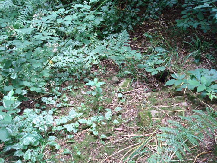
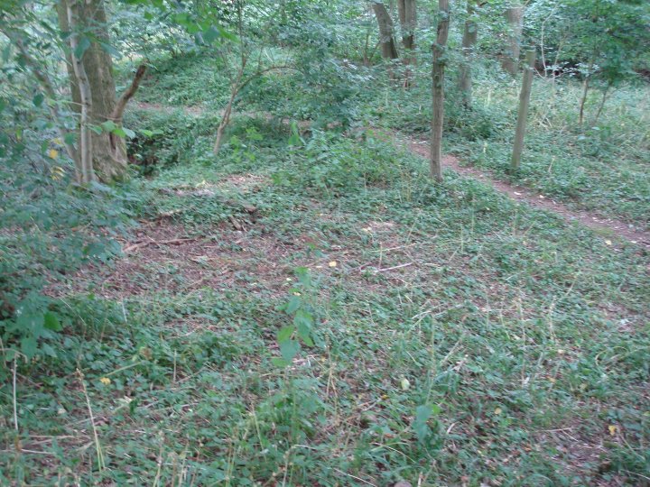
Visited July 2014
Not much more to add to the fieldnotes below. Very neglected round barrow with rabbit burrows on one side. Center clearly dug into with no attempt to repair. Barrow made up of stones and loose earth. On an old O.S. map of the area, two tumuli are marked, the other being further down the hill, next to the road, but this is not recorded on pastscape or the later O.S. maps.
|
Posted by Chance
30th July 2014ce
|
Details of the round barrow on Pastscape
(SP 5036 7477) The Island (Tumulus) (OE) (1)
The monks of Pipewell Abbey who had a grange here (SP 57 SW 4) "surrounded the ancient tumulus in the close with a moat, throwing the earth inwards and enlarging the space. This moat was filled from the land springs on the upper strata of the gravel.." and used as a stew for fish. (2) Wait describes 'the island' as having a small ditch, but says that in 1797 this ditch was "a moat from 4' to 6' wide, and full of water. A wooden drawbridge with a spiked gate in the centre, crossed this at the place where the cricket pavillion now stands." (3) Rugby 'the island' mound - scheduled as an Ancient Monument under Miscellaneous Sites. (4)The original nature of 'The Island' is uncertain. It could have been a BA barrow, a small motte, or even a mound constructed specifically for meditation by the monks of the Grange (as was their practice at Pipewell, See SP 88 NW 8). The name 'The Island' is still in current use, and it is now grass covered and planted with trees. A notice states that the moat was filled in in 1847. (5)
|
Posted by Chance
29th July 2014ce
|
Details of the henge on Pastscape
An evaluation undertaken by Warwickshire Museum Service at High Cross, Copston Magna in 1990 reportedly identified cropmarks. Field walking produced sparse flint scatters, while trial trenching located a henge and a possible hengiform monument.
|
Posted by Chance
29th July 2014ce
|
Details of temple on Pastscape
SP 195905. A Roman settlement extending for at least 400m. from N to S was discovered during industrial and housing development at Coleshill in March 1978. Excavations in 1978 and 1979 revealed a Romano-Celtic temple complex in the centre of a subrectangular stone-walled enclosure measuring 65m. N-S by 45m. E-W. The enclosure contained two other probable shrines, a building some 8m square in the southern corner and a structure with an apse 7.5m. in diameter between the temple and the eastern enclosure wall. The temple in its latest phase consisted of a stone built cella measuring 11m. E-W by 10m. N-S with an ambulatory 2m wide. The building replaced an earlier cella with a western apse, and this had replaced an earlier timber temple, whose cella was almost square and was surrounded by the post-holes of an ambulatory measuring 11m by 10m.
West of the timber temple and pre-dating it, was a circular building 12m. in diameter, possibly of Iron Age date. The final stone temple and the stone buildings in the enclosure probably date to the 2nd century. The associated pottery is mostly of 2nd century date or earlier, but the coin series continues to the 370's. Some 40m S of the enclosure the remains of a bathhouse were discovered, and other features noted so far include pits, ovens, ditches, floors and walls. Other finds include late Iron Age and 1st century Roman pottery, a bronze bull's-head bucket mount and two brooches. Excavations continuing. (1-4)
|
Posted by Chance
29th July 2014ce
|
Details of hillfort on Pastscape
The earthworks and buried remains of Oldbury Camp, a univallate hillfort. The hillfort utilises a prominent ridge which rises to the west of the village of Hartshill and occupies an area of some 2.8ha. Traces of the hillfort's defensive earthworks, a bank and external ditch, are visible along the north east, north west and south west sides. The best preserved section of the bank forms the north western defences to the site. It is visible as an earthwork, with a maximum width of 6.5 metres at its base, although its central section has been breached. Much of the external ditch has been infilled but will survive as a buried feature. A causeway across the ditch at the north west corner is believed to mark the site of an original entrance to the hillfort. Oldbury Camp originally extended to the south east, but this area has been extensively modified by the construction of buildings associated with both the now demolished Georgian house, Oldbury Hall, whch occupied part of the site until it was levelled in 1948, and a reservoir which was operational by 1954 and occupies the central part of the hillfort's interior. Scheduled.
|
Posted by Chance
29th July 2014ce
|
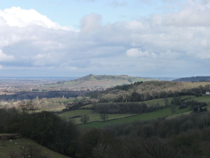
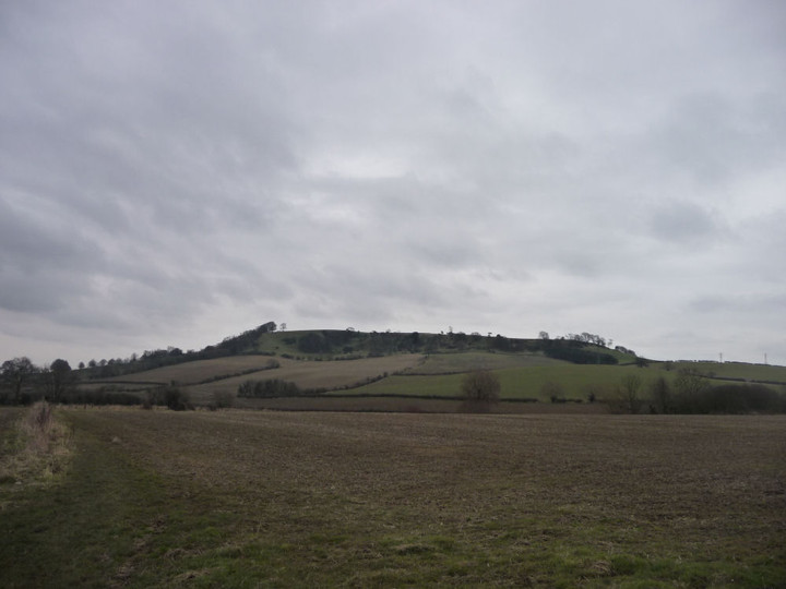
Details of the round barrow on Pastscape
[SP 3176 9433] Tumulus [LB] [As this is the only known barrow in the vicinity of Oldbury the following probably applies.]. (1) In 1835 Mr. Bloxham opened a barrow at Oldbury. It was common bowl shaped, 15feet high and 70feet in diameter. At a distance of 2 feet from the surface on the east side, some bones, a spearhead of iron, and an iron shield boss or umbo, much corroded were found. Within the barrow a cairn covered, at a depth of 6-7 feet a cist of rough stones. Inside were two sepulchural urns mouth down, both containing burnt fragments and two smaller vessels or drinking cups. Nearby lay the blade of a small brazen dagger or knife with a rivet or pin at one extremity, and at the same depth two small flint chippings. Below at a depth of 8 feet a third sepulchural urn mouth down over burnt bones, and a drinking cup, both in a rude cist (1). All the finds are in Warwick Museum (2). (2-3) The barrow is 2.1m high, heavily overgrown, and without trace of ditch. A deep excavation hollow in the centre reveals the cairn-like core of loose granite. Published survey, (25" 1959,) revised. Present location of finds is Warwick Museum. (4) Scheduled as 'Round Barrow on Hartshill Hayes'. (5) Additional bibliography (6)
|
Posted by Chance
29th July 2014ce
|
|

 Posted by thesweetcheat